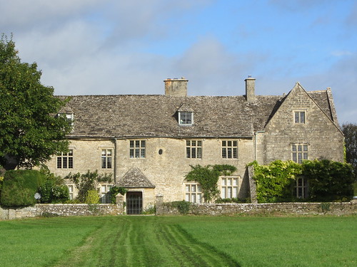
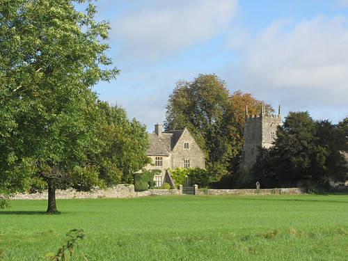
The village of Somerford Keynes, all mellow golden walls and handsome old houses, is a south Cotswold nugget set in the limestone uplands of the Gloucestershire/Wiltshire border.
First published in: The Times Click here to view a map for this walk in a new window
Facebook Link:
My early knock at the door of the Baker’s Arms found the landlord still at his morning ablutions, but he kindly agreed through a lather of shaving foam to let me park.
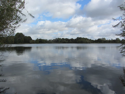
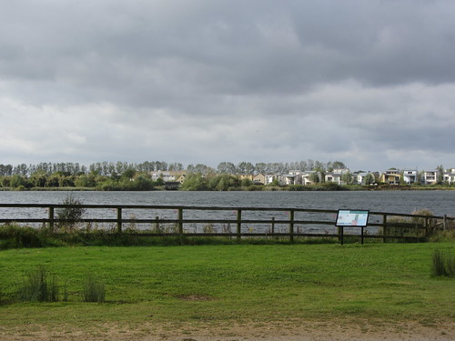
There are about 150 worked-out and flooded gravel pits in this flat countryside. Together they form the Cotswold Water Park’s jigsaw of wildlife reserves and water-sporting lakes. Threading its way through the watery maze wriggles the infant Thames, five miles from its source. I found it just outside the village, a hand-span deep and narrow enough to jump over, running as clear as glass over a stony bed between margins of cress leaves, mint and sky-blue brooklime.
The lakes around Neigh Bridge Country Park and Lower Mill estate were full of Canada goose gabble and coot honks. A great crested grebe sailed through the sun dazzle on the water, its ear-like twin crests raised as it stared me out, and a kingfisher shot low over the river in a streak of dragonfly blue. Soon enough I left the Thames to continue its London-bound sinuations, and turned north between the lakes. The gusty west wind flicked at the white poplar leaves in the hedges, a shivering coat of silver against a rushing grey and blue sky.
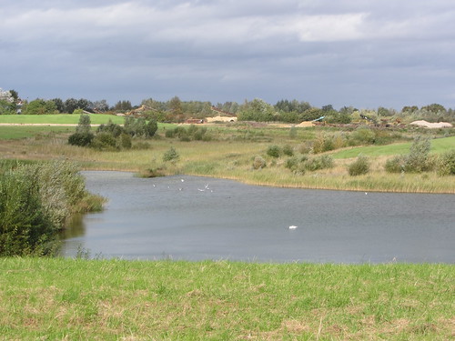
The path ran through the grounds of the Cotswold Community, once a pioneering centre for the therapeutic treatment of emotionally troubled boys. Recently closed, it’s now occasionally used for the training of police dogs. ‘We’re just about to practise a riot,’ said a laid-back policeman I met among the abandoned houses. How bizarre it was to hear angry shouting and swearing, the barking of dogs and the crack of firearms drifting across the fields. But all soon faded away as I followed the mazy path between busy sand quarries, landscaped lakes and dark ploughlands.
Coming back across the fields into Somerford Keynes the trees and grass glowed against slate-grey clouds with that unearthly emerald light that heralds an autumn rainstorm. By the time it had crept up on the village, though, I was snug by the fire in the Baker’s Arms.
Start & finish: Baker’s Arms, Somerford Keynes GL7 6DN (OS ref SU 018954) – please ask to park, and please give pub your custom! Alternative start: Neigh Bridge Country Park car park, GL7 6DN (just south of Baker’s Arms, ref 018947)
Getting there: Bus 93 (andybus.co.uk/bustimetables), Cirencester-Malmesbury. Road: A429 Malmesbury or A419 Cricklade; B4040, B4696, then minor road.
Walk (6½ miles, easy grade, OS Explorer 169. NB: Online maps, more walks: christophersomerville.co.uk): From Baker’s Arms turn left along village street. In 100m, left on gravel drive past former stables with fox weathervane. Bear right by gates (‘Church, Poole Keynes’); follow wall on left. By church gate, left through kissing gate; follow yellow arrow (YA) across field. Through kissing gate (015954, YA), across footbridge; ahead across field. At far side (013953), left on Thames Path/TP. Follow it to cross Neigh Bridge (015949, TP); continue to car park (018947 – alternative starting place). Left under height barrier; left along road for 200m; right down Mill Lane (020949). Cross Spine Road West at bottom (take great care!); ahead down lane (‘Lower Mill Estate’). Follow TP along lane past estate gates; in ¼ mile bear right across footbridge (027942); on along TP with River Thames on left for nearly a mile. Just before ‘Heavy Plant Crossing’ notice and double kissing gates, leave TP to turn left across Thames (036941; fingerpost, YA).
Ahead on fenced path with field on right. In 400m, path curves right out of trees (039943); cross a track, and keep ahead on gravel road between lakes for ⅔ mile to cross Spine Road West (036952 – take great care!). Pass gate with dog notices (it is a public right of way); on up drive through disused Cotswold Community complex (see below). Beyond complex, path crosses stile by metal gate (033959, YA); ahead along green lane for ⅓ mile, passing lake on left, to reach junction with fenced path (034963) – NB end of green lane is overgrown! Left along fenced path through gravel quarries. In 350m, at T-junction with lake ahead (031963), turn right past banded trail marker post. Continue for ⅔ mile, following lake edge, then on (YAs), through woodland and across fields, to reach road (023965). Cross road, then footbridge; right around field edge and on, keeping a road close on your right, to gate and stile onto road (021964). Left for 75m; right over stile; follow right-hand hedge for ¼ mile to stile, where you cross a road (016962). Follow wide grass path curving through field opposite. Pass ‘Somerford Keynes’ fingerpost; cross stile (015957, YA). Half left across field; over stile (017956, YA); follow right-hand field edge to gate into lane (018956). Left to road; right to Baker’s Arms.
NB – Cotswold Community complex occasionally used for police dog training – look out for notices. Green lane at junction with fenced path through gravel quarries (034963) may be overgrown. Paths can be wet!
Click on Facebook “Like” link to share this walk with Facebook friends.
Lunch: Baker’s Arms, Somerford Keynes (cosy and cheerful) – 01285-861298; thebakersarmssomerford.co.uk.
Accommodation: Lower Mill Estate (01285-869489; lowermillestate.com) – classy lakeside self-catering.
Cotswold Water Park: 01793-752413; waterpark.org
More info: Cirencester TIC (01285-654180); visitcotswolds.co.uk
www.ramblers.org.uk www.satmap.com www.LogMyTrip.co.uk