We’d been longing for a day like this – bright cold sunlight, wall-to-wall blue sky across the Hampshire/Berkshire border, the recently rain-sodden ground frozen hard underfoot on Silchester Common.First published in: The Times Click here to view a map for this walk in a new window


Facebook Link:
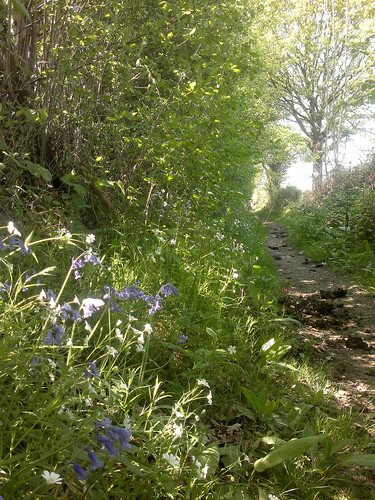
The low sun struck glitters out of the frost crusts in the red bracken clumps. We descended towards a wooded stream valley, watching squirrels playing kiss-chase in the birch tops, and turned along a bridleway that threaded the edge of Pamber Forest.
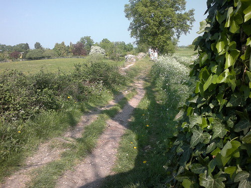
The ancient woodland, a fragment of the once-mighty Royal Forest of Windsor, lay faintly whispering, its leafless limbs still a month or two short of any hint of leaf-break. Distant cars murmured like waves on a beach. We followed a ruler-straight old woodbank, and went on out of the forest to the frost-sparkled lane at Latchmere Green where the daffodil buds were just beginning to swell. In the fields beyond, hoof pocks left by cattle in the mud were skinned over with white ice. The animals themselves, Highland beasts munching at a rich-smelling hay feeder, looked round at us through thick ginger fringes that completely hid their eyes.
The woodland boundary near beautiful old Clapper’s Farm was labelled ‘Park Pale’ on our Explorer map. Back at the beginning of the 13th century the Lord of Silchester Manor gave King John a palfrey in exchange for the right to create a deer park inside a pale, an earthen bank topped by a fence. It was cunningly designed so that wild deer could get in but couldn’t jump back out. Opposite Clapper’s we made out the medieval fishponds and the moated site where the Parker or keeper of the park had his fine residence. What status the Parker enjoyed back then – far more than any of today’s gamekeepers.
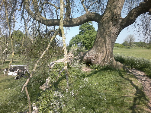
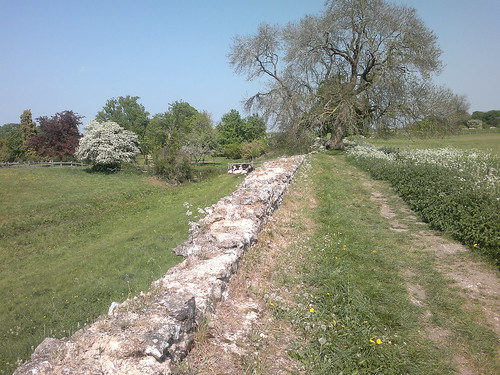
Field paths brought us back to Silchester by way of the remarkably complete flint walls of the Roman settlement of Calleva Atrebatum. Gridded streets, houses, shops, baths, an ancient Christian basilica and a steep-sided amphitheatre that could hold 3,500 seated spectators have all been excavated here. Stories say that Aelle, Saxon King of Sussex, sacked the place around 500BC, sending sparrows with flaming tails to set fire to the town. There were no sparrows in Calleva today, but we stopped by an oak to watch a treecreeper with curved back and beak picked hibernating insects from their refuge in the bark cracks – a fate perhaps as terrifying for today’s spider as a roaring Saxon warrior’s axe-blow for a cowering Callevite 1,500 years ago.
Start & finish: Calleva Arms, Silchester, Hants RG7 2PH (OS ref SU 627621)
Getting there: Bus 14 (stagecoachbus.com) Basingstoke-Tadley. Road: M4 Jct 11; A33 (‘Basingstoke’); in 300m, B3349 to Spencers Wood. Left to Beech Hill, Stratfield Mortimer and Silchester. Car park on village green.
Walk (6½ miles, easy, OS Explorer 159): Leaving Calleva Arms, left along Dukes Ride. In 150m, ahead (‘Brenda Parker Way’) along footpath. In ½ mile at foot of slope (618616), left for 700m to path crossing (621610; Pamber Forest noticeboard through gate opposite). Left across footbridge; ahead on bridleway for ⅓ mile to cross road (624607). Over stile opposite and on. In 250m path follows forest edge. Cross footbridge and keep ahead (yellow arrow) beside young plantation. At far end (630603), right down hedge; left at bottom to cross stile onto road in Latchmere Green (632600). Left to T-junction (634601); left up Ash Lane; in 150m, right over stile (fingerpost). Grass track for 500m to edge of Bramley Frith Wood (640603). Cross stile/gate into wood; in 30m, left across plank footbridge and follow field edge with ditch on left. In ½ mile, through gate and onto road (647608).
Right to T-junction (650610); left along Clapper’s Farm Road for ½ mile (NB gate into moated site on left). Pass Clapper’s farmhouse; at next right bend, ahead through kissing gate (651616, fingerpost). Cross footbridge; follow edge of north Copse, then ‘permissive path’ and ‘Silchester Trail’/ST signs through fields for ⅔ mile to road at St Mary’s church (643622). Right past pond; left through churchyard and 2 successive kissing gates (yellow arrows). Right (644624, ST); in 150m, left through 2 kissing gates (ST). (NB To view Roman amphitheatre, go through kissing gate/ST in 100m). Walk anti-clockwise half-circuit of Calleva Atrebatum Roman walls. On far side, cross end of track that bisects the site (637625) and keep ahead. In another 100m, right through gate (636624); on for ½ mile to cross road (629623). Ahead for 100m to cross another road; ahead for 50m; left to Silchester car park.
Lunch: Calleva Arms, Silchester (0118-970-0305; thecalleva.com) – popular, cosy, friendly; last orders 2pm.
Silchester Trail: hants.gov.uk/rh/walking/silchester-trail
Pamber Forest: hwt.org.uk
Silchester Roman Town: reading.ac.uk/silchester/
Tourist Information: visit-hampshire.co.uk
www.ramblers.org.uk www.satmap.com www.LogMyTrip.co.uk
Click on Facebook “Like” link to share this walk with Facebook friends.
[…] We had chosen Chris Somerville’s walk (published in the Times on 16 February 2013 and on his website): six and a half miles anti-clockwise from the Calleva Arms in Silchester (grid reference SU […]