The Gibbon Bridge Hotel and the nearby village of Chipping cater enthusiastically for walkers these days. First published in: The Times Click here to view a map for this walk in a new window


Facebook Link:
But before the Countryside & Rights of Way Act became law in 2000, most of the neighbouring Forest of Bowland was closed to the public. Nowadays, however, this great tract of upland moors with its encircling ribbon of villages is Lancashire’s prime walking location, a vast swathe of Access Land criss-crossed by hundreds of walker-friendly paths and tracks.
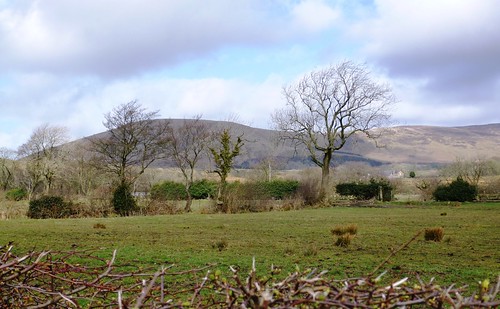
Daffodils and primulas were putting their heads out cautiously in Chipping’s window boxes as a fine strong wind came roaring in from the sea 20 miles westward. Cloud shadows and sunlight raced across the slopes of Wolf Fell and Parlick as we crossed the sedgy fields around Fish House and Windy Harbour. A big hare with dull orange pelt and black-tipped ears sprang up from a sedge clump and dashed away, and a lapwing went tumbling overhead across the gale in an ecstatic mating display. Two oystercatchers chased each other round the windy sky with piercing piping calls, and we could hear the bubbling cry of curlews in the wet fields – all signs of onrushing spring.
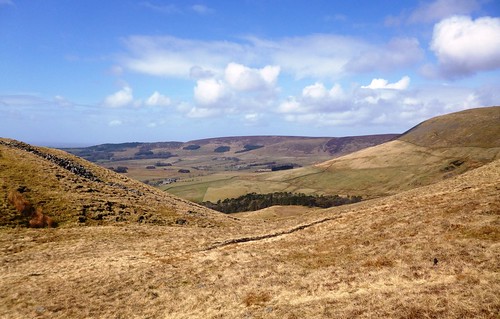
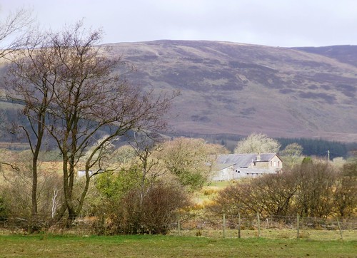
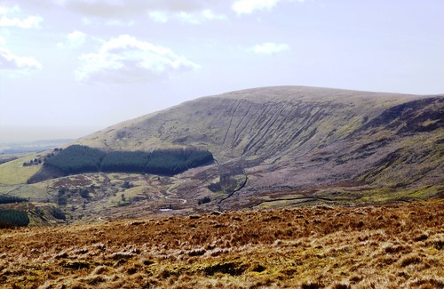
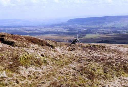
It was a stiff, steady climb up the steep grassy breast of Parlick, the wind shoving from the west, the path slippery underfoot. At the summit, a view in a million – back across the field and farms below the moors to witchy Pendle Hill grey and ship-shaped in the east, and forward to an enormous curve of moorland – Blindhurst Fell, Fair Snape Fell, Wolf Fell, Saddle Fell, Burnslack Fell, rounded flanks of oatmeal, olive and burnt orange dipping south, a great ridge of peat hags connecting them like waves in a sluggish rust-brown sea far back up the northern skyline.
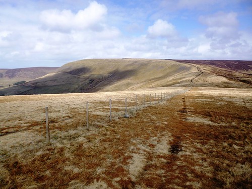
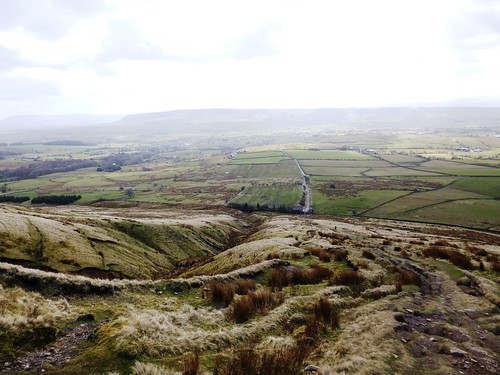
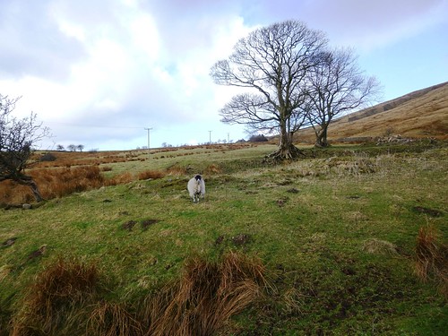
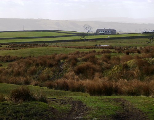
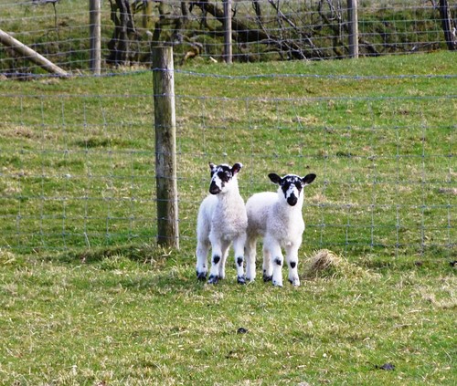
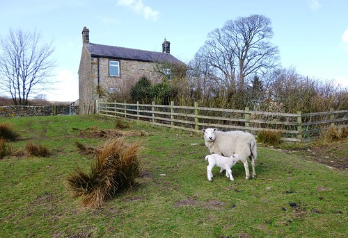
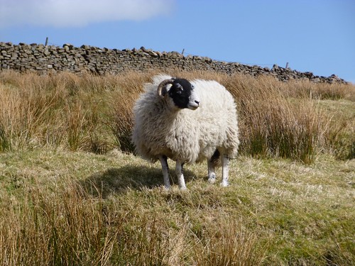
We followed a guiding fence and a whistling gritstone wall that filtered the wind into a high-pitched keening. At the crest of Wolf Fell we left the fence and plunged among fantastically eroded peat hags, then down the long green snout of Saddle Fell into the wind, with the Bowland valley spread before us. Ewes came bleating at Saddle End Farm as the farmer and his dogs herded them up the fellside, and down by Dobson’s Brook the week-old lambs bounced away as though each fat white leg were made of springs.
Start: Car park, Chipping, Lancs, PR3 2QH (OS ref SD 621433).
Getting there: Bus (lancashire.gov.uk): 5, 5A (Chipping-Clitheroe), 5B (Clitheroe-Garstang), 35 (Chipping-Blackburn)
Road: Chipping is signed from Longridge on B6243 Preston-Clitheroe road (M6, Jct 31a).
Walk (7½ miles, hard, OS Explorer OL 41. NB Online maps, more walks at christophersomerville.co.uk):
From car park, to road; left toward church; first left. In 300m, lane curves left (620435). Follow it past Old Hive. At gateway to Quiet Lane, left down Springs House drive (616436, fingerpost). In 350m, at left bend, right (612436, stile, yellow arrow/YA) across field; next stile (YA); stone stile by barn; cross stream (611437). Ahead (YA), bearing half-right to track to Fish House farm (610441). Left along Fish House Lane; in 30m, right (stile, fingerpost). Cross fields (stiles, YAs), aiming for left corner of trees ahead at foot of Parlick. Cross drive (603444, YA); on through kissing gate/KG by Wildcock House ruin (602446); left to Fell Foot house (599445). Turn right up steep pitched path to climb Parlick.
From summit cairn (596450) follow fence (keeping it on your left) for 1½ miles. Roughly opposite Paddy’s Pole cairn on left, fence bends half-right (595469). Soon it bends half-right again at a junction of fences, with 2 stiles on either side of a gate. Keep following it to summit of Wolf Fell (598472), another junction for fences with a pitched path going away north. Here 2 stony tracks, close together, lead off to right. Take 2nd one, a clear track heading east through peat hags. In ¾ mile, go through KG in fence (609470); bear right on grassy track parallel to descending fence, then trending away to left. Follow it south down Saddle Fell for 1¼ miles (YAs) to Saddle End farm (614451). Through farmyard; down drive to cross road (616448, fingerpost). On along track, across Dobson’s Brook (618446) to farmhouse. Through gate (619446, YAs); immediately right through gate (‘Chipping’); descend bank to cross brook (620445). Follow path (YAs) through fields, parallel to brook, down to lane by reservoir (619437). Left into Chipping.
Click on Facebook “Like” link to share this walk with Facebook friends.
Conditions: Steep climb up Parlick; some moor paths obscure; a walk for confident fell walkers, properly shod and equipped.
Lunch: plenty of pubs, cafés in Chipping
Accommodation: Gibbon Bridge Hotel, near Chipping (01995-61456; gibbon-bridge.co.uk) – characterful, enthusiastic, extremely friendly
Forest of Bowland: forestofbowland.com
Clitheroe TIC: 01200-425566; visitengland.com
www.ramblers.org.uk www.satmap.com www.LogMyTrip.co.uk