An enormous sky of blue and silver wheeled above the dark earth fields of west Lincolnshire as we set out from Swinstead to wander the paths and rides of Grimsthorpe Park.
First published in: The Times Click here to view a map for this walk in a new window


Facebook Link:
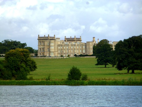
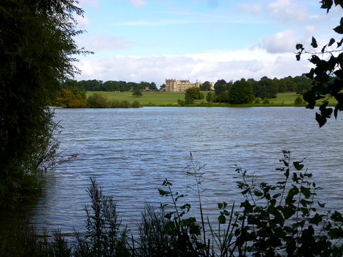
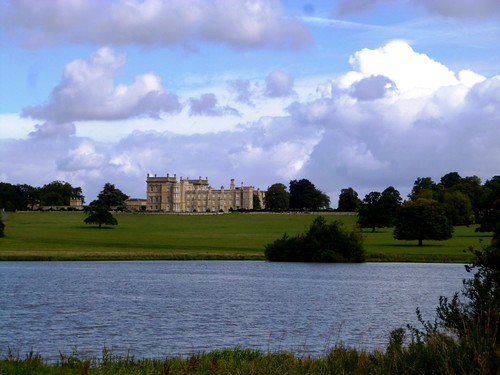
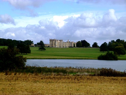
Stubbles, iron-rich ploughlands and cattle grazing – this is agricultural England, in which the big country estates sit handsomely in their landscaped grounds. The de Eresby family have held Grimsthorpe Castle since before the Reformation. Their seat and stronghold stands on a green ridge overlooking a long lake perfectly set in its valley.
We crossed the wide fields west of the lake, whose alders and willows framed a picture-book view of the castle. South lay the stew ponds that kept Grimsthorpe’s monastery well supplied with fish in medieval times. The sinuous little valley that curves away through the monastic site is known as The Vaudey, a corruption of the beautiful name the monks gave it – Vallis Dei, the Valley of God.
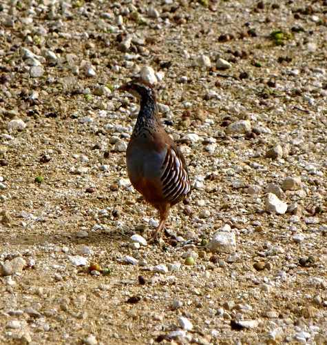
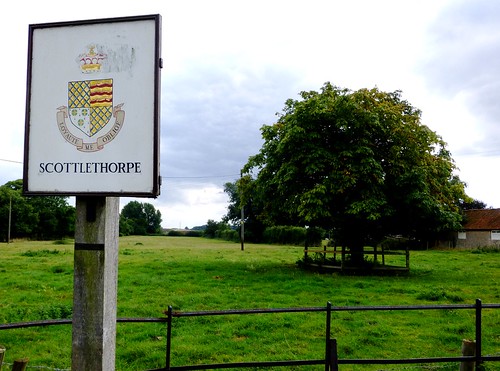
Dozens of partridge poults went scurrying frantically before us as we turned from the lakeside into the woods. The track led us east to Edenham for a pint of Market Deeping-brewed beer in the Five Bells, and a sandwich in the shade of the churchyard trees. Then it was off down Scottlethorpe Road, where stickily pungent hops hung in the hedges and naked ladies posed in miniature statue form among the geraniums at Cowman’s Cottage.
Alongside the lane ran the overgrown cutting of Lord Willoughby’s Railway. It didn’t exactly fulfil the dreams of its founder, Lord Willoughby de Eresby of Grimsthorpe Castle. He opened it in 1856 to connect two bigger railways on either flank of his estate, but his tiny branch line closed only 17 years later, scuppered by its limitations – mainly the speed of the trains, which at a maximum of 8 miles per hour was not all that attractive to paying customers.
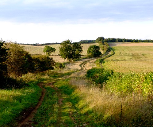
From Scottlethorpe Road we went west across the park, following the green way of Steel’s Riding through woodland full of majestic old oaks, then over the fields to Creeton and a railway with a history rather more magnificent than that of Lord Willoughby’s Railway. A mile or two north of this stretch of the East Coast main line, on 3 July 1938, the A4 locomotive Mallard flew into history at 126 mph, the fastest speed ever recorded by a steam train.
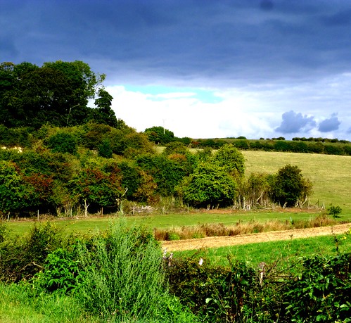
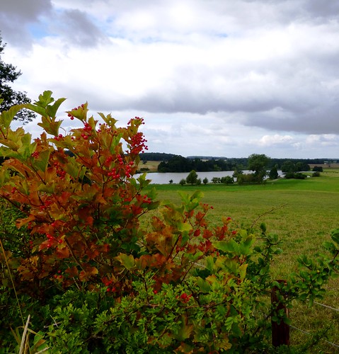
The racing railway has a companion through the countryside, the ancient drove road of The Drift where cattle and sheep would meander to distant markets at two miles an hour. We sauntered its ribbony course before turning aside to cross the Swinstead Valley – a deep-sunk and beautiful hollow of calcareous grassland never ploughed or fertilized. All lay gilded by the low evening sun as we climbed to the ploughlands and turned for home.
Start: High Street, Swinstead, near Bourne, Lincs NG33 4PA (OS ref TF 019225)
Getting there: Bus service 4 (centrebus.info), Grantham-Stamford
Road – Swinstead is on B1176, signed off A151 Bourne-Colsterworth road
Walk (11 miles, easy, OS Explorer 248): From High Street, walk up Park Road. 150m past ‘Park Farm’ notice, left (021223, yellow arrow/YA) across field. At far end follow hedge; left through hedge beside gate (025223); right along track and through Crow Wood. In ½ mile, where trees end with view of Grimsthorpe Castle ahead (032222), bear right off track along grass path to cross end of lake (039220) and on to T-junction (040219). Left on tarred road. In 250m, where lakeside track bends left (041219), turn right on stony track. In 50m, left up fence (YA), then rising gravel track, then through The Grove plantation. At end of trees (048219) dogleg left/right (YAs) to cross fields (YAs), keeping same direction towards Edenham church tower. In ½ mile, nearing village, cross old railway by stiles/YAs (057220); across paddocks towards houses. At A151 (060220), right through Edenham past Five Bells PH and church.
In ⅓ mile, right along Scottlethorpe Road (062215). In 2 miles, look for 3-finger post on right (041197). Right through gates here, across field. Bear right (038199) along edge of Elsea Wood to Pebble Gate (037201); then (YAs) for 1½ miles along Steel’s Riding through woods, then along field edges. 50m short of first house in Creeton, bear left over stile (015200) to lane. Right through Creeton to B1176 (011199). Left; in 200m, right at bend (010198, ‘Counthorpe’). In 700m, road bends left under railway; but keep ahead here (006204, fingerpost) up The Drift green lane. In ⅔ mile it climbs, levels out and broadens. In another ½ mile, just before it descends again, turn right along wood edge (003222; YA in sight 50m along this path). Descend into valley; cross footbridge (007223), left, then right up path (YA), climbing to crest. Left over stile (009226, YA); right along hedge (YA, stiles) to green lane (014225). Left to B1175 (015226); right into Swinstead.
Lunch: 5 Bells, Edenham (01778-591111; the-five-bells.co.uk)
Accommodation: Toft Country House Hotel, Toft PE10 0JT (01778-590614; tofthotelgolf.co.uk)
Information: Stamford TIC (01780-755611); visitlincolnshire.com