It was a brisk day over Wiltshire, brisker than you’d expect in early spring, with sheepy clouds scudding east and a cold nip under the blue sky. First published in: The Times Click here to view a map for this walk in a new window


Facebook Link:
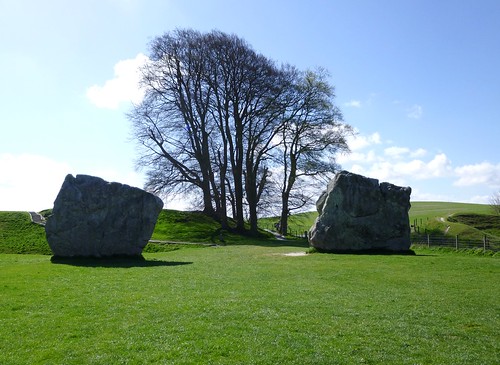
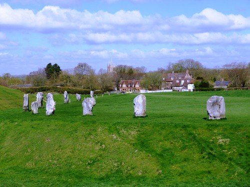
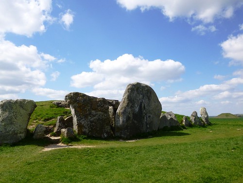
Avebury’s stones were warm, though, as I walked a circuit among them – rough and warm to the touch, huge and amiable with their rugged, bear-like shapes sparkling in the sunlight. Unfathomable, as always, the motives of those who in 2000 BC mounded the great circular bank and trench that encloses present-day Avebury village, pairing off one hundred sarsen stones in male and female couples, and building two smaller circles to touch each other within the greater ring.
How much labour must such a work have expended? How much organisation of that so-called “primitive” society? Our medieval ancestors feared the stones, toppling some and leaving others to fall. One 14th century surgeon-barber suffered the wrath of the stones for taking part in such vandalism; his skeleton was discovered under one of the largest in 1938, coins in his purse, scissors by his side. He’d been squashed flat as the great boulder slammed to earth before he could get out of the way.
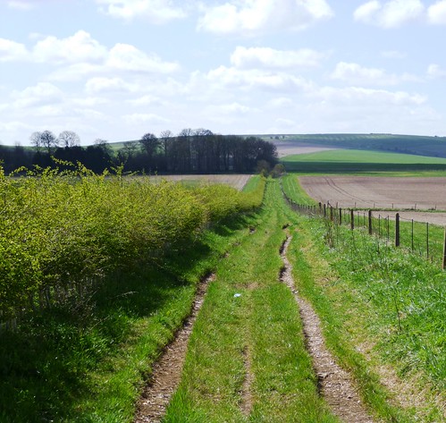
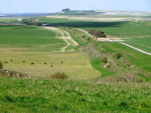
Field paths led me out of Avebury through paddocks where horses grazed, flicking their tails against the early flies. A cock crowed at Durran Farm as I followed a stony track rising for miles to the roof of the downs. The rhythmic crunch of flints under my boots, the sunshine and cold wind and the twitter of sparrows in the hedges combined to give a soporific, trance-like feel to the morning.
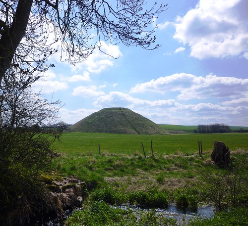
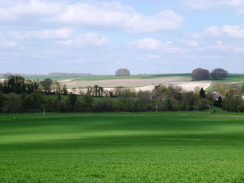
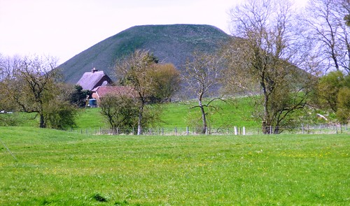
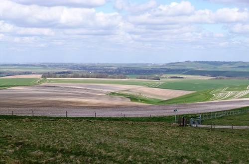
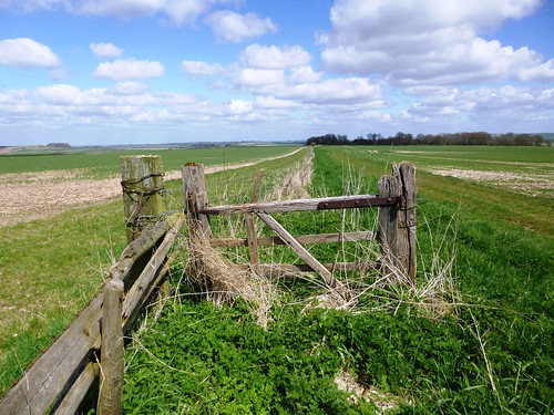
Up at the crest of the hills I followed the old ramparted ditch of Wansdyke above the broad flanks of the downs, enormous fields of ploughland and spring wheat all in geometric lines and malleable curves of white and green. Wind in the hair, sun on the cheeks, fantastic exhilaration under a windy blue heaven as I strode out at the hub of a 50-mile view. But the true focus of this walk lay in the valley of the River Kennet below – the flattened thimble of Silbury Hill.
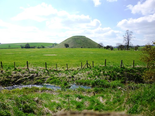
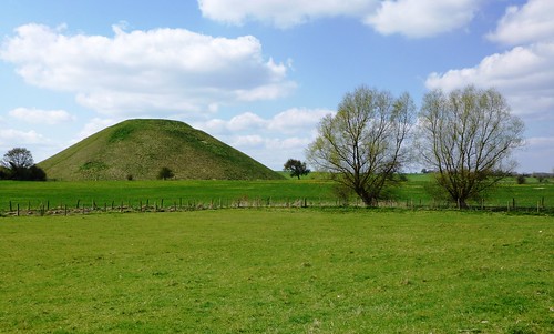
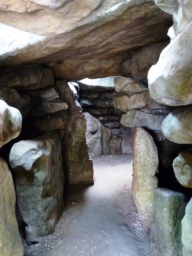
Down there I stood on the boulder-guarded mound of West Kennet Long Barrow and stared north at Silbury Hill. Why men constructed the long barrow around 3,500 BC with its five compartments and its mighty guardian sarsens is clear enough – the dead had to be honoured. But that 130-foot high, flat-topped hillock with its hidden core of concentric chalk-block walls: what was that about? We’ll never know – but we can imagine the feelings of awe that it invoked some 4,750 years ago when it first stood dazzling white and dominant between the rolling downs.
Start: Avebury village car park, Wilts, SN8 1RF (OS ref SU 100697)
Getting there: Bus service 49 (swindonbus.info), Swindon-Devizes
Road – Avebury is on A4361, 12 miles south of Swindon (M4, Jct 16)
Walk (11 miles, easy, OS Explorer 157): From car park, follow signs to stone circle. Walk the circuit of the stones; then follow minor road through village, passing church on right. Opposite Rectory gateway, right (099699) up lane; follow it to the left. Cross 2 footbridges; after second one, left (097698). Through gate (yellow arrow/YA); left along fence. Through gate (096696); immediately right through adjacent gate; up track past thatched cottage to cross road (095696). Pass noticeboard; follow tarred path to road opposite Rose Cottage (094695). Right for ⅓ mile; opposite farmyard, left (089692, ‘bridleway’) to cross A4361 (090691); on to cross A4 by Waggon & Horses Inn, Beckhampton (091689).
Down steps from inn car park; follow road round right bend. Opposite Butler’s Cottage, left (087688, ‘bridleway’) and follow track south for 1¾ miles to join stony track at 084688. In another 750m, just before Manor Farm cattle grid and gate, left (081652). In 150m, bear right and through gate (‘Mid Wilts Way’). Follow Wansdyke ditch and bank east. In 1 mile, a broad track comes in on right; 150m before a complex of gates where track converges with Wansdyke, turn left through makeshift gateway in fence (099647, ‘White Horse Trail’).
Left to fence; right along it, heading NE away from Wansdyke. In 1 mile dogleg right, then left through makeshift gate (109658); on with fence on right. In just over a mile, cross track and keep ahead past ruined barns (114675, ‘bridleway’) on grassy track. In 300m, left along track (114678); in 15m, right on hedged path; cross stile (YA) and follow left-hand hedge to cross road (110682). On (fingerpost) down fenced track. Cross stile, then follow fence. In ⅓ mile, under oak tree (105681, no waymark) left up field to West Kennet Long Barrow (105677) beyond skyline. Return to cross A4 (104684); take field path (‘Avebury’ fingerpost) to east of Silbury Hill. In 350m (103687), ignore stile on right, and go through gate and on beside river. At two-arch bridge, don’t turn right across it (101689), but keep ahead through gates (blue arrows) to cross A4361 to car park.
Lunch: Red Lion Inn, Avebury (01672-539266)
Info: Alexander Keiller Museum, Avebury Manor, shop etc – contact National Trust, 01672-539250; nationaltrust.org.uk/avebury
www.ramblers.org.uk www.satmap.com www.LogMyTrip.co.uk visitengland.com