It rained cats and dogs in the night, and on till mid-morning. So what’s new in the Scottish Highlands? First published in: The Times Click here to view a map for this walk in a new window

Facebook Link:
At last the sky began to brighten – enough to make a kilt for a wee sailor. I’d been looking forward so much to getting up high and wild into the back country of the Monadhliath Mountains, that a little bit of spit wasn’t going to put me off.
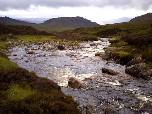
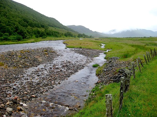
When the glaciers had finished with the Monadhliath, they’d created a hauntingly beautiful range with ice-smoothed flanks, deep side glens and thick moraines of rubble through which streams and rivers push. Today the River Calder in the flat lower strath of Glen Banchor and its tributary Allt Fionndrigh were rumbling and roaring, rain-swollen torrents shifting boulders and pebbles from their glacial banks by the ton. Rain moved in rippling curtains through the vees of the side glens, hanging in the throat of Fionndrigh’s cleft before moving away on the west wind to allow a gleam of sun through.
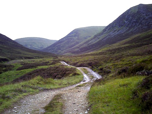
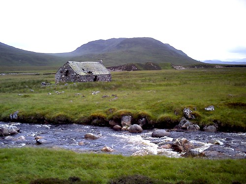
I passed the old cattle-raising and raiding settlement of Glenbanchor, now nothing more than mossy stones, and made north up the stony track where Glenbanchor’s cattle were driven each spring to sweeter grass high in the mountains. The Allt Fionndrigh came crashing down out of the hills, loud and chaotic over its boulders, and I walked upstream to find a footbridge. Red deer stags moved along the ridge a thousand feet overhead, only their antlers visible against the grey sky.
Under the rocky bluffs of Geal Charn I found a flimsy wooden bridge and crossed the river. Sodden and squelchy, a path led up and over a saddle of high moorland. I followed a line of old fence posts, descending a long slope towards the hissing torrent of Allt Ballach. On the far side the hills rose to hump-back peaks – Carn Dearg and Carn Macoul, with a jumble of darkly magnificent mountains to the edge of sight beyond.
Down by the River Calder again, I turned for home. A frantic squealing in the upper air drew my binoculars. A pair of slate-grey peregrines swooped down from the clouds and circled me, driving the intruder on and out of their private wilderness.
Start & finish: Shepherd’s Bridge car park, Glen Road, Newtonmore (OS ref NN 693998)
Getting there:
Rail (www.thetrainline.com) to Newtonmore.
Road: A9 to Newtonmore. From village main street, follow Glen Road to Shepherd’s Bridge car park.
Walk: (8 miles, hard, OS Explorer 402. NB Online maps, more walks at christophersomerville.co.uk): Continue across Shepherd’s Bridge; on for half a mile, passing abandoned cottage. Just before footbridge to Glenballoch (681993) turn right up Allt Fionndrigh river to join track up Fionndrigh glen. In 2 miles, descent left to cross footbridge (659019); follow track up cleft for 500m. At top (657015), more easily visible track swings right, but continue 50m, then bear left up faint grassy 4 x 4 track, aiming for Creag Liath peak. In 100m, track swings right; in 200m it reaches old fence posts (657012). Follow them to right (tricky underfoot – keep well left of the posts till past peat hags). Follow posts down to Allt Balloch river (652005); left beside river for 1 and a quarter miles to confluence with River Calder (652986). Left by river to Glenballoch and car park.
NB: Trackless and boggy from footbridge in Fionndrigh glen onwards. Take map, compass, GPS, hillwalking gear, stick.
Refreshments: Picnic, or Pantry Tearoom, Newtonmore (01540-673783).
Accommodation: Greenways B&B, Newtonmore PH20 1AT (01540-670136)
Info: Wildcat Centre, Main Street, Newtonmore (01540-673131)
Aviemore TIC (01479-810363); http://white.visitscotland.com
www.ramblers.org.uk www.satmap.com www.LogMyTrip.co.uk