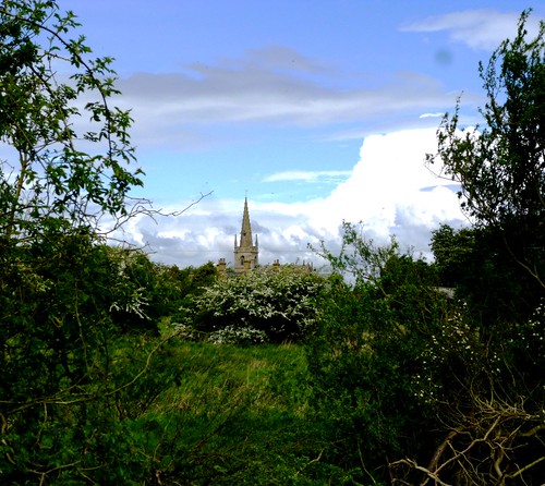
You can’t walk long in Lincolnshire without becoming aware of how the county’s hundreds of village churches punctuate the flat horizons with their slender spires or square-topped towers.
First published in: The Times Click here to view a map for this walk in a new window


Facebook Link:
The great swirling skies seem propped above the level land of Lincolnshire on these celestial staddle-stones.
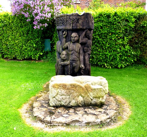
We set out from Ruskington station to follow the Spires and Steeples trail northwards through a long line of villages. Big blue skies teemed with cloud over the fields of barley and rape. The hedges bowed to the earth under their weight of hawthorn blossom. In a pen on the outskirts of Dorrington some proper old-fashioned chickens strutted in black plumage with iridescent tails and splendid scarlet combs and wattles. A sculpture of writhing demons on the village green recalled the tale of how the Devil and his minions prevented the church from being built on an ancient pagan site.
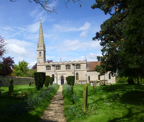
By the time we got to Digby’s lovely Church of St Thomas, the sky was boiling with giant white cumulonimbus clouds and dramatic grey thunderheads. We admired the church’s gargoyles and grotesques inside and out; then we followed a winding county lane to Rowston with its remarkably slim tower and spire, and on across big open fields of beet and grass, peas and beans showing white and velvet black flowers.
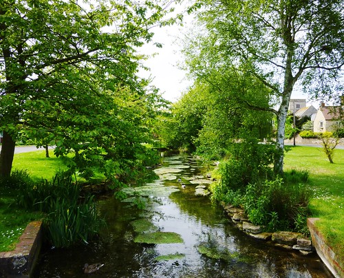
In Scopwick the brook streamed with duckweed as it flowed under a succession of miniature bridges. Four tiny ducklings huddled under the river wall, queeping for their mother; but it was father who came to the rescue, resplendent with silky green head and chestnut flashes. The village is an ancient foundation; when the inhabitants ceremonially beat the bounds in bygone times, they would dig holes and upend the village boys in them to knock the parish limits into their young heads.
The Church of the Holy Cross stood locked and silent. Beyond it we found the small, beautifully kept war cemetery where young fliers from Digby aerodrome who met an early death are buried – Canadians and New Zealanders, mostly. Beside them lie five young Germans, four of them the crew of a single plane that fell in January 1943.
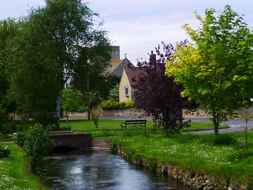
A rainstorm came sweeping across the fields to drive us on past immaculate little Blankney and into our homeward train at Metheringham, dripping wet and talking of all we’d seen.
Start: Ruskington station, near Sleaford, Lincs NG34 9ED (OS ref TF 083502)
Getting there: Rail to Ruskington
Road – Ruskington is on B1188, signposted off A153 Sleaford-Horncastle road
Walk (10 miles, easy, OS Explorer 272. NB: online maps, more walks at christophersomerville.co.uk): From Ruskington station, down station approach; ahead along road; round left bend, first right into Chestnut Street (‘Free Church’; ‘Spires & Steeples’ sign/SS’) At end, left along High Street. At end, bear right to cross road, leaving church on your left; ahead down laneway to left of old chapel (083511, SS). Right at end by barrier; in 50m, left up path to cross road (084512). On along pathway (SS), up side of playing field and on through fields. In 2nd field, fork left; in 3rd field, yellow arrow/YA points right (083524), but keep ahead here (SS on next telegraph pole). At road in Dorrington (082529) right past ‘demons’ sculpture; left across playing field to top left corner; right (SS) and on across fields (SS) to road in Digby (082548 – church to left).
Cross road by village cross; up road opposite with Red Lion PH on left. Follow this road north to Rowston. Round east end of church; immediately right (084564, SS) over stile and through farmyard. Keep left of barn; ahead for 500m over fields (SS) and through woodland to track (084570). Left to cross road; forward (SS) on track. In 400m track turns left; continue ahead here on grass path by hedge; in 100m, right across footbridge (079571, SS); on along hedge. In 150 m at hedge corner, bear diagonally left across field to pylon (075575). On across 2 fields (YAs); clockwise round 3rd field to road in Scopwick (07158). Left to church (Royal Oak PH is beyond).
Right up path beside church (SS). At T-junction of paths (070582, War Graves Cemetery to left), dogleg right and left (SS); on along wide grassy path. Follow SS north for 1 ¼ miles past Blankney Hall walled gardens to road (068600). Right; in 250 m, right (‘Blankney’); in 650 m, right (073605, ‘Blankney Walks’) for nearly half a mile, passing Beck’s Wood. Left (079607, fingerpost) past brick pump house; ahead across field; ahead (09611, SS) between woods to B1189 (078614). Right across level crossing; left to Metheringham station platform for return train to Ruskington.
Walk: Ahead along station approach, then road. Round left bend; first right (‘Spires & Steeples’/SS). At end, left to church; right across road; ahead down laneway by old chapel (SS). Right by barriers; left to cross road (084512, SS), ahead on path across fields to Dorrington (082529). Right past demon sculpture; diagonally left across playing field; right (SS) across field to Digby (082548). Pass Red Lion on left; follow road to Rowston. Pass church; right (084564, SS) through farmyard; north for 500 m to track (084570). Left across road; follow SS northwest across fields to Scopwick (071580). At church, right up path (SS); north for 1 and a quarter miles to raod at Blankney (068600). Right; right again (‘Blankney’) next right (073605, ‘Blankney Walks’). In half a mile, left (fingerpost) up track, across field, between woods to B1189 (078614). Right across level crossing to Metheringham station; train to Ruskington.
Lunch: Red Lion, Digby ( ); Royal Oak, Scopwick ( )
Accommodation: Finch Hatton Arms, Ewerby, Sleaford, postcode (01529+460363; website)
Spires & Steeples Trail: download leaflet guide at website.
Information: Lincoln TIC
www.satmap.com www.LogMyTrip.co.uk visitengland.com