‘Please treat the church and houses with care,’ said the handwritten plea left pinned by the villagers of Tyneham to their church door in the dark days of the Second World War.
First published in: The Times Click here to view a map for this walk in a new window


Facebook Link:
‘We have given up our homes where many of us lived for generations to help win the war to keep men free. We shall return one day,’ the note ended, poignantly, ‘and thank you for treating the village kindly.’
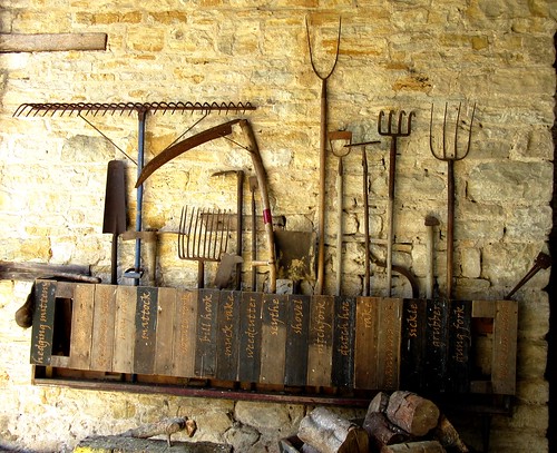
That return was to remain forever a dream. Evicted by the Army in 1943 so that their homes and lands could be used for training soldiers, the 40-or-so villagers of Tyneham and their 200 fellow parishioners never returned to the lonely valley in the Dorset downs. Lulworth Ranges absorbed the place and threw a cloak of inadmissibility over it. Nowadays only the school, church and great barn of Tyneham remain in good repair, open to the public on certain days (see below). Tyneham’s cottages and Post Office are empty shells whose former inhabitants stare from old photographs in the wall displays; the great manor house crumbles unseen and out of bounds among the trees.
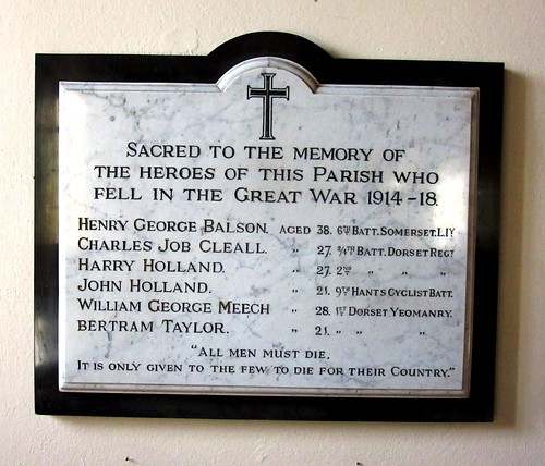
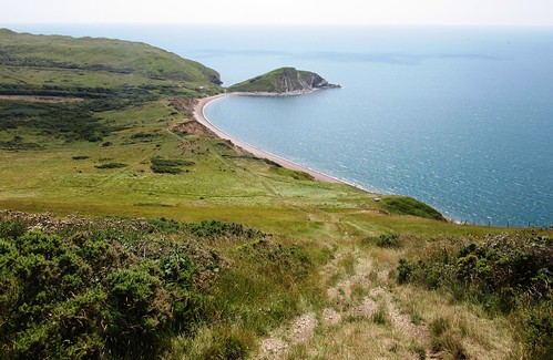
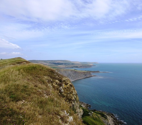
We wandered around the skeleton village with dairyman Walter Candy, shepherd James Lucas and a ghostly host of pinafored children and hobnailed farmworkers at our elbow, then made for the grassy track that undulates along the crest of Whiteway Hill, with stunning views west along the chalky, fossil-filled cliffs of Dorset’s Jurassic Coast.
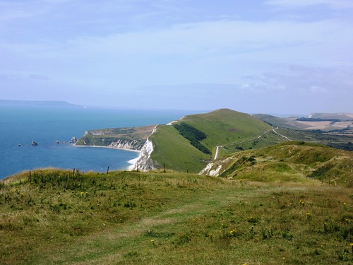
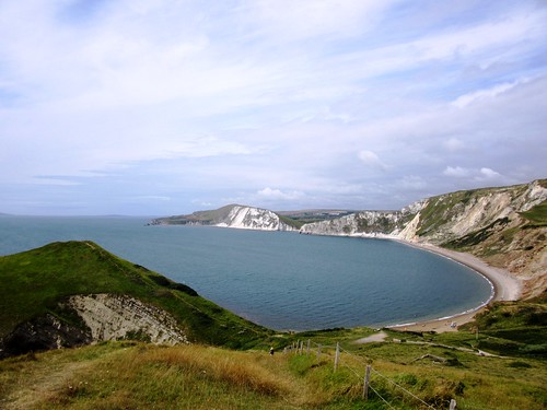
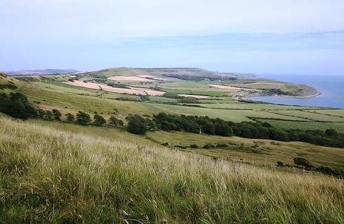
A breeze rippled the grassheads like an invisible hand stroking a head of newly-washed hair. We teetered down the steep slope below the ramparts of Flower’s Barrow hill fort, and had a quick, ecstatic plunge in the semi-circle of sea under the sloping cliffs of Worbarrow Bay. A stiff climb out of the cove and we were looking down on the Tyneham valley, its green slopes untouched by the intensive agriculture of the past seventy years, its trees concealing their secrets.
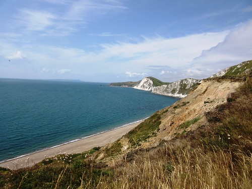
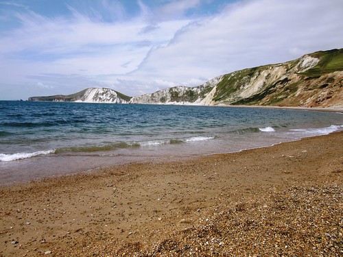
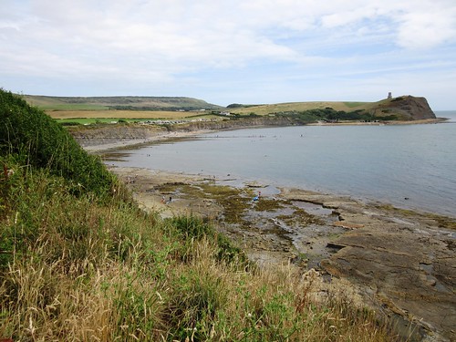
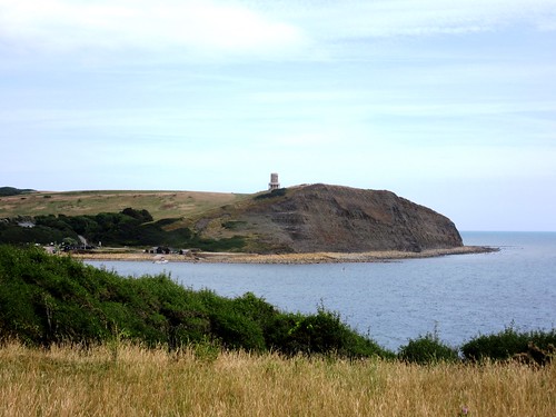
On past clumps of wild marjoram, so pungent when pinched that they made me gasp. The submerged rock ledges far below off Brandy Bay shimmered orange, black and jade green. In the sea haze the long wedge of Portland seemed not so much a peninsula as an island detached from the shore. A last look east to the much-quarried freestone cliffs under St Alban’s Head, and we were bowling back to Tyneham along the ridge of Tyneham Cap where sparrowhawks hovered on quivering wings, and a croaky old raven was teaching formation flying to this year’s youngsters.
Start: Tyneham car park, near East Lulworth, Dorset BH20 5DE (OS ref SY 882802)
Getting there: Tyneham is signposted from East Lulworth (B3070 from A352 near Wareham; or B3071 from Wool, 4½ miles west of Wareham on A352).
Walk: (8 miles, moderate/strenuous, OS Explorer OL15): From Tyneham church follow track north to top of down (882810; yellow marker posts/YM). Left along crest of down for 1 mile to Flower’s Barrow hill fort. Pass through first rampart; at Coast Path marker stone (866805), hairpin left (YM), steeply down to Worbarrow Bay. Steeply up and along Coast Path. Pass opposite Tyneham car park; in 500m, at gate/cattle grid (889798), fork right between YMs and on round edge of Brandy Bay. Halfway round Kimmeridge Bay, at ‘Kimmeridge View Point’ board and flagpole on right (904792), turn left up hedge. YMs to top of down (905802); left along crest of down. In 1 mile cross cattle grid/gate (889798); in another 400m, just beyond ‘Keep Back, Unstable Cliff’ notice (883797), fork right to Tyneham.
Conditions: Many ups and downs, some steep.
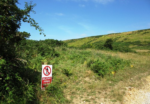
Opening: Lulworth Range walks and Tyneham are open weekends (9am Sat. to 8am Mon.) except 27/28 Sep, 15/16 Nov 2014. Also open for some school holidays and Bank Holidays. Info – Lulworth Range Control Office, 01929-404819;
gov.uk/government/publications/lulworth-access-times
Refreshments: Picnic
Information: Dorchester TIC (01305-267992; visit-dorset.com)
tynehamvillage.org; visitengland.com; www.satmap.com; ramblers.org.uk