First published in: The Times Click here to view a map for this walk in a new window


Facebook Link:
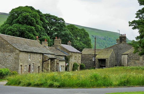
Littondale lies tucked away, a secluded cleft running away to the north-west from its parent valley of Wharfedale. If people venture to Littondale, it’s usually to get a sight of Arncliffe, the gorgeous little stone-built village where the first few series of ‘Emmerdale’ were filmed. Arncliffe’s houses line its expansive green, presided over by the creeper-hung Falcon Inn where beer is still served from barrel to jug to glass, the proper way.
The steep hillside I climbed out of Arncliffe was a mass of wild flowers – milkwort, bird’s-foot trefoil, lady’s bedstraw, hawkbit, rockrose, a litany of lovely jewel-like plants growing on the slopes. Every step left a pungency of crushed wild thyme as I went on up into a far bleaker moor landscape of black peat and sombre dark green heather. I passed pale stony heaps of lead mine spoil, and deep shake holes where subterranean caverns had subsided directly underneath.
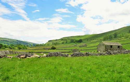
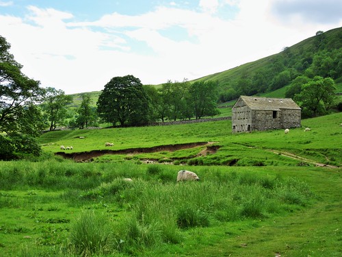
A gate in the summit wall led to the downward track into Wensleydale, the valley spread out at my feet in patchy sunshine with the clustered stone houses of Starbotton and Kettlewell under the long back of Cam Pastures, and miniature dots of sheep feeding in a maze of meadows boxed in by drystone walls, each field with its own handsome stone-built barn.
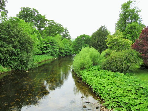
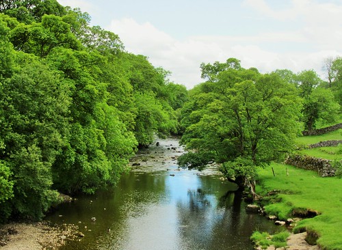
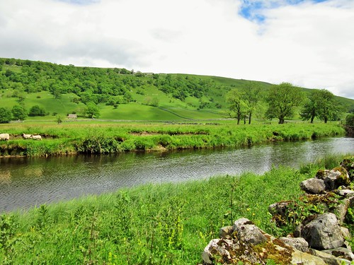
Down at Starbotton I followed the Dales Way beside the River Wharfe through flat pastures glinting gold with buttercups in the pale sun. The Wharfe ran slow and darkly viscous round its many meanders. This seemingly tame river can grow fierce in spate. Starbotton was wrecked in one terrible flood in 1686. ‘The rain descended with great violence for one hour and a half; at the same time the hill opening, and casting up water to a prodigious height, demolished several houses, and filled others with gravel to the chamber windows. The affrighted inhabitants fled for their lives.’
At Kettlewell I turned steeply back up the daleside, scrambling up through limestone crags to the top of the moor. Then it was down over sedgy grass, precipitously down the rocky sides of Park Scar Wood, and over the little humpy bridge into Arncliffe in the last of the sunshine.
Start: Village green, Arncliffe, N. Yorks, BD23 5QE (OS ref SD 931718)
Getting there: A59 (Skipton – Harrogate) to Bolton Bridge; B6160 through Grassington; past Kilnsey, left on minor road to Arncliffe.
Walk (7½ miles, strenuous, OS Explorer OL30. Online maps, more walks at christophersomerville.co.uk): Take laneway opposite water trough; cross river; at bend (932721) up steps, through gate, up fellside to cart track bridleway (932723). Turn right along it for 1 mile to go through gate at crest (941730). Down for ½ mile to circular sheep pen ruin near gate in wall (951736, 3-finger post). Left down to bridge over Wharfe (951745), Don’t cross; turn right along Dales Way for 1¾ miles to Kettlewell. At bridge (967722), hairpin back right up stony track, through gate. In 50m, left (‘Arncliffe’), steeply up fields. Rocky ‘staircase’ through outcrops (964723); on up grassy path. In 600m, right over ladder stile (958723); on up to 2 ladder stiles in quick succession at crest (952722). Down for 1 mile to gate into Park Scar Wood (938721). Steeply down to road (934721). Right, then left into Arncliffe.
Conditions: Very steep, slippery descent in Park Scar Wood.
Lunch: Plenty of places in Kettlewell.
Accommodation: Queen’s Arms, Litton, BD23 5QJ (01756-770096) – smart rooms, cheerful air. Also Falcon Hotel, Arncliffe, BD23 5QE (01756-770205, thefalconinn.com).
Info: Yorkshire Dales National Park Centre, Grassington (01756-751690); yorkshire.com