Search Results : Co Derry

Dec 142013
 

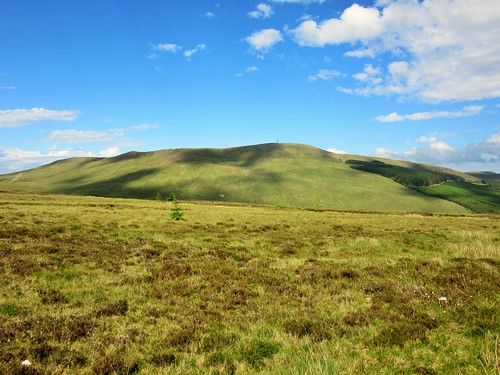
Slieve Gallion was Seamus Heaney’s home mountain, a bulky familiar in the childhood countryside that shaped his poetry, ‘one of the dream boundaries of my imagination’ as he put it himself.
First published in: The Times Click here to view a map for this walk in a new window
picture picture picture picture picture picture picture picture picture picture picture picture picture picture picture picture
Facebook Link:
But today I found it hard to see the mountain clearly. Heaney had died less than a month ago, and my head was crammed to spilling point.

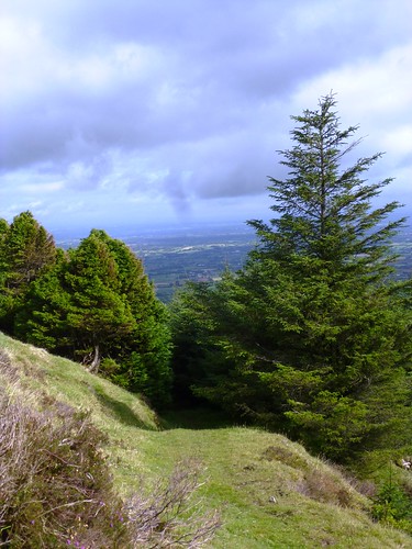
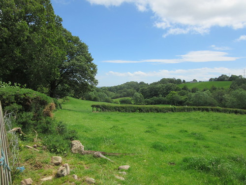
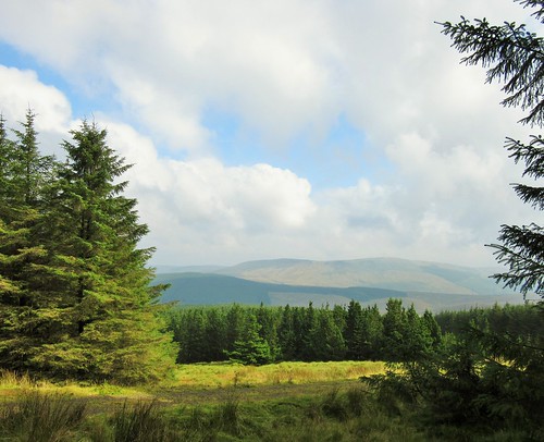
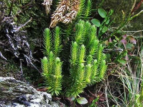
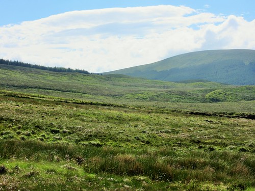
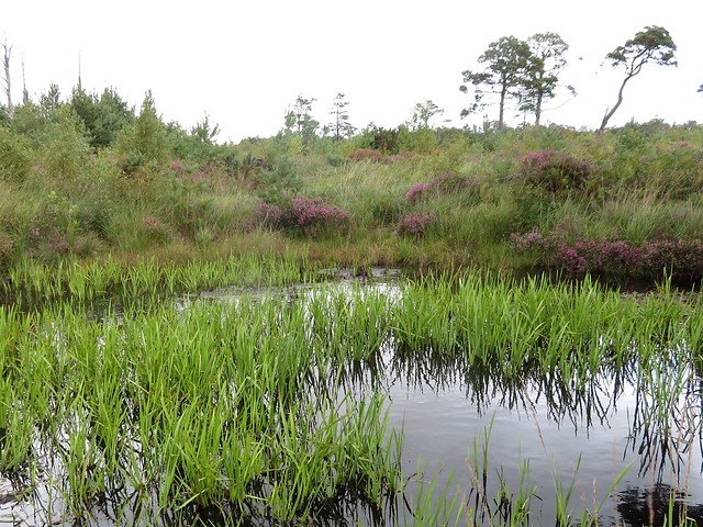
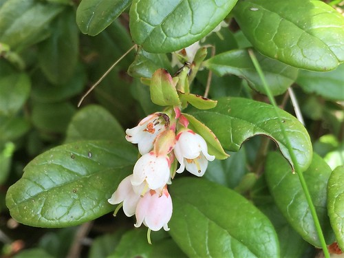
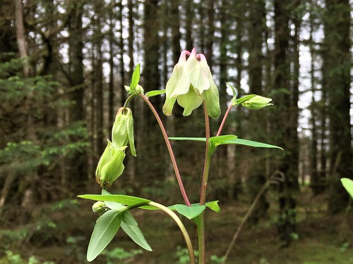
Yesterday at Laurel Villa, Magherafelt’s own House of Poetry, the ‘On Home Ground’ poetry festival had turned into a wake and thanksgiving for Ireland’s greatest poet since W.B. Yeats, Nobel Laureate and local boy. Everything seemed Heaney-coloured this cloudy midday on Slieve Gallion: the blue-fingered spruce trees, the birdsong in Iniscarn Forest, the tin-roofed farms and sedgy fields that he so brilliantly brought to new life with his pen, ‘snug as a gun’.

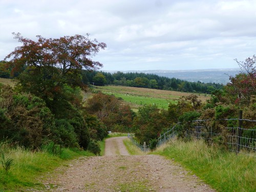
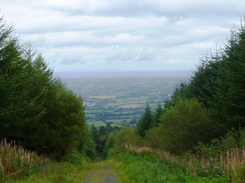
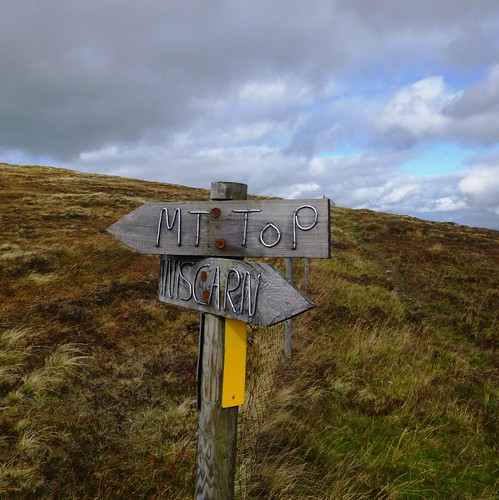
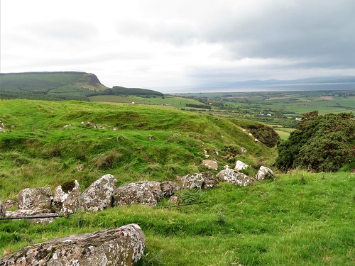
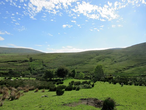
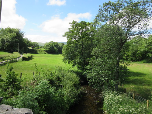
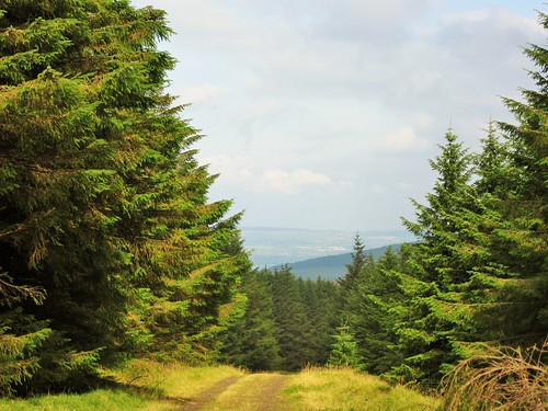
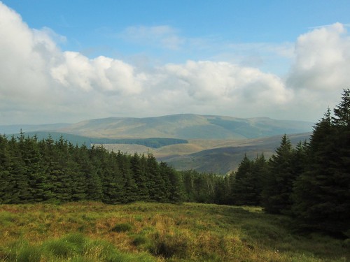
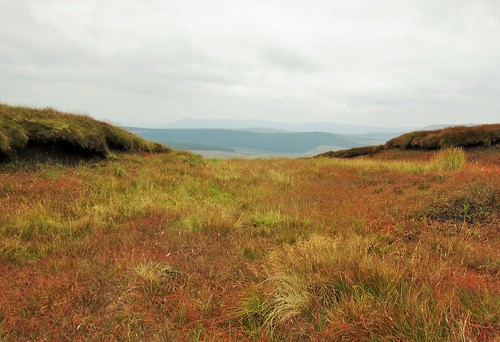
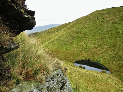
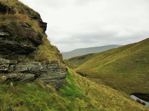
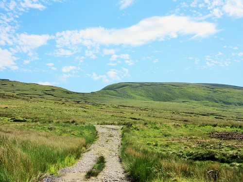
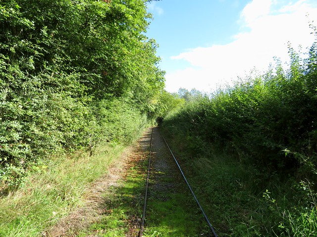
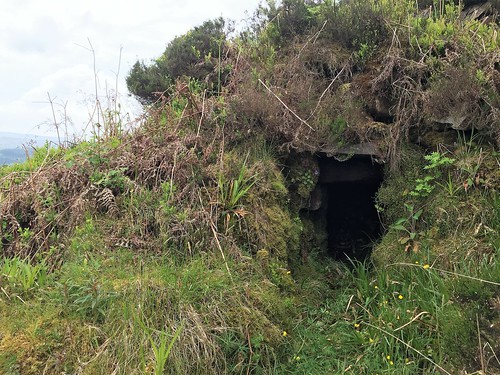
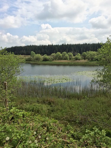
A long muddy track carried us up through the forest, where long-tailed tits sent their needly thin cries through the treetops. Up near the crest of the hill we broke out of the spruce and pine into open country. A path beaten into the heather led to the summit cairn, a solid flattened dome of stones, burial place of Callan, grandson of one of the High Kings of Ireland 1700 years ago.

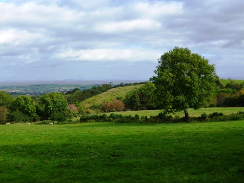
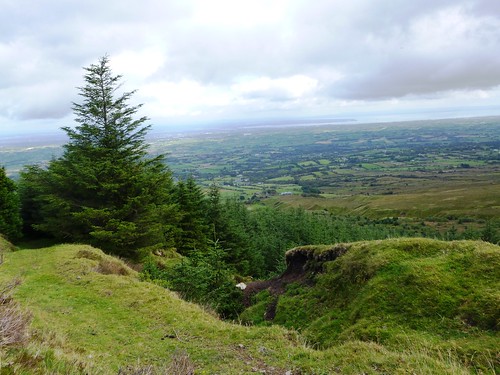
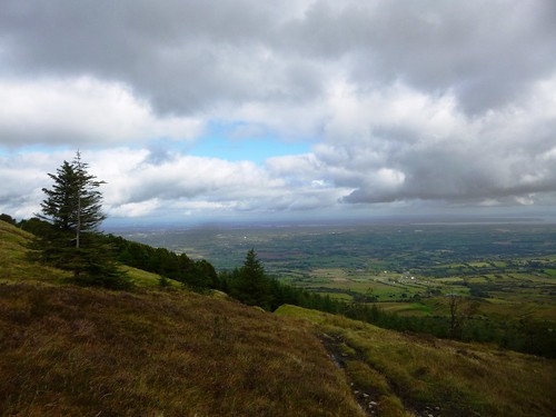
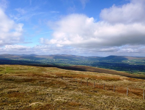
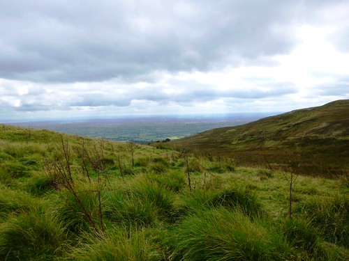
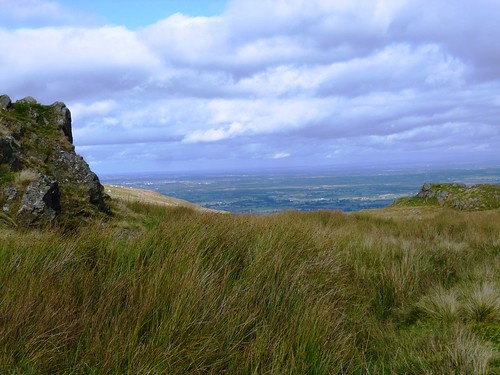
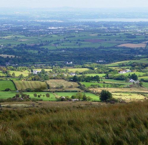
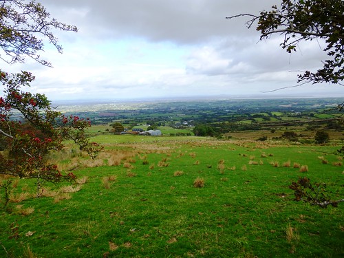
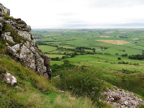
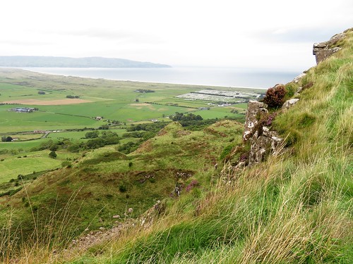
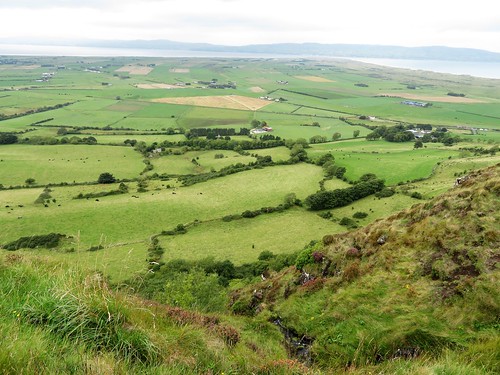
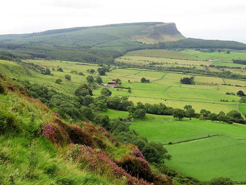
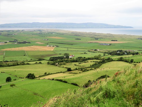
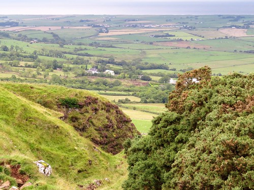
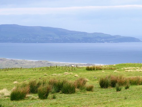
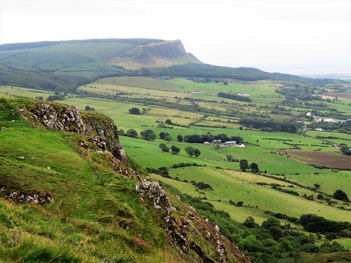
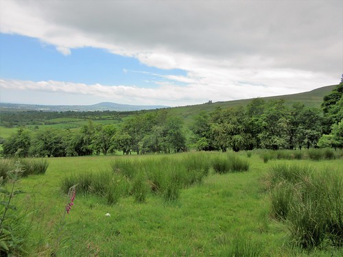
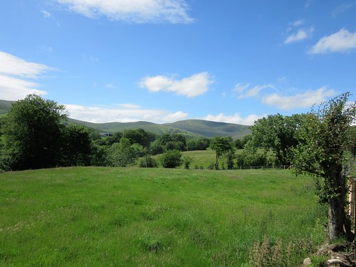
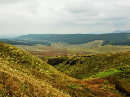
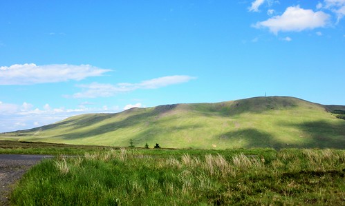
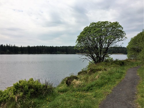
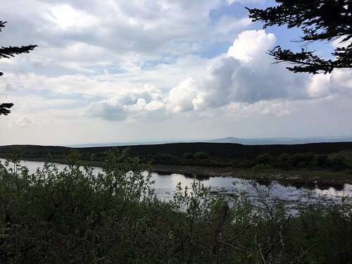
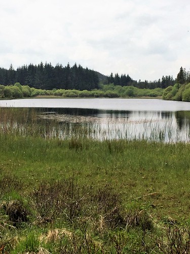
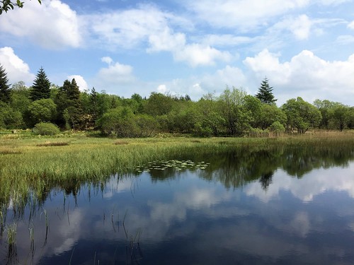
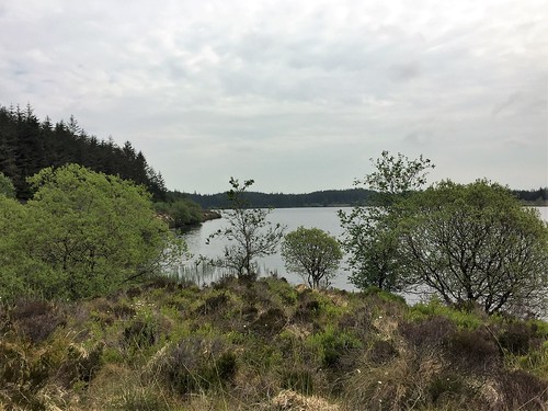
We stood by Callan’s grave, savouring the hundred-mile view. In the east, Heaney Country lay along the shores of cloud-like Lough Neagh – the green meadows around the poet’s birthplace of Mossbawn, Church Island’s spire beside Lough Beg, Castledawson and Magherafelt. Away beyond, Slemish Mountain, a pale grey cardinal’s hat under cloud; the Mourne Mountains sharp and clear in the south; and in the west the whole graceful spine of the Sperrin Hills, green and grey, with tiny fields raked up in converging lines of hedges rising toward their foothills.

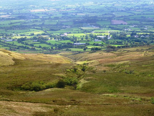
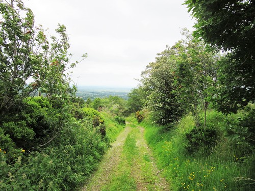
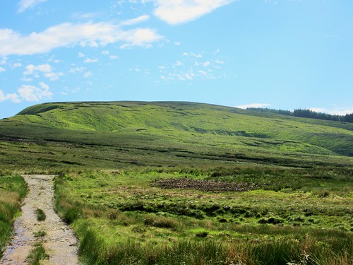
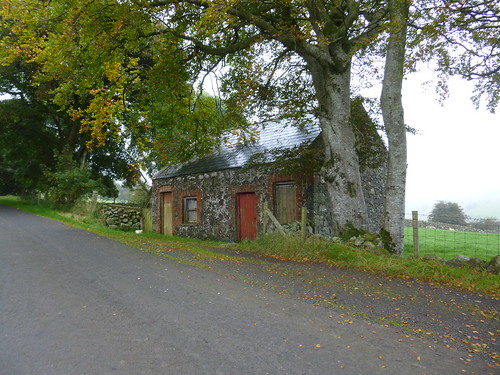
A curling tarmac road led down from Slieve Gallion’s peak, handing over to a rough farm track that descended through the rushy fields of small farms with rain-faded green corrugated barns. No grand images or thundering metaphors here today, but drifts of Heaney’s lines going in and out of the mind, along with a snatch of the beautiful old air of ‘Slieve Gallion Brae’:

‘May good fortune shine upon you when I am far away,
And a long farewell to bonny, bonny Slieve Gallion Brae.’

Start: Iniscarn Forest car park, near Desertmartin, Magherafelt, Co Derry (OS NI ref H832908)

Getting there: A6/A31 to Magherafelt, B40 to Desertmartin; B40 towards Draperstown. In 3 miles, left at crossroad up Iniscarn Road. Parking place on right in 3½ miles, signed ‘Iniscarn’.

Walk (5½ miles, moderate, OSNI Sheet 13. NB – online map, more walks at christophersomerville.co.uk): Pass gate, up forest track. In a ⅓ of a mile at ruined house, left (827905) past gate ‘2’. Keep ahead. Where track narrows keep uphill; keep to path that’s been trodden bare and muddy, climbing through spruce to reach open mountain and fence 1½ miles from start (814891). Right along fence; left over stile to masts and cairn beyond (813896). Back to mast; follow road (stony, then tarmac) for 1½ miles. Pass between rock outcrops; in 200m, on sharp right bend (820885), left along stony track. In ½ mile, at top of farm drive (824891), left along stony road, descending for a little over a mile to road (835905). Left to car.

Lunch: Bradley’s Bar, Desertmartin (028-7963-2377)

Dinner: Church Street Restaurant, Magherafelt (028-7932-8083) – fabulous Irish cooking

Accommodation: Laurel Villa, Magherafelt, Co Derry, BT45 6AW (028-7930-1459) – supremely hospitable and helpful ‘House of Poetry’.

Downloadable instructions: walkni.com

discovernorthernireland.com; www.satmap.com

 Posted by at 00:10
Apr 062019


First published in: The Times Click here to view a map for this walk in a new window
picture picture picture picture picture picture picture picture picture picture picture picture
Facebook Link:

The wind blew, great gusts of cold fresh air from the southwest across the coasts and cliffs of County Derry. The map said ‘Windy Hill’, so that seemed fair enough.

We stood at the brow of the hill looking over Lough Foyle to the cloudy peaks of County Donegal in the Irish Republic. Behind us a romantic statue depicted a handsome chieftain, or maybe a druid, standing in a boat. Arms upraised, he was casting gold into the ocean to placate the sea god Manannan MacLir. That was fair enough, too. In 1896, in the townland of Broighter just round the bend of the cliffs, two ploughmen had unearthed Ireland’s greatest ever hoard of ancient gold, including a beautiful little boat complete with tiny, delicate oars.

Today the sea god had roughened Lough Foyle and scored the sea with lines of wavelets. He’d also hidden from sight the distant Paps of Jura, sixty miles away in Scotland but sometimes glimpsed across the northern sea from this high viewpoint.

We set off south along the mountain road. Ahead rose the dark face of Binevenagh, its basalt cliff falling into the arms of rock pinnacles, then a gentle tree-smothered slope shelving to the plain below.

Enormous flows of lava formed the famous cliffs of the Antrim coast further east, but these western Derry outposts are just as dramatic. They stand breathtakingly rugged and steep over the great flat littoral of the tomahawk-shaped Magilligan Peninsula that shapes the eastern shore of Lough Foyle.

We left the road to reach the rim of the steep jagged cleft called Hell’s Hole, then set back north along the edge of the escarpment. The green and brown quilt of the Magilligan cattle pastures stretched away below to a coast of ancient sand dunes and a seven-mile strand, curving off to where a ferry ploughed a furrow between Magilligan Point and the little harbour town of Greencastle opposite on the Donegal shore.

Tiny frogs scrambled among the moor grasses, horned ewes bounced off like affronted dowagers, and a meadow pipit preened its striped breast, quite unafraid, on a fence post ten feet away.

As we gazed and stumbled, our eyes on the view rather than the rough ground we were walking, a big bird came sailing overhead on long dark wings – a marsh harrier, lordly enough to suit the prospect, turning and circling against the grey clouds until entirely lost to sight.
Start: Gortmore Viewpoint car park, Bishop’s Road, near Downhill, Co. Derry BT49 0LQ (OS ref C716342)

Getting there: Bishop’s Road is reached from B201 (Coleraine – Limavady), or A2 at Downhill.

Walk (5 miles, mountain road and rough field paths, OSNI Discoverer map 4; map/instructions downloadable at walkni.com): From car park, south along Bishop’s Road for 1 mile. At stone bridge, right (712327; stile, arrow) down fence. At bottom of field, right along fence, and follow escarpment edge north for 1 mile (stiles) to pass car park, then on for another 1½ miles along escarpment edge (stiles) beside fence, then stone wall. Above a waterfall (732356, ‘Umbra Bridge’ marked on map), stone wall curves inland; follow it with stream on left uphill for ⅓ mile, passing farm buildings, to ladder stile onto Bishop’s Road (731350, ‘North Sperrins Trail’). Right along road to car park.

Lunch: Anglers Rest, 660 Seacoast Rd, Benone BT49 0LG (028-7775-0600)

Accommodation: Hegarty’s Corner, 33 Glebe Road, Castlerock BT51 4SW (028-7084-9617, hegartyscorner.com)

Info: Two walks (Gortmore to Hell’s Hole, Avish to Eagle Hill) downloadable at walkni.com.
discovernorthernireland.com; satmap.com; ramblers.org.uk

Ships of Heaven – The Private Life of Britain’s Cathedrals by Christopher Somerville (Transworld) is published on 11 April

 Posted by at 02:18
Jun 252016


First published in: The Times Click here to view a map for this walk in a new window
picture picture picture picture picture picture picture picture picture picture picture
Facebook Link:

Drumderg Road runs west out of Moneyneany, shedding tarmac and houses as it gains height, with the eastern fells of the Sperrin Hills rising ahead. On this muggy midsummer day the verges were bright with vetches, foxgloves, speedwell and buttercups. The sharp yellow of tormentil and a white froth of heath bedstraw heralded the switch from rushy lowland sheep pastures to peat moors as the road lifted into a dark, wild upland of blanket bog under heavy grey clouds.

We reached the saddle between Crockmore (‘The Big Hill’, in actuality a flattened dome) and Crockbrack (‘The Speckled Hill’, a dun-coloured ridge). The far views were tremendous – Slieve Gallion lumping up in the south-east, Benbradagh raising a snub snout in the north-west, and all round a rollcall of Sperrin heights – Craigagh and Spelhoagh, Slievavaddy with its winking eye of a lough, Sawel Mountain’s dominant 678 m cone.

These rolling, peat-blanketed hills seem wilder than any other range in Northern Ireland, because you rarely see another walker up here. So Jane and I were saying to each other as we descended from Crockbrack, muffled against wind and rain, towards the deep cleft where the Drumderg River springs. Then a vision in T-shirt and shorts shot by. Noel Johnston from Belfast was doing a sponsored expedition to raise money for a charity bringing divided communities together. He’d tramped a long way, sleeping rough, and had a long way to go – another of those admirable youngsters putting their time and energy into making a better post-Troubles Northern Ireland.

By the time we’d got down into the dell, Noel was long gone over the horizon. We sat there on two picnic rocks, munching wheaten bread and chocolate mints like lords, savouring lark song and the soft hushing whisper of wind in rushes. Then we went steeply and boggily up to our third summit, Craigbane (‘The White Hill’, a sombre swelling) and found the long road home, a mountain track that fell gently away towards Moneyneany. The plains of Antrim lay spread in sunshine at our feet, cradled by the slopes of Craigagh and Crockmore, with a silvery gleam of Lough Neagh to beckon us down from the hills.

Start: Trailhead info board at Mulligan’s pub, Moneyneany, Co. Derry BT45 7DU (OS ref H 754965)

Getting there: A6, A31 to Magherafelt; B40 to Draperstown and Moneyneany.

Walk (7½ miles; moderate hillwalk, sometimes boggy, well waymarked; OSNI Activity 1:25,000 ‘Sperrins’ map. Walk downloadable at walkni.com. Online map, more walks at christophersomerville.co.uk): From pub car park, right along B40; in 30m, left up Drumderg Road (occasional yellow arrows/YAs, and ‘Crockbrack Way’/CW waymarks) for 2½ miles. At first cattle grid, tarmac changes to stones; at 2nd one, keep ahead; at 3rd one, at Crockmore summit, ignore stile on right and keep ahead (725956, CW, YA). In 100m at T-junction, right (YA) on bog road towards Crockbrack. In ½ a mile, right (717955, YA) up grassy track. In 200m, left (YA) to cross stile. Descend beside fence on left for 600m to fence running right (712959, YA). Follow it to right, steeply down to cross Drumderg River’s headwaters. Continue up fence on far side (sloppy, boggy!) to cross stile at top (711970). Right (CW, YA) down stony road, then tarmac, for 3¼ miles to B40 (749974). Right to Mulligan’s pub.

Lunch: Picnic; or Apparo Hotel, Draperstown (4 miles) – 028-7962-8100, apparorestaurant.com

Accommodation: Laurel Villa, Magherafelt, Co. Derry postcode (028-7930-1459, laurel-villa.com) – homely, helpful, spick-and-span B&B.

Info: Magherafelt TIC (028-7963-1510)

Northern Ireland’s Year of Food and Drink 2016: discovernorthernireland.com satmap.com; ramblers.org.uk

 Posted by at 01:42
Sep 052015


First published in: The Times Click here to view a map for this walk in a new window
picture picture picture picture picture picture picture picture picture picture picture picture picture picture picture picture
Facebook Link:

The Sperrin Mountains straddle the long border between Counties Tyrone and Derry. As shapely as a school of porpoises, they entice walkers with their softly rounded summits and gentle-seeming slopes. Meandering lanes and low-level paths curl round their feet. We were delighted to have an old friend, Martin Bradley, walking with us today. Exploring the Sperrins with a local man and expert guide like Martin is the best way to see the hidden corners of these wild uplands.

Under a milky grey sky we climbed the stony road through Altbritain Forest, its spruce and firs footed in the dense blanket bog that has grown to enwrap these hills over the past two thousand years. Waves of lime green sphagnum flowed over the dark peat under the trees, to be replaced by tuffets of green and orange deer grass as we left the cold shadow of the conifers and climbed the long flank of Mullaghaneany.

Up on the summit we paused by the fence that would guide us all way round the mountains today. To every point of the compass a superb prospect of hilly country unrolled, the names chiming in a cumbersome poetry – the Sperrin high points of Sawel and Meenard to the west, Mullaghearn hanging long and mighty over Omagh, the hummocks of Carnanelly and Slieveavaddy rolling in the south, and to the north-west the tilted peak of Benbradagh with a misted Lough Foyle at its foot and the hills of Donegal more imagined than seen in the cloudy haze beyond.

Shiny black fruit of crowberry glinted among bright green leaves against the chocolate-black peat. Twenty years ago, said Martin, over-grazing had reduced this place to a dismal slough. Now the bog is healing over with a haze of beautiful moor grasses, russet, emerald and cream.

We tramped the high tops from Mullaghaneany to Oughtmore and on to Spelhoagh, the hills all round us melting away into infinite shades of grey. A dreamy walk over the squelching turf, descending at last into a steep cleft where dragonflies circled a treacle-black bog pool. A last sharp scramble up the neck of Craigagh Hill, and we were crunching with Martin down a rocky bog road on the homeward path.

Start: Foot of forest road, Altbritain Forest, on B40 Draperstown-Feeny road (OS of Northern Ireland ref C 705003)

Getting there: From Draperstown, B40 (‘Moneyneaney’). 1 mile beyond Moneyneany, fork left (Moneyneany Road). In 3 miles cross bridge; in 100m, at ruined cottage on left, park carefully on right in gateway.

Walk (7 miles, strenuous, 1:25,000 Activity map ‘The Sperrins’. NB: online maps, more walks at christophersomerville.co.uk): Over stile/gate by ruined cottage; up forest road. In ½ mile, at left bend, (H 700997), keep ahead up green track. In ½ mile at T-junction (693993), left. In 200m, right up break in trees; across fence; up open hillside; left along fence at top. Keep to fence, crossing any side fences, for 3 miles over Mullagheany, Oughtmore and Spelhoagh summits. On Craigagh Hill fence descends steeply to turn left by pool (715988); leave fence, steeply up opposite slope to rough track on top; left along track for 1¼ miles down to B40 (719998). Left along road for 1 mile to car.

Conditions: Rough, boggy upland walking, some steep bits; best done in fine dry weather.

Lunch: Picnic; or Market Inn, Draperstown (028-7962-8250).

Accommodation: Laurel Villa, Magherafelt, Co. Derry postcode (028-7930-1459, laurel-villa.com) – immaculate, welcoming, helpful B&B. Dinner at excellent Church Street Restaurant, Magherafelt (028-7932-8083; churchstreetrestaurant.co.uk)

Guided walking: Martin Bradley, 028-7131-8473; mob 079-2678-5706; martin839@binternet.com
satmap.com; ramblers.org.uk;

 Posted by at 01:20
Aug 292009
 

First published in: The Times Click here to view a map for this walk in a new window
picture picture picture picture picture picture picture
Facebook Link:

It can be a wet old place, County Derry, after a month of good solid rain. Down in the glen of the Altkeeran River below Carntogher mountain, all was sedgy. But the old coach road along the glen gave firm footing through the turf. Streams ran orange from the iron minerals of the mountain, up whose green flank Jane and I went climbing.

Pink conquistador helmets of lousewort clashed with virulent red sphagnum in the banks of the tumbled wall we were following. It lifted us to the shoulder of the mountain, and a track where we met two walkers from a local townland. They pointed out Slieve Gallion ten miles to the south (‘a Derry mountain, despite what you might hear’) with great precision and pride. ‘I’ve walked this path since I was a boy,’ said one, ‘and by God I will do it till the day that I die!’

Up at the Snout of the Cairn, Shane’s Leaps lay just off the path – three innocuous-looking rocks. Did Shane ‘Crossagh’ O’Mullan, the light-footed outlaw with the scarred face whom all the ladies sighed for, once escape the lumbering English soldiery up here? So old tales say. At the Emigrants’ Cairn just beyond the Leaps we found a heart-stopping view to the hills of Donegal, the last prospect of their native land that those walking over the mountains to the ships in Lough Foyle would carry with them to ‘far Amerikay’.

Back across the slopes of Carntogher we went, following the boggiest of upland tracks, half peat and half puddle, past black heaps of iron-mining spoil to the top of the ridge and another most tremendous westward view, across the silver fishtail of Lough Foyle, on beyond the pale humps of Barnesmore and the Blue Stacks to the jagged spine of Errigal out at the edge of sight in western Donegal. Between Errigal and Mourne there cannot be fewer than a hundred miles. All Northern Ireland lay spread out for us, and we lingered long over this extraordinary feast.

On the way down we passed a Bronze Age cist grave. There was something about the little dark hole in the bank, slab-lined and secretive, that simply invited a tall and wild tale. But no-one was there to tell it to us today.

Start & finish: Tullykeeran Bridge, near Maghera (OSNI ref C 819045).

Getting there: Ulsterb us (www.nirailways.co.uk) to Maghera (3 miles) or Swatragh (3½ miles). Road: A29 (Coleraine-Maghera); minor roads to parking place by ruined cottage at Tullykeeran Bridge

Walk 5½ miles, moderate grade, OS of Northern Ireland 1:50,000 Discoverer 8): (red trail): Follow road. 100 m beyond 3rd bridge, left over stile by gatepost (red/blue arrows); follow track for ½ a mile into Altkeeran Glen (805407 approx). Right up path by tumbledown wall (red/blue arrows). In 3/4 of a mile, stony track crosses path (800058 approx); left (red arrow) to Emigrants’ Cairn and Shane’s Leaps (796058).

Return for 50 yards; left at post (red arrow) along grassy track to marker post on saddle of ground; walk 400 yards left here to ridge viewpoint over Lough Foyle and Donegal hills; return to marker post. Continue downhill along track for 2 miles, past cist grave (824061), through gates, down to road (823055). Right (red arrow) for 2 miles to car park.

NB – Online map, more walks: www.christophersomerville.co.uk.

Downloadable map/instructions at

http://www.walkni.com/d/walks/319/Carntogher_History_Trail.pdf. Trail map at car park.

Lunch: Rafters Bar and Restaurant, Swatragh (028-7940-1206); food all day, open fire, warm welcome.

Accommodation: Laurel Villa Townhouse, Magherafelt (02879-301459; www.laurel-villa.com) – friendly, well-run ‘house of poets’. From £70 dble B&B.

More info: Magherafelt TIC (02879-631510)


 Posted by at 00:00
Jul 042009
 

First published in: The Times Click here to view a map for this walk in a new window
picture picture picture picture picture picture picture
Facebook Link:
Frederick Hervey, 4th Earl of Bristol, Bishop of Londonderry from 1768-1803, was a remarkably broad-minded man. In that intolerant era of Penal Laws against Catholics, the Bishop allowed the local priest to celebrate Mass in the Mussenden Temple, one of the follies he erected around his preposterously extravagant Downhill Estate on the cliffs outside Castlerock. Hervey was also fabulously red-blooded and eccentric, fond of his wine and the ladies, addicted to foreign travel and art collecting, apt to have himself borne around in a palanquin and to drop spaghetti on the heads of pilgrims passing below his balcony in Rome.

Jane and I entered Downhill on a brisk windy morning under the knowing grins of the ounces or mythic lynx-like beasts that guard the estate’s so-called ‘Lion Gate’. Beyond lay the Bishop’s enormous Palace of Downhill in poignant ruin, its grand fireplaces hollow and stark, its windows blank, state rooms carpeted with grass and open to the sky. In the heyday of Downhill this incredible centre of luxury high on the cliffs had an entrance facade flanked by Corinthian pilasters, with a double stair leading to the door. There was a State Dining Room, a State Drawing Room, and a two-storey gallery for the Bishop’s superb art collection, all covered by a magnificent dome. Facade and double stair still stand, but now the interior walls, once beautified with exquisite plasterwork, are sealed with functional Ministry-of-Works concrete, the elaborate mosaics are gone from the chimney breasts, and buttercups and clover have taken the place of Wilton and Axminster. It’s a strange, uncanny and altogether haunting atmosphere in the empty shell of the Palace of Downhill.

Down on the brink of the basalt cliffs beside the domed Mussenden Temple, we looked out on a most sensational view: the sea shallows creaming on seven clear miles of sand that ran west in a gentle curve towards the mouth of Lough Foyle, with the clouded hills of ‘dark Inishowen’ beckoning from far-off Donegal.

That proved a quite irresistible call. Down on the strand we pushed into the wind. Waves hissed on the tideline, sand particles scudded by. Surfers rode the waves like water demons. The black and green rampart of the cliffs was cut vertically by white strings of waterfalls, the falling cascades blown to rags in mid-plummet. All this vigour and movement whipped us onwards to where the preserved sand dunes of Umbra rose between strand and cliff foot. A complete change of tempo here, sheltered among the sandhills, down on our hands and knees among pyramidal orchids of blazing crimson, yellow kidney vetch, lady’s bedstraw sacred to the Virgin Mary, and tall spikes of common spotted orchids of such a seductive milky pink and blue it was all I could do not to take a surreptitious lick at them.

Lying prone in the dunes, looking back through a screen of marram grass and clovers, we saw the dark pepperpot shape of the temple on the brink of Downhill cliff. Had the bold Bishop of Londonderry kept a mistress in there, as stories say? I rather hope he had, and his palanquin and spaghetti-tureen, too.

Start & finish: Lion Gate car park, Downhill Estate, Castlerock BT51 4RP (OS of NI ref C 757357)

Getting there (www.nirailways.co.uk): rail to Castlerock (½ mile), Ulsterbus service 134. Road: On A2 between Castlerock and Downhill Strand

Walk (6 miles, easy grade, OS of NI Discoverer 04): From Lion Gate car park explore Walled Garden, then Downhill Palace ruin, then Mussenden Temple (758362). Return anti-clockwise along cliff. From Lion Gate cross A2 (take care!); right downhill beside road on pavement. Short stretch with no pavement leads to foot of hill. Right under railway; left along Downhill Strand. After 1 ¼ miles, where river leaves dunes, look left for Ulster Wildlife Trust’s Umbra Dunes notice (732359). Follow fence through dunes to descend on Benone Strand. Continue to Benone (717362 – lavatories, Visitor Centre, sometimes ice cream vans). Return along beach and A2 to Lion gate car park.

NB – Online map, more walks: www.christophersomerville.co.uk

Lunch: Pretty Crafty Studio (signed across A2 from Lion Gate) for a cuppa and cakes

Accommodation: Downhill Hostel (028-7084-9077; www.downhillhostel.com) at foot of hill – dormitory (from £12) or private (from £35 dble, £60 for 4 adults). Whole hostel bookable.

More info:

Downhill (NT): 028-2073-1582; www.nationaltrust.org.uk

Coleraine TIC: 028-7034-4723; www.discovernorthernireland.com

 Posted by at 00:00
Oct 122019


First published in: The Times Click here to view a map for this walk in a new window
picture picture picture picture picture picture picture picture
Facebook Link:

Swallow were skimming low over the buttercup meadows of Peatlands Park, fuelling up on insect food as they strove to put on fat before their great flight south to African winter quarters. The flies and midges, in great abundance here on the southern shore of Lough Neagh, had been forced almost to ground level by low pressure over Northern Ireland. Rain clouds and sun bursts chased each other, blowing in across County Armagh from the west over the grey misty hummocks of the Sperrin Hills.

We stood watching the swallows for a while, before following the path through woods of oak and wych elm where a little narrow-gauge railway track snaked among the trees. Before Peatlands Park was formed as a recreational area, this was a bog extensively cut for peat which was trundled away by the diminutive railway for processing.

Beyond the trees the purple heather moorland of Derryhubbert Bog stretched away, dotted with tattered Scots pines. Three hundred men worked here early in the 20th century, cutting, drying, loading and shifting the turf for livestock bedding and vegetable packing.

First World War soldiers had their wounds packed with sphagnum collected from Derryhubbert Bog. The soft material, known as ‘bog moss’, is capable of absorbing up to twenty times its own volume of liquid – blood and corrupt tissue – and also contains an antiseptic agent.

We passed bog pools as black as polished marble. A dip in the ground, juicily wet and full of hazels and willow, showed where Annagarriff Lake once lay. The landowning Verney family used it for fishing, for wild fowling and as a supply of water for their Big House nearby. The Verneys preserved these woods for chasing the deer, and some of the trees are splendidly old.

A rain shower hissed across, polishing every blade of grass and bringing fruity, rooty smells from the bog. We took to a boardwalk path, and soon had glimpses between the willows of the grey waters of Derryadd Lough, a big open expanse fringed with reedbeds.

The boardwalk encircled the lough, its margins bright with purple buttons of devil’s-bit scabious. Bees hummed between the flowers, laden with pale gold saddlebags of pollen. Meadowsweet stood thick with seeds ready to drop. Gaps in the reeds gave views over the lake to the far reedbeds where a fleet of wigeon bobbed in the wind-furrowed water.

The return route brought us along a squelching track through bracken and birch scrub. A patch of bog had been laid out to show the process of old-fashioned turf cutting. Such labour, such strength and energy, to harvest that versatile material from the bed where it had lain for thousands of years.

Start: Peatlands Park, near Portadown, Co Armagh, BT17 6NW (OSNI ref H897603)

Getting there: Signposted from Jct 13, M1

Walk (5½ miles, easy, OSNI Discoverer 19; downloadable map and instructions at walkni.com): From car park ahead through gate; left along tarmac path with fence on left; follow red arrow waymarks of Peatlands Walk. In 3½ miles, near Derryadd car park, left onto boardwalk of Lake Walk (blue waymarks) anticlockwise round Derryadd Lake. Back on Peatlands Walk boardwalk, right (red arrow), retracing route for 400m. Left over footbridge (red arrow) to return to car park.

Conditions: Surfaced paths and boardwalks

Lunch: Picnic

Accommodation: Armagh City Hotel, 2 Friary Rd, Armagh BT60 4FR (028-3751-8888, armaghcityhotel.com

Peatlands Park: 028-3839-9195; doeni.gov.uk

Info: Armagh Visitor Information Centre (028-3752-1800); discovernorthernireland.com; satmap.com; ramblers.org.uk

 Posted by at 01:57
Jul 222017


First published in: The Times Click here to view a map for this walk in a new window
picture picture picture picture picture picture picture picture picture picture picture picture picture picture picture picture
Facebook Link:

The prospect over Lower Lough Erne from the Cliffs of Magho is dumbfounding, a window suddenly opening across the whole slice of country where Fermanagh reaches into Donegal. The panorama swings from a chink of the Atlantic in the west, round through thirty miles towards the head of Lower Lough Erne in the east. We gazed out from the viewpoint over islands and inlets, out to the giant wedge of the far-off cliffs of Slieve League and the long pale backs of the Bluestack Mountains.

Glencreawan Lough lay becalmed in the lee of the ridge that forms the Cliffs of Magho. Just down the forest road we skirted its sister lough of Meenameen, another placid sheet of steel-blue water where fishermen hid among the reeds and cast for brown trout.

All round the loughs stood the sombre ranks of dark conifers that form Lough Navar Forest. There’s a strong but indefinable Grimm’s Fairytale frisson about the stygian blackness under such massed trees. But soon other colours began to claim attention – purple heather, crimson and acid green sphagnum moss, the silver splinters of felled trees and the pale milky green of the long beards of usnea lichen sported by the older trees – infallible sign of unpolluted air.

We passed between Lough Navar and Lough Naman – the former a gunmetal grey plate of water under low hills, the latter a little saucer of a lake half filled with reeds. The rough road turned east past the brown bog slopes of Glenasheevar, newly planted with forestry, then plunged back into the trees to wriggle its way below the outcrop of Melly’s Rock.

Hard against the little cliff we found a doorway three feet high. Crouching under the lintel, we crawled one after the other into the stone-walled interior – an ancient sweathouse, where sufferers from a range of ailments would be enclosed to bake in the heat and smoke of a peat fire before being extracted and plunged into cold water. Kill or cure, literally.

We paused on the bench outside to admire the gorgeous hilly prospect southward, then made for the homeward road by way of a circuit of beautiful Lough Achork, the loveliest forest lake of them all.

Start: Glencreawan Lough car park, Lough Navar Forest, near Derrygonnelly, Co. Fermanagh, BT93 6AH approx. (OS NI ref H 033566)

Getting there: From Enniskillen, B81 to Derrygonnelly. Follow ‘Garrison via Glenasheevar’, then ‘Forest Drive’. Right into Lough Navar Forest (‘Scenic Drive’); follow forest road to Cliffs of Magho viewpoint. Return to junction; left to Meenameen Lough. Just before car park, bear right to reach Glencreawan Lough car park.

Walk (9 miles, easy, OSNI 1:50,000 Discoverer 17. Map downloadable at walkni.com): Return along road to Meenameen Lough car park (029561). Down steps, right along shore path (black arrow/BA). In ½ a mile, at road, left (025557, BA). After passing Lough Navar, left at junction (021544, BA). In 1¾ miles, at tarmac road, right (046545, ‘Ulster Way’/UW) along road. In ⅔ of a mile, on sharp bend, left up footpath (056544, ‘Sweathouse 450m’), following signs to sweathouse (054547). Return to road; right (retracing steps); in ⅔ of a mile, fork right (046545, BA). In ¾ of a mile detour left (044556) for circuit of Lough Achork. Back to road, left; at top of rise, fork left (047560, BA) for 1½ miles to car park.

Lunch: Picnic

Accommodation: Lough Erne Resort, Belleek Rd, Enniskillen BT93 7ED (028-6632-3230, lougherneresort.com) – luxury golf hotel, stunning lake views.

Info: Enniskillen TIC (028-6632-3110);
discovernorthernireland.com satmap.com, walkni.com

The January Man – A Year of Walking Britain by Christopher Somerville (Doubleday, £14.99).

 Posted by at 01:29
Mar 292014
 

Mist was hanging tattered curtains from the unseen rims of Glenariff as we drove up the twisting road from Waterfoot. First published in: The Times Click here to view a map for this walk in a new window
picture picture picture picture picture picture picture picture
Facebook Link:
The glen’s waterfalls showed as white threads tangling into wind-blown ropes down tall chutes in the basalt cliffs. At the top of the glen the moorland village of Cargan lay in a hollow below mountain slopes that we sensed rather than saw.

Along the road we walked from Cargan, cattle lay in the stone-walled fields, each cow preserving her own dry patch. We passed a rough-cut, square-topped standing stone half-hidden under an ornamental tree in a cottage garden, and turned along a lane that led past mountain farms towards Dungonnell Reservoir. Every farm gate held its black and white guardian collie, head cocked low and sideways, a picture of acute alertness and suspicion. Three magnificently horned sheep watched us across their field wall, stamping the grass and shaking mist-drops from their coats like dogs.

Dungonnell Reservoir, opened in 1971, lay curved in an elbow of low hills, its architecture suitably functional for the austere era it was built. Beyond the reservoir we left the road and crossed a strip of the Garron Plateau’s blanket bog, lushly sodden peat starred with pale pink marsh orchids. Down in Crockaharnan Forest all was still and dark among the long avenues of spruce, under which shone carpets of brilliant crimson and luminescent green sphagnum moss. Goldcrests squeaked in tiny voices among the treetops, and the mist trickled thin and milky between the pale trunks of the trees.

We crossed the road to Waterfoot, then the one to Cushendall, and were back in the foggy forest on a flint-surfaced path among horsetail plants, jointed and bristly like bright green bottlebrushes. A tiny brown frog sprang from stone to stone until it vanished in among the grass tussocks, where every sedge seed hung enclosed in the magnifying bowl of a water drop. It was an Antrim cloud-forest, seething soundlessly under the invisible slopes of Trostan mountain.

At the forest gate Artie O’Brien and his little Cairn terrier Zimba offered us a lift in their car along the mountain road and back to Cargan. Shall I confess that we took it? Well – I won’t tell, if Artie won’t. Zimba, you can keep your mouth shut, too.

Start: Cargan village, Glenariff, Co. Antrim, BT43 6RB (OSNI ref D 169189)

Getting there: Bus – service 150 (translink.co.uk/Services), Ballymena-Cushendun. Road – Cargan is on A43 Ballymena-Waterfoot road.

Walk (9½ miles, easy, OSNI Discoverer Sheet 9; downloadable map, directions at walkni.com; NB – online map, more walks at christophersomerville.co.uk): Head down street towards Ballymena. Left along Gortnageeragh Road. In 600m, round right bend; in 200m, left along Dungonnell Road (‘Dungonnell Walk’/DW waymark arrow) for nearly 3 miles. 400m past north end of reservoir, beyond notice-board on right bend, left (198185, DW) into forest. In ½ mile, left at T-junction (203194, DW); in 1 mile, reach A43 (191207). Right for 100m; left (DW) into forest. Follow DW to B14 at Essathohan Bridge (191217). Right beside road; left onto road, back across bridge (DW); in 200m, right over stile by gate (DW) into forest. In 400m, left at T-junction (187220, DW); in 1 mile, ahead along road (180206). In 2 miles, left (157187); in 700m, left (159180) along Legragane Road into Cargan.

Lunch: Greenhills pub/chip shop, Cargan (028-2175-8743)

Accommodation: Londonderry Arms, Carnlough, BT44 0EU (028-2888-5255; glensofantrim.com) – cheerful family-run hotel with sea views.

Info: walkni.com, nitb.comwww.satmap.com www.LogMyTrip.co.uk

 Posted by at 01:31
Dec 072009
 

Passing Laurel Villa, you’d never suspect it was a Tardis. One has to enter this modestly proportioned house on the outskirts of the County Derry town of Magherafelt to taste its magic. Your first impression is of a beautifully kept bed-and-breakfast house. Then you notice the photographs and paintings lining the walls: James Joyce, Samuel Beckett, Seamus Heaney. There are poems printed on linen, first editions in glass cases. Upstairs you pass the bedroom doors: the Kavanagh Room, the MacNeice Room, the Heaney Room. Laurel Villa is a shrine (though a very unstuffy one) – a genuine House of Poetry. Gerardine Kielt keeps things immaculate, and cooks the best breakfasts in Ireland; Eugene, her husband, organises poetry readings at Laurel Villa, and maintains contact with poets far and wide – including Seamus Heaney himself, the most celebrated and best-read living poet in these islands today.

Heaney, a local boy born on a farm a few miles from Magherafelt, has a great admiration for the Kielts’ love and respect for poetry. So much so that this Nobel Laureate, hugely in demand and fêted all over the world in this year of his 70th birthday, found the time to come to the unassuming Magherafelt house in June and give a reading in front of an audience of fifty. My wife Jane and I were there; so were Heaney’s brothers, his relations, his local acquaintances. Watching him chat and sign books, joke and clink wine glasses after the reading, you got the measure of a very genuine and grounded man, very pleased to be back on the soil that sprouted all those famous poems.

Joining Eugene Kielt on one of the guided tours he conducts round Seamus Heaney Country, we found the building blocks of Heaney’s young life and his life-long art coming at us round every corner, shining a light on poems that we seemed to have known and loved for ever. At the Hillhead near Magherafelt, Barney Devlin’s forge stood beside the roaring Toome road, the low ‘door into the dark’ exactly as Heaney described it in one of his best-known poems, ‘The Forge’. And there was the 89-year-old Barney himself, ‘90 next Boxing Day!’ An ageless man, full of life and fun (personal motto: ‘You must get up!’), delighted to be so much visited. We leaned against the door jamb and listen to the smith yarn and ring the anvil with his great hammer, as he did at the Millennium hour. He pointed out hearth and bellows, long-redundant tools, a stuffed rooster in the rafters. ‘Dick the fighting cock, champion of Meath!’ Pouring out a none-too-mean measure of whiskey, Barney gave a wicked chuckle and slapped me on the back. ‘I’ve never touched it in my life, but I like a man who takes his drop!’

In the townland of Broagh below the forge, a long-abandoned railway line curved across the lanes. Heaney wrote in ‘The Railway Children’ of climbing its grassy cutting, level with the telegraph poles where ‘words travelled the wires/In the shiny pouches of raindrops’.

How many people wish that Mossbawn, the original thatched house where the poet was born to Patrick and Margaret Heaney in 1939, had not been demolished! But it was, some years ago, and in its place another long, low, modest farmhouse stands beside the Toome road. The McLaughlin family live here now, farming the same fields and milking cows in the same yard as Patrick Heaney did seventy years ago. We looked around the place – the byre, the sheds, the waterlogged field at the back of the house where the Heaney boys put down ‘four jackets for four goalposts’ and played football until the light died:

‘And the actual kicked ball came to them

Like a dream heaviness, and their own hard

Breathing in the dark and skids on grass

Sounded like effort in another world …’

Of all the places we visited, I found Church Island on the shores of Lough Beg the most resonant. The spire stuck up skywards from the massed trees of the island, unapproachable beyond a rain-sodden wetland. Leaning against the ivy-grown road wall, Eugene quietly read us ‘The Strand at Lough Beg’, Heaney’s eulogy for his second cousin Colm McCartney, murdered by sectarian killers in 1975. The backdrop of the poem and the present setting were one and the same: cows in a mist, clays and waters, a soft treeline.

‘ … I dab you clean with moss

Fine as the drizzle out of a low cloud.

I lift you under the arms and lay you flat.

With rushes that shoot green again, I plait

Green scapulars to wear over your shroud.’

The late afternoon light began to fade. The unvisited locations of Heaney Country would have to wait for another day – Anahorish (‘We were killing pigs the day the Americans arrived’), Bellaghy Bawn, the graveyard where Seamus’s brother Christopher Heaney lies buried near Colm McCartney. ‘I like to think that I belong to these places,’ said Eugene Kielt, steering us back towards Magherafelt, ‘and they belong to me. What Seamus Heaney’s magic is, for me – he can attach a total stranger to these places, and leave that stranger attached to them as strongly as I am myself – these ordinary places that I’ve known all my life.’

Laurel Villa Townhouse

60 Church Street, Magherafelt, Co. Derry BT45 6AW (02879-301459; www.laurel-villa.com) – From £70 dble B&B.

Guided tours of Seamus Heaney Country

Variable length, depending on people’s interest. From £60 pp, transport and copies of poems included; group rates negotiable

Reading (all titles published by Faber & Faber):

Seamus Heaney’s poems:

Opened Ground: Poems 1966-1996; The Spirit Level (1996); Electric Light (2001); District and Circle (2006)

Prose:

Preoccupations: Selected Prose 1968-1978 (1980); The Government of the Tongue (1988); The Redress of Poetry: Oxford Lectures (1995); Finders Keepers: Selected Prose 1971-2001 (2002)

Interviews: Stepping Stones: Interviews with Seamus Heaney by Dennis O’Driscoll (2008)

Listening

‘The Poet and The Piper’ (Claddagh Records 2003): Heaney reads many of his best-loved poems; master musician Liam O’Flynn plays uilleann pipes and whistle

Collected Poems’ (RTE Lannan 2009, 15-CD box set): Heaney reads his 11 collections in their entirety

 Posted by at 00:00