Search Results : Lancashire Lancs

Feb 212023


First published in: The Times Click here to view a map for this walk in a new window
Blackstone Edge - one troll whispers in another's ear 1 Gritstone outcrops of Blackstone Edge 1 the Aiggin Stone and its cairn The Aiggin Stone at Blackstone Edge cobbled Roman road leading to Blackstone Edge Blackstone Edge - one troll whispers in another's ear 2 footpath fingerpost by Rishworth Drain Green Withens Reservoir - municipal architecture in the middle of nowhere fingerpost pointing the way to Baitings Reservoir - but ignore it!

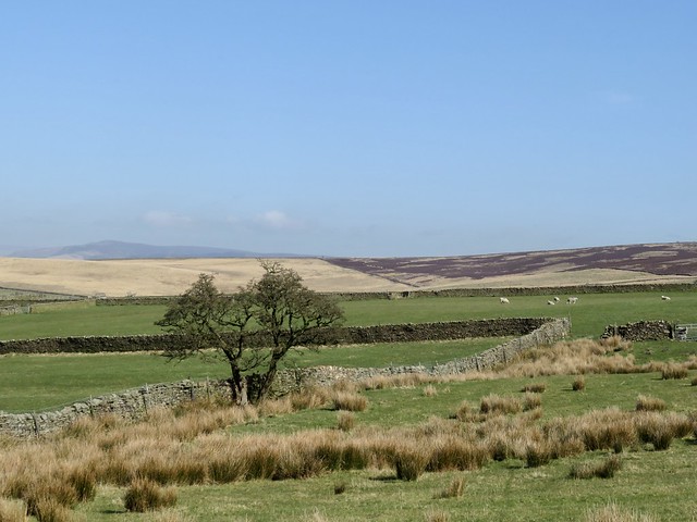
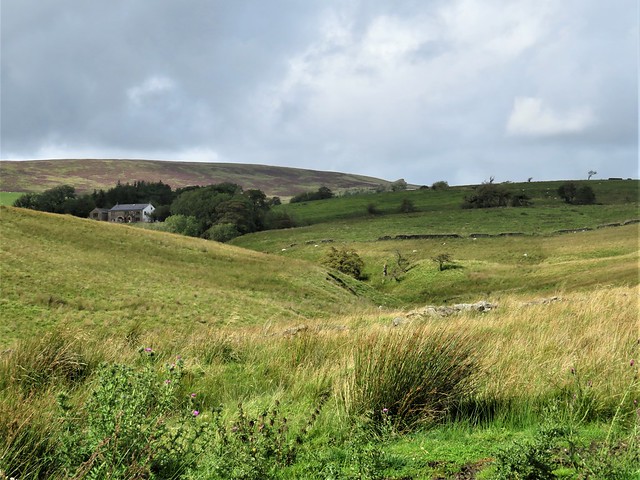
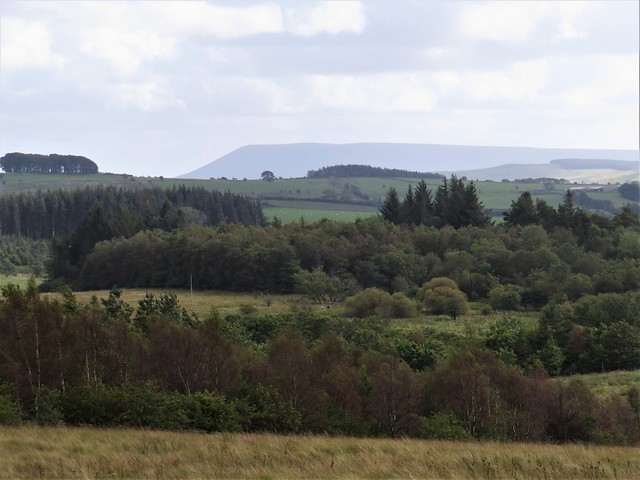
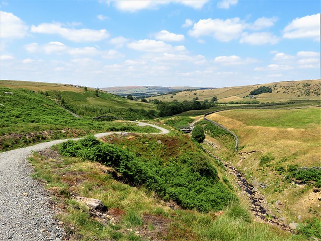
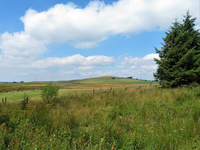
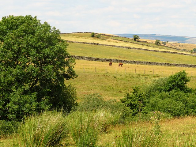
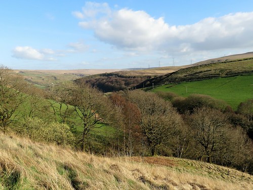
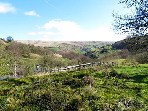
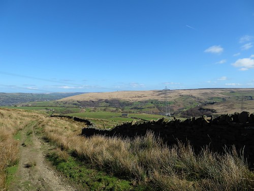
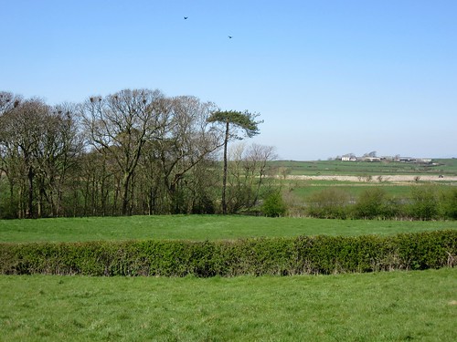
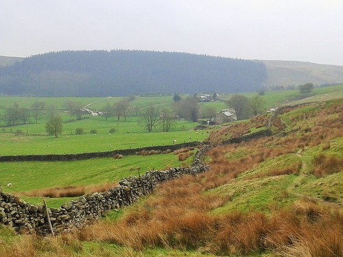
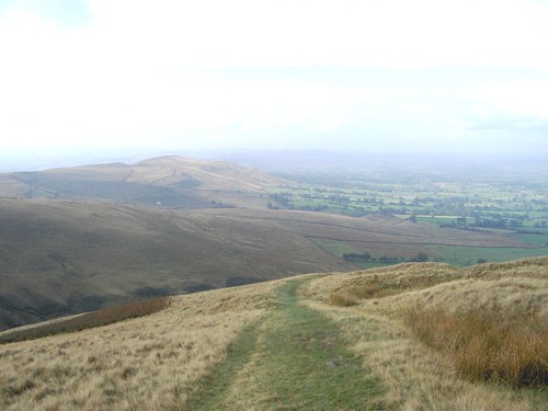
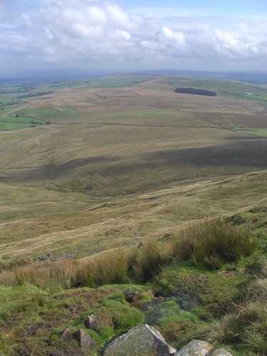
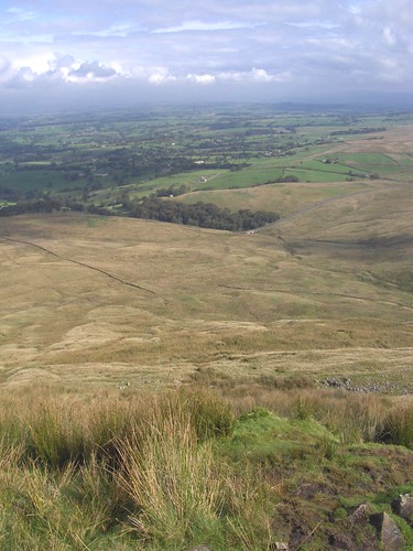
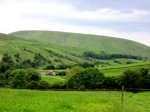
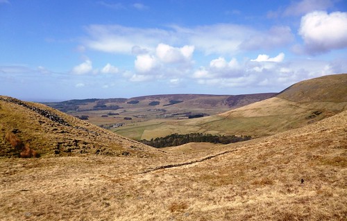
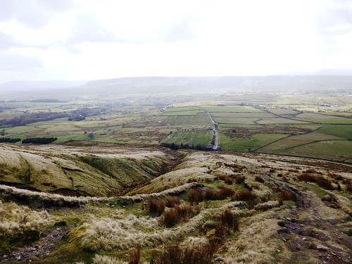
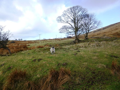
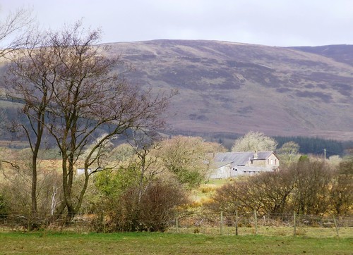
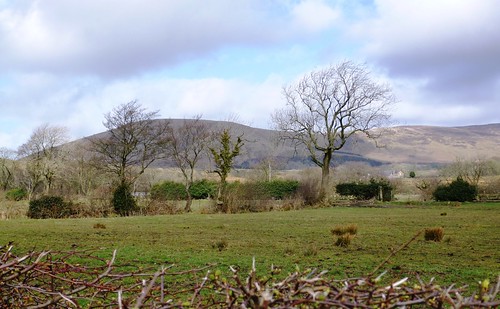
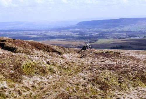
Around Blackstone Edge the gritstone moors roll away, breezy uplands that are a godsend to anyone bent on getting out of the former manufacturing towns of Lancashire and Yorkshire for a good day in the open air.

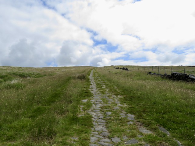
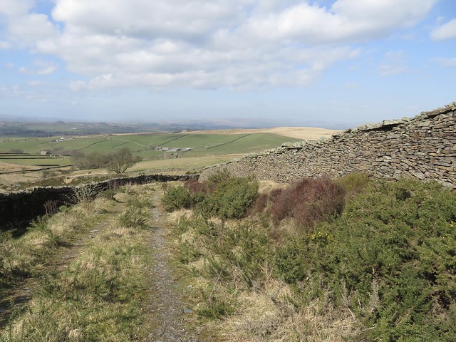
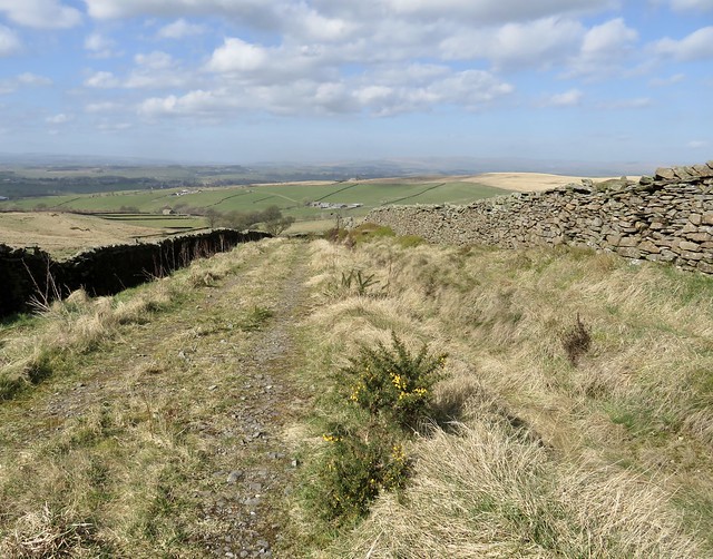
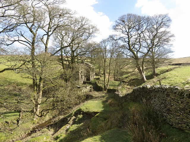
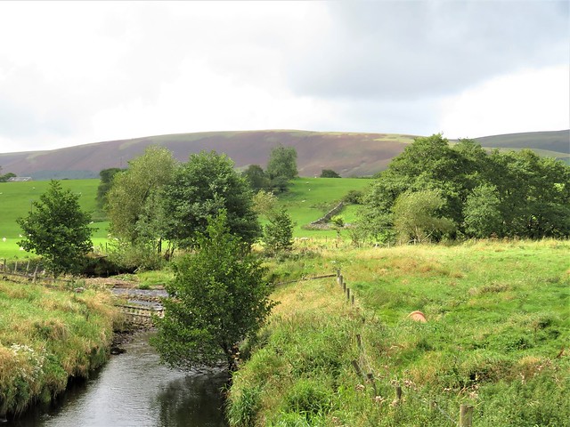
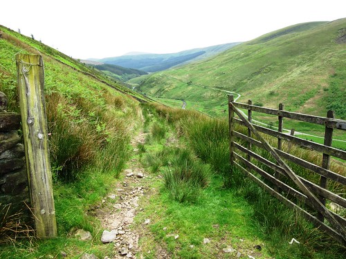
From White House Inn we crossed the road and followed the broad stony track of the Pennine Way. The path surface had broken down under millions of footfalls into sand and quartz, a creamy, honeyed hue, the components of gritstone disassembled once more after three hundred million years of clinging together.

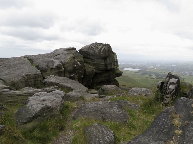
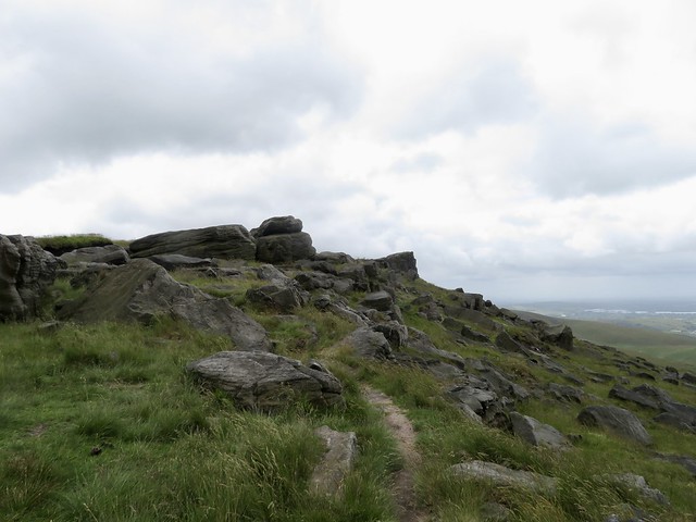
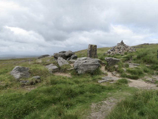
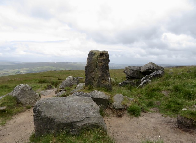
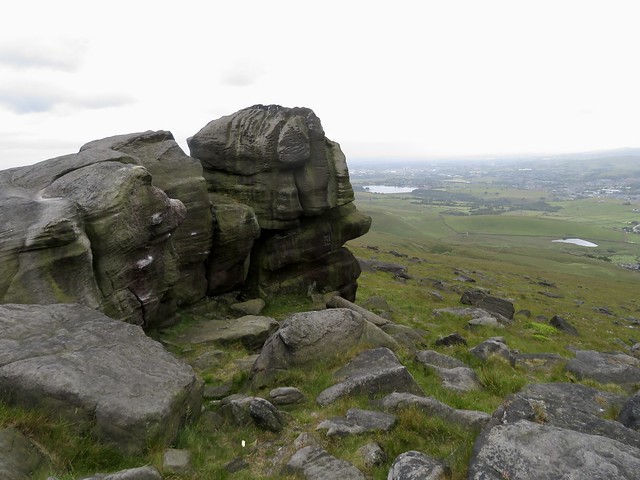
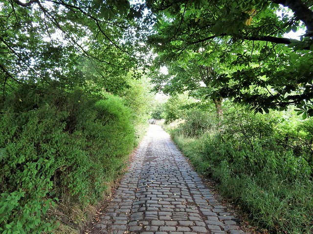
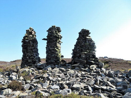
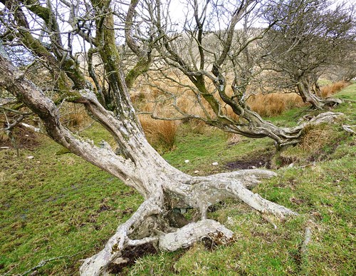
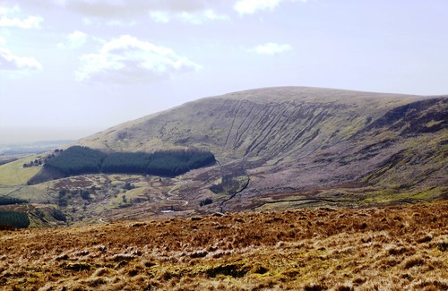
A short cobbled section of Roman road led up to the Aiggin Stone, a medieval waymark pillar set up to guide benighted or mist-beguiled travellers. From here the Pennine Way rose to Blackstone Edge, a classic gritstone ridge with cliffs jutting westward like ships’ prows. Wind-distorted boulders stood at the edge, weathered to resemble stacks of black pancakes or gossiping trolls, their rough sandy bodies studded with specks of white quartz like globules of fat in coarse salami.

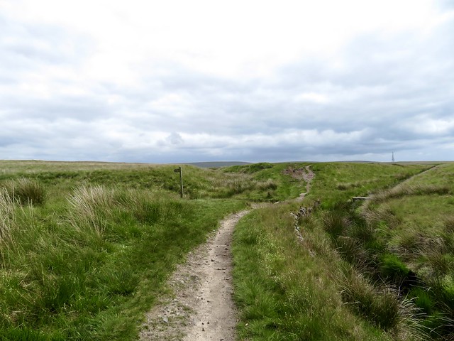
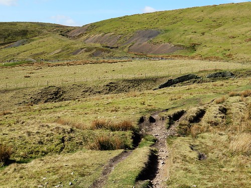
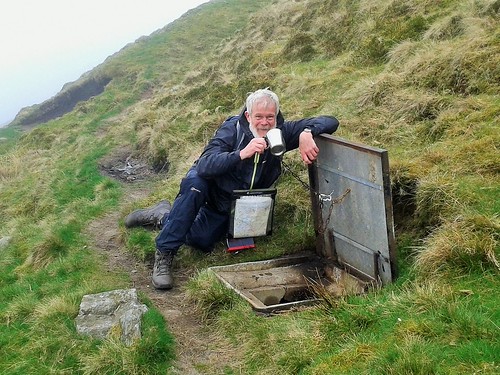
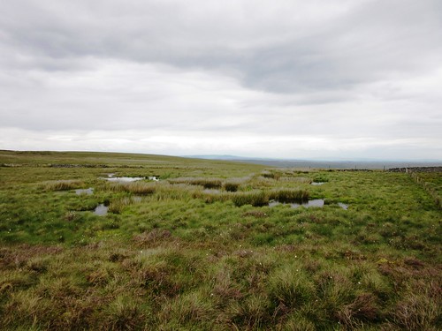
The narrow, stumbly path headed south down a long slope into the rushy declivity of Redmires and Slippery Moss. ‘Standing knee deep in this filthy quagmire,’ Alfred Wainwright wrote with mordant humour in his 1967 Pennine Way Companion, ‘there is a distinct urge to give up the ghost and let life ebb away.’ But thing have changed since Wainwright’s day. Nowadays it’s a dry-shod walk on a path of flagstones salvaged from the floors of redundant textile mills.

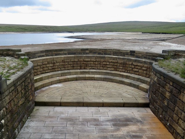
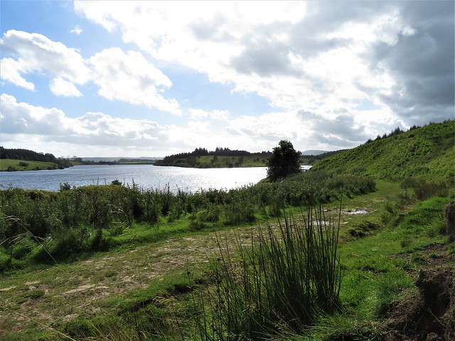
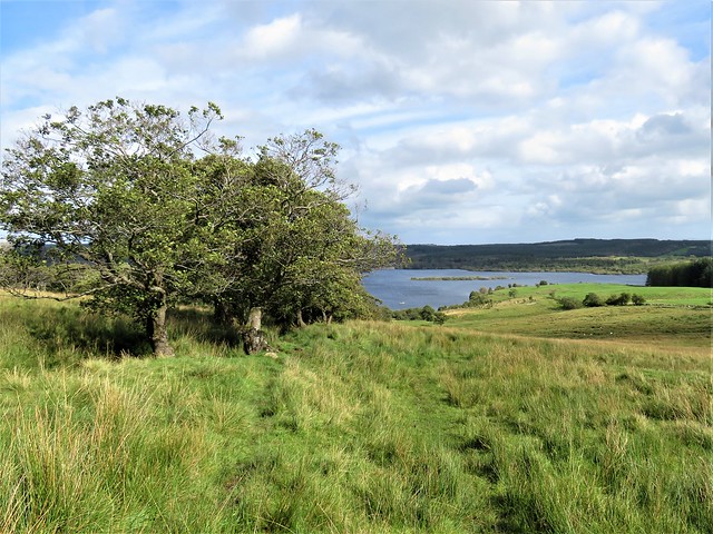
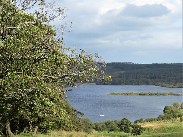
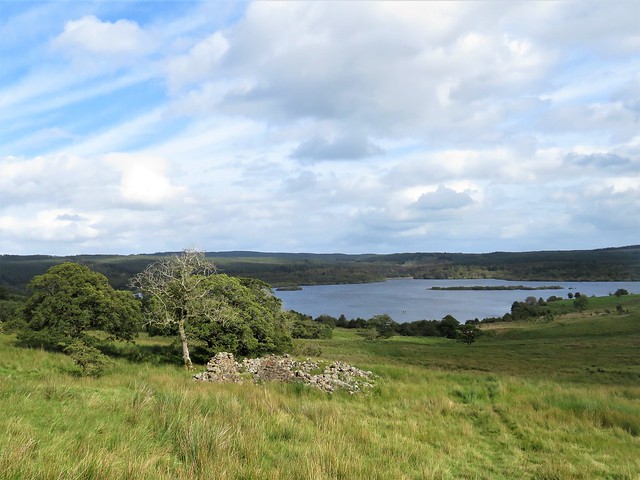
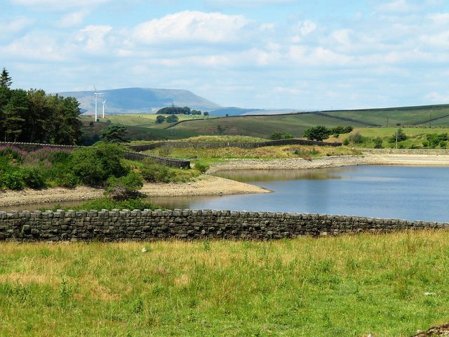
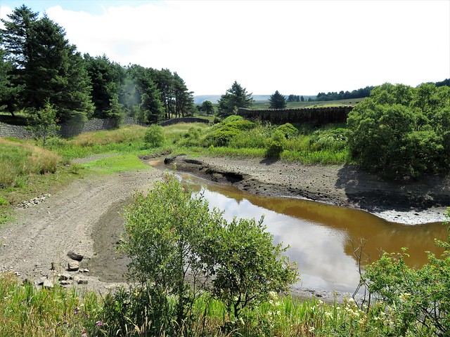
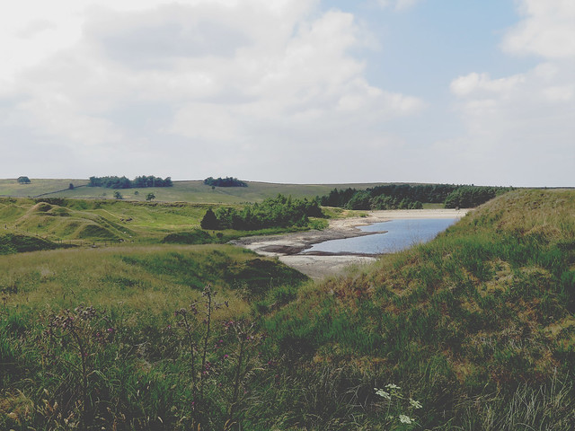
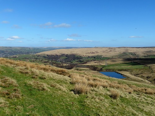
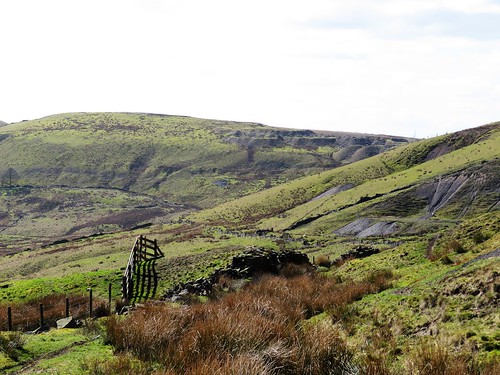
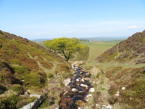
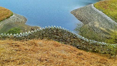
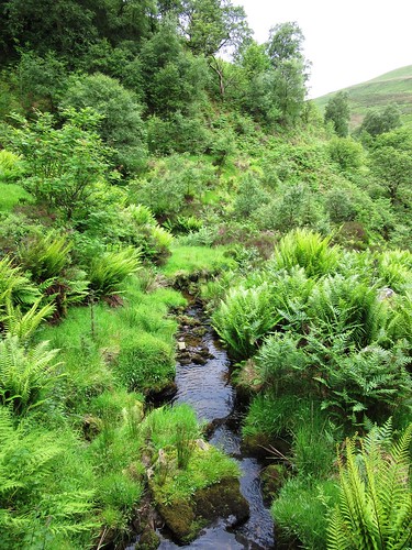
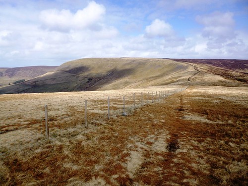
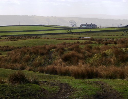
Beyond Slippery Moss the M62 cuts the moor with a roar and rush. We turned away to follow a trickling leat of water across the peat and heather to Green Withens Reservoir, a classic of municipal sandstone architecture, built in the 1880s in the middle of nowhere to supply Wakefield with water. From here the path ascended the dimpled face of Green Withens Edge before meeting Rishworth Drain and curling back towards the Aiggin Stone.

As we came level with Rishworth Drain a big bird of prey, its pale wings tipped with black, came flapping easily along the waterway. ‘Hen harrier!’ we exclaimed on the same breath. We watched spellbound as it launched itself downwards and pounced into a grass tuffet, then resumed its flight having missed its grab. Hen harriers are wonderfully efficient hunters, but even they have their off days, it seems.

How hard is it? 7½ miles; moderate; moorland tracks. Pick a fine day.

Start: White House Inn, Blackstone Edge, Halifax Road, Littleborough OL15 0LG (OS ref SD 969178)

Getting there: Bus 587 (Rochdale-Halifax).
Road – White House Inn is on A58 (Littleborough-Sowerby Bridge)

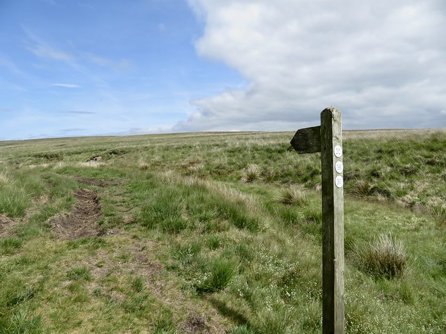
Walk (OS Explorer OL21): Cross road; follow Pennine Way/PW, then path beside Broad Head Drain. In 800m, left through gate (970169); up cobbled road to Aiggin Stone (974170). Right on PW (gate, National Trail acorn), southward by Blackstone Edge and Redmires. In 1¾ miles PW turns right to cross M62 (984147); don’t cross, but keep ahead with motorway on your right; then follow path on right of leat (986148) to Green Withens Reservoir (991160). Right along two sides; 100m beyond far end, right beside leat (991165). In 150m, left across leat. Follow path across moor, up Green Withens Edge; near the top, left on crossing track (991169). In ½ mile at Rishworth Drain (986172), fingerpost points right (‘Baitings Reservoir’); but keep ahead here. In 700m left across footbridge by pool (982176); bear back left on rutted Old Packhorse Road to Aiggin Stone; retrace steps to White House Inn.

Lunch: White House Inn, Blackstone Edge (01706-378456, thewhitehousepub.co.uk)

Accommodation: Premier Inn, Newhey Road, Rochdale OL16 3SA (0333-321-8449, premierinn.com)

Info: moorsforthefuture.org.uk; yorkshire.com

 Posted by at 04:59
Apr 232022


First published in: The Times Click here to view a map for this walk in a new window
On the Pennine Way near The Mount Stanridge Clough Lane 1 view from Stanridge Clough Lane towards the moors the walls, the moors, the hills around Earby Descending Dodgson's Lane, looking towards Oak Slack farm 1 Descending Dodgson's Lane, looking towards Oak Slack farm 2 In Fiddling Clough 1 In Fiddling Clough 2 In Fiddling Clough 3

The old Lancashire mill village of Earby, tucked under the western edge of the West Pennine Moors, is facing a lot of challenges, like other similar post-industrial settlements in this part of the world. But the Red Lion pub is still proud to eschew a food service in favour of specialising in well-kept beers, and the Youth Hostel (now Earby Holiday Hostel) does a lively trade.

The wind-torn sycamores were budding out as we climbed the stone walled track of Stanridge Clough Lane to the upper ground of Bleara Moor. You have to grab with both hands a day like today with unbroken blue sky, the east wind bringing cries of young lambs and the bubbling calls of curlew. The sun spread its cheerful buttery light across upland moors and valley pastures, a reminder of just how long and dreary winter had been.

When in 1965 John Hillaby came walking the just-opened Pennine Way a few miles eastward, he found the first section across the gritstone moors a muddy purgatory. But there were moments of rare delight, too, expressed by Hillaby in his classic account Journey Through Britain. The tumbling flight of courting lapwings in their aerial dances today recalled Hillaby walking into a lapwing kindergarten not far away. ‘In the air they play with the wind, toying with it, rolling over … then they settle down on their nests with a little shiver of ecstasy.’

In the black trickling sykes or peat moor streams, frogs set up their insistent mating calls: ‘Breddit, breddit, breddy-eddy-eddit.’ All over Blears Moor and Thornton Moor, nature was tuning up for the grand symphony of spring.

We descended the rough hill road of Dodgson’s Lane to pass Fiddling Clough where the farmstead lay pinched in the narrow stream cleft, abandoned, already sinking back into the ground. A former tenant, John o’Ned’s, once held a grand opening of his new henhouse for all the neighbourhood, including a contest involving eating hot dumplings from a greasy plate without benefit of cutlery. They knew how to have fun in them days.

Past Fiddling Clough and Oak Slack farm we met the Pennine Way and followed it down smooth green sheep pastures for the final couple of miles back to Earby.

How hard is it? 7 miles; easy; hill paths

Start: Car park, Victoria Road, Earby, BB18 6US (OS ref SD 907468)

Getting there: Bus 280, Preston-Skipton
Road: Earby is on A56 (Colne-Skipton)

Walk (OS Explorer OL21): left to Water Street, right; left up Red Lion Street, on up Mill Brow Road. In 600m at bench on left, fork right (918468, ‘bridleway’) for 600m to meet Stanridge Clough Lane (919461). Left. In 600m pass Higher Verjuice ruin (925458); left along wall. In 700m, left down Dodgson’s Lane (932460). In 650m at gate in dip, ahead through gate (929466); aim left of barn, right of farmhouse ruin (926469). Cross stream; continue to cross Wentcliff Brook (925472) and up to Oak Slack Farm (924474). Cross drive; up field to stone stile (923576); ahead (923478, The Mount garden, stile). Half left to footbridge (925481); left down Pennine Way to Brown House (918484). Left through farmyard between cattle sheds; through gate; follow right-hand fence, then stream on right to Booth Bridge (914478). Cross drive; path up plantation, then fields to Batty House Farm (914473). Follow drive to T-junction (913468); right past Red Lion into Earby, or left to Holiday Hostel.

Lunch: Punch Bowl, Skipton Rd, Earby BB18 6JJ (01282-843017, thepunchbowlearby.co.uk)

Accommodation: Earby Holiday Hostel, Birch Hall Lane, Earby BB18 6JX (0779-190-3454; earbyhostel.co.uk)

Info: visitpendle.com

 Posted by at 01:21
Feb 272021


First published in: The Times Click here to view a map for this walk in a new window
picture picture picture picture picture picture picture picture picture picture picture picture
Facebook Link:

A day of big weather over the Forest of Bowland – big clouds sailing in patches of blue sky, a big boisterous wind across the high empty moors of this most treeless of ‘forests’. Bowland is a huge area of wild hilly country in the north west of Lancashire, Slaidburn a rare centre of civilisation at its heart.

We passed the First World War memorial in the village – 27 local men killed in that great slaughter – and crossed the arched bridge over Croasdale Brook. From the road a field path led north by way of stepped wall stiles and clover leys, the big bosomy fells of Bowland rising in the west, their flanks dull red with bracken, the long back of Pendle Hill ten miles off in the southeast like an upturned ship’s hull.

Twenty years ago the Forest of Bowland was notorious for possessing only one public footpath within its hundreds of square miles of moorland. Nowadays, thanks to the Countryside & Rights of Way Act of 2000 and a more enlightened attitude among landowners, plenty of hill paths are open to all, and the lower pasture lands are crisscrossed with rights of way.

We followed a path across grass fields gleaming in the sun, down to Shay House and a moorland road north. Soon we branched off along tracks and paths through coarse grass, rush clumps and boggy dells where cattle stared and went trotting off with panicky little steps.

Below lay Stocks Reservoir, looking for all the world like a natural lake with its islets, encircling trees and angling boats. The navvies who lived up here in the late 1920s, constructing the reservoir dam, had a canteen with its own branch railway line bringing barrels of Dutton’s Blackburn ale direct to the cellar, whence it was sold to the men at 4d a pint.

Round the reservoir we went, crossing the grassy rampart of the dam wall, then descending a long track through sheep pastures. We passed the Tudor country house of Hammerton Hall, the dozens of blank windows in its three gabled bays lending it a secret and inward looking air, and came down to Slaidburn just as the rain began to freckle in over the hills.

How hard is it? 6½ miles; moderate; field and moorland paths

Please only walk within your Tier area, or enjoy this as an armchair walk till restrictions lift. And please consider others when you park.

Start: Slaidburn car park, BB7 3ES (OS ref SD 714524)

Getting there:
Slaidburn is signed from A65 (Skipton-Settle) at Long Preston.

Walk (OS Explorer OL41): Right along road; right by war memorial; in 200m, left (712526, wall stile, fingerpost) up fields. Beyond beech plantation, half left (712529); path over 6 fields to Shay House drive, left of barn (707544). Right to road (710546); left. In ½ mile, right (710553, fingerpost) on moorland track. At corner of plantation fork half left (714556, yellow arrow/YA) to far left corner of plantation ahead (717559, stile, YA). On across stream and past ruined house for 700m to reservoir track (723559). Right. In 1 mile, cross track near Board House (717547); cross dam wall. Near far end, right down steps; left; at end, left (720544, gate). Immediately right up bank, across successive stiles and fields. Right along grassy track (721543) with wall on left, down to Hammerton Hall. Through gate (720539); right; bend left through gate (YA); follow stony drive. 100m after crossing Holmehead Bridge, left (713530) with wall on right. At ford (714525), right along river to road (712525); left into Slaidburn.

Info: forestofbowland.com; satmap.com; ramblers.org.uk
More walks info: @somerville_c

 Posted by at 01:10
Sep 142019


First published in: The Times Click here to view a map for this walk in a new window
picture picture picture picture picture picture picture picture picture picture picture picture picture
Facebook Link:

Trawden lies in a narrow dale – the name signifies a trough-like valley – between the old mill towns of Nelson and Colne and the high empty moors of the Lancashire/Yorkshire border. We left this cheerful, friendly village gearing up for a festival with stalls and silver bands, and climbed a cobbled lane south towards the open country under a blue sky.

Out in the fields, well-tended gritstone walls divided the large square pastures. The cockerels and dogs of Trawden made Sunday music far below, their cries fading under the sharp alarm calls of curlew in the sedge clumps as we gained height towards the twin Coldwell reservoirs. The water sparkled in little sandy bays where oystercatcher parents piped their fledgling chicks in line astern along the shore.

An old moor lane led east at the foot of the rough slopes of Boulsworth Hill. Rutted and walled, paved with slabs deeply indented by boots, hooves and cart wheels, it gave superb views north over the walled fields and farmsteads of the Forest of Trawden, a Saxon hunting forest gradually overtaken by farming, milling and mining. Back west rose the shapely bulk of Pendle Hill, burdened with legends of witches and evil spells, today just a beautiful hill in plain sunshine.

Deep brackeny cloughs brought hill streams twisting down from the heights to the south. We crossed Turnhole Clough and followed the Brontë Way down to the sprawling shell of Wycoller Hall, Charlotte Brontë’s model in Jane Eyre for Mr Rochester’s lonely house of Ferndean Hall. A melancholy ruin – blank windows, chilly stone halls – in a gorgeous leafy dell.

A glass of pink lemonade, cold and refreshing, in the little tearoom at Wycoller, and we found the homeward path through fields where sheep lay panting in the shade of upright gritstone slabs that served for fencing.

The pale blue shoulder of Pendle Hill rose on the far skyline as an aiming point, and from down in Trawden the thump and blare of a silver band came in atmospheric blasts across the still, sun-scorched fields.

Start: Trawden Arms PH, Trawden, Lancs BB8 8RU (OS ref SD 912388)

Getting there: Bus M3, Trawden-Accrington
Road – Trawden (B6250) is signed off A6068 in Colne.

Walk (8 miles, field paths and moorland tracks, OS Explorer OL21): Fork left off B6250 at Trawden Arms, up lane. In 450m cross road (912384); path to right of Trawden Literary Institute, past garages (fingerpost) into fields (911383). Ahead uphill beside wall; past radio mast (909378). At Pasture Springs Farm dogleg right/left (908377). At Moss Barn, right along front of house (907374); through gate (yellow arrow/YA); cross field to stile into plantation (YA).

Left; in 30m, ahead (YA); follow path through trees. At wall (906372) bear right through plantation to stile/footbridge onto moor (905370, YA). Half right, aiming a little left of wind turbine, to ladder stile overlooking Lower Coldwell Reservoir (903367). Ahead to gate onto road (903364); left for 350m; left onto bridleway (903361, fingerpost), following ‘Pennine Bridleway’ and ‘Wycoller’. After 3 miles, cross Turnhole Clough (941379); in 300m, left (943381, ‘Brontë Way, Wycoller’) for 1 mile to Wycoller.

Pass Wycoller Hall ruin (933392) and packhorse bridge; follow Trawden road out of village across road bridge. In 200m on right bend, go through wooden gate on right of farm track (930394, fingerpost). Diagonally across field to stile; on with fence on left; through metal gate, and fork left uphill (928393, YA) past Bracken Hill Farm. On west across fields (YAs, ‘Trawden’ fingerposts), aiming for Pendle Hill ahead.

In ¾ mile cross farm track at Higher Stunstead (916390) and on along lane down to Trawden. At B6250 (912389), left to Trawden Arms.

Lunch: Trawden Arms (01282-337055, trawdenarms.co.uk) – cheerful, popular village pub.

Tea: Wycoller Tearoom.

Accommodation: Old Stone Trough, Kelbrook, Barnoldswick BB18 6XY (01282-844844, oldstonetrough.co.uk) – convenient, great value.

Info: trawdenparishcouncil.org.uk; visitlancashire.com; satmap.com; ramblers.org.uk

 Posted by at 01:45
Apr 272019


First published in: The Times Click here to view a map for this walk in a new window
picture picture picture picture picture picture picture picture picture picture picture
Facebook Link:

Walsden lies in a hollow of the hills in bleak moorland country where Yorkshire meets Lancashire. Strong sunlight and a cold wind greeted us as we climbed the stony trod of Long Causeway. Below, swathes of blanket bog cradled the reservoir of Cranberry Dam in cushions of pale brown velvet.

For all its upland wildness, this is a landscape of industrial endeavour, past and present. Sheer-sided scoops in the sides of the steep little cloughs or stream valleys showed evidence of lead and coal mining. Pylons like skeleton trees strode across the country. And high on Noon Hill and Ramsden Hill, tall white wind turbines lazily turned their three-blades apiece with a gentle, greasy whine and whoosh.

Among these ghostly giants we found an old track that rose past the gritty spoil banks of long-gone lead mines in the flanks of Rough Hill. Far in the south, beyond the million diamond sparkles of Watergrove Reservoir, the towers and factory chimneys of Manchester lay hazed with distance.

A confusion of ill-marked paths had us scratching our heads at the junction with the Rossendale Way, but soon we were heading north over squelchy black peat, through sedgy fields where sheep grazed. A pair of baths, complete with shiny chrome taps, stood beside the fence half-full of scummy green water, waiting for a walker too hot and sweaty to resist their allure.

On the heights of Trough Edge End the broad walled track of the Rossendale Way met the old trodden track now styled the Todmorden Centenary Way. It dropped down a bank among mine ridges to the ruin of Coolam Farm, and followed the old road past Pot Oven, once a beer-house for travellers in these lonely wastes. ‘Deaf old Sam’ Jackson, farmer, fustian weaver and tenant here in 1784, raised ten children with his wife Martha Woodhead. Foulclough Mine opened in the 1790s, and Sam and Martha’s sons became colliers and left the fustian trade forever.

A final descent into Ramsden Wood’s narrow clough, and a teetering path through bluebell woods high above waterfalls and cascades, back to the lake where stolid fishermen with twenty-foot roach poles were patiently sitting the evening out.

Start: Ramsden Wood fishing lake, Ramsden Lane, Walsden, W. Yorks OL14 7UN approx (OS ref SD 928213).

Getting there: Bus 589, 590 (Todmorden – Rochdale)
Road – A6033 (Todmorden – Littleborough) to Walsden; Ramsden Wood Road (next to Border Rose Inn); in 600m, left up Ramsden Lane to car park. Also parking in Ramsden Wood Road.

Walk (6 miles, moderate, OS Explorer OL21): On up lane. At Plantation Barn fork left (924213) over cattle grid. In 200m, right through gate (‘Long Causeway’). In 1 mile cross wind turbine service roadway (918199); in 200m, right at marker stone on moor track. In 400m, left across stream spring (914200, yellow arrow/YA). Track rises through mine heaps. 100m beyond last heap, fork left on rutted track (910201). In 200m wall comes in on left; follow it for 600m to turn right along gravel road (903198).

In 200m, at post with red reflectors, left (904199); turn left to follow enclosure fence, keeping it on your right. At northwest corner, keep ahead on track over Hades Hill. In 450m through gate (906203); left along fence; in 300m, left (904207, stile) across field to ladder stile (903206). Don’t cross it, but turn right/north with wall on left, on Rossendale Way. In nearly 1 mile right (901221) along Todmorden Centenary Way/TC.

In 350m, cross stile (904218); left along fence to trig pillar (906219). Half right on path down hillside towards Coolam Farm ruin. Near ruin, left through gate (911215, TC); follow rocky lane downhill. In 200m left along walled lane (913215, TC). In ⅔ mile, pass Pot Oven (920219); in another 200m, right (922220, TC) across farmyard. On down green lane. 50m before it turns left across Ragby Bridge, left through gate (923216, YA), on path (see below) above river to car park. Alternative: follow TC up past Inchfield to meet outward route (923212); left to car park.

Conditions: Rough moor paths. Riverside path to car park – steep drops, narrow path.

Lunch: Border Rose Inn, Walsden OL14 7UA (01706-812142)

Accommodation: Moorcock Inn, Halifax Road, Blackstone Edge, Littleborough OL15 0LD (01706-378156, themoorcockinn.co.uk)

Info: Hebden Bridge TIC (01422-843831)
satmap.com; ramblers.org.uk

Ships of Heaven – The Private Life of Britain’s Cathedrals by Christopher Somerville (Transworld) was published on 11 April

 Posted by at 02:54
Jun 172017


First published in: The Times Click here to view a map for this walk in a new window
picture picture picture picture picture picture picture picture picture picture picture picture picture
Facebook Link:

Young lambs crying, ewes blaring, and a curlew emitting haunting cries from the slopes of Clougha as we skirted the stone stronghold of Cragg Farm. Sunlight slanted across the folded fells that climbed southward into the great upland wilderness of the Forest of Bowland. Nearer at hand, our aiming point of Clougha ran as a high line stretched against a pale blue summer sky.

Beyond the slit-windowed wall of Skelbow Barn – more fortress than hay-store – we turned uphill beside the musically burbling Sweet Beck. A faint path led up beside a nameless stream trickling over mats of slippery moss, heading for higher ground through tough old heather sprigs and acid green bilberry.

The sun struck glitters of mica out of the sandy stones of the track. Two bright green butterflies spiralled together over the heather, lovers or antagonists. A spring whelmed from the heart of a cushion of emerald moss so intensely green it stung the eyes. Thirty thousand feet above, a jet drew a smoky finger of white across the blue ceiling of the sky, a message from another world entirely.

Up at the heights of Clougha, three rectangular stone monoliths stood side by side in a sea of grey stony clitter. Close-up, they proved to be an installation by landscape artist Andy Goldsworthy – ‘Clougha Pike Chambers’, a trio of sentry boxes with beautiful elliptical openings. ‘A womb with a view,’ said Jane, sitting back in one of the sculptures to gaze out across the hillside and listen to cuckoos calling from Cragg Wood far below.

A Landrover track proved a reliable guide on our descent from Clougha. We stopped to watch an army of ants dragging a dried-out centipede across the stones. A mother grouse clicked frantically to her three fluffball chicks to stay low and invisible as we walked by. And out in front unrolled a most stupendous hundred-mile view over the low-tide immensities of Morecambe Sands, the widening arms of the Lakeland and North Wales coasts, and a blur on the western sea horizon that might have been the Isle of Man.

Start: Little Crag car park, near Caton, Lancaster LA2 9ET (OS ref SD 546618)

Getting there: On Littledale Road (off Rigg Lane, between Caton and Quernmore – M6, Jct 34)

Walk (5½ miles, moderate, OS Explorer OL41): Leaving car park, right along road. In 100m, right by cattle grid, over ladder stile, past Cragg Farm on field track. In 700m, left through gate at Skelbow Barn (551613). In 100m, right uphill with wall on right. Through gate; in 150m, left over ladder stile (551611). Right along wall; in 100m, beside gate, left up track on left of beck (NOT green embanked track on your right!), aiming for tree. Above tree continue, keeping about 100m from wall on left. In 300m, make for stony track bearing left round hillside, parallel with wall. 700m after leaving tree, track curves right/south (553606) for ¾of a mile to meet a 4 x 4 track (552596). Left to Goldsworthy installation (556595); return along 4 x 4 track. After 1¾ quarter mile descent, track turns sharp left near Cragg Wood wall for steep descent into gully (541612); right here on path along north edge of Access Land for ⅔ of a mile to ladder stile (551611), Skelbow Barn and car park.

Conditions: Ascent boggy after rain. Inadvisable in mist.

Lunch: Picnic

Accommodation: The Borough, Dalton Square, Lancs LA1 1PD (01524-64170) – cheerful city centre stop-over.

Info: Lancaster TIC (01524-582394)
Information, online maps, more walks: christophersomerville.co.uk

Rossendale Round-the-hills Walk, 3 September:
facebook.com/Rossendaleroundthehillswalk/

visitlancashire.com, satmap.com, ramblers.org.uk

The January Man – A Year of Walking Britain by Christopher Somerville (Doubleday, £14.99).

 Posted by at 02:11
May 282016


First published in: The Times Click here to view a map for this walk in a new window
picture picture picture picture picture picture picture picture picture picture picture picture picture picture picture picture
Facebook Link:

A glorious afternoon on the west Lancashire coast under wall-to-wall blue sky. We walked the green fields of Cockerham with the Bowland moors rising in the east, Blackpool Tower tiny and familiar down in the southwest, and the Lake District fells around Helvellyn and Scafell Pike standing as if cut from pale blue card on the northern horizon.

Down at the sea wall a great flat apron of saltmarsh lay spread at the edge of Cockerham Sands, cut with wriggling channels. Brackish pools winked in the sun like a thousand bright eyes. The tide was on the make, advancing along the shore road and up the creeks in a frothy mini-tsunami, driving flights of loudly piping dunlin, oystercatchers and redshank shoreward in agitation. Further out on a vanishing sandbank, geese babbled together, a musical chiming across the water, reminiscent of sheep bells in Alpine pastures.

The seawall path ran past Bank End and Bank Houses, remote farmsteads among flat green pastures out at the edge of the land. As the coast turned north we came to Cockersand Abbey, or what remains of it – a curious semi-rectagonal chapter house among angles of walls, its soft red sandstone rubbed into dimples and hollows by 800 years of wind and weather.

Cockersand Abbey was founded on this lonely shore as a leper hospital. When the site was excavated in the 1920s, archaeologists found fragments of lead and coloured glass from the windows that were smashed at the Dissolution of the Monasteries. The abbey ruin became a source of ready-worked building stone. Only the chapter house survived, because the local landowners wanted it for their family mausoleum.

From Cockersand Abbey we followed the windy coast path north to Crook Farm, with Heysham Power Station looming massively ahead like a 1950s suburban house designed by an ogre. Soon it was behind us, and we followed the grassy imprint of Marsh Lane over sheep pastures to Glasson Dock, a rare survival of a small working port. A dip into the cornucopia of goodies in the Port of Lancaster Smokehouse here, and a last stretch on a railway path into Conder Green above the golden marshes of the Lune Estuary.

Start: Manor Inn, Cockerham, near Lancaster, LA2 0EF (OS ref SD 465522)

Getting there: Bus 89, 89H (Lancaster-Knott End)
Road – Cockerham is on A588 between Conder Green and Pilling (M6, Jct 33)

Walk (7 miles, flat and easy, OS Explorer 296. Online map, more walks at christophersomerville.co.uk): South from Manor Inn down A588; in 50m, right beside Old Mill House. Follow lane; through garden at top; through kissing gate at end of garden (464524, yellow arrow/YA). Follow fence on right downhill; follow YAs along field edges, round cottage (462529). Leave cottage garden over stile; ahead over field and footbridge (YA); follow ditch/fence on right for ½ mile to Hillam Lane (455531). Left past Hillam Farm; in ½ mile, right (449528) along sea wall. Follow Lancaster Coastal Path/LCP north for 3¾ miles via Bank End (441528), Cockersand Abbey chapter house (427537), Crook Farm (431550) and Marsh Lane to road at Glasson (443556). Left, then right to Glasson Dock. Cross swing bridge (445561); cross road by Victoria Inn; right along LCP. In ¾ of a mile, cross bridge (456560); right to Conder Green. Bus 89/89H or taxi (01995-607777; £6.50) to Cockerham.

Lunch: Picnic – provisions from Port of Lancaster Smokehouse, Glasson – 01524-751493, lancastersmokehouse.co.uk

Accommodation: The Mill at Conder Green, Lancs, LA2 0BD (01524-752852; themillatcondergreen.co.uk) – really comfortable, superbly positioned.

Information: Lancaster TIC (01524-582394), visitlancashire.com

visitengland.com; satmap.com; ramblers.org.uk

 Posted by at 01:05
Jul 112015


First published in: The Times Click here to view a map for this walk in a new window
picture picture picture picture picture picture picture picture picture picture picture picture
Facebook Link:

We found a witch – albeit a stuffed one – sitting at a table outside the Barley Mow, and witches riding broomsticks on the footpath signs out of Barley village. One can scarcely avoid the pointy-hatted personages in this part of the world. Pendle Hill, the great whaleback that looms over Barley from the west, is the witchiest hill in England – mostly, but not entirely, on account of the notorious trials of 1612 when ten local men and women were hanged at Lancaster for practising the Dark Arts.

Pendle Hill is a massive presence in the landscape. It seems always to have had an ominous reputation, probably because of the way it attracts dramatic weather. Today it rode under a great breaking wave of cloud. As we climbed the steep, stone-pitched path to the summit, skeins of mist came drifting across, turning Pendle House farm below into a washy watercolour. A kestrel came swooping out of the cloud and cut down across the path with backswept wings, vanishing into the mist.

Runners, dog walkers and hill climbers materialised, passed us and were swallowed up in cloud. At the top we followed a grassy track to find George Fox’s Well, a modest, urban-looking trapdoor in the hillside. Raising it revealed a silver tankard chained to the lid, ready to be lowered into the well. I drank a scooped handful from the spring below – ice cold, glass-clear and sweet. George Fox, young and full of spiritual zeal, refreshed himself here in 1652. He had just experienced the epiphanic revelation on Pendle’s summit that drove him forth to preach mightily and to found the Quaker movement.

We forged south through the mist along the crest of Pendle, on a cairned track that soon turned and plunged down out of the murk. Big views opened eastward as we followed a rutted bridleway at the foot of the hill, down to where the Ogden Water’s shallow flow wound out of steep-sided Ogden Clough to fill the twin reservoirs that lie above Barley.

Coming back into the village we passed the site of Malkin Tower, lair of the Pendle witches – according to their persecutors. What Alizon Device, Chattox, Old Demdike and Mouldheels were really up to, who knows? Probably no more than a few home cures and a bit of unwise chanting. Whatever it was, their shadows still lie long across this beautiful valley and the hill that overhangs it.

Start: Car park, Barley Picnic Site, Nr Nelson, Lancs, BB12 9JX (OS ref SD 823403)

Getting there: Bus 7 (Clitheroe-Nelson)
Road – M65, Jct 13; A682 (‘Kendal’); in ¾ mile, left (‘Roughlee’). From Roughlee, follow ‘Barley’.

Walk (6¼ miles, moderate/hard, OS Explorer OL41. NB: Detailed description, online map, more walks: christophersomerville.co.uk). Turn right through village. Left by Meadow Bank Farm (‘Pendle Way’/PW) along stream. Follow ‘Pendle Hill’ signs through fields for 1 mile to Pendle House farm (809412). Follow steep, stepped path diagonally right to top of Pendle Hill. Right over stile (806418) and follow path for 200m to George Fox’s Well (hatch cover by path, 805420). Return over stile; right for 100m; left/south on sandy/stony path to Big End trig pillar (805414). On south along track past big cairns; at the last big cairn, fork slightly right on a path marked with smaller cairns. 600m beyond trig pillar, PW forks right (804409); but keep ahead, following grassy track in groove that bends left to rim of escarpment (805408).

Descend to Pendle House farm. Bear right along bridleway, leaving farm below on left. Keep wall on left and follow bridleway south for ¾ mile, passing above Under Pendle (808404). Near top of narrow gully, bridleway turns left (807401); but keep ahead through kissing gate, on and down to Ogden Water (801397). Left through gate (PW). Follow PW past Upper Ogden Reservoir. Join road (807397) past Lower Ogden Reservoir, and on to Barley.

Conditions: Sharp, steep climb from Pendle House to summit. Pendle Hill often windy, rainy, misty – hill-walking gear advised.

Lunch/accommodation: Barley Mow, Barley, Pendle BB12 9JX (01282-690868, barleymowpendle.co.uk) – welcoming, walker-friendly pub with rooms.

Info: The Cabin Café and Information Centre, Barley Picnic Site (01282-696937); Clitheroe TIC (01200-425566); visitlancashire.com

Pendle Walking Festival:
15-23 August, www.visitpendle.com/countryside/walking-festival

satmap.com; ramblers.org.uk; visitengland.com

 Posted by at 01:45
Sep 132014
 

A cool and cloudy morning over the Forest of Bowland, the moorland heart of Lancashire.
First published in: The Times Click here to view a map for this walk in a new window
picture picture picture picture picture picture picture picture
Facebook Link:
As we walked the sheep pastures under the dun brown shoulder of Beatrix Fell, a curlew got up from its nest among the sedges and flew low past us. Its long downcurved bill quivered open to emit the familiar bubbling trill that haunts these northern hills. The sedgy field path brought us past a string of old stone farmhouses, then up the open flank of Dunsop Fell and out into open moorland.

In past times the Forest of Bowland lay under harsh laws of prohibition. The landlord’s tenants were made to pass their dogs through a silver hoop – any animal too big and powerful to scramble through would be destroyed as a potential poaching asset. Grouse shooting interests were paramount, and ramblers were strenuously discouraged. But times and tempers changed. When the Countryside and Rights of Way Act was passed in 2000, this enormous wheel of bleak and beautiful country was opened to all walkers for the first time in history.

Bowland is properly wild country, with plenty of surprises for walkers. Up at Dunsop Head we found the springs of Dunsop Brook overflowing with stored rainwater. We floundered along through soft, sloppy, sucking peat and moss. Jane went in knee-deep, emerging with a tremendous sucking sound as though the bog were smacking its lips over her like a tasty lollipop.

At last we reached firmer ground, where three birdwatchers were waiting. ‘See the male hen harrier?’ cheerily enquired their leader. ‘Flew right across where you were.’ But we’d been too preoccupied with our battle with the bog to spare a glance for anything else. ‘Yep, only three of them in Britain,’ the twitcher exulted. ‘We saw him, all right!’

Down in the hidden cleft of Whitendale, other ornithological celebrities are resident – a pair of breeding eagle owls, surprise incomers with six-foot wingspans, capable of taking out a young deer. We didn’t spot these beautiful strangers on the way back to Dunsop Bridge. But there were grey wagtails and herons, white-chested dippers and black-capped stonechats, and a crowd of jolly house martins hawking over the river, their white rumps and scarlet streaks a vivid splash of colour against the grey skies of evening.

Start: Dunsop Bridge car park, Lancs BB7 3BE approx. (OS ref SD 661501)

Getting there: Bus Service 10 (dalesbus.org), Clitheroe-Slaidburn
Road: M6, Jct 31a; B6243 (‘Clitheroe’) through Longridge; 1 mile past Knowle Green, left on minor road through Whitewell to Dunsop Bridge.

Walk (10½ miles, strenuous, OS Explorer OL41. NB: Detailed directions – highly recommended – online map, more walks at christophersomerville.co.uk): Right along road; just before bridge, right (‘bridleway’) along drive. Pass terraced houses (658507); in 100m, right (yellow arrow/YA) through kissing gate, up steps, over stile; ahead along fence. At ruined wall, half-left to Beatrix Farm (664514). 100m past farmhouse, left through gate. Blue arrow/BA points ahead, but follow 2 YAs (pointing left) along right bank of stream (YAs). In ½ mile, at bottom of Oxenhurst Clough, cross stream (671518). Follow YAs, with fence on right, to farm drive (674521); on past The Hey to Burn House (682528). Through driveway gate and on down to lane (685522).

Left for ¾ mile. Left up drive (694530, ‘Burnside Cottage’). Skirt Burnside Cottage through gates (690537); on up fellside beside stone wall (BAs). At top of wall (687540), through gate; bear right. 200m past conifer clump, path hairpins back left and climbs for 1 mile to Dunsop Head (676542).

NB! Deep, wet bogs across the path here! Bear left to stone wall on high ground to left of bogs; follow it to the right, to a fence curving away to left; follow this fence west, then north, keeping close to it, and treading with care, till you meet the wall again near a gate (675544).

From the gate, left along moor path (yellow-topped posts, arrows, cairns) for 1 mile, descending to Whitendale. By first stone wall of farmyard, left (662550, unmarked) on path with wall on right. In nearly 1 mile, horseshoe left across Costy Clough footbridge (659536). In 150m, right over stile, down to track; left for 500m; right across footbridge (654533), left along road for 2¼ miles to Dunsop Bridge.

Conditions: Deep, wet bogs at Dunsop Head. Hill-walking gear, boots, stick.

Refreshments: Picnic; Puddleducks tearoom, Dunsop Bridge (01200-448241)

Accommodation: Inn at Whitewell, BB7 3AT (01200-448222, innatwhitewell.com) – wonderful old inn; comfortable, welcoming, full of character; 2½ miles from Dunsop Bridge

Information: Clitheroe TIC (01200-425566)

visitengland.com; www.satmap.com; ramblers.org.uk

 Posted by at 01:41
Apr 272013
 

The Gibbon Bridge Hotel and the nearby village of Chipping cater enthusiastically for walkers these days. First published in: The Times Click here to view a map for this walk in a new window
picture picture picture picture picture picture picture picture picture picture picture picture picture picture picture
Facebook Link:
But before the Countryside & Rights of Way Act became law in 2000, most of the neighbouring Forest of Bowland was closed to the public. Nowadays, however, this great tract of upland moors with its encircling ribbon of villages is Lancashire’s prime walking location, a vast swathe of Access Land criss-crossed by hundreds of walker-friendly paths and tracks.

Daffodils and primulas were putting their heads out cautiously in Chipping’s window boxes as a fine strong wind came roaring in from the sea 20 miles westward. Cloud shadows and sunlight raced across the slopes of Wolf Fell and Parlick as we crossed the sedgy fields around Fish House and Windy Harbour. A big hare with dull orange pelt and black-tipped ears sprang up from a sedge clump and dashed away, and a lapwing went tumbling overhead across the gale in an ecstatic mating display. Two oystercatchers chased each other round the windy sky with piercing piping calls, and we could hear the bubbling cry of curlews in the wet fields – all signs of onrushing spring.

It was a stiff, steady climb up the steep grassy breast of Parlick, the wind shoving from the west, the path slippery underfoot. At the summit, a view in a million – back across the field and farms below the moors to witchy Pendle Hill grey and ship-shaped in the east, and forward to an enormous curve of moorland – Blindhurst Fell, Fair Snape Fell, Wolf Fell, Saddle Fell, Burnslack Fell, rounded flanks of oatmeal, olive and burnt orange dipping south, a great ridge of peat hags connecting them like waves in a sluggish rust-brown sea far back up the northern skyline.

We followed a guiding fence and a whistling gritstone wall that filtered the wind into a high-pitched keening. At the crest of Wolf Fell we left the fence and plunged among fantastically eroded peat hags, then down the long green snout of Saddle Fell into the wind, with the Bowland valley spread before us. Ewes came bleating at Saddle End Farm as the farmer and his dogs herded them up the fellside, and down by Dobson’s Brook the week-old lambs bounced away as though each fat white leg were made of springs.

Start: Car park, Chipping, Lancs, PR3 2QH (OS ref SD 621433).

Getting there: Bus (lancashire.gov.uk): 5, 5A (Chipping-Clitheroe), 5B (Clitheroe-Garstang), 35 (Chipping-Blackburn)
Road: Chipping is signed from Longridge on B6243 Preston-Clitheroe road (M6, Jct 31a).

Walk (7½ miles, hard, OS Explorer OL 41. NB Online maps, more walks at christophersomerville.co.uk):

From car park, to road; left toward church; first left. In 300m, lane curves left (620435). Follow it past Old Hive. At gateway to Quiet Lane, left down Springs House drive (616436, fingerpost). In 350m, at left bend, right (612436, stile, yellow arrow/YA) across field; next stile (YA); stone stile by barn; cross stream (611437). Ahead (YA), bearing half-right to track to Fish House farm (610441). Left along Fish House Lane; in 30m, right (stile, fingerpost). Cross fields (stiles, YAs), aiming for left corner of trees ahead at foot of Parlick. Cross drive (603444, YA); on through kissing gate/KG by Wildcock House ruin (602446); left to Fell Foot house (599445). Turn right up steep pitched path to climb Parlick.

From summit cairn (596450) follow fence (keeping it on your left) for 1½ miles. Roughly opposite Paddy’s Pole cairn on left, fence bends half-right (595469). Soon it bends half-right again at a junction of fences, with 2 stiles on either side of a gate. Keep following it to summit of Wolf Fell (598472), another junction for fences with a pitched path going away north. Here 2 stony tracks, close together, lead off to right. Take 2nd one, a clear track heading east through peat hags. In ¾ mile, go through KG in fence (609470); bear right on grassy track parallel to descending fence, then trending away to left. Follow it south down Saddle Fell for 1¼ miles (YAs) to Saddle End farm (614451). Through farmyard; down drive to cross road (616448, fingerpost). On along track, across Dobson’s Brook (618446) to farmhouse. Through gate (619446, YAs); immediately right through gate (‘Chipping’); descend bank to cross brook (620445). Follow path (YAs) through fields, parallel to brook, down to lane by reservoir (619437). Left into Chipping.
Click on Facebook “Like” link to share this walk with Facebook friends.

Conditions: Steep climb up Parlick; some moor paths obscure; a walk for confident fell walkers, properly shod and equipped.

Lunch: plenty of pubs, cafés in Chipping

Accommodation: Gibbon Bridge Hotel, near Chipping (01995-61456; gibbon-bridge.co.uk) – characterful, enthusiastic, extremely friendly

Forest of Bowland: forestofbowland.com

Clitheroe TIC: 01200-425566; visitengland.com
www.ramblers.org.uk www.satmap.com www.LogMyTrip.co.uk

 Posted by at 01:05