Search Results : Wiltshire Wilts

Apr 062024


First published in: The Times Click here to view a map for this walk in a new window
Oak and bluebells, Rotherley Wood apple blossom, Tollard Royal track above Munday's Pond spring greenery and blossom above Tollard Royal Skulls information pillar by General Pitt-Rivers's excavations, Rotherley Down view from Ox Drove Track descending to Ashcombe Bottom Track descending through bluebell woods to Ashcombe Bottom Bluebells by the track to Ashcombe Bottom King John Inn, Tollard Royal track in Ashcombe Bottom

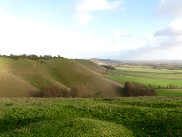
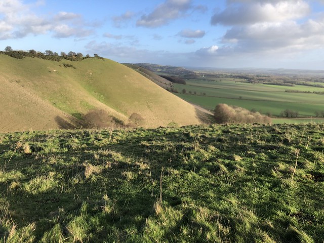
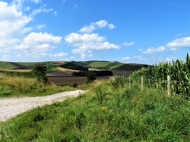
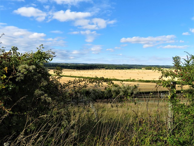
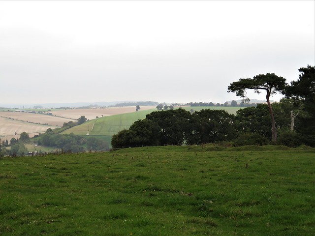
A cloudy, murky morning over Cranborne Chase. The views from Win Green were all melted into muted greys. The topograph on the saddle of high ground hinted at the prospect: fifteen miles northeast to Salisbury, twice that to the Isle of Wight down in the southeast.

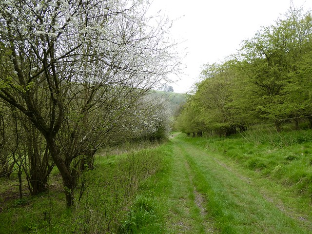
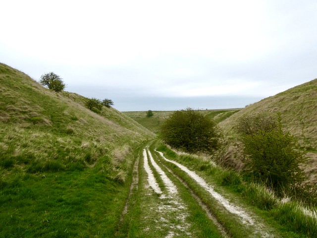
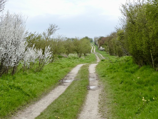
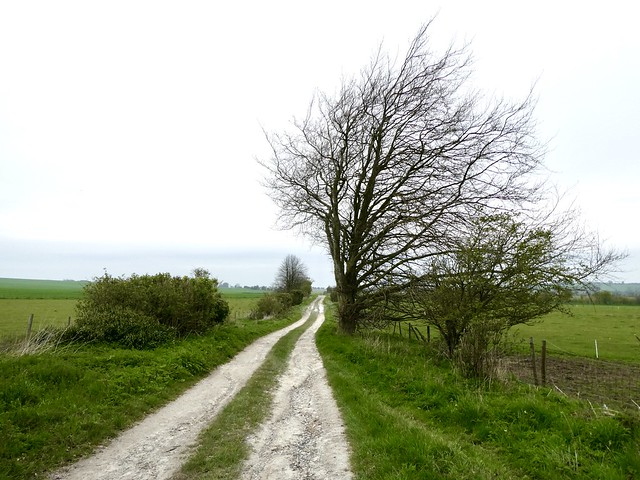
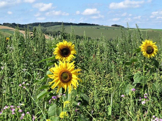
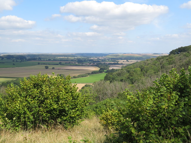
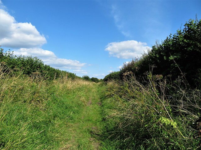
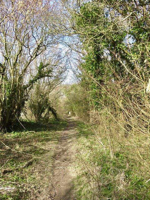
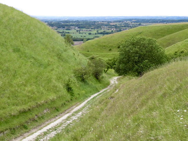
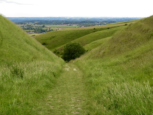
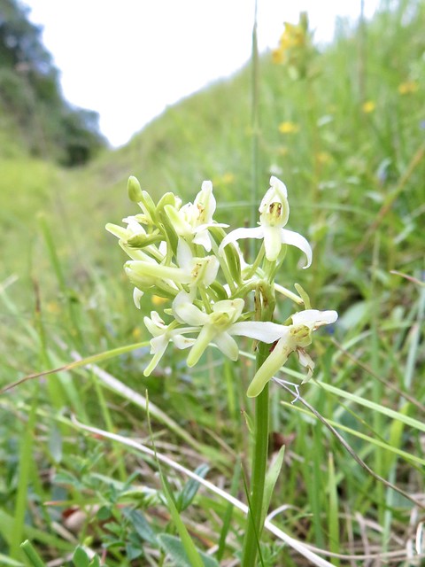
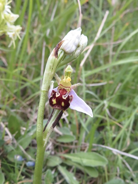
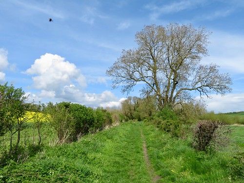
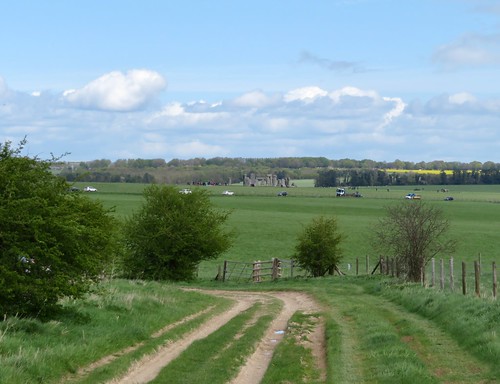
Children skipped and tumbled down the steep slope towards the wooded Ashcombe valley. The sharp spring wind was soon shut away, and calm descended on the deep green cleft where the path ran edged with primroses, violets and pungent wild garlic in full flower.

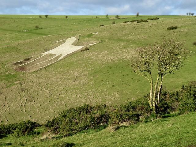
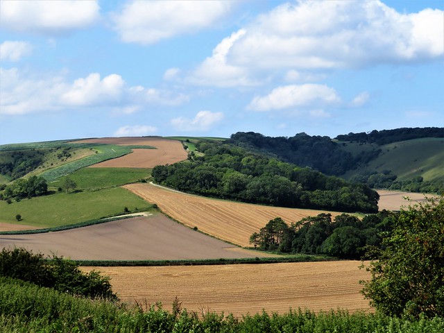
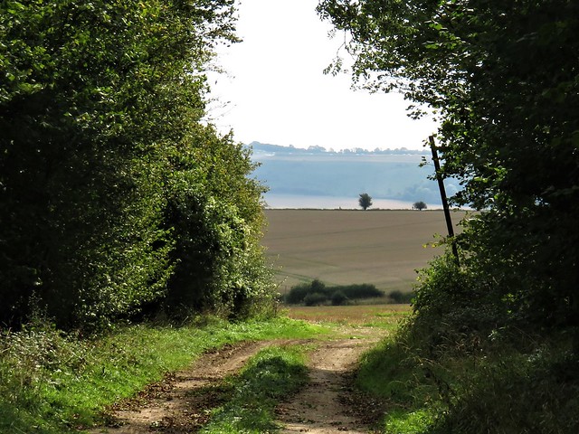
These woods of the Ashcombe Estate are a prime example of careful management and discreet signage. The vast hunting forest of Cranborne Chase, on whose borders they lie, was once a different affair – a tangled tract of deep forest where outlaws skulked and wild locals in straw helmets beat up gamekeepers and poached the deer.

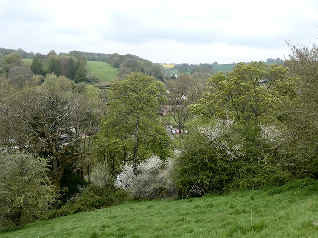
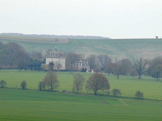
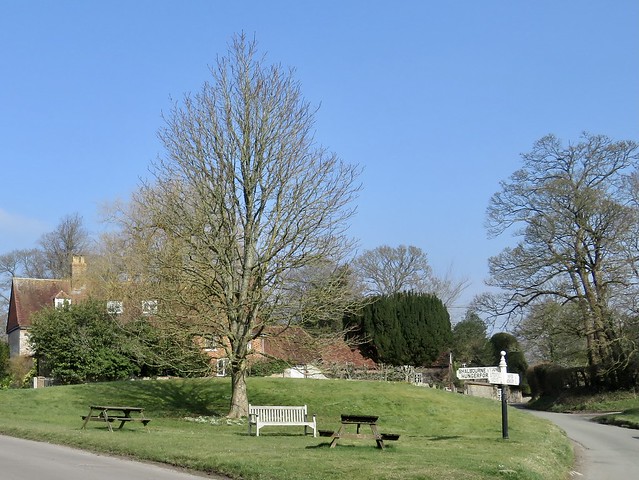
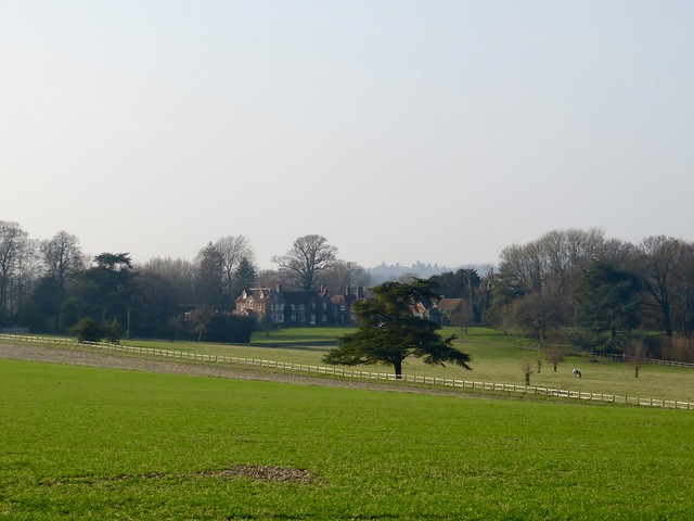
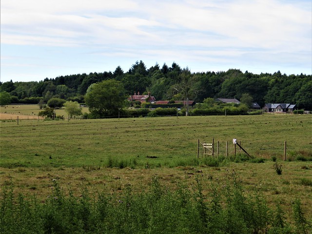
Down in Tollard Royal all was peachy, the snugly thatched cottages of flint and clunch, the gossipers on the benches round the village pond, all in a Sunday morning peace under steep valley slopes.

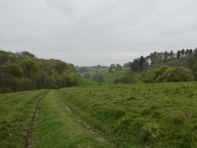
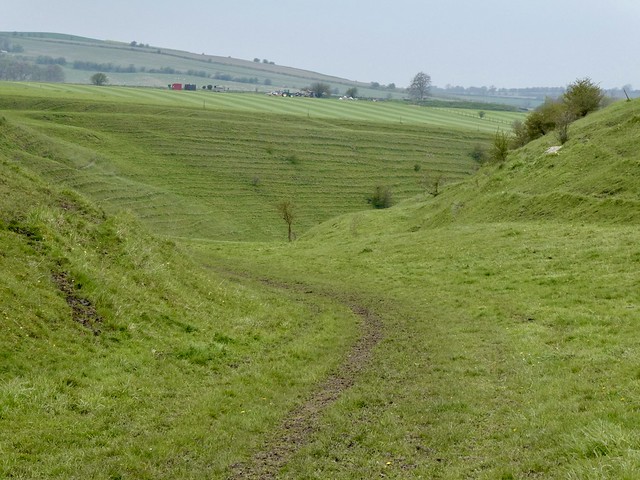
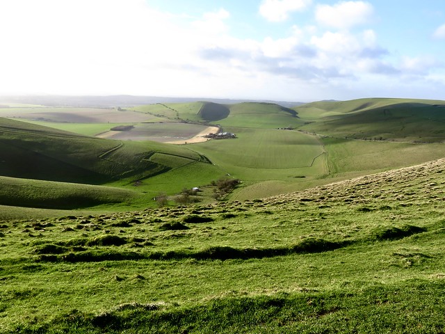
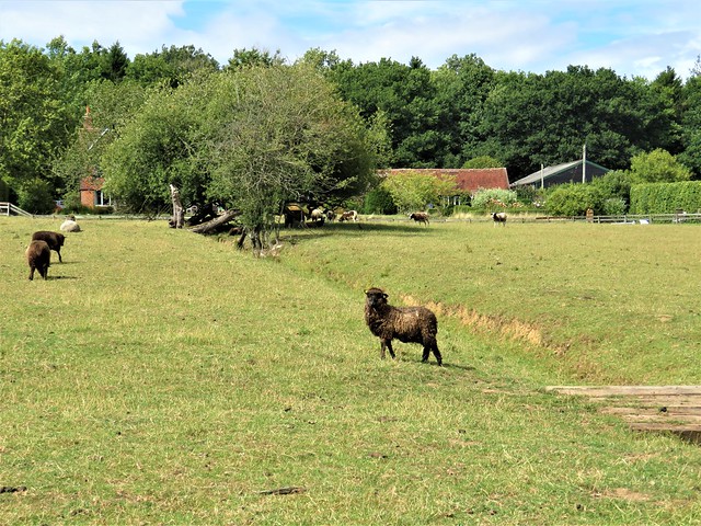
We climbed over a ridge where spring lambs were busy butting milk out of their mothers’ udders. In the cleft below the rains of late winter were drying, leaving Munday’s Pond a soggy circle of nettles.

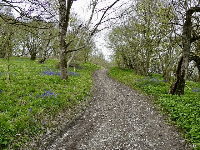
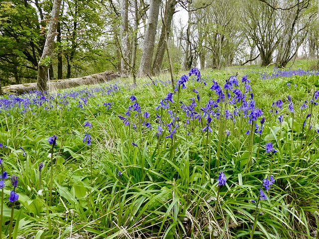
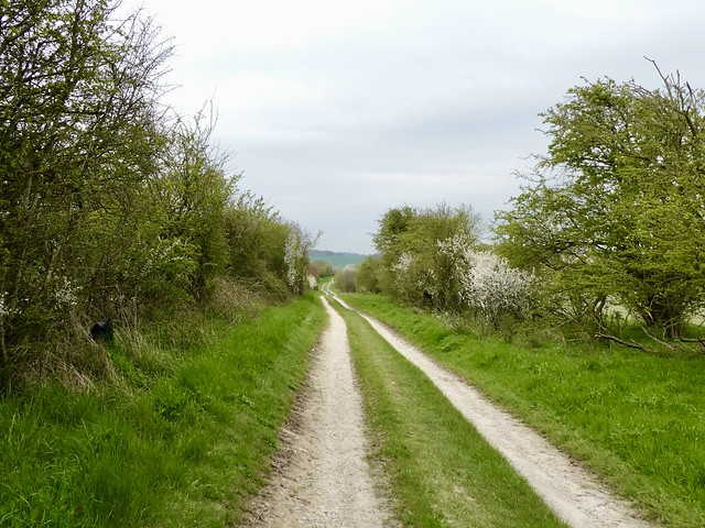
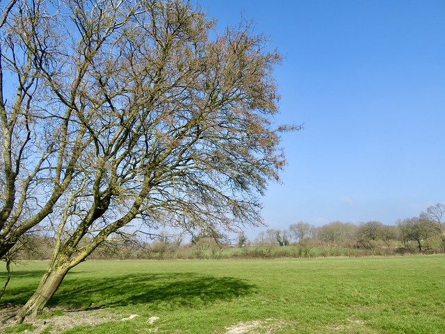
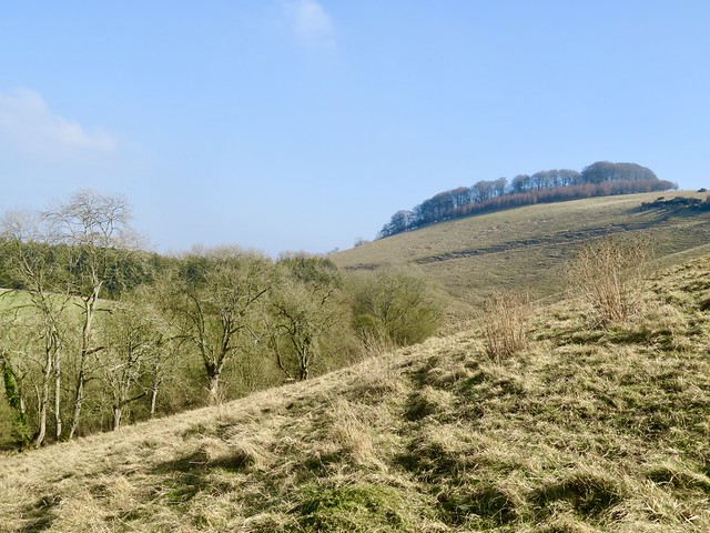
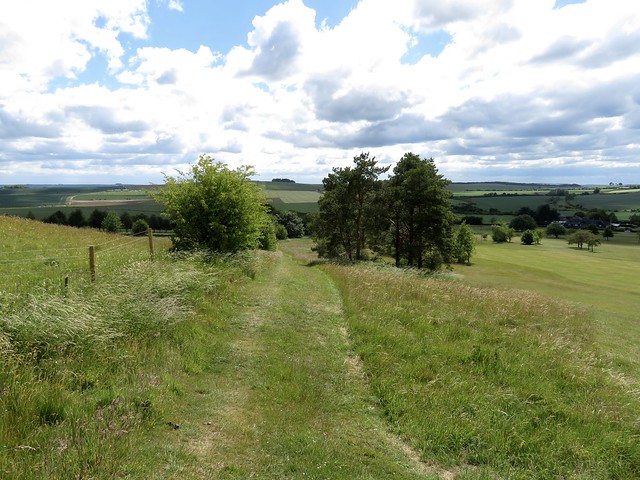
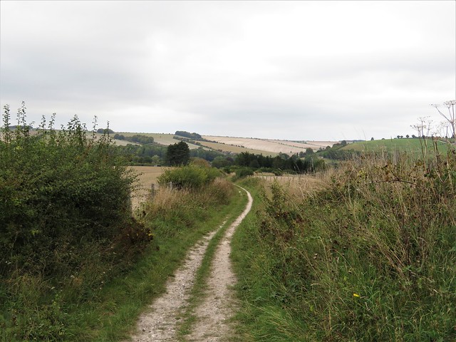
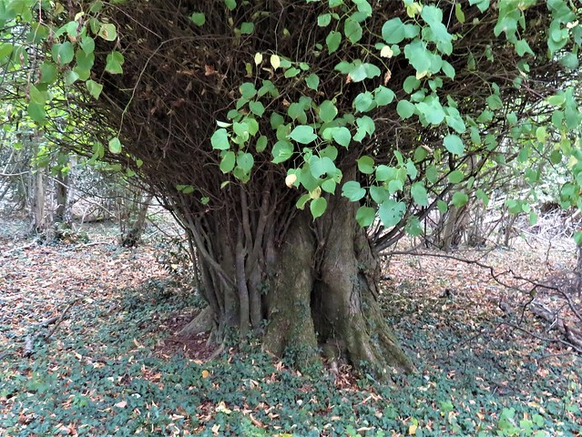
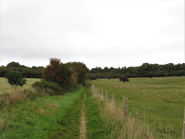
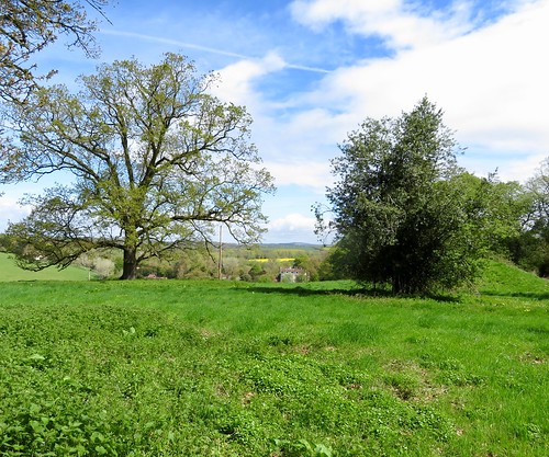
Our path lay uphill, breasting a slope beside the old hazel coppice of Rotherley Wood. A marvellous sentinel oak, twisted, split and bow-backed, stood with its feet in a flood of bluebells, and the hazel stools themselves were circled by the sharp evergreen leaves of butcher’s broom, another indicator of ancient woodland.

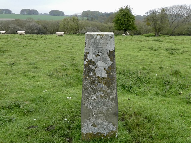
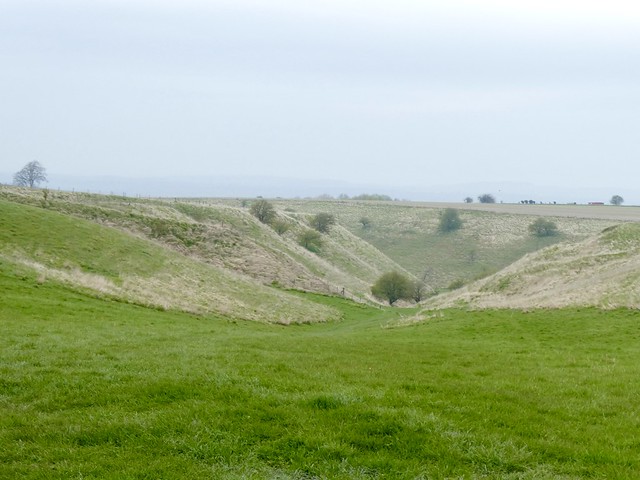
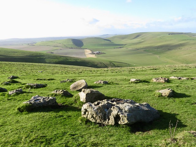
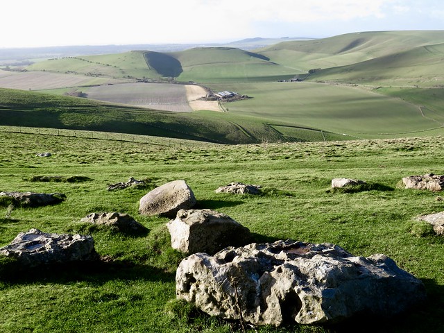
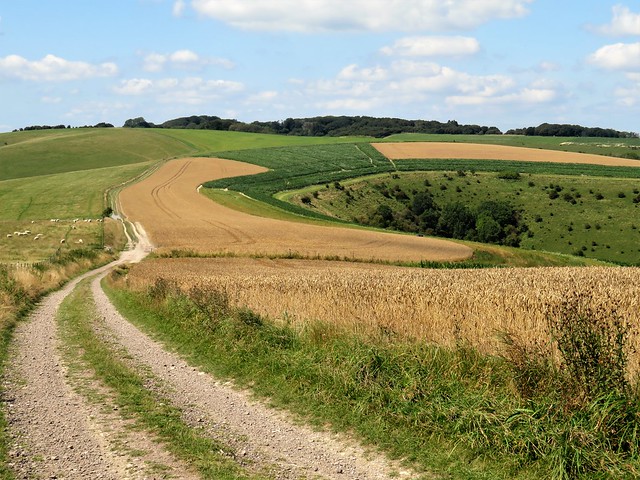
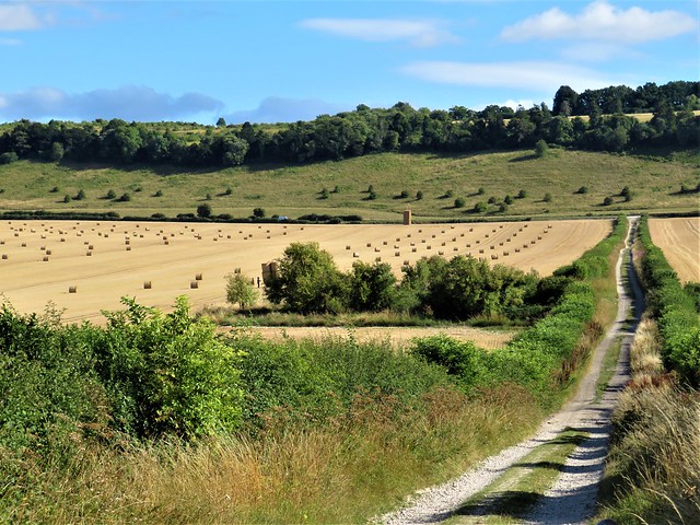
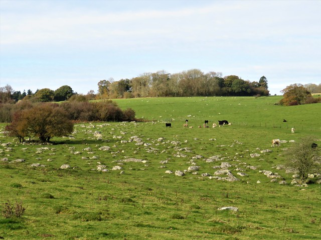
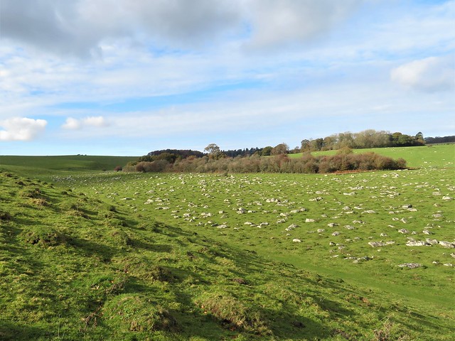
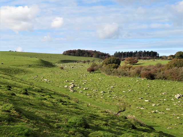
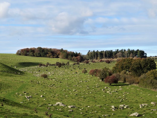
Up on the back of Rotherley Down lumps and bumps in the turf showed where a Romano-British settlement was excavated in 1886-7 by local landowner General Augustus Pitt Rivers. ‘Skulls’, says the inscription on a modest pillar. ‘1 was brachycephalic, 3 were mesaticephalic, 6 were dolichocephalic, 3 were hyperdoliocephalic, one was uncertain’. The General, father of modern British archaeology, remained an educator to his fingertips.

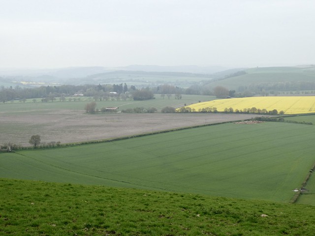
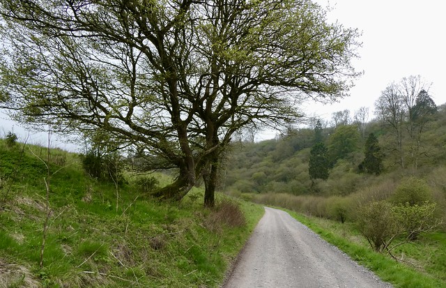
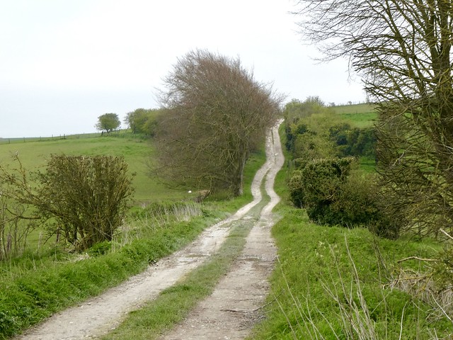
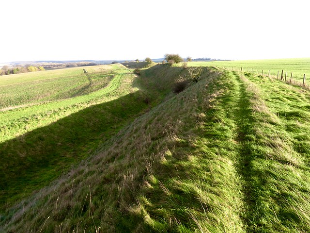
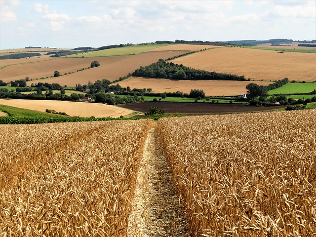
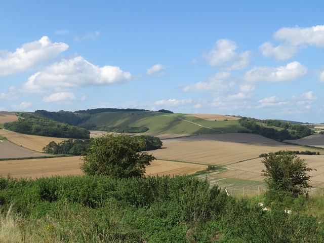
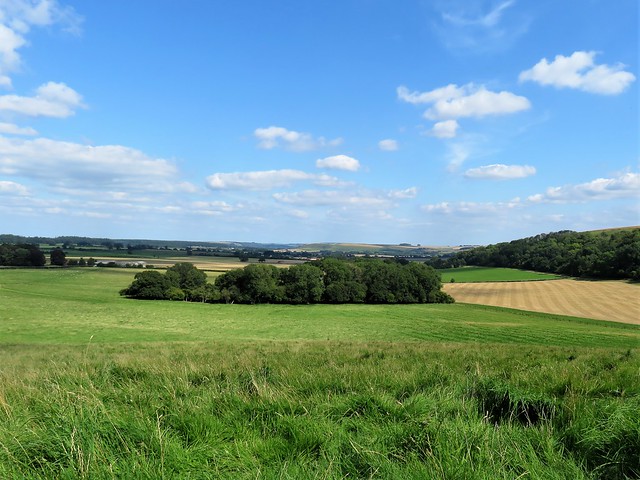
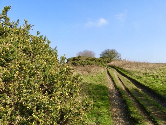
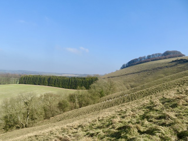
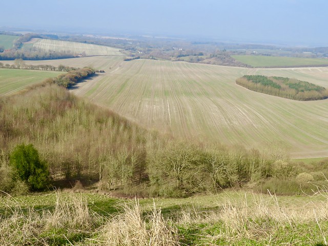
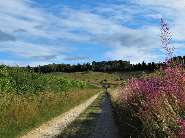
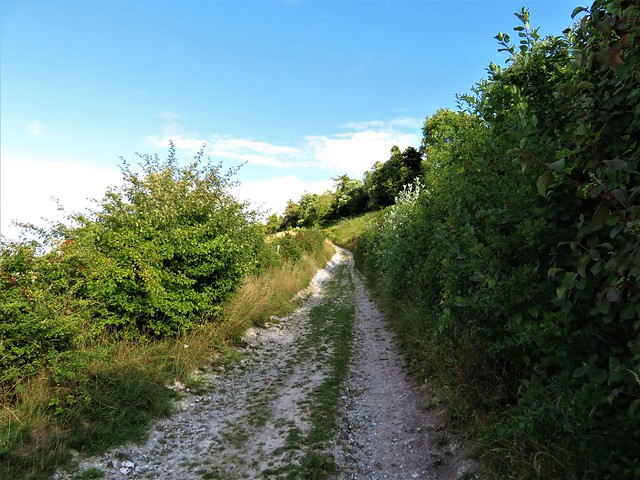
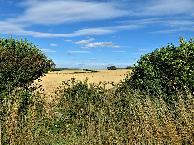
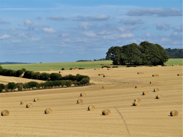
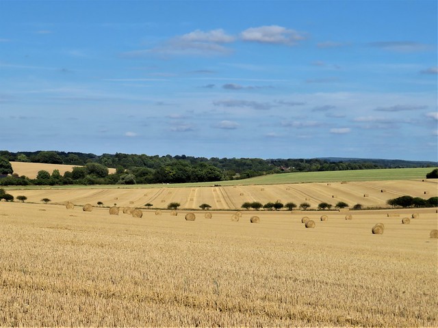
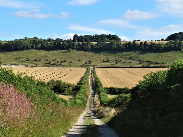
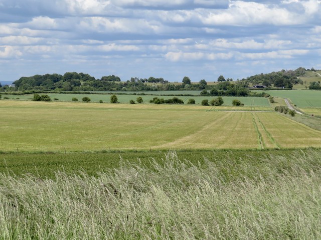
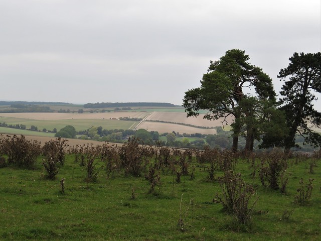
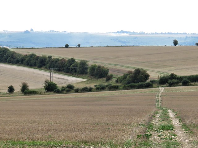
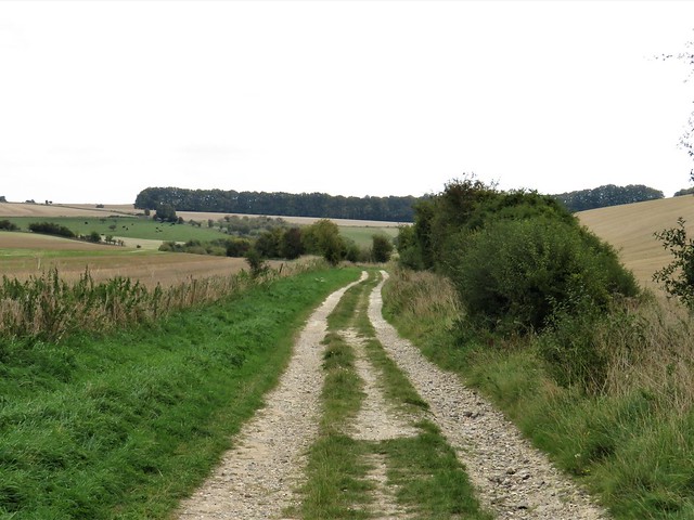
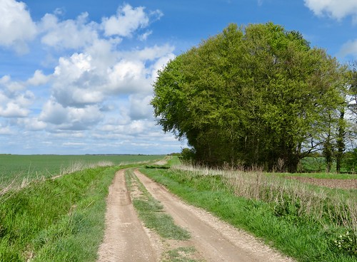
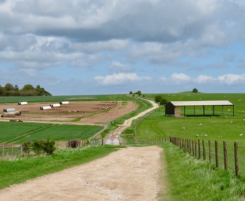
Beyond the settlement site we turned along the chalky white track of the old Ox Drove ridge road towards Win Green. The clouds had cleared, and the Isle of Wight lay blue and humped on an invisible sea far in the southeast, a view familiar to those residents of Rotherley Down two thousand years ago.

How hard is it? 7¼ miles; easy; downland and woodland tracks

Start: Win Green car park, near Tollard Royal, SP7 0ES (OS ref ST 924204)

Getting there: Tollard Royal (B3081) signed from A350 (Shaftesbury-Blandford Forum). At top of hill before Tollard Royal, follow ‘Donheads’, then ‘Win Green’.

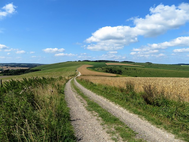
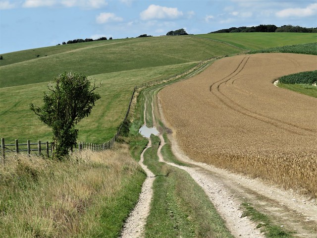
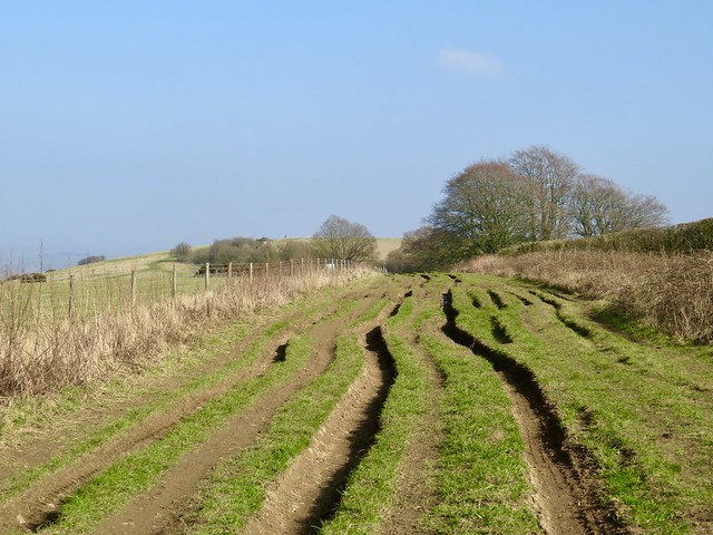
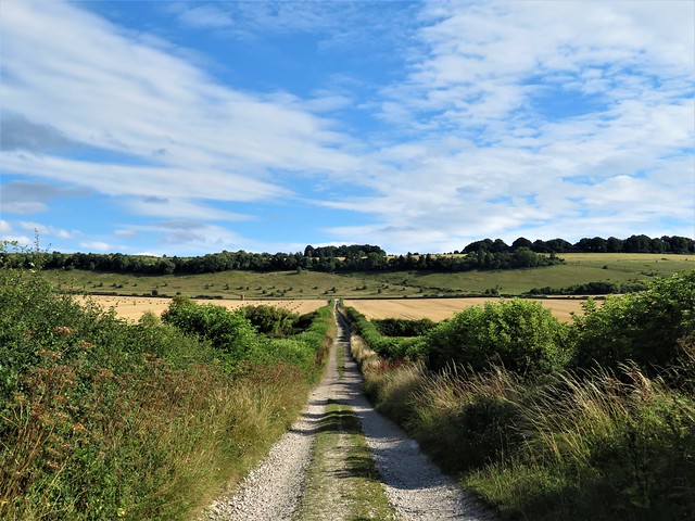
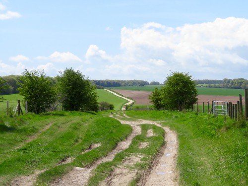
Walk: Through gate at top of car park; follow path along fence and downhill. Follow ‘Wessex Ridgeway’/WR and ‘Footpath’ signs through Ashcombe valley. In 1¾ miles, hairpin back left (937185, ‘Tollard Royal’ fingerpost); in 50m right through 2 gates (WR); follow path with fence on right. In ¾ mile, just before Tollard Royal pond (945178), left over stile. (NB for King John Inn, right at road). From stile climb bank, at top, on through gate (arrow) along fenced path to stile (949181). Diagonally left down to gate (940184, Munday’s Pond on left). Ahead on grassy track up slope beside Rotherley Wood. In ⅔ mile track enters wood; ahead through gate onto open down; Pitt-Rivers information pillar and excavations to right (950194). Opposite pillar, left through gate; right up middle of fields (arrows) to Ox Drove road (949205). Left; in ½ mile fork left (938206, ‘Cranborne Droves Way’), then right on chalk trackway. In ¾ mile, beside NT ‘Win Green’ sign, left (928207) up grass path to car park.

Lunch/Accommodation: King John Inn, Tollard Royal SP5 5PS (01725-516207, kingjohninn.co.uk)

Info: cranbornechase.org.uk

 Posted by at 01:16
Dec 162023


First published in: The Times Click here to view a map for this walk in a new window
chalk track to the Ridgeway dry valley with cultivation and erosion terraces on the way to the Ridgeway The Ridgeway above Bishopstone 2 The Ridgeway above Bishopstone 1 The Ridgeway above Bishopstone 3 The Ridgeway above Bishopstone 4 The Ridgeway near Ridgeway Farm permissive path through Eastbrook Valley tower of Ashdown House Ashdown House in its misty valley

It was scarf and frozen fingers weather over the Wiltshire Downs on a murky, muted morning. As we left Bishopstone the village children were prancing to school past the thatched houses with their walls of clunch or chalk blocks. ‘David Beal, Master of Thatch’ proclaimed a board outside a cottage, with the proof of the pudding on show all through the twisty byways of Bishopstone.

Chaffinches sang us off along an ivy-tangled lane that led to a dry valley with medieval strip lynchets lying in parallel ledges along the slopes. We threaded our way among a flock of recumbent sheep, the gently rising track turning from grass green to chalky white as it reached the Ridgeway on the crest ahead.

The ancient ridge track, a dozen paces wide, was potholed and puddled. A blackbird sang with piercing sweetness from a hawthorn twig just above our heads, so close and unafraid that we could see the working of its throat and the trembling of its bright orange beak with every phrase.

A line of leafless beeches kept the wind from the sheds at Ridgeway Farm. Here we turned south past a pig farm, the pink incumbents scampering away as though stung simultaneously into flight. Solitary crows stalked the plough furrows around the dishearteningly named Starveall Farm, and a shaggy-legged horse with a white nose blaze came up to accept a handful of grass from the greener side of the fence.

At the top of the track we turned east with red kites cutting circles overhead. There were big views to far downland ridges north and south, and as we descended the slope of Idstone Down a fine prospect ahead to the tall white shape of Ashdown House, a grand hunting lodge built in the 17th century for Elizabeth Stuart, elder sister of King Charles I and sometime Queen of Bohemia.

Elizabeth had a curious life, targeted by the Gunpowder Plotters at nine years old to be a hostage and puppet Catholic monarch, then in her teenage years as marriage fodder for the European monarchies. She was nobody’s stooge, however, but a highly educated and accomplished person with a passion for literature and language.

We passed the clamorous rookery in Swinley Copse and followed a wide valley track up to turn for home along the Ridgeway. A permissive path led us aside down a steep, twisting valley, quiet and beautiful, and we beat the rain into Bishopstone by a very short head.

How hard is it? 7¼ miles; easy; downland tracks

Start: Royal Oak, Bishopstone, Swindon SN6 8PP (OS ref SU 247837)

Getting there: Bus 47 (Lambourn–Swindon)
Road: signed from A419, Swindon-Cricklade (M4, Jct 15)

Walk: Between Bishopstone Stores and Village Hall, take pathway (‘Ridgeway’) to road (247836). Right; right up Nell Hill. In 150m fork right (‘Ridgeway’). Follow ‘Ridgeway’ signs up valley to The Ridgeway (249823). Left; in ⅓ mile at Ridgeway Farm, right (253827, ‘Public Right of Way’) along track. In ¾ mile climb slope; at top, left at track crossing (259810); in 100m, fork left (260809, arrows). In ¼ mile through gate (265809, blue arrow); on along fence. In ½ mile bear half left (273810, ‘Ashdown’) to cross stile. Keep same direction downhill, pass Swinley Copse (276816); in 100m in valley bottom, left on grassy track (277818). In 1⅓ mile, left along The Ridgeway (264835). In ⅓ mile, right over stile (260832, ‘Permissive Path’). After next stile, bear left down Eastbrook Valley. At bottom, through squeeze stile (251834); down track to road (249837); left (take care!) into Bishopstone.

Lunch/Accommodation: Royal Oak, Bishopstone (01793-790481, helenbrowningsorganic.co.uk) – superb throughout.

Info: bishopstoneandhintonparva.org

 Posted by at 01:34
Feb 042023


First published in: The Times Click here to view a map for this walk in a new window
White Horse on Milk Hill Sarsen stones on Milk Hill Wansdyke Sarsen stones on Milk Hill 2 view west from Milk Hill looking east along the downs from the summit of Knap Hill 1 looking east along the downs from the summit of Knap Hill 2

It was one of the mightiest winds I’d ever encountered, and it tore across the Wiltshire downs from the west like a mad thing. I was smashed in the face and shoved around as I climbed the flank of the Neolithic long barrow called Adam’s Grave, and when I got to the top the blast of the wind sent me staggering sideways.

Maybe it was the unquiet ghost of Giant Adam, mythical occupant of the 5,000-year-old tomb, or maybe the bellicose spirits of the Anglo-Saxon warrior slain in a great battle here in 592 AD; but something up here was stirring the air into a maelstrom. My eyes were so blurred with wind tears I could hardly take in the magnificent view across the Vale of Pewsey, its brilliant green pastures and glittering floodwater lit up by the low winter sun.

I turned full face into the wind and battled along the slope of Walkers Hill. People with their backs to the gale came scudding by, hair and coat tails flapping, cheeks beaten red, gasping and nodding their complicity in outfacing the weather.

A turn of the hill brought the Pewsey White Horse into view, a slender-legged beast 180 feet tall with an elongated nose and a cropped tail twitched high. Farmer Robert Pile of Alton Barnes down in the vale below cut it out of the turf in 1812, and his handiwork has survived the two intervening centuries pretty well.

A crowd of fifty starlings went rushing across the slope, wings rigid, surfing the wind as one entity. I turned uphill past hissing gorse bushes and went east along the old bank and ditch of Wansdyke, a great groove thirty feet deep in the landscape. Wansdyke runs for sixty miles between the Hampshire Downs and the British Channel, but no-one knows the purpose of the Dark Ages folk who built it so tall and strong.

A broad green trackway took me down into the shelter of the valley once more. Beyond stood Knap Hill with its ceremonial ramparts and dimpled crown. I let the wind propel me up to the crest. There I revolved, soaking up the view of sun-gilded downland, marvelling at the energy of our ancestors who made their mark so forcefully all over these chalk hills of the west.

How hard is it? 4¾ miles; easy; downland tracks.

Start: Pewsey Downs car park, near Alton Barnes, SN8 4LU approx (OS ref SU 116637)

Getting there: On minor road between Alton Barnes and East Kennett (signed off A4 near Avebury)

Walk (OS Explorer 157): Cross road; through gate; immediately left through gate; follow clear grass path to top of Adam’s Grave (113634). Turn back across dip; bear left on path, passing above White Horse (107637) and on (‘Mid Wilts Way’/MWW; ‘White Horse Trail’/WHT). In 500m pass gorse patch on right; beside lone tree on left (101638), bear right uphill past another lone tree. Bear right to gate (101639, MWW, WHT); on to next gate; bear left with fence on right. In 450m, right through gate (102645, MWW, WHT); follow fence on right. In 200m through gate (103646); right along Wansdyke for 1 mile to T-junction (118648). Right on rutted track for ¾ mile to Pewsey Downs car park. Through car park, past stones and barrier; in 100m, left (117636, gate, fingerpost); fork right up Knap Hill. Half left off summit (122636) down to gate (123639); sharp left back to gate and car park.

Lunch: Barge Inn, Honey Street, Pewsey SN9 5PS (01672-851222, thebargeinnhoneystreet.uk)

Accommodation: Circles Guest House, 15 High St, Pewsey SN9 5AF (07769-018643, circlesbandb.com)

Info: visitpewseyvale.co.uk

 Posted by at 01:51
Sep 032022


First published in: The Times Click here to view a map for this walk in a new window
golden wheatfields leading to Cold Kitchen Hill speckled wood butterfly looking back from the path to Cold Kitchen Hill path towards Cold Kitchen Hill Woodcombe Bottom from Cold Kitchen Hill looking from Cold Kitchen Hill towards Bushcombe Bottom and Woodcombe Bottom pheasant crop on Cold Kitchen Hill wheatear on the path ridge track on Cold Kitchen Hill 1 ridge track on Cold Kitchen Hill 2 ridge track on Cold Kitchen Hill 3 looking east from Whitecliff Down east from the foot of Whitecliff Down green lane back to Longbridge Deverill

Strong morning sunlight threw into prominence the lumpy shapes of house foundations and sunken lanes, all that remains of the medieval village of Hill Deverill.

In the green lane that led west towards the Wiltshire downs, a bench had been placed in the shade of a field maple. ‘Bob Hembury,’ said the memorial plaque. ‘He loved to walk this lane every day with his dog’. A man and a place summed up with perfect simplicity.

At the roots of a coppiced hazel badgers had dug out the multiple entrances to their subterranean city, throwing back the pale chalky earth in showers as though miniature shells had exploded there.

A side lane led up between wheat and barley fields onto the rolling back of Cold Kitchen Hill. In pre-Roman times it was Col Cruachan, the ‘wizard’s hill’, perhaps in deference to the spirits of the Neolithic long barrow that lies at the crest of the down. A wonderful bronze brooch was unearthed here, a rider on a capering horse, his clubbed hair bouncing behind him.

At the crest of Cold Kitchen Hill a magnificent view unfolded, a great semi-circle of undulating downs patterned in green, tan and grey, folding in steep hollows to the level farmland below. The ridge track ran west, a white streak ribboning away through dull gold wheatfields past the iron cresset of a Jubilee beacon, with King Alfred’s Tower at Stourhead a pointed finger raised on the distant skyline.

Steep-sided Bushcombe Bottom sank out of view, a green basin down whose flanks the bushes and trees appeared to be sliding towards an invisible plughole. We followed the track through grasses awash with the pale purple fronds of bartsia, looking down into the horseshoe of Woodcombe Bottom three hundred feet below.

Down through a nameless wood of old oak and beech, its floor thick with the dried-up seed heads of last spring’s bluebells, and out at the bottom to turn along the homeward track at the foot of the downs.

In a grassy meadow by the path a rough square block of stone carried the names and dates of Joan and Bernard Russell. No other clues about them, but they, like Bob Hembury and his dog, must have loved this beautiful corner of countryside.

How hard is it? 6¾ miles; easy; green lanes, downland tracks, muddy in parts.

Start: George Inn, Longbridge Deverill, Warminster BA12 7DG (OS ref ST 869408). Please ask parking permission, and give them your custom.

Getting there: Bus 57 (Warminster-Mere)
Road: Longbridge Deverill is on A350 (Warminster-Shaftesbury)

Walk (OS Explorer 143): Right along A350, in 100m, right (‘The Deverills’). In 500m, past ‘Stonewold’, right (868403, fingerpost/FP) up field. At top, 2 opposing gates (865404); through right-hand gate along lane. In 700m at crossroads, left (859402, ‘Restricted Byway’, bridleway FP) up hedged lane. In ½ mile, right through gate (860395); in 100m, over rusted-up gate; fork left (ignore ‘Permissive Path’) up to gate (858395, yellow arrow). Up field to FP (858394); on past tree clump. In 300m, successive gates (854391, FP); on past barrow mound (847383), Cold Kitchen Hill trig pillar (846382) and beacon cresset (841391). In another 900m on Whitecliff Down, keep ahead (834386), following fence on left. In ½ mile, track curves sharp right away from fence (827389), round top of Woodcombe Wood. In 250m fork left (828391, gate, FP, ‘Mid Wilts Way) through trees. At bottom of slope, through gate (828399); right (orange arrow, ‘Byway’) along path/lane at foot of downs for 3¼ miles back to Hill Deverill, then Longbridge Deverill.

Lunch/Accommodation: George Inn, Longbridge Deverill (01985-840396, the-georgeinn.co.uk)

Info: visitwiltshire.co.uk

 Posted by at 02:05
Mar 052022


First published in: The Times Click here to view a map for this walk in a new window
Ancient track along the downland ridge near Inkpen Hill 1 path up the grazing slopes of Ham Hill Ancient track along the downland ridge near Inkpen Hill 2 grazing slopes of Ham Hill 1 path up the grazing slopes of Ham Hill 2 Ham village green grazing slopes of Ham Hill 3 path down the rolling chalk slopes below Inkpen Hill Mount Prosperous, sometime home of agricultural reformer Jethro Tull 22 red kites wheeling over the fields near Ham View north from the slopes of Inkpen Hill Green lane to Inkpen

Early mist was sifting away from the Wiltshire downs as we laced our boots on Ham village green. Snowdrops showered the banks of the lanes with white, and wild garlic and celandines were peeping out.

The sun swept up the last of the mist, diffusing a clear light over the hills. A heavy distant thumping, like giants of the upper air pushing their wardrobes around, came from Salisbury Plain where big guns were firing.

Larks sang over the big prairie fields of winter wheat as we started up the steep path to the top of the downs. A raven went tumbling in a barrel roll to impress its mate below. Up on the height of Inkpen Hill a thirty-mile view showed the sheep-nibbled downs and rolling arable fields of the Wiltshire/Berkshire border, patterned this way and that by the plough.

A sunken lane ran east just below the ridge, an ancient trackway sheltered by the lie of the land. Ploughed fields rose to the crest. A pair of partridges went skimming low across the dark furrows, their short wings downcurved for maximum gliding power.

Ahead we caught a glimpse of the ominous T-bar of Combe Gibbet, especially built in 1676 so that the hanged bodies of murderers George Broomham and Dorothy Newman could be displayed as an awful warning to the world at large.

We slanted steeply back down the slope towards a round spinney of dark green conifers set in the pale chalky ploughlands 400 feet below. A prospect that might have been placed specifically for the palette of Eric Ravilious.

Down in the green lane through the fields we found a squirrel skull by the path, as thin and white as paper, its two outsize incisors bright orange. Hips and haws in the hedges were still plump, and we puzzled how they could have evaded the hungry birds of winter.

From Inkpen village Bitham Lane ran west, a flinty holloway in a tunnel of trees. Just before turning off it for Ham, a glimpse to the north showed the handsome country house of Mount Prosperous set in parkland where white horses grazed under a cedar.

Here in the early 1700s Jethro Tull came to live and farm, and it was in these fields that he experimented with a brainchild of his, the horse-drawn seed drill. Tull and his inventions soon ushered in the great agricultural movement that saw muscle power replaced by machinery on the farms, a first seismic shock of the Industrial Revolution that would soon shake the whole world.

How hard is it? 6 miles; easy; one short, steep climb

Start: Crown & Anchor, Ham, Marlborough SN8 3RB (OS ref SU 331630)

Getting there: Bus 20 (Hungerford-Marlborough)
Road – Ham is signed off A338 (Hungerford-Marlborough)

Walk (OS Explorer 158): South along road (‘Buttermere, Andover’). In 500m opposite Manor Farm, left (332625, ‘Mid Wilts Way’/MWW on pole). In ½ mile, right across field (339626, MWW). At foot of down, left on track (340622). In 200m, right (342622), gate, MWW), half left up steep path to gate (344620). Half left to ridge track (346619). Left. In ¾ mile at ring of 6 beech trees, just before dip with fingerpost, left (358621, stile, arrow). 50m past Wigmoreash Pond, left (359622) steeply downhill. Gate at bottom (357623); path north for 1 mile to road (356638). Right; in 250m, left at Inkpen Church fingerpost (357639) past Bitham Farmhouse. On along byway. In 1½ miles, opposite Mount Prosperous gates and drive on right, left (334641) across fields for ⅔ mile to road (333632). Right into Ham.

Lunch/accommodation: Crown & Anchor, Ham (01488-503040, crownandanchorham.co.uk)

Info: Hungerford TIC (01488-692419)

 Posted by at 01:02
Jul 312021


First published in: The Times Click here to view a map for this walk in a new window
picture picture picture picture picture picture picture picture picture picture picture picture picture
Facebook Link:

Walking through West Dean on a sunny afternoon, we got a strong sensation of temps perdu – a curious, time-suspended village, many of its ancient brick and timber farm buildings tumbledown or in the embrace of weeds. A smell of newly mown grass hung about Church Farm, where two Hardyesque lovers, very young and bashful, sat against the fingerpost, close together, shyly grinning at their own feet.

Among the dark trees of Dean Copse the squirrels had emptied the hazels and acorns, leaving the husks, neatly snipped and hollowed, strewn across the path. Beyond the wood the path declined to a matter of guesswork, but we nosed our way across the rough pastures and padlocks around Keeper’s Cottage, and on into Bentley Wood.

The purple emperors, white admirals, Dukes of Burgundy and other nobly-named butterflies for which the wood is famous were lying low or gone into chrysalis accommodation. But we enjoyed wandering the path among distorted old oaks in thick jackets of moss that shone a brilliant green in the dappled afternoon light.

On the outskirts of East Grimstead a fabulous tree house sat high in the fork of a tree, some lucky child’s Dorothy-and-Toto fantasy. The village lay scattered along a road that led down to a cluster of bridges – humpbacks that crossed the River Dun and the dry bed of the long-forgotten Salisbury & Southampton Canal, and a plain brick span over the railway.

A long flinty track headed south for the ridge that overlooked the Dun valley. A young roe deer cantered ahead on wobbly legs, and a yellowhammer, startled by our approach, flung itself up and away out of the hedge with a swoop and flick of wings.

We climbed a chalky holloway to the crest of the down and set back towards West Dean along the ridge track. Under Dean Hill a labyrinth of chalk caverns once stored the munitions of the RN Armaments Department, nuclear weapons sometimes among them. That all seemed a world away from this peaceful evening prospect, with views open to north and south across a countryside harvested, neat and complete.

How hard is it? 7 miles; easy; field and woodland paths

Start: Dean Station, West Dean, Salisbury, Wilts SP5 1JF (OS ref SU 257271)

Getting there: Rail to Dean; Bus 37 (Salisbury circular)
Road – West Dean is signed off A27 between Romsey and Whiteparish

Walk (OS Explorer 131): From railway crossing, down right side of King George’s Hall. In 100m fork left; in 100m, left (256273, gate, yellow arrow/YA); follow fence on right, then footpath signs across fields, into west flank of Dean Copse (249279). In 200m, right up forest road; in 70 m, left (248282, YA) on path that leaves copse (247282). Keep same direction ahead across fields (stiles, YAs). Through gate into field opposite Keeper’s Cottage (242285); left to stile (241286), then more stiles across paddocks (YAs) into Bentley Wood (240284).

Follow public footpath through wood. In 300m at cross track, left for 10m (237281); right (‘No Horse Riding’) on path for 400m to leave wood past info board, then horse barrier (232280). Ahead for 500m to T-junction (226280, ‘Bugmore Lane’). Left; left by village noticeboard opposite pond (226278, fingerpost), through kissing gate/KG. Down right-hand hedge; at bottom, right through hedge (230276); half left to KG; along fence on right, then path (YAs) to road (225274), Left to bend; ahead up side road across canal, then railway (225271); on for ¾ mile to T-junction (228259). Right; in 150m, hairpin left (226259) up chalk track to ridge (229256). Left on gravel track. In 1¼ miles, left down Dean Hill road (249258); 20m beyond S-bend, right through hedge (253261); left along fence. At end, right along hedge (253263); through gate; left down hedge. At field bottom, left through hedge (254269); right to road; right to West Dean.

Conditions: Keep your eyes peeled for waymarks and stiles in field around Keeper’s Cottage!

Lunch: Black Horse, West Tytherley SP5 1NF (01794-340308)

Accommodation: Mill Arms, Barley Hill, Dunbridge, Romsey SO51 0LF (01794-340355, millarmsdunbridge.co.uk)

Info: visitwiltshire.co.uk

More walks at christophersomerville.co.uk

 Posted by at 01:36
May 222021


First published in: The Times Click here to view a map for this walk in a new window
picture picture picture picture picture picture picture picture picture picture
Facebook Link:

Heddington lay in thatch and mellow brick, cradled by the Wiltshire downs, as pretty and sleepy as a summer photograph from long ago.

We passed the tiny half-timbered Ivy Inn and were soon walking through green pastures towards the hills.

At Harley Farm we crossed the neat garden and the cornfields beyond, to join the straight old track that leads as a deep chalky holloway due east up on to the crest of Morgan’s Hill. A crowd gathered here to see local man John Morgan hanged in 1720 for the murder of his uncle. Today the hill has a gentler reputation as a nature reserve with wonderful views to all quarters.

We sat in the sun and wind among wild thyme and common spotted orchids to eat macaroons like the Famous Five, gazing north over a landscape striped and chequerboarded in white chalk and green barley and beans. The wind moved the unripe barley in silky waves and brought us the sweetly pungent smell of the bean flowers.

The patchwork variety of the plants and creatures of the reserve came as a striking contrast to the shaven uniformity of golf course grass on the south slope of Morgan’s Hill. Soon we were down in a long valley that looked south towards Salisbury Plain, following the ancient Wessex Ridgeway between fields of oats and beans and barley, just as the old song names them.

Corn buntings are in severe decline across the UK, their habitat degraded and food sources diminished by pesticides. But now one of these chunky little birds with a striped chest and thick bill kept us company, flitting a little ahead and perching along the fence wire.

The way home ran past the Iron Age hill fort called Oliver’s Castle. Here on 13 July 1643 a Parliamentarian army suffered heavy defeat by Royalist forces. Many of the Roundhead casualties were troopers in flight; they rode in panic over the steep edge of the down and crashed to their deaths in a heap of men and horses.

On this sunny afternoon the banks of the ‘Bloody Ditch’ were thick with bee and lesser butterfly orchids. Wandering here, it was hard to give credence to the awful scenes of the long-ago disaster that gave this flowery cleft its ominous name.

How hard is it? 8¼ miles; easy; field paths and trackways

Start: St Andrew’s Church, Heddington, Calne, Wilts SN11 0PL (OS ref ST 999663)

Getting there: Bus 43 from Calne
Road: Heddington is signed off A3102 between Calne and Devizes

Walk (OS Explorers 156, 157): Stockley Road north out of Heddington. In ⅓ mile, opposite row of cottages, right (SU 001666, stile); follow field path (unwaymarked) for ⅓ mile east, then north-east to Harley Farm (006671). Through gate into garden (unwaymarked, but it’s a Right of Way); half right to stile. On across 2 fields to stony lane (006675). Right; in 300m, ahead at bend (009675). In ½ mile dogleg right/left across road (018673, ‘Byway’) and on.

In 500m, reach Morgan’s Hill Nature Reserve gate on right, with another gate/track on left (023672). Take middle track between them along north edge of reserve. In 500m, right (027672, gate, white arrow), diagonally across nature reserve. At top, through gate onto golf course (025671). Dogleg left/right down path through golf course; in 300m bear right (025668, arrows) to cross road near Club House (023667). On along Wessex Ridgeway. In 1¾ miles pass Plantation car park (015642); in 300m, right (013639, ‘Leipzig Plantation’) up road. In just under 1 mile, near Oliver’s Castle, dogleg left/right and on (005648). In ¼ mile, left through gate (003651); down steep cleft. In ¾ mile at bottom of hill, on left bend just after gates on right (992655), go right through hedge gap by wooden post. North along path; in 300m cross marked Byway and on (992658, ‘Restricted Byway’) to Heddington.

Lunch: Ivy Inn, Heddington SN11 0PL (01380-859652, ivyinnheddington.co.uk)

Accommodation: George & Dragon, High Street, Rowde, Devizes SN10 2PN (01380-723053, thegeorgeanddragonrowde.co.uk)

Info: Calne TIC (01249-814000); visitwiltshire.co.uk
satmap.com; ramblers.org.uk

 Posted by at 03:34
Feb 062021


First published in: The Times Click here to view a map for this walk in a new window
picture picture picture picture picture picture picture picture picture picture
Facebook Link:

The sun had broken through at last, rolling away a cold blanket of mist to reveal the Wiltshire Downs and their subtle undulations. We stepped out under a blue sky, hearing horse hooves pounding along an unseen gallop in the hollow where Manton Stables lay hidden.

This wide open downland is horse and cattle country, the gallops tending to stretch along the tops, the cattle grazing the dry valleys below. A very fine Charolais bull, contentedly recumbent, kept a lazy eye on us as we passed on our way to the Devil’s Den.

Neolithic men raised the huge stones that form the structure of this passage grave. After the end of the last glaciation, these sarsens – ‘saracens’ or foreign stones – lay scattered all across the downs, easy pickings for the builders of Stonehenge and other ancient monuments.

We followed a wide path west through a shallow valley where a great congregation of lichen-stained sarsens delineated the curve of the hollow. Local people, seeing their resemblance to an enormous flock of sheep in bedraggled fleeces, named these clustered stones the Grey Wethers. Cows moved slowly among them, and a handsome ginger-and-white Simmental bull licked one ruminatively for the minerals it contained.

Sarsen stone is composed of sandstone bound together with a glassy silica. In his book ‘The Stonemason,’ Andrew Ziminsky calls it ‘diamond-hard, tougher even than granite.’ Nonetheless, three centuries ago in his ‘Palaeographia Britannica,’ antiquarian William Stukeley warned masons not to build with sarsen; ‘It is always moist and dewy, and rots the furniture.’

We shadowed the river of stones up the valley, then took to the ancient downland tracks that are the pride and joy of Wiltshire’s walkers. The Herepath (a Saxon word for ‘warpath’) led to the Ridgeway, a high road of braided ruts with a stunning view westward over many miles of downs and wooded valleys gilded by the afternoon sun.

Sarsens lay alongside the Ridgeway, and sarsens bounded the White Horse Trail, another venerable downland track that led us homeward between leafless hedges. A yellowhammer perched high on a bush, its breast sulphurous in the sunlight, and fieldfares flew over with vigorous wing thrusts, flocking together for protection and company in obedience to an age-old winter instinct.
How hard is it? 7½ miles; easy; downland paths and tracks

Please only walk within your Tier area, or enjoy this as an armchair walk till restrictions lift. And please consider others when you park.
gov.uk/government/publications/the-countryside-code 

Start: Gravel Hill car park, Downs Lane, near Fyfield, Wilts SN8 1PL (OS ref SU 159700)

Getting there: Follow ‘Manton House & Hollow’ on A4 (Calne-Marlborough) between Fyfield and Manton. Car park 1 mile on left.

Walk (OS Explorer 157): Follow gravelled trackway west. In 700m left through gate (153703); on through field, with fence on left. In 500m, left (149701) down slope beside fence; left through gate (150698) to Devil’s Den stones (152697). Return to gate; on along grass track through Grey Wethers valley. In 1 mile path curves right to metal gate (137706). On with fence on right to corner of Wroughton Copse (138711); left down slope; left along Wessex Ridgeway/Herepath (133710). In 300m cross gallop (130709); bear right for 550m to stile onto Ridgeway National Trail (127714). Right for 1 mile; right onto White Horse Trail/WHT (125729). In ⅔ mile fork right at copse (132723), cross track and on (WHT). Through wood (135720), then grassy track (WHT). In 600m, left on Wessex Ridgeway/Herepath (143714); in 100m right (‘Byway’) to car park.

Info: uksouthwest.net/wiltshire/fyfield-down; satmap.com; ramblers.org.uk

The Stonemason by Andrew Ziminski (John Murray)

 Posted by at 01:29
Oct 312020


First published in: The Times Click here to view a map for this walk in a new window
picture picture picture picture picture picture picture picture picture picture
Facebook Link:

The first knockings of autumn were making themselves heard in the whistle of cold wind and rustle of falling leaves along the Wylye valley.

From the creeper-hung Royal Oak at Great Wishford we followed a flinty track up a downland spine between stubble fields, the view opening out over the steep scrubby slopes and curving valley of Penning Bottom. Tiny green and orange crab apples, as hard as marbles, lay across the path, and the banks of the sunken lane were scarred with pale grey chalky spoil and showers of white flints kicked out by burrowing rabbits.

Ahead on the ridge lay the long dark bar of Grovely Wood. Great Wishford’s relationship with this ancient piece of forest is long-standing. The village enjoys the right every 29 May, Oak Apple Day, to gather wood from Grovely, a custom that can only be upheld through a ritual entry of the villagers into Salisbury Cathedral for the purpose of shouting ‘Grovely, Grovely, Grovely … and all Grovely!’

Grovely is a beautiful wood of sweet chestnut, hazel, oak and handsome specimen conifers. Fine old beech trees, well spaced, form glades where little else grows, and there was a cool and solemn atmosphere as we traversed these green, cathedral-like spaces.

Two ancient ways twist through Grovely Wood – a ridgeway that might have been used as a thoroughfare for as long as 7,000 years, and Grim’s Ditch, a defensive earthwork built by Iron Age Britons. Norsemen, coming across the earthwork nearly 1,000 years after its creation, named it after Grimr, their conception of the Devil.

At a place where ancient ridgeway and demonic ditch entwined, we left Grovely Wood and descended into a valley of billowing ploughland, where yet another of Wiltshire’s ancient tracks, the Ox Drove, ran a snaking course. A much-weathered milestone in the verge bore witness to the importance of this old byway to riders and coach travellers of bygone days. We puzzled out its eroded lettering: ‘VI Miles from Sarum – 1759.’

We found a path between fences where stonechats perched, wheezing ‘wheesh-chat! wheesh-chat!’ Their dark heads and white canonical collars gave them a rather severe air, offset by their cheerful buff waistcoats.

Back through the murmuring trees of Grovely Wood, and down a long flint track towards Great Wishford, its thatched roofs and chequered flint-and-freestone walls cradled in a tree smother of red, gold and green.

Start: Royal Oak PH, Great Wishford, Salisbury SP2 0PD (OS ref SU 078355)

Getting there: Bus 2A (Devizes-Salisbury)
Great Wishford is signed from A36 (Salisbury-Warminster) at Stoford

Walk (6½ miles; easy, downland and woodland tracks; OS Explorer 130): From Royal Oak, under railway; right up track (‘Public Bridleway’). In ½ mile at gate (070353), ahead along fence. In ½ mile enter wood (062351), bear left along inner edge, follow track for ¾ mile to road (055344). Right; in ½ mile at edge of wood, fork left (048341, No Through Road, Monarch’s Way, blue arrow). In ½ mile at Grovely Farm, left (044335); fork immediately right along wood edge. In 600m leave trees (046329), ahead to valley bottom; left (047327) along Ox Drove track. In ⅔ mile at junction, left (057324, ‘Restricted Byway’); in 20m, left at milestone for 2½ miles – up fenced path, through Grovely Wood, down to Great Wishford. Under railway (080351), left; right down South Street to church (081355); left to Royal Oak.

Lunch: Royal Oak PH, Great Wishford (01722-790613, royaloakgreatwishford.com) – open all day, Thursday-Sunday

Accommodation: The Old Post House, Great Wishford SP2 0NN (01722-790211, theoldposthouse.co.uk) – cosy B&B, Covid compliant

Info: Salisbury TIC (01722-342860), visitwiltshire.co.uk; satmap.com; ramblers.org.uk

 Posted by at 01:07
Dec 012018


First published in: The Times Click here to view a map for this walk in a new window
picture picture picture picture picture picture picture picture
Facebook Link:

The River Avon went rushing under the mill bridge at Little Durnford, the water as grey as molten glass. We leaned on the bridge rail to admire it before setting off along a green lane that shadowed the course of the river up its shallow valley.

At Lake the flanks of the valley were scratched with strip lynchets and laneways, evidence of a vanished village. From the valley bottom Lake House stared out from multiple windows under five tall gables, a handsome old house in a beautiful setting sheltered among its trees.

A wide green track led north up the dry chalk valley of Lake Bottom, past the paddocks at Springbottom Farm where a ginger horse rolled ecstatically on the grass. Up on the skyline a row of ancient burial mounds made a grand introduction to a memorable view – Stonehenge in all its glory, the tall grey trilithons catching and holding the eye.

A trio of hippy caravans stood parked by the greenway. We turned off before the Stones and the rushing traffic of the A303 that so disfigures the prospect, and made for the braided trackway of the Harroway, the oldest and least regarded of England’s prehistoric roads.

The white chalky ribbon of the Harroway winds south over Normanton Down, a remarkable ritual landscape associated with Stonehenge, whose mysteries and meanings are only now beginning to be probed with modern ground-penetrating remote sensors.

Bowl barrows, long barrows, bell barrows lie scattered across the grassland. We passed Bush Barrow, a tree still growing out of it, excavated in 1808 to unearth a skeleton six feet tall and 4,000 years old, adorned with a golden breastplate. The Harroway ran between a pair of shallow disc barrows and descended past a field of cheerfully grunting pigs rooting in an Armageddon of mud.

At Druid’s Lodge we left the ancient road and turned back over the downs towards the Avon valley. Lapwings flickered in black and white over the fields, three hares scampered and stopped, scampered and stopped, and a big bird of prey (marsh harrier? hen harrier? – we couldn’t decide) suddenly sailed across our track, flapping its great wings with enormous lazy power as it scanned the ploughlands for unwary mice.
Start: Black Horse PH, Great Durnford, Wilts SP4 6AY (OS ref SU 135380)

Getting there: Bus 201 (Amesbury-Salisbury)
Road – Great Durnford is signposted off A345 (Amesbury-Salisbury) at Stock Bottom

Walk (8 miles, easy, OS Explorer 130): From Black Horse, right along road. In 100m, opposite Field House, right on gravel track. Cross millstream; follow path for ½ mile to cross road (132386). Stile opposite (‘Normanton Down’); path down to road (129389). Left up trackway. In 1 mile, track curves left by Springbottom Farm stables (122400); in 150m keep ahead (right) at fork on grassy track. In nearly 1 mile, at NT sign, left through kissing gate (120413); in 350m, left at next kissing gate along Harroway trackway (117415) for 1¾ miles to A360 (099392). Left along verge for 250m; left (‘Upper Woodford’) on track, then road for 1¾ miles to road at Upper Woodford (124373). Left; in 60m, right (fingerpost) on stony, then grassy lane. In ¾ mile, right (133379) across millstream bridge, back to Black Horse.

Lunch: Black Horse, Great Durnford (01722-782270) – NB closed Sun eve, all Mon.

Accommodation: Rollestone Manor, Shrewton, Wilts SP3 4HF (01980-620216, rollestonemanor.com) – very comfortable B&B + dinner in historic house

Info: Salisbury TIC (01722-342860); visitwiltshire.co.uk; satmap.com; ramblers.org.uk

 Posted by at 01:45