Search Results : cotswold

Jan 232016


First published in: The Times Click here to view a map for this walk in a new window
picture picture picture picture picture picture picture picture picture picture picture picture picture
Facebook Link:

A church bell was ringing nine in the morning as we set out from Winchcombe, one of Gloucestershire’s nicest towns to linger in with its chic little shops and golden houses of oolitic Cotswold limestone. It’s a good place to walk out of, too, dropping down between the pretty estate cottages of Vineyard Street with a green ridge of hills in prospect to the south.

We passed the tall gatehouse of Sudeley Castle and struck out across squelchy fields of medieval ridge-and-furrow, the mud under our boots as pale and thick as batter. The view eastward opened over the deep valley where Sudeley Castle lay set with towers like a cathedral among well-kept pastures and woods of pale wintry mauve and brown.

The sun was a greasy button of silver in a thick grey cloak of cloud as we passed Wadfield Farm, whose hedge of holly and beech whistled in the wind. A track flecked with dull gold stone led up past Humblebee Cottage, and from the road above we followed the well-trodden path up to Belas Knap at the crown of the hill.

Belas Knap is truly impressive, a magnificent long barrow nearly 200 feet in length, lying north-south along its ridge. Its northern portal, deliberately blocked with an enormous chockstone, lies between walls that curve outwards like the flippers of a giant turtle. What those who built the great tomb some 5,000 years ago intended when they constructed the dummy entrance is unclear – perhaps to deter robbers, or maybe as a spirit door to allow the dead free passage.

We walked a circuit of Belas Knap. Then it was back down to Humblebee Cottage and a slippery grass track to Newmeadow Farm where they were shifting loads of dung and straw from the cattle shed to the steaming muck heap in the yard.

A muddy path led on north past the intriguingly named wood of No Man’s Patch towards the broad green parkland around Sudeley Castle. King Henry VIII’s sixth and final wife, Katherine Parr, remarried and lived here after his death. Sometimes she’s seen at one of the castle windows, a wan figure in a green dress, gazing out and watching the world go by.

Start: Back Lane car park, Winchcombe, GL20 5RX (OS ref SP 024284)

Getting there: Bus 606 or W1 from Cheltenham
Road – M5 Jct 11, A40 to Cheltenham, B4632 via Prestbury and Cleeve Hill to Winchcombe.

Walk (6 miles, easy, OS Explorer OL45): Follow ‘Town Centre’ to High Street. Right; in 150m, left down Vineyard Street (‘Sudeley Castle’). Follow road past castle gates and on; in 300m, right (025278, ‘Winchcombe Way’/WcW) off road. Follow WcW across fields (kissing gates/KG, footbridge, yellow arrows/YA) for 1¼ miles, up past Wadfield Farm (026264) and Humblebee Cottages (023259) to road. Right for 600m; at car park left (020262, ‘Belas Knap’) on well-trodden path for ½ mile to Belas Knap long barrow (021255).

Return to Humblebee Cottages. Just below cottages, right (waymark post with YA on left) past cottages. In 300m, through gate and turn left (025257, ‘Gustav Holst Way’/GHW) along fence, down to Newmeadow Farm (029261). Right along track (YA, GHW); in 700m, left at fingerpost (035259, ‘Windrush Way’/WdW). Follow WdW north through succession of gates/stiles, some unwaymarked. In 600m, at north end of No Man’s Patch wood (032265), half right across two fields (directional posts). At WW fingerpost just short of a road, right (031271) across brook; at far side, left (KG), then half right up grass slope past post. Aim left of Sudeley Castle. Opposite castle, through double gates (030276); bear half left (not ahead, as KG and YA suggest!) past playground to drive (028278). Left to gatehouse, return to Winchcombe.

Conditions: Can be very wet and muddy in fields

Lunch: Plaisterer’s Arms, Abbey Terrace, Winchcombe (01242-602358, plaisterersarms.co.uk) – friendly pub

Sudeley Castle: 01242-604357, sudeleycastle.co.uk. Open early March – end Oct

Info: Cheltenham TIC (01242-522878)
visitengland.com; satmap.com; ramblers.org.uk

 Posted by at 02:42
Apr 112015


First published in: The Times Click here to view a map for this walk in a new window
picture picture picture picture picture picture picture picture picture picture picture picture picture picture picture picture
Facebook Link:
The infant River Thames joins Gloucestershire to Wiltshire at the outer edge of the Cotswolds, in low-lying gravelly country. Setting off along the towpath of the reed-choked old Thames & Severn Canal, we marvelled at how dozens of unsightly old gravel pits have been transformed into the wide, tree-hung lakes of the Cotswold Water Park. This is a really fine example of a conservation landscape; and down beyond the hamlet of Cerney Wick there’s another in the lush hundred-acre grassland of North Meadow.

This is a beautiful wide hayfield, fringed with greening willows and filled with flowers; a habitat that comes into its own each springtime. Entering the meadow from the old canal, we walked among spatters of wild flowers – golden buttons of dandelions and buttercups, creamy yellow cowslips, the pale blues and pinks of milkmaids, which some call lady’s smock or cuckoo flower. And everywhere the large drooping heads of snake’s head fritillaries, singly, in pairs or in loose clumps, bobbing and trembling in the wind on their dark red stems.

We got down on our knees, as though in obeisance, to enjoy a close-up look at one of Britain’s rarest and most spectacular plants. Some of the downward-hanging flowers were white with green spots inside; the majority were a dusky, deep rose-pink, speckled within in pale pink and rich purple, like stained-glass bells filtering the sunlight. It was astonishing to see them in such numbers – over a million in this one large meadow.

Snake’s head fritillaries are particularly choosy about where they colonise. They are nationally scarce – but not here. North Meadow, meticulously managed by Natural England, is home to 80% of the entire British population of these remarkable flowers. The Thames, no wider than a stream, dimples through the meadow, its waters slow and thick with nutritious earth particles which are spread across the land by winter floods. The silt-enriched grass is left uncut until midsummer or later, by which time the fritillaries and all the other plants have had time to set the seeds of the next generation.

A slice of lemon and lavender cake (improbable but delicious) in the Fritillary Tea Rooms on the outskirts of Cricklade. And then a slow stroll back through the flowery meadows and along an old railway line where primroses grew thickly and the breeze carried hints of horses, cattle and that indefinable breath of spring in full flow.

Start & finish: Cotswold Gateway Centre car park, Spine Road, South Cerney, Glos GL7 5TL (OS ref SU 072971)
Getting there: Bus service 51 (Swindon-Cirencester). Road: M4 Jct 15; A419 towards Cirencester; B4696 towards South Cerney; in 200m, left into car park (free).
Walk (6½ miles, easy, OS Explorer 169. NB: Detailed directions, online map, more walks: christophersomerville.co.uk): Pass Cotswold Gateway info centre; path to canal (073970); right along towpath. In ¾ miles cross road and on (079960, ‘Cricklade’). At Latton Basin, right (088954) down road (white/green arrow). Bear right on track (yellow arrow/YA) past lock-keeper’s house and on beside old canal bed. In 450m cross bridge (087949); ignore immediate left turn into North Meadow. In 200m, go through gate; left through kissing gate/KG into North Meadow. Fork left and walk clockwise circuit of North Meadow (1¼ miles), returning to same KG (087947)). Through it; right though gate; left (‘Thames Path’/TP) along right bank of River Thames. In 500m, right along old railway (082947). TP leaves it in 350m (080949), but keep ahead along railway for ½ mile to go under viaduct (073954). In another 250m, right through KG (070956, YA) on path through fields. In 700m cross road (076959); over stile (YA); on to road. Ahead past Crown Inn to canal (079960); left for ¾ mile to car park.
Click on Facebook “Like” link to share this walk with Facebook friends.

Lunch: Old Boathouse Inn, Cotswold Gateway (01285-864111); Fritillary Tea Room, Thames Bridge, Cricklade (11-12, 18-19, 25-26 April)
Info: Cotswold Water Park (01793-752413 / 752730)
North Meadow: Natural England (01452-813982; naturalengland.org.uk). Fritillary updates – http://www.crickladeinbloom.co.uk/fritillary_watch.html

Gilbert White 9-day walk, 27 April-5 May: gilbertwhiteshouse.org.uk
satmap.com; ramblers.org.uk; LogMyTrip.co.uk

 Posted by at 01:27
Nov 082014


First published in: The Times Click here to view a map for this walk in a new window
picture picture picture picture picture picture picture picture
Facebook Link:
A grey cool day had hung low cloud over the Somerset coast and capped the Quantock Hills with mist. A stodge of red mud sucked at our boots in the ferny old lane that rose from West Bagborough up the steep south face of Lydeard Hill. A ghostly hoot and a frantic heartbeat of chuffing from far below tracked the progress of a train, rattling along the West Somerset Railway and leaving fat white gouts of smoke to dissolve in the breeze.

Up on the brackeny back of Lydeard Hill we found ourselves just under the mist line. A giant view opened northwards over the coastal plain to the silver coils of the River Parrett snaking into the low-tide mud flats of the Severn Estuary. Steep Holm and Flat Holm islands lay black and two-dimensional, as though cut from slate. The Welsh shore ran away westward, the grey whaleback of the Mendip Hills barred the northward horizon twenty miles off, and at our feet opened a steep, nameless little valley, a Quantock combe full of golden treetops.

A pink horse came ambling past. ‘Oh,’ laughed his rider, ‘he should be white, but he loves rolling in all this red mud!’ We followed a ridge path down to Bishpool Farm, richly scented with applewood smoke and lying in a red and green valley. A little girl came out among barking dogs at Lambridge Farm to watch us go by. We rounded Gib Hill and followed a bridleway up through the woods to the summit of Cothelstone Hill. Some British chieftain lies here under a round barrow, lord of a hundred-mile prospect – Blackdown, Quantock, Mendip, Exmoor, Cotswold and Wales.

We stood to savour it all, then plunged down the mucky bridleway through Paradise woods to Cothelstone where the red sandstone church, model farm and Elizabethan manor house huddled together in a beautiful cluster under the hill. St Agnes Well lay under a corbelled cap by the road, its dimpling water efficacious in curing infertility and vouchsafing virgins a glimpse of their future husbands. We trailed our fingers in the spring, and then made west across handsome parkland where black cattle stared stolidly from under the trees.

A high-banked lane, a last glimpse of broad Taunton Vale from a bridleway, and we were back in West Bagborough in time for tea at the Rising Sun.

Start: Rising Sun Inn, West Bagborough, Taunton, Somerset TA4 3EF (OS ref ST 171334)

Getting there: West Bagborough is signed off A358 Taunton-Williton road between Combe Florey and Crowcombe.

Walk (7½ miles, moderate with some ups and downs, OS Explorer 140): Up lane beside Rising Sun, through gate; on uphill for ⅔ mile. At top of hill, path forks; right here (174344; ‘Restricted Byway’) through gate. Three paths diverge; follow left-hand one. In 100m go over path crossing and on east over Lydeard Hill for ½ mile. Into woods (183343, yellow arrow/YA). In 200m, track curves right; left here (185341); in 100m, right through kissing gate. Keep ahead along ridge with hedge on right; in ½ mile, right through gate (194344, no waymark); follow hedge down to road (197342). Right past Bishpool Farm; in 50m, left through kissing gate (YA) and farmyard. Left through gate; right over stile (fingerpost); aim half-right down field to cross stream (200339). Track to road.

Right past Lambridge Farm; steeply up through gate (199337); pass to right of cottage. Up through gate (blue arrow/BA); up through next gate; follow hedge on left for ⅓ mile to go through gate into wood (195333, BA). In 100m track bends right; follow it up to road (193331). Right along road (take care! Left side is best!) for 300m. Just before road on right, turn left up bridleway through wood (190330, BA, ‘The Rap’ fingerpost). In 150m, at T-junction, left (189330); in 200m, fork left through gate (188328, ‘footpath’ arrow). Up through trees for 250m to fenced tumulus on ridge (188326). Left to stony knoll and viewpoint at summit of Cothelstone Hill (190327)

Bear right downhill on broad grass path. In 100m ignore fork to left. Down to pass animal pens on your right. In 200m, 2 gates on right (193324). Go through kissing gate beside left-hand one; turn right and immediately left to post with 2 waymark arrows. Right here; in 100m, at crossing of tracks (192323), bear left downhill on bridleway through Paradise Wood, keeping ahead over various track crossings (occasional BAs) for ¾ mile to road (185319). Ahead downhill in Cothelstone. In 150m, right (fingerpost) across footbridge (optional detour, signed right, to St Agnes Well). Follow path past back of Cothelstone Farm. Left through gate (182319, YA); through gate at churchyard corner; across parkland field. In ¼ mile, over stile in dip (178321); ahead to gate into woodland strip; cross road (175322, YA). Half right across field to stile (174325, YA) and fenced path to road. Ahead up road; in 200m, pass Pilgrim’s Cottages; in 150m, left (175329, ‘bridleway’) on bridleway for ¼ mile to road (171331). Right into West Bagborough.

Lunch: Rising Sun, West Bagborough (01823-432575, risingsuninn.info) – very cheerful, friendly pub with rooms

Accommodation: Rising Sun (see above), or Cothelstone Manor (01823-433480; cothelstonemanor.co.uk)

Info: Taunton TIC (01823-336344)

www.LogMyTrip.co.uk; www.satmap.com; www.LogMyTrip.co.uk

 Posted by at 01:22
Sep 272014


First published in: The Times Click here to view a map for this walk in a new window
picture picture picture picture picture picture picture picture picture picture picture picture picture picture picture picture
Facebook Link:
Back in 1985, a head-over-heels fan of Cider with Rosie, I spent a day exploring Slad with Laurie Lee as my guide. I’ve never forgotten the deep and amused affection that the author showed for the little South Gloucestershire village where he grew up. So it was a thrill to be back there in Lee’s centenary year, walking the recently opened Laurie Lee Wildlife Way which meanders – marked here and there with posts displaying Lee’s locally-inspired poems – through a succession of nature reserves cared for by the Gloucestershire Wildlife Trust. Click here for a map of Cider With Rosie sites

Below the path in ancient Longridge Wood ran the dark dingle of Deadcombe Bottom where lay the haunted house of the Bull’s Cross hangman – or so young Laurie and his friends believed. Up at the crest the poem ‘Landscape’ summoned images of a lover and a countryside melting into one another. But the stolid sheep among the harebells of Slad Slope munched on regardless.

On through Snows Hill wood, and down across a jungly hillside to a brook fragrant with spearmint. ‘My heart’s keel slides to rest among the meadows,’ said ‘Home From Abroad’ on the far bank. Up again to a long view over the roofs of Slad, and a poem about The Three Winds in Catswood. Here a tawny owl got up and flapped briskly away before me.

Through autumn gentians and ladies tresses on the steep flank of Swift’s Hill; and then the approach to Slad itself, past the field where Rosie Burdock and young Laurie exchanged cidrous kisses under that famous hay wagon. Past the tangle of trees in the valley bottom where Laurie’s friend Sixpence Robinson lived – ‘the place past the sheepwash,’ Lee remembered in Cider With Rosie, ‘the hide-out unspoiled by authority, where drowned pigeons flew and cripples ran free; where it was summer, in some ways, always.’

Past the pond where poor crazed Miss Flynn drowned herself, and up the lane to the L-shaped house where Lee and his seven siblings lived, laughed, fought with and finally left their scatter-brained, infinitely loving mother Annie. As her dreamy youngest son put it in his poem ‘Apples’, she too was fated to ‘welcome the ripe, the sweet, the sour, / the hollow and the whole.’
Start & finish: Bull’s Cross car park, near Slad, Glos GL6 7QS (approx.) – OS ref SO 877087)

Getting there: Bull’s Cross is on B4070, 1 mile north of Slad (signed from A419 in Stroud – M5, Jct 13)

Walk (6½ miles, moderate, OS Explorer 179. NB leaflet guide from Woolpack Inn, Slad, or download at gloucestershirewildlifetrust.co.uk):

Heading north from Slad, don’t take first path on right! At ‘Equinox’ poem at northern end of car park, ‘Wildlife Way’ arrow/WW points up B4070. In 100m, right (yellow arrow/YA) down lane. In 400m, through gate (882089); in another 350m, fork right off track (885088, YA on tree) on descending path. Pass end of lake, up across track (886087) and on up steep path rising to left. At top, cross bridleway (887087), through stone wall gap (YA) and on, down through grassland reserve. Stile (YA); cross field to bottom left corner and gate into Snows Farm Nature Reserve (889085).

Ahead down track through wood. At bottom, path bends right (892085, ‘Laurie Lee’/LL post, red arrow). Follow LL and WW southwest across grass slopes and through woods for 500m. Near Snows Farm cross brook (887081); on far bank, through gate; right (LL) along fence and through kissing gate. Don’t cross brook, but bear left over stile (YA, Wysis Way). Fork right in next field to cross stream by plank; fork right up slope and over stile; diagonally up across grassy field and into Catswood (886077). Right on path along lower edge of Catswood, and on into Redding Wood.

In a little over ½ mile, turn right along tarmac lane (880073). In 400m at bottom on right bend, left up steps (880070); follow path through Laurie Lee Wood Nature reserve (‘Trantershill Plantation’ on OS Explorer map). Through gate at top of wood (877068, with road below to right). Turn left past another gate, uphill on stony track. In 200m, pass ‘Field of Autumn’ poetry post on your right; at top of slope, with field gate on left, hairpin back right (879067), heading west over brow of Swift’s Hill Nature Reserve and down to road (875066). Left over cattle grid. Pass Knapp Farm; at left bend, right along drive (872067, ‘Upper Vatch Mill’). In 100m, right over stile (YA), and follow YAs across 3 fields for 600m to hollow lane (878071). Left to road at Furners Farm. Left past farm; on along stony lane.

In 10m, over stile (877072); on along green pathway through 2 fields and woodland corner. Cross stile on left into 3rd field (877076); follow hedge on left down to gate (877077). Pass village pond; left up lane. At top (874078), either left to B4070 (Lee’s childhood home – NB it’s a private house! – is down the bank on the left at junction, 874075) and on to Woolpack Inn, with church and school opposite; or turn right at top of lane to cross B4070 at war memorial (873079). Up lane opposite; at left bend, right (872079, fingerpost) along lower edge of Frith Wood Nature Reserve. In 200m fork left uphill; in 250m at top (874084), bear right to Bull’s Cross car park.

Conditions: Some short steep climbs; sticky/slippery after rain.

Lunch: Woolpack Inn, Slad (01452-813429)

Reading: Laurie Lee’s Selected Poems (Unicorn Press); Cider With Rosie (Vintage Classics)

2014 Centenary events: laurielee.org

Info: Stroud TIC (01453-760960)

visitthecotswolds.org.uk; www.satmap.com; ramblers.org.uk

 Posted by at 01:11
Jan 282014


First published in: The Times Click here to view a map for this walk in a new window
Looking north along the Cotswold Way Snowshill parkland Snowshill parkland 2 Snowshill parkland 3 looking north across the Vale of Evesham looking towards the southerly slope of Bredon Hill Cotswold Way looking north to the Vale of Evesham Snowshill steam train and viaduct Snowshill Arms Snowshill village street Chipping Campden morris aloft outside the Snowshill Arms Snowshill 2

In the early twentieth century Charles Paget Wade created a world for himself in his Cotswold manor and Arts & Crafts garden at Snowshill. His family motto was ‘Let nothing perish’, and he followed that dictum to the hilt as he collected over 200,000 objects – clocks, toys, chairs, musical instruments, craft tools, bicycles, suits of armour.

Snowshill manor, its garden and collection are curated by the National Trust these days. Setting off from Snowshill, we followed the Winchcombe Way down across a slope of coarse pasture into a valley of springs and streams. Sheep grazed among the thistles and scrub bushes where last autumn’s sloes and rosehips still hung. The light chakker of jackdaws made a tenor counterpoint to the harsh baritone cawing of rook in the parkland oaks.

Up on the opposite ridge we paused under a great spreading ash to look back across the valley to the manor and silver-gold cottages of Snowshill crowning their hilltop. A crunchy byway led north, with fine views opening east to the folly of Broadway Tower on its knoll. Then the path swung west, and suddenly we were contemplating thirty or forty miles of countryside laid out in the sunshine, the low-lying Vale of Evesham leading off past the broad dome of Bredon Hill to where a tsunami of bruise-coloured cloud marked the distant Malvern Hills and hazy blue hills beyond.

Now it was south again along the ridge track of the Cotswold Way, hurdling the bumpy slopes on pale oolitic limestone. I very stupidly picked and sampled a blackberry that somehow still clung to its bramble. After spitting out the rank, disgusting mess, I spent the rest of the walk picking seeds from my molars.

The mound and ditch of Shenberrow hill fort lay ahead, preserved from destruction by the plough thanks to the line of sturdy trees along its ramparts. Here at 997ft, the highest point in Gloucestershire, we stood looking across the plain at the outliers of the Cotswold Hills. A tiny steam train crept across the landscape, passing over a viaduct and away out of sight toward Cheltenham, leaving behind a dissolving trail of smoke and a mournful owlish hoot.

The homeward bridleway edged past ploughed fields of dark, iron-rich earth. Snowshill appeared ahead, having apparently shunted itself from its hilltop into a valley we hadn’t even noticed till then. A mystery we failed to unwrap as we spread out the map by the fire in the Snowshill Arms. In that cosy place with a pint of Donnington Best Bitter at our elbow – frankly, my dear, we didn’t give a damn.

How hard is it? 4½ miles; easy; field paths and well-marked trails

Start: Free overflow car park, Snowshill, Broadway WR12 7JU (OS ref SP 097340)

Getting there: Snowshill is signposted off B4632 in Broadway (A44, Evesham – Stow-on-the-Wold).

Walk (OS Explorer OL45): Left down road; at Snowshill Manor entrance, through gate (‘Winchcombe Way’/WW). Follow yellow arrows/YAs for ½ mile into valley, across stream, uphill (YAs) to byway (088345). Right (WW). In ½ mile through gate (089352); left through kissing gate (WW); in 200m, left along Cotswold Way/CW (087354). In 50m, ignore WW on right. Follow CW for 1½ miles to Shenberrow hillfort (080335). CW continues ahead, but turn left here (‘bridleway’). By Shenberrow Buildings barn, left (080333, ‘bridleway’). In 400m dogleg left/right (084331, WW); on across fields to road (091335). Right; in 550m, left at junction (093336) into Snowshill.

Lunch: Snowshill Arms (01386-852653, donnington-brewery.com)

Accommodation: The Lodge at Broadway, Keil Close, 2 High Street, Broadway WR12 7DP (01386-852007, thelodgebroadway.co.uk)

Info: Snowshill Manor (01386-852410, nationaltrust.org.uk)

 Posted by at 01:50
Jul 132013
 

A brilliant blue day of wind, with big clouds sailing over Warwickshire, building and dissolving in towers of rain and blurry shafts of sunlight.
First published in: The Times Click here to view a map for this walk in a new window
picture picture picture picture picture picture picture picture picture picture picture picture picture picture picture
Facebook Link:
Jane and I were planning on a quick circuit of the fields and woods around Coughton, but we hadn’t reckoned with the seductive powers of Coughton Court. This handsome old house, seat of the staunchly Catholic Throckmorton family, was one of the centres of conspiracy of the Gunpowder Plotters in 1605.

The explosive old story, its heroes and villains twisted topsy-turvy by the distorting mirror of religion, held us spell bound. One peep down the secret alcove of the Tower Room into the deep, chilly refuge of the priest’s hole concealed there was enough to summon up all the desperation and paranoia of that mistrustful age.

Walking away from the grand old house, we crossed thick clay ploughland studded with flood-smoothed pebbles. Big centuries-old oaks in the hedges, rooks sailing with the wind, and lacy curtains of rain sifting sideways across the gently rolling landscape. We crossed the River Arrow, red with mud as it coiled lazily through the fields near Spernall, and went on over a little hill sown with thousands of young poplars and cherries, silver birch and sweet chestnut. These dense plantations of infant trees are a wonderful feature of this walk, an ambitious reseeding of William Shakespeare’s sadly diminished Forest of Arden.

We passed the neat brick house and the immaculately kept garden of St Giles Farm, and found ourselves forging through head-high rushes and reeds on a squelchy path with young aspen leaves quivering a translucent cherry-red against the blue sky. A group of buzzards rode the wind over Spernall Park Wood, their cat-like calls cutting across the continual, wind-generated susurration of the oaks on the knoll.

From Round Hill the path ran south with the Cotswold hills folding gracefully in sunlight far ahead, and then made west over the hump of Windmill Hill along an old green lane. Blackthorn, hawthorn, guelder rose and spindle spattered the hedges with their varying berry shades of crimson, pink and scarlet, and the sky raced vigorously overhead until we came back to Coughton.

Start: Coughton Court, Coughton, Warwickshire, B49 5JA (OS ref SP 082607). NB NT car park – non-members pay. If not visiting Coughton Court, park in Coughton village.
Travel: Road: Coughton Court is signposted in Coughton, on A435 between Alcester and Studley.
Bus: 26 Redditch-Stratford (stagecoachbus.com)
Walk (6 miles, easy, OS Explorer 220. NB – Detailed description (recommended!), online maps, more walks at christophersomerville.co.uk):

Starting from Coughton Court NT car park – Turn left (away from house) through gates and across overflow car park field. Through kissing gate (083608) to join Arden Way/AW.
Starting in Coughton village – go north along A435; pass car entrance to Coughton Court; turn right (‘Arden Way’/AW) across field to kissing gate at 083608. Turn left here along AW.

Both routes now keep ahead along field edge. At far end (082612; AW, Millennium Way/MW), right for 50m; then left through kissing gate (no waymarks). Cross field, through kissing gate (085615; AW, MW); on to cross River Arrow (086618). On to road by Spernall Church (087621). Ahead (AW, MW) to T-junction; right along road (MW) for 300m. Pass Rose Cottage on left; through kissing gate just beyond (089624, MW) and on, up and over a hill, following MW. On far side, under power lines (092626), a broad grass path forks right, but keep ahead here (MW yellow arrow on telegraph pole) with hedge on left, down to cross drive (095629). Through wicket gate (yellow arrow/YA); along edge of St Giles Farm garden; through another gate (MW) and on under power lines. Through gate on far side of field (095631, MW); cross stream and turn right off MW (YA) along rushy path, under power lines again to cross road (098630).

Through pedestrian gate (YA); on with wood on right. Through kissing gate; bear right between plantation and hedge (YA), then across field to corner of Spernall Park Wood (101626). Follow path round right-hand edge of wood. Where it curves into trees (104624), keep ahead down grassy ride, then through kissing gate. Keep ahead (YA) across a field, through kissing gate (106624); across next field, aiming to left of tree. In top left corner of field, turn right down steps onto lane (108623). Left for 150m; right through gate; left (YA) along hedge for 2 big fields, into trees (110618). Through gates; in 15m, right (YA) out of trees and along hedge. Follow field edge to go through kissing gate by a house (110613). Right down drive (‘Heart of England Way’) to road (109610). Right for 30m; left along green lane (AW) for 1½ miles to road (085603). Right to cross river by footbridge beside ford. In 200m, right (083604, ‘Coughton Court’) to car park.

Lunch: Picnic, or Coughton Court restaurant/tea room

Coughton Court: 01789-400777; nationaltrust.org

Information: Redditch TIC (01527-60806)
www.ramblers.org.uk www.satmap.com www.LogMyTrip.co.uk

 Posted by at 04:49
Dec 302012
 

NB Please note that this was a Supplement article, with a maximum allowance of only 170 words approx. for each walk. So these are sketchy directions. But you should be able to work out the exact route if you relate the walk instructions to the relevant OS Explorer map.

1. Rock & Polzeath, Cornwall
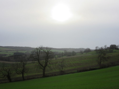
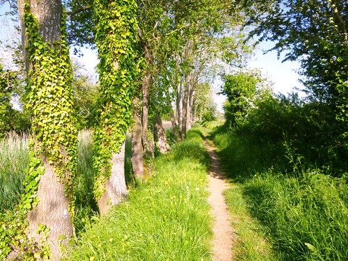
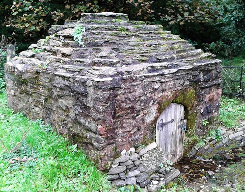
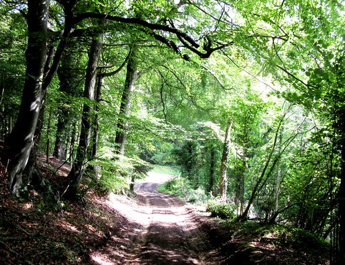
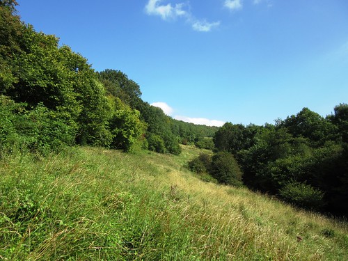
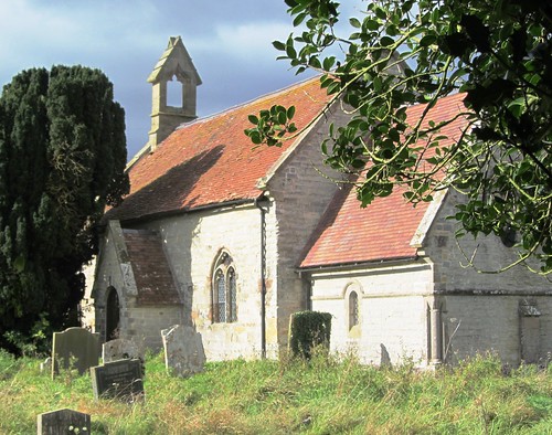
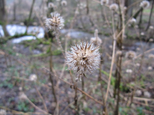
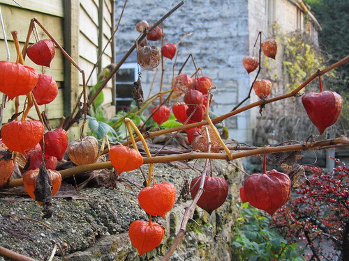
Everything is very John Betjeman around this wonderful stretch of the Camel Estuary, the poet’s favourite corner of Cornwall. Start this beautiful walk with a ferry ride over the estuary from Padstow; then follow the South West Coast Path up the coast via St Enodoc’s, the ‘church in the sands’ where Betjeman is buried, to Daymer Bay. Then it’s over the cliffs above Greenaway beach (magnificent in storm seas), to Polzeath’s long surfing beach (ditto), and back through Cornish fields and farms.

Map OS Explorer 106
Start Ferry car park, Rock, PL27 6LD; OS ref SW 928759; ferry from Padstow, or signed from B3314 (Polzeath signs from A39 at Wadebridge)
The walk Follow the coast path north to Polzeath (detouring inland to St Enodoc’s Church); return via Shilla Mill (940783), Llangollan (945778), Trewiston (944773), Penmayne (948759), Trefresa (948757) and Porthilly (939753)
How hard is it? 6½ miles. Cliff paths and farmland; a good stretch with not too much up-and-down
Eat en route The Sandbar, Polzeath (01208 869655)

2. Worth Matravers & St Alban’s Head, Dorset
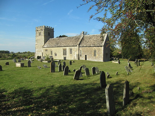
Purbeck is a wild and rugged stretch of the Dorset coast. From the old stone-quarrying village of Worth Matravers you descend a narrow cleft to Winspit, a cliff notorious for its winter wrecks (the worst, in 1786, claimed 168 lives). West along the cliffs stands the vaulted and buttressed Norman chapel of St Aldhelm, a lonely seamark. Back in Worth Matravers, the Square & Compass is a cosy and characterful pub – sensational pies!

Map OS Explorer OL15
Start Square & Compass PH, Worth Matravers, BH19 3LF; OS ref SY 975775; signed from B3069 at Langton Matravers (off A351 Corfe-Swanage)
The walk 150m past church, turn left (972773) on path to coast at Winspit (976761). Right on SW Coast Path past St Aldhelm’s Chapel (961755), then for another 1½ miles to hamlet in Hill Bottom (963773). Leave Coast Path; north on Purbeck Way for 500m; right (966781) to Worth Matravers.
How hard is it? 5 miles. Well-marked field and cliff paths, with some steep short ascents
Eat en route Square & Compass PH (01929 439229)

3. Godshill, Isle of Wight
The thatched houses of Godshill ooze rustic charm. A lovely old driveway takes you through rolling parkland to reach Appuldurcombe House, palely glimmering among trees – the eerie semi-ruin of an 18th-century mansion, famous all over the island for its many ghosts. Back at Freemantle Gate you pass over the steeply scarped Gat Cliff (sensational views) before dipping south through more parkland and back to Godshill. All Saints Church contains a beautiful 15th-century fresco of Christ on a cross of lilies.

Map OS Explorer OL29
Start Griffin Inn, High Street, Godshill PO38 3JD; OS ref SZ 530817; bus 2, 3 (islandbuses.info); A3020 Newport-Shanklin
The walk A3020 (Shanklin direction) for 250m; right (533817, ‘Wroxall’) on drive to Freemantle Gate (540807). In another 100m, fork left to outskirts of Wroxall (546802); right to Appuldurcombe House (543801). Right to Freemantle Gate; left (Worsley Trail) to Gat Cliff (534805) and Sainham Farm (528810). Right into trees; left (530810) to Godshill.
How hard is it? 3½ miles. Rolling parkland, good conditions underfoot; a nice stroll
Eat en route Griffin Inn (01983 840039)

4. Alfriston & Cuckmere Haven, East Sussex
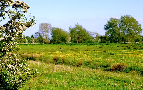
No direction-finding problems here – the path follows the snaking Cuckmere River all the way from Alfriston to the sea and back. Views in both directions are fabulous. Setting out from the old inland smuggling village of Alfriston, you cut through a cleft in steeply rolling downland – look for the White Horse cut into the top of the well-named High & Over Down. A complete contrast is the flat apron of marshy ground through which the river winds in silvery sinuations to Cuckmere Haven and the dazzling white chalk cliffs of the Seven Sisters.

Map OS Explorer 123
Start The Willows car park, Alfriston, BN26 5UQ; OS ref TQ 521033; bus 126 (cuckmerebus.freeuk.com); signed off A27 Lewes-Eastbourne
The walk Follow right (west) bank of Cuckmere River south for 3¼ miles to Exceat Bridge; Vanguard Way to Cuckmere Haven (515978); Cuckmere River cut (west bank) back to Exceat Bridge, then right (east) bank north to Alfriston
How hard is it? 9 miles. Flat, easy riverside paths.
Eat en route Golden Galleon, Exceat Bridge (01323-892247)

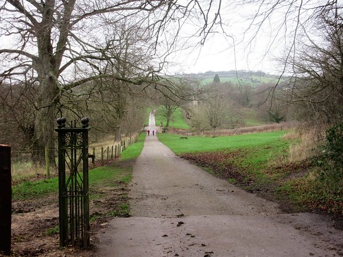
5. Hampton Court to Richmond, Middlesex
This is a walk packed with history. The Thames Path makes a grand curve round Cardinal Wolsey’s great Tudor palace of Hampton Court. You cross the four pale stone arches of Kingston Bridge, and continue north along the Thames past fine houses and boatyards to reach the thundering weir at Teddington Lock. Soon you pass Eel Pie Island, whose dance hall hosted The Rolling Stones, Eric Clapton and lots more embryo stars in the 1960s. Then comes Ham House, a handsome Jacobean riverbank mansion, before you reach Richmond by way of Petersham’s waterside meadows.

Map OS Explorer 161
Start Hampton Court station KT8 9AE; OS ref TQ 154683; rail from Waterloo, Zone 6
Finish Richmond station TW9 2NA (District line, Zone 4)
The walk Cross the Thames to north bank; right on Thames Path to Kingston Bridge (177694); cross to right (east) bank; north to Richmond Bridge (178745); inland to Richmond station
How hard is it? 8 miles. Flat, well-marked, easy underfoot
Eat en route Tiltyard Café, Hampton Court Palace (020 3166 6971) – child-friendly, no Palace ticket needed

6. Hellfire Caves, West Wycombe, Bucks
A lovely path runs south along a spine of Chiltern woodland to reach the scene of the misdeeds and mischiefs of Sir Francis Dashwood’s mid-18th century Hellfire Club. The great golden ball moored to St Lawrence’s Church tower was the Club’s card and boozing den, the flint-built hexagon alongside is the Mausoleum built to house the members’ hearts, and the labyrinthine stone quarries in the hill below were the notorious Hellfire Caves. Lots of hokum, whiffs of magic and orgies, all enjoyably explored these days in the tourist-orientated caves (hellfirecaves.co.uk).

Map OS Explorer 172
Start Saunderton station, near West Wycombe, HP14 4LJ; OS ref SU 813981; on A4010 Princes Risborough-High Wycombe
The walk From lane (812977), follow woodland track for 2 miles to St Lawrence’s Church (827950), Mausoleum, and Hellfire Caves (829948). Return via A40 (826945), Great Cockshoots Wood (813948), road at Chorley Farm (816955) and Buttlers Hanging nature reserve (819961) to woodland track (821962); left to Saunderton.
How hard is it? 6 miles. Woodland and farmland tracks.
Eat en route George & Dragon, West Wycombe (01494 535340)

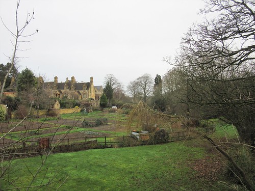
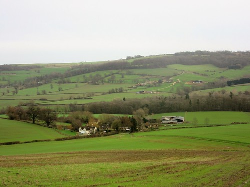
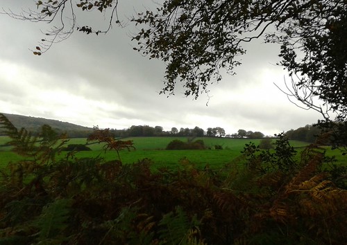
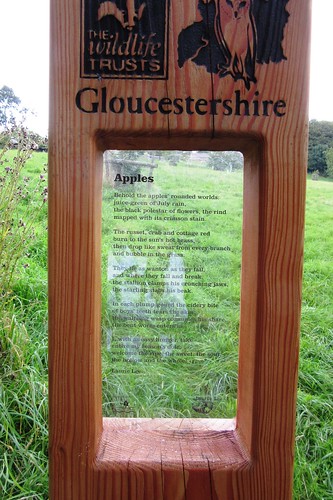
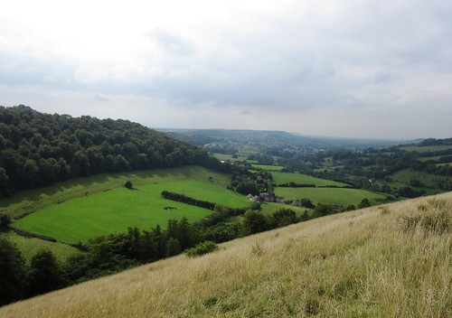
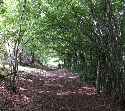
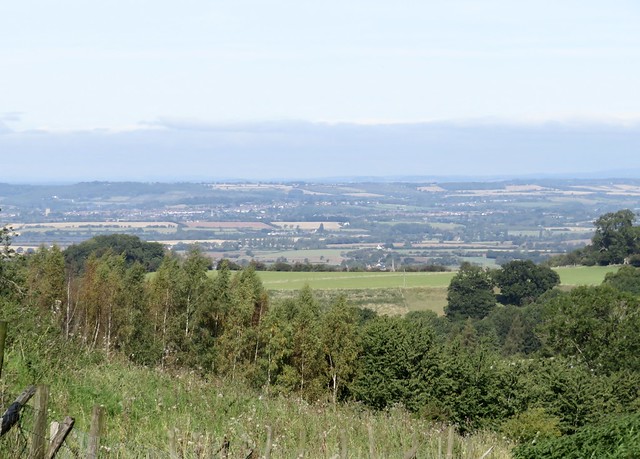
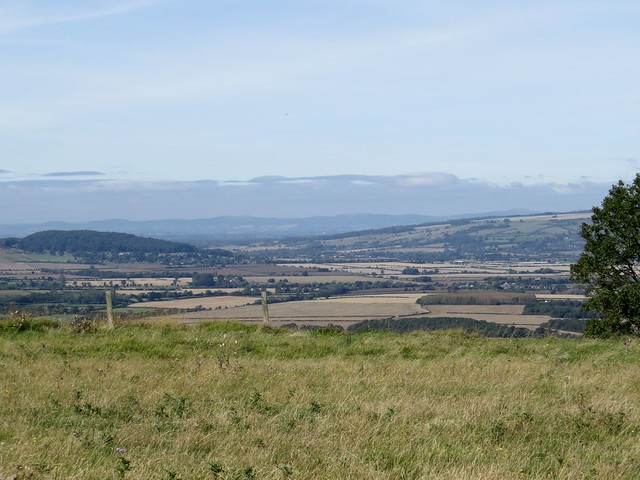
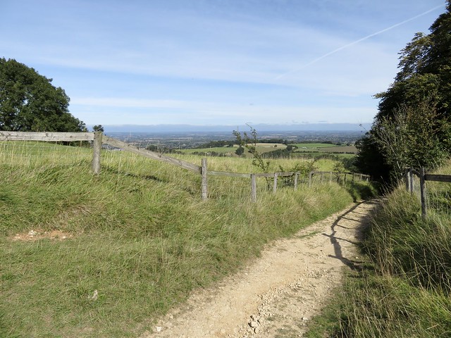
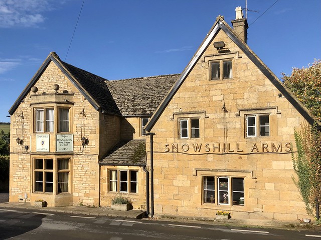
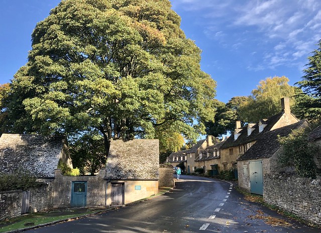
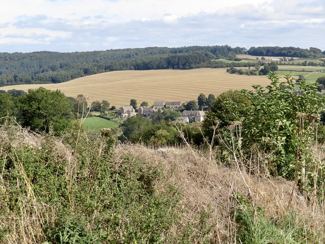
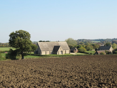
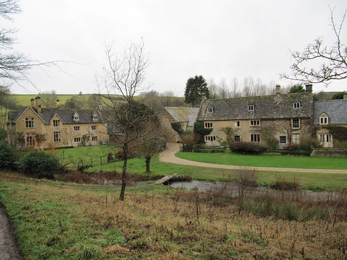
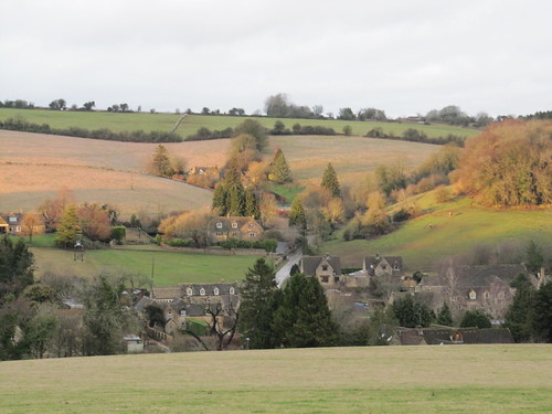
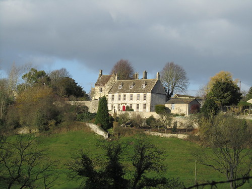
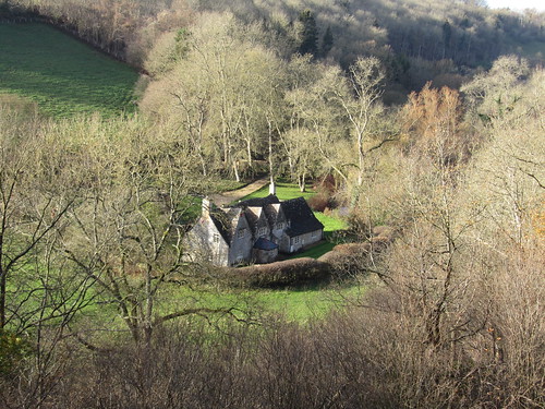
7. Nympsfield & Owlpen, Glos
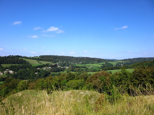
Starting high on the South Cotswold ridge at Nympsfield, you plunge down through the trees to find the secret valley of Owlpen with its Tudor manor house of beautiful silvery stone. Back along Fiery Lane to Uley, steeply up a grassy hill to the Iron Age hillfort of Uley Bury (there’s a stunning prospect from its ramparts across the River Severn into Wales), and a return through the woods to the roaring fire in the Rose & Crown.

Map OS Explorer 168
Start Rose & Crown, Nympsfield, GL10 3TU; OS ref SO 800005; signed off B4066 Stroud-Dursley road (M5 Jct 13, A419)
The walk Nympsfield church; in 200m, right (803003); cross road (802000); Dingle Wood; south to Fiery Lane (797986). Left to Owlpen Manor (800984); return to Uley (792986). Beside churchyard, right to Uley Bury (787990). Cotswold Way (787993) north for 1¼ miles; cross B4066 (795008); Nympsfield
How hard is it? 6 miles. Short steep climb to Uley Bury
Eat en route Rose & Crown, Nympsfield (01453 860240); Old Crown, Uley (01453 860502)

8. Brancaster to Burnham Overy Staithe, Norfolk
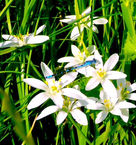
The Norfolk Coast path skirts a wonderfully moody coast under enormous skies. The seawall path makes a grandstand for bird-watching, and this is the best time of year to stroll at the edge of the saltmarsh, binoculars at the ready for pinkfooted geese, golden plover and clouds of wigeon, with snow buntings on the shore and fieldfares gobbling berries in the bushes. Dawn and dusk bring spectacular skies and huge, noisy packs of geese on the wing.

Map OS Explorer 250/251
Start Ship Hotel, Brancaster, PE31 8AP; OS ref TF 773439; Coasthopper bus (coasthopper.co.uk); on A149 Hunstanton to Wells-next-the-Sea
The walk Down lane opposite Ship Hotel towards sea; right on Norfolk Coast path to Burnham Overy Staithe
How hard is it? 6 miles. Flat seawall and marsh paths. Wrap up warm, and don’t forget binoculars!
Eat en route Ship Hotel, Brancaster (01485 210333); The Hero, Burnham Overy Staithe (01328 738334)

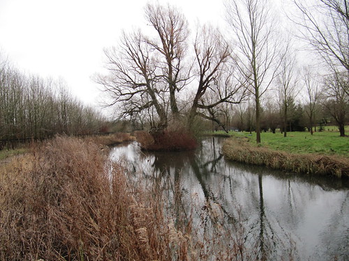
9. Ely & Little Thetford, Cambs
The pride and joy of this walk is the majestic bulk of Ely Cathedral, riding the level Fenland landscape like a fabulous ship in a flat calm sea. On the outward leg, south down the slow-flowing Great Ouse, the cathedral stands behind you, a compelling presence urging you to turn round and stare. The fen landscape hereabouts wheels in a great disc of peat black and corn green. Returning towards Ely you are beckoned home by the cathedral’s tall towers and the great lantern turret that straddles the building. Ely Cathedral is superb – it contains some absolutely wonderful carvings, including splendidly wild and wicked Green Men peeping out in unexpected places, great fun for children to spot.

Map OS Explorer 226
Start Ely station, CB7 4BS; OS ref TL 543794; beside A142
The walk South along Fen Rivers Way (west bank of Great Ouse) for 3¼ miles to confluence with River Cam. Right under Holt Fen railway bridge (531745); right up Holt Fen Drove to Little Thetford (533760). North by Thetford Catchwater, Grunty Fen Catchwater. Cross Braham Dock at Great Ouse (540773); Fen Rivers Way to Ely station; continue to Cathedral.
How hard is it? 9 miles including Cathedral. Flat riverbank and field paths
Eat en route Refectory Café (01353 660346) or Almonry Restaurant (01353 666360), Ely Cathedral

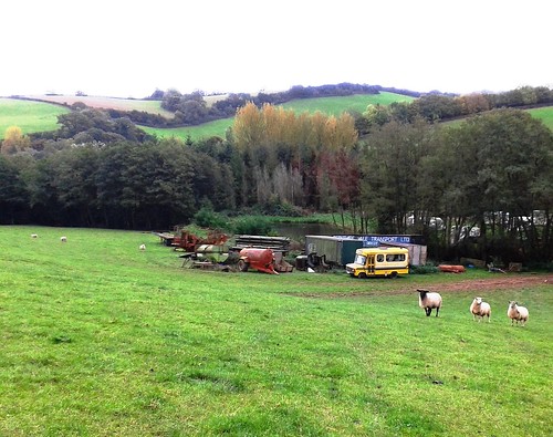
10. Manifold Valley, Staffs
The limestone dales of Staffordshire are often thought of as neighbouring Derbyshire’s poor relations, but here’s a superb round walk that shows you Staffordshire’s most enchanting face. Field paths take you through steep, stream-filled farming country, before dipping into the dramatic limestone cleft of the River Manifold, a thickly wooded canyon with crags of naked rock. The Leek & Manifold Light Railway once trundled through the gorge, and its track is now a popular cycleway. This cranky little rattler of a narrow-gauge railway ‘from nowhere to nowhere’ never made a penny in its brief and inglorious lifetime (1904-1934), but passengers loved the superb scenery it ran through, the deep tree-hung Manifold dale. You follow the Leek & Manifold’s trackbed all the way back to Wetton Mill and its welcoming tearoom.

Map OS Explorer OL24
Start Wetton Mill car park, near Wetton, DE6 2AG; OS ref SW 095561
The walk (theaa.com/walks) Bridleway west by Waterslacks; footpath by Hoo Brook (086556) to Butterton. Village road, then path north to cross B5053 (075579). North for 400m; left (076583) to Warslow. School Lane (087585), then field path to Manifold Way near Ecton Bridge (091579). Follow it south for 1¼ miles to Wetton Mill.
How hard is it? 5½ miles. Muddy footpaths, some steepish; flat and firm underfoot on Manifold Way
Eat en route Wetton Mill Tearoom (01298 84838; weekends only in winter); Greyhound Inn, Warslow (01298 687017)

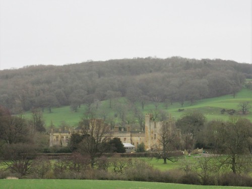
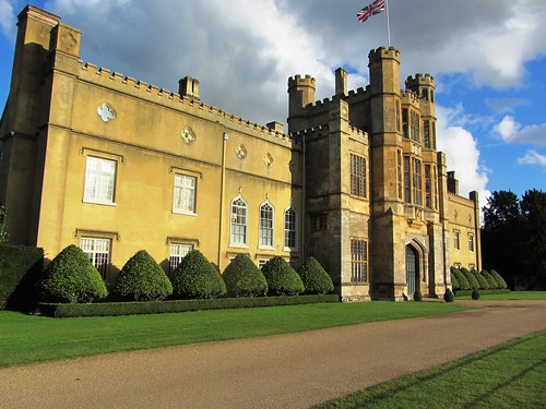
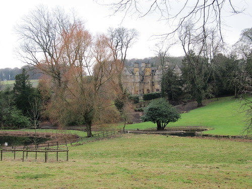
11. Hardwick, Derbys
‘Hardwick Hall, more glass than wall’ was built in the 1590s by the formidable Elizabeth Hardwick, Countess of Shrewsbury, a woman of iron will and ambition. There are great views to the Hall and its ruinous predecessor as you walk this parkland round through cleverly landscaped woods and valleys. Great avenues of trees, ponds alive with wildfowl, and many viewpoints over the twin houses.

Map OS Explorer 269
Start Hardwick Park Centre, near Mansfield, S44 5QJ; SK 454640; between Jcts 28 and 29, M1
The walk (nationaltrust.org.uk/walks) From Centre cross footbridge; on between ponds to pass between two Hardwick Halls (462637); follow Lady Spencer’s Walk, bearing left in Lady Spencer’s Wood to cross Hardwick Park Farm track (470637). Ahead through Park Piece Wood; cross drive (469646); on into Lodge Plantation. Bear left to blue gate (461645); go through, downhill to cross drive (458642); ahead to ponds and Centre.
How hard is it? 3½ miles. Parkland and woodland paths; an easy stroll
Eat en route Hardwick Inn, Hardwick Park (01246 850245)

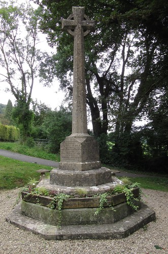
12. Flamborough Head, East Yorks
The poignant memorial at Flamborough’s crossroads, to a crew of fisherman who drowned trying to help their fellow villagers, demonstrates the dangers of fishing off this cliff-encircled, tide-ripped promontory, and once out on those tremendous chalk ramparts you can fully appreciate the power of winter’s winds and tides. This is a walk full of drama and spectacle – seabirds wheeling far below, crash of waves against the cliffs, and the remarkable isolation of Flamborough, high on its remote nose of land.

Map OS Explorer 301
Start Crossroads by St Oswald’s Church, Flamborough, YO15 1PW; OS ref TA 225702; bus 510 (eyms.co.uk); B1255 from Bridlington
The walk South along West Street; footpath from Beacon Farm to south coast (226692). Anti-clockwise around promontory for 5½ miles, via Flamborough Head and North Landing, to North Cliff (224726); left inland to Flamborough.
How hard is it? 7½ miles. Field and cliff paths; no difficulties, but take care on the unguarded cliffs!
Eat en route Rose & Crown, Flamborough (01262-850455)

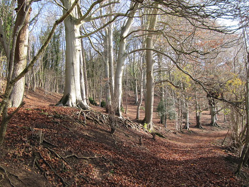
13. Stoodley Pike, West Yorks
From the old wool town of Hebden Bridge a steep path leads up and over the moors to the summit of Stoodley Pike with its landmark monument to Waterloo and the Crimean War. Pause to take in the fantastic moorland views, then descend to the friendly Top Brink Inn at Lumbutts, and on down to the Rochdale canal and a welcome flat towpath walk back to Hebden Bridge.

Map OS Explorer OL21
Start Hebden Bridge station, HX7 6JE; OS ref SD 995268; road – A646
The walk Left along river; in 500m, left across railway (991270); steeply up to radio mast (988268); left, then in 250m right, up to Pennine Bridleway (988262). Follow bridleway, then Pennine Way, to Stoodley Pike monument (973242). Pennine Way to Withens Gate (969231); Calderdale Way and lane to Lumbutts (956235); path down Lumbutts Clough to Rochdale Canal at Castle Street (951244); canal towpath to Hebden Bridge.
How hard is it? 9 miles. Moorland paths (some short, steep bits), then canal towpath. Not for bad weather.
Eat en route Top Brink Inn, Lumbutts (01706 812696)

14. Saltburn, Cleveland
A straightfoward, brisk walk from Cleveland’s favourite seaside resort of Saltburn-by-Sea, out east along the cliffs with a huge pavement of scars (sea-ground rock plates) exposed at low tide. Back over the hummock of Warsett Hill (great views all round), and back through the fields to the Ship Inn with its cosy fires and handy seaside location.

Map OS Explorer OL26
Start Ship Inn, Rosedale Lane, Saltburn-by-Sea, TS12 1HF; OS ref NZ 670216
The walk (nationaltrust.org.uk/walks) Follow waymarked Cleveland Way along the cliffs for 2 miles. Right (inland) at Guibal Fanhouse info board (699213); path across railway and over Warsett Hill. Recross railway (688215); path ahead across Brough House Farm track (682215); Ladgates (678214); Ship Inn.
How hard is it? 4½ miles. Cliff and field paths, easy gradients, a good 2-hour round walk
Eat en route Ship Inn (01287 622361); Virgo’s Café-Bistro, Dundas Street (01287 624031)

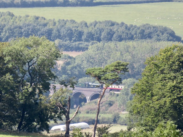
15. Causey Arch and Beamish, County Durham
Quiet paths through woods and fields take you through the North Durham countryside (Beamish Open Air Museum is just down the road). At the walk’s end, the Causey Arch is the oldest railway bridge in the world, its parent railway (originally a horse-drawn coal tramway) the oldest of its kind, too. Now the steam-powered Tanfield Railway (tanfieldrailway.co.uk) runs here – Sunday is the best day to do this walk if you want to see the trains.

Map OS Explorer 308
Start Causey Arch car park, Causey, NE16 5EG; OS ref NZ 205561; opposite Beamish Park Hotel, off A6076 Stanley-Sunniside
The walk (theaa.com/walks) Cross A6076, then Beamishburn Road (207561, ‘Beamish Hall’); Coppy Lane footpath to road opposite Beamish Hall (212550). Right; in 400m, left (208548) through picnic area. Right on Great North Forest Trail (208546) across Beamishburn Road (204546) and A6076 (201547) to road (195546); right to East Tanfield station (193549). Right beside Tanfield Railway to Causey Arch (201559) and car park.
How hard is it? 4 miles. Field paths, woodland tracks
Eat en route Causey Arch Inn (01207 233925)

16. Loweswater, Cumbria
Loweswater makes a perfect circuit for a winter’s afternoon, under the rumpled flank of Burnbank Fell and through beautiful Holme Wood, before taking the track to Maggie’s Bridge. Great views here, back to the high shoulder of Carling Knott, before reaching the road and decision time – back to the car, or a sidetrack to the warm and welcoming Kirkstile Inn? Hmmm …

Map OS Explorer OL4
Start Car pull-in at Waterend, NW Loweswater, CA13 0SU; OS ref NY 118225; on Mockerkin-Loweswater road (off A5086 Cockermouth-Cleator Moor)
The walk A simple anti-clockwise circuit of the lake via Hudson Place (115222), Holme Wood and Watergate Farm (127211), Maggie’s Bridge (134210) to road (138211). Right for 300m; right again (140211) to Kirkstile Inn (141209). Return to Mockerkin road; left along it to car park.
How hard is it? 4¼ miles (3¾ miles without Kirkstile Inn detour). Level and easy underfoot; can be very squashy after rain
Eat en route Kirkstile Inn, Church Bridge, Loweswater (01900 85219)

17. Cardurnock, Cumbria
Once you have walked down the short green lane from Cardurnock, a remote hamlet at the edge of the Solway Firth, there’s no set path. Just pick your way along the green apron of Cardurnock Flatts, the creek-cut fringe of saltmarsh, or wander the vast firm sands under gigantic bird-haunted skies, looking north across the enormous estuary to the Scottish hills, south to the 3,000-ft hump of Skiddaw twenty miles off in northern Lakeland.

Map OS Explorer 314
Start Park near phone box in Cardurnock, CA7 5AQ; OS ref NY 172588; M6 Jct 44, Carlise Western Bypass, B5307 to Kirkbride; Angerton, Whitrigg, Anthorn, Cardurnock
The walk Down the green lane by the phone box to the shore; then choose any direction and enjoy strolling the sands
How hard is it? As many miles as you like! Green lane; then flat, firm sand underfoot
Eat nearby King’s Arms, Bowness-on-Solway CA7 5AF (01697 351426) – 4½ miles NE of walk

18. Marcross & St Donat’s, S. Glamorgan, Wales
Marcross lies just inland of the Bristol Channel’s carefully-preserved Glamorgan Heritage Coast. Reach the cliffs by way of St Donat’s Castle, a splendid medieval fortress. Down on the shore, bear left to beautiful little Tresilian Bay – chuck a pebble across the natural rock arch inside Reynard’s Cave here (low tide only!), and you’ll be wed before the year’s end. Return along the cliffs to the twin lighthouses at Nash Point, then inland to the Horseshoe Inn.

Map OS Explorer 151
Start Horseshoe Inn, Marcross, CF61 1ZG; OS ref SS 924693; 1 mile west of St Donat’s, off B4265 near Llantwit Major
The walk From Marcross (922691), follow Valeways Millennium Heritage Trail to St Donat’s Castle (934681), road (937685) and coast (941682 to 940679). Left for ½ mile to Tresilian Bay (947677) and Reynard’s Cave (just west of beach – see below). Back along cliffs for 2¼ miles to Nash Point (916683); inland to Marcross.
How hard is it? 5½ miles. Field and cliff paths. Reynard’s Cave, low tide only (easytide.ukho.gov.uk)
Eat en route Horseshoe Inn (01656 890568)

19. Aberlady Bay, East Lothian, Scotland
If you like wild geese, you’ll love Aberlady Bay. Some 20,000 or more pinkfooted geese spend the early part of the winter here, and their massed flight (inland at dawn, seaward at dusk) is a great wildlife spectacle. Walk north beside the wind-whipped Firth of Forth, with the shark-fin peak of North Berwick Law ahead; then return from rocky Gullane Point by dune paths. Braw, brisk, bracing!

Map OS Explorer 351
Start Aberlady Nature Reserve car park, Aberlady, EH32 0PY; OS ref NT 471805; bus X24, 124 (Edinburgh-North Berwick); on A198, just east of Aberlady
The walk Cross wooden footbridge; north (1¾ miles) to Gullane Point (462830). South along track, parallel to shore, golf course on left. In ¾ mile fork right (466817) to Marl Loch; shore path (468809) to car park.
How hard is it? 4 miles. Shore paths (can be marshy); dune paths and tracks. Don’t forget the binoculars! Beware flying golf balls.
Eat nearby Old Aberlady Inn (01875 870503), on A198 in Aberlady, ½ mile from start

20. Tollymore Forest Park, Mourne Mts, Co Down, N Ireland
If you’ve no taste or time or daylight to tackle the Mourne Mountains proper, here’s a great network of paths at the northern feet of the mountains – a stroll by the river through the 18th-century Gothic folly of The Hermitage, the forest paths and excellent Mourne views of the longer Mountain Trail, and the Drinns Trail with its Curraghard viewpoint over sea and mountains.

Map OSNI 1:25,000 Activity Map ‘The Mournes’; downloadable ‘Forest Trails’ map at walkni.com
Start Tollymore Forest Park Lower Car Park, Newcastle, Co Down; OSNI ref J 344326; signposted on B180 between Bryansford and Newcastle
The walk You can compose your own round walk using the trails; Mountain Trail intersects with River Trail at Parnell’s Bridge, Hore’s Bridge and Old Bridge. Drinns Trail is a circular extension of Mountain Trail
How hard is it? River Trail (mostly level) 3¼ miles, Drinns Trail (a couple of climbs) 3 miles, Mountain Trail (gentle inclines) 5½ miles. Well-surfaced and waymarked tracks
Eat nearby Villa Vinci, Main St, Newcastle (028 4372 3080)

 Posted by at 12:55
Apr 142012
 

A sleepy noon in Coleshill, with a pure blue sky spread across this quiet corner of the Oxfordshire Cotswolds.
First published in: The Times Click here to view a map for this walk in a new window
picture picture picture picture picture picture picture picture
Facebook Link:
National Trust-maintained Coleshill couldn’t be more gorgeous if it tried, a village and church of beautiful purple-grey stone. ’We’re not in Kansas now, Toto,’ myself said to me as I passed the mellow old Radnorshire Arms, the village green and Estate Office, and set out across the green acres of Coleshill Park. Every newly planted oak boasted its own hand-built wooden cattle guard, and the cattle themselves lazily chomped under spreading trees. A couple in pot sunhats, reclining under an ancient oak with their picnic hamper, completed this Rousseau landscape of peace and plenty.

A rusty outmoded harrow like a troll’s bedsprings lay in the hedge. Old overshot hazels sprouted from their coppiced boles in the skirts of Flamborough Wood. I followed a lane rubbly with chunks of red brick and pale limestone between the pasture fields to Great Coxwell – another immaculate collection of colour-washed houses, some under thatch, along a narrow street.

Out at the edge of the village I came to the Great Barn. A name to live up to, a drum-roll of a name. The barn was built of creamy stone in the 13th century to store the produce of a grange or outlying farm of Beaulieu Abbey. I stood and watched it sail on its duckpond reflection – a ship of the harvest bulwarked with gabled doorways and spread aloft with intricate timbering that upheld a huge roof of stone.

Two buzzards went planning over the bluebell clump at the crest of Badbury Hill as I approached the old hill fort. Its ramparts have been partially ploughed in the couple of millennia since it was last inhabited, but the sections that lay in the shelter of the trees stood tall enough to distinguish. A family was picnicking in the fort, their children playing on a rope swing that whirled them away from the ramparts to fly in a circular swoop out over the ditch and back to earth again.

The dappled light under the sycamores gave way to full sunshine and a tremendous view north across the wide valley of the upper Thames. Was this the prospect that greeted King Arthur when he brought his British forces to contest mastery of the kingdom with Anglo-Saxon invaders some time around 500 AD? Some say that Badbury is the ‘Mount Badon’ of semi-legend, site of the siege at which Arthur slew 960 foes with his own sword Excalibur, securing peace in Britain for a generation.

Ahead of me a little lad went trailing his family on the path to Brimstone Farm and Coleshill. Something of the stirring old story was running in his imagination, judging by the way he swung his plastic Excalibur and laid armies of nettle-heads low in the dust.

Start & finish: Radnor Arms PH, Coleshill, Oxfordshire SN6 7PR (OS ref SU 237938)

Getting there
Bus: Service 65 (swindonbus.info), Witney-Swindon
Road: M4 (Jct 15); A419, A361 to Highworth; B4019 (signed ‘Faringdon’) to Coleshill

Walk: (6½ miles, easy, OS Explorer 170): Leaving Radnor Arms, right downhill. Left opposite church (‘village shop’); in 150 m, pass Estate Office notice; on through 2 gates (236936; yellow arrows/YA). Follow path across fields of Coleshill Park (stiles, YAs). In ¾ mile, bear left (246930; YA) along edge of Flamborough Wood. At Ashen Copse Farm cross track (250934); ahead past barn (YA). Diagonally right across 2 fields (stiles, YAs) to track (255934); follow this round right bend; on between fields. Near Great Coxwell, cross stiles (264934; YA) and on. At field end follow ‘Footpath To River’; in 30 m, left over stile to road (268933). Left up village street for nearly ½ mile; then right (269940; fingerpost) past Great Barn. Over stile; right (YA, ‘Circular Route’) round field edge. In 250 m, right through kissing gate (266941; ‘Circular Route’); follow path to cross B4019 (264945). Left on path parallel to road inside field (National Trust arrow). At field end, forward through car park (262945). Ahead through gate (‘Badbury Clump’); follow path ahead beside fort ramparts; on for ¾ mile, down slope (ahead over cross-tracks), out of trees (256951), forward to Brimstone Farm. Cross farm lane (251952; YA); take track ahead through gates past left end of cattle yard. In 30 m, left (YA) over stile, through woodland belt, then across 2 fields (YAs, stiles) and along green lane. Through end of Fern Copse (244945); on for ½ mile to road (237940). Left; fork immediately right to Radnor Arms.

Radnor Arms (237938) – path through Coleshill Park – corner of Flamborough Wood (246930). Ashen Copse Farm (250934) – path east for 1 mile to Great Coxwell (268933). Great Barn (269940) – corner of woodland (266941) – cross B4019. Badbury Hill – path through Coxwell Wood to Brimstone Farm (251952). Path SW for 1 and a quarter miles, passing end of Fern Copse (244945) to Coleshill.

Click on Facebook “Like” link to share this walk with Facebook friends.

Lunch: Radnor Arms, Coleshill (01793-861575; radnorarmscoleshill.co.uk) – busy, friendly, cosy.

Great Barn: Great Coxwell (NT): Open daily (50p entrance)

Information: Faringdon TIC (01367-242191); www.visitsouthoxfordshire.co.uk

Readers’ Walks: Come and enjoy a country walk with our experts! Dates, info etc.: http://www.mytimesplus.co.uk/travel/uk/1867/times-walks. Next walks: Holy Island, Northumberland, 13 May; Tibbie Shiels Inn, Scottish Borders, 10 June; Northern Ireland, 8 July
www.satmap.com www.LogMyTrip.co.uk

 Posted by at 03:23
Mar 102012
 

They’ve seen a few winners at the Hollow Bottom; a few losers, too. The walls of this famous horse-racing pub in the north Gloucestershire Cotswolds are hung with jockeys’ silks, snapshots of grinning owners, racing mementoes and photos of our four-legged, long-faced chums in action.
First published in: The Times Click here to view a map for this walk in a new window
picture picture picture picture picture picture picture picture picture picture picture picture picture picture picture picture
Facebook Link:
It’s a great place to stay the night if you’re after local atmosphere, because this is horse country nonpareil. If we saw one horse on our walk through the Cotswolds’’ most delectable corner, we saw a hundred.

After a night of rain the woods were full of cold mist above the valley where Naunton lay, a dream of rich gold stone houses and snowdrop gardens. Horses in blue blankets cropped the paddocks. Every hawthorn twig held a line of raindrops suspended, each drop reflecting a miniature world of inverted trees and walls. Up on the roof of the Cotswolds it was a wintry scene of sombre beauty, all bright colours leached away by the mist. A group of bullocks grazing at a mountain of silage in an isolated barnyard turned their muddy faces towards us as we walked by. ‘Hey, hey!’ soothed a hawk-faced little man leading a nervously shying colt along the lane, gentle authority in each of his gestures.

The sky began to clear as we came down towards Upper Slaughter. The view broadened to reveal wide upland fields dipping to hidden valleys. The horizons rolled with smoking cloud, and a weak sun came through to frost the lichen-encrusted ash trees with cold silver light.

Upper Slaughter is everyone’s Cotswold dream made manifest – a gorgeous manor house with peaked gables, mullioned windows and tall chimneys, the church high on a bank like a ship on a billow, the whole village scented with apple wood smoke, a mellow fantasy. In Lower Slaughter the channelled waters of the River Eye ran under a diminutive stone footbridge. The plain red brick chimney of the old mill came as a relief to the eye after so much beautiful gold stone.

In a green lane beyond we stopped to hear a song-thrush fluting his twice and thrice repeated phrases from the hedge. The lane took us twisting down to follow the River Windrush in its tightly curving valley. Goldcrests swung in the treetops – gold seemed to be the theme today. We skirted the skittish horses beyond Lower Harford Farm, and came up over the hill and down towards Naunton with evening blackbird song echoing through the valley below.

Start and finish: Black Horse PH, Naunton, Glos GL54 3AD (OS ref SP119235)

Getting there: Road – M5, Jct 11a; A40, A436, B4068 towards Stow-on-the-Wold, Naunton signposted on left. Park in village street.

Walk directions (9 miles; easy/moderate; OS Explorer OL45): From Black Horse PH, right; in 50m, right up lane; in 150m, right (‘Wardens Way’/WW) on bridleway for ¾ mile to road (126243). Turn right through gate (WW) along field edges next to road. At T-junction (133242) continue along hedge; at field end, left to cross road (134241, WW). On along track opposite; in 300m, right through gate by barn (136243; blue arrow) and on (WWs) for ¾ mile to B4068 beside houses (149241). Left (WW – take care!) for 350 m; right (152242, WW) along driveway for ⅔ mile to Upper Slaughter. Follow road to The Square; left down to road; left (155232) for 150 m; right (156232, WW) down walled path. Follow WW through fields to Lower Slaughter. At road, right (164226) past mill; cross stone footbridge, up lane opposite.

At T-junction, cross road and keep ahead along green lane (161222; ‘Macmillan Way’/MW). In ⅓ mile cross road (157219); on across field (MW); through hedge, left (153218); follow MW into Windrush Valley. At path junction, right (151213; ‘Windrush Way’/WiW). Cross river; in 150 m, right (148213; WiW) through Aston Farm and on through fields and woods for ¾ mile. Leave wood (139220); in 250 m, through gate (138221); take left fork downhill. WiW for ¾ mile to road by Lower Harford Farm (129225). Left (WiW); in 100 m, right through gate (WiW). At foot of slope, left along valley bottom. At end of 3rd field, through gate (119226); right across brook; up slope to waymark post; on through gate (118227). Ahead to cross B4068 (117231). Down track opposite; in 100 m, right down path by fence; cross river, pass dovecote; right along lane to Naunton village street (116234). Right to Black Horse.

Lunch: Picnic; or Black Horse Inn, Naunton (01451-850565; www.theblackhorsenaunton.co.uk)
Old Mill, Lower Slaughter (01451-820052, oldmill-lowerslaughter.com) – really good tearooms; scrumptious flapjack!

Accommodation: Hollow Bottom Inn, Guiting Power, GL54 5UX (01451-850392; www.hollowbottom.com); famous horse racing pub, refurbished rooms, warm and friendly – especially around Cheltenham Festival races (13-16 March this year).

Info: Stow-on-the-Wold TIC (01451-870083); www.visitcotswolds.co.uk
www.ramblers.org.uk www.satmap.com www.LogMyTrip.co.uk

 Posted by at 01:08
Dec 242011
 

In theory you might find a prettier and cosier spot than Castle Combe as a starting point for a cold winter day’s walk, but in practice? No chance.
First published in: The Times Click here to view a map for this walk in a new window
picture picture picture picture picture picture picture picture
Facebook Link:
So I informed myself, anyway, as sloth fought with sense on the doorstep of the warm and cheery Castle Inn. Once out under the blue Wiltshire sky, wandering among the gables and tall chimneys, mullioned windows and Cotswold stone roofs of medieval cottages and woolmasters’ fine houses, everything was just perfect. The sun struck gleams from the creamy oolitic walls, and sparkled in the ripples of the By Brook as it gurgled under miniature bridges along the village street.

I batted my cold hands together and followed the Macmillan Way down the valley, walking between whitethorn hedges where redwings were stripping the berries. The woods were full of dark brown bracket fungi with white frilly edges, like Belgian chocolates scattered prematurely by a careless Father Christmas. A grove of tall old beeches stood in their own crisp litter, their roots gripping the slope like arthritic fingers, the sun painting the smooth trunks in silver verticals.

Two men were burning tree cuttings in a pall of blue smoke. ‘Just waiting for the fire to die down so we can cook a bit of breakfast,’ one said. ‘Yeah, proper smoky bacon,’ added his mate with dreamy relish.

A snarl of speeding cars on the main road at Ford, and then the green rutted lane of the Old Coach Road where express four-in-hand stagecoaches once jolted from Bath to Chippenham at 8 miles an hour. Today? One girl walking her dog, a couple of rabbits, and a millennium of ghostly travellers at my elbow.

The high-perched stone houses of North Wraxall looked down from their ridge as I followed a lane that crossed the Romans’ Fosse Way high road and slipped over into the valley of the Broadmead Brook. A muddy old bridleway led back east toward Castle Combe beside the twisting brook, past a low clapper bridge whose big decking slabs were supported on sturdy, moss-jacketed piers. Yellow-streaked siskins flocked in the alders, chittering as they picked at the seed cones, and the dipping sun sent a few last bars of silver slanting across the water from which an evening steam was already rising.

Start & finish: Castle Inn, Castle Combe, Wilts SN14 7HN (OS ref ST 842772)
Getting there: Bus 35 (www.wiltshire.gov.uk) from Chippenham. Road: M4 (Jct 18); signed from B4039 to village car park.

Walk (7½ miles, moderate grade, OS Explorer 156): From Castle Inn continue down village street. In 300m pass South Cottage; left over footbridge (841768); right, and follow Macmillan Way (MW arrows) along east bank of By Brook for 1 mile to mill at Long Dean. Here bear right on bridleway (851756; MW, ‘Ford’), ascending for 300m to go through gate. In 200m, left over stile (846754; MW) on hillside path to stile into road (845750). Left to A420 (843748). Right through Ford; past church, right (841749) up Old Coach Road. Where tarmac ends (838751), ahead for 1 mile to road (822747). Right through North Wraxall. Pass church; right up road (818750; ‘Castle Combe’). In ⅓ mile, below power lines, left over stile (817757; fingerpost, yellow arrow/YA)’ follow YAs across 2 roads and over fields for ¾ mile to road by house (812770). Bear right here (fingerpost), along bridleway beside wood, to a road (813771). Right; in 150m fork left (fingerpost) along bridleway through Broadmead Brook valley. In ½ mile, at road (823769), left for 100m, then right (bridleway fingerpost). In nearly ½ mile, beside brook, go through gate (829773); pass (but don’t cross) clapper bridge; in 30m, right over stile (YA); on beside brook for ¼ mile to road at Nettleton Mill (833775). Right through tall iron gate; on to reach golf course. Right along concrete roadway; left across bridge (838776); right, and follow ‘public footpath’ signs, then a wall into Castle Combe.
NB – Online map, more walks: www.christophersomerville.co.uk. Click on Facebook “Like” link to share this walk with Facebook friends.

Lunch: Castle Inn, Castle Combe (rambling old inn of nooks & crannies): 01249-783030; www.castle-inn.info
More info: Chippenham TIC (01249-665970); www.visitwiltshire.co.uk
www.ramblers.org.uk www.satmap.com www.LogMyTrip.co.uk

 Posted by at 01:42