Search Results : devon

Apr 202013
 

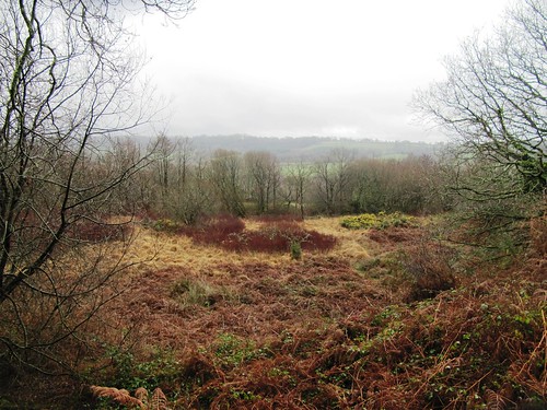
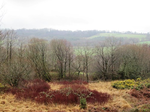
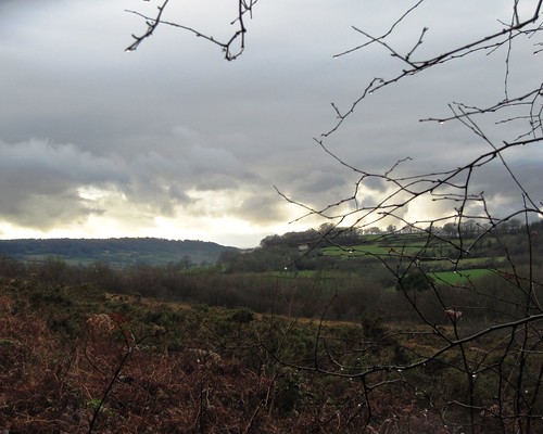
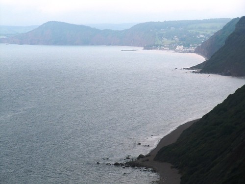
A fresh cold day with a dilute blue sky over the mid-Devon woods and fields. First published in: The Times Click here to view a map for this walk in a new window
picture picture picture picture picture picture picture picture
Facebook Link:
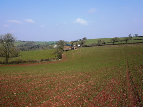
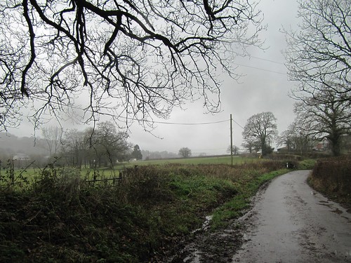
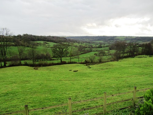
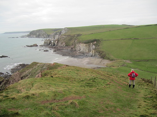
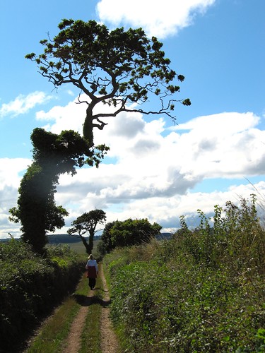
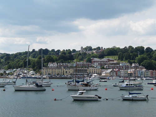
The little Tarka Line train rattled away north from Morchard Road station into Henry Williamson country. I was glad to swap the rush of lorries on the Barnstaple road for the call and response of ewes and their new-born lambs in the steep green fields. The farmer had been deep ploughing around Oakview; I stumbled among the ruts, and came down to Middle Yeo Farm with boots as heavy as the Emperor of China’s famed iron shoes.
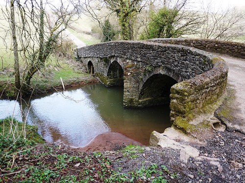
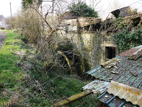
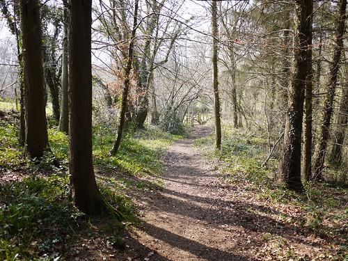
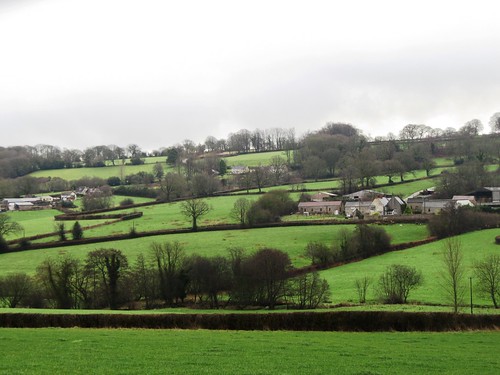
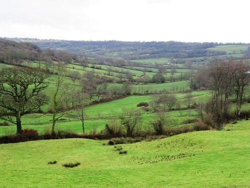
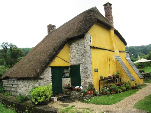
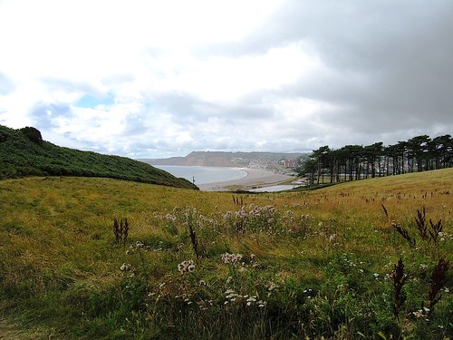
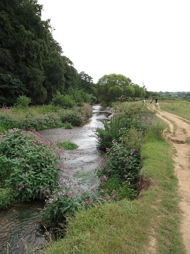
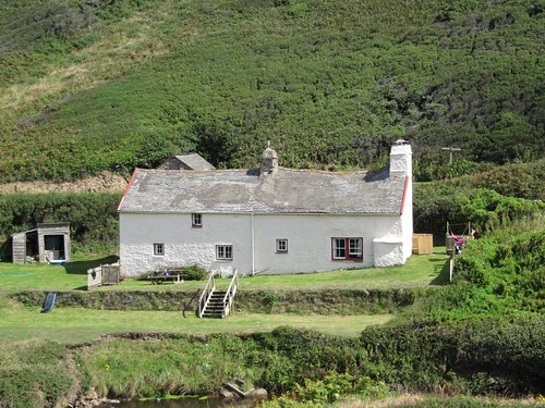
Beyond Old Mill I threaded a resinous pine plantation and took the stony lane up to Zeal Monachorum, where a feeble spring sun was shining on the thatched roofs and thick cob walls. The village lay tightly stretched along its ridge-top, the sloping lanes full of sparrow twitter and the cooing of ring doves. In the rough lane down to Tucking Mill Bridge, a robin gripped a hawthorn twig six feet away in the hedge and sang quite unafraid into my face. The old tucking or cloth-fulling mill lay among daffodils. and periwinkles just above the two-arched bridge, its tin roof and timbers sliding into a green ruin, the double hoop of the mill wheel still attached to the outside wall.
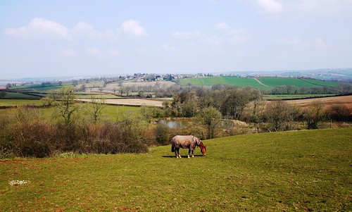
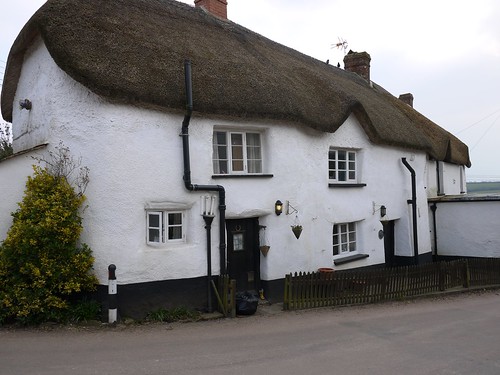
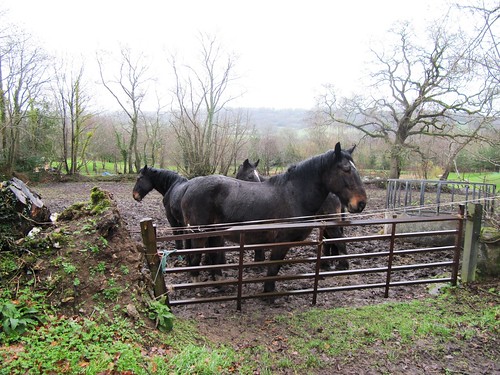
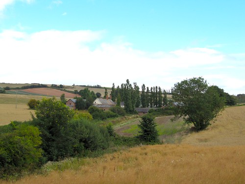
In the fields at Oak Tree Farm two black-faced lambs bounded for safety in the hedge, their mother’s cracked bellow of a call as throaty and querulous as a gin-soaked duchess. ‘Come hyyyaaaah!’ The farmer at Lower Thorne found me fumbling with a tricky horse-proof gate. ‘Pull it up! If you were a proper walker,’ he teased in a gentle Devon burr, ‘you’d have known that!’ How long had he lived here? ‘Oh, about seventy years. See that old house?’ He pointed at a beautiful thatched cottage across the fields. ‘Lammacott – I was born in that house, so I haven’t travelled far.’
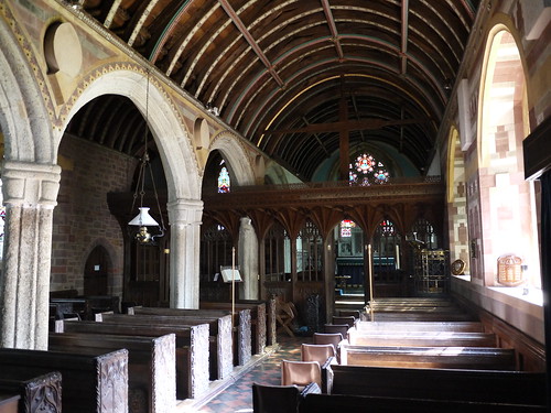
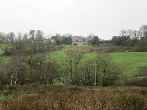
Up at Down St Mary, another ridge-top village, I admired the tympanum carved over the south door of St Mary’s Church, a calmly smiling figure assailed by demonic beasts with palm-frond tails. Seven hundred years old? Eight hundred? The drama, the vigour and humour of the work shine through, now as then – a contact with the medieval stonemason as warm and direct as a handshake across the centuries.

Start: Morchard Road station, EX17 5LR (OS ref SS 750051)
Getting there: Rail (thetrainline.com; railcard.co.uk) to Morchard Road.
Road: Morchard Road station is between Copplestone and Lapford on A377 Crediton-Barnstaple road.
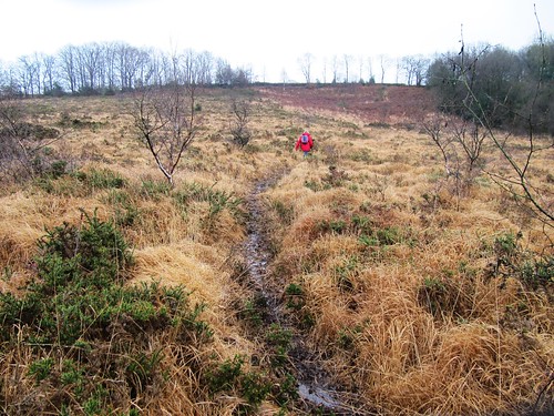
Walk: (6½ miles, moderate, OS Explorer 113): From station cross A377; take B3220 (‘Winkleigh’). In 300m, left through gate (747051, yellow arrow/YA) up Ellicombe Farm drive. Don’t fork left to Ellicombe House. By entrance pillars to red brick house, left through gate (745050, YA); follow fence round to right. Pass house; continue along hedge; through kissing gate to right of tin shed (744050). Right through metal gate (YA); immediately left through another metal gate (YA). Pass a tree (ignore gate on skyline to right here); keep ahead up bottom of shallow valley, rising to go through gate at far end (741049). Left (YA); over stile into lane.
Left for 200m; right up steps, over stile (742047). Down left-hand hedge; cross stile and turn left (741047, YA) along hedge. At end of field through gate (741045); right (YA) along irregular edge of field for 400m, with Oakview house on your left. At end of field, right over stile (737045, YA) over stream and stile beyond. Half left across field to cross 2 stiles in far top left corner (737046, YAs). In 30m, left over stile (YA); follow hedge to Middle Yeo Farm lane (733046). Left to road (733045). Right downhill. Just before bridge at The Old Mill, left through gate (732044, fingerpost), and follow YAs and stiles with river on right for ½ mile. At end of plantation, turn right across river by tall footbridge (726039); follow stony lane opposite uphill to road in Zeal Monachorum (721041).
Left; at phone box by church, left downhill (720040, ‘Bow’). At foot of slope left along ‘No Through Road’ (720038; ‘The Waie Inn’) past Waie Inn and on downhill to cross Tucking Mill Bridge (724035). Right (‘Bridleway’). At cottage, left (YA); in 20m, left up track. In 100m at field entrance, bear left and follow inside edge of wood to cross stile (725034, YA). Cross field; through gates; follow hedge on your right. In 200m, at bottom of dip, right over stile and through gate (729034, YAs); left along hedge, cross stream and go through gate (731033, fingerpost). Cross field, aiming for left-hand of 2 trees ahead. Through gate into lane (733033).
Ignore footpath fingerpost pointing right along lane; go through gate to right of Merrifield drive; diagonally right across field; through gate on far side (735031, YA). Left with hedge on left; at far end of field, descend to go through kissing gate (YA) and cross stream in dell (738032). Keep hedge on right to reach gate into lane at Lower Thorne (741032). Left; in 20m, sharp right (fingerpost) through several gates and farmyard. Continue on path across fields (YAs). In dip, through wood (744032), crossing stream and bearing left downhill to stile. Cross field to bridleway by cottage (736033). Left for ½ mile to road (741040); right uphill through Down St Mary.
Pass church (743045) and on (‘Morchard Road’). In 150m, left over stile (744046, YA, fingerpost). Follow right-hand hedge, then centre of long field downhill to two neighbouring metal and wooden gates. Turn right through wooden gate (744050); retrace steps to Morchard Road station.
Lunch/accommodation: Waie Inn, Zeal Monachorum (01363-82348; waieinn.co.uk); Devonshire Dumpling, Morchard Road (01363-85102; devonshiredumpling.com)
‘Tarka Line Walks’ by Peter Craske (Crimson Publishing) – 60 walks in the locality.
Exmoor Walking Festival: 27 April-6 May (exmoorwalkingfestival.co.uk)
Info: Exeter TIC (01392-665700)
visitdevon.co.uk vistengland.com www.ramblers.org.uk www.satmap.com www.LogMyTrip.co.uk
Click on Facebook “Like” link to share this walk with Facebook friends.

 Posted by at 01:36
Mar 092013
 

Wrapped like lifeboatmen, we left the Half Moon at Clayhidon to explore the steep valleys under the Blackdown Hills. First published in: The Times Click here to view a map for this walk in a new window
picture picture picture picture picture picture picture picture picture picture picture picture picture
Facebook Link:
No-one else was out braving the rainy winter morning; we had this beautiful green corner of the mist-shrouded East Devon countryside entirely to ourselves.

From the sedgy fields below Clayhidon we looked back to see the houses and church tower of the lonely hamlet stretched out along their ridge. The air struck damp and cold, pearling in our hair and in the stiff coats of the dogs who barked us into and out of Cordwent’s Farm. Grey veils of rain drifted through the valley below the farm, softening the stark outline of the skeleton woods and dripping from the leafless oaks in the hedges. It was a morning of steaming breath, dewdrop noses and many sniffs. At Barne Farm three glossy black horses with white foreheads looked over a gate, shaking the rain from their forelocks as they watched us go by along Applehayes Lane. Lines of raindrops edged the long gleaming leaves of hart’s-tongue ferns, and the nettle-like yellow archangel plants were already beginning to bud – testimony to the mild climate in this sheltered, south-westerly corner of England.

Down in the flat bottom of the Culm Valley the River Culm chuckled over rapids in its red earth bed. Against the sombre brown of bracken and black of the trees, scarlet shoots of dogwood and yellow bursts of gorse flowers made splashes of colour to brighten the late winter day. A cock pheasant, betrayed by the white flash of its neck collar, scuttled away through the sodden grass and squelching hoof-pocks. In a barn we found an ancient Ford Popular, its pop-eyed headlamps and elongated mouth of a radiator grille giving it the expression of a shocked schoolmarm in mid-shriek.

The rain slackened and went away eastwards, leaving a crack of duck-egg blue overhead. The first primroses of the year made a sulphurous splash in the hedges of Ashculme Farm. We climbed the slope of Clayhidon Turbary, an old common where the villagers once cut peat for their fires and furze for their animals’ winter bedding. Half an hour later we were out of muddy clothes and steaming boots, and in by the Half Moon’s fire. Proper job, as they say hereabouts.

Start & finish: Half Moon Inn, Clayhidon, Devon EX15 3TJ (OS ref ST 161155)
Getting there: 5 miles south of M5 Jct 26 (‘Wellington’), via A38, Ford Street and Hunter’s Lodge
Walk (5 miles, easy, OS Explorer 128): Leaving Half Moon Inn, left along road. In 150m, right (162157; fingerpost/FP) up steps. Follow yellow arrows/YA past Smith’s Farm. Left along track; in 100m, through gateway (164157) and right down fence. Cross stream (165156), up through gate and woodland (YAs) to track (166154). Right; in 100m, left (FP) up farm track. Through gate, past horse ring and on (hedge on left). Through double gate; on to angled corner of hedge ahead (170155); aim ahead for house and barn at Applehayes. Down left side of barn to Applehayes Lane (173155). Right for 700m, passing Barne Farm. At foot of lane, at house marked ‘Shepherds Hill’, right up path (171149; FP). In 100m, left along fence and follow path downhill. In 250m, left (YAs) downhill through bracken. Bear to right of wet woodland to go through gate; right through next gate, and left through one below (YAs); down hedgebank to lane at Bellett’s Farm (170145).

Right for 600m; left at T-Junction by Parish Hall (164143). In 150m, left (164142; FP) through gate opposite Clayhidon Mill and follow path on right bank of River Culm (YAs) for ¼ mile to Bridgehouse Bridge (160141). Cross lane, and on. In 2nd field, after 100m bear up bank and through gate on right (YA). Clockwise round field to YA on post, halfway up far hedge. Cross footbridge and stile; on up hedge to lane (155142). Right; in 20m, left over stile and on with hedge on right. Above Gladhayes Farm, in 2nd field bear right through gate and left along hedge. Through gate (150143, YA); down green lane. In 50m, straight ahead through gate and on past barn, down track to tarmac lane (149144); left downhill to road (148142).

Right for ½ mile, passing Tanhouse Farm (148147). Bear right at Middle Ashculme Farm (147149, FP); pass barn and keep ahead (don’t fork left through stockyard!); through 2 gates and follow concrete farm track. At end of 2nd field, right (148152, FP) across stream, through neck of scrub woodland and on up field (YA). Left through gate. Round left side of barn and over stile (151152, YA) in right-hand corner of field (NB very muddy hereabouts!). Up field to gate into trees (YA); cross green lane (152152) and on up slope of Clayhidon Turbary. Don’t try to follow footpath that bears right as shown on OS map, but follow clear path up to ridge and gate into lane (FP). Don’t go through the gate, but turn left along grass path by hedge. Through gate at end (155153, YA); up bank; through gate to left of barn; on through gate; lane to cross road (158154). On along bridleway (FP). Bear right around Glebe Barn, back to Clayhidon.

Lunch: Half Moon Inn, Clayhidon (01823-680291; halfmoondevon.co.uk) – excellent village pub
More info: Tiverton TIC (01884-255827); visitdevon.co.uk
www.ramblers.org.uk www.satmap.com www.LogMyTrip.co.uk
Click on Facebook “Like” link to share this walk with Facebook friends.

 Posted by at 01:46
Jun 302012
 

Rain, rain, rain. For goodness sake, Clerk of the Weather, give it a rest, will you? Ah, here we go … half a day of respite, tentatively forecast. Right, where’s the boots? Quick, now – down to the east Devon coast, to the steep green valleys around beautiful, tucked-away Branscombe. First published in: The Times Click here to view a map for this walk in a new window
picture picture picture picture picture picture picture picture
Facebook Link:
There was scarcely another soul out on the South West Coast Path as we climbed west away from the pebbly beach at Branscombe Mouth. At the top of West Cliff we stopped and stared back at the majestic eastward view – the long grey skirt of the beach with its lace hem of surf, the towers and spires of Hooken Cliffs, and the giant landslips that had exposed white chalk faces above jungly undercliff ledges of fallen rock, tier upon tier, poised to crumble in their turn onto the foreshore 400 feet below. The cliffs of this dynamic coast seem massively weighty and immobile, yet they are forever slipping and sliding seaward.

Wild flowers grow here in generous variety – pyramidal orchids, yellow rockrose with crumpled petals, royal blue spikes of viper’s bugloss, the weird-looking bell flowers of psychoactive henbane with petals varicosely veined in purple. Out on Berry Cliff the forward view showed great red cliffs of sandstone, Sidmouth a huddle of houses shining white in a rare shaft of sun, and the Devon coast trending south and west in a sweep of rain-washed blues and pinks.

From the grassy ramparts of Berry Camp hill fort we turned inland past Berry Barton where peacocks stepped fastidiously through the farmyard muck. Steeply down to Cotte Barton, steeply up again and over the ridge; rollercoaster country where the path swung through wet woods past houses ancient and modest, modern and brash. The sky lowered and spat every so often, the flowery hillsides wept streamlets and sprouted rain-pearled yellow flags and intense blue trails of brooklime. A soaking wet walk, and a sensationally beautiful one.

Back at the Old Bakery in Branscombe, home-made leek and potato soup was on the bubble. Treacle tart, too? Sure. Clotted cream with that? As Brian Ferry said – you can guess the rest …

Start & finish: Branscombe Mouth car park, Branscombe, Devon EX12 3DP (OS ref SY 207882)
Getting there: Bus – 899 Coasthopper (Seaton-Sidmouth, jurassiccoast.com). Road – Branscombe is signposted off A3052 Exeter-Lyme Regis

Walk (5 miles, moderate/hard grade, OS Explorer 115): From car park go to sea front; fork right up track past Sea Shanty Café. Through kissing gate (‘Coast Path/CP, Weston Mouth’); on across 2 fields; steeply up to your left to go through kissing gate (205882); up steps, and follow CP through woods for ¾ mile. By a gate, left (192883; fingerpost); follow CP along Berry Cliff. In ⅓ mile, pass through kissing gate (187882; yellow arrow/YA) at western end of Berry Camp rampart; in another 300m, at 4-finger post (184883; ‘Berry Barton’), hairpin back to right across field. In 300m, left at stone-walled kissing gate (187884; fingerpost) up farm lane to road at Berry Barton (184887). Left for 150m; right through gate (183888; no YA); immediately right through adjacent gate (no YA); on above Berry Barton farmhouse. In 150m, left at YA; follow hedge and YAs over ridge and down at edge of trees (NB very steep and slippy!) to road near Cotte Barton (186890).

Left for 100m; right past fingerpost, through wicket gate at left side of house, and up path through scrub and long grass (beware nettles!) to edge of field (185892). Right to fence; left along it, soon crossing through and continuing up fence/hedge to cross airstrip (186893; warning signs, take care!) and then Northern Lane (186894). Go through gate opposite (‘Bridleway, Hole House’); follow green lane for ⅓ mile down to Hole House (191894). Bear left past front of house and down lane; in 50m, right over stile (fingerpost). Follow contour of hillside ahead, then steeply down to cross brook by footbridge (193894). Right (YA) along hillside path for ¼ mile, rising to gate into road (196891). Right; in ¼ mile, right at staggered crossroads (198882) to Branscombe Forge and Old Bakery. Back to crossroads; right along lane (‘Branscombe Mouth, Coast Path’). Follow path through fields to Branscombe Mouth and car park.

Branscombe Mouth car park – Coast Path west for 1⅔ miles. 300m past west rampart of Berry Camp, right (184883) across fields; up farm lane (187884) to Berry Barton (184887). Left along road for 150m; right over fields past house; left (YA) over ridge, steeply down to road at Cotte Barton (186890). Left for 100m; right past house, up hillside; over airstrip (186893) and Northern Lane (186894). Green lane opposite for ⅓ mile to Hole House (191894). Left down lane; in 50m, right over stile (fingerpost); along hillside, down to cross brook (193894); right along hillside for ¼ mile to road (196891). Right to crossroads in Branscombe (198882); right to Forge and Old Bakery. Back to crossroads; right (‘Branscombe Mouth’) to car park.

Conditions: Some paths very steep, slippery, narrow. Walking stick/pole, shoes with good grip advised.

Lunch: Old Bakery, Branscombe (01297-680333) – excellent home-made food
Accommodation: Mason’s Arms (01297-680300; masonsarms.co.uk) or Great Seaside B&B (01297-680470; greatseaside.co.uk), Branscombe
Info: nationaltrust.org.uk/branscombe-bakery-mill-and-forge/
Sidmouth TIC (01395-519333); visitdevon.co.uk
Subscriber Walks: Enjoy a walk with Christopher Somerville in the Mourne Mountains, Co. Down, N. Ireland, 8 July. Email timespluspartners@newsint.co.uk to book. Tickets £10.
www.ramblers.org.uk www.satmap.com www.LogMyTrip.co.uk

 Posted by at 01:39
Feb 042012
 

Kingston lies shut away in a tangle of high-banked lanes, a South Hams village that retains a vigorous social life in and out of the holiday season.
First published in: The Times Click here to view a map for this walk in a new window
picture picture picture picture picture picture picture picture
Facebook Link:
Crockers and Terrys lie companionably in the churchyard of St James the Less, our starting point for a walk along the coast of this isolated region of south Devon. In the ferny banks an astonishing treasury of flowers had responded to the mildness of this winter – herb robert, celandines, primroses, red campion and snowdrops all blooming together.

Between the leafless, wind-streamed trees of Furzedown Wood we caught glimpses of the tide-ribbed, dull gold sandflats and milky turquoise water of the Erme estuary, a snaking channel that reached its mouth between wooded headlands of black rock. Out on the coast a low wind brought a breath of winter in from the sea. The water lay slate-coloured under a grey sky streaked with pearly patches. Contorted cliff faces fell hundreds of feet to secret beaches and coves floored with tight-packed parallel lines of rock scars. A little back from the edge ran the path, swooping a couple of hundred feet into the green grassy dips, then soaring back up and over a succession of headlands.

It was heady walking, with the sea-monster shape of tidal Burgh Island as an aiming point ahead. The island’s Art Deco hotel gleamed in the muted winter light, an exotic morsel much picked over by guests both actual and apocryphal – Noel Coward, Winston Churchill, The Beatles and M. Hercule Poirot among them. We descended to the shore in Bigbury-on-Sea opposite Burgh Island’s other hostelry, the tiny old Pilchard Inn. Jane opted to cross the sandy causeway for a bowl of soup and a bit of a sit-down there, while I set off back to Kingston through the switchback fields and stream valleys of the hinterland.

By the time I’d fetched the car and negotiated the narrow lanes back to Bigbury-on-Sea, the tide had risen to cover the causeway. I watched as Jane came ashore on Burgh Island’s tall blue sea tractor, riding in state like Queen Suriyothai on her war elephant.

The Dolphin in Kingston is one of those pubs that draws you in on a cold winter’s night – a combination of lamp-lit windows, the promise of a pint and a plate of food, a cosy setting and the flicker of a real good fire. It was great to get the weight off our muddy feet and settle down there with the wind and rain shut out, the map spread on the table and a great day’s walking to chew over at leisure.

Start & finish: Dolphin Inn, Kingston, Bigbury, Devon TQ7 4QE (OS ref SX 636478)
Getting there: M5, A38 to Ivybridge turn; minor road to Ermington; A3121, A379 to Modbury; minor road to Kingston.

Walk (9 miles, strenuous, OS Explorer OL20): From Dolphin Inn, left past church. At crossroads, right (‘Wonwell Beach’). In ¼ mile, just past dogleg, left (632481; ‘Wonwell Beach’); follow fingerposts and yellow arrows/YAs over fields for ¾ mile, down through Furzedown Wood to road by Erme estuary (620478). Left for 150m; left up steps (‘Coast Path, Bigbury-on-Sea’). Follow coast path for 5 miles to Bigbury-on-Sea (if tide allows, cross sands causeway – 651442 – to Pilchard Inn – 648440).

Climb Parker Road; at top, through gate (653446; arrow, fingerpost/FP). On across fields; at end of 3rd field (658448), left downhill with fence on right (FP, ‘Ringmore’). Follow YAs, crossing lane at 656453, to Ringmore. At road, ahead to T-junction by church (653460). Right, then left up side of church. In 150m, left through kissing gate (653461; ‘Kingston’ FP). Diagonally right across field and through gate; follow YAs through gates and fields, turning left (650463) to descend to stream in valley. Bear right (648463) along stream, crossing it at ruined Noddonmill (649465); on (YA) along left bank of stream, into wood (very muddy!). In ¼ mile, steeply uphill out of trees; anti-clockwise round field to far right corner (645471; FP). Right along farm track. Round left bend, and turn right (644473; FP) across field to lane (643474). Left (YA) for 50m; right (FP) and follow YAs along field edges and through woodland to road (637476). Right to T-junction in Kingston (636477); right, then left to Dolphin Inn.

NB – Online map, more walks: www.christophersomerville.co.uk. Click on Facebook “Like” link to share this walk with Facebook friends.
Lunch: Pilchard Inn, Burgh Island (01548-810514; soup and baguettes only; if marooned by high tide, return ashore on Sea Tractor – £2– check times/tides in advance); Journey’s End Inn, Ringmore (01548-810205).
Accommodation: Dolphin Inn, Kingston (01548-810314); low beams, fires, good cheer – a community hub.
More info: Totnes TIC (01803-863168); www.visitdevon.co.uk
www.ramblers.org.uk www.satmap.com www.LogMyTrip.co.uk

 Posted by at 04:09
Jul 232011
 

Blues and folk, cream teas, own bakery, story-telling, art exhibitions, and a perfect setting by the River Otter at the edge of a village of cob and sandstone cottages under thatch.
First published in: The Times Click here to view a map for this walk in a new window
picture picture picture picture picture picture picture picture
Facebook Link:
No wonder Otterton Mill café is as popular in summer as a cold beer on a hot day. We could have squeezed there in for a pre-walk cuppa, but the call of riverbank, estuary and rugged red cliffs was too strong on this beautiful afternoon along the South Devon coast. We crossed the three old arches of Otterton Bridge instead, and walked off downriver along the slow-flowing Otter.

This is flat green river country bounded by low hills, the Otter running shallow and red over ridges of shillets that trailed green hanks of weed, rippling silkily like mermaid hair. ‘Have you seen the grey mullet?’ enquired a fisherman. ‘In the shallows, look.’ There they were, a long shoal sinuating with the stream. ‘I’m going to attempt to catch one – but they’re pretty shy.’ He flicked a lure into the water and drew it wobbling and flashing past the noses of the unmoving mullet.

We crossed the river and went on beside ripe wheatfields glistening in the sun. Down at the river mouth a pebble spit has almost closed off the Otter’s estuary from the sea. Gulls called mournfully over the piled roofs of Budleigh Salterton, wetsuited youngsters shrieked the echoes out of caves, and surf sighed on the stony ridge – essence of the sounds of summer.

The dusty coast path led north along cliffs striated and weather-bitten, their strata dipping eastward in a mighty curve through the white sprinkle of Sidmouth, the tall red triangle of Dunscombe Cliffs and a far white smudge of chalk at distant Beer Head. Fulmars and kittiwakes planed along the line of the cliff edge, and the dark purposeful shape of a peregrine went dashing by at head height. Inland, a bare field of pigs rooted among pink stones, seagulls whirled, and a farmer in a red tractor got his straw bales organised in a newly harvested field.

Above Smallstones Point we pulled up to stare across the great layered rock stacks in Ladram Bay, lambent and crimson in the late sun – a famous view, one that always delivers a pure jolt of delight. One more glance along the pink and white coast, and we headed along green lanes through the stubble fields towards Otterton and that well-earned cream tea.

Start & finish: Otterton Mill, Otterton, S. Devon EX9 7HG (OS ref SY 080851)

Getting there: A3052 (Exeter – Sidmouth); B3178 at Newton Poppleford (‘Budleigh Salterton’). In 3 miles, Otterton signposted at Brick Cross. Park in village.

WALK (6 miles, easy grade, Explorer 115):
From Otterton Mill cross River Otter bridge; left along riverbank footpath. In two thirds of a mile don’t cross Clamour Bridge: continue on right bank to cross next bridge (075830, ‘Ladram Bay, Coast Path’/CP). Don’t turn right immediately along river; keep ahead on road for 100 m, then right (CP) on path to coast. Follow CP arrows to left along cliffs for 2 miles. At ‘Otterton half a mile’ fingerpost (094848), ahead for 50 m to view Ladram Bay; return and follow path (soon green lane) inland. Left at gate of Monk’s Thatch to road (089849). Left for 100 m; right along Lea Lane (‘Unmetalled Road’). Just after right bend, keep ahead (085847; black arrow) to road in Otterton (085852). Left; follow lane past church to village.

LUNCH: Otterton Mill (01395-568521; www.ottertonmill.com)

MORE INFO: Budleigh Salterton TIC (01395-445275); www.visitdevon.co.uk
www.ramblers.org.uk www.satmap.com www.LogMyTrip.co.uk
Click on Facebook “Like” link to share this walk with Facebook friends.

 Posted by at 04:36
Apr 162011
 

Goliath lay at ease in Churston station, lazily jetting steam and curls of smoke into the cloudless blue South Devon sky.
First published in: The Times Click here to view a map for this walk in a new window
picture picture picture picture picture picture picture picture
Facebook Link:
We stood watching – Jane, her sister Susan and I – mesmerised by the sounds and smells of childhood. ‘She’ll stay there till she’s ready to go,’ was the Zen-like observation of the man on the bridge. When the little black tank engine finally moved off, chuffing and clanking, her place at the platform was taken by Lydham Manor, resplendent in Great Western Railway green, simmering like a kettle and emitting mournful hoots like an owl on the boil.

Out beyond the village we found stony Combe Lane rising gently, a hollow way through unseen fields. Buildings, cars and the trains of the Dart Valley Railway had all been whisked out of sight and earshot in a fold of the landscape, and we walked in a tunnel of blackthorn bushes and coarse-leaved elm suckers bursting with finch song. It wasn’t until we were standing tiptoe on the fence at the crest of the hill like inquisitive kids (it must have been the Goliath effect) that we caught our first glimpse of the Dart estuary, a blue gleam between wooded hills, a scatter of yachts, a sprinkle of civilisation around Torbay, and the jagged granite vertebrae of Haytor sticking out of the back of Dartmoor on the northern horizon a dozen miles off.

Beyond Higher Greenway and tree-cloaked Oakham Hill we followed a permissive path near the narrow estuary, south along a hillside where Long Wood clung steeply above the river. A hoot and a rapid panting from down by the Dart betrayed Goliath’s progress along the waterside line. A gap in the trees allowed a peep over the river, a jade-green snake between dark woods and fields of deep red Devon soil. ‘I-think-I-can, I-think-I-can!’ fussed invisible Goliath.

Down and out of the woods, descending paths to emerge on the River Dart opposite the Royal Naval College, huge in red brick, all towers and ranks of windows on its hill. Trundling ferries churned the estuary between Kingswear and Dartmouth, opposing nests of tight-packed houses, blue, pink, white, yellow on the steep, as pretty as a picture. As we walked between river and railway towards Kingswear, Lydham Manor came hissing past in a cloud of pungent coal smoke, every carriage window filled with faces, an escapist grin across every one.

Start: Churston station, Dart Valley Railway TQ5 0LL (OS ref. SX 894563)
Finish: Kingswear station TQ6 0AA (OS ref SX 881510)
Getting there: Train (www.thetrainline.com; www.railcard.co.uk) to Paignton; Dart Valley Railway (01803-555872; www.dartmouthrailriver.co.uk) to Churston.
Road: A379 Paignton-Dartmouth; Churston station signed in Galmpton.
Walk (5 miles, moderate, OS Explorer OL20): Leaving Churston station, left across railway; left down Greenway Road. In ⅓ mile, left past Manor Inn. Up hill; left along Kennel Lane; cross railway; right along Combe Lane (‘Greenway Walk’/GW). In ⅔ mile at top of rise among trees, right (blue arrow, GW) along hedged lane. Cross stile; follow hedge/fence for ⅓ mile. Just before gate of Higher Greenway, left (‘permissive path’; Dart Valley Trail/DVT) into Long Wood. Steeply downhill; follow track (white, blue arrows). Where DVT turns steeply downhill to right by wooden frame, keep ahead. In 1 mile path hairpins right; descend to bear left across stream (DVT). Follow DVT for ½ mile to cross A379; on along roadway; in 400m, right (DVT) down path; cross road and railway; left along estuary to Kingswear station.
NB – Online maps, more walks: www.christophersomerville.co.uk
Lunch: Royal Dart Inn (01803-752213), Ship Inn (01803-752348; www.shipinnforecast.com), Kingswear
More info: Dartmouth TIC (01803-834224; www.discoverdartmouth.com)
www.ramblers.org.uk www.satmap.com www.LogMyTrip.co.uk
Llanelli Festival of Walks, Carmarthenshire: 27–30 May 2011

 Posted by at 05:00
Jan 222011
 

A brisk, blowy, blustering day on the North Devon coast, with a scudding grey sky and big Atlantic waves racing onshore to smash against the wicked black rock teeth of the cliffs. I actually felt the ground quake beneath me as I pushed north into the wind along the line between sea and land, wondering whether leaving the warmth and light of the Hartland Quay Hotel had been a good idea after all.
First published in: The Times Click here to view a map for this walk in a new window
picture picture picture picture picture picture picture
Facebook Link:
Tides are strong and cross-currents treacherous out at Hartland Point, where the Devon coast cuts at right angles from north to east on its outer entrance to the Bristol Channel. Curved and contorted bands of sandstone, ground by the sea into upturned razor edges, lie just below the surface – they have brought thousands of sailing ships to grief down the years. I paused by the lighthouse on the point and took a last breathless prospect of dark sky, dark sea and black rock before heading inland along the high-hedged lanes so characteristic of this part of the world.

In the shelter of the lanes the wind, roaring high overhead, scarcely trembled a leaf. The loom of the ground shut away the hiss and crash of sea against rocks. I threaded the deep holloways past farms with Betjemanic names – Blagdon and Blegberry, Berry and Wargery – with the sounds of trickling water and tentative robin song for company.

In the ridge-top village of Stoke, master craftsmen down the centuries have beautified St Nectan’s Church. I admired the Tudor panelling of the rood screen, all slender ribs and exquisite floral detail, and the roof with its coruscating stars and carved bosses. Then it was out and on along the field lanes, dropping down to the cliffs and the roar of the wind once more.

The great waterfall at Speke’s Mill Mouth was a lace veil blown to rags, the floor of the cove a seethe of white foam among black rock scars. Above the green shark’s tooth of St Catherine’s Tor a raven was struggling unavailingly to fly north, kept at a standstill in mid-air by the counterblast of the wind. I put my head down and shoved on, a midget in motion among the huge forces of nature. Later, sitting in the warm bar of the Hartland Quay Hotel, I found my cup of tea tasted salty – legacy of all the sea wind and spray absorbed by my beard on this wild and entrancing walk.

Getting there: M5 to Jct 27; A361 to Bideford; A39 towards Bude. ¼ mile beyond B3237 Clovelly turning, bear right on minor road to Hartland and Hartland Quay.

Walk (7½ miles, moderate/hard grade, OS Explorer 126): South West Coast Path/SWCP (fingerposts, acorn symbols) north to Hartland Point. Just before radar station, inland. In 100 m, ahead (‘bridleway, Blegberry’) past Blagdon Farm; bridleway for 3/4 mile to road. Right to Blegberry Farm. Left (‘unmetalled road’); green lane for ½ mile to road. Ahead past Berry Farm, across Abbey River; road up to Stoke. Left; immediately right up lane by Rose Cottage. In 200 yards pass ‘Unsuitable for Motors’; keep ahead for a good half-mile. At Wargery, right to road at Kernstone Cross; right (‘Kernstone’) for 450 m to T-junction; left through gate (‘Speke’s Mill Mouth’) on grass path; SWCP north to Hartland Quay Hotel.

NB – Online maps, more walks: www.christophersomerville.co.uk

Conditions
Beware strong wind gusts on exposed cliff tops! Many steps, many climbs and descents. Allow 3-4 hours.

Lunch: Hartland Quay Hotel (01237-441218;
www.hartlandquayhotel.co.uk) – friendly, characterful and welcoming.

More info Bideford TIC (01237-477676);
http://www.visitdevon.co.uk/site/areas-to-visit/north-devon-and-exmoor;
www.ramblers.org.uk;
www.satmap.com

 Posted by at 12:08
Nov 062010
 

First published in: The Times Click here to view a map for this walk in a new window
picture picture picture picture picture picture picture picture
Facebook Link:
" 'Mr Holmes, they were the footprints of a gigantic hound!' "

The most thrilling and chilling lines in The Hound of the Baskervilles were first read by ten-year-old me under the bedclothes with a frisson of pure, delicious fear. I’ve loved Holmes and Watson’s great supernatural Dartmoor caper ever since. And although the real Hound Tor isn’t quite within howling distance of Conan Doyle’s fictional Great Grimpen Mire, I just couldn’t resist that atavistic name when it came to choosing a walk on the moor.

It turned out misty – well, of course. As soon as Jane and I had climbed from Haytor Vale up onto the open moor, ghostly hands began to draw a white woollen blanket across the granite tors and the undulating sea of gorse and heather in which they rode like weathered grey ships. The twin hulks of Haytor Rocks slipped out of sight, and nearer at hand a harras of moor mares and their foals faded to insubstantial silhouettes. But moor mists are funny things, and this one ran up against an invisible barrier. Smallacombe Rocks, our aiming point, remained in broad sunlight, and from the tor we saw the dog’s tooth of Hound Tor sharply outlined against blue sky across the steep little valley of the Becka Brook.

We descended among crab apples, sloes and whortleberries, and crossed the Becka Brook by a stout old clapper bridge. Up in the shadow of Hound Tor the path ran past a tight-packed maze of stone-built dwellings, smothered in bracken and bramble. The high ground of Dartmoor may be deserted today, but in medieval time it was spattered with shepherding and tin-mining settlements such as this.

On the peak of Hound Tor we paused to breathe and take in the view. Then it was on, down to ford the Becka Brook, up again to follow the rails and sidings of the Haytor Granite Tramway. Laid down in the 1820s, its railway lines carved out of solid stone, the tramway trundled granite from the Dartmoor quarries to build some of London’s greatest Victorian edifices.

Haytor Rocks stood clear of the receding mist. We climbed to the top and surveyed the moor. Snaking away through the purple-gold landscape, the chunky granite tramway looked endearingly clumsy – as though a troll had taken a peep over George Stephenson’s shoulder, and decided to do a bit of DIY on his own account.


Start & finish: Rock Inn, Haytor Vale TQ13 9XP (OS ref SX 771772)

Getting there: Haytor Hoppa bus service 271 (Sat April-Oct, plus Thurs May-Sep) from Bovey Tracey (www.dartmoor-npa.gov.uk/vi-haytorhoppa)

Road – M5, A38, B3344 to Bovey Tracey; B3387 towards Widecombe-in-the-Moor; in 3 miles, Haytor Vale signed to left.

Walk (6½ miles, moderate, OS Explorer OL28): Leaving Rock Inn, right for 50 yards; on bend, ahead (bridleway fingerpost); in 75 yards, right (‘Moor, Smallacombe’). In 350 yards, in a dip, fork left through turnstile; follow roadway to cross B3387 (778773). Up path opposite through bracken to ridge; left towards Haytor Rocks for ⅔ mile to cross Manaton road through car park (770778). Follow clear track across Haytor Down, with Haytor Rocks ¾ mile away on your left. Just before reaching Smallacombe Rocks, bear right/north (756782) down rocky path. In 300 yards, at fork, left downhill past fingerpost (754786; ‘Houndtor Down’). Follow bridleway to cross Becka Brook (752787); uphill past medieval settlement (746787) to Hound Tor (742789).

Retrace steps for 300 yards; right (south) along green path just above settlement, with Greator Rocks on left. In 100 yards pass waymark post, and on. In 300 yards, through gate (745783); left (‘Haytor Down’); descend to ford Becka Brook (747778). Up path opposite, aiming for Holwell Tor, to reach Haytor Granite Tramway track just below it (750778). Left along it. In ⅓ mile, pass branch to right (757777); in another ¼ mile, right (761777) along branch through quarry to climb Haytor Rocks (757771). Aim for Dartmoor National Park centre on B3387 below (767772); left along road; in 100 yards right, then immediately left to Haytor Vale.

NB – In mist, only for map/compass/GPS users.

Online maps, more walks: www.christophersomerville.co.uk

Lunch/accommodation: Rock Inn, Haytor Vale (01364-661305; www.rock-inn.co.uk)

Cottage rent: Beam Ends, Haytor Vale (Jill Morrish, 01364-661376, morrish.beamends@talktalk.net)

More info: Ashburton TIC (01364-653426); www.dartmoor.co.uk; www.visitdevon.co.uk

Dartmoor National Park Visitor Centre, Haytor (01364-661520) – books, guides, maps, advice

www.ramblers.org.uk; www.satmap.com


 Posted by at 00:00
Jun 192010
 

First published in: The Times Click here to view a map for this walk in a new window
picture picture picture picture picture picture picture
Facebook Link:

I hadn't made a mistake after thirty years – the ridgetop village of Drewsteignton, perched on the northern edge of Dartmoor, was still totally charming. There were the pretty cottages and the Drewe Arms as I recalled them, bowed low under thatch on the diminutive village square, all presided over by the tall tower of Holy Trinity church. When I was last here the pub had been run as a front-room business by Mabel Mudge, 83 years old and spry as a lamb. ‘Oh, you remember Mabel!’ smiled the man I got chatting to on the path over to the River Teign. ‘Yes, she retired when she got to 99. Seventy-five years she ran that place, and it never changed a bit.’

There was a wonderful view from the neighbouring ridge back to Drewsteignton huddled on its hilltop, and a sight of moor ponies grazing the gorse with streaming manes and tails. The bridlepath ran at the rim of the Teign’s steep wooded gorge, then slanted down through oak and silver birch to where the river ran flashing with sunlight under the three ancient arches of Fingle Bridge. I lingered, watching children skimming stones between the cutwaters, before following the Fisherman’s Path on its rocky, rooty, twisting way, close above the river.

A gang of four tiny tots hooted and squeaked as they fished for bubbles with sticks, and high overhead a buzzard went circling over the walls of Castle Drogo. At the bridge below the castle I struck up a side path, climbing past the L-shaped thatched house of Coombe, snug among fruit trees in its peach of a dell.

If there was ever a fairy-tale castle … Castle Drogo looks down from a spur of rock, 300 feet to the Teign in the wooded gorge below. Edwardian tea tycoon Julius Drew excavated himself a Norman ancestry, decided to build himself a proper old castle, and got Sir Edwin Luyens to make his dream come true in stark granite. No Mad King Ludwig touches here – all is plain, strong and massive, a triumph of restraint. Marked ways lead from the gorge paths to the castle by way of beautiful gardens of roses and spring flowers. No wonder Drogo is called ‘the last great castle in England’.

When I got back to Drewsteignton and into the Drewe Arms, I saw it had changed – more than a bit. But it’s still a cosy place to raise a glass under the beams in celebration of Mabel Mudge and all that’s great about the West Country village pub.

Start & finish: Drewe Arms, Drewsteignton, Devon EX6 6QN (OS ref SX 736908)

Getting there: Bus – Dartline 173 (Exeter-Chagford), Country Bus 279 (Totnes-Okehampton; Sundays, public hols). Road: From A30 east of Okehampton, A382 through Whiddon Down. In ½ a mile, Drewsteignton signed to left.

Walk (6 miles, moderate, OS Explorer OL28): From Drewsteignton Square, left; round right bend; 20 yards past old school, left (‘2 Moors Way’/MW) down lane. Ahead in bottom of valley (‘Castle Drogo/CD’) up steps. Follow fence up fields and over ridge. Through kissing gate; in 15 yards, left (732900); follow ‘Fingle Bridge’ fingerposts for 3/4 of a mile down to road (743901). Right to Fingle Bridge; don’t cross; right along river (‘Fisherman’s Path, CD’) for 1 ½ miles to bridge below Castle Drogo (721895). Right uphill (CD). In 1/3 of a mile, right (720900; ‘Hunter’s Path’); follow MW back to Drewsteignton.

Some steep steps; some rocky ledges in gorge with handrail (watch kids/dogs!)

NB – Online map, more walks: www.christophersomerville.co.uk

Lunch: Drewe Arms, Drewsteignton (01647-281224; www.thedrewearms.co.uk); Fingle Bridge Inn (01647-281287; www.finglebridgeinn.com)

Castle Drogo (NT): 01647-434118; www.nationaltrust.org.uk/castledrogo/)

Mabel Mudge: http://yeosociety.com/biographies/Aunt%20Mabel.htm

More info: Okehampton TIC (01837-53020); www.visitdevon.co.uk; www.ramblers.org.uk


 Posted by at 00:00
Nov 062009
 

Martin French deserves a medal. Not only did he get up in the cold and dark to see me off from his Bark House Hotel at Oakfordbridge, but he put porridge, bacon and eggs on the table at six in the morning. They make them tough down there on Exmoor. Ranger Richard Eales was nursing flu and the effects of a kick from an over-excited Exmoor pony, but he turned up for our dawn rendezvous at Exmoor National Park headquarters in Dulverton in his usual form – humorous, observant, and passionately knowledgeable about red deer.

From West Anstey Common Richard and I surveyed the ground around Lyshwell Farm. The farmer, Raymond Davey, enjoys seeing red deer, so Lyshwell is a likely spot to find a sample of Exmoor’s herd of some 4,000 of these beautiful and impressive creatures. Red deer have been native to Britain since shortly after the last Ice Age. Stags and hinds spend most of the year apart, but in autumn they come together briefly for the rut or mating season. That’s when the wooded combes and farm pastures of Exmoor echo to one of the most thrilling sounds in nature – the roaring of the stags.

As Richard and I watched from the high common, a deep dog-like bark rose from the oakwoods in the combe of Dane’s Brook far below. ‘A hind,’ said Richard. ‘She’s spotted us, and she’ll be warning the others.’ Then came the sound we had been waiting for – a grating, throaty roar from the direction of Lyshwell Farm. ‘Ah, he’s bolving,’ exclaimed Richard with satisfaction. ‘That’s the Exmoor word for the roaring. It’s a threat and a challenge to any other stag: “I’m here, and I’m in charge!” ’

Through binoculars I made out the stag as he stood by the hedge, head back and bolving, a large figure indistinct in the early morning light. In the field above him several hinds and two little calves came into focus. Beside them were a couple of prickets, two-year-old stags with two long dagger-blade horns where their antlers would eventually grow. ‘When a stag’s in his pomp,’ Richard expounded, ‘he’ll have his “rights” – his brow, bay and tray spikes at the base of the antler – and up to three “points” at the top of each antler. That stag we’re looking at, he’s a fine beast – he’s got all his rights and three points on one side, and all his rights and two on the other. Let’s have a closer look at him.’

Down in the Lyshwell fields we crept with bent backs along a hedge to a point where we could see through a screen of twigs. The stag was the size of a racehorse. He stood sideways on about 50 yards away, a magnificent spectacle against the rising sun, his dark form dazzlingly outlined in dewdrops, his heavily-antlered head thrown back as he bolved. The roar, a mixture of circular saw, Harley-Davidson and outraged lion, echoed out across Lyshwell Wood, projected forth on a puff of steamy breath.

‘See how dark his coat is?’ breathed Richard. ‘He’s been wallowing in his soiling pit, peeing in the mud and rolling in it to get a good stinking smell all over. A stag’s cologne, that is.’

Among his harem of a dozen hinds, most faces were turned towards us, but the stag seemed oblivious. He was sizing up one of the hinds, and had nudged her a little apart from the others, scenting her hindquarters and lifting his head between sniffs as if pondering a rare old vintage. Hinds are in season for a matter of hours only, so the stag relies on all sorts of clues to tell him the time is right. ‘He’ll lick up the hind’s urine,’ murmured Richard, ‘and run it along the Jacobson gland in his upper lip to see if she’s ready to be served.’

This hind was ready. It has to be admitted that the red stag is no languorous artiste du chambre. Ten seconds and the embrace was finished. The hind resumed her grazing, the stag his bolving and scenting of other posteriors. But the group of hinds remained uncomfortably aware of us. Soon enough they began to move off. Richard’s nudge was followed by his whisper, ‘We’ll go down in the wood and catch them there.’

Deep in Lyshwell Wood the stag’s soiling pit lay well-trodden, the wet mud exuding a powerful goaty smell. We crept along a sunken path. From the field above came the groans and roars of bolving in several separate voices – not just one stag, but three. Peeping over the top we saw ‘our’ stag trotting and roaring, and another animal making off in disappointment.

‘He’ll be back,’ said Richard as the herd disappeared into the wood and we straightened our stiff backs. ‘There’s a lot of hard work for the stags during the rut, keeping the hinds together, seeing off rivals, not to mention the mating. But they must think it’s worth it – they’ve been doing it for about ten thousand years.’

FACT FILE

Red Deer Watching: Ranger-led expeditions: contact Exmoor National Park Visitor Centre, Dulverton (01398-323841) or Exmoor National Park Authority, Exmoor House, Dulverton (01398-323665); www.exmoor-nationalpark.gov.uk. NB Lyshwell Farm is private property, but there are several footpaths across it.

Richard Eales’s deer-watching hints:

  • Go at dawn or dusk

  • Take good binoculars

  • Keep your eyes open, and give them time to adjust to spotting the deer

  • Be quiet, move slowly and keep downwind of the deer

  • Keep low to break up your outline

  • Stop still as soon as you spot a deer

World Bolving Championship: Held each October at Blaydon Rails above the Barle Valley, in aid of Devon Air ambulance. Details: Rock House Inn, Dulverton (01398-323131; www.rockhouseinndulverton.com)

Video:

http://www.thisiswesternmorningnews.co.uk/news/wild-beats-TV-talent-shows/article-1438375-detail/article.html

Accommodation: The Bark House, Oakfordbridge, Devon EX16 9HZ (01398-351236; www.thebarkhouse.co.uk) – really charming, welcoming small hotel, happy with very early starts!

Reading:

Kia – A Study of Red Deer by Ian Alcock (Swan Hill Press); Red Deer by Richard Jefferies (Halsgrove); Exmoor’s Wild Red Deer by N.V. Allen (Exmoor Press)

Information: www.exmoor.com

 Posted by at 00:00