Wrapped like lifeboatmen, we left the Half Moon at Clayhidon to explore the steep valleys under the Blackdown Hills. First published in: The Times Click here to view a map for this walk in a new window


Facebook Link:
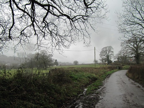
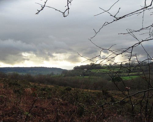
No-one else was out braving the rainy winter morning; we had this beautiful green corner of the mist-shrouded East Devon countryside entirely to ourselves.
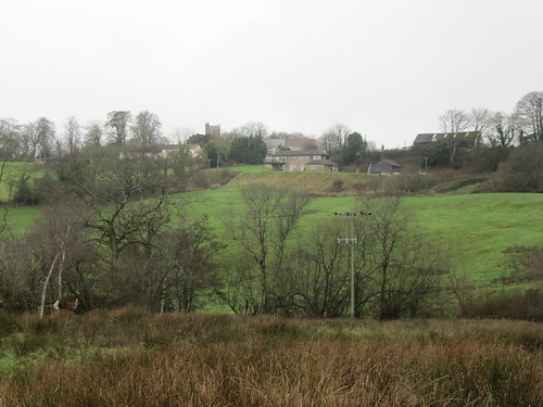
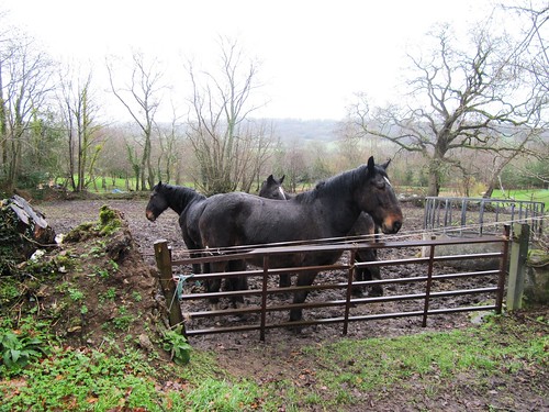
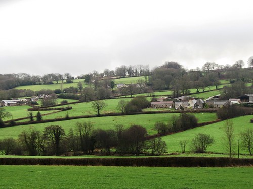
From the sedgy fields below Clayhidon we looked back to see the houses and church tower of the lonely hamlet stretched out along their ridge. The air struck damp and cold, pearling in our hair and in the stiff coats of the dogs who barked us into and out of Cordwent’s Farm. Grey veils of rain drifted through the valley below the farm, softening the stark outline of the skeleton woods and dripping from the leafless oaks in the hedges. It was a morning of steaming breath, dewdrop noses and many sniffs. At Barne Farm three glossy black horses with white foreheads looked over a gate, shaking the rain from their forelocks as they watched us go by along Applehayes Lane. Lines of raindrops edged the long gleaming leaves of hart’s-tongue ferns, and the nettle-like yellow archangel plants were already beginning to bud – testimony to the mild climate in this sheltered, south-westerly corner of England.
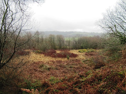
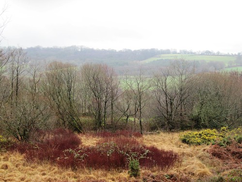
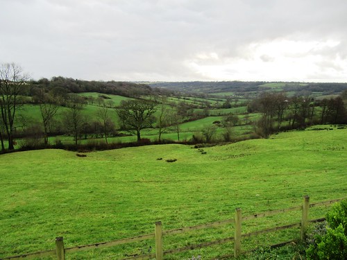
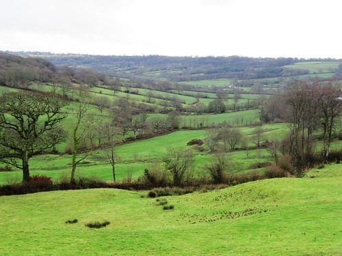
Down in the flat bottom of the Culm Valley the River Culm chuckled over rapids in its red earth bed. Against the sombre brown of bracken and black of the trees, scarlet shoots of dogwood and yellow bursts of gorse flowers made splashes of colour to brighten the late winter day. A cock pheasant, betrayed by the white flash of its neck collar, scuttled away through the sodden grass and squelching hoof-pocks. In a barn we found an ancient Ford Popular, its pop-eyed headlamps and elongated mouth of a radiator grille giving it the expression of a shocked schoolmarm in mid-shriek.
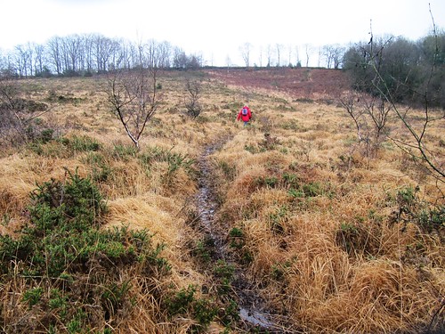
The rain slackened and went away eastwards, leaving a crack of duck-egg blue overhead. The first primroses of the year made a sulphurous splash in the hedges of Ashculme Farm. We climbed the slope of Clayhidon Turbary, an old common where the villagers once cut peat for their fires and furze for their animals’ winter bedding. Half an hour later we were out of muddy clothes and steaming boots, and in by the Half Moon’s fire. Proper job, as they say hereabouts.
Start & finish: Half Moon Inn, Clayhidon, Devon EX15 3TJ (OS ref ST 161155)
Getting there: 5 miles south of M5 Jct 26 (‘Wellington’), via A38, Ford Street and Hunter’s Lodge
Walk (5 miles, easy, OS Explorer 128): Leaving Half Moon Inn, left along road. In 150m, right (162157; fingerpost/FP) up steps. Follow yellow arrows/YA past Smith’s Farm. Left along track; in 100m, through gateway (164157) and right down fence. Cross stream (165156), up through gate and woodland (YAs) to track (166154). Right; in 100m, left (FP) up farm track. Through gate, past horse ring and on (hedge on left). Through double gate; on to angled corner of hedge ahead (170155); aim ahead for house and barn at Applehayes. Down left side of barn to Applehayes Lane (173155). Right for 700m, passing Barne Farm. At foot of lane, at house marked ‘Shepherds Hill’, right up path (171149; FP). In 100m, left along fence and follow path downhill. In 250m, left (YAs) downhill through bracken. Bear to right of wet woodland to go through gate; right through next gate, and left through one below (YAs); down hedgebank to lane at Bellett’s Farm (170145).
Right for 600m; left at T-Junction by Parish Hall (164143). In 150m, left (164142; FP) through gate opposite Clayhidon Mill and follow path on right bank of River Culm (YAs) for ¼ mile to Bridgehouse Bridge (160141). Cross lane, and on. In 2nd field, after 100m bear up bank and through gate on right (YA). Clockwise round field to YA on post, halfway up far hedge. Cross footbridge and stile; on up hedge to lane (155142). Right; in 20m, left over stile and on with hedge on right. Above Gladhayes Farm, in 2nd field bear right through gate and left along hedge. Through gate (150143, YA); down green lane. In 50m, straight ahead through gate and on past barn, down track to tarmac lane (149144); left downhill to road (148142).
Right for ½ mile, passing Tanhouse Farm (148147). Bear right at Middle Ashculme Farm (147149, FP); pass barn and keep ahead (don’t fork left through stockyard!); through 2 gates and follow concrete farm track. At end of 2nd field, right (148152, FP) across stream, through neck of scrub woodland and on up field (YA). Left through gate. Round left side of barn and over stile (151152, YA) in right-hand corner of field (NB very muddy hereabouts!). Up field to gate into trees (YA); cross green lane (152152) and on up slope of Clayhidon Turbary. Don’t try to follow footpath that bears right as shown on OS map, but follow clear path up to ridge and gate into lane (FP). Don’t go through the gate, but turn left along grass path by hedge. Through gate at end (155153, YA); up bank; through gate to left of barn; on through gate; lane to cross road (158154). On along bridleway (FP). Bear right around Glebe Barn, back to Clayhidon.
Lunch: Half Moon Inn, Clayhidon (01823-680291; halfmoondevon.co.uk) – excellent village pub
More info: Tiverton TIC (01884-255827); visitdevon.co.uk
www.ramblers.org.uk www.satmap.com www.LogMyTrip.co.uk
Click on Facebook “Like” link to share this walk with Facebook friends.