Search Results : devon

Apr 252009
 

First published in: The Times Click here to view a map for this walk in a new window
picture picture picture picture picture picture picture
Facebook Link:

On this cloudy spring day, Tillicoultry looked just as I remembered it: a neat, proud Clackmannanshire mill town, with the Ochil Hills rearing 2,000 feet behind in a dramatic green wall. The mills had long fallen silent along the River Devon, but sheep still dotted the hill slopes like flecks of snow. St Serf, Tillicoultry’s own 6th-century miracle worker and missionary, would have enjoyed the sight. The saint, a keen shepherd, had his own flock under special protection. When a rustler stole, roasted and ate Serf’s pet ram, and then boldly denied the crime, the very mutton was heard bleating inside the guilty party’s stomach.

Nowadays the winding River Devon runs at the feet of the Ochils in company with the Devon Way, a beautifully landscaped footpath and bridleway established along a disused railway line. I walked briskly, trying to work off a bacon-and-haggis breakfast, with the slow-flowing Devon on my right hand and the tremendous green and black rampart of the hills on the left. Along the old railway the ash buds were clamped shut and hawthorns still thick with last autumn’s shrivelled berries, but a song thrush in an elder bush was busy trying to charm the laydeez.

Along the valley in Dollar, the Dollar Burn came sparkling from its steep glen through the town. I climbed a steep and slippery pathway up the rocky cleft of Dollar Glen where the Burns of Care and Sorrow sluiced down black rock chutes to mingle in the stream of Dolour. Gloomy names, and a doom-laden history to the castle that blocks the throat of the glen on a formidable bluff. Impregnable it must have seemed to the Campbells who built it, warmed themselves before its enormous stone fireplaces, and shut their captured enemies away out of sight and mind in its cruel and terrible pit prison. Bonnie Montrose couldn’t take Castle Campbell – Castell Gloum was its ominous nickname – when he tried during the Civil War. But the Macleans destroyed it in 1654, firing the stronghold with flaming arrows while the garrison was out scouring the hills for food.

I climbed the spiral stair, to a roof-top view that had me gasping – Dollar below, a gleam of the Firth of Forth amid southern hills thirty miles off, Saddle Hill and King’s Seat towering to the north, seemingly just overhead. Then I descended from Castell Gloum down the Burn of Sorrow, back along the old railway line where mating frogs filled the ditches and wrens sang as if man and his bloody inclinations had never been invented.

Start & finish: Sterling Mills car park, Tillicoultry FK13 6HQ (OS ref NS 920965).

Getting there: Buses (www.traveline.info) from Glasgow, Stirling, Alloa, St Andrews

Train (www.thetrainline.com) to Alloa (3 miles)

Road: A91 from Perth or Stirling to Tillicoultry; car park off A91, on A908 Alloa road.

Walk (8 miles, easy/moderate grade, OS Explorer 366): Follow Devon Way to Dollar. Left through Dollar, then Dollar Glen to Castle Campbell (962993). Cross Burn of Sorrow above castle (959995), and turn left. In 200 yards, left downhill; path crosses 4 footbridges below castle, then rises to west rim of glen (960991). Follow West Glen signs to descend to cross Dollar Burn (963988); return to East Burnside (963983). Lane past Dollar Golf Club and Belmont House; cross A91 (47978); left, then right to Devon Way (950977); right to Tillicoultry.

NB – Detailed directions, online map, more walks: www.christophersomerville.co.uk

Detailed map of paths in Dollar Glen:

http://walking.visitscotland.com/walks/centralscotland/dollar-glen

Conditions: Steep, slippery paths in Dollar Glen; dogs on leads in Dollar Glen

Lunch: Plenty of places in Tillicoultry and Dollar

More info: Tillicoultry TIC (0870-720-0605); www.visitscotland.com


 Posted by at 00:00
Aug 182007
 

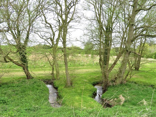
Splashing through the shallows of the River Torridge, I was keeping half an eye out for otters. I knew my chances of seeing Tarka or one of his ilk mid-morning – even such a beautiful, hazy spring morning as this – were minimal.

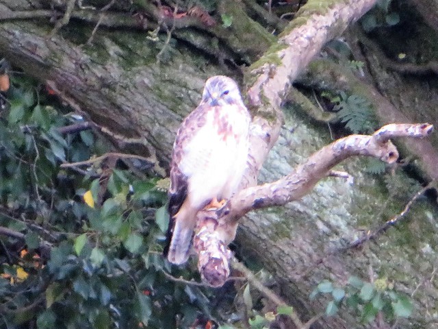
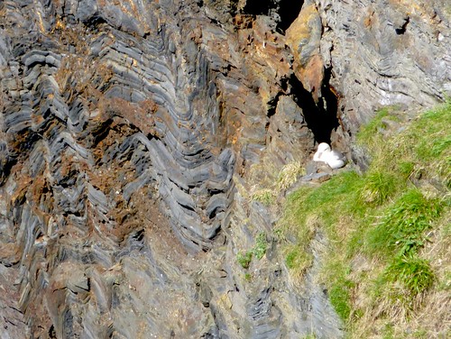
Otters are essentially nocturnal creatures, and very shy of humans. But a mother and cubs had recently been spotted by day nearby, a mile or so downriver at Beam Weir. The sleekly furry little water-wanderers have been reported spreading once more along the rivers of North Devon after decades of near-extinction. Here in the country of the most famous – though fictional – otter of them all, I just couldn't prevent myself hoping against hope.

Henry Williamson wrote Tarka the Otter 80 years ago, covering hundreds of miles on foot with the local otter hunt and uncounted more on solo expeditions as he researched his story meticulously.

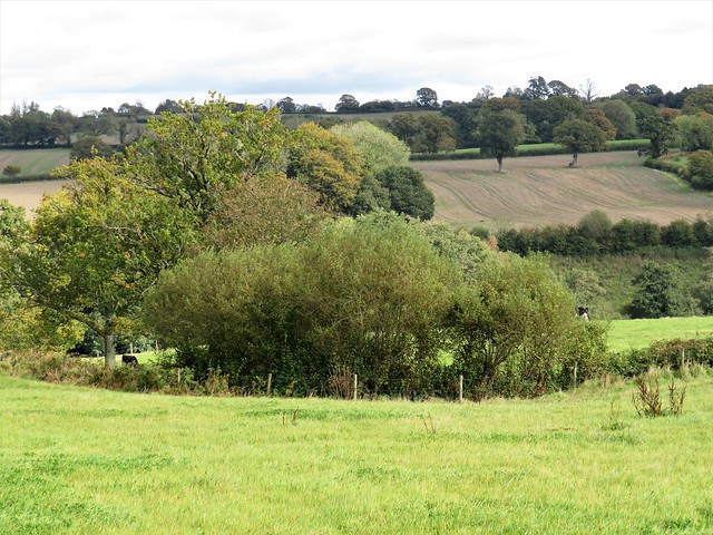
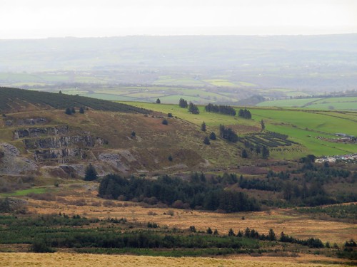
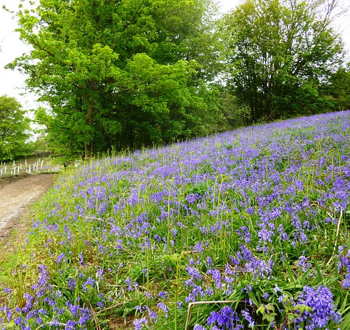
Wandering in his footsteps today around North Devon and the Country of the Two Rivers, Torridge and Taw, I found it quite astonishing to discover how little had changed at otter's-eye level – or, to put it another way, just how careful and accurate had been Williamson's descriptions of the river banks, the flood islands, the trees and meadows, the bridges, the flowers growing among the stones.

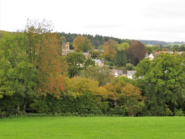
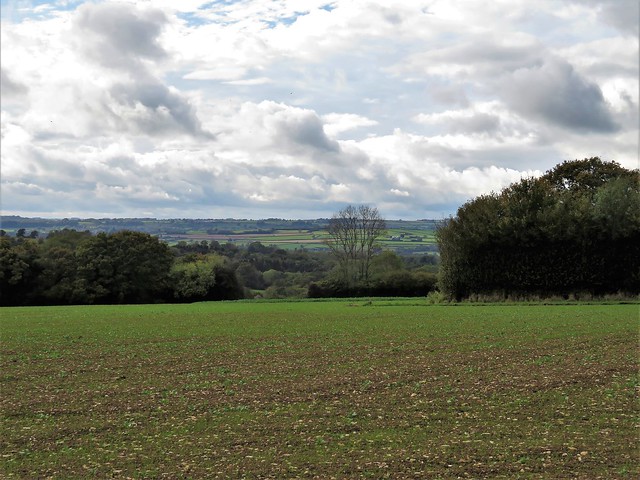
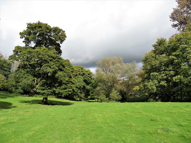
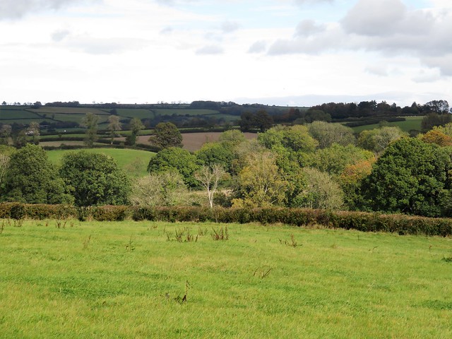
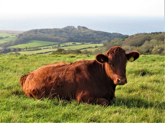
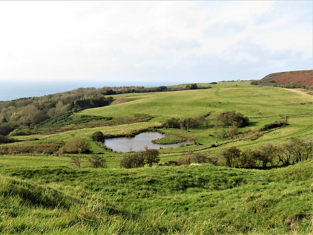
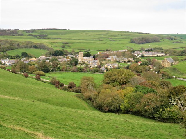
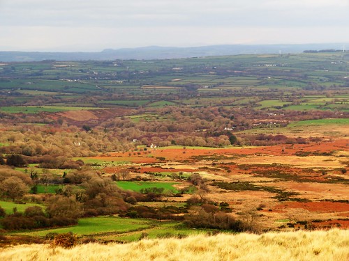
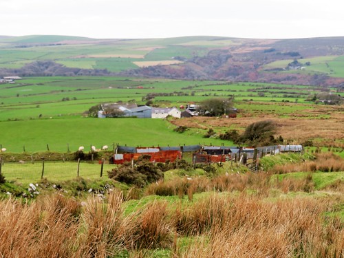
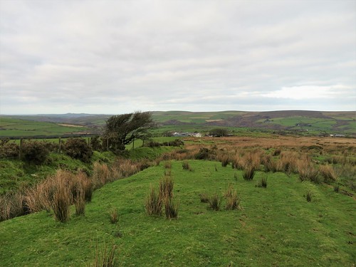
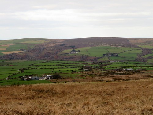
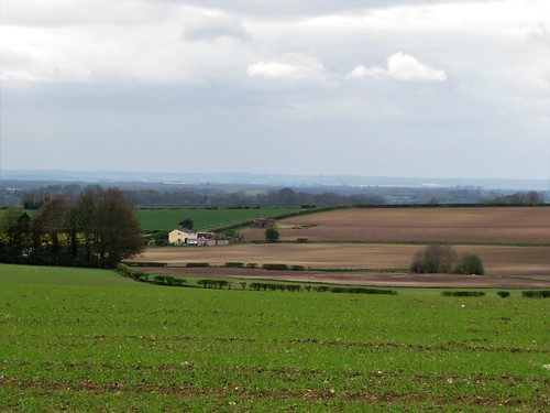
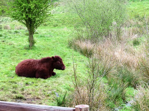
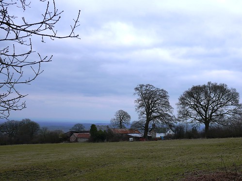
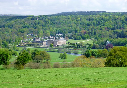
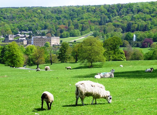
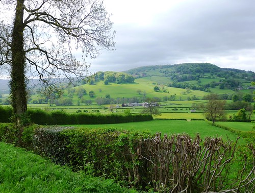
Roads have been built, railways closed, new housing thrown up around old town centres since Williamson lived and roamed here. But the rivers and woods, the high bogs and heather tracts of Exmoor have altered remarkably little.

Henry Williamson, born in 1895, served in the trenches during the First World War. This extremely sensitive, highly strung and romantic soul never recovered from the horror and the disillusionment he experienced in Flanders. From 1921 onwards he buried himself in the little North Devon village of Georgeham, seeking an escape from inner torment by exploring and writing about the wild and unfrequented landscapes of Exmoor.

When Tarka the Otter won the Hawthornden Prize for Literature in 1928, fame came, too. But it didn't make Williamson happy. He was a prickly customer, an outsider, who could be witty and charming or crushingly rude and intolerant as the mood took him.

In the 1930s he embraced Fascism with a naïve conviction that turned many of his friends against him. He almost drove himself mad, and did drive his family to despair and eventual break-up, by taking on the reclamation of a derelict Norfolk farm during the Second World War.

After the war he returned to Georgeham and spent much of the rest of his life in a spartan writing hut he built on the hill above the village. He died in 1977, author of dozens of books, recipient of no honours or public recognition.

All this sadness was far from my mind as I commenced my wanderings in the pawprints of Tarka. Through my hands in childhood had passed most of Henry Williamson's nature writings – Salar the Salmon, The Old Stag, Tales of Moorland and Estuary and, of course, the incomparable Tarka the Otter.

I loved them all – their romance and high adventure, their tiny details and flashes of humour, their absolute truthfulness to nature. The countryside of North Devon was for evermore to be seen by me through Williamson-coloured spectacles. For me he remains the supreme writer of the English countryside.

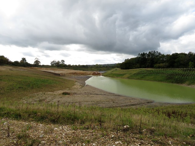
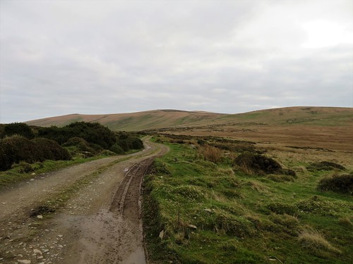
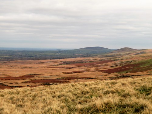
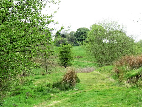
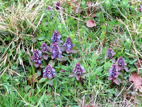
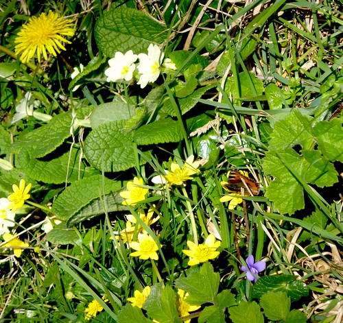
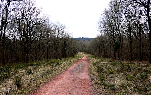
I started in the middle of Exmoor, its loneliest stretch of ground up at Pinkworthy Pond and the bare sweep of moorland known as The Chains. Heather and coarse grass squelched under my boots, water squirted with every step and the sharp, spring wind carried a curlew's mournfully bubbling cry.

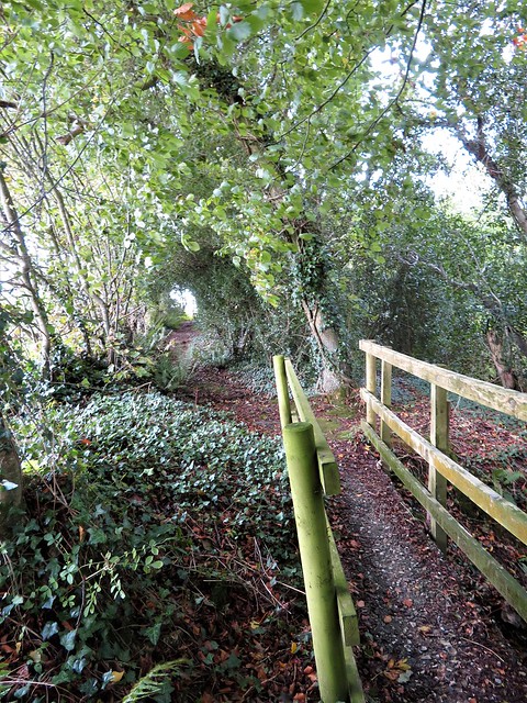
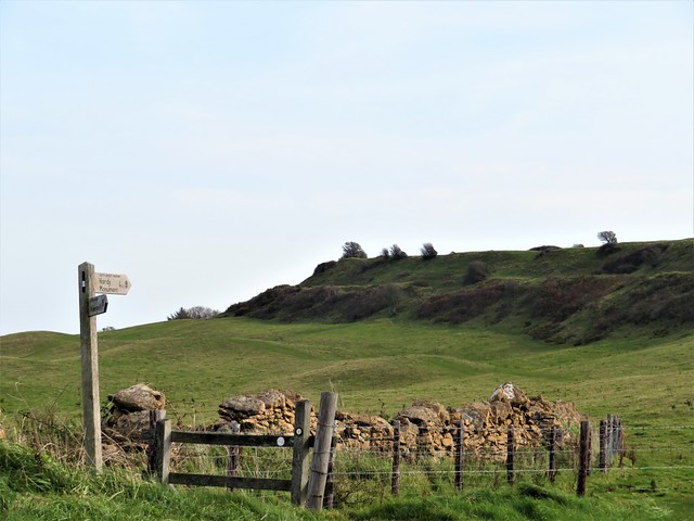
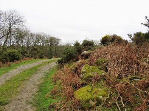
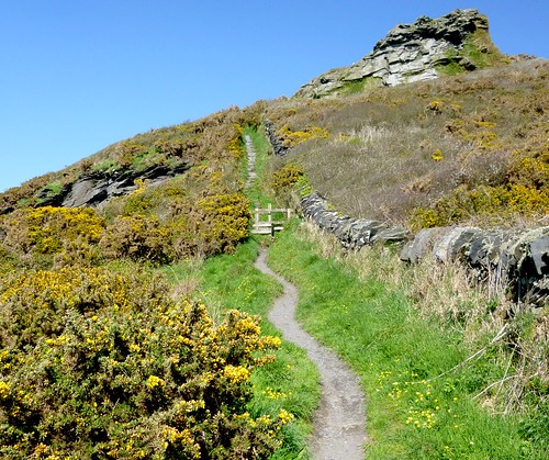
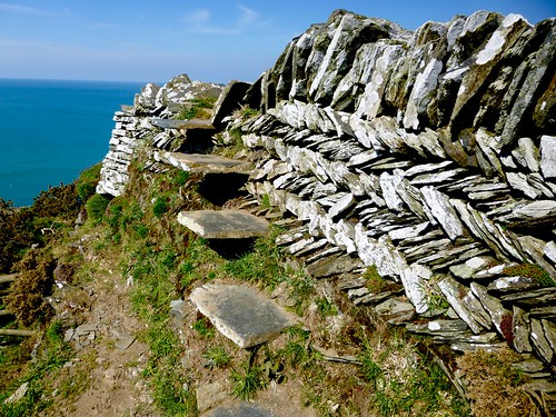
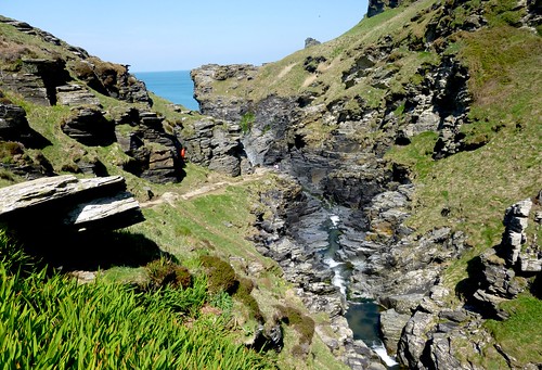
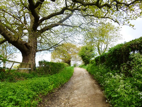
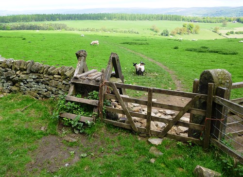
Tarka would recognise the steely waters of Pinkworthy Pond where he hunted for frogs, and the remote goyal or valley of the Hoaroak Water down which he journeyed to the sea at Lynmouth. It was a boggy footpath that carried me seawards on the otter's track, a section of the 180-mile Tarka Trail whose waymarks I came across time and again on these foot expeditions in Henry Williamson country.

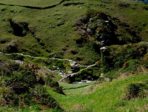
Down on the East Lyn Water I came to Watersmeet, a renowned beauty spot where the Hoaroak Water tumbles to meet the East Lyn among trees. Here, Tarka grappled with his mortal enemy Deadlock the otterhound, escaping hound and hunters to make his way to the sea and the safety of the coast.

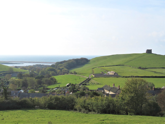
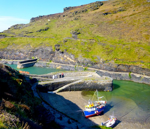
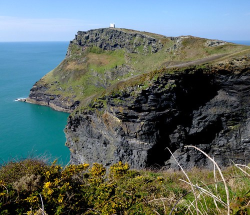
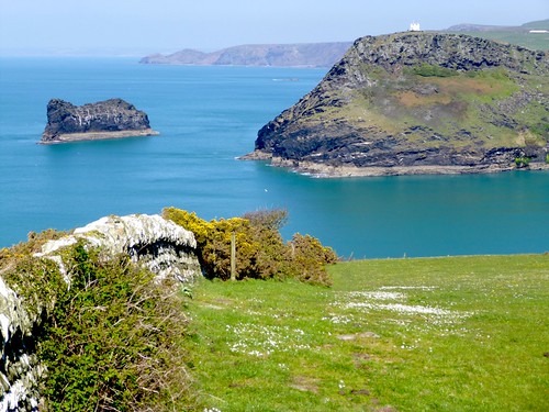
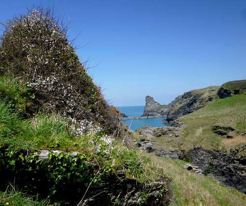
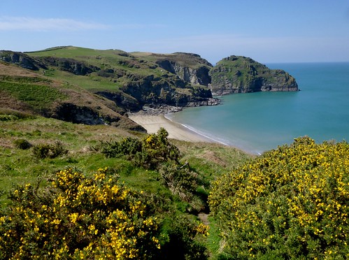
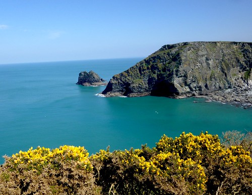
I followed the cliff roads round to the great westward-facing scoop of Morte Bay, two miles of shining sand enclosed between the sentinel headlands of Morte Point and Baggy Point. Surfers were making the most of the wind-whipped rollers in the bay as I sat looking out to the Morte Stone, a rock rising from the tiderips where Tarka hunted bass. Later I caught the last of a spectacular red sunset out at the tip of Baggy Point, a favourite haunt of Henry Williamson's when he was living at Georgeham a mile or so inland.

In the morning I followed the final act of the Tarka drama from Great Torrington down the River Torridge, biking and hiking along the Tarka Trail from the mill house where Tarka hid on the waterwheel (still there) at the start of the hunt to the mouth of the estuary where the otter closed with Deadlock the hound and dragged him down to drown in the ebbing tide.

As the hunters stood round the body of the hound, "a great bubble rose out of the depths and broke, and as they watched, another bubble shook the surface, and broke; and there was a third bubble in the sea-going waters, and nothing more." So passed Tarka.

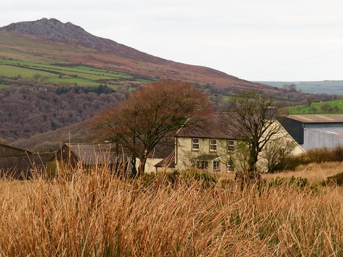
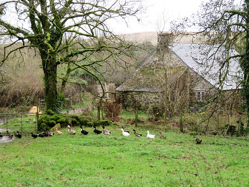
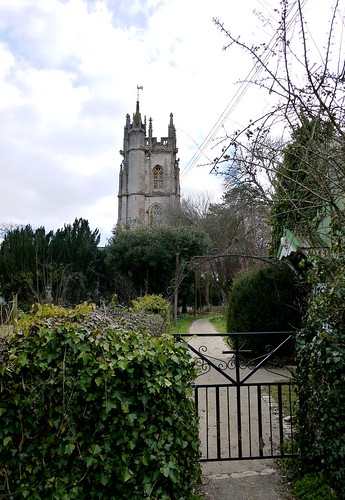
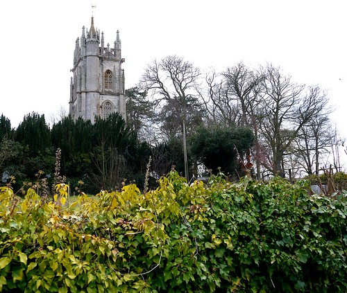
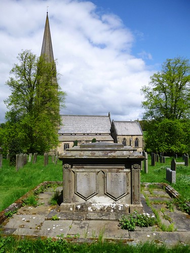
My last day in Williamson's North Devon I spent mooching around the writer's adopted village of Georgeham. The thatched cottage that he rented for £5 a year, last in a short row under the church tower, still carries the name he gave it, Skirr Cottage.

Just up the lane, a blue plaque has been fixed to the house to which he moved as his family expanded. But there's not a great deal else in Georgeham to commemorate the man who lies between Skirr Cottage and church tower under a black slate stone inscribed with his barn owl colophon or trademark and the simple comment, "Here rests Henry Williamson".

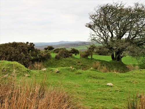
Up on the hill above the village at Ox's Cross, Williamson's writing hut is preserved in the grove of pine trees he planted. The views over fields, estuary and moor are stunning.

Inside the elm-board hut he built, Williamson's boots stand against the wall and his tatty old plaid jacket hangs across the back of his chair. A pair of spectacles lie folded on the blotter, as if their owner had just laid them down to go outside for a moment. I could easily believe that the man himself might appear in the doorway, perhaps to blare out, "What the bloody hell do you think you're doing in my hut?" – or maybe to allow me to shake his hand and tell him how his masterpieces of country writing had shone like beacons of delight in a boy's imagination.

Essentials

Getting there

Rail to Barnstaple (08457 484950, www.thetrainline.co.uk). Car: M5 to Jct 27, A361 to Barnstaple.

Getting around

Maps OS Landrangers 180, 181; Explorers OL9, 139.
Tarka Trail 180-mile circular walking trail connecting many Tarka sites. Meeth-Braunton (32 miles) suitable for cycling. Free Tarka Country leaflet with map, places to visit, information on cycle hire, refreshment stops: call 01271 336070.
Bike hire Torrington Cycle Hire, Station Yard, Great Torrington (01805 622633 ); Tarka Trail Cycle Hire, Railway Station, Barnstaple (01271 324202 ); Biketrail, The Stone Barn, Fremington Quay (01271 372586/07788 133738, www.biketrail.co.uk); Bideford Bicycle Hire, Torrington Street, East-the-Water, Bideford (01237 424123).

Staying there

Yoldon House Hotel, Durrant Lane, Northam, Bideford, EX39 2RL (01237 474400, www.yeoldonhousehotel.co.uk): stylish and welcoming, on the Torridge Estuary; double b & b from £110; short-break deals available.
The Croft, Ox's Cross, near Georgeham (inquiries 01271 816345, www.coastal-cottages.com): cottage where Henry Williamson lodged; self-catering weekly rate from £225 (low and mid-season), £545 (high).

More information

  • Henry Williamson Society (webmaster@henrywilliamson.co.uk, www.henrywilliamson.co.uk) offers talks, meetings, books, tapes and videos on the life of Henry Williamson. UK adult membership, £12; family, £15. Members can visit Williamson's Writing Hut at Ox's Cross, by arrangement.
  • Barnstaple TIC, The Square, Barnstaple (01271 375000, www.discoverdevon.com). Among useful publications available here are Tarka Country Explored by Trevor Beer, Pub Walks Along The Tarka Trail by Michael Bennie, and Henry Williamson, A brief look at his Life and Writings in North Devon by Anne Williamson and Tony Evans.
  • Background reading Tarka the Otter by Henry Williamson (Puffin Modern Classics, £6.99). The Illustrated Tarka the Otter (Webb & Bower, 1985), with photographs by Simon McBride, is out of print but obtainable on-line.
  • www.northdevon.com
 Posted by at 00:00
Dec 092022


First published in: The Times Click here to view a map for this walk in a new window
Thorncombe near Forde Abbey Farm footbridge over Stonelake Brook near Thorncombe fungi on the Monarch's Way near Thorncombe IMG_5264 flooded gravel workings at Westmills Plantation rain approaching parkland near Forde Abbey IMG_5255 bushy hollow near Thorncombe near Thorncombe

The old wool-trading and lace-making village of Thorncombe lies up and down its sloping street, a handsome huddle of old cottages in a steep, remote piece of countryside where Dorset tips over into Somerset.

The sun was finally groping its way through the clouds after days of miserable rain. The fresh wind and brilliant autumn colours of the woods put a spring in our step as we followed the rim of the deep ferny cleft of Stonelake Brook.

The Monarch’s Way led north through pastures where the wet grass polished our boots for us. Flints underfoot crunched and crackled. Off on our left side the church and houses of Thorncombe sloped down their hillside, framed by oaks and beech trees in wind-tattered gold and scarlet.

Down at Synderford bridge we picked up the Jubilee Trail and followed it north across the red mud squelch of rain-swollen brooks and the broad clover leys on Chitmoor. Devon Ruby cattle grazed the fields at Wheel House Lane, the sturdy little bull inspecting the females with close solicitude.

A screeching chorus of pheasants arose from a maize field as we neared Forde Abbey, where the last of the afternoon was slanting across the old monastic buildings. The view down the drive from the ornate gates was of a surf of pink, white and purple cyclamen along the lime avenue leading away to beautiful gardens and fountain pools.

Just beyond Forde Abbey the meanders of the River Axe mark the Dorset border. We crossed the bridge into Somerset and turned west through lush river meadows dotted with fine old cedars. Along the river, the pink blooms of Himalayan balsam opened their spotted throats to release a spicy fragrance. We edged round a deep gravel pit, pushed our way through an elephantine jungle of maize nine feet tall, and skirted the empty yards of Forde Abbey Farm.

Now the sun made a belated return, streaking the sky with patches of blue and fringing the clouds with a sharp lining of silver. Lemon yellow beech leaves scuffed under our boots as we came past Whistling Copse and turned for home.

A great view of rolling country to west and east, and we were crossing Thorncombe’s cricket field where goldfinches in a flicker of wings were gobbling up the grass seed laid on the pitch by the groundsman in hopes of a perfect surface for next summer’s opening match.

How hard is it? 6½ miles; easy; field paths. NB GPS and OS Explorer map are helpful for route-finding.

Start: St Mary’s Church car park, Thorncombe, Dorset TA20 4NE (OS ref ST376034)

Getting there: From Crewkerne (A30, Chard-Yeovil) follow ‘Forde Abbey’, then ‘Thorncombe’.

Walk (OS Explorer 116): Path through churchyard to road; left to junction at chapel (376032); right uphill. In 100m pass ‘Old Alley’; left (375032, fingerpost/FP). At stile, ahead (yellow arrow/YA); in 2nd field, stile (377027, ‘Liberty Trail’) through trees. In 200m, sharp left on Monarch’s Way/MW (377025) to pass Yew Tree Farm (383031, ‘Wessex Ridgeway’). At road, right (380035).

At Synderford sign, left (382037, FP, Jubilee Trail/JT), skirting water treatment plant. Cross brook; bear right up field slope with hedge on right to gap (380037, JT). On by hedge, following JT waymarks to cross brook in trees by stepping stones (376041). Left up hedge, left through hedge at top of bank (375043); right to kissing gate/KG. Follow right-hand hedge; in 200m, right (374045, KG); left up hedge. In 200m, left with hedge on left (374047); follow JT to Wheel House Lane (371048).

Left; opposite Thorncombe turning, right (366047, FP, JT) across fields to road (362053). Right past Forde Abbey gates, across River Axe. Left (362054, ‘Horseshoe Road’). In ½ mile, recross Axe (356051, YA). Follow Liberty Trail/LW and YAs clockwise round gravel excavation at Westmills Plantation (354050). Cross road (355046, ‘Forde Abbey Farm’) across field. Skirt to right round Forde Abbey Farm buildings (357042); follow farm drive. At fuel tank fork left (363037, blue arrow) across field to Horseshoe Road (366037). Right (LT). In 200m bear right along hedge (366036, FP). In 650m path descends and bends right; left here (368030, stile) to stile in conifer hedge (370030). Across recreation ground to cross road (371031), then more fields (YAs) to Thorncombe.

Lunch: Bell Inn, Winsham TA20 4HU (01460-30677)

Accommodation: Haymaker Inn, Wadeford, Chard TA20 3AP (01460-64161, thehaymakerinn.co.uk)

Info: Chard TIC (01460-260051); fordeabbey.co.uk

 Posted by at 16:52
Oct 162021


First published in: The Times Click here to view a map for this walk in a new window
St Catherine's Chapel from the hill above Abbotsbury 1 St Catherine's Chapel from the hill above Abbotsbury 2 Iris foetidissima or Stinking Iris What a gem! A Devon Red Ruby cow on the ridge above Abbotsbury. view from the ridge looking north from the ridge path ramparts of Abbotsbury hill fort field mushroom near the hill fort old limekiln above West Bexington Abbotsbury from the hill near St Catherine's Chapel 1 St Catherine's Chapel Abbotsbury from the hill near St Catherine's Chapel 2

Under a clearing sky and a brisk wind we set out among the cottages of Abbotsbury with their walls of deep golden stone under grey-green thatch. Chicken, duck and goose eggs were for sale at the farm in Rosemary Lane.

Stony, sunken Blind Lane led away uphill between horse pastures. From here we looked back over Abbotsbury and its steep guardian hill topped by St Catherine’s Chapel, the shingle bar of Chesil Beach enclosing the long inlet of The Fleet, and the leonine form of the Isle of Portland with its long back and tail sloping down into the dull sea. Half a dozen dark lumps lay beyond, giant container ships at anchor off Weymouth.

Up over the corrugations of medieval strip lynchets to the ridge, where the South Dorset Ridgeway ran out west along a bracken-brown bar of downland parallel to the sea. An ancient ceremonial landscape where Neolithic long barrows and Bronze Age round barrows lay side by side. The tribal leaders of 3,000 years were laid to rest on this high eminence overlooking land and sea.

On the ramparts of Abbotsbury hillfort a female stonechat sat on a gorse tip, her breast a soft buff pink, a bold dark stripe through her eye. Looking west from here we had a grand prospect of the Jurassic Coast all round the great curve of Lyme Bay, with the crumbling cliffs of Golden Cap shining a rich gold in the muted late-year light.

A cobbled green lane descended to West Bexington between hedges bright with fruit – hard red blackberries, shiny black dogwood berries, the burnished scarlet of hawthorn peggles, and old man’s beard draped over the stone walls.

The single street of West Bexington sloped down to the seafront, where beach fishermen cast their heavy leads in hopes of bass or codling. We turned east into the wind and crunched along a beach of pebbles almost as small as sand. Pale leaves of sea kale like elephant ears grew on the scrubby maritime sward, along with thrift flowers now dry and silvery.

On the seaward side of Abbotsbury we climbed steeply across strip lynchets to reach St Catherine’s Chapel, massively buttressed in thick dark gold stone on its hilltop. In medieval times the maturer maidens of Abbotsbury would make an annual pilgrimage to offer a fervent prayer in the chapel on the hill:
‘A man, St Catherine,
Please, St Catherine,
Soon, St Catherine!’
… following that with: ‘Arn-a-one’s better than narn-a-one, St Catherine!’

Flora: blackberries, dogwood berries, hawthorn peggles (berries), old man’s beard
Birds: female stonechat

How hard is it? 8½ miles; moderate; downland tracks, shore path, short steep climb to chapel

Start: Abbotsbury car park, Rodden Row, Abbotsbury DT3 4JL (OS ref SY 578853) – £1 per hour, signposted in village.

Getting there: Bus X53 (Weymouth-Axminster)
Road: Abbotsbury is on B3157 (Weymouth-Bridport)

Walk (OS Explorer OL15): Cross B3157; up Rosemary lane; left on Back Lane. In 150m, right beside Spar House up Blind Lane (578854, ‘Hill Fort’). In 600m, through gate (574859, yellow arrow), then another (blue horse). At ridge, left (571863, gate, ‘West Bexington’). Follow ‘South Dorset Ridgeway’ and ‘Bexington’ signs for 2¾ miles to West Bexington seafront (531864). Left along shore path, then road for 2¼ miles to road end (560846). Ahead along lower edge of car park. Follow ‘Coast Path’ signs for ⅔ mile to 3-finger post; right (568847, ‘Swannery’). In ½ mile, left at stone marker (575845, ‘St Catherine’s Church’). Steeply uphill to chapel (572848); downhill into Abbotsbury.

Lunch/Accommodation: Manor House, West Bexington, Bridport DT2 9DF (01308-897660, manorhousedorset.com).

Info: Bridport TIC (01308-424901)

 Posted by at 01:47

Ships of Heaven – talks and events coming up round the country


2020 Dates:

23 January, 6.45 pm – Henleaze Library, 30 Northumbria Drive, Bristol BS9 4HP

30 January, 1pm – Stanfords Travel Writers Festival, Olympia, Hammersmith Rd, Hammersmith, London W14 8UX – www.stanfords.co.uk/Destinations-Show-Travel-Writers-Festival

17 March, 7.00pm – Southwark Cathedral, London – cathedral.southwark.anglican.org

28 March, 2pm – Balliol Hall, Church Rd, West Huntspill, Highbridge, Somerset TA9 3RN

10 May, 11am – Chiddingstone Castle Literary Festival, Kent – chiddingstonecastle.org.uk

12 May, 4pm – Stratford-on-Avon Literary Festival, Warwickshire – stratfordliteraryfestival.co.uk

29 May-6 June (date TBC) – Derby Book Festival – derbybookfestival.co.uk

25 June – Reform Club, Pall Mall, London

5 September, 3pm – Friends Day, Salisbury Cathedral – salisburycathedralfriends.co.uk

 Posted by at 08:15
May 192018


First published in: The Times Click here to view a map for this walk in a new window
picture picture picture picture picture picture picture picture picture picture picture picture picture picture picture
Facebook Link:

The Preseli Hills march east to west across the heart of West Pembrokeshire, and the Golden Road marches with them – an ancient drove road and highway that hurdles their peaks. Out at the western end of the range the Golden Road climbs gently up the flanks of Foel Eryr, the Eagle’s Peak, and we climbed with it, peat and soakwater squelching underfoot.

By the summit cairn a topograph specified places in view and their distances, but these cold facts and figures could never catch the splendours of this extraordinary view. Lundy lying like a sleeping sea-dog 50 miles off in the south, with a faint hint of the North Devon coast beyond Exmoor’s long spine; the shadowy shapes of the Cambrian mountains far to the north; west to Skomer and Ramsey islands; and in the east the dragon humps of Worm’s Head promontory.

We stood and marvelled, while the mountain ponies of Foel Eryr cropped the grass nearby and nibbled the itches out of one another’s necks. Then it was down over sedgy ground to the lonely farm of Pen-lan-wynt, where wind-bent thorn trees lined the hedges.

This is the land of small farms and smallholdings – Pentrisil, where the fine rich savour of a freshly opened silage clamp wafted across the lane; the stone cottage of Gernos Fawr in a watery dell full of runner ducks; the hillside farm of Gernos Fach, where a young sheepdog leaped gymnastically between the high bars of a gate to fawn on us and lick our hands in welcome.

Beyond the farm a moorland track led away, the cold cloudy sky reflected in its peaty pools. A little way off the track, standing stones stood in the heather – a hip-high pair sloping close together, and a short distance away a fine solo stone of man height, crusted with lichens, upright in a little circular moat of water. A posy of wild flowers had been laid at its foot.

We crossed the road and climbed a boggy old path that snaked up the wet hillside of Rhwngyddwyffordd. Ponies with tangled manes moved reluctantly off the track as we followed it to the saddle. Here we turned for a final stare over bog and hillside, coasts, islands and distant mountains, before a last homeward stretch along the miry ridgeway of the Golden Road.

Start: Bwlch-gwynt car park, near Tafarn-y-Bwlch, Pembrokeshire SA66 7RB approx. (OS ref SN 075322)

Getting there: Bwlch-gwynt car park is on B4329 (Cardigan-Haverfordwest), between Tafarn-y-bwlch and Tufton

Walk (6½ miles, moderate, OS Explorer OL35): Cross B4329; path to Foel Eryr summit (066321). Keep same line descending. At fingerpost with arrow (061321), right on path. In 300m at another fingerpost with arrow (061324) fork left, soon bearing downhill to wall. Right to 4-finger post (060327); follow wall to Pen-lan-wynt farm (058330). Follow blue arrows/BA to track (057333), then road (055337). Right; 250m beyond Pentrisil, right (062342, ‘Tafarn Bwlch, Pembrokeshire Trail’). Follow track past Gernos-Fawr (069341, BAs); up green lane to gate (069344); right (bridleway fingerpost) to Gernos Fach (075343). Right (fingerpost) on track to B4329 (084337). Right; in 350m, fork left (082333, BA) up hill track for ¾ mile to fence at Bwlch Pennant (085321). Don’t go through gate; turn right along fence to car park.

Conditions: Very wet and boggy in parts

Lunch: Tafarn Sinc, Rosebush SA66 7QU (01437-532214, tafarnsinc.co.uk) – 3 miles

Accommodation: The Harp Inn, Letterston SA62 5UA (01348-840061, theharpatletterston.co.uk)

Info: Fishguard TIC (01437-776636), visitwales.com; satmap.com; ramblers.org.uk

 Posted by at 01:10
Apr 282018


First published in: The Times Click here to view a map for this walk in a new window
picture picture picture picture picture picture picture picture picture picture
Facebook Link:

A brisk spring day in the southern folds of the Lincolnshire Wolds offered us a walk of two very distinct flavours. The first half snaked through the steep green valleys of Snipe Dales; the second strode across broad uplands with mighty views.

Snipe Dales Nature Reserve is beautifully tended by Lincolnshire Wildlife Trust. This is a damp, deep bowl of country full of birdsong, where many springs rise. A shallow stream meanders and bubbles between flowery banks, artfully shaped to slow the flow and nurture a richer palette of wildlife.

A crowd of crows a hundred strong strutted in the furrows of a newly harrowed field, snatching up leatherjackets in their sharp black beaks. We crossed a road where a shallow ford ran sparkling in wrinkles across the way. Then we turned west on a broad trackway that led over the hills and between a brace of recently erected stone circles, before diving down once more into the damp wooded depths of Snipe Dales.

Beyond the tall brick block of Winceby House on its ridge road, the scene changed as though one backdrop had been snatched away and another substituted. Wild flowers and birdsong vanished, as did the lush intimacy of the deep green dale. Up here the landscape seemed to widen all in an instant, shooting off south and west across low-lying countryside, out to the towers of Lincoln Cathedral standing tiny and sharp-cut against the rainy sky nearly thirty miles away.

We walked the margins of enormous silent ploughlands under a great bowl of sky. Field shapes were geometric, colours flat and simple – brown for ploughed earth, green for corn, yellow for oil-seed rape. It was easy striding through a top-of-the-world landscape.

Down below the uplands, in the ominously named Slash Hollow, a troop of Cavalier horsemen were hacked to death by their Roundhead pursuers at the start of the Civil War. They had become trapped at a country gate they couldn’t open. Such horrors seemed an age and a world away as we descended from the broad sweep of the arable uplands into Snipe Dales, with all the intimate details of nature close at hand once more.

Start: Snipe Dales Country Park car park, near Hagworthingham, Lincs PE23 4JB (OS ref TF 331682)

Getting there: Signed from A158 (Skegness-Lincoln] and B1195 (Horncastle-Spilsby)

Walk (5 miles, easy, OS Explorer 273. Snipe Dales trail leaflet from dispenser in car park): Pass office/toilets. Follow broad track downhill. In 400m, at path crossing (335685; pine tree waymark to left; ‘Path to Pond’ to right) keep ahead (‘Bolingbroke Way’). In 400m at T-junction, right (338687, ‘Hagworthingham’) on fenced path to road (346689). Don’t cross ford; cross road and keep ahead (fingerpost, stile, yellow arrow/YA, ‘Furze Hill’) up field. 2 stiles to gravel path; left to road (346697). Left; at lower road, left; in 70m, right (344691, fingerpost), following track across wolds.

In ¾ mile, between 2 stone circles, fork half left through hedge (333689, white arrow). In 300m through gate (YA), along path into Snipe Dales Nature Reserve. Cross stream (331687); at 2-finger post, right (YA). In 200m, left fork through gate; in 200m, don’t cross footbridge on left (326686) but keep ahead on right bank of stream. Path crosses stream at hydraulic ram (323686), and rises to go through gate (‘Nature Reserve Car Park’). Path to ruined graveyard (321684); through gate, left over stile (YA). Cross field to stile (YA); driveway to B1195 at Winceby (321682).

Right; in 150m, left (fingerpost) through trees, then fence (YA). Ahead down field edge with hedge on left. At bottom of field bear right round field edge; in 150m, left over stile (314677, YA). Half left across field to fingerpost and lane at Old Ash (313676). Left; in 400m, just before right turn (‘Hameringham’), left through hedge (312672, fingerpost, YA) on track eastwards across fields (YAs). Approaching Asgarby in 1 mile, cross stile (327668) and keep to right of pond. Stiles, YAs to drive (330670); right to road. Left for nearly 1 mile to cross B1195 at Winceby (322682).

Stile, YA, ‘Greenwich Meridian Trail’; ahead to YA post; right across field to stile (324684, fingerpost). Grass path into Snipe Dales Nature Reserve; then follow red square markers on right bank of stream for ½ mile back to car park.

Lunch: Picnic

Accommodation: Admiral Rodney Hotel, Horncastle LN9 5DX (01507-523131, admiralrodney.com)

Snipe Dales Nature Reserve: 01507-588401, lincstrust.co.uk

Info: visitlincolnshire.com; satmap.com; ramblers.org.uk

 Posted by at 14:24
May 022015


First published in: The Times Click here to view a map for this walk in a new window
picture picture picture picture picture picture picture picture picture picture picture picture picture picture picture picture
Facebook Link:
There’s no shortage of plumed helmets, dragon-roaring shields, coats of mail, crossbows and swords – some of these real enough to cleave a foe in twain – in English Heritage’s child-friendly shop at the gates of Tintagel Castle.

I crossed the footbridge slung over the chasm that separates the mainland from the castle on its massive, rock-like promontory, known as The Island. Here, protected by sheer cliffs on all sides, a prosperous community traded tin for Mediterranean pottery and glassware in post-Roman times. And here, if the ancient chroniclers and poets can be believed, Arthur the Once and Future King was conceived of an adulterous union (magically facilitated by the wizard Merlin) between the British King Uther Pendragon and the Duke of Cornwall’s wife, beautiful Igraine.

Was Arthur born at Tintagel? Or was he washed up there on a tempest-driven wave, to be raised by Merlin in the cave that still underpins The Island? And what of the ancient stone inscribed with Arthur’s name, unearthed at Tintagel in 1998? I pondered these signs and wonders as I explored the tiny Dark Ages dwellings and the stark castle ruins on the promontory. Then I set out north along the coast path with the sun on my back and the wind in my face.

It was a springtime day in a thousand, under a sky of unbroken blue. The path wound into and out of hidden valleys, swung up flights of steps and slithered down over slaty rocks. Primroses, white sea campion and pink tuffets of thrift trembled in the strong sea breeze. Herring gulls wheeled and wailed above a sea of milky turquoise two hundred feet below. Ahead, the cliffs crinkled around tiny rock coves, leading the eye forward to a great curve of coast where Cornwall ran north into Devon.

In the gorse banks above Smith’s Cliff, tiny Dartmoor ponies galloped skittishly to and fro. I walked out to the spectacular sheer-sided promontory of Willapark, one among dozens of sections of this precious piece of coastline bought by the National Trust with funds raised through their Neptune Coastline Campaign – 50 years old this very month. Beyond Benoath Cove’s perfect fingernail of dull gold sand lay Rocky Valley, where the Trevillet River jumps down towards the sea over a series of rock steps. I crossed a little grassy saddle near Firebeacon Hill, brilliant with violets and shiny yellow stars of celandine.

Under the white tower of a coastguard lookout, the coal-black cliffs of Western Blackapit stood twisted, contorted and streaked with splashes of quartzite as though a painter had flicked his brush across them. Beyond the promontory, the white houses of Boscastle lay hidden in their deep narrow cleft, appearing in sight only at the last moment as I turned the corner by the harbour wall – a magical revelation of which Merlin himself might have been proud

Start: Tintagel Castle, near Camelford, Cornwall, PL34 0HE (OS ref SX 052889)

Getting there: A30, A395, B3266; or A39, B3263 to Boscastle. Park in village car park (PL35 0HE) – about £5 in coins. Then take bus 595, or taxi (£10, Boscars, tel 07790-983911, boscars.co.uk) to Tintagel. Walk down to castle entrance.

Walk (6 miles, strenuous, OS Explorer 111. NB: online maps, more walks at HYPERLINK “http://www.christophersomerville.co.uk” christophersomerville.co.uk): Follow South West Coast Path to Boscastle.

Conditions: Many steps and short steep sections

Lunch/Tea: Harbour Lights Tea Garden, Boscastle (01840-250953)

Accommodation: Mill House, Trebarwith, near Tintagel, PL34 0HD (01840-770200, themillhouseinn.co.uk)

Tintagel Castle (English Heritage): 01840-770328; english-heritage.org.uk

NT South West Coastal Festival 2015: nationaltrust.org.uk/visit/south-west

Info: Boscastle TIC (01840-250010)
satmap.com; ramblers.org.uk; LogMyTrip.co.uk

 Posted by at 02:13
Feb 152014
 

When the kids were tiny, a winter treat was a visit to the Greyhound Inn at Staple Fitzpaine to watch the morris men. First published in: The Times Click here to view a map for this walk in a new window
picture picture picture picture picture picture picture picture
Facebook Link:
On this cold midwinter day the old grey stone Somerset inn still smelt and felt much as we remembered it from back then, a rich and heady mix of open log fire, furniture polish, beer, good food and a whiff of muddy boots. But I’d forgotten how the church tower stood tall behind its trees in a prickly welter of crocketed pinnacles and the goat-faced, humpbacked gargoyles that are known in this part of the world as hunky-punks.

We went up the long farm track past Staple Park and Staple Lawns, then turned south through the woods and began to climb the escarpment of the Blackdown Hills. The silver grey clouds over the hills parted reluctantly enough, and I felt the lift of the heart that comes with the first honest sun of the year warming a face too long chilled by the east winds of winter. The countryside dipped and rose in waves of grey and cream-coloured stubbles and olive-green pastures rising to the leafless woods on Blackdown ridge.

A buzzard flew down and landed on an oak branch, and we stopped still to admire its speckled breast and fiercely hooked yellow beak. The path led on among the trees, gradually gaining height, with a grand view opening behind us across Taunton Vale for 30 miles to the long blue bar of the Mendip Hills on the northward horizon. We crossed a string of former commons, now partly overgrown with well-managed woodland, in other parts still lying open and pimpled with the tussocky nests of yellow meadow ants. Boggy ground had invaded the small fields around the ruined farm of Britty, and there were the mossy remnants of old cart lanes to follow up to the sandy heights of ancient Neroche Forest.

Saxon kings hunted Neroche, and so did the Norman lords who superseded them. But the broad summit of the range with its wide views to all quarters must always have been a valuable strongpoint. When Robert Count of Mortain, half-brother to William the Conqueror, came to construct a castle at the top of the forest, he founded it on a great ramparted fort that Iron Age tribesmen built up here.

We went up through enormous earthen ramparts to find the motte or castle mound and the ruin of its baileys and ditches among widely spaced oaks and beeches. Between the trees we looked south towards the green hills of East Devon, and then made for Staple Fitzpaine with Somerset’s flatlands and hill ranges spread out before us, a feast of West Country landscape lying waiting for spring.

Start & finish: Greyhound Inn, Staple Fitzpaine, Taunton, Somerset TA3 5SP (OS ref ST 264184)
Getting there: Bus – Stagecoach (stagecoachbus.com) service 99, Taunton-Yeovil
Road: Staple Fitzpaine is signed from Bickenhall, off A358 Taunton-Chard road (M5, Jct 25)
Walk (7 miles, easy, OS Explorer 128): From crossroads by Greyhound Inn, follow ‘Park Farm’ road. In 150m, on left bend, keep ahead (262182). In ½ mile pass Staple Park Farm; keep ahead (‘Bridleway’ fingerpost, blue arrows/BA) through gates on gravel track (‘East Deane Way’/EDW) and Herepath Trail/HP. Dogleg round Staple Lawns Farm. In Oakey Copse, turn left (245185) on broad bridleway. In 1 mile turn right up Underhill Lane (247173). In 300m, opposite cream-coloured house, left through kissing gate (247169, EDW). Ahead along grassy ride, keeping close to fence on left, following EDW and yellow arrows/YA. In 350m go through a gate (248166, EDW), cross a track, through another gate (YA) and keep ahead. In 200m dip to cross a stream beside a wooden railing with EDW arrow. Follow main track uphill to reach T-junction of tracks just below conifers. Left here (EDW, BA) on path, to meet track above Mount Fancy Farm (251163).

Turn right up track; left into wood through gate (EDW). Follow surfaced bridleway, then main path (EDW, HP) for ½ mile to Britty ruin (258160). Right (EDW, BA) along lane. In ¾ mile cross road and on (267159, EDW) into trees. In 150m, track bends left; in 400m, at 3-finger post (271161), turn right (‘Castle Neroche car park’) up track to castle ramparts. Return to 3-finger post; ahead downhill (BA) along Green Lane. At road, right (270167); pass drive, then in 10m right up lane past former chapel. Through V-stile; follow hedge round to left; through another V-stile; ahead through 4 fields by stiles to cross road (274174). Down Crosses Farm equestrian centre’s drive opposite (fingerpost with YA). Over stile by barn; over following gate; through boggy field. Follow path round to right; in 100m, left at fingerpost, through bushes; follow path over rough ground to Perry Hall (seen ahead). Cross farm drive (271179); through gate ahead (YA). In first field keep hedge on right; in 2nd and 3rd fields, hedge on left; cross stream in dip (270183); ahead to Staple Farm on skyline. At road (268184), left into Staple Fitzpaine.

Click on Facebook “Like” link to share this walk with Facebook friends.

Lunch: Greyhound Inn (good food, beer, cheer, smells) – 01823-480227; greyhoundinn.biz
More info: Taunton TIC (01823-336344)

www.ramblers.org.uk www.satmap.com www.LogMyTrip.co.uk visitengland.com

 Posted by at 07:35
Jul 072013
 

A brisk wind was hurrying from the north over Derbyshire, pushing grey clouds down the long valley of the River Wye.
First published in: The Times Click here to view a map for this walk in a new window
picture picture picture picture picture picture picture picture picture picture picture picture picture picture picture picture
Facebook Link:
Looking back from the heights of Rowsleymoor Woods across the valley with its intense greens of pasture and hedges, the farther peaks topped with bushy spinneys under a sky of gunmetal grey and Chartres blue, I thought a palette of two or three colours could catch the whole scene.

A pair of mountain-bikers passed me, panting hard. I followed them across a common of peaty soil and pine trees cushioned with big tuffets of moss, and came out of the trees onto the wide green sheep walk of Calton Pastures. This open grassy upland looks more like the undulating, unfenced pastures of Eastern Europe than anything you’d expect to see in the compartmented farmlands of England. Alone in one corner stood an ornate gingerbread cottage with white bargeboard and elaborate window shutters – the Russian Cottage, built as a full-size copy of a model farmhouse given to the 6th Duke of Devonshire in 1855 by his good friend Czar Nicholas II, Emperor and Autocrat of All the Russias.

The Cavendish family, Dukes of Devonshire, are the power in the land hereabouts. Emerging from New Piece Wood I was overwhelmed by what must be the most striking of all views of their great mansion of Chatsworth House. The building rises beyond the River Derwent’s meadows, an enormous cube of windows and walls among formal gardens, its Emperor Fountain blasting a mare’s-tail jet of water a hundred feet into the air, the pepperpot domes of the 16th-century Hunting Tower rising among the trees beyond. Chatsworth owes a lot of its effect to the sombre wildness of the Peak District moors that back it to the east. A jewel of orderly civilisation in a wilderness setting was the effect that the 1st Duke of Devonshire was aiming for when he built the place in 1687-1707, and even today you can see exactly what he was after.

The 6th Duke was lucky to have the brilliant designer Joseph Paxton as his right-hand man in the mid-19th century when he rebuilt Edensor village just over the hill from the house (having cleared away the existing settlement because it was spoiling his view). I went to pay my respects at Paxton’s tomb behind St Peter’s Church; he lies a little down the hill from the Dukes that commissioned him to design their gardens and glasshouses and estate buildings. Then I went slowly back to Rowsley by way of the flat, wide and lovely meadows along the Derwent.

In 1849 Joseph Paxton designed a beautiful little station for a railway line that was to run up the Derwent valley past Chatsworth. The 6th Duke objected, the line was never built, and now Paxton’s station stands marooned among the retail outlets of Peak Village Shopping Centre in Rowsley – as fine a picture of Dignity and Impudence as you could hope to find.

Start: Walker’s Zone car park, Peak Village Shopping Centre, Rowsley, Derbyshire, DE4 2JE (OS ref SK 258660)

Getting there: Rowsley is on A6 Bakewell-Matlock road
Bus: ‘The Sixes’ (trentbarton.co.uk), Bakewell-Matlock; ‘Transpeak’ (highpeakbuses.com), Matlock-Buxton

Walk (9 miles, moderate, OS Explorer OL24): From Grouse & Claret Inn, right on A6 across bridge. Right up Church Lane (256658), which becomes stony lane. In 1¼ miles, at metal barrier, lane forks (244670). Take upward path to right of right-hand fork (BA, ‘Chatsworth’), following BAs through woods and across Calton Pastures for 1¼ miles to descend to wall at Calton Plantations (243286). Through gate; sharp right along wall (BA). In 200m bear left beside gate (244685). Cross pasture near Russian Cottage, following BA (‘Edensor, Chatsworth’). Through shank of New Piece Wood to gate (247689) and view of Chatsworth House. Half right to waymark post; ahead (YA) past Maud’s Plantation and aim for Edensor church spire.

From Edensor cross B6012 (251700); bear right on stony path to Palladian bridge (257702). Don’t cross, but turn right through meadows on Derwent Valley Heritage Way (DVHW). In nearly 1 mile, at mill ruin, right up bank to cross B6012 (258688); left past car park on path marked ‘Garden Centre, Calton Lees’, then minor road to Calton Lees. Left at junction (257682; ‘Rowsley’ fingerpost). By Calton Lees Cottage, left through gate (257680; ‘Rowsley’); follow wall, then DVHW arrows. At end of 2nd big meadow, right over stile (260667, DVHW); on to lane to Rowsley.

Lunch: Edensor Tea Cottage (01246-582315)

Accommodation: Devonshire Arms, Beeley, DE4 2NR (01629-733259; devonshirebeeley.co.uk)

Chatsworth House: chatsworth.org
www.ramblers.org.uk www.satmap.com www.LogMyTrip.co.uk

 Posted by at 15:39