Search Results : essex

Mar 262022


First published in: The Times Click here to view a map for this walk in a new window
salt marshes of Paglesham Pool, looking to Wallasea Island 1 salt marshes of Paglesham Pool, looking to Wallasea Island 2 Plough & Sail, Paglesham Eastend fertile fields around Paglesham drainage ditch alongside Paglesham Creek grave of William 'Hard Apple' Blyth, churchwarden, grocer and smuggler shellfish station, Paglesham Pool Paglesham boatyard on the River Roach 1 houseboat and jetty on River Roach, Paglesham Waterside Roach Valley Way across the fields to Paglesham Churchend

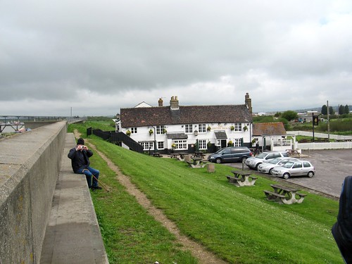
The Plough and Sail out at Paglesham Eastend must be one of Essex’s remotest pubs, an end-of-the-road inn catering for locals and the odd inquisitive outsider who ventures this far.

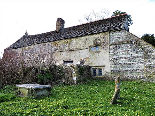
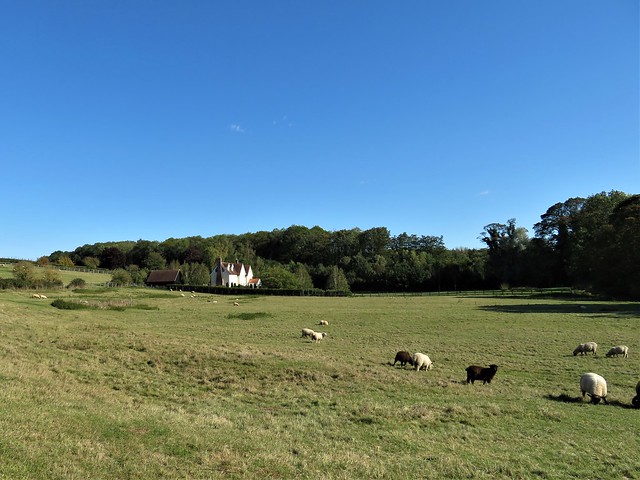
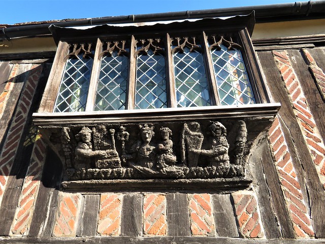
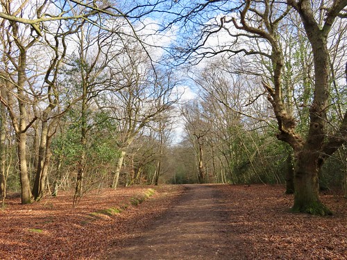
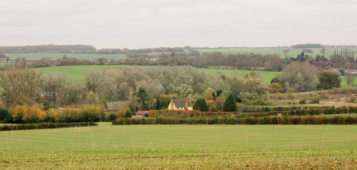
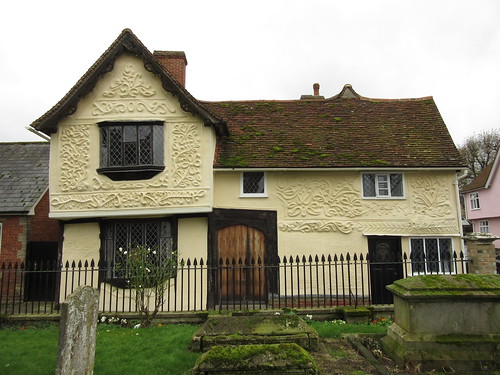
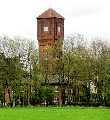
Large, curiously-shaped old houses and widely scattered farms shelter (or hide, it sometimes appears) behind thickets of trees. Paglesham was a notorious haunt of smugglers back in Georgian times, and some of these handsome abodes were built from the proceeds, so local history asserts – notably the tall red-brick Cupola House with its outsize observation turret offering a gull’s-eye view of coastguard activity on the nearby River Roach.

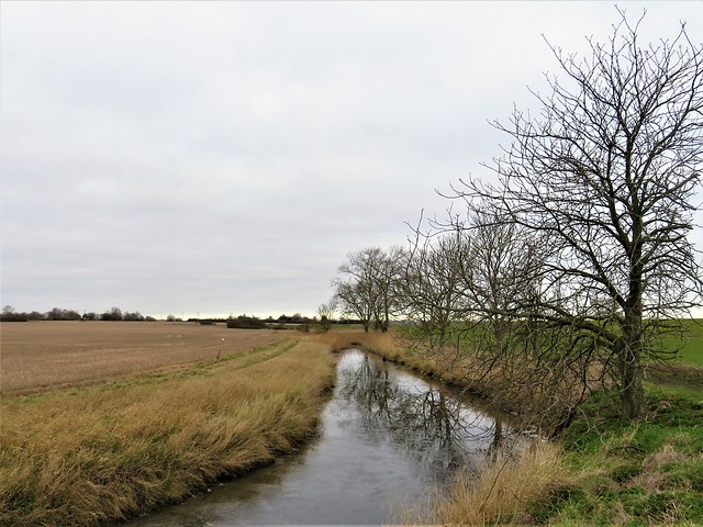
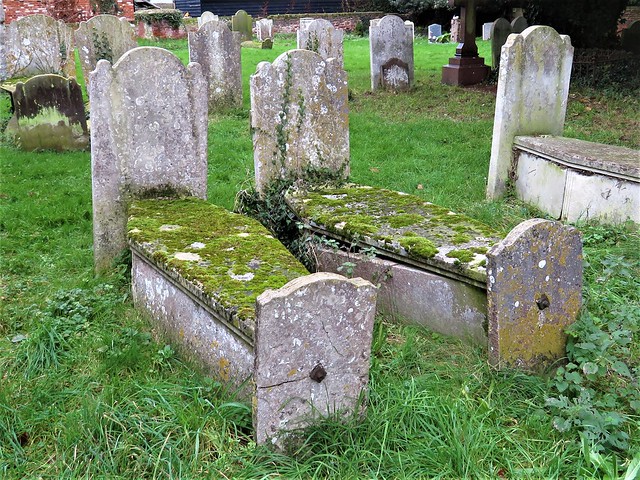
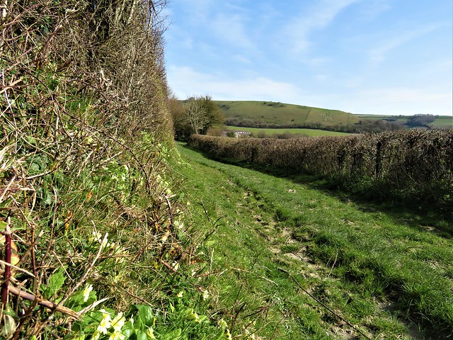
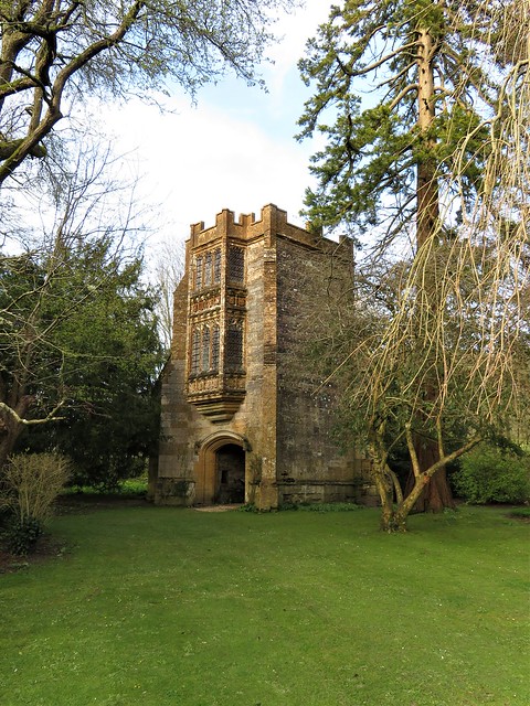
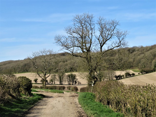
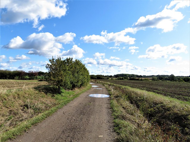
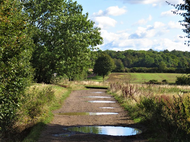
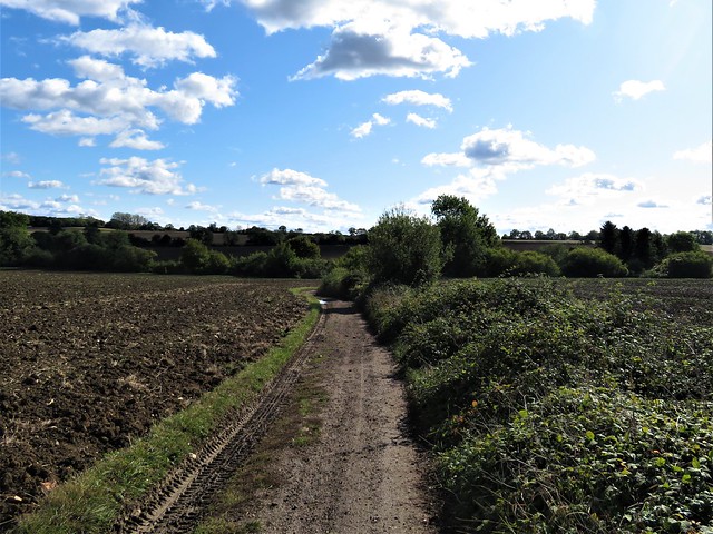
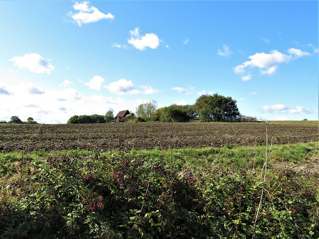
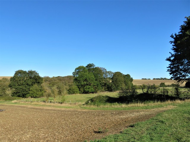
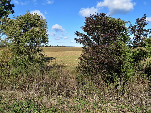
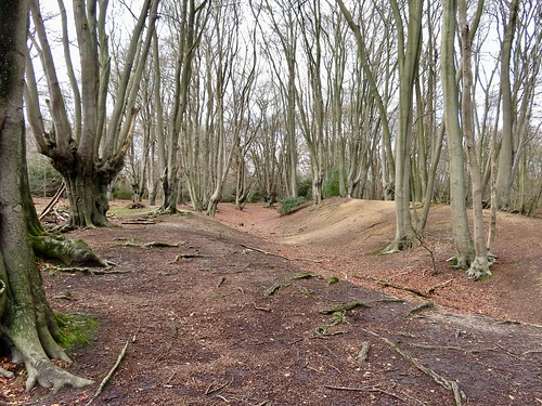
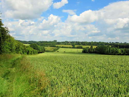
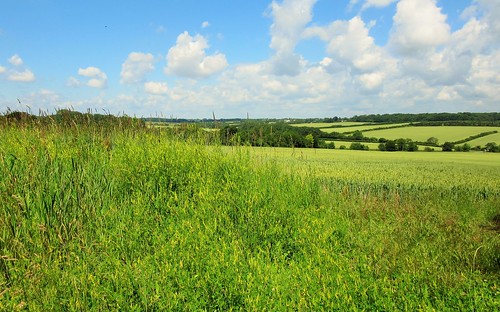
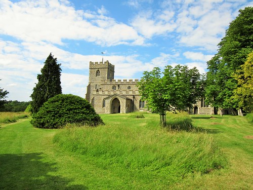
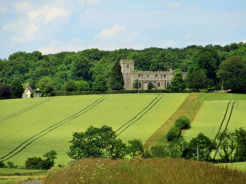
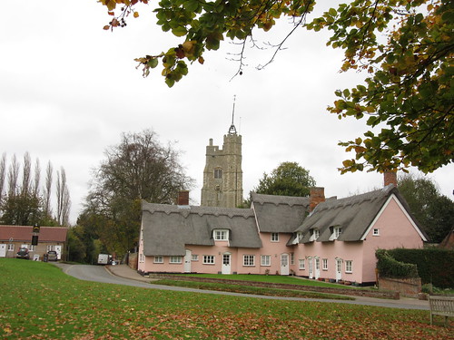
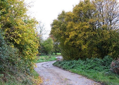
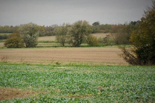
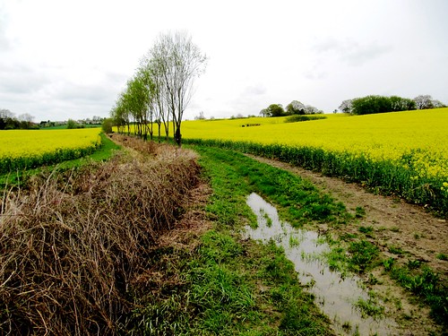
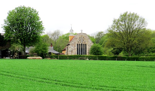
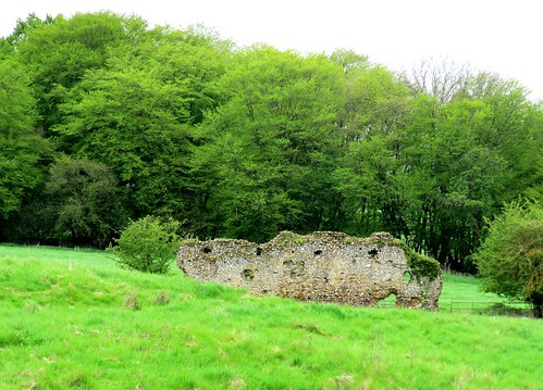
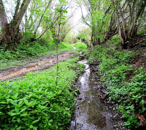
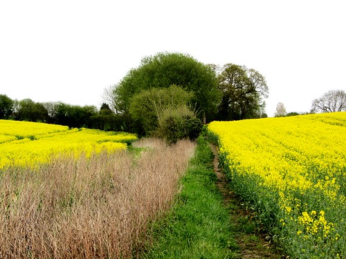
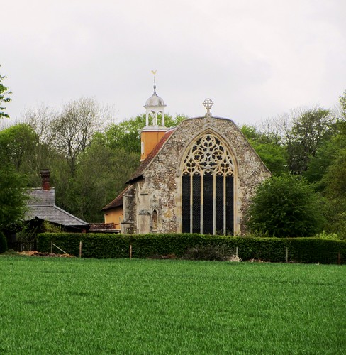
A muddy path took us across flat fields of spring wheat and mouldering stubble where tottering Dutch barns and towering stacks of straw bales were the only upstanding features. At Paglesham Churchend we came to St Peter’s Church, where a rickety stone tomb enclosed the mortal remains of William ‘Hard Apple’ Blyth, churchwarden and grocer by day, smugglers’ ringleader by night.

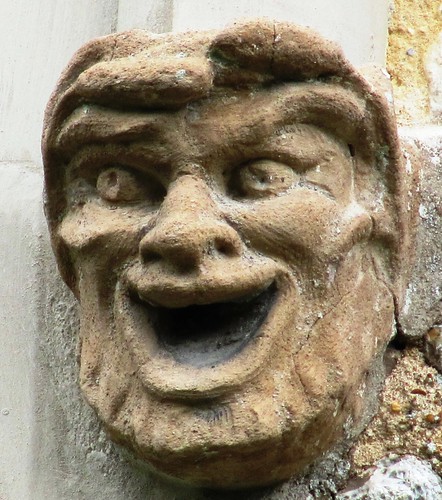
Hard Apple cut a fantastic figure in his 18th century heyday, keeping hold over his ruffian gang by deeds of prowess such as wrestling bulls, munching wine glasses and drinking a keg of brandy at a sitting. Ferrying contraband, outwitting and outsailing the Revenue in his cutter Big Jane, Hard Apple used the tower of St Peter’s as a hiding place for smuggled goods. Occasionally apprehended, always slipping through the net, he died at the age of 76 in the odour of sanctity, uttering his final words: ‘I’m ready for the launch.’

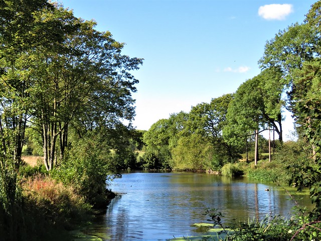
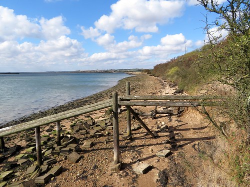
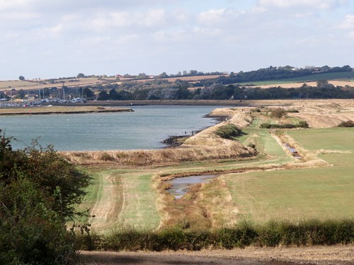
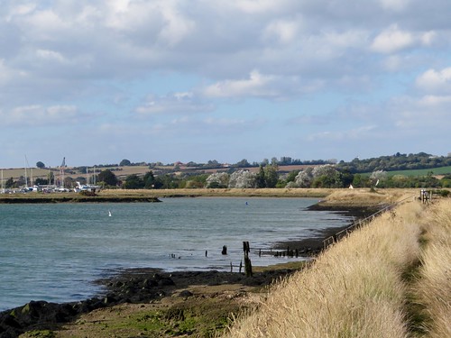
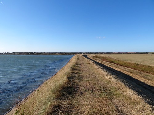
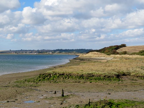
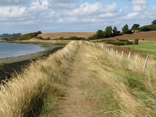
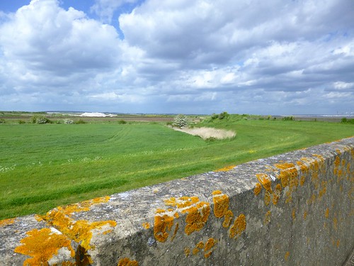
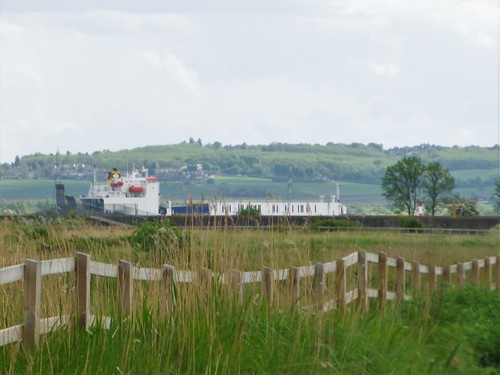
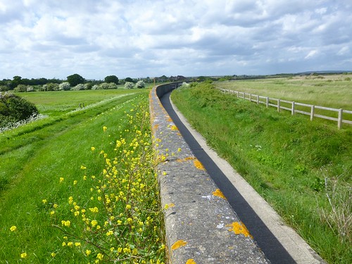
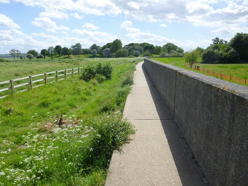
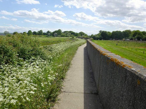
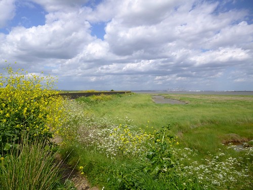
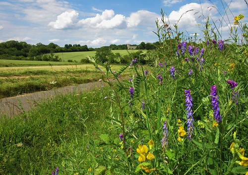
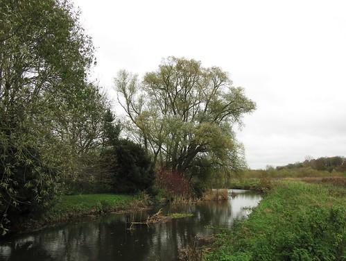
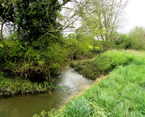
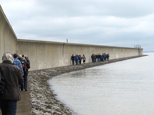
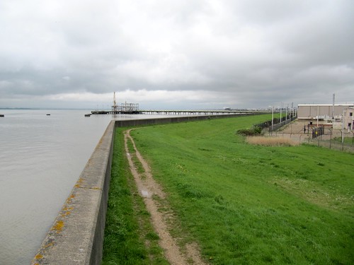
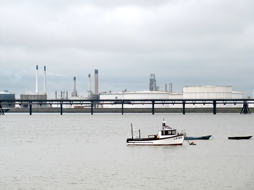
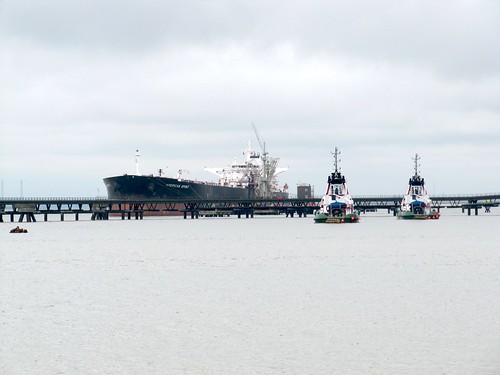
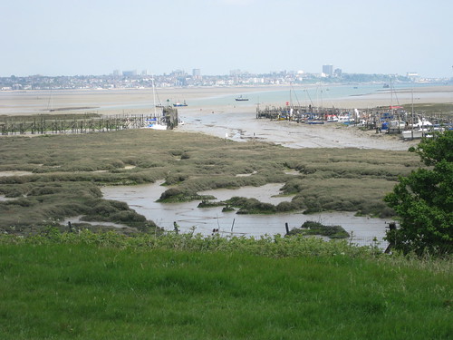
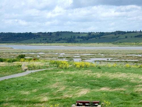
Beyond Churchend we found the marshy bank of Paglesham Creek, a broad muddy tidal outlet. Oystercatchers and curlew made their plaintive piping calls from the great tangle of saltmarsh on Wallasea Island RSPB reserve across the river. We walked the flood-wall path towards the distant sea, watching shifting clouds of geese and ducks swirling over the far horizon. Flotillas of wigeon paddled across the creek, and a flight of dunlin switched direction, all together in one instant, passing so close that we could hear the whir of their wings.

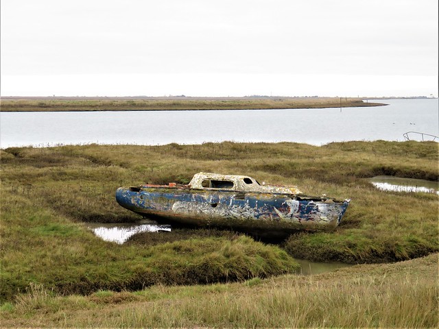
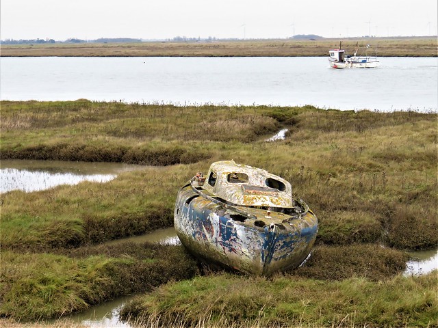
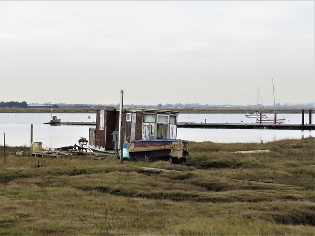
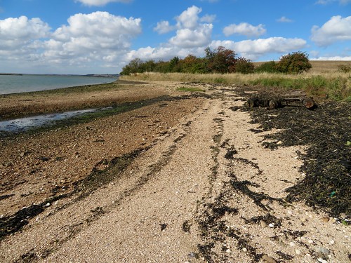
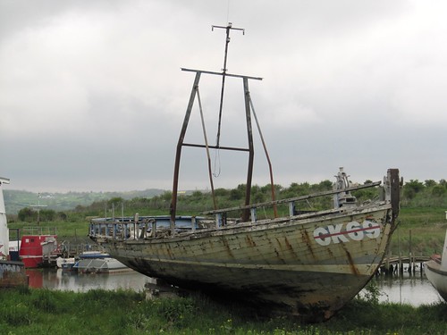
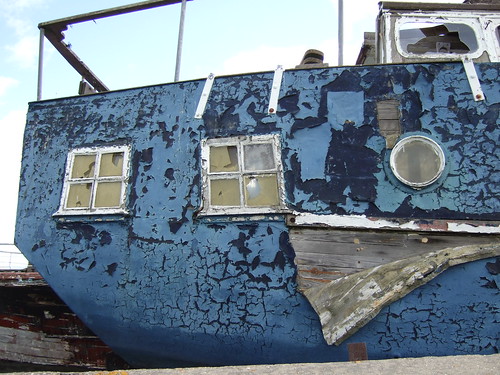
Down at the tip of the Paglesham peninsula we paused before turning for home to contemplate a remarkable case of historical bathos. On this spot in 1870 Coastguard Watch Vessel No 7, downgraded and neglected, was finally broken up. Some forty years earlier, as survey ship ‘HMS Beagle’, she had carried Charles Darwin across the world on the voyage of discovery that gave rise to his epoch-making Theory of Evolution. Quite a claim for a forgotten hulk on this obscure stretch of a muddy Essex creek.

How hard is it? 5¾ miles; easy; field and river wall paths

Start: Plough & Sail PH, Paglesham Eastend, Rochford SS4 2EQ (OS ref TQ 944922)

Getting there: Bus 60 from Southend-on-Sea
Road: M25, Jct 29; A127 to Southend-on-Sea; A1159 to Rochford; follow ‘Great Stambridge’ and on; Paglesham signed from Ballards Gore.

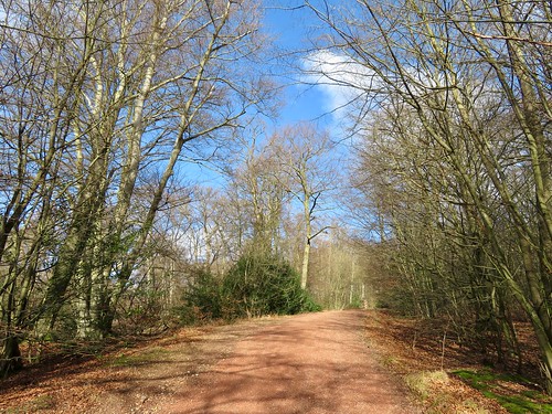
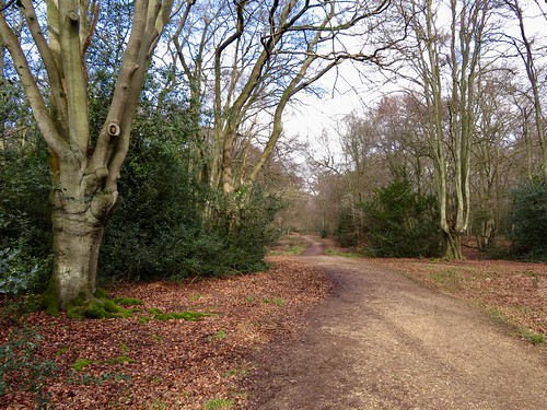
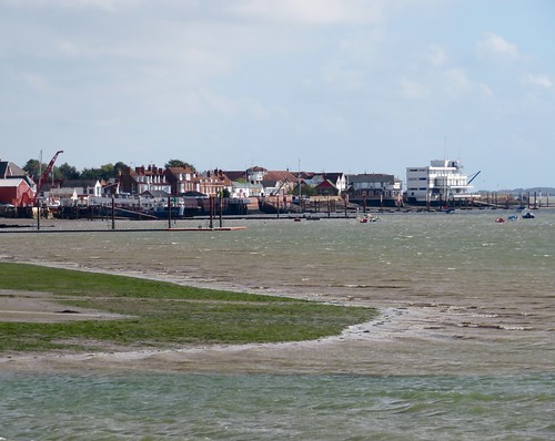
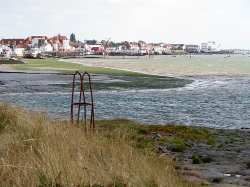
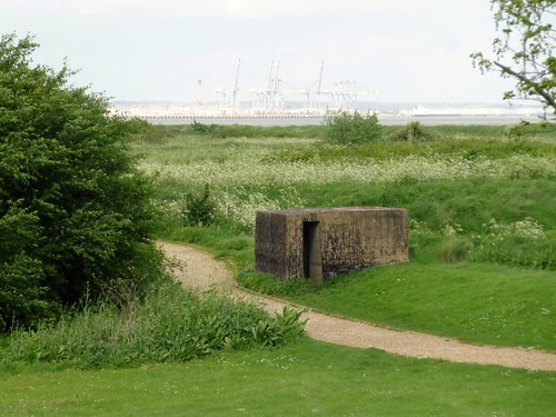
Walk (OS Explorer 176): Walk up left side of Plough & Sail (‘To The Coast’), past Cobblers Row and on (yellow arrows/YAs). At Well House (944926) left along road. In ½ mile at East Hall Farm, right (936926, fingerpost) to skirt buildings. Follow YAs across fields for ¾ mile to Paglesham Churchend. Pass church (926930); on past houses; on bend, right (924931) onto field track (YAs). In 700m, right (924936) along Paglesham Creek flood wall. In 2¾ miles at pillbox, turn right (953925) along River Roach to boatyard and jetty (948921); right to Plough and Sail.

Lunch: Plough & Sail, Paglesham, Eastend (01702-258242, theploughandsail.co.uk)

Accommodation: Holiday Inn, 77 Eastwoodbury Crescent, Southend-on-Sea SS2 6XG (01702-543001, ihg.com)

Info: Southend-on-Sea TIC (01702-212534), visitessex.com

 Posted by at 01:14
Mar 132021


First published in: The Times Click here to view a map for this walk in a new window
picture picture picture picture picture picture picture picture picture picture picture picture picture picture
Facebook Link:

The Cerne giant looked particularly rampant this morning, the low sun of early spring lighting up every detail of his splendid physique. No-one knows when this phallic wild man, brandishing a fearsome club and very clearly ‘pleased to see you,’ was cut into the chalk hillside above Cerne Abbas.

Plenty of fun has been had with the Cerne Giant over the centuries. Childless couples would couple on his mighty member to quicken their seed. Advertising agencies have clad him in jeans and a condom; he has been paired with a giant Homer Simpson wielding a doughnut, and has sprouted an outsize grass handlebar moustache during Movember. Unadorned, though, he emanates the wildness, dignity and menace that his originators must have intended.

We set out west from Cerne Abbas, blown by an icy east wind along banks already thick with primroses. Bees were bumbling there, and we spotted a great black oil beetle in jointed armour labouring up through the grasses. The wind whistled in the leafless hawthorn hedges and trembled the green spear-blade leaves of wild garlic up in Weam Coppice.

At the ridge we passed the medieval earth-and-flint bank of Park Pale, constructed to keep the hunted deer in Cerne Park. Beyond ran the Wessex Ridgeway, an ancient track, broad and green, hurdling the downs. We followed it north past holly and elder hissing with wind, looking west to where hedges and field shapes undulated together across the chalk valleys under a clear-cut skyline.

From Redpost Hill we cut east across big open fields jingling with flints, under the first lark song of the year sounding sweet and silvery in the upper air. A view opened ahead over the valley of the River Cerne, with the thatched cottages and old gabled manor at Up Cerne far below. South over the distant, unseen sea a long cloud bar formed, streaming slowly to the west.

In the hedge-banks along the lane to Cerne Abbas, violets made splashes of contrasting colour to the predominant yellow of celandines, primroses, dandelions and daffodils. Back at the village we climbed Giant Hill, circling round the great chalk man before returning by way of Cerne Abbey – abbot’s hall, tithe barn, guest house, and a tall porch hidden in a thicket, with an oriel window exquisitely carved.

Start: Giant View car park, Cerne Abbas DT2 7JX (ST 662016)

Getting there: Bus: X11 (Dorchester – Yeovil)
Road: Car park is signed off A352 (Yeovil-Dorchester)

Walk (6½ miles, easy, OS Explorer 117): Cross A352; right around field edge to green lane; left. In 50m fork left; follow lane, then path (yellow arrow; fingerposts ‘Cerne Park,’ then ‘Weam Coppice’) up valley, into wood by gate (650013). In 50m fork right uphill. At top of trees (647013) dogleg right/left (‘Sydling Drove’), past radio mast and sarsen stone to Wessex Ridgeway (645013). Right; in 1¼ miles pass ‘Up Cerne’ fingerpost (639032); in 100m fork right, then right (fingerpost ‘Wether Hill’). Cross field; pass ‘Up Cerne’ fingerpost (642033); on, soon downhill to T-junction (653035). Right to pass Great Pond (655031); in 150m round left bend; in 50m right (655029) past end of trees to cross road by white gate (656027). On across field (fingerpost) to road (659023); ahead to A352 (661018); ahead to car park.

Giant Hill climb (strenuous): Ahead from car park (‘Picnic Area’); left on Kettlebridge Lane (663015); follow ‘Giant Hill’ and yellow arrows to climb wooden steps. Clockwise up and around Giant’s enclosure; returning, follow ‘Abbey’ signs to Cerne Abbey; back around to car park.

Info: Dorchester TIC (01305-267992)
satmap.com; ramblers.org.uk
More walks info: @somerville_c

 Posted by at 01:50
Nov 092019


First published in: The Times Click here to view a map for this walk in a new window
picture picture picture picture picture picture picture picture picture picture picture picture picture
Facebook Link:

A beautiful sunny morning in rural Essex, wintry but bright, with a blue sky mitigating the sharp northwest wind. There were puddles in the rough old road leading east from Newport Station, and a good solid crunch of flint underfoot.

South of the lane the big bowl of Chalk Farm Quarry has scooped away half a hill. Its roadways lay slick and glistening with the sheen of chalk compressed and polished by heavy tyres.

The lane ran as a holloway in a tunnel of goat willow and hawthorn. Hard green crab apples lined the ruts. The hedges were filled with brushy green heads of ivy berries, scarlet droplets of rosehips, and the plump pink fruits of spindle, about to burst to reveal their bright orange interiors.

Up in the open fields the feeling was a top-of-the-world one. The wind at our backs bowled dry beech leaves ahead of us along the track. Enormous fields of dark plough and tender green bean shoots stretched away to woods with intriguing names: Hop Wood, Cabbage Wood, Pig’s Parlour.

At Waldegrave’s Farm the barns were tight packed with the winter’s straw in neat square bales. At the farm fence three little spaniels did their best to give us a fierce send-off, their wagging tails belying every yap.

Down at Rook End we turned north beside the woods of Debden Park to reach the lonely church of St Mary the Virgin. The grand estate developed in Georgian times by well-to-do merchant Richard Chiswell is only a memory now, but St Mary’s retains a whiff of the family’s whims and wishes in the strange Moorish roof of the chancel and the exuberant monuments and stained glass armorial devices.

A snaking footpath runs the length of the Debden Water’s shallow valley, and we followed it back to Newport through coarse sheep pastures and whispery groves of poplar and willow.

I fell for the old trick pulled by sloes each autumn – look how plump and blue we are! How tasty we must be, don’t you think? Ugh! Nothing had changed. Still that old sensation of blotting paper and sour metal on the palate. Never mind – drowned in sugar and a Kilner jar of gin, they’ll sweeten my Christmas potations.

Start: Newport railway station, near Saffron Walden, Essex CB11 3PL (OS ref TL 522335)

Getting there: Rail to Newport. Bus 301 (Saffron Walden-Bishop’s Stortford).
Road: Newport is on B1383 (M11, Jct 9)

Walk (6½ miles, easy, OS Explorer 195): From Platform 1, right along Byway (‘Saffron Trail’). In 1 mile, ahead along road (536329); in 100m, right past Waldegrave’s Farm on track for 1 mile to road (550323). Left; just beyond Rook End cottage garden, left (552323) across field. Cross ditch; left up field edge. In ½ mile, path turns left through hedge (553332) across field to road. Left to Debden church (551332). From west end, path to kissing gate and on (‘Harcamlow Way’/HC). In 150m, right by stables (549333) to cross road at Newport Lodge (550340). On past Howe Barn. At corner of wood (547343), left along grass strip to pass Brick House Farm (545341, arrows). At road, right over stile (545339), following HC. In 600m fork left off HC (540339, yellow arrow) on path through meadows. In 1 mile at field corner, fork right (525342) into trees. Cross footbridge (524343); under railway (522343) to Newport High Street. Left to station.

Lunch: Picnic from Dorringtons Bakery, 24 High Street, Newport CB11 3PQ

Accommodation: The Cricketers, Clavering, Saffron Walden CB11 4QT (01799-550442, thecricketers.co.uk)

Info: Saffron Walden TIC (01799-524002); satmap.com; ramblers.org.uk

 Posted by at 02:30
Dec 152018


First published in: The Times Click here to view a map for this walk in a new window
picture picture picture picture picture picture picture picture picture picture picture picture picture
Facebook Link:

The wind nipped at our heels as we left the tube train at Loughton and climbed the hill behind the little Essex town. Handsome red brick villas lined the road, proclaiming this the Metroland that the railways brought into being for Edwardian commuters to the city.

At the crest of the rise a few steps plunged us back into the medieval England of great hunting forests and the footpad-haunted wilds that all travellers feared. Epping Forest today, 6,000 acres of tree-smothered uplands, is only a shadow remnant of the sprawling Royal Forest of Waltham that once stretched away from London. But walking the broad tracks under these old beeches and hornbeams with their green sinewy limbs, you still catch the silence and solitude of proper deep woodland.

Long-tailed tits flirted their tail feathers and squeaked in miniature voices among the bare boughs. There were goblin faces in the contorted trunks of beeches unpollarded for a century or more. The circular embankments of Loughton Camp, an Iron Age enclosure where Whitechapel highwayman Dick Turpin kept a hideout, lay screened among trees that spread their own witchy darkness around themselves.

If it hadn’t been for the lobbying of far-sighted Victorian campaigners, Epping Forest would have been nibbled away to nothing by smallholders, squatters and developers. The 1878 Epping Forest Act put a stop to all their encroachment, and today’s walkers, cyclists and runners are the beneficiaries.

The wind made a seashore roar in the treetops, but down at the roots of the forest hardly a breath stirred the leaf carpet. We followed the well-made path north-east, revelling in the silence and the earthy scent of millions of trees.

Beyond Jack’s Hill the landscape changed character. Heathy patches of birch scrub and bog appeared in wide clearings and the tree cover thinned as more blue sky spread overhead. The ramparts of Ambresbury Banks, another Iron Age ring fort, stood naked and tall, studded with smooth-trunked beeches.

The sigh of the wind gave way to the muted roar of the M25. We crossed the motorway, turned our backs on the massed trees of the forest, and dropped down to Epping tube station with wide views opening across the Essex ridges to the far blue hills of Kent across the unseen Thames.

Start: Loughton tube station (Central Line), IG10 4PD (OS ref TQ 423956). Finish Epping station, CM16 4HW.

Getting there: Underground rail to Loughton. Road – Loughton is off M11, Jct 5.

Walk (7½ miles, easy, OS Explorer 174): From Loughton station, to main road; left across bottom of Station Road; up Old Station Road with Sainsbury’s on left. Over roundabout; up Ollards Grove. At top at Forest View Road (418961), left along path. At road, right; in 200m, left (418963) through car park, past ‘The Stubbles’ sign. Across grassy hill; into trees; in 150m, right at Strawberry Hill Ponds (414965) along broad, flat Three Forests Way (3FW).

In 300m cross Earl’s Path (416967); take right fork. In ¾ mile, just past Loughton Camp, 3FW forks left (421977), but keep ahead along The Green Ride. In 1 mile cross A121 (429986); bear right through metal barrier, then follow path round to left and on. In 600m at Ditches Ride T-junction (434989), left to cross B172 at Jack’s Hill (435996). Keep same direction past Epping Forest sign, and on.

In nearly 1 mile at Epping Thicks, with tall post on left and short one with yellow arrow on right, keep ahead at fork (444004). In ½ mile, at Ivy Chimneys, left along road (450011). Fork right along Bell Common. At end of houses (454015), right; just before Hemnall House, left through hedge; right down grassy slope; left at bottom on green lane among trees (‘Centenary Walk’ on OS Explorer). At road (458013), left round Western Avenue. At T-junction, left along road. In 250m pass Woodland Grove on right; in 30m, right (460016, ‘station’ sign) to tube station (462016).

Lunch: Forest Gate Inn, Ivy Chimneys CM16 4DZ (01992-572312)

Accommodation: Premier Inn, The Grange, Sewardstone Rd, Waltham Abbey EN9 3QF (0333-321-9123)

Info: Epping Forest Visitor Centre, IG10 4AF (0208-508-0028)
visitengland.com; satmap.com; ramblers.org.uk

 Posted by at 02:41
Jan 212017


First published in: The Times Click here to view a map for this walk in a new window
picture picture picture picture picture picture picture picture picture picture picture picture picture picture picture picture
Facebook Link:

The little train from London rattled through the low-lying countryside of easternmost Essex. Burnham-on-Crouch lies almost at the end of the line, a small self-contained town for sailors and oyster-eaters, tucked into the mud and saltmarsh on the north bank of the sea-going River Crouch. The great days of fishing-smack fleets and smuggling ketches may be gone, but Burnham on a day like this, under a blue sky with a brisk east wind blustering in from the North Sea, is a salty town you want to linger in.

We put our backs to the breeze and headed upriver away from Burnham marina where the yacht halyards were screaming softly in the wind. Black-headed gulls in white winter hoods were tossed about the sky, too intent on staying aloft to make their usual fishwife screeching. The wind ruffled the estuary into white horses and slapped the waves against the wrinkled mud banks. Across the Crouch came more faint banshee wailing from the yacht rigging in a distant marina, and the iron clank of a crane unloading timber from a dark blue freighter tied up at Baltic Wharf – evocative name.

It was wonderfully exhilarating, walking the narrow seawall path above hissing reedbeds and long hanks of bladder wrack flying from posts and railings like a mermaid’s washing. Seaweed lay far up the road at the tiny enclave of Creeksea, testament to the power of East Coast tides at the full.

We passed duckboard jetties and plank causeways over the marsh, unfathomable posts in the water, and lines of black stakes squaring off the muddy beaches into long-abandoned oyster beds. To the north the ground rose into a clearly defined ridge of clay farmland topped with small woods and houses; southward across the river it looked flatter and moodier, a compelling landscape spreading into the long creek-divided wastes of Bridgemarsh Island, where brent geese were feeding.

The navigable channel past the marsh island was marked with stakes, each thin rod topped with a warning triangle. A stranger in these shallow, murky waters would find it all too easy to go aground on an unsuspected mudbank.

Egrets rose out of the creeks, snow-white against the dun marshes. The wind puts its hand in our backs and shoved us along, mile after zigzag mile, until Fambridge’s little quay hove in sight, with a row of sea kayaks like a rack of giant kippers hung up to dry in the wind and sun.

Start: Burnham-on-Crouch station, Essex, CM0 8BQ (OS ref TQ 948965)

Getting there: Rail to Burnham-on-Crouch.
Road: M25 Jct 29; A127 to Wickford, A132 to South Woodham Ferrers; B1012, B1010 to Burnham-on-Crouch station car park.

Walk (9½ miles, easy, OS Explorer 176.): Down station approach, right; first right along Foundry Lane. In 600m, fork left (944963) on footpath across rough ground to marina. Cross car park, down steps (942961); cross north end of marina; left down far side; right/west (940956) along sea wall. In ⅔ of a mile at Creeksea (932957) follow road; in 300m on right bend, left (fingerpost) on field path to another gate (928961); follow sea wall path west for 6 miles. 400m short of Fambridge Quay, turn inland (857965, waymark) on path northward past Blue House Farm for ½ a mile to road (855973). Ahead to North Fambridge station (856978). Return by rail to Burnham-on-Crouch.

Lunch: Ferry Boat Inn, North Fambridge CM3 6LR (01621-740208, ferryboatinn.net)

Accommodation: Oyster Smack Inn, 112 Station Road, Burnham-on-Crouch CM0 8HR (01621-782141; theoystersmackinn.co.uk)

Information: Southend-on-Sea TIC (01702-618747)

visitengland.com; satmap.com; ramblers.org.uk

The January Man – A Year of Walking Britain by Christopher Somerville (Doubleday, £14.99)

 Posted by at 01:29
Apr 162016


First published in: The Times Click here to view a map for this walk in a new window
picture picture picture picture picture picture picture picture picture picture picture
Facebook Link:

Coalhouse Fort lay low and ominous under a grey, rain-speckled sky. Any damned Frenchie coming up the Thames to burn London would be blown out of the water before he’d even spotted the bastion at the bend of the river; that was what General Gordon of Khartoum surmised when he built the fort out here in the marshy wastelands east of the capital. The French never came; it was the Dutch, 200 years before, who had burned East Tilbury church tower in a daring raid, and they were the last foes to get so far upriver until the German airmen of the 20th century.

We passed the grim old stronghold and set out north along the seawall path where large lilac-coloured flowers of salsify bloomed among the grasses. Across the river lay the ghostly outline of Cliffe Fort, where Charles Dickens sent poor little Pip in ‘Great Expectations’ on a foggy Christmas morning with stolen ‘wittles’ and a file for escaped convict Magwitch. This is all moody country hereabouts, looking downriver over bird-haunted marshes and mudflats to the giant skeleton cranes at the new container port of London Gateway.

All the marshes hereabouts have for centuries been the dumping ground for London’s rubbish. Now they’ve finished land-filling the giant tip on the appropriately named Mucking Marshes, and a phoenix from the ashes is arising there – Thurrock Thamesside Nature Park, a big reserve of reedbeds and grasslands, woods and lakes, already up and running even as it expands and consolidates.

The senior warden gave up some precious time to show us around. Reed buntings chattered, invisible among ten thousand stems, a cuckoo called, shelduck hoovered the mud flats, a brown hare scampered off. We mounted the spiral ramp to the roof of the Visitor Centre and had a wonderful 360o view over the sullen grey river, the cranes like giraffes at a waterhole, the greened-over hills of the landfill, and floating on the western skyline the towers and spires of London, as strange and distant as a dream.

Start: Coalhouse Fort, Princess Margaret Road, East Tilbury, Essex RM18 8PB (OS ref TQ 690769)

Getting there: Train/bus – train to East Tilbury; bus 374 to Coalhouse Fort. Walk ends at Stanford-le-Hope station; return to East Tilbury by rail.
Road (2 cars) – A13, A1013, minor road to Mucking; follow signs to Thames Thurrock Nature Park/visitor centre. Leave 1 car here, drive other to Coalhouse Fort (‘East Tilbury’, then ‘Coalhouse Fort’).

Walk (5½ miles, Coalhouse Fort to Stanford-le-Hope station; 5 miles, car to car; easy, OS Explorer 163. Online maps, more walks at christophersomerville.co.uk): Follow seawall path north from Coalhouse Fort for 1½ miles till fence blocks path (695792). Left along fence for 1 mile. Through metal gate (684793); right through kissing gate (‘Essex Wildlife Trust/TTNP’) into Thurrock Thamesside Nature Park. Left along path for ½ mile to lakes; right (679799) along path beside railway. In ¾ of a mile, path bends right just before Mucking road (683810); in 400m, bear right by Warden’s house (687810, ‘Visitor Centre’ fingerpost). If doing 2-car walk, follow roadway to Visitor Centre. If station-to-station, left at roadway in 100m (arrow) along path; in 350m, left through gate; cross sluice (691808). In 200m, fork left past metal gate (694809) to road (693812); left for 1 mile to Stanford-le-Hope station (682823).

Lunch: Inn on the Green, Stanford-le-Hope SS17 0ER (01375 400010, innonthegreen-stanfordlehope.co.uk); TTNP Visitor Centre café

Accommodation: Bell Inn, Horndon-on-the-Hill (01375-642463; bell-inn.co.uk) – friendly, well-run stopover

Thames Thurrock Nature Park: 01375 643342, essexwt.org.uk/reserves/thurrock-thameside

Coalhouse Fort: 01375 844203, coalhousefort.co.uk

visitengland.com; satmap.com; ramblers.org.uk

 Posted by at 01:46
Aug 082015


First published in: The Times Click here to view a map for this walk in a new window
picture picture picture picture picture picture picture picture
Facebook Link:

A gloriously sunny morning in late June, with the low-rolling cornlands of north Essex looking an absolute picture. Just the day for 18-month-old Bertie to bring his dad Justin and his granny Patsie (long-term friend of Jane and me) out for a walk.

A mighty prospect into Cambridgeshire opened ahead as we walked the field path from Chrishall to Elmdon, a gradual landscape quilted in black and cream under the sun. This is wheat and horse country, the cornfields just flushing from pale green to pale gold. A pair of beautiful chestnut colts, skittish as schoolchildren, teased each other in a paddock under the red brick garden wall at Lofts Hall.

The hedges hung heavy with hard green fruit – plump bullace and sloes, vestigial cherries and hazelnuts. ‘Aaaaahh!’ said Bertie in his buggy, by way of approval. On the well-mown lawn of the Hamlet Church at Duddenhoe End we let him out to teeter across the grass. This thatch-roofed church is a modest wonder, a barn converted to a chapel by a mid-Victorian squire parson, Rev Robert Wilkes of Lofts Hall. Simple beams, an alabaster font, sturdy pews of oak and pine, the whole atmosphere very peaceful and still in the midday sunshine.

Bertie collected all the coins we had and clattered them into the offertory box. He ate our lunch for us, redistributed a couple of molehills, and gave the church wall mosses a thorough scrub before being removed by dad to enjoy a well-earned nap. Patsie, Jane and I went through the ripening wheat, and turned along the old Roman road now known as Beard’s Lane between hedges of frothy meadowsweet. The level sunlight had reduced all far-off things to a simple palette of colours – milky green corn, green-black woods, burnt orange pantile roofs, washed blue sky, tarnished silver clouds – the unemphatic beauty of an English summer’s day.

In a puddled dip we left the old lane and turned north again along field paths, past Chiswick Hall where the driveway lay lined with big blue heads of scabious, yellow and purple vetches and hard-packed globular seedheads of wild alium. Chrishall’s isolated Holy Trinity Church stood ahead on a ridge, knapped flints in its walls, chequerboard flushwork round its tower top. We sat a while in the cool of the church porch, looking forward to a cup of tea, yet reluctant to close the circle of this lovely walk through the Essex cornfields.

Start: Red Cow PH, Chrishall, Essex SG8 8RN (OS ref TL 446393)

Getting there: Buses from Cambridge, Saffron Walden, Bishops Stortford, Royston – see chrishallpc.org.uk
Road – Chrishall is signed off B1039 Wendens Ambo to Royston road (M11, Jct 9)

Walk (9½ miles, easy, OS Explorer 194):

Right to crossroads; down Loveday Close (‘Icknield Way’/IW, yellow arrow/YA). Pass Marchpayne House on right, turn right (IW, YA) down alley, and follow footpath east through fields for ½ mile into wood (454397). At multiple arrow post, right; at T-junction (455395), left to road (458397); right into Elmdon. Follow village street south (‘Wendens Ambo’); right through gate (462392, ‘footpath’/FP) along side of recreation field. On south (YAs) for ½ mile to B1039 (462379). Dogleg right/left; on in tunnel of trees (FP) to cross School Lane (463372 – NB Hamlet Church is 100m to right). On south for 600m to road at Duddenhoe End (463367).

Left and over crossroad (‘Bridleway’). In 100m, just beyond house on right, bear left (465367, blue arrow/BA) between paddocks. In 250m, ahead through hedge (467367), right along hedge for 300m to road (470364). Left to T-junction; right along lane. In 500m, at Cooper’s End (465360), ahead (‘Cosh Farm Only’). In ½ mile, at drive to Cosh Farm (461354), keep ahead (‘Byway’, red arrow/RA). In another 300m, pass footpath on left (459351, arrow). Keep ahead (RA); in another 50m, turn right along hedge (YA), following Harcamlow Way (unmarked on ground, marked on Explorer map). In 600m, at crossing of hedges (452350), bear right (YA) round hedge end, left through hedge gap, and right (YA) with hedge on right for 500m to road in Langley (448353).

Left for 100m; right past ‘The Gables’ along right side of village green. In top right corner of green, bear right along green lane (446353). In 20m fork left (YA) and on along field edges. In 500m, at three-arrow post, right (443356) along field edge, following YAs. In 500m, bear right through thicket (443362, YA – ignore ‘CLA Welcome’ arrow pointing ahead here). Head NNE for almost 1 mile to Chiswick Hall (450375). Dogleg left/right round house (YAs); follow path between paddock fence and hedge, then on down drive to B1039 (451382). Left for 20m; right across footbridge (FP), up field path to church gate (452386). Diagonally across churchyard; through kissing gate by tower; on to cross Bury Lane (450387). On (FP) between paddocks and on, following field edge path (YAs) to cross Chalky Lane (448389). On (FP) along field edge. In 400m, at top left/NW corner (446391), right through hedge (FP) along lane to road at Red Cow PH.

Lunch: Red Cow PH, Chrishall (01763-838792, theredcow.com). NB Closed Mondays

Accommodation: Crown House, Great Chesterford, Saffron Walden (01799-530515, crownhousehotel.com)

Info: Saffron Walden TIC (01799-524002)

satmap.com; ramblers.org.uk; visitengland.com

 Posted by at 01:09
Dec 062014


First published in: The Times Click here to view a map for this walk in a new window
picture picture picture picture picture picture picture picture picture picture picture picture
Facebook Link:
Cavendish lies perfectly arranged for a painter’s canvas. Why John Constable never got himself along here to capture the thatched and pink-faced cottages on the village green, and the flint tower of St Mary’s Church peeping over their shoulders, is a mystery. Even on this blowy winter’s morning under a scudding grey sky, the composition seemed flawless.

We passed crooked old Tumbleweed Cottage, half pink and half green, and turned down a path among poplars to cross the slow-flowing River Stour. Out in the fields a green bridleway led through gently rolling country, the meandering of the invisible Stour marked by grey and gold willows. Wide ploughed fields slanted up from the river, their crests bristling with hedge oaks. From this high ground we looked back to see Cavendish church tower poking up above the trees. Then it was down again over the sticky fields to a wandering green lane between banks of iron-rich, burnt orange soil across which burrowing badgers had spread their bedding.

On the outskirts of Clare the grounds and ancient flint buildings of the Priory lay very quiet and still. Opposite rose the castle mound with its tall fragment of Norman masonry. In 1865 local ‘detectorist’ Walter Lorking unearthed a gold cross and chain in the castle grounds. It had been lost there 500 years before by King Edward III, and contained a fragment of the true cross in a tiny compartment. Walter was more than happy to sell it to his Sovereign, Queen Victoria, for the rather appropriate sum of three gold sovereigns.

There was beautiful pargetting – ornate plasterwork – on many of the houses in Clare, and a host of scowling and howling Green Men to guard the doorway of the village church, the ‘cathedral of the Stour Valley’. I left my companions to linger among the antique shops of Clare, and hurried back to Cavendish along the high ground north of the river. The cold wind tousled me all the way, pouring out of a sky ridged with grey billows of cloud, a wintry ceiling for the furrowed ploughland below.

Start: George Inn, Cavendish, Suffolk CO10 8BA (OS ref TL805465)

Getting there: Bus service 236 (Haverhill-Sudbury)
Road – Cavendish is on A1092, between Long Melford (A134) and Haverhill (A143)

Walk (8 miles, easy, OS Explorers 196, 210. NB: Detailed directions, online maps, more walks at christophersomerville.co.uk): From George Inn, left (east) along main street. Opposite Bull Inn, right on path (fingerpost, yellow arrow/YA) to road (810464). Right across Pentlow Bridge; on along B1064. In 300m, on left bend, right (812461, ‘Bridleway’) along field edges. In ½ mile, through trees (805458) and on to Bower Hall. Just before first barn, left (800455) up field edge. 50m before hedge at top, right (803450, post with YA) across field to hedge end of green lane. Follow it (YA) to road (749449). Right downhill.

Just before reaching river, left by waterworks hut (797453, ‘Bridleway’) along green lane and field edges. In 1 mile, bridleway bends right (782449) to river bank (782451). Left here (‘Bridleway’) to road at Hickford Hill (777447). Right; in 200m, right across field (fingerpost) to cross river (775450). Fork left across meadow to cross weir (774451) and on. In 350m, opposite car park and castle mound, pass metal bridge on right, and in 50m turn left (770451) through stone gateway into Clare Priory grounds.

Returning through gateway, turn right and immediately left across footbridge into Clare village. Right to church (770455). Follow A1092 Cavendish road out of town. In 300m, left up Harp Lane (773454, fingerpost); pass sheds and keep ahead through trees, following ‘Stour Valley Path/SVP’, YAs and ‘Heritage Trail’ purple arrows/HT. Opposite Hermitage Farm (775463) bear right up field edge. At top, left through hedge (778464, HT) and on along field edge, aiming to pass roofs and outbuildings of Houghton Hall (785466). In another 600m, at field bottom, right (791468, SVP, HT, fingerpost). In 150m, left and right over 2 ditches (792466, SVP, HT) and on to road at Mumford Cottages (796468). Right; in 450m, right down field edge (SVP, HT, ‘Cavendish’). At bottom (802465), left through hedge (SVP); diagonally left across field; path beside graveyard into Cavendish.

Lunch: Plenty of cafés and pubs in Clare and Cavendish.

Accommodation: George Inn, Cavendish (01787-280248, thecavendishgeorge.co.uk) – smart, stylish, comfortable

Information: Sudbury TIC (01787-881320)
visitengland.com; www.satmap.com; ramblers.org.uk

 Posted by at 02:24
May 312014
 

A late flight from Stansted, and half a day to kill – how better than to spend the previous night in the friendly Swan Inn at Great Easton, only a spit and a shout from the airport, and get out for a leg-stretch along the green lanes that thread the gently rolling landscape of this rural north-west corner of Essex? First published in: The Times Click here to view a map for this walk in a new window
picture picture picture picture picture picture picture picture picture picture picture picture picture picture picture picture
Facebook Link:
Great Easton is full of lovely old houses, half-timbered and whitewashed, with some fine pargetting plasterwork on the walls of the former Bell Inn – a beaky gryphon, a sun in splendour, a bell enfolded by its ropes. Broad fields of rape surround the village, and crossing them felt like walking in a Sergeant Pepper-style dream of intense, opiate yellow, all the more sense-scrambling for lying under a sky full of sharply defined but still grey clouds from which issued the occasional grumble and whine of a Stansted-bound jet.

Apple blossom frothed in pink and white along the path to Tilty Mill, a witchy ruin caught with its curly-spoked flywheels in a thicket of ivy. In the field beyond stood the crumbling walls of Tilty Abbey, the magnificent rose window and chequerboard flint flushwork of today’s parish church the only reminders of the former glories of the 12th-century Cistercian foundation. ‘Allelu-alleluia,’ sang the congregation at their Sunday morning devotions within, their harmony floating us past and away over the billowing cornfields.

Sleek horses were grazing the paddocks at Brookend stables. ‘There’s wartime USAF runways hidden under these crops,’ said a man over his garden gate. ‘You’ll find a window to those brave young men down in Little Easton church.’

That wasn’t the only memorial in the church. Beautiful medieval frescoes adorned the nave walls, and the south chapel was packed with magnificent monuments to Bourchiers and Maynards – ruffs and beards, armour and silks, faces lean or podgy, all lent authority and in some cases arrogance by their whiteness and immobility. Yet it was those young Americans, far from home, daily facing death, who filled my mind as we walked the fields under the growling airliners of the modern age.

START: Swan Inn, Great Easton, Essex CM6 2HG (OS ref TL 606255).

GETTING THERE: Bus service 313, Saffron Walden-Great Dunmow
Road – M11, Jct 8; A120 to Great Dunmow; B184 to Great Easton; left to church and Swan Inn.

WALK (7 miles, easy, OS Explorer 195): From Swan Inn, left up village street, left beside The Bell (607255; fingerpost), over stile, on across fields (stiles, yellow arrows/YA). In ¼ mile, at footbridge (604258), don’t cross, but turn right along right bank of stream, aiming for Duton Hill ahead. At top of field, left across footbridge with metal rails (604265); across stile; half right to stile into road. Right for ¼ mile. Opposite the right turn into Duton Hill (602269, ‘Lindsell’), turn left across ditch (fingerpost). In 200 m path bears left; cross stream and keep ahead to Tilty Mill (600267). Left through gate opposite mill; cross field and pass Tilty Abbey (600265) to road.

Turn right; in 400 m, 2 adjacent footpaths go left; take the first (597264, black wooden fingerpost) and follow Harcamlow Way (marked on map but not on ground). In ½ mile, at bottom of 2nd shallow dip, follow track to right (595256); in 200 m, left (YA) to cross road (594253). Over stile (YA); down track and through gate. Right (YAs and white arrows/WA) down right side of paddock; through gate at bottom (YA, WA); up field edge to road (594250). Right; in ½ mile, on right bend, keep forward (589245; fingerpost, blue arrow/BA) along green lane. In 100 m fork left and continue between stream and paddock; on between paddock fences. At Brookend stables (587242), bear left past house. Left along drive (YA) for just over a mile to Little Easton church.

Left by church gates (604235; fingerpost), through gates of Little Easton Manor; along drive with manor on left and barn on right; through gates beyond and on down field. Cross between two ponds (606239); ahead up fence with garden on right. Bear right round top of garden (BA); follow track to road in Little Easton (608241) with Stag Inn to your right. Left; right at village sign down Butchers Pasture, through gate at end (YA); cross footbridge and bear half left across field. Cross footbridge (610245); go straight ahead (not left) for 50 m, then turn right over another footbridge and stile. Bear left along right bank of stream (YA). Cross a stile (610247, YA); fork left, aiming for church; follow stream. In 300 m, by metal rails on left, turn right (608248) up right bank of a ditch. In 100 m, left across ditch (YA); follow path up to Great Easton.

LUNCH: Swan Inn, Great Easton (01371-870359; swangreateaston.co.uk); Stag Inn, Little Easton (01371-870214)

ACCOMMODATION: Swan Inn, as above

INFORMATION: Saffron Walden TIC (01799-524002);
visitessex.com www.satmap.com www.LogMyTrip.co.uk

 Posted by at 02:18
May 042013
 

Before I ever set foot on Canvey Island I’d thoroughly explored this dead flat offshoot of the Thames Estuary’s Essex shore in my imagination – washed up there on the tides of Wilko Johnson’s gritty lyrics and Lee Brilleaux’s gravelly bark.
First published in: The Times Click here to view a map for this walk in a new window
picture picture picture picture picture picture picture picture picture picture picture picture picture picture picture picture
Facebook Link:
If the tough-looking, fist-punching Brilleaux was the voice and face of Dr Feelgood, Canvey Island’s crunchy home-grown R&B band, guitarist Johnson was its heart and soul, with a unique song-writing talent for depicting the mean streets and hard men and women of a place he called ‘Oil City’. It wasn’t the real Canvey Island, but it was a real enough place to me and thousands more fans of the ‘greatest local band in the world’.

Setting out across Benfleet Creek to walk a circuit of the Canvey seawalls, I found myself immediately in acres of green marshes where piebald horses grazed and skylarks sang overhead. This western sector of the island houses one of the most diverse bird reserves in Britain – marsh harriers over the reedbeds, lapwings in the fields, curlews on the muddy foreshore – more RSPB than R&B.

Where was the Feelgoods’ Oil City? I looked ahead and saw the burning flare stacks and mad scientist’s geometry set of Shell Haven oil refinery across the creek. Further round the island a giant black jetty, remnant of a never-built refinery on Canvey itself, rose out of the fields and hurdled the mud flats of Hole Haven to curve into the River Thames. ‘I’ve been searching, all thru’ the city,’ growled Brilleaux on Dr Feelgood’s debut album, ‘see you in the morning, down by the jetty.’ Here it was, as skeletal and ominous as I’d always imagined.

Now the Thames lay in full view, nearly two miles wide, the green and yellow escarpment of the North Kent shore rising on the southern skyline. A great concrete sea wall fifteen feet high keeps the tides out of Canvey these days – it was built after the East Coast flood disaster of 1953 when the island, lying below sea level, was inundated and 58 people lost their lives.

I followed the sea wall under the jetty and on above the white weatherboarded Lobster Smack pub, a notorious haunt of smugglers back in the day, where Charles Dickens had Pip and Magwitch hiding out in Great Expectations. On along the Thames shore among sunbathing Canveyites; past the Art Deco cylinder of the Labworth Café; round the eastern point of the island, a maze of ramshackle wooden jetties with a glimpse of Southend Pier far ahead.

The northern side of Canvey is all saltmarshes and creeks. I strolled the seawall path and hummed the tunes that brought the ‘Canvey Delta’ to life in my imagination, back when the Feelgoods ruled the world.

NB Please retain all this information!

START: Benfleet station, South Benfleet, Essex (OS ref TQ 778859).

GETTING THERE:
Train (www.thetrainline.com) to Benfleet
Road: M25 Jct 29; A127, A130 to Waterside Farm roundabout on Canvey Island; left on B1014 to Benfleet.

WALK (14 miles, easy, OS Explorer 175):
From Benfleet station turn left along B1014 onto Canvey Island; turn right (west) along the sea wall and follow it, and the outer edge of the island, anti-clockwise all the way round.

LUNCH: Lobster Smack PH, Haven Road (01268-514297; thelobstersmackcanveyisland.co.uk)

ACCOMMODATION: Oysterfleet Hotel, Knightswick Road, Canvey Island (01268-510111; oysterfleethotel.com) – friendly, welcoming and very helpful.

Dr Feelgood Exhibition: 10-29 May; Canvey Club, 162 High Street; free entry. Free guided walks: 10, 17, 24 May; 10.30, Lobster Smack Inn, Haven Road

Visitor Information: Southend-on-Sea TIC (01702-215620); www.visitessex.com.
www.ramblers.org.uk www.satmap.com www.LogMyTrip.co.uk

 Posted by at 01:48