Search Results : kent

Oct 312009
 

First published in: The Times Click here to view a map for this walk in a new window
picture picture picture picture picture picture picture
Facebook Link:

The three brick oast houses beside the A20 at Harrietsham looked like a trio of square-built Kentish women going a-marketing in russet coloured cloaks. Each was capped by a hood like a nun’s coif, a slender white cone upheld against the windy autumn sky.

It was a leafy path from the railway station up towards the North Downs, an avenue of golden field maple and thorn trees heavy with crimson haws. Winter wheat was beginning to spring in the pale grey clay fields that lay knobby with greeny-white chalk lumps. The breast of the downs billowed like sheets on a washing line, a succession of curved slopes of beet where every individual leaf was pearled with last night’s raindrops. I didn’t turn round until I was properly up there, 200 feet above the plain, lord of a prospect of fine houses peeping among red and gold trees, and long misty miles towards the Kentish Weald.

Near Ringlestone I passed through a field of ewes, perhaps 150 of them. Every woolly rump had been smeared with colour. The three rams responsible – Mr Blue, Mr Green and Mr Red – limped after the flock wearing chest holsters of raddle, wearied beyond measure by their tupping duties. The passage of a hot air balloon over the field caused the ewes to flee in a panicking crowd, but the three Reservoir Rams couldn’t even raise a shamble.

Little Ringlestone Cottage stood under crooked chimneys and a camel-backed roof. Its owner leaned contentedly on the pond fence. A fine afternoon for walking! Nice quiet spot, this. How old’s the house? Oh, about five hundred. A little creaky, but a wonderful place to live. Beyond the cottage, spiky sweet chestnut pods had fallen from their parent trees to lie across the footpath. I crushed one underfoot and popped the triangular glossy nut into my mouth. Kritziturken! Like munching blotting paper steeped in sal volatile. I spat it out in fragments – lesson learned.

There were deneholes in the flanks of the dry valleys – pits dug in medieval times to win the alkaline chalk that sweetened the acid clay. I walked south again by timeless trackways with thick hedges and wide verges, under the yews, hornbeams and oaks of High Wood. The ancient Pilgrim’s Way carried me for a stretch; then it handed me on to paths through huge open fields swirled by plough and harrow into milky whorls, down past Goddington Oast and into Harrietsham, with the low autumn sun lighting the pale Kentish fields and the long roll of the Downs above them.

Start & finish: Harrietsham station, Harrietsham, Kent ME17 (OS ref TQ 866529).

Travel: Rail (www.thetrainline.com; www.railcard.co.uk) to Harrietsham. Road: M20 to Jct 8, A20 to Harrietsham.

Walk Directions (8 miles, easy grade, OS Explorer 148): At Harrietsham station, Platform 2 (866529), pass footbridge and take path beside railway. It swings north to cross a road (OS ref TQ 870532) and continues. At gate (873535), bear left (footpath marker) to cross North Downs Way/Pilgrim’s Way (NDW/PW). Climb path, following footpath signs, to road at Lower Deans farm (872546). Right for 10 yards; left over stile (fingerpost). Diagonally across field to yellow arrow (YA); left along field edges to cross road near Merlewood Farm (874552). Follow left-hand field edge for half a mile to road and Ringlestone Inn (879558).

Right for 30 yards; left up track. Pass Little Ringlestone cottage; cross stile. Follow fence on left; in 30 yards cross stile (880560;YA). Aim across field, left of pylon; follow YAs for ⅓ mile to cross lane by Park Farm (880565). Diagonally left; follow hedge to road at Yew Tree farm, Wormshill (878569). Right for 150 yards (Blacksmiths Arms is 100 yards further along road); then left over stile. Aim diagonally right down slope to valley bottom; uphill through gap (874569); across field and through shank of wood (871569). Climb slope to left of old quarry; over stile; turn left (869569) across field to join clear trackway of Drake Lane on edge of wood (866568). Follow it for ¾ mile to Ringlestone Road (865558).

Left for 40 yards; right past barrier; on along lane for ¾ mile, descending through High Wood to edge of trees (856549). Ahead downhill; left along Pilgrim’s Way (854546) for ⅔ mile. Turn right down third hedgerow on right (863542 – at top of slight rise) for ¼ mile to meet track by waymark post (861538). Left for 300 yards; right where track doglegs (red ‘Byway’ arrow) for ¼ mile to tarmac road at Goddington. Forward under railway; immediately left (860532; fingerpost) on path beside railway. In 350 yards, cross stile, diverge from railway over ridge to meet gravel path (864529). Left with fence on right, through kissing gate to reach station.

Lunch: Roebuck, Harrietsham (01622-858951/858388); Ringlestone Inn (01622-859900, www.theringlestoneinn.co.uk); Blacksmith’s Arms, Wormshill (01622-884386)

Accommodation: Black Horse Inn, Thurnham, Kent ME14 3LD (01622-737185; www.wellieboot.net) – characterful and welcoming

More Information: Maidstone TIC (01622-602169); www.enjoyengland.com


 Posted by at 00:00
Jan 242009
 

First published in: The Times Click here to view a map for this walk in a new window
Facebook Link:

The Norman church of St Thomas, down by the marshes in the furthest corner of the Isle of Sheppey, is only an hour from London. But as you set off across the fields from the tiny chapel, the capital seems a whole world away. Sheppey, the big island lying low in the throat of the River Thames, is North Kent’s remotest outpost; and with a short winter’s afternoon in hand, and a great need to escape the city and get some countryside under one’s boots, it beckons irresistibly.

In winter, geese haunt the muddy Swale channel between island and mainland. The throaty sound of their gabbling came clearly across the flat landscape as I walked a field path through ploughland and grazing meadows, where a spatter of last week’s snowfall still lay in the furrows. Before the First World War, pioneer airmen went spluttering in their stringbag biplanes across Sheppey’s great flat apron of grazing marshes, confident of a soft crash-landing. It was at Leysdown, just up the hill, that John Moore-Brabazon made Britain’s first official powered flight in May 1909, a jolting hop in his box kite Voisin biplane. Then he airlifted a piglet in a basket tied to the wing, just to prove that pigs could fly.

Today the still air held the bleating of sheep, and the cries of hundreds of thousands of seabirds. Out at the eastern tip of Sheppey a crunchy cockleshell beach lies between the cottages of Shell Ness hamlet and the widening Thames. ‘Wonderful, don’t you think?’ confided a man outside Cockle Cottage, going home with retriever and binoculars from his afternoon’s goose-watching along the seawall. ‘Where else could you get such peace as this?’ he murmured, sweeping a hand over white beach, blue-grey mud banks and stippled sea.

The sea wall path back to St Thomas’s lay in absolute solitude, scoured by salty wind and flooded with wintry light. In the landward meadows, medieval saltmakers once boiled the salt-rich mud in great cauldrons. The spoil heaps they left behind, now grassy hillocks in the fields, cast long fingers of shadow pointing east to where clouds of wigeon swirled this way and that over the steel-grey North Sea. Small dark brent geese hurried low across the marshes, as purposeful as stout little ministers late for a meeting. Up in the misty air a curlew gave out its liquid bubble of a cry, curleek! curleek! – a call guaranteed to raise the nape hairs with its poignancy and melancholy.

As the afternoon light drained out into the thickening blue of dusk I splashed along a rough lane towards the Ferry House Inn. The old pub lay low, its lights twinkling across the fields. There would be a roaring fire in the low-ceilinged bar, a rumble of local chat, a plate of hot food, the pleasure of warmth and company after the cold, lonely walk. But before going in I lingered a while on the seawall, gazing over the darkening Swale, hearing the mutter of settling birds and the gentle slap of salt water on the mud. A forthright driver, leaving the island now, could be among the jostling West End theatre-goers in just one hour – an improbable notion, out here on the windy Sheppey shore.


Start & finish: Ferry House Inn, Isle of Sheppey ME12 4BQ (OS ref TR015660)

Getting there: M2 (Jct 5); A249 (‘Sheerness’) onto Isle of Sheppey; B2231; right on minor road to Sayes Court and Ferry House Inn

Walk (6 miles, easy grade, OS Explorer 149): St Thomas’s Church (022662) – across flat fields by Brewer’s Hill to Muswell Manor (043694) – seawall path by Shell Ness back to Ferry House.

Bring your binoculars!

Lunch: Ferry House Inn (roaring fires, good cheer): 01795-510214; www.theferryhouseinn.co.uk

More info: Sittingbourne TIC (01795-417478)

http://tourism.swale.gov.uk/isleofsheppey.htm

 Posted by at 00:00

Ships of Heaven – talks and events coming up round the country


2020 Dates:

23 January, 6.45 pm – Henleaze Library, 30 Northumbria Drive, Bristol BS9 4HP

30 January, 1pm – Stanfords Travel Writers Festival, Olympia, Hammersmith Rd, Hammersmith, London W14 8UX – www.stanfords.co.uk/Destinations-Show-Travel-Writers-Festival

17 March, 7.00pm – Southwark Cathedral, London – cathedral.southwark.anglican.org

28 March, 2pm – Balliol Hall, Church Rd, West Huntspill, Highbridge, Somerset TA9 3RN

10 May, 11am – Chiddingstone Castle Literary Festival, Kent – chiddingstonecastle.org.uk

12 May, 4pm – Stratford-on-Avon Literary Festival, Warwickshire – stratfordliteraryfestival.co.uk

29 May-6 June (date TBC) – Derby Book Festival – derbybookfestival.co.uk

25 June – Reform Club, Pall Mall, London

5 September, 3pm – Friends Day, Salisbury Cathedral – salisburycathedralfriends.co.uk

 Posted by at 08:15
Dec 152018


First published in: The Times Click here to view a map for this walk in a new window
picture picture picture picture picture picture picture picture picture picture picture picture picture
Facebook Link:

The wind nipped at our heels as we left the tube train at Loughton and climbed the hill behind the little Essex town. Handsome red brick villas lined the road, proclaiming this the Metroland that the railways brought into being for Edwardian commuters to the city.

At the crest of the rise a few steps plunged us back into the medieval England of great hunting forests and the footpad-haunted wilds that all travellers feared. Epping Forest today, 6,000 acres of tree-smothered uplands, is only a shadow remnant of the sprawling Royal Forest of Waltham that once stretched away from London. But walking the broad tracks under these old beeches and hornbeams with their green sinewy limbs, you still catch the silence and solitude of proper deep woodland.

Long-tailed tits flirted their tail feathers and squeaked in miniature voices among the bare boughs. There were goblin faces in the contorted trunks of beeches unpollarded for a century or more. The circular embankments of Loughton Camp, an Iron Age enclosure where Whitechapel highwayman Dick Turpin kept a hideout, lay screened among trees that spread their own witchy darkness around themselves.

If it hadn’t been for the lobbying of far-sighted Victorian campaigners, Epping Forest would have been nibbled away to nothing by smallholders, squatters and developers. The 1878 Epping Forest Act put a stop to all their encroachment, and today’s walkers, cyclists and runners are the beneficiaries.

The wind made a seashore roar in the treetops, but down at the roots of the forest hardly a breath stirred the leaf carpet. We followed the well-made path north-east, revelling in the silence and the earthy scent of millions of trees.

Beyond Jack’s Hill the landscape changed character. Heathy patches of birch scrub and bog appeared in wide clearings and the tree cover thinned as more blue sky spread overhead. The ramparts of Ambresbury Banks, another Iron Age ring fort, stood naked and tall, studded with smooth-trunked beeches.

The sigh of the wind gave way to the muted roar of the M25. We crossed the motorway, turned our backs on the massed trees of the forest, and dropped down to Epping tube station with wide views opening across the Essex ridges to the far blue hills of Kent across the unseen Thames.

Start: Loughton tube station (Central Line), IG10 4PD (OS ref TQ 423956). Finish Epping station, CM16 4HW.

Getting there: Underground rail to Loughton. Road – Loughton is off M11, Jct 5.

Walk (7½ miles, easy, OS Explorer 174): From Loughton station, to main road; left across bottom of Station Road; up Old Station Road with Sainsbury’s on left. Over roundabout; up Ollards Grove. At top at Forest View Road (418961), left along path. At road, right; in 200m, left (418963) through car park, past ‘The Stubbles’ sign. Across grassy hill; into trees; in 150m, right at Strawberry Hill Ponds (414965) along broad, flat Three Forests Way (3FW).

In 300m cross Earl’s Path (416967); take right fork. In ¾ mile, just past Loughton Camp, 3FW forks left (421977), but keep ahead along The Green Ride. In 1 mile cross A121 (429986); bear right through metal barrier, then follow path round to left and on. In 600m at Ditches Ride T-junction (434989), left to cross B172 at Jack’s Hill (435996). Keep same direction past Epping Forest sign, and on.

In nearly 1 mile at Epping Thicks, with tall post on left and short one with yellow arrow on right, keep ahead at fork (444004). In ½ mile, at Ivy Chimneys, left along road (450011). Fork right along Bell Common. At end of houses (454015), right; just before Hemnall House, left through hedge; right down grassy slope; left at bottom on green lane among trees (‘Centenary Walk’ on OS Explorer). At road (458013), left round Western Avenue. At T-junction, left along road. In 250m pass Woodland Grove on right; in 30m, right (460016, ‘station’ sign) to tube station (462016).

Lunch: Forest Gate Inn, Ivy Chimneys CM16 4DZ (01992-572312)

Accommodation: Premier Inn, The Grange, Sewardstone Rd, Waltham Abbey EN9 3QF (0333-321-9123)

Info: Epping Forest Visitor Centre, IG10 4AF (0208-508-0028)
visitengland.com; satmap.com; ramblers.org.uk

 Posted by at 02:41
Mar 052016


First published in: The Times Click here to view a map for this walk in a new window
picture picture picture picture picture picture picture picture
Facebook Link:

It was a chilly February morning in the lee of the Surrey hills, but the sparrows of Ewhurst were chirping all round the village nonetheless. Cold fresh air stung our nostrils in Wykehurst Lane, where the sharp, sweet song of a solitary robin laid the archetypal soundtrack for a wintry walk in the woods.

Snowdrop clumps were still full and white down in the sheltered hollow of Coneyhurst Gill. We followed a muddy path up towards the tree-hung escarpment of the great greensand ridge that cradles the lowlands of the Surrey Weald. This was all loud and smoky ironworking country in the late Middle Ages, but these days the fine large houses of the stockbroker belt look out from their hillside eyries onto paddocks and pastures that lie silent and unblemished. Under a hazel by the path we passed a modest plaque: ‘Tony sleeps here. Good dog.’

Signs of spring were already infiltrating the closed doors of winter – lambs-tail catkins and tiny scarlet flowers on hazel twigs, rushy spears of bluebell leaves under the oaks, and an insistent bubbling of birdsong up in the high woods along the ridge. A stream stained orange by iron leachings had cut deeply into the greensand, and the golden ball of a crab apple bobbed endlessly in a back eddy where the brook had trapped it for a plaything.

The Greensand Way trail strings together the promontories and heights of the escarpment, and we followed its knobbly yellow track up through the woods to Holmbury Hill. In the century before the Romans invaded Kent, a Belgic tribe built a mighty fort here with ramparts and ditches as tall as three men. From its southern lip a wonderful view opens out across the Weald and away towards the South Downs some 20 miles off. On clear days, walkers on Holmbury Hill can spot the semaphore flashes of the sea at Shoreham on the Sussex coast. But today all was muted and misty down there.

Using gorse branches as banisters we groped our way down a precipitous slope below the hill fort. At the foot of the escarpment the mud-squelching track of Sherborne Lane led us back through the fields towards Ewhurst, between hedges where primroses were already beginning to cluster among the hawthorn roots.

Start & finish: Bull’s Head PH, Ewhurst, Surrey GU6 7QD (OS ref TQ 090408)
Getting there: Bus 53 (Horsham-Guildford)
Road: Ewhurst is on B2127 between Forest Green and Cranleigh

Walk (6 miles, moderate grade, OS Explorer 145, 146): From Bull’s Head cross B2127; follow Wykehurst Lane (fingerpost/FP). In ½ mile cross bridge over Coneyhurst Gill (082407); in 50m, right (FP, stile) on path through trees. In 600m, left along road (081413); in 50m, right (‘Rapsley’) up drive. Pass Rapsley Farm; on up path on edge of wood. At road, right (081422); in 100m, left up Moon Hall Road.

In 200m, opposite gates of Folly Hill, fork left up bridleway (084422, FP) for 400m to turn right along Greensand Way/GW (085425). In 300m fork right past wooden barrier (086428, GW), downhill and through grounds of Duke of Kent School. Cross Ewhurst Road (090430); on along GW for ¾ mile to car park on Holmbury Hill (098431). Leave car park at far right corner. In 150m, just past pond on right, fork right on path (not broad track) among trees, past wooden barrier (‘Footpath Only’). At edge of escarpment bear left; in 200m turn right along GW (101430). Follow GW to trig pillar on Holmbury Hill fort (104429), and on for 100m into hollow. Right here (105429) down slope past notice ‘Bridleway 193 – Caution, steep slope ahead’. Very steep, rubbly slope down to road (105428).

Right; in 200m, left off road, and follow fenced path to left of gate marked ‘Wayfarers’ (FP). In 100m cross road (103426); ahead along drive with staddle stones (FP). By pond, fork left (‘Bridleway’ FP) along Sherborne Lane bridleway. In ½ mile pass drive to Radnor Place Farm on left (095419). Continue along Sherborne Lane. In 300m, at stile and yellow arrow on right, turn left onto driveway (093418). Right; in 50m, left (FP) along fenced path across Path Four Acres field and into wood (094414). Right (FP) to road in Ewhurst (090409); left to Bull’s Head.

Conditions: Muddy/wet paths; very steep slope down from Holmbury Hill fort.

Lunch/accommodation: Bull’s Head, Ewhurst (01483-277447, bullsheadewhurst.co.uk) – lovely pub, lovely grub
More info: Guildford TIC (01483-444333)
visitengland.com; satmap.com; ramblers.org.uk

 Posted by at 01:05
May 042013
 

Before I ever set foot on Canvey Island I’d thoroughly explored this dead flat offshoot of the Thames Estuary’s Essex shore in my imagination – washed up there on the tides of Wilko Johnson’s gritty lyrics and Lee Brilleaux’s gravelly bark.
First published in: The Times Click here to view a map for this walk in a new window
picture picture picture picture picture picture picture picture picture picture picture picture picture picture picture picture
Facebook Link:
If the tough-looking, fist-punching Brilleaux was the voice and face of Dr Feelgood, Canvey Island’s crunchy home-grown R&B band, guitarist Johnson was its heart and soul, with a unique song-writing talent for depicting the mean streets and hard men and women of a place he called ‘Oil City’. It wasn’t the real Canvey Island, but it was a real enough place to me and thousands more fans of the ‘greatest local band in the world’.

Setting out across Benfleet Creek to walk a circuit of the Canvey seawalls, I found myself immediately in acres of green marshes where piebald horses grazed and skylarks sang overhead. This western sector of the island houses one of the most diverse bird reserves in Britain – marsh harriers over the reedbeds, lapwings in the fields, curlews on the muddy foreshore – more RSPB than R&B.

Where was the Feelgoods’ Oil City? I looked ahead and saw the burning flare stacks and mad scientist’s geometry set of Shell Haven oil refinery across the creek. Further round the island a giant black jetty, remnant of a never-built refinery on Canvey itself, rose out of the fields and hurdled the mud flats of Hole Haven to curve into the River Thames. ‘I’ve been searching, all thru’ the city,’ growled Brilleaux on Dr Feelgood’s debut album, ‘see you in the morning, down by the jetty.’ Here it was, as skeletal and ominous as I’d always imagined.

Now the Thames lay in full view, nearly two miles wide, the green and yellow escarpment of the North Kent shore rising on the southern skyline. A great concrete sea wall fifteen feet high keeps the tides out of Canvey these days – it was built after the East Coast flood disaster of 1953 when the island, lying below sea level, was inundated and 58 people lost their lives.

I followed the sea wall under the jetty and on above the white weatherboarded Lobster Smack pub, a notorious haunt of smugglers back in the day, where Charles Dickens had Pip and Magwitch hiding out in Great Expectations. On along the Thames shore among sunbathing Canveyites; past the Art Deco cylinder of the Labworth Café; round the eastern point of the island, a maze of ramshackle wooden jetties with a glimpse of Southend Pier far ahead.

The northern side of Canvey is all saltmarshes and creeks. I strolled the seawall path and hummed the tunes that brought the ‘Canvey Delta’ to life in my imagination, back when the Feelgoods ruled the world.

NB Please retain all this information!

START: Benfleet station, South Benfleet, Essex (OS ref TQ 778859).

GETTING THERE:
Train (www.thetrainline.com) to Benfleet
Road: M25 Jct 29; A127, A130 to Waterside Farm roundabout on Canvey Island; left on B1014 to Benfleet.

WALK (14 miles, easy, OS Explorer 175):
From Benfleet station turn left along B1014 onto Canvey Island; turn right (west) along the sea wall and follow it, and the outer edge of the island, anti-clockwise all the way round.

LUNCH: Lobster Smack PH, Haven Road (01268-514297; thelobstersmackcanveyisland.co.uk)

ACCOMMODATION: Oysterfleet Hotel, Knightswick Road, Canvey Island (01268-510111; oysterfleethotel.com) – friendly, welcoming and very helpful.

Dr Feelgood Exhibition: 10-29 May; Canvey Club, 162 High Street; free entry. Free guided walks: 10, 17, 24 May; 10.30, Lobster Smack Inn, Haven Road

Visitor Information: Southend-on-Sea TIC (01702-215620); www.visitessex.com.
www.ramblers.org.uk www.satmap.com www.LogMyTrip.co.uk

 Posted by at 01:48

Books


Walking the Bones of Britain is the story of a thousand-mile journey through the rocks and landscapes of the British Isles, unrolling over three billion years. It starts in the Outer Hebrides at the northwest tip of Scotland among the most ancient rocks in the land, formed in fire and fury when the world was still molten. And it finishes a thousand miles away in the southeast corner of England, where nature and man are collaborating to build new land.

In between, an incredible journey along footpaths and byways, moving from melted rock to volcanic upheaval, the clash of continents, mountain ranges rising and falling, seas invading and retreating, lands ripped apart and oceans snapping shut. In the evidence of the rocks under our feet and the landscapes around us we find life forming and flourishing, snuffed out by crashing asteroids, sent packing by ice sheets a mile thick, flooding back by land and sea.


In my workroom is a case of shelves that holds 450 notebooks. Their pages are creased and stained with mud, blood, flattened insect corpses, beer glass rings, smears of plant juice and gallons of sweat. Everything I’ve written about walking the British countryside has had its origin among these little black-and-red books.

During the lockdowns and enforced idleness of the Covid-19 pandemic, I began to revisit this rough treasury of notes, spanning forty years of exploring these islands on foot. The View from the Hill pulls together the cream of this well-seasoned crop, following the cycle of the seasons from a freezing January on the Severn Estuary to the sight of sunrise on Christmas morning from inside a prehistoric burial mound. In between are hundreds of walks to discover randy natterjack toads in a Cumbrian spring, trout in a Hampshire chalk stream in lazy midsummer, a lordly red stag at the autumn rut on the Isle of Mull, and three thousand geese at full gabble in the wintry Norfolk sky.
https://www.hauspublishing.com/product/the-view-from-the-hill/


Our War Paperback – Unabridged
‘Our War – How the British Commonwealth Fought the Second World War’ tells the extraordinary story of the men and women of the British Commonwealth, from many nations all over the world, who volunteered to fight alongside Britain during World War Two.

How did people of all kinds, races, religions and ways of thinking come together like this? Why did young men and women from Trinidad and Australia, India and Canada, Seychelles, Kenya and New Zealand put themselves at risk thousands of miles from home? Why did they feel so strongly attached to Britain, the ‘mother country’? And how were their lives and attitudes changed by their experiences?

From the jungles of Burma and the night skies over Berlin to the icy waves of the Arctic convoys, the blitzed streets of London and the hellish PoW camps of Borneo and Poland we follow them. Survivor’s guilt, immense pride, PTSD, stoicism and bitter anger: all these are here, in the words of people who never dreamed they would find themselves at the cutting edge of war.

I travelled round the world in the nick of time to catch the experiences of these elderly survivors of many nations. This is the one and only only record of their service and its aftermath.

‘Our War – How the British Commonwealth Fought the Second World War’, published by Weidenfeld & Nicolson 16 April 2020 in paperback and audio.

Our War


Ships of Heaven – The Private Life of Britain’s Cathedrals is the story of Britain’s flotilla of cathedrals, tossed on waves of power and glory, scandal and mayhem for a thousand years. Nowadays these great stone ships seem as solid and unshakeable as any Rock of Ages. But they are leaky old vessels in uncharted waters. They creak and groan, they fail and founder, then resurface against all odds. Theirs is a thrilling saga of crisis and boldness, of ruin and revival.

Ships


The January Man (paperback edition)
The January Man (shortlisted for Wainwright and Richard Jefferies prizes) – Christopher’s much-praised account of a year’s walking and nature watching in Britain, out in paperback.

JanMan
The January Man
The January Man is the story of a year of walks that was inspired by a song, Dave Goulder’s ‘The January Man’. Christopher describes the circle of the seasons around the British Isles, each month in its own unique setting – January in the winter floodlands of the River Severn where he grew up, March in the lambing pastures of Nidderdale, May amid the rare spring flowers of Teesdale, June along towering seabird cliffs on the remote Shetland island of Foula, September among the ancient oaks of Sherwood Forest. Flowers and birds, sensational landscapes and remote corners of country, winter and rough weather, shepherds, musicians and farmers, Robin Hood and the Green Man – they’re all here in this powerful evocation of the countryside, its treasures and secrets, and its cycle of life, death and rebirth.

The walks and landscapes of The January Man are interwoven with meditations on the relationships between people of Christopher Somerville’s post-war generation and their reticent fathers. Christopher’s father John, a senior civil servant at the secret GCHQ establishment in Cheltenham, never spoke about his work or his wartime experiences. But he was a great walker during his lifetime, and it was through walking and talking that he began to open up to his son as they drew closer to one another. As he walks the land through the cycle of the seasons, ten years after John’s death, Christopher comes to appreciate and understand the man that his father really was, as he reflects on the circle of his life.

JanMan


Times Britain’s Best Walks (paperback edition)
Times Britain’s Best Walks – 200 walks all over these islands, this paperback edition offers the cream of Christopher’s long-running ‘A Good Walk’ column in The Times.

BBW
The Times Britain’s Best Walks
At long, long last! – 200 of the best of Christopher’s ‘A Good Walk’ walks from The Times, gathered between covers. Lovely photos (many by Christopher’s wife Jane), maps, detailed directions, where to eat/drink etc., how to get there – and of course, Christopher’s lyrical descriptions of landscape, nature, history and people.
TTBBW

Traveler Ireland
A 4th edition of this top-selling guidebook to Ireland is just out.
‘This book and Map was amazing!! It had EVERTHING on it. I took 4 guide books with us; Rick Steve’s, Ireland for Dummies, Back Roads of Ireland, and this one. I never used any of the other books but this one. It have everything we needed and more. The other books seemed to be promoting areas that were not that great, This book highlighted some of the most amazing places that were off the beaten path of the main tourist areas.’ – Amazon review of 3rd edition by ‘Samantha’, 1 July 2014.

travi

Somerville’s 100 Best Walks
Hooray! Haus Publishing have produced a new paperback of ‘Somerville’s 100 Best Walks’, a collection (first published in 2009) of some of the best walks I did during my 17-year stint as Walking Correspondent of The Daily Telegraph. Entitled ‘Somerville’s 100 Best British Walks’, the new version (in weatherproof laminated covers) is smaller, lighter and more handy, but still contains all the walks complete with their wonderful hand-drawn illustrated maps by Claire Littlejohn.

100

Where To See Wildlife In Britain And Ireland
‘Where To See Wildlife …’ brings together the very best places you can see wildlife in Britain and Ireland – 826 of them, from famous national nature reserves to local sites, hillsides, woodlands, marshes and mountains.

The wildlife of the British Isles is just about the most diverse and fascinating in the world for such a small archipelago. Chalkhill blue butterflies, early purple orchids, golden eagles, spawning salmon, otters, thousands of insects and fungi … We value and admire these beautiful creatures and plants – but where can we actually find them? Where, near your house or your holiday cottage or campsite, can you go to smell a fragrant orchid, see a rare large blue butterfly mating, or hear the roar of a rutting stag or the babble of ten thousand dunlin on a tideline? ‘Where To See Wildlife …’ tells you exactly where.

Each of these sites is individually and evocatively described, and enhanced with how-to-get-there directions, conservation designations, and information on facilities, refreshments and much else. Superb colour photos and maps, too.


This book is a practical tool as much as a treasure-chest of descriptions. Keep it in the car or by the bed; take it with you on holiday or work trips; put it in with the bird-watching binoculars and walking boots.

Wildlife

Traveler Great Britain
A new edition (the 3rd), part of the very highly respected National Geographic Traveler series, which I’ve updated and enhanced with lots of ‘Experience’ and ‘Tips’ panels – how and where to experience everything from watching a cricket match to joining in a Scottish ceilidh, hunting for Ice Age flora to taking a guided walk in Snowdonia.

Great Britain

Traveler Ireland
A new edition (the 3rd), part of the very highly respected National Geographic Traveler series, which I’ve updated and enhanced with lots of ‘Experience’ and ‘Tips’ panels – how and where to experience everything from
discovering Dublin’s great pubs to viewing the gable-end murals of Belfast, and from cookery classes at famed Ballymaloe in Counbty Cork to taking a seaweed bath in County Mayo!

Ireland

The Golden Step
Christopher’s much-acclaimed account of his 300-mile walk across Crete has gone into another, larger-format edition.

Golden Step

Walks in the Country near London
New and improved – 25 walks from railway stations (4 of them new, all of them re-walked – thank you for your help, Ruth!) in the beautiful countryside just outside London. Kentish apple blossom, Surrey lanes, Buckinghamshire beech woods, Essex wildfowl creeks – they’re all here.

walksnearlondon.jpg

Somerville’s Travels’ (AA Publishing – see below), Christopher’s account of 20 journeys at slow pace through Britain from Land’s End to Shetland, has been reissued as an ebook with a new and maybe better title – ‘Slow Travels Around Britain’. Here’s your chance to kick back with Christopher on your Kindle!

slowtravels.jpg

Britain and Ireland’s Best Wild Places
‘A gloriously idiosyncratic guide … Reading him, you want to get out, get walking, get looking’ (Robert Macfarlane, Sunday Times)
‘Brilliant and heartfelt … magnificent … an extraordinary work’ (Sunday Telegraph)
‘An excellent survey .. informative and poetic’ (Financial Times)
‘Utterly charming … a wonderful book and elegant reference guide’ (Irish Times)


That’s what the critics said about Christopher’s best-selling guide to 500 wild excursions, ‘Britain and Ireland’s Best Wild Places’. Now it’s out in paperback!

500.jpg

Never Eat Shredded Wheat, Christopher’s acclaimed gallop through the Geography of the British Isles (complete with Pub Quiz, naturally), is out in paperback! Here’s what the critics said:

‘This is geography not as a dry academic subject full of jargon and terminology, but as the natural history of a living, evolving landscape.’ (Economist )

‘This neat and engaging book will remind you of the geography of our green and pleasant isle, and, aside from anything else, will ensure you are never without the correct fact again’ (The Oldie )

‘Let’s lift our heads from the flat, mechanical, simplistic world inside the video screens and feast our five senses on the earthly delights of real geography where it rules supreme: out there.’ (Sunday Express )

‘An amusing and informative read.’ (Sunday Telegraph )

‘Packed with a wealth of information – making it a must for fans of pub quizzes. And it’s good to know someone else was taught that Great Britain looks like an old lady riding a pig’ (Press Association )

‘This book is brilliant…you will find explanations and descriptions of every nook and cranny of our nation.’ (The Sentinel )


‘A sort of Lynne Truss for our geography, by the author of COAST.’ (The Bookseller )

Never Eat Shredded Wheat

Walking has never been a more popular pastime and nowhere is more beautiful for walkers to explore than Ireland. In this beautifully written and superbly researched guide, Christopher Somerville draws on his very popular column for the “Irish Independent”, to present 50 of the very best walks in Ireland – from the Nephin Beg Mountains in Sligo in the North to Dingle Way in Kerry in the South. Practical instructions for the walks are married with evocative and informative passages on the history, flora and fauna, culture and topography of the land. Whether it’s exploring the Burren in its floral glory or seeing the Walls of Derry, or even sitting at home in your armchair planning your next walk, this book will prove popular with walkers, holiday makers and anyone who loves the Irish landscape.

Walking in Ireland.jpg

I’ve written Never Eat Shredded Wheat for everyone who – like me – found schoolroom Geography a boring parade of facts and figures, or who has forgotten most of what they did learn, or who has come to rely so heavily on Sat Nav that they’ve stopped noticing the landmarks that make our wonderful country such a pleasure to explore. We are so insulated from the real world when we’re in the car, plane or train, so plugged into iPods, stereos, CDs, phones and laptops, that we are in danger of becoming the best-travelled and worst-orientated Britons ever known. Let’s reconnect with the Geography of our islands – their look and feel, what made them and shaped them, where everything is, and why it’s there. Let’s celebrate the journey, and let’s arrive enriched and bewitched, with all our five senses tingling!
Never Eat Shredded Wheat takes you exploring the coasts and islands, the rivers and rocks, the cities and counties of Britain, from the Thames Estuary to the Irish Sea and from Rockall to Land’s End. It’s packed with facts and stories, anecdotes and jokes and ‘did-you-know’s. There’s a huge, 200-question Pub Quiz to test your knowledge and get one up on your friends. And the whole book is delightfully illustrated with maps and cartoons by my long-term collaborator Claire Littlejohn.

nesw.jpg


This book tells the story of 20 journeys- mostly on foot, but also by bicycle, branch line train, bus, narrowboat and ferry – across very special areas of Britain. Here are remarkable landscapes, travelled by the unfrequented ways that reveal their unique characters – the ancient Cornish coast wrapped in mist, the South Country downs threaded by the oldest road in Britain, post-industrial Birmingham and Stoke explored by canal, the Cheviot Hills on the tracks of cattle-thieves, musicians and murderers, the Shetland Isles and the northernmost point of our idiosyncratic archipelago. Illustrated throughout with colour photos, most taken by Christopher on his journeys.

travels.jpg


Christopher Somerville has been walking, exploring and writing all over the world for 30 years, and as the Walking Correspondent of the “Daily Telegraph” has written the “Walk of the Month” for over 15 years. This is his selection of his 100 favourite walks. They are to be read individually, as they are a true traveller’s observations of people, places, moods and reflections as they strike him. As a collection, they take the reader on a vivid, moving and unforgettable adventure through Britain, from the A of Angus Glens to not quite the Z but at least Y of York City Walls.

DT100.jpg

I have had the pleasure of writing the text, the captions and a long poem for this pictorial journey round the coast of Britain by way of sublime aerial photos by Adrian Warren and his wife Dae Sasitorn. These have to be seen to be believed – some of the rock, estuary and shoreline shots are more like collages or sculptures than photos. A real work of art, and it was a tremendous challenge for me to find the words that would enhance rather than weigh down such /images. ‘The Living Coast’ is published by Adrian and Dae’s publishing house, Last Refuge.

the-living-coast.jpg

Christopher’s acclaimed account of his end-to-end walk through Crete is now out in paperback!

gs.jpg


My second collection of poems – 100 of them, all inspired by my travels over the past 10 years. Thank you, Haus Publishing, for taking this on! It isn’t just a solid block of indigestible poems – here are notes and comments to give the context in which each poem was written, so that readers who’d normally run a mile at the thought of reading poetry can enjoy these, while the mystery and magic inherent in poems stays intact.

greenwooddark.jpg


This is a keenly-anticipated treasury of a book, illustrated with over 150 colour photographs and hand-drawn maps, the fruit of Christopher’s 30 years of exploring out-of-the-way places all over Britain and Ireland. Here are 500 Wild Places – overgrown city cemeteries, stormy cliffs and mountains, old quarries filled with orchids, ancient woods loud with nightingales, remote isles off the coasts of Wales, Scotland and Ireland. Lyrical descriptions combine with practical where-to and how-to instructions to make this a unique, indispensable guide to the Wild in these islands in all its forms, out in the wild blue yonder or right there on your doorstep.

NB – one of the 500 doesn’t really exist! Can you spot which it is? Visit www.penguin.co.uk/static/cs/uk/0/callofthewild/ to see how you can win a prize … !

wild.jpg


The Golden Step: A Walk Through the Heart of Crete (Haus Publishing 2007) The story of Christopher’s 300-mile walk from end to end of the magical Mediterranean island of Crete – across some of the toughest mountain terrain in Europe, among some of the world’s most fiercely hospitable people.

GoldenStep.jpg


Coast – The Journey Continues Following the smash hit success of COAST, this new book accompanies the second and third BBC TV series, exploring new regions and uncovering yet more fascinating stories around our British and Irish coasts (BBC Books 2006)

coast2.jpg

Coast – A Celebration of Britain’s Coastal Heritage Accompanies the major television series (BBC Books 2005)

coast1.jpg


The Story of Where You Live – Uncover the history of your home, neighbourhood and countryside (The Reader’s Digest Association Ltd)

tsowyl.jpg

OUR WAR – How the British Commonwealth Fought the Second World War
(Cassell Military Paperbacks 2005)

pbwar.jpg

AA Key Guide Ireland (AA Key Guide 2005)

keyIreland.jpg

Ireland (National Geographic Traveler 2005)

tIreland.jpg

Britain’s Most Amazing Places (The Reader’s Digest Association Ltd)

amazing.jpg

Walks in the Country Near London (Globetrotter Walking Guides)

globwalksnl.jpg

/images OF RURAL BRITAIN (New Holland 2001)

rural.jpg

THE SPIRIT OF RURAL IRELAND
(New Holland 2001)

rurali.jpg

AAA BRITAIN TRAVEL BOOK (2001 – Edition)

aaabrit.jpg

AA SPIRAL IRELAND (AA Books 2000)

ireland.jpg

EXTRAORDINARY FLIGHT – collection of poems (Rockingham Press 2000)

flight.jpg

AA BOOK OF BRITAIN’S WALKS (1999 – contributions)

brit.jpg

NATIONAL GEOGRAPHIC TRAVELER BRITAIN (National Geographic/AA Books 1999)

britain.jpg

OUR WAR – How the British Commonwealth Fought the Second World War (Weidenfeld & Nicolson 1998)

war.jpg

AA EXPLORER CRETE (AA Books 1995)

crete.jpg

COUNTRY WALKS NEAR LONDON (Simon & Schuster 1994)

london.jpg

DAILY TELEGRAPH WEEKEND WALKS (Pan Books 1993)

teleww.jpg

THE ROAD TO ROARINGWATER – A Walk down the West of Ireland
(Harper Collins 1993; p/b 1994)

rr.jpg

THE GREAT BRITISH COUNTRYSIDE (David & Charles 1992)

gbside.jpg

WELSH BORDERS (George Philip 1991)

welsh.jpg

THE BEDSIDE RAMBLER (Harper Collins 1991)

bed.jpg

THE OTHER BRITISH ISLES (Grafton 1990)

other.jpg

ENGLISH HARBOURS & COASTAL VILLAGES (Weidenfeld & Nicolson 1989/93)

harbour.jpg

BRITAIN BESIDE THE SEA (Grafton 1989)

beside.jpg

FIFTY BEST RIVER WALKS (Webb & Bower 1988)

50.jpg

COASTAL WALKS IN ENGLAND AND WALES (Grafton 1988)

coast.jpg

SOUTH SEA STORIES (WH Allen 1985)

southsea.jpg

TWELVE LITERARY WALKS (WH Allen 1985)

12.jpg

WALKING WEST COUNTRY RAILWAYS (David & Charles 1982)

wrail.jpg

WALKING OLD RAILWAYS (David & Charles 1979)

rail.jpg
 Posted by at 14:48
Dec 182010
 

Facebook Link:

1. Lanlivery and Helman’s Tor, Cornwall

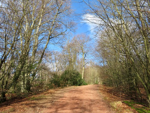
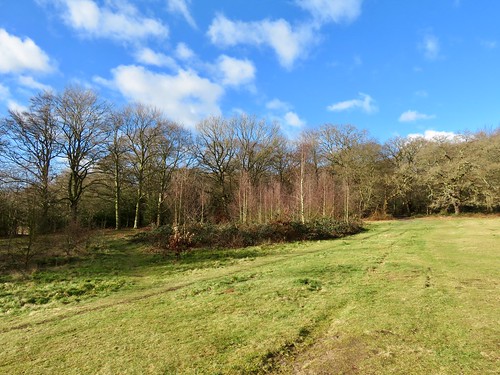
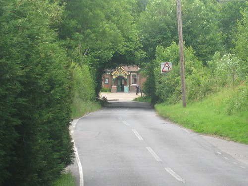
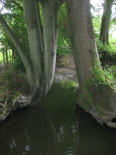
Lanlivery lies lost among its high-banked lanes to the west of Lostwithiel, a tiny hamlet sprinkled around the nucleus of St Brevita’s Church and the ancient Crown Inn. The pub – cosy and welcoming – dates back to Norman times. In fact it predates the church; the masons who built St Brevita’s with its tower of striped granite were put up there. As for Brevita: rather charmingly, absolutely nothing whatever is known about her – or him. There’s certainly a Saints Road or Saints Way that runs past the village, a former droving track (now a waymarked long-distance path) whose slanting course across the Cornish peninsula is dotted with ancient crosses, wells, standing stones and burial sites. It’s this path you follow between high hedges, a secret lane that smuggles you through the fields until you come out at the foot of Helman’s Tor. Up at the summit among the granite boulders you’ll find a logan or rocking stone – see if you can discover the subtle pressure needed to make it rock, while admiring the sensational views across the rolling Cornish farmlands.

Start: Crown Inn, Lanlivery, near Lostwithiel PL30 5BT (OS ref SX 079591)

Walk symbol: 4 miles, 2 hours, OS Explorer 107

Route: From Crown Inn, take Luxulyan road. At chapel, straight on (‘Lanivet’). In a quarter of a mile, right up green lane (‘Saints Way’) for 1 and a quarter miles to car park under Helman’s Tor. Climb Tor; return same way.

Lunch symbol: Crown Inn, Lanlivery (01208-8727071; www.wagtailinns.com).

Grade: 2/5 boots. Gentle ascent of tor. Green lane can be muddy!

Info: Lostwithiel TIC (01208-872207); www.visitcornwall.com


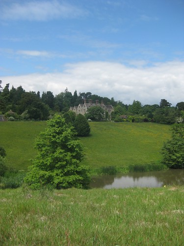
2. Stourhead and Alfred’s Tower, Wiltshire

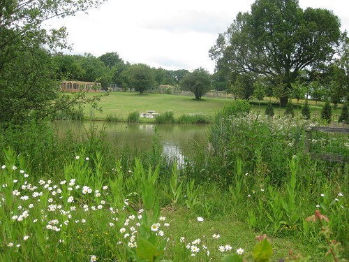
Superb 18th-century Palladian grounds and park created by the Hoares – father Henry ‘The Good’, son Henry ‘The Magnificent’. Stroll a circuit of the lake and its temples, follies and grottoes, or step out up the valley to the wonderful Rapunzel-like Alfred’s Tower on the ridge above. Then cosy up to a cockle-warming casserole in the Spread Eagle Inn at the park gates, or plump for cake and cuppa in the tearooms.

Start: Stourhead car park, BA12 6QD (OS ref SX 778340) – signed from B3092 Zeals-Maiden Bradley road, off A303 at Mere

Walk symbol: 1 and a half miles round lake (1 hour) or 5 and a half miles Alfred’s Tower circuit (2-3 hours), OS Explorer 142 (grounds map available at Visitor Centre)

Route: From Visitor Centre. down path. Don’t cross bridge to gardens and house; turn left to Spread Eagle Inn and Lower Garden entrance (pay/show NT card). Anti-clockwise round lake. For Alfred’s Tower circuit: At Pantheon, don’t turn left across Iron Bridge; continue through trees to gate and gravel roadway. Right (‘Alfred’s Tower’); follow blue arrows up valley for 1 and a half miles. At top, left to Alfred’s Tower. From tower, retrace steps 100 yards; right into woods (yellow arrow/YA). In 300 yards YA points right, but keep ahead on main track. In 500 yards at crossroads, main track swings left (YA); but take downhill path. In 200 yards near foot of slope, left (YA) past shed; follow YA back to Pantheon; cross Iron Bridge; complete lake circuit.

Lunch symbol: Spread Eagle Inn (01747-840587; www.spreadeagleinn.com)

Tea symbol:

Grade: Lake 2/5 boots; Alfred’s Tower 3/5.

Stourhead (National Trust): 01747-841152; http://www.nationaltrust.org.uk/main/w-stourhead


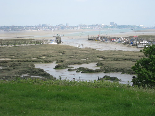
3. Chidham Peninsula, West Sussex

The Chidham peninsula hangs like a skate’s wing in the middle of Chichester Harbour’s vast flats of marsh and mud. At any time of year you’ll get a tang of green countryside and a salty smack of the sea here. In winter there’s the added thrill of big crowds of over-wintering seabirds.

From the friendly Old House At Home pub in Chidham village, grass paths lead to the eastern shore of the peninsula. There’s a fine view across water, mud flats and saltmarsh to the squat grey spire of Bosham church above a cluster of waterfront houses – every chocolate-box artist’s dream of delight. The sea wall path runs south around Cobnor Point with its wonderfully gnarly and contorted old oaks, and on up the edge of Nutbourne Marshes where wildfowl spend the winter in their tens of thousands. A new sea bank has been built inland here, against the day when the old one is washed away by the never-satisfied, ever-hungry sea.

Start: Old House At Home PH, Chidham PO18 8SU (OS ref SV 786040)

Walk symbol: 5 miles, 2 hours, OS Explorer 120

Route: From pub, right along road. Just before church, right along grassy path (fingerpost), past Chidmere Pond to road. Right for 100 yards; right (fingerpost) through car park; left along hedge to shore (797034). Right (clockwise) round peninsula for 3 miles to pass Chidham Point (779042). In a quarter of a mile, right (781045) on footpath along field edges to road; right to Old House At Home.

Lunch symbol: Old House At Home PH, Chidham (01243-572477; www.theoldhouseathome.co.uk)

Grade: 1/5 boots. Flat seawall path.

Info: Chichester TIC (01243-775888; www.visitchichester.org); Chichester Harbour Conservancy (www.conservancy.co.uk)

4. Shoreham and Eynsford, Kent

A really delightful walk in north Kent’s wide Darent Valley. The rood screen and organ casing in Shoreham’s church boast fabulous carving. Just down the road, Water House (private) was a 19th-century haven for artists including William Blake and Samuel Palmer. The Darent Valley Path takes you north in lovely river scenery to pass Lullingstone Castle, a gorgeous Tudor country house, and Lullingstone Roman Villa – 30 rooms, several frescoes, and a magnificent mosaic floor. At the turn of the walk, Eynsford is a photogenic old village with a fine tumbledown Norman castle. From here you follow a quiet road up a secret valley, then climb over the ridge through the woods to return to Shoreham.

Start: Shoreham station, Shoreham, Kent TN14 7RT (OS ref TQ 526615)

Walk symbol: 8 miles, 3-4 hours, OS Explorers 147, 162

Route: Shoreham station – Shoreham church (523616) – Water House (521616) – Darent Valley Path (signed) north for 3 and a half miles via Lullingstone Castle (530644) and Lullingstone Roman Villa (530651) to Eynsford. Left along A225 to Eynsford Castle (542658); return through village. Just before railway bridge, left past Eynsford station; follow Upper Austin Lodge Road for 1½ miles. Before Upper Austin Lodge, fork right past golf clubhouse; footpath south-west through woods for 1 mile to cross A225 and railway (526618); dogleg left to Station Road – Shoreham station.

Lunch symbol: Olde George Inn, Shoreham (01959-522017); teashops and pubs in Eynsford

Grade: 2/5 boots. Field and woodland paths (muddy!).

Info: Lullingstone Castle and gardens (www.lullingstonecastle.co.uk) closed till April; Lullingstone Roman Villa and Eynsford Castle (EH; www.english-heritage.org.uk) open Wed-Sun till 31 Jan (closed 24-26 Dec, 1 Jan); open daily thereafter.


5. Regent’s Canal, Victoria Park and Thames Path

To get you going on this exploration of east London’s waterways and markets, a gentle blur of reggae among the earring and shawl stalls in the covered shed of Old Spitalfields Market. Next, Brick Lane’s street market – curry, chilli, salsa, roasting beef and goat; titfers and tomatoes, fish and fascinators, bread and chairs, sandwiches, socks and sun-specs in more colours than the good Lord ever made. A pause to commune with the animals in the city farm; then you follow Regent’s Canal’s towpath towards the Thames in company with tinies in pushchairs, runners, strollers and the dog walkers of wide green Victoria Park. Approaching the river, the colossi of Canary Wharf and the space-rocket nose of the Gherkin rise pale and ghostly. There’s the smack of tidal waves and a tang of the sea as you swap the stillness of the canal for the salty vigour of the Thames, to stroll upriver into the cosmopolitan heart of the city once again.

Start: Liverpool Street station (Central/Circle/Metropolitan/Hammersmith & City)

Walk symbol: 8 miles, 3-4 hours, OS Explorer 173, London A-Z pp 40-2, 54-6

Route: Liverpool Street Station –- Old Spitalfields Market – Brick Lane – Bethnal Green Road – City Farm – Haggerston Park. Regent’s Canal to Limehouse Basin. Thames Path to St Katharine Docks. North via Mansell Street and Commercial Road to Liverpool Street.

Lunch symbol: Beigel Bake, Brick Lane (0207-729-0616) – salt beef, cream cheese, fish: you name it, it’s here in a fresh-baked bagel

Grade: 1/5 boots.

More info: Old Spitalfields Market www.visitspitalfields.com; Brick Lane Market www.visitbricklane.org; Regent’s Canal http://www.bertuchi.co.uk/regentscanal.php; Thames Path www.walklondon.org.uk

Reading: London Adventure Walks for Families by Becky Jones and Clare Lewis ( Frances Lincoln)


6. Ingatestone and Mountnessing Hall, Essex

Here’s a beautiful ramble in easy country (but muddy!) out in mid-Essex, a much-overlooked walking county. Ingatestone Hall is a superb Elizabethan mansion with ranks of mullioned and latticed windows, acres of tiled roofs, crowstepped gables and castellated turrets. Cross the fields to Buttsbury church on its ridge; then head south through old field lanes and horse paddocks to the outskirts of Billericay. A stumpy spire beckons you west across the River Wid to where St Giles’s Church and handsome Mountnessing Hall with its tall chimneys stand companionably side by side. From here field paths lead north past Tilehurst, a Victorian mansion out of a Gothic fable, and on back to Ingatestone.

Start: Ingatestone station, Essex CM4 0BS (OS ref TQ 650992)

Walk symbol: 7 miles, 3 hours, OS Explorer 175

Route: From station, left on path; left to cross railway; Hall Lane to Ingatestone Hall. Field path (yellow arrows/YAs) to St Mary’s Church, Buttsbury (664986). Buttsbury road – footpath south for 1 and three quarter miles (YAs) via Little Farm and Buckwyns Farm to road on west edge of Billericay (661977). Left for 150 yards to right bend; ahead here on footpath for 1 mile to Mountnessing Hall and church. Field path north (YAs) for three quarters of a mile to road (648975) and Westlands Farm. Path via Kitchen Wood to Tilehurst; road to Ingatestone Hall and station.

Lunch symbol: Star Inn, Ingatestone (01277-353618)

Grade: 2/5 boots. Gentle farmland paths. Can be very muddy!

Info: Ingatestone Hall (01277-353010; www.ingatestonehall.com) open Easter-Sept; guided tours at other times by arrangement

Chelmsford TIC (01245 283400; www.visitessex.com)


7. Little Chalfont and the Chess Valley, Buckinghamshire

As soon as you get into the woods that lie north of Chalfont & Latimer tube station, you’re immersed in proper countryside. The Buckinghamshire landscape slopes to cross the winding River Chess and reach the charming small village of Latimer, where the heart and harness of Lord Chesham’s bold charger Villebois are buried in the village green. From here the Chess Valley Walk leads by the river. Out in the fields you pass the brick-built tomb of ‘Mr William Liberty of Chorleywood, Brickmaker, 1777’, and follow the beautiful River Chess up to Church End (Christmas-themed 14th-century church frescoes, and delightful Cock Inn). The main feature of the homeward walk is Chenies village with its vast church monuments and grand Tudor manor – the house is haunted by the ghost of King Henry VIII.

Start: Chalfont & Latimer tube station, Metropolitan line, HP7 9PR (OS ref SU 997975)

Walk symbol: 7 miles, 3 hours, OS Explorer 172

Route: From station follow Chess Valley Walk across River Chess to Latimer; then east for 2 miles along River Chess valley, passing William Liberty’s tomb (009987), Valley Farm (026090) and Sarratt Bottom. At 034984, opposite footbridge over Chess, left on footpath to Church End (Holy Cross Church; Cock Inn), Return to cross 2 footbridges; in 100 yards fork right (032984) – path via Mountwood Farm (024984) to Chenies. Bridleway west via Walk Wood, Stony Lane (005982) and West Wood to Chess Valley Walk (997981) and station.

Lunch symbol: Cock Inn, Church End (01923-282908; www.cockinn.net)

Grade: 2/5 boots. Field and woodland paths.

Info: Chenies Manor (01494-762888; www.cheniesmanorhouse.co.uk) open April-Oct.

High Wycombe TIC (01494-421892); www.visitbuckinghamshire.org


8. Goring to Pangbourne, Oxfordshire/Berkshire

This is one of the most appealing sections of the Thames Path, linking two classically attractive Thames-side pairs of towns by way of a lovely wooded path. Descending the hill from Goring’s railway station, you turn left along the river bank and are swallowed in a tunnel of trees. Here the Thames snakes through the Goring Gap, a cleavage between the thickly wooded Berkshire Downs and the more open and bare Chiltern Hills.

Soon you are out in wide grazing meadows, passing under the stained and weatherbeaten brick railway bridge that carries Isambard Kingdom Brunel’s Great Western Railway line across the river. Now the Thames Path enters woodland of beech, yew, alder and willow; soon it climbs to the rolling downs, before striking into a farm track and then the road down into Whitchurch-on-Thames. Cross the Thames into Pangbourne. Kenneth Grahame, author of The Wind In The Willows, lived in Pangbourne for the last eight years of his life, and is buried in the churchyard just up the street. It was at Pangbourne that the soaked and miserable heroes of Three Men In A Boat abandoned their craft and caught the train back to London.

Start: Goring & Streatley station, RG8 0EP (OS ref SU 603806)

Walk symbol: 5 miles, 2 hours, OS Explorer 171

Route: From Goring station, left and left again to River Thames; left on Thames Path to Whitchurch; cross river to Pangbourne station; return to Goring.

Lunch symbol: Ferryboat Inn, Whitchurch (0118-984-2161; www.theferryboat.eu)

Grade: 3/5 boots. Flat path by river; some ascents in woodland.

Info: Wallingford TIC (01491-826972); www.nationaltrail.co.uk/thamespath


9. Apperley, Deerhurst and the River Severn, Gloucestershire

A gorgeous half-day’s walk in classic River Severn country – rolling, green, gentle, bucolic. From the Severnside village of Apperley you follow field paths north to climb a ridge with wonderful views, before dipping down to the river at Lower Lode. Tewkesbury’s Abbey and half-timbered houses are just up the river-bank; but the walk heads south, with the wide Severn at your elbow. Make time to explore Odda’s Chapel and St Mary’s Church at Deerhurst with their rare and beautiful Saxon stonework and angel carvings, before heading back downriver to the Coal House Inn for ‘steak on a stone’ – a hungry walker’s delight.

Start: Coal House Inn, Gabb Lane, Apperley GL19 4DN (OS ref SO 855284)

Walk symbol: 6 and a half miles, 3 hours, OS Explorers 190, 179

Route: From Coal House Inn, up lane; in 50 yards, footpath (fingerpost) to road (862282). Left through Apperley; follow ‘Tewkesbury, Cheltenham’; left past village hall (867285; fingerpost). Footpath for 1 mile by Wrightfield Manor, passing Deerhurst Vicarage (872293), to cross road (873298; 3-way fingerpost). Cross stile (not gateway!); north for a third of a mile to pond (874303); north along ridge for 1 mile to River Severn at Lower Lode Lane (881317). Left along Severn Way for 1⅓ miles to Deerhurst; detour left to Odda’s Chapel (869299) and Church of St Mary (870300). Return to Severn Way; continue for 1⅓ miles to Coal House Inn

Lunch symbol: Coal House Inn, Apperley ((01452-780211)

Grade: 3/5 boots. Field and riverside paths. Can be muddy!

Info: Tewkesbury TIC (01684-855040);

http://www.enjoyengland.com/destinations/find/south-west/gloucestershire/dg.aspx


10. Ysgyryd Fawr (‘The Skirrid’), Abergavenny, Gwent

Ysgyryd Fawr, the Holy Mountain, rises in a beautiful and striking whaleback above the neat farming landscape on the eastern edge of the Brecon Beacons National Park. To see it is to want to climb it, whether you’re a hill-walker, country rambler or active youngster. The climb from car park to summit is just under a thousand feet, and once up there (a really superb spot for mince-pies and hot coffee) you are monarch of a huge view around the Welsh Border country. Traces of earthen ramparts show where Iron Age tribesmen fortified the hilltop, and a scatter of stones marks the site of St Michael’s Church, where the Catholic faithful attended the outlawed Mass during the 17th century.

Start: Car park on B4521, 2 and a half miles east of Abergavenny (OS ref SO 328164). NB – Please don’t leave valuables on show!

Walk symbol: 3 and a half miles round base, 2 and a half miles to summit and back (both 1 and a half – 2 hours), OS Explorer OL13

Route: From car park, follow pass across fields, up through Caer Wood, through gate (327172). Left to make clockwise circuit of base of hill; otherwise right. In 300 yards, either keep ahead for anti-clockwise circuit, or fork left. Steep climb, then levelling out for half a mile to reach summit (330182). Retrace steps; or continue, forking left or right to descend steep north slope to bottom; left or right to return to car park via round-base path.

Lunch symbol: Walnut Tree Restaurant, Llanddewi Skirrid (01873-852797; www.thewalnuttreeinn.com)

Grade: 3/5 boots round base; 5/5 to summit (steep). Wrap up warm!

Info: Abergavenny TIC (01873-857588); www.brecon-beacons.com


11. The Stiperstones, Long Mynd, Shropshire

It’s tough, but you’ve got to do it … tear yourself away from the warm welcome and fabulous home baking at the Bog Centre, and venture out up the stony path among the extraordinary quartzite outcrops of the Stiperstones. Cranberry Rock, Manstone Rock, the Devil’s Chair, Shepherd’s Rock – they poke up out of the beautifully restored heathland along their ridge like craggy spines on a stegosaurus back. Legends of warlocks and witches hang thickly round the Stiperstones. Lady Godiva rides naked there still. When the mist is down, the Devil himself sits brooding in his great rock Chair.

From the ridge you descend steeply to the Stiperstones Inn. It’s a stiff climb afterwards, and a stony lane home.


Start: The Bog Centre, Stiperstones, SY5 0NG (OS ref SO 355979)

Walk symbol: 5 miles, 2-3 hours, OS Explorer 216

Route: From Bog Centre, footpath/road to south end of Stiperstones ridge (362976). Follow Shropshire Way past Cranberry Rock (365981), Manstone Rock (367986) and Devil’s Chair (368991). From cairn just before Shepherd’s Rock (374000), bear left on steep descent between Perkins Beach and Green Hill to road in Stiperstones village (363004). Left past Stiperstones Inn for 400 yards; left across stile (361002; fingerpost, arrows); steep climb for half a mile (arrows), up past National Nature Reserve board to reach stony lane (36294). Follow it south, parallel to Stiperstones for ¾ mile. At Black Ditch opposite Cranberry Rock, through gate (361983); footpath down to road and Bog Centre.

Lunch symbol: The Bog Centre; or Stiperstones Inn, Stiperstones village (01743-791327; www.stiperstonesinn.co.uk)

Grade: 4/5 boots. Rough and stony around Stiperstones; steep descent to road; steep ascent to lane.

Info: Bog Centre (01743-792484; www.bogcentre.co.uk)


12. Thetford Forest, Suffolk/Norfolk border

Thetford Forest covers some 80 square miles of the sandy Breckland country along the Norfolk/Suffolk border; and as it’s largely composed of conifers, you might think it’s a gloomy old place for a winter walk. In fact low winter light lends mystery to the dark forest. Walking is sheltered and easy. Well-waymarked Yellow and Red Trails circle out from High Lodge and Thetford Warren Lodge respectively; combining the two gives you an excellent morning’s stroll. Children love clambering on the huge squirrel, spider, woodpecker and chum along the Giant Play Sculpture Trail (wheelchair and buggy friendly). Towards the end of winter there will be a night-time spectacular as the trees are transformed into the Electric Forest, with stunning light and sound effects.

Start: High Lodge Forest Centre, IP27 0AF – signed off B1107 Thetford-Brandon road (OS ref TL 809850)

Walk symbol: Red Route, 3 and a half miles; Yellow Route, 3 miles; Red/Yellow combined 7 miles; Giant Play Sculpture Trail (Easy Access), 1 mile. Map online (see below); OS Explorer 229

Lunch symbol: High Lodge café.

Grade: 1/5 boots. NB Parts of trails may be closed for forestry operations; diversions signposted.

Info: High Lodge Forest Centre (01842-815434; http://www.forestry.gov.uk/highlodge)

Electric Forest (www.theelectricforest.co.uk) – over February half-term 2011 (19 to 27 February), plus 3 to 6 March. Book your slot (5-9 pm) online or tel 01842-814012; £15.50 adult, £10 concessions, £41 family. 1 and a half mile self-guided walk by night; spectacular lights, effects; food and drink

13. Robin Hood and the Royal Forest, Edwinstowe, Nottinghamshire

This Sherwood Forest walk follows the newly-opened ‘Robin Hood and the Royal Forest’ trail from the Visitor Centre near Edwinstowe. It passes two massive and venerable trees, the Major Oak and the Centre Tree – the philanthropic outlaw’s hideout and rendezvous, according to legend. From here the trail curves through the forest to reach King Edwin’s Cross, marking the spot where Edwin, King of Northumbria, was buried after his death in battle in 633AD. A track on the edge of the forest brings you to Edwinstowe and the Norman church of St Mary. Were Robin Hood and Maid Marian married here? Anyone with an ounce of romance thinks so.

Christmas-flavoured celebrities at Sherwood Forest Visitor Centre include St Nicholas, who will be manning his grotto till 19 December (11-4), and the Dukeries Singers who belt out their Christmas songs on 19th (2-3 pm).

Start: Sherwood Forest Country Park Visitor Centre car park, Edwinstowe, Notts NG21 9QA (OS ref SK 627676)

Walk symbol: 6 miles, 3 hours, OS Explorer 270

Route: From Visitor Centre follow Blue Trail to Major Oak 621679); on along Robin Hood Way to the Centre Tree (606676); ahead, keeping same direction, for three quarters of a mile; left (595672) along ride for a third of a mile; left (591667) past King Edwin’s Cross (594666) to meet A6075. Left along verge for 300 yards; left (north) for half a mile; right (607671) for nearly a mile towards Visitor Centre. Right (621676) on bridleway to Edwinstowe and St Mary’s Church. Return to Visitor Centre.

Lunch symbol: Visitor Centre

Grade: 2/5 boots. Forest tracks.

Info: Sherwood Forest Country Park Visitor Centre (01623-823202); www.sherwoodforest.org.uk


14. Beverley and Westwood, East Yorkshire

A cosy, friendly town, some truly astonishing medieval artwork, a wide green common and a (very) characterful pub with coal fires and great food – what more could you ask of a winter walk? Beverley Minster and St Mary’s Church between them boast some of the finest stone carvings in Britain – merry musicians, gurning demons, Green Men spewing foliage, forest monsters and improbable animals. Gaze and marvel your fill; then stroll through the town, every vista packed with nice old buildings. Walk across the racecourse and out over the wide open spaces of Westwood Common, carefully preserved from development by Beverley’s vigilant Pasture Masters. From the Black Mill high on its ridge there’s time for a lingering prospect over the town, before making for the warmth, good cheer and bright fires of the White Horse in Hengate – know to all as Nellie’s.

Start: Beverley station, HU17 0AS (OS ref TA 038396))

Walk symbol: 5 miles, 2-3 hours, OS Explorer 293

Route: Beverley Minster – Wednesday Market – Saturday Market – St Mary’s Church. Through North Bar – along North Bar Without – left down Norfolk Street onto Westwood Common (025401). Ahead across racecourse, then A1174 (019397). Ahead through Burton Bushes, to exit stile at far side (010392). Aim for Black Mill on hill (021390). From mill, aim for St Mary’s tower; through Newbegin Pits dell to footpath on far side (027395). Right past Westwood Hospital; left along Lovers Lane (027394 – kissing gate, lamp post) to St Mary’s Church and town centre.

Lunch symbol: White Horse, Hengate, Beverley (01482-861973; www.nellies.co.uk)

Grade: 2/5 boots. Town pavements, grass paths

Info: Beverley TIC (01482-391672; www.realyorkshire.co.uk)

15. Whitby and Hawsker, North Yorkshire

Whitby is a great winter town, full of museums, teashops and odd nooks and crannies. It’s also where Bram Stoker based Dracula, and the walk starts up the steps, through the clifftop churchyard and by the towering abbey ruins haunted by the toothy Transylvanian. Then a wonderful, wind-blown three miles along the cliffs where Victorian miners dug shards of fossilised monkey-puzzle trees. Polished and shaped by craftsmen, the fragments became shiny black jet, to be turned into ornaments that made many Whitby fortunes. Inland over the fields, and then a smooth stretch of the old Whitby & Scarborough Railway, a hop over the River Esk across mighty Larpool Viaduct, and a bun and cup of tea in Elizabeth Botham’s iconic and excellent teashop.

Start: Whitby harbour bridge (OS ref NZ 900111).

Walk symbol: 8 miles, 4 hours, OS Explorer OL27

Route: Church Street – 199 Steps – St Mary’s Church (902113) – Whitby Abbey – Cleveland Way coast path east for 3 miles. Near Gnipe Howe farm, cross stream (934091); in another third of a mile, right (936086; arrow, ‘Hawsker’ fingerpost) to Gnipe Howe (934085). Farm drive for two thirds of a mile – right on Scarborough-Whitby Railway Path for 2 and a half miles. Cross Larpool Viaduct (896097); in 250 yards, right (arrow; Esk Valley Walk ‘leaping fish’ fingerpost) – cross A171 (898102). Right for 100 yards; left (fingerpost), descending to west quayside – ahead along River Esk to bridge.

Lunch symbol: Windmill Inn, Stainsacre (01947-602671, closed Tues and Thurs lunchtime; Elizabeth Botham’s Teashop, 35-9 Skinner Street, Whitby (01947-602823; www.botham.co.uk)

Grade: 3/5 boots. Coast and field paths (muddy round Gnipe Howe Farm); cycleway

Info: Whitby TIC, Langborne Road (01723-383637); www.yorkshire.com


16. Keld and Tan Hill, North Yorkshire

A long morning’s or afternoon’s walk in a very beautiful location, this moorland hike is an absolute peach, especially if the sun’s out and it’s a crisp winter day. You start from Keld Lodge Hotel, a great conversion job on the old youth hostel, and walk through the pretty stone-built village of Keld before crossing the River Swale by some fine waterfalls. The well-marked Pennine Way National leads you north across open, rolling moorland, with the Tan Hill Inn beckoning– a classic walker’s inn, very lively and warm. The return walk is down a ribbon-like moorland road; then you retrace your steps along a mile of the Pennine Way before taking the footpath down lovely Stonesdale to the rushing waterfall of Currack Force on the outskirts of Keld.

Start: Keld Lodge Hotel, Keld, N. Yorks DL11 6LL (OS ref NY 110839)

Walk symbol: 9 miles, 4 hours, OS Explorer OL30

Route: Right along road; left into Keld. Right (893012; ‘footpath to Muker’). In 300 yards, left downhill (‘Pennine Way/PW’). Cross River Swale footbridge; follow PW for 4 miles to Tan Hill Inn (897067). Left along road for 100 yards; left on moor road for 1 and three quarter miles. Just before Stonesdale Bridge, left on bridleway for 200 yards (884043); right on PW for 1 mile. Just beyond Frith Lodge drive, right on footpath (890030), south for three quarters of a mile to meet bridleway near Currack Force on Stonesdale Beck (888016). Left to PW and Keld.

Lunch symbol: Keld Lodge Hotel (01748-886259; www.keldlodge.com); Tan Hill Inn (01833-628246; www.tanhillinn.co.uk)

Grade: 3/5 boots. No steep ascents, but rough moorland paths. Hillwalking gear, boots.

Info: Richmond TIC (01748-828742); www.yorkshire.com


17. Askham and Heughscar Hill, Cumbria

Alfred Wainwright wrote his walking guidebook Outlying Fells Of Lakeland (Frances Lincoln) for ‘old age pensioners and others who can no longer climb high fells’. That makes his Heughscar Hill walk perfect for those with a bellyful of Christmas grub. A farm lane winds west from Askham village on the eastern edge of the Lake District, bringing you gently up to the ‘heights’ of Heughscar. This modest green ridge of limestone pavement gives stunning views west over Ullswater to the Helvellyn range, and east to the upthrust of Cross Fell on the Pennine spine. The old Roman Road of High Street carries you to The Cockpit, an ancient circle of knee-high stones on a wide moor. From here green paths and farm tracks return you to Askham.

Start: Queen’s Head Inn, Askham CA10 2PF (OS ref NY 514237)

Walk symbol: 5 and a half miles, 2-3 hours, OS Explorer OL5

Route: Follow wide tree-lined street uphill. West out of village past Town Head Farm (508236). Over cattle grid; ignore tarred road branching left; keep ahead with wall on right for three quarters of a mile, passing barn (502232). At Rigginleys Top (498230), through gate; aim for corner of wood half a mile ahead. Along wood edge. At far corner (489229), aim a little right on path past boundary stone (488230) to Heughscar Hill summit (tiny cairn, 488232). On for a third of a mile to Heugh Scar crags (486237). Descend left; left along broad track of High Street. In two thirds of a mile descend to pass cairn (483227); on to stone circle (482222 – ‘The Cockpit’ on map). Aim for wood edge uphill on left (491229); return to Askham.

Lunch symbol: Queen’s Head, Askham (01931-712225; www.queensheadaskham.com)

Grade: 3/5 boots. Farm tracks, moorland paths.

Info: Penrith TIC (01768-867466); www.golakes.co.uk


18. Gilsland and Birdoswald Fort, Hadrian’s Wall, Northumberland

This fascinating ramble is one of the Hadrian’s Wall Linked Walks – short, circular, family-friendly walks that take in a glimpse of the Wall and some of its countryside. Start from Gilsland, following Hadrian’s Wall Path beside the monument. At Willowford Farm there’s a fine section of Wall. In the 1,600 years since the Romans left Britain, these handy stones have built houses, barn and walls all along the line of the Wall. Willowford Farm is full of them. One barn wall incorporates a stone with an inscription, the lettering all but faded: ‘The Fifth Cohort of the Century of Gellius Philippus (built this)’.

Beyond the farm, the river and its steep bank offered the Romans a natural defence. Here are the massive abutments of Hadrian’s great bridge across the river. Before a footbridge was built here in the 1960s, children walking to school in Gilsland would cross the river by aerial ropeway – what a thrill that must have been.

Beyond lies Birdoswald fort with its fine gateways, its drill hall and its pair of stone-paved granaries big enough to feed a garrison of up to a thousand men. Here you leave Hadrian’s wall and descend through hazel and oak wood to cross Harrow’s Beck, before a stretch of country road back into Gilsland.


Start: Samson Inn, Gilsland, Northumberland CA8 7DR (OS ref NY 636663)

Walk symbol: 3 and a half miles, 2 hours, OS Explorer OL43

Route: Gilsland – Hadrian’s Wall Path to Birdoswald Fort – lane towards Breckney Bed Bridge. Path (616665) – cross Harrow’s Beck to road (622669) at The Hill – right to Gilsland.

Lunch symbol: Samson Inn, Gilsland (01697-747220)

Grade: 2/5 boots. Good paths.

Info: Walk – http://www.eccp.org.uk/images/great-days-out/BirdO-Gilsland2.pdf

Birdoswald Roman Fort (01697-747602; www.english-heritage.org.uk/birdoswald); www.hadrians-wall.org


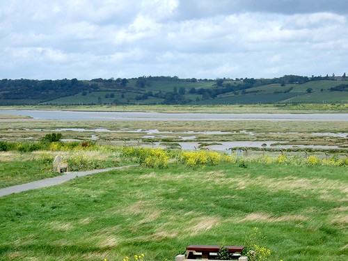
19. Old Military Road, Creetown to Gatehouse-of-Fleet, Dumfries & Galloway

Following the chaotic troop movements of the ’45 Jacobite Rebellion, the Old Military Road from Creetown to Gatehouse-of-Fleet was built in 1763 to allow soldiers an easy march through to Stranraer, port of embarkation for Ireland. You get a flavour of its military straightness and purpose as you follow it out of Creetown, a narrow tarmac ribbon running through woods and past a fine old stone circle, climbing over wild moors, to shed its surface and run as a stony green lane down to the poignant ruin of Anwoth Old Kirk with its tombs and inscriptions. Climb to the heights of the lumpy Boreland Hills (wonderful views), before descending into neat and charming Gatehouse of Fleet.

Start: Creetown clock tower, High Street/St John Street DG8 7JF (OS ref NX 476589)

Walk symbol: 9 miles, 4 hours, OS Explorers 311, 312

Route: Uphill up High Street (‘Gem Rock Museum’). In 150 yards, right (‘Glenquicken Farm’). Follow road for 5 miles, crossing Billy Diamond’s Bridge (508585) and stone circle beyond (far side of field on right; 509582) then past Cambret and Stronach Hills. Where road bend sharp right (548582) keep ahead (‘Lorry restriction’ sign) across Glen Bridge. 300 yards past Lauchentyre cottage, ahead over crossroads (561574); on for 3 miles to Anwoth. Up right side of Old Kirk (582562; ‘public path Gatehouse’); yellow arrows/YAs to gate into wood (584562). Steeply up; leave wood; left (YA). At next YA post bear left; follow YAs through hollows of Boreland Hills; down to Gatehouse-of-Fleet.

Return to Creetown: bus service 431 or 500/X75

Lunch symbol: Ship Inn, Gatehouse of Fleet (01557-814217; www.theshipinngatehouse.co.uk)

Grade: 2/5 boots. Easy all the way.

Info: Gatehouse TIC, Mill on the Fleet (01557-814212); www.visitdumfriesandgalloway.co.uk


20. Castle Archdale, Co Fermanagh

During the Second World War, Lower Lough Erne’s huge sheet of water was perfectly placed (once a secret deal over airspace had been struck with the Republic) for Sunderland and Catalina flying boats, based on the wooded peninsula of Castle Archdale, to hunt U-boats out in the Atlantic. Follow the waymarked World War II heritage trail as it loops round the headland, past fuel and ammunition stores as overgrown and ancient-looking as Stone Age huts, down to the marina with its big white beacon and memorial stone to wartime crash victims, and out along the ‘Burma Road’, a jungly path cut through the forest to reach the isolated explosives dumps. The lake views are superb, too.

Start: Castle Archdale Visitor Centre, near Lisnarick, BT94 1PP

Walk symbol: 2 and a half miles, 1-2 hours, OS of NI Discoverer 17; downloadable maps/instructions at www.walkni.com

Route: (World War 2 Heritage Trail marked with numbered posts): From Courtyard Centre car park, sharp left past ‘No Entry’ sign on path through trees. Follow ‘Woodland Walk’ signs to roadway. Left for 30 yards; right to marina. Left to beacon; left along shore path; bear right at yellow marker, continue on cycle track. At another yellow marker, right to shore path. Follow it through Skunk Hole car park. Follow ‘Butterfly Garden’ past pond, butterfly garden and deer enclosure. Dogleg right and left to gate at drive (don’t go through!). Left along path; right to castle gardens.

Lunch symbol: Tullana on the Green, Lisnarick (028-6862-8713; www.tullanaonthegreen.co.uk); Molly’s Bar, Irvinestown (028-6862-8777; www.mollysbarirvinestown.com)

Grade: 1/5 boots. Surfaced paths

Info: Castle Archdale Visitor Centre (028-6862-1588;

www.ni-environment.gov.uk/places_to_visit…/parks/archdale.htm) – winter opening Sundays, 12-4

www.discovernorthernireland.com

 Posted by at 00:00
Oct 022010
 

First published in: The Times Click here to view a map for this walk in a new window
picture picture picture picture picture picture picture
Facebook Link:
Foggy moors and misty mountains aren't the only places where a walker can do with a little helping hand from technology. The rolling, heavily wooded Wealden country where Kent and Surrey join hands with Sussex, for example, is beautiful for walking, but baffling enough. What with tree-shrouded tracks, mazy field paths and ancient holloways tunnelling through the hedges, Jane and I were glad of the direction-finding miracle called Satmap – not to mention the ever-reliable OS Explorer.

Among the beeches and oaks of the North Sussex Weald, bramble flowers screened old iron-working ponds and pits, reminders of a time when these deep woods smoked and roared with industry. The only man-made sound today was the hoot and ‘chuff-chuff’ of a steam locomotive on the Bluebell Railway just beyond the trees. We wandered north through buttercup fields, skirting Fen Mill Place with its wonderful meadows of wildflowers – moon-like marguerites, red bursts of campion – and newly planted hedges of maple, rose and blackthorn. How good to see someone putting time, thought and money into enhancing the biodiversity of this countryside.

Splashing sounds came from a pond just beyond Fen Mill. Carp? Pike? Young otters? We couldn’t tell, but it was a great way to spend half an hour, craning between the trees and watching the dragonfly-haunted water while a squirrel in the oak canopy kept his beady eyes on us.

From Crawley Down we went south down a sunken lane whose banks had been burrowed into fans of sticky yellow clay dimpled with rabbit paw-prints. Holly hedges were hung with long strings of the shiny, heart-shaped leaves of bryony. It was quite a shock to come back to civilization in the form of Pots & Pithoi Pottery, a fabulous place where giant earthenware vessels stood out under flowery trellises as if waiting for a visit from Ali Baba.

A cake and a cuppa here fired us up for the last few miles, through the birch and heath of Selsfield Common, round the parkland of Gravetye Manor – all silver-grey stone and ranks of mullioned windows under tall brick chimneys, high and handsome above its lake. ‘Forsyte Saga country,’ murmured Jane as she gazed, and that exactly summed it up.


Start & finish: Kingscote Station, Bluebell Railway, near East Grinstead (OS ref TQ 367657); or Forestry Commission car park, Minepit Wood (360350).

Getting there:

By train/bus: Kingscote Station from Sheffield Park (TN22 3QL) or Horsted Keynes (RH17 7BB) by Bluebell Railway (www.bluebell-railway.co.uk); or by Bus 473 from East Grinstead Station (www.thetrainline.com). By road: Kingscote Station signposted off B2110 East Grinstead – Turners Hill (NB no parking at station). FC car park ½ mile further.

Walk: (7½ miles; moderate, OS Explorer 135. NB – GPS or Satmap are helpful): FC car park – from bottom right corner, right on gravel path; it bends left to follow power lines east. In ⅓ mile cross gravelled roadway (364350; house on right); continue, trending left away from power lines; in 150 yards, forward at double fingerpost to road (368351). Left (‘High Weald circular walks’), passing right turn to Kingscote Station (fingerpost) to cross road (365355; fingerpost). Keep left of Tickeridge Farm buildings; through 2 gates, across field, through kissing gate, across brook. Keep hedge on right (fingerpost, stiles) for ¼ mile to cross B2110 (363362).

Left for 50 yards, right up drive (‘Mill Wood’); in 20 yards, right (fingerpost). Following ‘High Weald Landscape Trail/HWLT’ and footpath fingerposts, skirt round Fen Place Mill. By gate on left marked ‘Private’, HWLT turns right; but keep ahead (fingerposts). Pass pond (360369); right through kissing gate (fingerpost). Cross field; left on West Sussex Border Path (357372) for ½ mile. Left up Sandhill Lane (349372); in ¼ mile, right (footpath fingerpost); in ⅓ mile, left at T-junction (349362) to pass Pots & Pithoi Pottery and reach B2110 (NB Metrobus 84/684 stops here).

Cross road and on (fingerpost); cross stream (353357); right (fingerpost) on track to recross stream. Left up field edge; follow fingerposts under power lines (351355), along field edges and sunken lanes for ¾ mile to 3-way fingerpost on NW edge of Selsfield Common (348346). Left here; in 10 yards pass another fingerpost; ahead (east) across Selsfield Common. Through kissing gate; through grounds of Selsfield Place, through kissing gate; follow grass and flint ride to Vowels Lane (354345). Left to next corner; right up drive (‘Moatlands’); left (fingerpost) through trees to skirt Moatlands. Path descends for ¼ mile to T-junction (360341); right past Old Moat house. Over stile, diagonally up field slope opposite Gravetye Manor. Aim for far right corner of field; cross stream; left (363336, HWLT) on path. Left at field corner; right across lake bridge (363339); up path to drive by Manor gates (363341). Follow drive, in 300 yards bear right (HWLT) past Home Farm; on into Bushy Wood. In 200 yards, right (HWLT) down ride; under 2 sets of power lines; then in 20 yards, left, and retrace steps to car park.


NB: Detailed directions (highly recommended!), online map, more walks: www.christophersomerville.co.uk.

Tea and Cakes: Pots & Pithoi Pottery, on B2110 near Turners Hill (01342-714793; www.postandpithoi.com)

More info: East Grinstead TIC, Library Buildings, West Street (01342-410121; www.visitsussex.org) www.ramblers.org.uk; www.satmap.com


 Posted by at 00:00
Jun 202009
 

First published in: The Times Click here to view a map for this walk in a new window
Facebook Link:

The little hilltop town of Rye oozes charm, from its red roofs and cobbled laneways to its ancient timber-framed smuggler’s pub, the Mermaid Inn. Weatherboarded brick houses line the steep streets, their window-frames picked out in black and white, roses and hollyhocks blooming along their walls and round their dimity doors. On a pin-sharp summer’s morning I climbed the tower of St Mary’s Church (steps of stone and brick, treads of wood, wobbly ladders, hold-your-breath squeezes) to gaze over the town, and further on out across the flat green apron of Romney Marsh where East Sussex gives way to Kent. No wonder Henry James came to live and write here. Who wouldn’t be inspired by all that time-suspended, fabulously evocative beauty at their doorstep every day?

Out on the flatlands I went upstream against the seaward-sliding tides of the River Rother. Across the river rose a wooded cliff, the old line of the coast before the marshes were drained in medieval times. Soon I was across the river and up on top of the rampart, walking through fields of fat sheep with greenfinches darting through the hedges. The fortified manor house of Iden Mote has long gone, but the big horseshoe-shaped moat remains alongside the farm among orchards and oast-houses, symbols of the traditional husbandry of this fruitful region.

The church of St Peter and St Paul lay well beyond its parent village of Peasmarsh, a lovely small Norman building set with several strange animal carvings. Carved leopards playfully swallowed their own tails on the chancel arch. Outside in a drain at the south-east corner I discovered the stone likeness of a running beast – a horned stag, or perhaps a hare – tucked into the church foundations by a medieval mason with pagan sympathies.

From Peasmarsh I followed a path through broad open grazing meadows among more flocks of stout white sheep. Overshot willows with bushy crowns lined the drainage channels. Beyond them Rye rode its hilltop, the red-roofed houses rising in a wave to the church on the crest, like some fabled city in a painting, or an augury of what might happen should the sea rise to reclaim the long-drained marshes of this coast and reach that stranded cliff once more.


Start & finish: Tourist Information Centre, Strand Quay, Rye TN31 7AY (Tel 01797-226696)

Getting there: Train (www.thetrainline.com) to Rye

Road: M20 to Jct 9/10; A2070, A259

Walk (10 miles, easy/moderate grade, OS Explorer 125):
Leaving Rye Tourist Information Centre (918203), left up Mermaid Street to top; right along West Street past Lamb House to St Mary’s Church. Up Lion Street; right along Market Street; left down East Street; right along East Cliff, bending left to pass through Landgate (912205). Continue down to A268; right to roundabout; left on A259 to cross River Rother. Turn left along right (east) bank for 2¼ miles to Boonshill Bridge (936237). Cross river; follow lane past Cliff Farm, steeply up cliff, on for 600 yards to cross road (926237). Continue along right-hand field edge. At far end, field narrows like bottle neck; through hedge in top right corner; on to far end of next field where yellow arrow points forward through gateway (922237).
To visit Bell Inn, Iden, right through gap in hedge before gateway; diagonally left across field to cross stile in far hedge; over next field to cross stile; right to road; left to Bell Inn (918238). Return same way to gateway.
Through gateway; beside hedge for 400 yards/metres to Playden Lane. Ahead to cross B2082 (918233); on up gravelled lane opposite. In 400 yards, right at fork (914232); on past Iden Park for ⅓ mile to road (910236). Right for 75 yards, then left (fingerpost) into orchard. Bear left down nearest ‘ride’ to pass pylon; follow hedge on right, curving left to reach lane (907238). Right; at following right bend, ahead along gravelled lane to pass Iden Moat .
In front of twin oasts, left (899240); in 50 yards fork right through gateway. In another 50 yards ignore FP pointing right; keep ahead (bridleway arrow) on track through orchard. At far side, right through gate (897237); forward down field edge for 300 yards, then left on gravelled track past Old House Farm; on through Cock Wood to A268 in Peasmarsh (886230). Cross road; right for 50 yards; before Cock Horse Inn, left through gates into caravan field. Follow left-hand hedge; in top left corner cross stile, then stile opposite; diagonally across field to bottom left corner; cross stile; continue to road (885225). Right for 50 yards; left over stile. Keep right up hedge; in 75 yards fork left on path across field, keeping parallel with electric cables. Cross stile in far hedge; cross footbridge and another stile; ahead, following direction of waymark arrow on stile footboard, to reach Peasmarsh church (887218).
From church, left along road for 150 yards; on left bend, right (fingerpost; ‘Clayton Farm’) on gravelled track past Clayton Farm (893216); on for 600 yards to pass derelict building on left (897212). Shortly after, ignore right fork and keep ahead at waymark arrow post with hedge on left, through gate (‘High Weald Landscape Trail’/HWLT waymark) and on. Cross stile and plank footbridge (HWLT); on with hedge on left. Through gateway into open field. Continue, keeping to left of line of willows, towards gate on its own diagonally left ahead; go through (HWLT). Aim for right end of line of trees ahead; continue, soon between watercourses, to Rolvendene Farm (916210). Follow yellow HWLT arrows; bear right to River Tillingham on right. Follow it on tarmac path, to cross B2089 near railway level crossing.
For Rye station, left over crossing and first left.
Continue down lane, passing to left of windmill. Just before river, left through gate to cross railway (please take care!); on to road and Rye Tourist Information Centre.
NB – Detailed directions, online map, more walks: www.christophersomerville.co.uk

Lunch: Bell Inn, Iden (see below); Cock Horse, Peasmarsh (01797-230281)

Accommodation: Bell Inn, Iden (01797-280242; www.idenbell.co.uk)

Rye church tower: open daily. 85 steps including steep ladders; some narrow squeezes!

More info: Rye TIC (01797-226696; www.visitrye.co.uk)


 Posted by at 00:00