First published in: The Times Click here to view a map for this walk in a new window


Facebook Link:

It was a chilly February morning in the lee of the Surrey hills, but the sparrows of Ewhurst were chirping all round the village nonetheless. Cold fresh air stung our nostrils in Wykehurst Lane, where the sharp, sweet song of a solitary robin laid the archetypal soundtrack for a wintry walk in the woods.
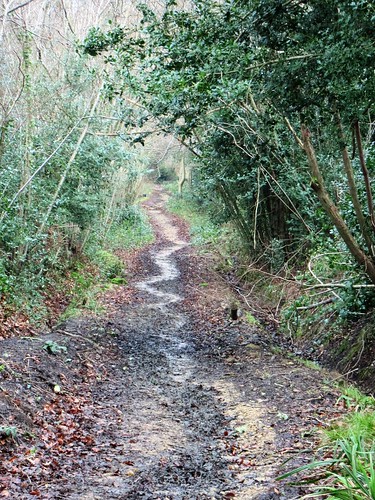
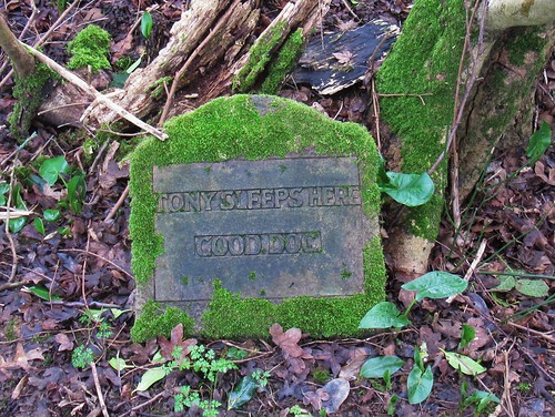
Snowdrop clumps were still full and white down in the sheltered hollow of Coneyhurst Gill. We followed a muddy path up towards the tree-hung escarpment of the great greensand ridge that cradles the lowlands of the Surrey Weald. This was all loud and smoky ironworking country in the late Middle Ages, but these days the fine large houses of the stockbroker belt look out from their hillside eyries onto paddocks and pastures that lie silent and unblemished. Under a hazel by the path we passed a modest plaque: ‘Tony sleeps here. Good dog.’
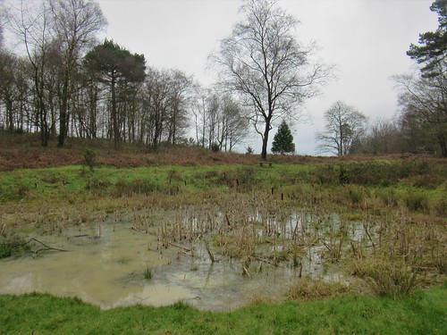
Signs of spring were already infiltrating the closed doors of winter – lambs-tail catkins and tiny scarlet flowers on hazel twigs, rushy spears of bluebell leaves under the oaks, and an insistent bubbling of birdsong up in the high woods along the ridge. A stream stained orange by iron leachings had cut deeply into the greensand, and the golden ball of a crab apple bobbed endlessly in a back eddy where the brook had trapped it for a plaything.
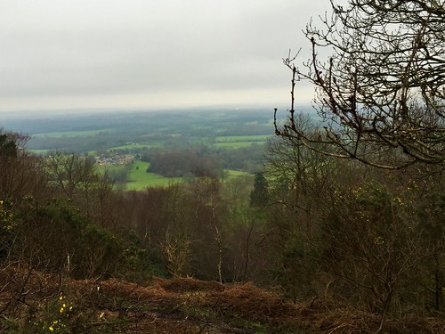
The Greensand Way trail strings together the promontories and heights of the escarpment, and we followed its knobbly yellow track up through the woods to Holmbury Hill. In the century before the Romans invaded Kent, a Belgic tribe built a mighty fort here with ramparts and ditches as tall as three men. From its southern lip a wonderful view opens out across the Weald and away towards the South Downs some 20 miles off. On clear days, walkers on Holmbury Hill can spot the semaphore flashes of the sea at Shoreham on the Sussex coast. But today all was muted and misty down there.
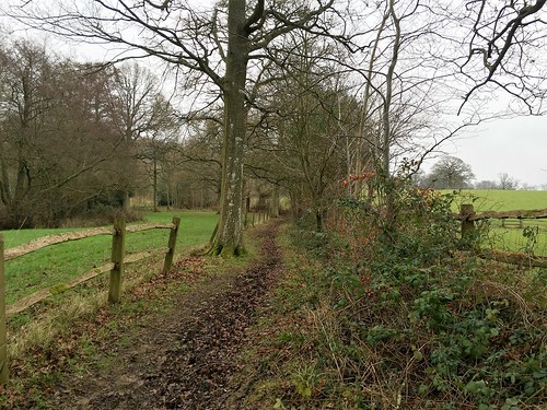
Using gorse branches as banisters we groped our way down a precipitous slope below the hill fort. At the foot of the escarpment the mud-squelching track of Sherborne Lane led us back through the fields towards Ewhurst, between hedges where primroses were already beginning to cluster among the hawthorn roots.
Start & finish: Bull’s Head PH, Ewhurst, Surrey GU6 7QD (OS ref TQ 090408)
Getting there: Bus 53 (Horsham-Guildford)
Road: Ewhurst is on B2127 between Forest Green and Cranleigh
Walk (6 miles, moderate grade, OS Explorer 145, 146): From Bull’s Head cross B2127; follow Wykehurst Lane (fingerpost/FP). In ½ mile cross bridge over Coneyhurst Gill (082407); in 50m, right (FP, stile) on path through trees. In 600m, left along road (081413); in 50m, right (‘Rapsley’) up drive. Pass Rapsley Farm; on up path on edge of wood. At road, right (081422); in 100m, left up Moon Hall Road.
In 200m, opposite gates of Folly Hill, fork left up bridleway (084422, FP) for 400m to turn right along Greensand Way/GW (085425). In 300m fork right past wooden barrier (086428, GW), downhill and through grounds of Duke of Kent School. Cross Ewhurst Road (090430); on along GW for ¾ mile to car park on Holmbury Hill (098431). Leave car park at far right corner. In 150m, just past pond on right, fork right on path (not broad track) among trees, past wooden barrier (‘Footpath Only’). At edge of escarpment bear left; in 200m turn right along GW (101430). Follow GW to trig pillar on Holmbury Hill fort (104429), and on for 100m into hollow. Right here (105429) down slope past notice ‘Bridleway 193 – Caution, steep slope ahead’. Very steep, rubbly slope down to road (105428).
Right; in 200m, left off road, and follow fenced path to left of gate marked ‘Wayfarers’ (FP). In 100m cross road (103426); ahead along drive with staddle stones (FP). By pond, fork left (‘Bridleway’ FP) along Sherborne Lane bridleway. In ½ mile pass drive to Radnor Place Farm on left (095419). Continue along Sherborne Lane. In 300m, at stile and yellow arrow on right, turn left onto driveway (093418). Right; in 50m, left (FP) along fenced path across Path Four Acres field and into wood (094414). Right (FP) to road in Ewhurst (090409); left to Bull’s Head.
Conditions: Muddy/wet paths; very steep slope down from Holmbury Hill fort.
Lunch/accommodation: Bull’s Head, Ewhurst (01483-277447, bullsheadewhurst.co.uk) – lovely pub, lovely grub
More info: Guildford TIC (01483-444333)
visitengland.com; satmap.com; ramblers.org.uk