Search Results : leicestershire

May 062023


First published in: The Times Click here to view a map for this walk in a new window
Midshires Way between Brooksby and Gaddesby 1 meadows of the Wreake valley Midshires Way between Brooksby and Gaddesby 2 Midshires Way between Brooksby and Gaddesby 3 Midshires Way between Brooksby and Gaddesby 4 Midshires Way near Gaddesby wildflower meadow near Gaddesby River Wreake near Hoby 3 River Wreake near Hoby 1 River Wreake near Hoby 2

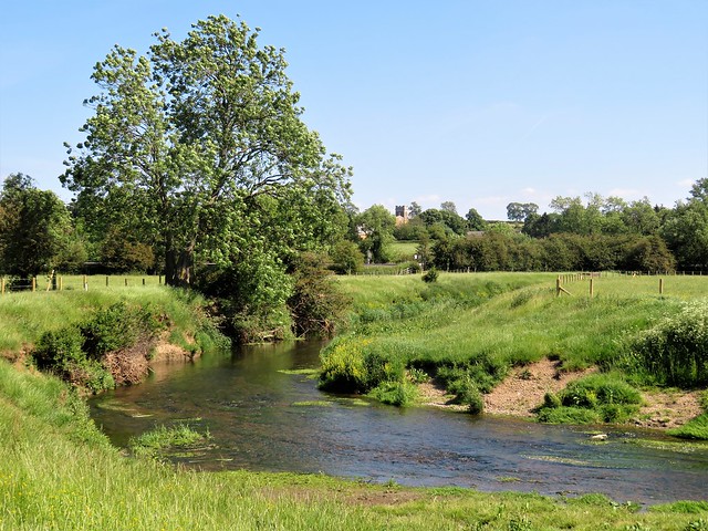
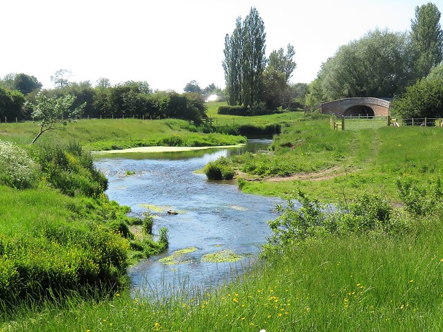
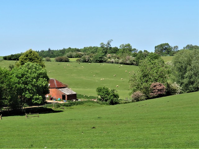
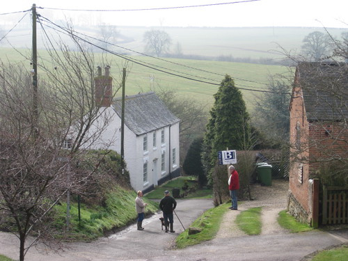
A cool morning above the Leicestershire Wolds, and neighbourly conversations developing over the garden fences of Hoby. The village, perched on a ridge overlooking the valley of the River Wreake, trails its mellow red brick buildings along a street as bendy as the snaking meanders of the river through the meadows below.

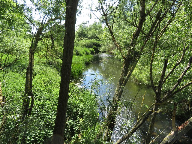
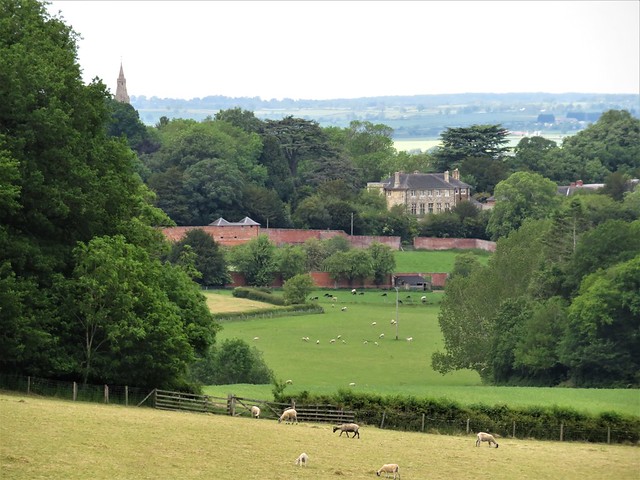
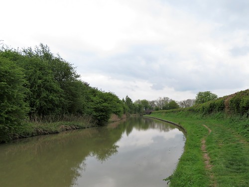
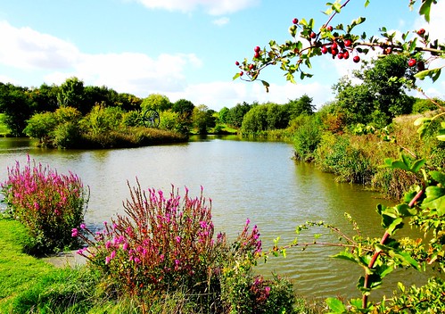
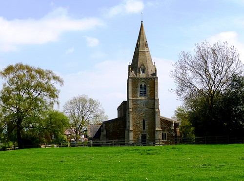
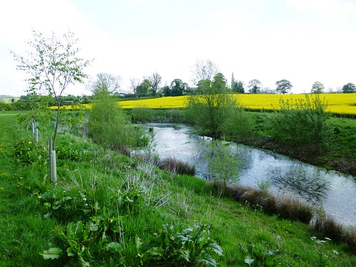
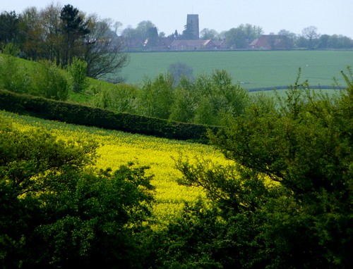
I followed a path beside the Wreake. A family picnicking by one of the river bends watched their children splashing in the shallows. I passed the handsome square tower of All Saints church at Rotherby, and then the crocketed spire of Brooksby’s Church of St Michael – just two of the dozens of churches on the Leicestershire Wolds built and embellished by medieval wool wealth.

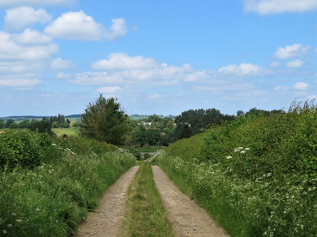
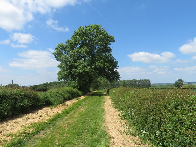
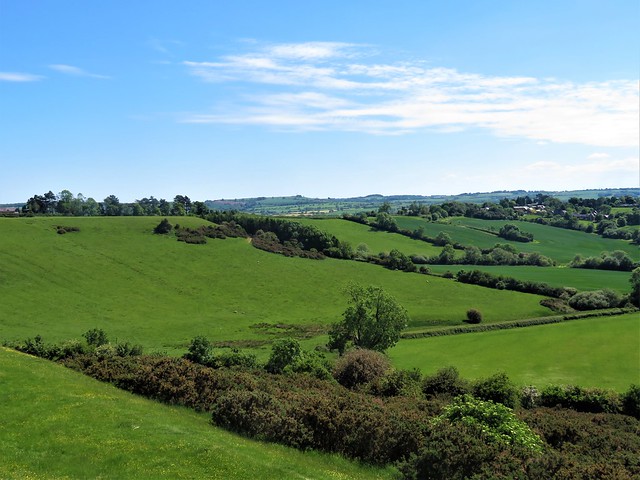
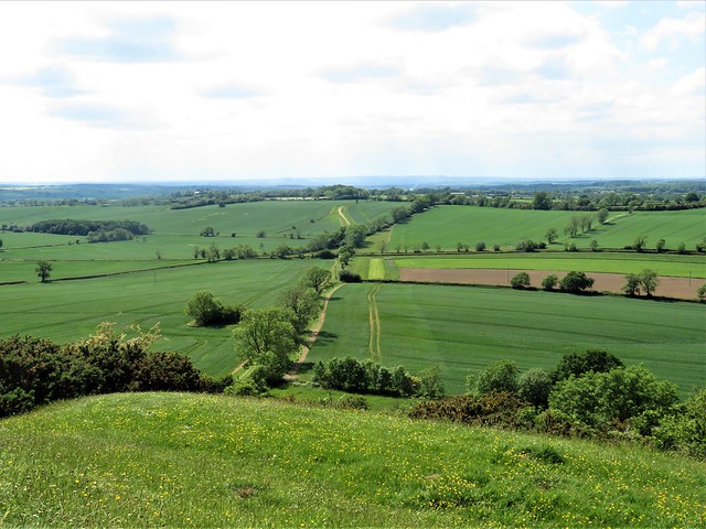
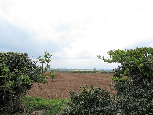
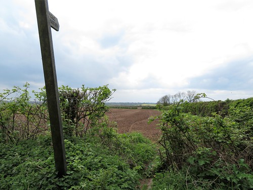
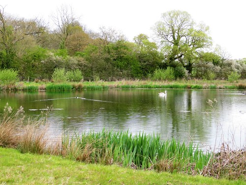
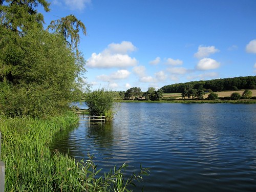
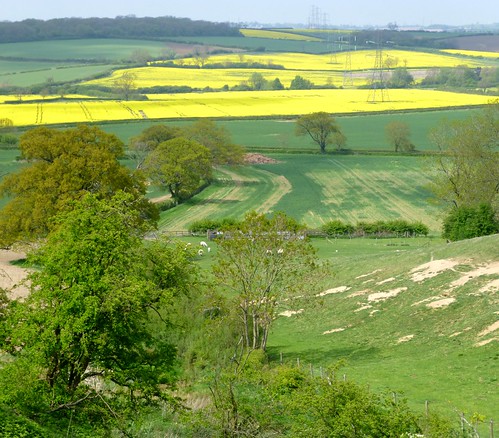
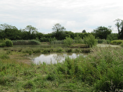
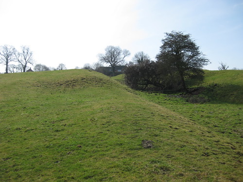
This is long rolling country, with shallow descents to gravelly rivers and gradual climb to the next ridge. The stony track of the Midshires Way ran south past a sand and gravel quarry, the conveyors and elevators dribbling their loads onto ever-growing cones of pinkish diggings. On the opposite side of the track an old quarry flooded for nature conservation showed the other side of the extraction coin with its sailing mallards and reedbeds a-chatter with warblers.

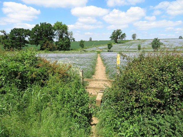
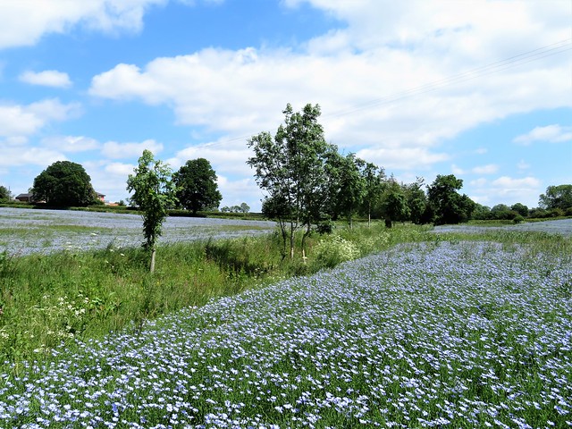
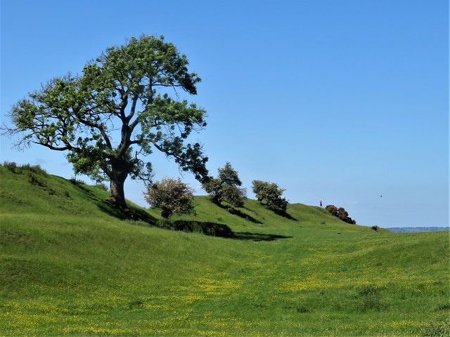
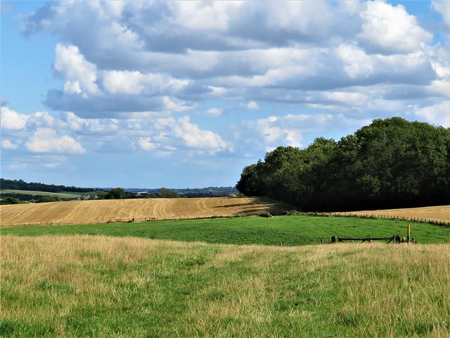
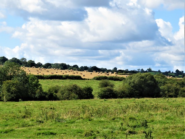
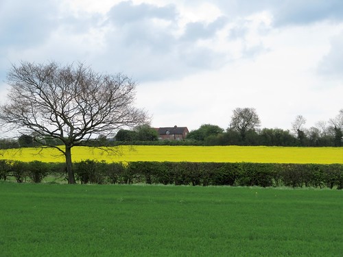
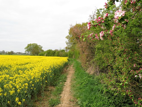
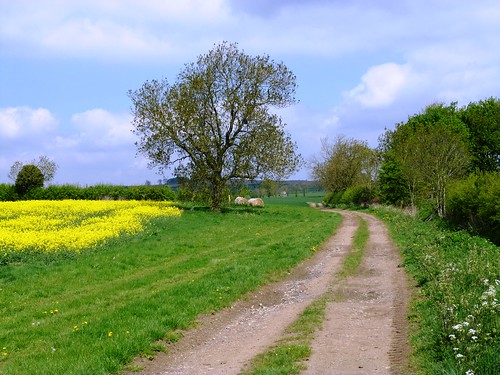
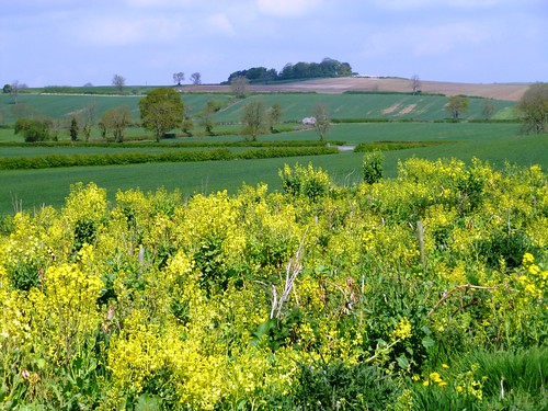
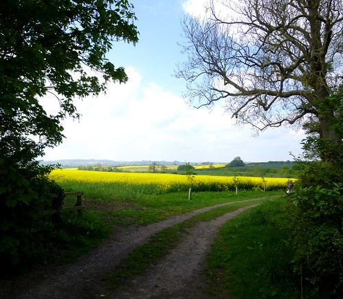
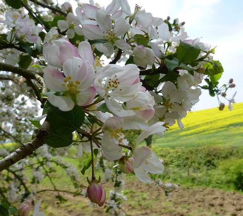
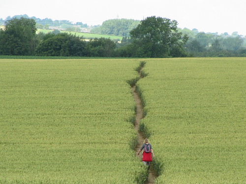
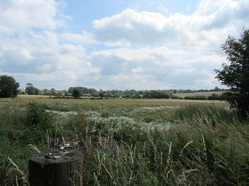
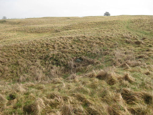
From the ridge we had long views over mile upon mile of cornfields, the farms isolated like cargo ships in these seas of wheat and barley. A patch of sky blue linseed among the green acres made a striking contrast, the delicate five-petalled flowers gently stirring in the wind.

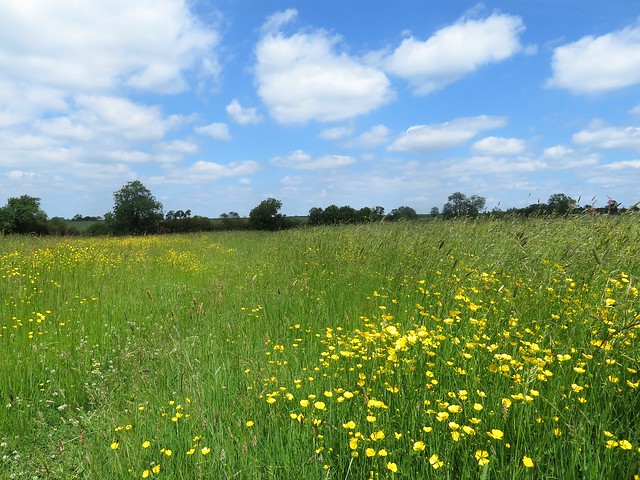
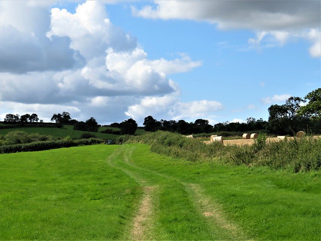
At Gaddesby we detoured to St Luke’s Church, where a line of gurning little faces looked down from the wall, some medieval stone-carver’s humour that spanned the ages. An apple and a bit of chocolate underneath a spreading chestnut tree, and we were heading north over the undulating corn fields on the Leicestershire Round footpath. Skylarks ascended and poured out song, yellowhammers wheezed in the hedges, and little black spiders ran for shelter into the cracks of the sun-baked clay soil.

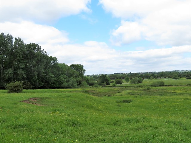
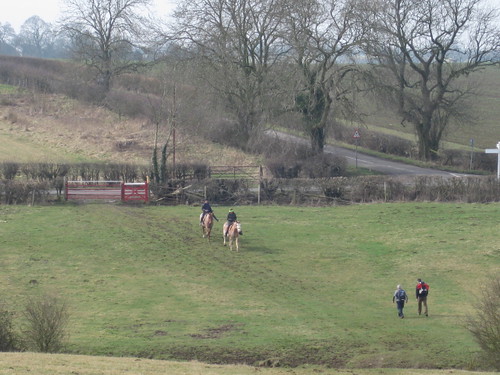
In Frisby-on-the-Wreake we passed the stump of the old preaching cross and found the homeward path across the ridge and furrow pasture. In the willows by the river cattle sheltered from the hot afternoon sun, and a cream-coloured bull exchanged loving nose-licks with his dappled grey bride-of-the-moment.

How hard is it? 8½ miles; easy; well-marked field paths

Start: Blue Bell Inn, Hoby, Melton Mowbray LE14 3DT (OS ref SK 670175)

Getting there: Bus 128 (Melton Mowbray-Leicester)
Road – Hoby is signed off A607, Melton Mowbray-Leicester

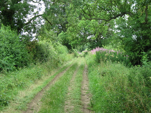
Walk (OS Explorer 246): From Blue Bell, left along village street. In 200m, right (‘Brooksby’); in 50m, left (kissing gate, ‘Rotherby’). Path between cottages and river; cross river (671169); cross railway to road at Rotherby church (675165). Right to Brooksby; left at road (672161). Cross A607 (671359) and on, following Midshires Way (yellow arrows /YAs and yellow topped posts/YTPs). In 1½ miles, approaching Carlton Lodge Farm, right (686141, stile, YTP) across fields to road (689135). Cross into Pasture Lane. In 300m, just beyond Rose Cottage driveway, left through hedge (692135, ‘Frisby on the Wreake’, YTP). Follow Leicestershire Round/LR for 2¾ miles to road in Frisby-on-the-Wreake (694175). Right; fork left to corner of Main Street and Water Lane (694177). Right; follow LR for nearly 1 mile to corner of Rotherby Lane (682171). Fork right off LR, on path aiming for Hoby Church. Cross railway (677133), then river; follow LR into Hoby.

Lunch: Blue Bell Inn, Hoby (01664-434247, sites.google.com/site/bluebellhoby

Accommodation: Star Inn, The Green, Thrussington, LE7 4UH (01664-424220, thestarinn1744.co.uk)

Info: Melton Mowbray TIC (01664-480992)

 Posted by at 02:41
Oct 092021


First published in: The Times Click here to view a map for this walk in a new window
picture picture picture picture picture picture picture picture picture

The track to Burrough Hill ran through pastures corrugated by medieval ridge-and-furrow, and rubbed to billiard table smoothness by sheep. On this hot cloudless afternoon they lay in any shade they could find, ewes sweltering in heavy fleeces, lambs panting like little steam engines at three breaths a second.

The ramparts of Burrough Hill’s splendid Iron Age hill fort stood ahead, an undulating line of turf-covered stone whose hollows spoke of millennia of weathering, trampling and quarrying. We walked the circuit, pausing at the topograph to spy out the hazy towers of Leicester, the red brick smear of Melton Mowbray and the charmingly named Robin-a-tiptoe Hill.

The path led steeply down the north face of the fort, past a crowd of young bullocks too hot and sleepy to follow us, and on through the cool avenue of ash and beech in Rise Hill Spinney. A seat placed for the northward view was presented by two foresters, Jack Atton and Terry Darby, who spend nearly twenty years in the 1980s and 90s planting the trees that now cover these hillsides.

Turning south, we followed the Leicestershire Round long distance path through the parkland of the Dalby Estate, looking back to where Little Dalby Hall peeped from a collar of trees. A short sharp climb led to uplands characteristic of these Leicestershire Wolds, broad corn fields and plough, the hedges dotted with pink spindle berries, where the dip and roll of the land hid the nearby fort on Burrough Hill.

Did Mrs Orton, farmer’s wife, produce the world’s first Stilton cheese in this parish in 1730? Certainly they claim she did in nearby Somerby, where the village pub is named after the pungent delicacy. But should you fill the hollow in your truckle of Stilton with crusty port? That debate is still open.

Beyond Somerby we skirted the rim of a dry valley where ridge-and-furrow plunged down the flanks, testament to the exploitation of every bit of land by our hungry medieval ancestors. Under a pearly evening sky we made for the ramparts of Burrough Hill, now in full view ahead once more. The homeward path skirted the hillfort, a green track through thickets of gorse above which rooks flocked on their homeward flight.

Flora: spindle berries
Birds: rooks (nothing prettier, sorry!)

How hard is it? 6 miles; easy; well-marked field paths

Start: Burrough Hill car park, Burrough Road, Somerby, Leics LE14 2QZ (SK 766115)

Getting there: Bus 100 (Syston-Melton Mowbray)
Road – Car park signed off Somerby-Burrough on the Hill road (signed from A606 Oakham-Melton Mowbray)

Walk (OS Explorer 246): Up signed track to Burrough Hill. Clockwise round ramparts via topograph. At north side near cut tree trunks (761121), descend past yellow-topped post/YTP to gate (763122, YTP, yellow arrow/YA) and on. In 450m, ahead through wood (767124, ‘Leicestershire Round’/LR). In ⅔ mile, at T-junction, right (775126, Dalby Hill Path’) and follow YTPs. In 300m up steps (775123); diagonally across field; follow LR/YTPs) for 1 mile to road in Somerby (778106). Right; in 200m, right (776105, ‘The Field’) to cross road (775107). On across fields (‘Public Footpath to Borough on the Hill’). In 400m at kissing gate, right (771108); follow fence on your right (YAs) round top of dry valley. Descend to cross stream (763107); aim for pole on knoll, then to left of house with prominent window. Right at road (758109); in 50m left (YTPs) across fields. In ¾ mile at YTP with LR arrows (756119), right past Burrough Hill to car park.

Lunch: Stilton Cheese Inn, Somerby (01664-454394, stiltoncheeseinn.co.uk)

Accommodation: Admiral Hornblower Hotel, High Street, Oakham, Rutland LE15 6AS (01572-723004, hornblowerhotel.co.uk)

Info: leicscountryparks.org.uk

 Posted by at 01:46
Sep 122020


First published in: The Times Click here to view a map for this walk in a new window
picture picture picture picture picture picture picture picture
Facebook Link:

September, and that first definite nip of autumn in the breeze. We stood in the circular churchyard at Braunston-in-Rutland, admiring the stumpy charms of the Braunston goddess. Imagine the surprise that workmen got in the 1920s when, relaying the church doorstep, they turned it over to discover this extraordinary pagan idol carved on the reverse, mouth and eyes agape, little round breasts outthrust.

Our path lay west across rough pastures where we stumbled up and down the furrows of medieval agriculture, still printed in these fields. Big billowy clouds went blustering about the sky, at one moment dipping us into shivery shade, the next bathing us in hot sunshine. Goldfinches twittered in the hedge where our approach had driven them from their feast of thistle seeds.

In the recently harvested wheatfields, straw bales the shape of giant cotton reels lay among the stubble like an Andy Goldsworthy installation. A ploughman drew furrows of earth behind his tractor, the soil rich and dark with minerals, while a red kite and a swoop of herring gulls homed in on the worms and insects thrown up by the plough.

We dropped into a green lane, the hedges thick with wild fruit – elderberries, hips, haws, milky white hazelnuts and blackberries green, red and polished jet. Beyond lay Withcote Hall Farm, the stables and big house of beautiful gold stone falling into dereliction.

At Launde Abbey we stopped for tea and cakes. The magnificent Tudor house built by Thomas Cromwell’s beloved son Gregory looked out on a bowl of parkland and sheep pasture, as peaceful and soothing as could be.

The way home lay along the valley of the wriggling River Chater, diminished to a streamlet after the long hot summer. In the green grassy bridleway near Leigh Lodge we met a couple hastening along, bearing plastic bags bulging with ripe blackberries. ‘Blackberry wine!’ they beamed.

A flock of linnets bounced and chirruped in the hedge. The shadows of sheep lengthened across the pastures as the sun dipped, bringing a wash of late afternoon gold to this quiet corner of English countryside.

Start: Blue Ball, Braunston-in-Rutland, LE15 8QS (OS ref SK 833066)

Getting there:
Braunston is 2 miles SW of Oakham (A606)

Walk (8½ miles, easy, OS Explorers 234, 233): From west side of church tower, through gate (yellow arrow/YA); on, parallel with hedge on right. In 3rd field fork left (825065) along left-hand hedge and on (YAs, yellow-topped posts/YTP). In 3rd field beyond South Lodge Farm, half left (814057, YA) to far top corner (812056, YTP). On to hedge gap (810054, YTP). Right, then right along green lane. At road, left (809060, stile, YA) across 2 fields to lane (805060). Dogleg right/left; on (YTPs) to Withcote Hall Farm (798058). Left around barn; at gate with YTP, left along fence (‘Leicestershire Round’/LR). At Dutch barn 798056, gate, YTP) ahead over hill, following YTPs to road at Launde Abbey (796044).

Left; in 150m, right (fingerpost, ‘Belton’) following LR (YTPs). In 1¼ miles, LR turns right (815044), but keep ahead/east for 1 mile. Opposite Leigh Lodge, half left (828041, stile, YA, ‘Rutland Round’) across field to lane (825045, stile, YTP). Right to corner; fork right; keep ahead up west side of Priors Coppice. On to road (831059); right to Braunston.

Lunch: Blue Ball, Braunston (01572-722135, theblueballbraunstone.co.uk). Pop in for drinks, or book ahead for 2-hour dining slot (text/WhatsApp 07377-954176)

Accommodation: Admiral Hornblower, High Street, Oakham LE15 6AS (01572-723004, hornblowerhotel.co.uk)

Info: Rutland Water TIC (01780-686800)
satmap.com; ramblers.org.uk

 Posted by at 00:43
Apr 142018


First published in: The Times Click here to view a map for this walk in a new window
picture picture picture picture picture picture picture picture picture picture picture picture picture
Facebook Link:

Walking south from Market Bosworth under the horse chestnuts along Sutton Lane, we saw ahead the tump of Ambion Hill, twin banners streaming from its summit. One showed a rampant lion, the other a rampaging dragon – England against Wales, Richard of York versus Henry Tudor, in a famous clash of arms hereabouts on a summer’s day in 1485.

For centuries historians believed that the Battle of Bosworth took place in the fields around Ambion Hill. That’s why there is a visitor centre with all the trimmings up here. But recent discoveries of lead shot, hacked-about armour and a badge of a silver boar – King Richard III’s emblem – place the battle in low-lying fields a mile or so away.

The former marshland where Crookback Dick lost crown and life lay today in a steamy grey light. We gazed our fill from Ambion Hill, then went down to where the Ashby-de-le-Zouch Canal snaked its way under alders and willows. At Sutton Warf narrowboats lay moored, Danny Boy and Doris stem to stem, Black Pearl a little distant, festooned in macabre style with gargoyles, ghosties and a skeleton clambering out of a coffin.

At a humpbacked bridge we left the old coal canal for pastures where fat red cattle sat the day stolidly away and stout ewes attended to the toilet of their tiny lambs. In cornfields under lark song the crumbly Leicestershire soil was scattered with pebbles smoothed and rounded by some unremembered river aeons ago.

A brown hare jumped up and pelted away as we crossed newly harrowed ploughlands into Sutton Cheney. A pint in the Hercules Revived pub, and we were on the homeward path through the broad acres of Bosworth Park.

Through binoculars we made out a distant statue of Hercules himself, rising heroically out of a beanfield. The statue was ‘acquired’ on the Grand Tour of Europe – a common enough practice in Georgian times – by Sir Wolstan Dixie, 4th Baronet of Bosworth. By all accounts Sir Wolstan was an angry, litigious bully, famed for his ignorance and ready to knock anyone who crossed him into the middle of next week. Back then a squire could do just what he damn well liked on his own estate – and Sir Wolstan Dixie certainly did.

Start: Market Place, Market Bosworth, Leics CV13 0LF (OS ref SK 405031)

Getting there: Bus 153 from Leicester.
Road – Market Bosworth is signed off A447 (Hinckley-Coalville)

Walk (8¾ miles, easy, OS Explorers 232, 233):

South down Market Place. From corner of Rectory Lane, follow Sutton Lane south out of town. In ¾ mile, right (fingerpost) across footbridge (406019); left along field edges. In 2nd field, right at bottom corner; in 100m, left through hedge (405016). Follow yellow arrows and yellow-topped posts/YTP across fields to road (404006). Ahead uphill to Bosworth Battlefield Visitor Centre (403000). Follow waymarked Leicestershire Round/LR south through Ambion Wood to Ashby Canal (406995). Left along canal to Sutton Wharf (411994) and Bridge 33 (412986). From here, follow LR across fields; left along Stapleton Lane (413982). 200m past St George’s Farm, left over stile (418984); follow YTPs north for just over 1 mile to Sutton Cheney (417003). Right along Main Street. Beside Royal Arms Inn, left (419008, LR) and follow LR through Bosworth Park for 1½ miles to Market Bosworth.

Lunch: Hercules Revived PH, Sutton Cheney (01455-699336, herculesrevived.co.uk)

Accommodation: Softleys, Market Place, Market Bosworth CV13 0LE (01455-290464, softleys.com) – excellent restaurant-with-rooms

Bosworth Battlefield Heritage Centre; 01455-290429, bosworthbattlefield.org.uk

Info: visitleicestershire.com
visitengland.com; satmap.com; ramblers.org.uk

 Posted by at 01:41
Sep 242016


First published in: The Times Click here to view a map for this walk in a new window
picture picture picture picture picture picture picture picture
Facebook Link:

Thornton Reservoir is shaped like the tail of a dolphin in the act of plunging headfirst into the coal-bearing country to the west of Leicester. Tucked into a bowl of shallow hills, it’s a lovely stretch of water on a sunny morning with dog-walkers, runners, cyclists and walkers exchanging the musical ‘How-do’ greeting of the area as they follow the circuit path through the resinous pines around the reservoir.

We took our time, watching fishermen in their small boats casting and tying flies with monumental patience. Great crested grebes sailed the reeds with snow-white cheeks and breasts, and a pair of half-grown cygnets sat tight on a dome-shaped nest padded out with the downy white feathers their parents had plucked and laid there.

From the north-western tail tip of the reservoir we climbed the ridge where Thornton village straggled on either side of the church spire. Down on the western side, young woodland has grown tall and graceful in the twenty years since it was planted – Manor Wood and Bagworth Heath Wood, component parts of the inspiring enterprise that is the National Forest, 200 square miles of planting to green up and beautify a great swathe of the post-industrial Midlands.

Where the lakes and meadows, the woods and commons of Bagworth Heath now lie, the pit wheels and slag heaps of Desford Colliery stood until its closure in 1984, the year of the miners’ strike. Many of the 700 miners who lost their jobs have joined their children and grandchildren in planting the millions of oak, ash, silver birch and rowan trees that compose today’s woodlands. A single pit wheel installed on an islet in one of the lakes is the only reminder of the pit and its hard realities.

We followed the path through Desford Brickworks Wood, looking out between the fresh young trees onto a vast red bank of spoil burrowed into thousands of corrugations by the digging machines. Then we turned away and made for the homeward path.

Start: Thornton Reservoir car park, Thornton, Leics LE67 1AR (OS ref SK 470074).

Getting there: Bus 26 from Leicester.
Road M1 Jct 22; from Markfield follow ‘Thornton’; car park is on Reservoir Road in village.

Walk (5½ miles, firm trails, field and woodland paths, OS Explorer 233):
From car park walk anticlockwise circuit of Thornton Reservoir. In 2 miles, just before Visitor Centre, cross weir at NW tip of reservoir (466081); right through kissing gate; follow ‘Leicester Round’/LR up bank to Thornton. Cross road (465079); down Hawthorne Drive opposite (LR). In 250m on left bend, ahead (LR, ‘Bagworth’) across paddock. Left down lane, following LR past Thornton Mill and up to cross railway (459079). LR through Manor Wood for 550m; at yellow-topped post/YTP (454076) left off LR on gravel cycle path to reach lake at Desford Colliery site (458068).

At roadway with car park opposite, right to T-junction. Left along road; in 150m, left through kissing gate (457066, fingerpost); up grass track. Half left to kissing gate (YTP; yellow arrow/YA); path through young woodland. Cross a grass ride (YTP); in 100m, right at T-junction (459065, YA). In 100m, left over stile (‘Permissive Path’/PP arrow); follow PP through Desford Brickworks Wood to recross fence. Left on grass path, which turns left (459062) beside road.

Follow this path for ⅔ mile, parallel with Heath Road and then Merrylees Road, to south-west corner of industrial estate at Merrylees (467058). Left (north) along bottom edge of field, following YAs and YTPs. In ½ mile, right down steps (464066) through industrial area. Ahead (YAs, YTPs) to pass fishing lake, then cross railway and river (465067). Up across a field; in following field, don’t turn left (466069), but keep ahead uphill with hedge on left, following YTP/YA to road (469072). Left past garage; first right to reservoir car park.

Lunch: Reservoir Inn, Thornton (01530-382433, thereservoirinnthornton.co.uk)

Accommodation: Curtain Cottage, 92 Main St, Woodhouse Eaves, Leics LE12 8RZ (01509-891361, curtaincottage.co.uk) – immaculate B&B

Info: Leicester TIC (0116-299-4444); nationalforest.org

www.goleicestershire.com; satmap.com; ramblers.org.uk

 Posted by at 01:08
Feb 212015


First published in: The Times Click here to view a map for this walk in a new window
picture picture picture picture picture picture picture picture picture picture picture picture picture
Facebook Link:
Snow had fallen across Leicestershire overnight, and hundreds of people were out running and walking, sledging and sliding in the 800 open acres of Bradgate Park beyond the northern boundary of Leicester city.

I followed the path beside the icy pools and spillways of the River Lyn, where a couple were busy building a seated snowman on a park bench – they’d even brought a nose carrot and some coal eyes to make a good job of it.

Above the path sprawled the ruins of the great Tudor mansion of Bradgate House, its red brick towers and chapel set off handsomely against the pure white of the snow. Henry Gray, Duke of Suffolk, built it early in the Tudors’ reign, and here his eldest daughter Jane grew up, a distant heir to the throne through her mother.

Poor Jane! – strictly brought up, resentful over the ‘pinches, nips and bobs’ with which her parents disciplined her, she was shovelled onto the throne against her will when the boy king Edward VI died in July 1553, in an attempt to prevent Edward’s Catholic half-sister Mary acceding. The Privy Council deserted her, and within nine days Mary had been proclaimed queen. Jane was clapped into the Tower, and seven months later the 16-year-old was executed by beheading for a treason she had never intended.

Beyond the house young fallow deer was grazing, their spotted coats and white bellies well camouflaged against the russet winter-dry bracken and the snowy parkland. Up by Hallgate Hill Spinney beyond the steel grey waters of Cropston Reservoir, Scots pines stood tall, their ramrod trunks marbled and scaled like dragon skin.

Up on the crest of a knoll stood Old John Tower, a crenellated turret with a curious arched buttress alongside, making the shape of a giant beer tankard. It was built in 1784 by the Earl of Stamford; legend says he named it and added the ‘handle’ in memory of an old retainer who had been fond of a pint or ten.

A strong northerly blew like a fury up there. I sheltered in the arm of the buttress and savoured the prospect of forty miles of countryside transfigured by the beauty of newly fallen snow. Then I let the gale shove me off the tump, and all the way down to the ruined house in the valley once more.

Start: Bradgate Park car park, Newtown Linford, Leics LE6 0HB (OS ref SK 523098)

Getting there: Bus 120, Coalville-Leicester
Road – M1 Jct 22; A50 towards Leicester; follow ‘Newtown Linford’. In village, brown signs to Bradgate Park.

Walk (5 miles, easy, OS Explorer 246. NB: online maps, more walks at christophersomerville.co.uk): From car park, go through kissing gate to right of tall iron gates. Follow tarmac track for 2 miles, past Bradgate House ruin (534102) and Deer Barn café (539104) to gate into car park and Roecliffe Road (542114). Left along road for 100m; left (footpath fingerpost) up drive, then walled lane beside Hallgate Hill Spinney for 1 mile. Just before wooden hut opposite public toilet at Hunt’s Hill, left through kissing gate (525115); climb to Old John Tower (526112). Aim southward between Elder Plantation and Bowling Green Spinney in valley below; through gap in wall (530102), right to car park.

Lunch: Deer Barn café, Bradgate Park; or The Bradgate PH, Newtown Linford (01530-242239, thebradgate.com)

Accommodation: Mercure Grand Hotel, Granby Street, Leicester LE1 6ES (0116-255-5599, mercure.com) – large, comfortable city centre hotel.

Bradgate Park: 0116-236-2713, bradgatepark.org

Info: Leicester TIC (0116-299-4444)
visitengland.com; www.satmap.com; ramblers.org.uk; LogMyTrip.co.uk

 Posted by at 01:05
Apr 192014
 

Where to walk in the Leicestershire Wolds, that rolling landscape lying east of the county capital, so beautifully maintained by its farmers and landowners, so overlooked and undervalued by the walking community at large? First published in: The Times Click here to view a map for this walk in a new window
picture picture picture picture picture picture picture picture picture picture picture picture picture picture
Facebook Link:
A glance at the map showed a ring of villages all named ‘Langton’ – Tur Langton, Church Langton, East Langton, Thorpe Langton – each with its own prospering pub. ‘I’ll drive,’ Jane volunteered, unselfishly. Right, then. Half a pint in each, and a damn good walk to link them up and shake the ale down.

Tur Langton sits on the roof of the Wolds, handsome, settled and comfortable with its houses of dark gold stone and its Victorian Italianate church. Glossy horses cropped the Manor’s paddocks and shook themselves for pleasure – ‘Glad to be rid of their winter jackets,’ said the woman tending them. We followed a path through fields of young wheat and of oil-seed rape so intensely yellow under this morning’s sun that it hurt the eye to gaze on it. A yellowhammer sat on a wire, giving out its characteristic chatter and wheeze. Its head and breast were yellow, too, but of a shade so subtly rich as to put the brashly glaring rape to shame.

In Church Langton, a half of Old Golden Hen outside the Langton Arms, to the nostalgic chime of church bells. At East Langton, a half of smoky-flavoured, locally brewed Caudle Bitter, in the garden of the Bell, to the intrusive splutter of a microlight overhead. Never mind – the beer was great, and so was the walking, moving on over ridge-and-furrow fields where medieval villagers ploughed and sowed before the more profitable sheep usurped them. At the Bakers Arms in Thorpe Langton, a tasty half of Bakers Dozen from the village’s own Langton Brewery, and we went floating along the lilac-fringed lane that led up to the high spot of the walk, the summit of Langton Caudle hill. A view to take your breath, a view to all quarters – a landscape sailing and billowing with yellow rape and green corn, patched with thick brown ploughland under a huge blue and white sky.

Down in Stonton Wyville, grassy lanebanks showed the layout of an abandoned medieval village. In a sheltered hollow near Tur Langton we found the square-mouthed well where in 1645 King Charles I, in flight from disastrous defeat nearby at the Battle of Naseby, stopped to give his horse a drink. It was poignant to picture the beaten man in bitter contemplation by the pool, a fugitive from his own subjects in the wide land where he was no longer king.

Start: Crown Inn, Tur Langton, Leics LE8 0PJ (OS ref SP 713946)

Getting there: Bus service 44 (centrebus.info), Fleckney-Foxton
Road – Tur Langton is on B6047, 1 mile north of Church Langton (signed off A6 Leicester – Market Harborough road)

Walk (8½ miles, easy, OS Explorer 233): From Crown Inn, right (west) along street. At right bend (710946), ahead down The Manor drive (fingerpost). Immediately right over stile; follow yellow-topped posts (YTP) and yellow arrows (YA) through paddocks and round farm buildings. In field with chapel ruins, cross stile (708945), then ahead down right side of field. Path bends left along field edge past moat. At bottom of slope (704941), blue arrow points left along left bank of stream; this is wrong! Ignore, and cross stream; right along right stream bank. In 400m, left over footbridge (704937, YTP, YA); up field with hedge on right, following YTP/YA towards Church Langton church tower.

Cross road in Church Langton (722932); by Langton Arms pub signboard, enter pub car park. In 30m, right over stile; left to cross next stile (YTP); follow YTPs to road (725931). Right to T-junction (725929); cross road and stile (fingerpost); at bottom of field, left through gate (726928, YTP); on to reach road opposite Bell Inn, East Langton (727927). Left for 50m; right (fingerpost) up path beside Yew Tree Cottage. Cross stile (728927); across field to cross stile (YTP, YA) by last house on left. Narrow hedged path to road (728926). Left; through kissing gate and follow ‘Leicestershire Round’ (LR) for nearly 1 mile to pass church in Thorpe Langton. At T-junction beyond church (741924) left to road. Right; just before Bakers Arms, left (741925, LR) down lane. At ford, keep right over right-hand bridge (743930, LR); follow LR for ¾ mile up to trig point at summit of Langton Caudle hill (795942).

Walking on from trig point, ignore YTP ahead and to right; keep to left-hand hedge in corner of field, left through gate (BA, YTP), follow BA, YTP for ½ mile down to lane (738946). Right to cross road (737948); ahead (‘No Through Road’) into Stonton Wyville. At right bend, left (736951, YTP) through iron gate; half left across field to YTP; right along hedge. At far end of lumpy ground of Stonton Wyville medieval village (735949), aim half right for YTP and cross footbridge (733949). On to go through hedge gap (YTP); left (YA) up field edge with hedge on left. Follow YTP past King Charles’s Well (722949) and on to Tur Langton. Cross road (715946); down road opposite, to reach Crown Inn.

Lunch: Crown, Tur Langton (01858-545264): Langton Arms, Church Langton (01858-545181); Bell Inn, East Langton (01858-545278); Bakers Arms, Thorpe Langton (01858-545201).

Accommodation: Nevill Arms, Medbourne, Leics LE16 8EE (01858-565288; thenevillarms.net)
www.ramblers.org.uk www.satmap.com www.LogMyTrip.co.uk

 Posted by at 01:53
Aug 202011
 

First published in: The Times Click here to view a map for this walk in a new window
picture picture picture picture picture picture picture picture
Facebook Link:
In the car park of the Pig In Muck at Claybrooke Magna I found a carload of cheerful chaps packing clinking bags of booze into a pink minibus. Whither away? ‘To Birmingham – it’s my stag night tonight. Go-karting, and then the dogs!’

I wished them good luck, and set out into the bright, breezy day. If you’re looking for a walk in the heart of rural Middle England, Leicestershire’s hard to beat, and Claybrooke Magna’s pretty typical of the county’s villages – red brick, neat, friendly, set in low-lying countryside that’s half pasture and half arable, rich in handsome houses and horse paddocks.

Claybrooke Hall stood solid and brick-faced on the outskirts of Claybrooke Parva among parkland lime trees, their trailing skirts of leaves raised to head height by the nibbling teeth of generations of cattle and horses. St Peter’s Church, on ancient foundations, is built of pale sandstone so soft that the fearsome scowls of its gargoyles have weathered to expressions of mild enquiry. ‘JST’ carved his initials into the east wall on a summer’s day in 1883, one among hundreds of graffiti.

I turned north through fields hump-backed with medieval ridge-and-furrow, butterfly-haunted hay meadows and cornfields flushed with poppies. An old biplane with a gracefully rounded snout went grunting across a blue sky puffed with giant white cumulus clouds. Fields of rye-grass flattened by big winds and rains; fields of dry-rustling oats enclosing dark ranks of potato plants. The horses at high-perched Hill Farm stared me through. Nearing Frolesworth I paused to admire a flock of pink-snouted Charmoise Hill sheep buddied up with some chubby Polled Dorsets – whose wool ‘goes to make coffins’, a notice enigmatically informed me.

A long westward path, sinuating like a dark snake through the corn, and I was walking the bushy tracks of Fosse Meadows nature reserve among Lammas meadows full of flowers, bird chatter and the cries of little kids let off the leash. The hedges were hung with brilliant purple flowers of bittersweet, the long yellow stamens protruding like woodpecker bills. From a hide I watched swallows over a pond, banking after midges in tight curves like fighter aces.

At Claybrooke Lodge I turned along a stretch of the Fosse Way, a broad stony track between thick old hedges. History rang at every footfall along this ancient British trackway that the Romans appropriated to forge a ruler-straight highway from Exeter to Lincoln. A field of bright blue linseed, a sky full of larks, and a pair of young lovers playfully smacking each other as they preceded me down the bridleway to Claybrooke.

Start & finish: Pig In Muck PH, Claybrooke Magna, NE Hinckley, Leics, POSTCODE (OS ref SP489889)

GETTING THERE:
Bus – Centrebus (http://www.leics.gov.uk/j0499_ptu_timetables_service_58.pdf) Service 58, Mkt Harborough-Hinckley.
Road – A5 (Lutterworth-Hinckley; at High Cross, right to Claybrooke Magna. Park near Pig in Muck PH.

WALK (6 miles, easy grade, OS Explorer 233):
From Pig in Muck PH, left along Main Road. Pass village hall; in 200 m, left along Back Lane (492886). In 200 m, right along Holly Tree Walk (‘Leicestershire Round’/LR). Follow LR and yellow-topped posts/YP through fields to Claythorpe Parva. At road, left (496880), right through churchyard, left along lane to road (498879). Cross bend; left along bridleway (‘Claybrooke Mill’). Follow YPs and blue arrows/BAs for ¾ mile to mill (499891). Cross yard, up bank, cross mill leat. Fork left (LR circular symbol) across field beyond. Cross Frolesworth Lane (499893); follow LR/YP for nearly 1 mile to road in Frolesworth (502907). Left for 50 m; on right bend, keep ahead through Manor Farm yard (‘Sharnford 2’). Follow yellow arrows/YA and YP west for ¾ mile to cross Foss Way (491911). YA points ahead over field; cross River Soar; ahead on path through Fosse Meadows reserve. In 150 m at meeting of gates, keep straight ahead through kissing gate (489912) onto duckboard trail. In 150 m, bear right through kissing gate; ahead across field with hedge on your right; through kissing gate to rejoin LR (487911). Diagonally left over field to YP. Follow LR and YPs to Fosse Way (486905) at gate of Claybrooke Lodge Farm. Right along stony Fosse Way for over ½ mile. At gate across track, left (481897; YP, BA) across field to YP. Follow YP/BA to road. Left to Pig In Muck PH.

LUNCH: Pig in Muck PH, Claybrooke Magna (01455-209524); friendly local.

ACCOMMODATION: Greyhound Inn, Lutterworth (01455-553307; www.greyhoundinn.co.uk); family-run and full of character.

INFO: Hinckley TIC, Hinckley Library (01455-635106); www.goleicestershire.com
www.ramblers.org.uk www.satmap.com www.LogMyTrip.co.uk
Click on Facebook “Like” link to share this walk with Facebook friends.
Coast Along for WaterAid, 10 September: 250 sponsored UK coast path walks to join! www.coastalongforwateraid.org

 Posted by at 03:35
Sep 112010
 

First published in: The Times Click here to view a map for this walk in a new window
picture picture picture picture picture picture picture picture
Facebook Link:

Early morning over the Leicestershire wolds, cold and foggy, with a Sunday morning slumber over the golden stone village of Hungarton. Rose Cottage, Pear Tree Cottage, Lilac Cottage: they snoozed, one and all. The cat-like gargoyle on the tower of St John the Baptist’s church lifted a silent howl into the mist as I slipped out of the village past grazing horses and over a kale field, my boots already clotted with dark clay soil. Sheep came running up to lick my fingers with their stiff tongues and butt my knees gently with their woolly foreheads.

The 15th-century moated manor of Ingarsby Old Hall, its house and barns beautiful in rich gold and pale silver oolitic stone, presides in isolation over a field of hummocks and hollows, seamed across with deep old trackways – all that’s left of the deserted village of Ingarsby, the property of the Canons of Leicester Abbey in medieval times. In 1469, in the middle of a wool boom, the abbey enclosed and hedged the land for sheep, forcing the crop-growers of Ingarsby to abandoned their homes and fields. It was a ghostly place to wander, the grassy humps sparkling with dew and buttered with sunlight cutting through the mist.

Ingarsby is one of half a dozen abandoned medieval villages in this rolling corner of Leicestershire. From Ingarsby I followed a slowly plodding horse across fields trenched with the ridge-and-furrow of strip farming, up to Quenby Hall. This magnificent red-brick Jacobean pile, a palace in the wolds, is a different and more showy order of architecture from the domestic enclave of Old Ingarsby. The village of Quenby lay reduced to a patch of ridge and furrow in the smooth, lawn-like parkland. Beyond, the abandoned settlement of Cold Newton was an echo of the Ingarsby model, all slopes, humps and slanting house platforms.

From this haunted landscape of abandonment I followed the gentle green valley of the Queniborough Brook. A bedlam of cawing from the rookery in Carr Bridge Spinney; seven horses nosing an ancient oak tree at Bell Dip Farm; the handsome pale stone Baggrave Hall on a knoll above its still lake. The park still carried faint ridges of the vanished fields of Baggrave village. There is deep poignancy in such landscapes. But the well-laid hedges around Waterloo Lodge Farm, and the beautifully looked after sheep in the homeward fields, were proof that not all the old agricultural traditions are gone from this countryside.


Start & finish: Black Boy Inn, Hungarton, Leics LE7 9JR (OS ref SK 690075)

Getting there: Train (www.thetrainline.com; www.railcard.co.uk) to Leicester (7 miles). Bus (www.rutnet.co.uk): Rutland Bus Rural Rider 5, 6, 11 (Sat. and Wed.) to Black Boy, Hungarton. Road: Hungarton signposted off A47 at Houghton-on-the-Hill, between Leicester and Uppingham

Walk (8½ miles, moderate, OS Explorer 233): Black Boy Inn – Hungarton Church – south by lane and field paths to Ingarsby Old Hall – road/footpath triangle through Ingarsby deserted village, back past Old Hall (685053). Bridleway for 1½ miles by Quenby Hall to road (713064). Footpath north through Cold Newton deserted village; ahead to road (717077). Follow Queniborough Brook NW (Carr Bridge Spinney, Hall Spinney) past Baggrave Hall to road (698091). Baggrave Park; Waterloo Lodge Farm; past Watson’s Spinney; south across fields to Black Boy Inn.

NB – Detailed directions (highly recommended!), online map, more walks: www.christophersomerville.co.uk

Lunch: Black Boy Inn, Hungarton (0116-259-5410; www.theblackboyhungarton.co.uk)

Accommodation: Nevill Arms, Medbourne (01858-565288; www.thenevillarms.net) – delightful, friendly village inn

More info: Leicester TIC (0844-888-5181; www.goleicestershire.com)

www.ramblers.org.uk; www.satmap.com

Coast Along for WaterAid: Sponsored walks day, 11 September (info 01225-526149; www.coastalongforwateraid.org)

 Posted by at 00:00
Apr 042009
 

First published in: The Times Click here to view a map for this walk in a new window
picture picture picture picture picture picture
Facebook Link:

Hallaton is a beautiful village, all thatched roofs and golden walls, set in the rolling wolds of East Leicestershire. But there’s more to Hallaton than meets the uninformed eye. Setting off from the Bewicke’s Arms past the Buttercross on a windy spring morning, I glanced up the road to St Michael’s Church. In a couple of weeks’ time Hallaton’s great Easter Monday procession would gather at the church gates for the ceremonial cutting of a giant Hare Pie, the gentler half of the village’s annual ritual Hare Pie Scramble and Bottle Kicking.

If you don’t like rough play, beer drinking and large muddy men, stay away from Hallaton’s Hare Pie Bank on Easter Monday afternoon. It’s there that the dismembered pie is sent flying into the crowd. After that, the Master of the Stowe launches a painted wooden cylinder or Bottle into the air. Hundreds of men and one or two women hurl themselves on top of it and each other, and battle commences

The rough aim (and rough’s the word) is for Hallaton to score by getting the 12lb Bottle – actually a wooden keg filled with beer – across to their bank of the Medbourne brook through fair means or foul, while the neighbouring and rival villagers of Medbourne do their damndest to force it across to their side. Best of three Bottles wins. And that’s it. Unlimited numbers can take part, with no time limit and no rules. Everyone ends up plastered with mud, covered with bruises, full of ale and hilarity. Bragging rights and glory are all the victors gain.

Picturing the mayhem and the fun, I walked fast over fields of fresh spring wheat where the farmers had refrained from ploughing in the old ponds. Frogs croaked there, enmeshed in mats of spawn. From Keythorpe Hall the Midshires Way long-distance path led me south, an easy, undulating track between pastures where the ewes brought their new-born lambs to stare at the stranger. Hunting fences separated the fields, their upper rails smoothed by the friction of passing horse legs – a reminder that I was tramping the ‘Galloping Shires’.

Down among the immaculate gardens of Medbourne, daffodils were out along the brook. Another Bottle stood on a rail above the bar of the Nevill Arms. Which village had gained the victory last Bottle-Kicking? ‘They did,’ mumbled a tough guy in a teeshirt, ‘but not next time, mate!’

A giant spring hailstorm marched across the wolds as I walked back to Hallaton by way of Blaston Chapel. Hailstones pattered on my coat and heaped up among the primrose clumps in the hedge roots. Blackbirds sang. Nature seemed bursting with life; and people, too, were preparing in their own rough-and-tumble way to celebrate health, strength and proper vigour.


Start & finish: Bewicke Arms, Hallaton LE16 8UB (OS ref SP 788965)

Getting there: A47 Leicester towards Uppingham; minor road East Norton-Hallaton. Park near Bewicke Arms.

Walk (11½ miles, easy grade, OS Explorer 233): Bewicke Arms – bridleway for 2 miles by Hallaton Spinneys to Keythorpe Hall Farm (766994) – south for 3 miles by Midshires Way, through Cranoe to Churchfield House (760945) – bridleway for 2 and three quarter miles across Welham Road and Green Lane to Medbourne and Nevill Arms (798929). Along Uppingham Road for half mile – left (802938 – ‘Blaston, Field Road’) for 1 mile to Blaston – left at foot of Horninghold Lane (803956) across fields to Medbourne Road (794961) – right to Hallaton.

NB – Online map, more walks: www.christophersomerville.co.uk

Lunch: Nevill Arms, Medbourne (01858-565288; www.thenevillarms.net)

Accommodation: Bewicke Arms, Hallaton (01858-555217; www.bewickearms.co.uk)

More info: Leicester TIC (0844-888-5181; www.goleicestershire.com)

Hare Pie Scramble and Bottle Kicking 2009: 13 April 2009

 Posted by at 00:00