Search Results : northumberland

Nov 112023


First published in: The Times Click here to view a map for this walk in a new window
Blawearie Farm ruin Ros Castle moor track to Blawearie 1 Blawearie Farm ruin 2 Blawearie Farm ruin 3 moor track to Blawearie 2 view from Ros Castle to the Cheviot `Hills Hepburn Bastle 1 paths up through the heather to Ros Castle view from Ros Castle to the Cheviot Hills 2

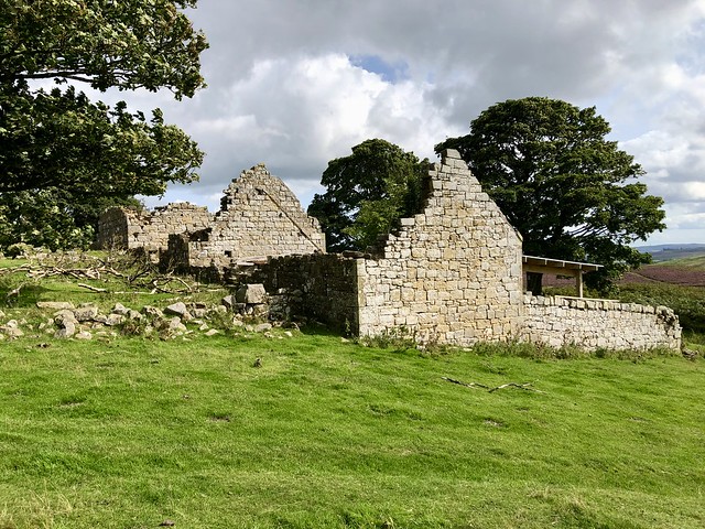
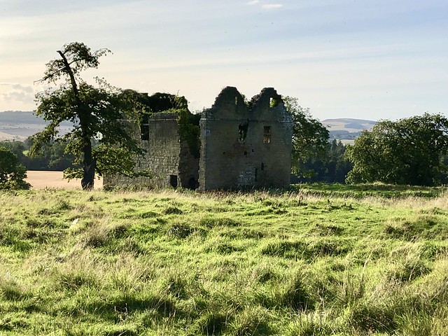
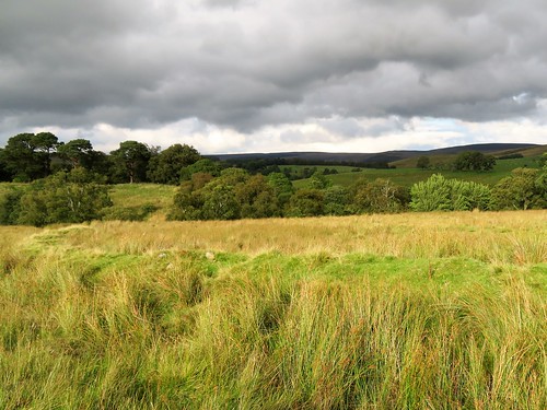
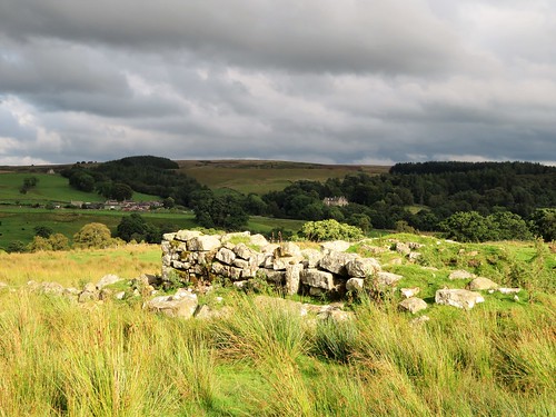
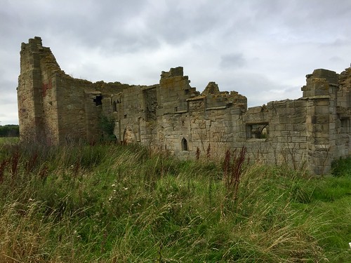
The bastle stood on its rise of ground, looking west over the turrets of Chillingham Castle towards the distant lumpy line of the Cheviot Hills. Everything about this 15th-century fortified farmhouse, its tall fractured walls of sandstone ten feet thick, spoke of hard and dangerous times along these borderlands in an era where might was right and the Hebburn family held sway on this spot.

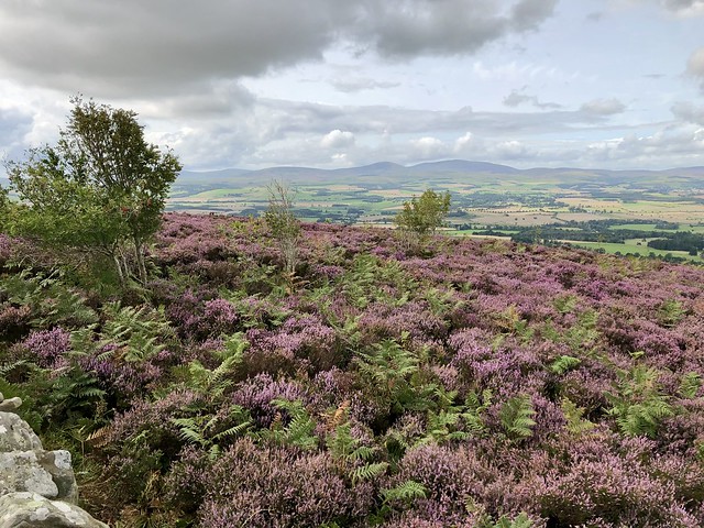
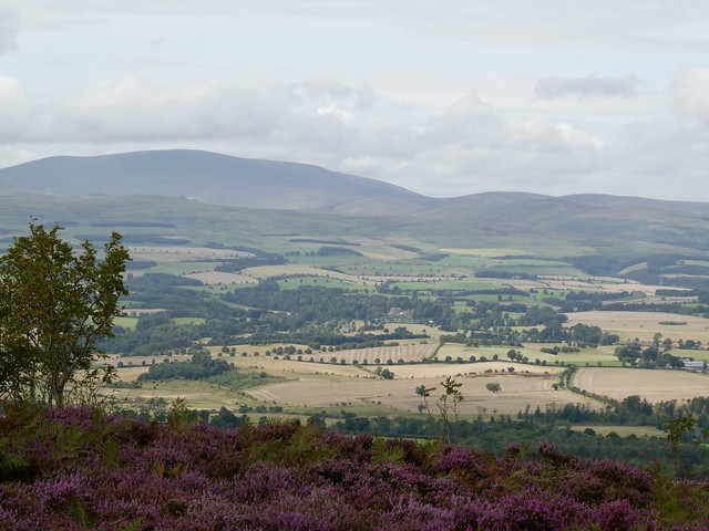
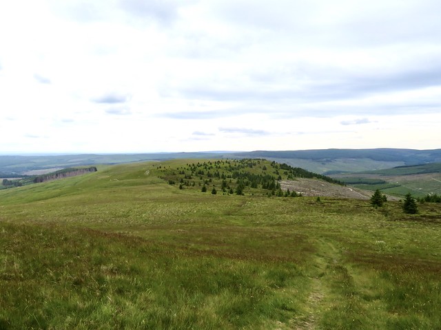
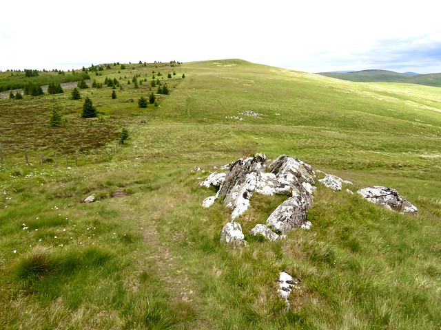
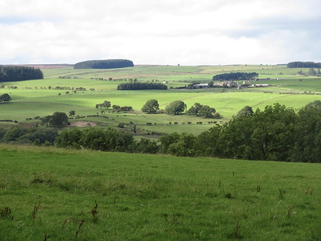
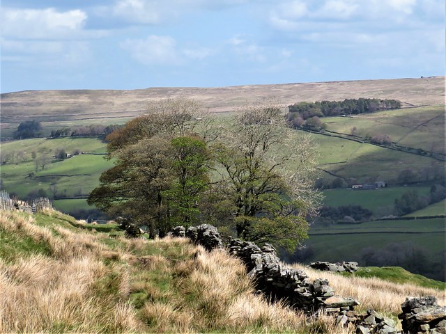
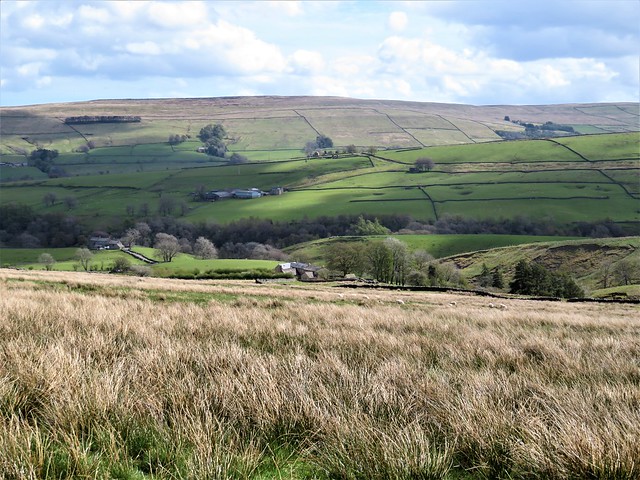
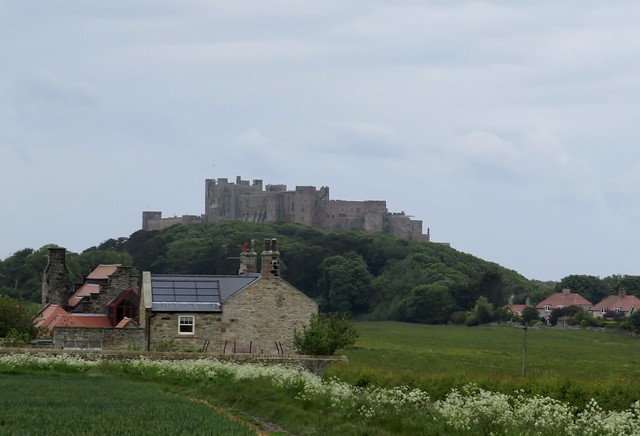
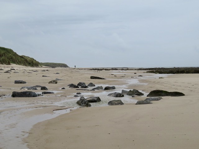
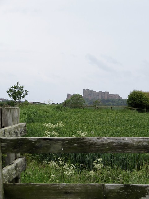
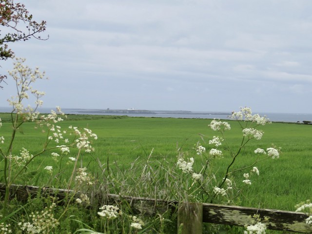
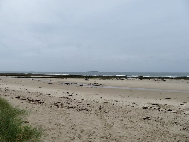
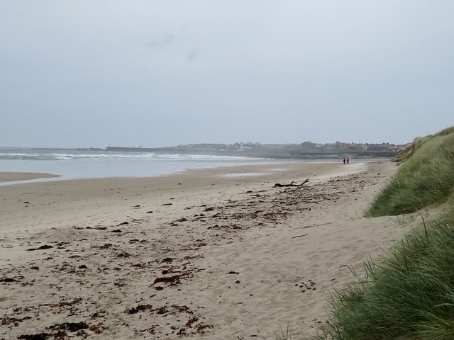
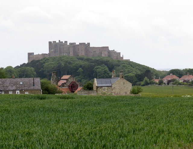
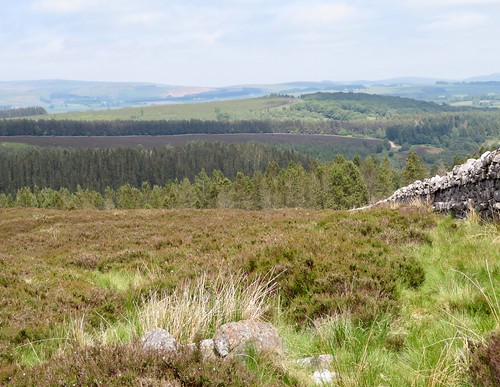
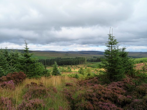
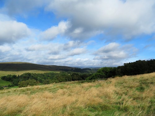
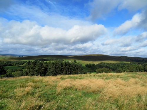
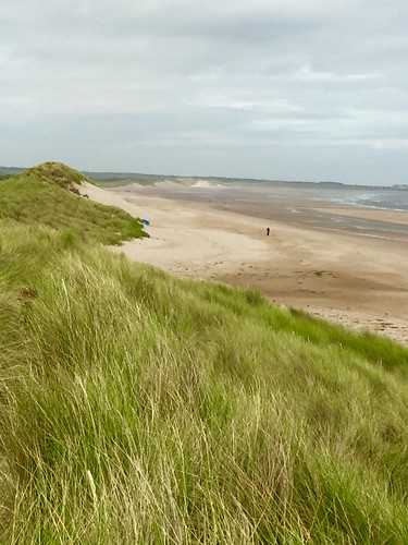
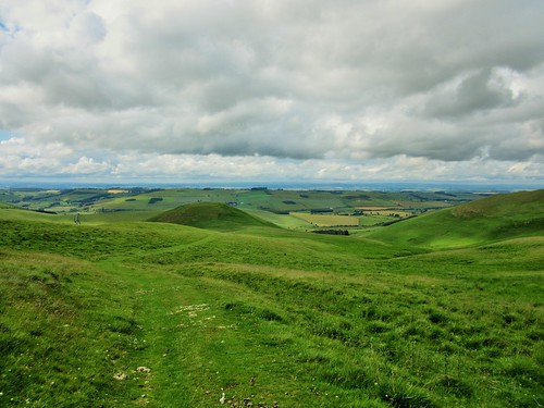
We followed the Chillingham estate wall uphill, and at the crest turned off the road to climb a steep zigzag path to the crest of the thousand-foot knoll of Ros Castle, a stronghold through the millennia. From up here the view was stupendous, northward to the grey North Sea and the coastal castles of Lindisfarne, Bamburgh and Dunstanburgh, west to the smooth dome of Hedgehope Hill and the dominant whaleback of The Cheviot itself, monarch of the Cheviot range.

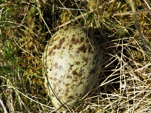
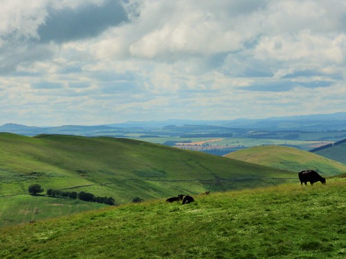
Nearer at hand, I could just make out a bunch of the Chillingham herd of wild cattle browsing under the estate trees. These pale horned beasts have been grazing these borderlands for uncounted centuries. Unhandled, untamed, they live out their own natural lives in genetic isolation here.

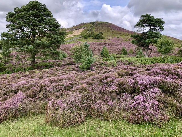
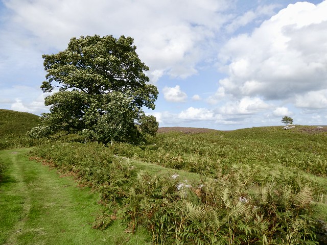
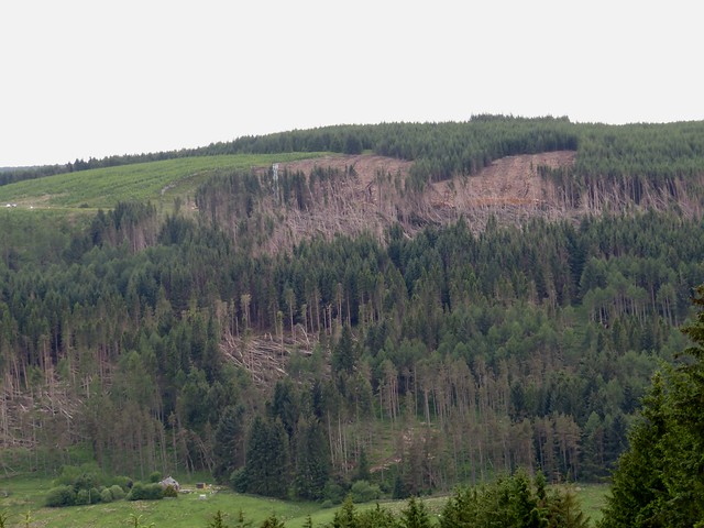
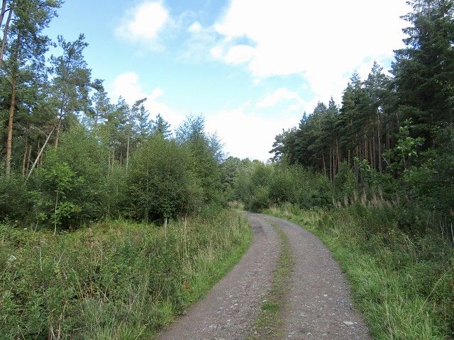
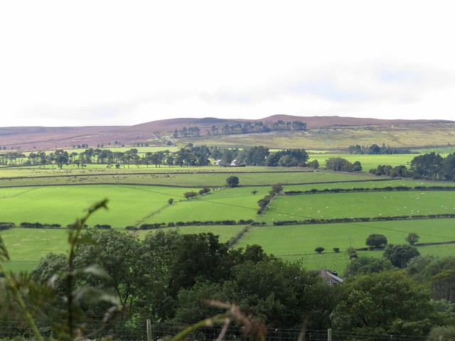
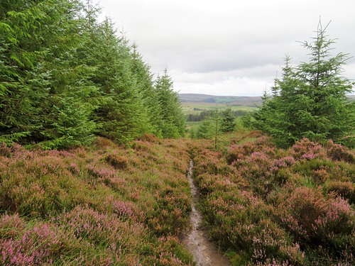
Back on the moor road we put up a snipe that swerved jerkily away, piping its disapproval of being disturbed. At Botany Farm a trust-the-walker roadside freezer yielded an ice lolly apiece, a sugar-shock that propelled us past the storm-tattered trees of Halfcrownhall Plantation and out onto the open heath of Quarryhouse Moor.

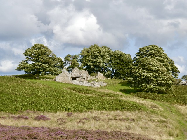
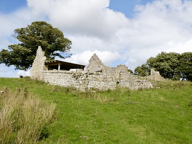
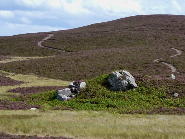
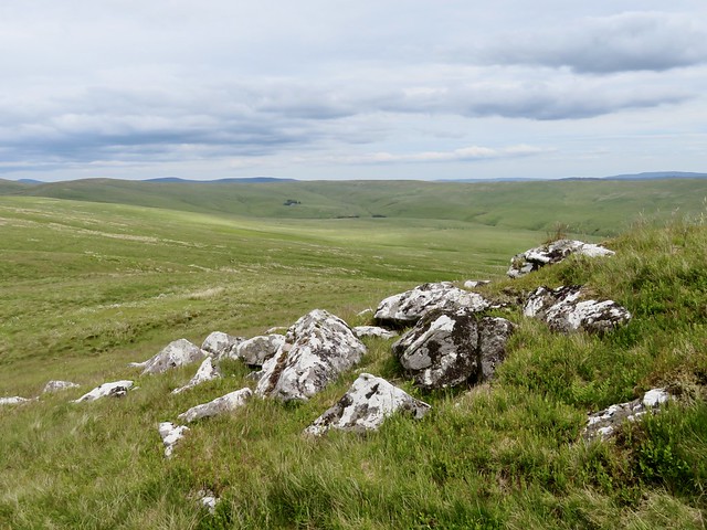
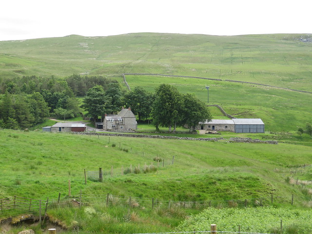
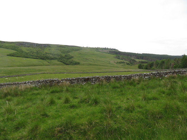
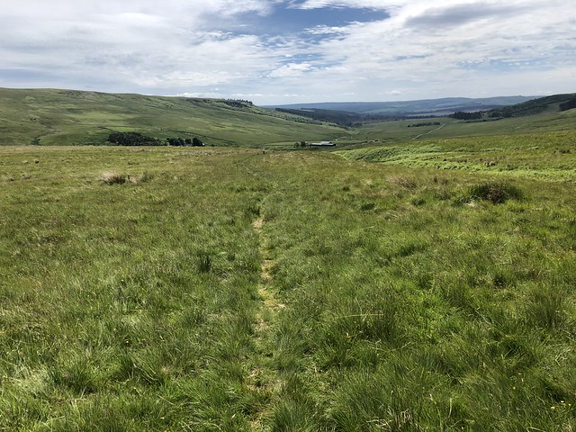
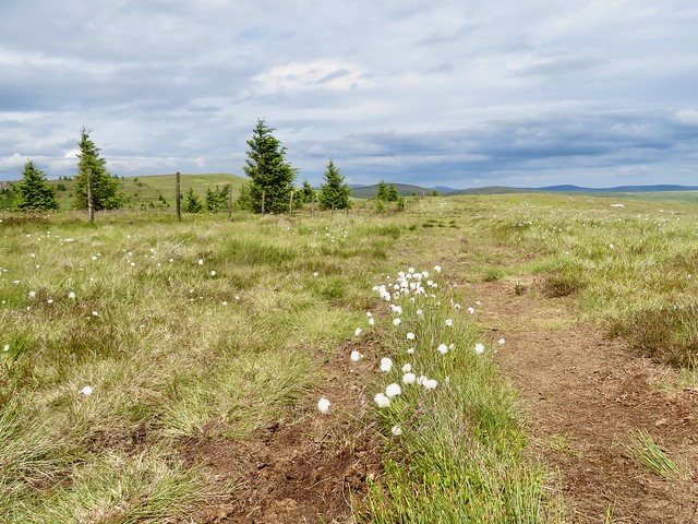
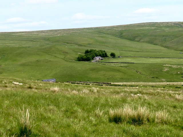
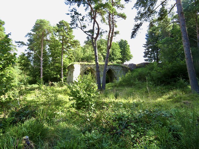
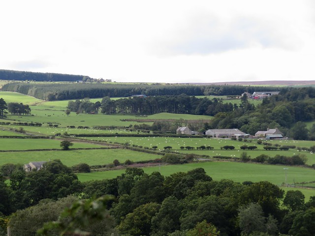
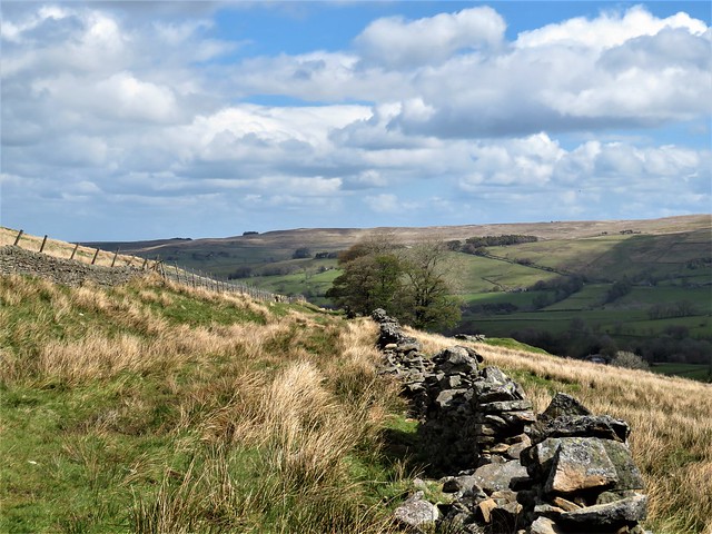
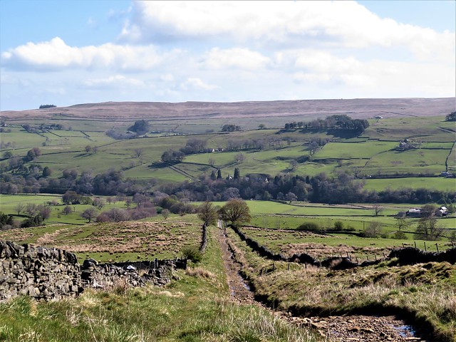
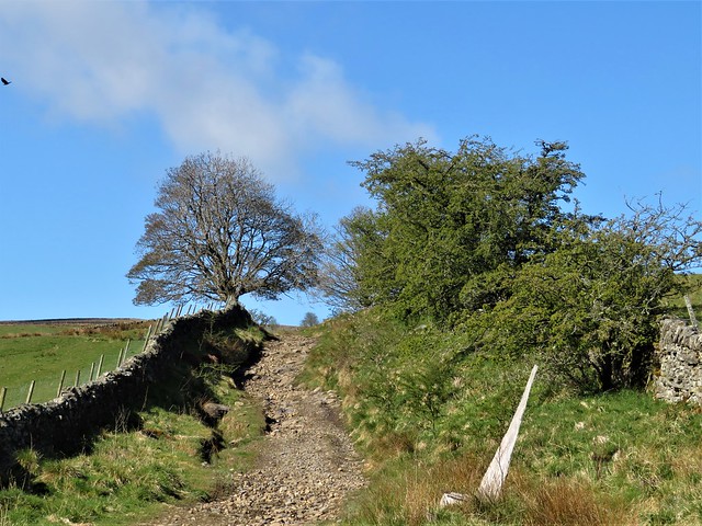
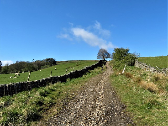
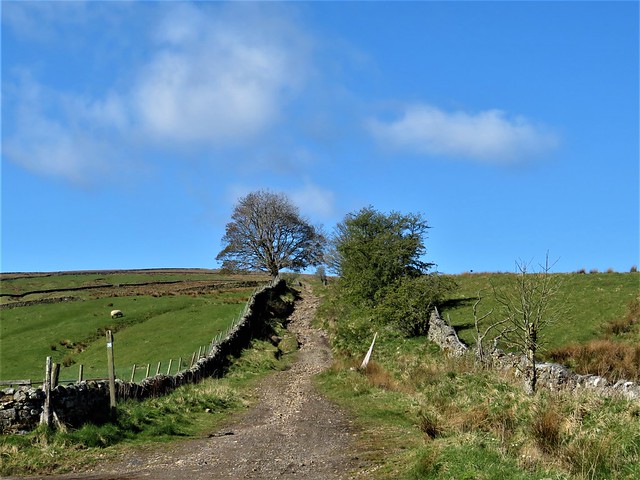
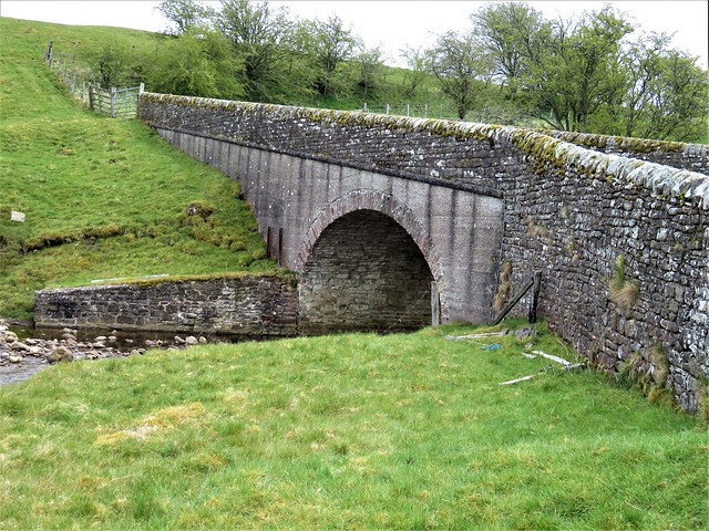
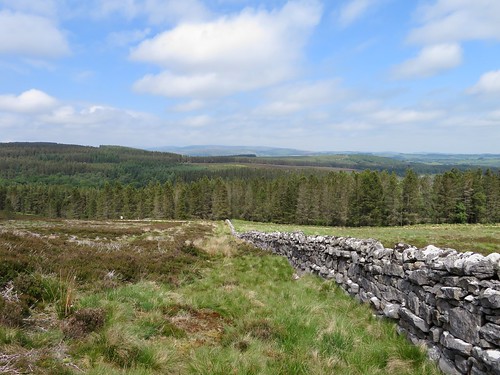
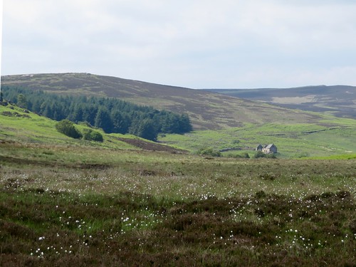
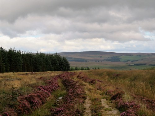
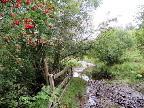
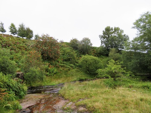
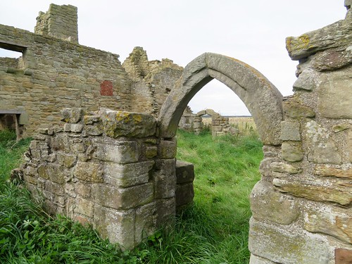
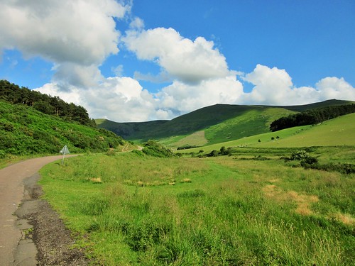
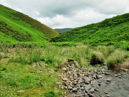
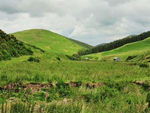
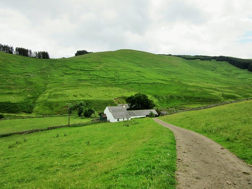
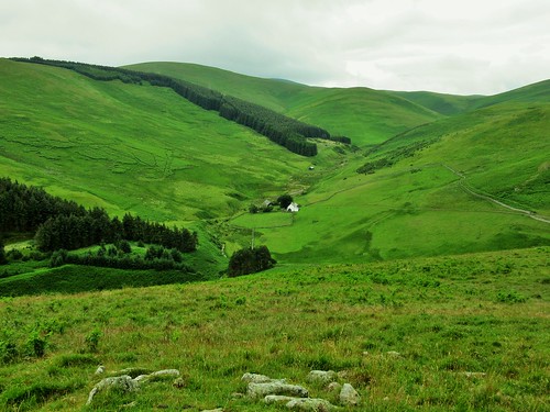
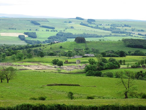
A broad green bridleway led southwest across heather moorland where the rushy ditches reflected the sky in iridescent silver. Our planned return route via Hepburn Wood turned out to have been swallowed by the bracken, and we were glad to have the old cart track as a guide past Blawearie Farm, a lonely ruin among shelter trees hissing in the wind, abandoned now for nearly a century.

What a tough life it must have been at Blawearie, farming these hard acres of rocky moorland, walling in the nearby prehistoric stone circle to make a sheep pen, enduring the bitter winters with the nearest neighbours far across the hill and out of sight.

How hard is it? 9 miles; moderate, with one short steep ascent; moorland tracks and country roads. NB Option 2 (below) includes short section of woodland tangle and undefined path.

Start: Hepburn Wood car park, near Chillingham NE66 4EG (OS ref NU 073248)

Getting there: From A697 south of Wooler, follow ‘Chillingham’.

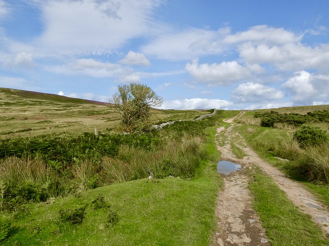
Walk (OS Explorer 340): From car park, right along road. In ⅔ mile at top of road, left (081249, ‘Access Land’) to Ros Castle summit (082252). Return to road; left. In ¾ mile pass Botany Farm (093248), then Halfcrownhall Plantation. In next dip, right (102245, fingerpost ‘Blawearie, Old Bewick’) for 3 miles, passing Blawearie ruin (085223) and continuing to Old Bewick (068215). Just before house, through gate.

Option 1 – continue past house to road; right; in 500m fork right (064219); in 1¾ miles take first turning on right by estate wall (061245); follow road past Hepburn Farm to car park.
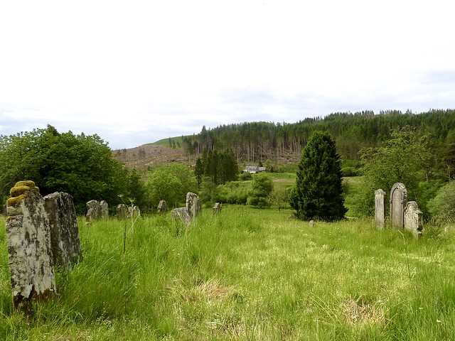
Option 2 – from gate, right across field, aiming for Old Bewick church. Right along far field edge, through gate (069220); in 150m, left (stile, YA) into messy woodland. Right to footbridge (069222). Keep close to fence on left, uphill; pass gate (YA). Up field edge (hedge on left) to Bewick Folly (068226). Left to road (062226); right; then as Option 1 above.

Lunch: Picnic

Accommodation: Tankerville Arms, Wooler NE71 6AD (01668-281581, tankervillehotel.co.uk)

Info: visitnorthumberland.com

 Posted by at 02:27
Apr 152023


First published in: The Times Click here to view a map for this walk in a new window
near Ravens Knowe, looking towards Cottonshope Church of St Francis, Byrness - Catcleugh Reservoir workers forestry damaged by Storm Arwen, near Cottonshope Cottonshope Farm Pennine Way descending towards Byrness 1 above Cottonshope, looking toward Ravens Knowe above Cottonshope path to Ravens Knowe, looking back towards Cottonshope graveyard at Byrness lousewort and sphagnum bog cotton on the Pennine Way, looking north towards The Cheviot Pennine Way, looking north towards Raven's Knowe path to Ravens Knowe, looking towards Cottonshope 2

The friendly and hospitable Forest View inn at Byrness lies in a wild corner of the Cheviot Hills. From the forestry hamlet I followed the Pennine Way up through the trees, and soon turned off on a forest byway that dipped to the lonely valley of Cottonshope.

By the road I found a red flag fluttering and a notice warning of live firing on the adjacent Otterburn Ranges. But a call to Range Control elicited a courteous ‘That’ll be ok today, they won’t be over your way at all.’ A rattle of machine gun fire and the pop of a rifle sounded occasionally from some far-off valley, interspersed every now and then with artillery fire much further away, a curiously feeble and hollow sound, like a giant punching an empty biscuit tin.

I walked up the road to the lonely farm of Cottonshope, where a faint path climbed through rough grass pastures, swerving in and out of the boundary of Otterburn Ranges, up to meet the Pennine Way on Raven’s Knowe.

What a splendid view from the cairn up here. To the northeast the rounded bulk of Cheviot lifting gently to the cloudy sky, the flanks rolling and tumbling down to where I stood. South and west, lower ground with hills and forests running to the Scottish border. To the east, the barely perceptible path up which I’d come falling away into the Cottonshope Valley. South from Raven’s Knowe it was all forest, great swathes of the coniferous cladding that has adhered to the Redesdale hills since the area was planted between the world wars of the last century.

I turned for home along the boardwalks and squelchy corners of the Pennine Way, accompanied by a flittering meadow pipit. Catcleugh Reservoir came into view, a wedge of steely water among the trees. The Pennine Way descended among tuffets of bilberry and sphagnum, before suddenly slanting precipitously down a staircase of rocks.

Down in Byrness the little Church of St Francis held a stained glass window in memory of those who died constructing Catcleugh Reservoir late in the 19th century. It depicted men labouring with pick, shovel and wheelbarrow, with a little girl seated at their feet. In the background a dark, ominous train bears down on them. A very poignant and touching memorial.

How hard is it? 7½ miles; moderate/strenuous; forest and moorland tracks on well-marked Pennine Way.
NB Between Cottonshope and Raven’s Knowe, path veers in and out of Otterburn Ranges boundary. Ranges may be closed if live firing; ring Range Control (01830-520569) before setting out.

Start: Otterburn Green, Byrness NE19 1TS (OS ref NT 764027)

Getting there: Bus 131 (Newcastle-Jedburgh), once a day – nexus.org.uk
Road – Byrness is on A68 Between Otterburn and Jedburgh.

Walk (OS Explorer OL16): From Forest View, right along Otterburn Green; past village hall and on. At A68, by church, left along cycleway (771023, ‘Pennine Way’/PW). In 50m cross A68 (take care!); left up path. In 100m, go through hedge (PW); on through gate into trees (769026); continue up PW. In ⅓ mile, at 3rd major crossing track, right off PW (773030). In ¾ mile, left along Cottonshope Road in valley bottom (773030). In 1½ miles, just past farm sheds, left up track beside range flagpole and notice (789049). Follow clearly seen route for 1¼ miles over moorland to cairn on Raven’s Knowe (781061). Left along Pennine Way for 2¾ miles back to A68; retrace steps to Byrness.

Lunch/Accommodation: Forest View Walkers Inn, Byrness NE19 1TS (07928-376677, fortestviewbyrness.co.uk) – open 12 April–8 October 2023

Info: Otterburn Ranges Range Control access info: 01830-520569;
gov.uk/government/publications/otterburn-firing-times

 Posted by at 08:44
Sep 042021


First published in: The Times Click here to view a map for this walk in a new window
picture picture picture picture picture picture picture picture picture picture

A cool day of smoky cloud over southern Northumberland. The houses and church at Slaley glowed in green-grey stone as we left the windy ridgetop village and headed west past a string of farms – Palm Strothers, East and Middle Dukesfield.

This is all upland grazing country with long views to purple heather moors, sheep and cattle amicably sharing the same fields, farmsteads of longhouses with byres attached, and sturdily built stone barns that would be snapped up as desirable residences if they were situated 400 miles south of here.

Under the rolling green fields and massed ranks of conifers lie the seams of lead that sustained a major lead mining and processing industry from medieval times till the 19th century. At Dukesfield we passed the handsome 3-storey house of Dukesfield Hall where the mine agent lived, and down in the deep valley of the Devil’s Water beyond we found the two tall Gothic arches by which a stone flue carried the noxious lead fumes away from the smelting mill that once worked day and night here.

Imagination and a couple of helpful information boards had to supply the background of noise, heat, furnace roar, clanging and banging. Devil’s Water nowadays couldn’t be more quiet and beautiful. We picnicked by the river to the splash of clear water over miniature cascades, watching out for dippers and for tiny brown trout that rose to flip the surface with their snouts.

A bracken path lead south past Redlead Mill to a quiet road where the aptly named Viewley Farm commanded a wonderful westward prospect from its ridge, over a wide green valley of scattered grey farms to brown and purple fells far beyond.

At the farm gate the road declined to a broad sandy track that rose through the dark conifers of Slaley Forest. Fly agaric fungi as tempting as sweeties with their white-spotted scarlet caps lay in wait among the heather for passing witches and the unwary stepchildren of woodcutters’ wives.

Beyond the forest wide uplands spread north towards a distant hint of the Cheviot Hills. Fallen crab apples spattered the lanes, and the hedges winked scarlet with holly berries. We skirted a caravan park that was threating a takeover of the footpath, and followed the sheep pastures back up the hill to Slaley.

How hard is it? 8¾ miles; easy farm and forest tracks

Start: Rose & Crown, Slaley, near Hexham NE47 0AA (OS ref NY 975577). Please ask permission to park, and give pub your custom!

Getting there: Bus 689 (Consett-Hexham)
Road – Slaley is signed from B6306 (Hexham-Stanhope)

Walk (OS Explorer OL43): Left to cross B6306 (‘Byway’), follow ‘Palm Strothers, Dukesfield’ and blue arrows. In 1¼ miles pass Dukesfield Hall (944574); bear right (yellow arrow/YA) down through trees to arches (941580). Left beside Devil’s Water for ¾ mile to Redlead Mill (931573). Pass house, over stile (YA); ahead for ¾ mile to road (930560). Left; at Viewley Farm gate, ahead (933558) on sandy track through Slaley Forest for 1¼ miles to road (955554). Left; in 600m, right (956560, ‘Spring House’). In 250m at cottage (958560, ‘Private Road’), right; in 5m, left (stile, YA) through plantation, across drive, up grass track. In 400m cross track (963560); path ahead to stile; along wood edge to Cocklake (966561). Left through 2 gates; along drive; in 150m through gate (966563). Aim for left end of plantation; waymark/stile to drive (968565); left to Blue Gables (969568). Right to cross road (974569); down drive (‘Well House, Slaley’). Right round back of East Ridley Hall (974571); YAs to stile and footbridge (975573); up 2 fields to Slaley.

Lunch/Accommodation: Rose & Crown, Slaley (01434-673996, roseandcrownslaley.co.uk)

Info: Hexham TIC (01434-652220), visitnorthumberland.com
@somerville_c

 Posted by at 01:40
Jun 262021


First published in: The Times Click here to view a map for this walk in a new window
picture picture picture picture picture picture picture picture picture picture picture picture picture
Facebook Link:

A cold and brilliant Northumberland morning, the sky blue over West Allen Dale, the light as clear and sharp as glass. Fat lambs in the pastures by the Mohope Burn went bouncing around; so did the hares, jumping and lolloping in close company.

We climbed the lane past the old lead-mining hamlet of Keirsleywell Row, its grassed-over spoil heaps as prominent as Viking burial mounds, then on up toward Mohope Moor on a broad rubbly track between stone walls. All around the land lay open under the sun, green inbye fields striped with walls and dotted with handsome pale stone farms rising to darker moor tops that rolled away out of sight.

Sycamores flanked the lane. These trees, so often sad urban droopers full of blight and insect wounds, were properly grown out here, with limbs stretched to the full. From the sedgy fields came the calls of curlew. Their silvery trilling song, and the abrupt whistling alarm call cur-leek! cur-leek!, seem the very soul of these northern moors.

A cold wind blew out of the southwest into our faces as we reached an old sheep dip flanked by square stone sheep passes in the lane walls. A boggy track led away south across the long upland waste of Mohope Moor, its line indicated by waymark posts among the peat and moss.

The broken shell of a curlew egg, its olive surface scribbled with tarry streaks for camouflage, lay by the way. Nearby two large pellets, ejected by some raptor with a mixed diet, were a clotted mass of fur, feathers, small bones and fragments of marine shells.

At the black trickling stream of Low Blackish Clough we turned back towards the West Allen Valley, tramping through rushes and down a grassy walled lane to find the homeward path along the pebbly flood meadows of the Mohope Burn.

Beyond Malakoff Bridge flashes of silver showed along the river bank. Sand martins were flicking through the air like a shoal of eager fish, darting into and out of their nesting cavities in the overhang of the bank. Their young stood like impatient Deliveroo customers at the threshold of each hole, squeaking as they waited for the next beakful of nutritious insects to be delivered to their doorstep.

How hard is it? 5½ miles; moderate; some rough, boggy moorland walking. Take binoculars to spot waymark posts on Mohope Moor.

Start: Ninebanks Bridge, Chapel Bank, Hexham NE47 8DB (OS ref NY 782524)

Getting there: Ninebanks is signed off A686, Alston-Haydon Bridge. Half a mile beyond Ninebanks, fork right (‘Mohope’); park just beyond bridge.

Walk (OS Explorer OL 43, 31): Take road signed ‘Mohope’. In ¾ mile at left bend, keep ahead (774518, ‘Isaac’s Tea Trail, Long Cross’); climb stony lane for 1 mile to stile at sheep dip (763508, ‘Welcome to the Moor’ signboard). In 100m track bends right; keep ahead here, over stile, then follow waymarked posts (yellow arrows/YA) across moor. In ¾ mile, the sixth post (2 YAs) stands on far bank of Low Blackish Cleugh stream (759497); don’t cross stream, but turn left, aiming a little left of farm on distant slope. In 300m you’ll see line of posts ahead; follow to wall corner (765499); walled green lane to road at Fairplay (769506). Ahead; in 300m, sharp right (771510). In 450m on right bend, keep ahead (774507, ‘Redheugh, Malakoff Bridge’); follow waymarked path for 1 mile to Malakoff Bridge (782518); left on road to car.

Lunch: Picnic

Accommodation: Ninebanks Hostel, Keirsleywell Row, near Hexham NE47 8DQ (01434-345288, ninebanks.org.uk)

Info: Hexham TIC (01670-620450); visitnorthumberland.com

 Posted by at 01:39
Jul 112020


First published in: The Times Click here to view a map for this walk in a new window
picture picture picture picture picture picture picture picture
Facebook Link:

When the weather decides to throw a wobbler on the Northumberland coast, it doesn’t do it by halves. Winds whistle, waves thump the beaches, the sea grumbles, gulls go tumbling across the sky. And when the Shiel family of Seahouses cancel their boat trips to the Farne Islands just offshore, you know that it’s going to be a vigorous sort of day.

Seahouses Harbour was built to withstand anything the North Sea could throw at it – a great deep basin of solid walls that dwarf the sheltering fishing boats. Seahouses fishermen still go out after crabs and lobsters, and the piles of creels they stack along the harbourside streets bear witness to an age-old industry.

We set out into the wind along one of the most beautiful coasts on earth – if you like your beauty harsh, stripped back and elemental. Tan sands, black rock scars, orange bladder wrack, grey sea, as simple and striking as that. On one hand the dunes with their velvety nap of pale marram grass, on the other the long surfacing-submarine shapes of the Farne Islands clinging to the sea horizon.

How under heaven did St Cuthbert stick out his eight years of eremitic solitude on Inner Farne? Ancient tales tell of the demons that battled the saint, of the eider ducks – ‘cuddy’s ducks’ – that he loved and protected, and of the seals that brought him fish and sang to him. It certainly seems that only divine intervention could have sustained life in such a lonely place, windswept, storm-battered and hard as iron.

As we walked north between dunes and sea, the massive fortification of Bamburgh Castle grew steadily larger and more upstanding ahead. The castle is all walls and turrets, keep and battlements, high over everything. It radiates power and impregnability.

Some sort of stronghold has dominated land and sea from this perch on a dolerite crag overlooking the ocean for at least the past 2,000 years. Wandering through its stone chambers among suits of armour, delicate Meissen porcelain and framed photographs of the resident Armstrong family, we heard the wind booming down the chimneys and looked out over the enormous beach below where sea and sky were blown into tatters by strengthening gusts from the north.

The homeward path lay along wet pastures where black cattle grazed, and through fields of young wheat where every step released a shower bath of raindrops and skylarks sang themselves high into the scudding grey sky.
Start: Seahouses town car park, Northumberland NE68 7SW approx. (OS ref NU 218320)

Getting there: Bus X18 (Beadnell-Berwick)
Road: Seahouses is on B1340, signed from A1 at various points between North Charlton and Warenford)

Walk (6¾ miles, easy, OS Explorer 340): From Seahouses harbour (220322), head north-west along the beach for 3 miles to Bamburgh. Return towards Seahouses along B1340. 200m beyond The Links car park, right over stile (186347, ‘Coast Path’). Cross fields, aiming for Redbarns (190343). Follow waymarks for St Oswald’s Way and Northumberland Coast Path/NCP. At Fowberry (192334), left along road; follow road and NCP for 1 mile to T-junction at Shoreston Hall (204326). Right; in 25m, left (stile, NCP) across fields for ⅔ mile to stile into road (210318). Right; in 150m, left on old railway path (210316, NCP) to Seahouses harbour.

Lunch: Bamburgh Castle Inn, Seahouses NE68 7SQ (01665-720283, bamburghcastlehotel.co.uk)

Accommodation: Springhill Farm, Seahouses NE68 7UR (01665-721820, springhill-farm.co.uk). Beautifully run, welcoming self-catering place.

Info: Seahouses TIC (01670-625593); visitnorthumberland.com
Bamburgh Castle: 01668-214515, bamburghcastle.com
satmap.com; ramblers.org.uk

 Posted by at 01:51
Jun 222019


First published in: The Times Click here to view a map for this walk in a new window
picture picture picture picture picture picture picture picture picture picture
Facebook Link:

The nuns of Holystone Priory must have been a tough and determined bunch, to have maintained their prayerful community through all the hard times, Border battles, reivers’ raids and lack of funds associated with the Northumbrian borderlands of the wild Middle Ages.

There is a faint whisper of their presence in the little 12th-century (but much restored) Church of St Mary, and a breath of their holy spirit on the still waters of Lady’s Well, just north of the hamlet of Holystone. Legend has St Ninian, stern pioneer of Christianity in these parts, baptising three thousand sinners in the well around 500 AD. Today the waters still dimple and run, and the brook below the well is lined with beautiful monkey flowers, gold with orange-spotted nether lips.

We followed a lane through forestry, looking for the red squirrels that inhabit these trees. Bog myrtle in the verges released a churchy incense smell as we crushed the leaves between finger and thumb.

A scramble of a path up through the pinewoods of Cat Law brought us out into the heather uplands of Daw’s Moss. Within the walls of a cross-shaped plantation stood the Pedlar’s Stone, mysteriously named and never explained.

At lonely Craig Farm in the valley below, the massively strong structure of a bastle formed part of the farm buildings. A bastle was a fortified farmhouse, its stone walls five feet thick. With the animals locked in the vaulted basement below, the ladder pulled up and the family barricaded behind tiny windows, a farmer living here four hundred years ago could hope to hold out against the reivers – buccaneers who made their own laws and rustled cattle as a day-to-day business.

From Craig Farm our way led east across trackless moor where curlews bubbled their melancholy warning cries. We passed the Five Kings, a line of rough and rugged standing stones (four in number – one’s now a gatepost elsewhere), and came down to Dueshill Farm.

The farmer went bouncing across the pastures on a quad painted up like a racing car. The sheep ran bleating towards the field gate, and an old hand of a sheepdog kept the whole show together, now bullying, now coaxing – a masterful display of crowd control.

Start: Forestry Commission car park, Holystone, near Rothbury NE65 7AX (OS ref NT 951026)

Getting there: Holystone is signed from B6341 between Elsdon and Thropton

Walk (7 miles, strenuous, OS Explorer OL16, OL42): Right along road. In ¾ mile, beside Forestry Commission ‘Holystone Common’ sign (941020), fork left past barrier along forest track. In 500m track curves left (purple arrow/PA) to cross Holystone Burn (934013). In 250m, hairpin back left up track (933012). In 200m pass PA post on left; in 100m, right (935011, unmarked) up bank, then rough path south through trees to stile and gate at top by MoD notice (935010). Ahead with wall on left for 500m to road at Pedlar’s Stone walled copse (934005).

Ahead down road to Craig Farm. At farm entrance, left (938999, fingerpost ‘Dueshill 2½’) over stile. Follow grassy track into valley, aiming for far right corner of field with conifer plantation beyond. Over gate (943995, waymark post/WP); in 100m right across Keenshaw Burn; in 100m recross (footbridge). Follow edge of plantation (WPs). In 400m leave corner of plantation (948995), bearing a little left away from fence on right for 700m over rough ground (faint track), aiming for right hand corner of plantation ahead.

At MoD notice at corner (954999), ahead, keeping close to fence and trees on left. In 200m, cross stile at angle of fence (956000, yellow arrow/YA). Keep same direction for 150m through wood, picking your way over fallen timber, to MoD notice at far side (957001, stile). Ahead, keeping uphill of Five Kings standing stones, to left corner of plantation wall (958002, YA). Half left to gate (959003, YA) and on. At WP bear half left and follow fence downhill, keeping it on your right, to left corner of plantation below (959006).

Through gate (YA); ahead (YAs) for 350m to join farm road (960009). Left to Dueshill Farm. At gates (960013), through gate, across dip, through next gate with shed ahead. Left; through field gate (YA); right up field edge. At top of plantation, right over stile (960016, YA); left down fence. In 100m at edge of trees, ahead for 700m, crossing 2 stiles (YAs) to road (958023). Left into Holystone.

Conditions: A tough walk, reasonably well waymarked on faint tracks. For experienced self-guiding ramblers, properly equipped and clad.

Refreshments: Picnic

Accommodation: Coquetvale Hotel, Station Road, Rothbury NE65 7QH (01669-622900, coquetvale.co.uk) – modernised former railway hotel
Info: visitnorthumberland.com; satmap.com; ramblers.org.uk

 Posted by at 07:50
Aug 262017


First published in: The Times Click here to view a map for this walk in a new window
picture picture picture picture picture picture picture picture picture picture picture picture picture picture picture picture picture picture picture
Facebook Link:

The Holly Bush Inn at Greenhaugh is one of a very rare breed – an old drovers’ inn, long, low and full of character, in a hamlet tucked into a fold of the Northumberland National Park. They welcome you here in a no-nonsense way, no matter where you’re from.

We followed the rough lane to Boughthill between fields of cut hay and pastures grazed by blackfaced sheep. ‘A fair lambing this year,’ said the farmer, stopping his old Land Rover to find out if we were lost. ‘Not a good summer so far, though. But if farmers weren’t complaining about that, it’d be something else, eh?’

Past the grey stone barns at High Boughthill we turned up the hill road to Thorneyburn. The verges were spattered with colour – pink campion, purple heads of knapweed, sharp yellow of meadow vetchling, and the brilliant scarlet of rowan berries, hanging in bunches and dripping with the last of the afternoon’s rain.

High Thorneyburn farm lay on its lonely hillside in a protective collar of shelter trees, looking out over sedgy fields across the North Tyne valley to the rise of Snabdaugh Moor and the ripples of rocky crags beyond. These upland farms, beautiful though their aspect is, are tough places, demanding practical ingenuity from those who work them. The sheep dip and pens beside the lane were a marvel of clever construction, with little gates, lath fences and runways to direct the animals exactly where the shepherd wanted them to go.

Beyond High Thorneyburn we scrambled round the flooded spillway of Slaty Ford, and climbed a path knee-deep in heather up over the shoulder of Thorneyburn Fell. At the entrance to the forest of Sidwood a pack of siskins went flitting through the birch tops with a flash of yellow and a thin burst of twittering.

The wind rushed with a sea-like murmuring through the pine tops as we followed the forest track down to the valley of the Tarset Burn. The moorland path led home by way of the stark stone ruin of a pele tower, built back in the dark days of raiders and reivers when all these hills and valleys were dangerous, debateable land.

Start: Holly Bush Inn, Greenhaugh, near Bellingham NE48 1PW, (OS ref NY 795873)

Getting there: Greenhaugh is signposted off B6320 between Otterburn (A68) and Bellingham.

Walk (8 miles, some boggy sections, OS Explorer OL42): From Holly Bush Inn, right along road. In 200m, right (fingerpost, ‘High Boughthill’) down drive. In 500m cross Tarset Burn by footbridge (793867). On to turn right through Boughthill farmyard (2 gates) and up track (occasional yellow arrows/YA). Pass Higher Boughthill barns (789867); ahead with wall on right through trees. Through gate (787867); left along back of plantation and on to road (785862).

Turn right. In 350m, fork right through gate (782864) and on along moor road. In 1¼ miles, at turning on left at High Thorneyburn farm (766872), ahead through gate along track to Slaty Ford (767874). Scramble round to the right to avoid the stream. 50m beyond, through gate; in 70m, right (‘Sidwood, 1½’ fingerpost), on clear track to cross Thorney Burn, then NE up well-trodden path through grass and heather over Thorneyburn Common for 700m to a gate beside wall opposite Stank Well (765881, blue arrow/BA).

Ahead into Sidwood. Keep ahead on broad track. In 600m cross a forest road (770885, BA); continue on path, descending among trees for 600m to cross forest road (775889, BA). Ahead on path among trees to road in valley (776890). Right along road. In ⅔ mile pass Redheugh (784885); in another 500m, right (‘Thorneyburn’) to Thorneyburn church (786877).

Just past church, left through gateway, down west wall of churchyard. On through garden; out into a field. Head half-right (YA), steeply down a rough slope, to cross burn by footbridge (786875, YA). Climb far bank; head half left across open moor, aiming for low ruin of pele tower (787872). Ahead to stile in fence – don’t cross, but turn left (YA), keeping fence on right, to bottom of field (790868). Right through gate; left through gateway (YA); ahead to waymark post (YA). From here aim ahead, steeply down bank to cross burn (791867). Steeply up far bank to waymark post at top (YA); down track to Boughthill farm and retrace route to Greenhaugh.

Conditions: Route over Thorneyburn Common faintly marked in places; Slaty Ford wet and slippery.

Lunch: Picnic

Accommodation: Holly Bush Inn, Greenhaugh (01434-240391, hollybushinn.net) open Mon-Fri from 4 pm, weekends from noon.

Info: Bellingham TIC (01670-620450); Kielder Forest TIC (01434-250209)

3 September: 50th Rossendale Round-the-Hills Walk, Rawtenstall, Lancs (realtd.co.uk/50th-rossendale-round-hills-walk)

visitengland.com; satmap.com; ramblers.org.uk

The January Man – A Year of Walking Britain by Christopher Somerville (Doubleday, £14.99).

 Posted by at 02:12
Dec 032016


First published in: The Times Click here to view a map for this walk in a new window
picture picture picture picture picture picture picture picture picture picture picture picture picture picture picture picture
Facebook Link:

Walking through the pine trees towards the sandhills of Hadston Links, we could hear the sea pounding the sands of Druridge Bay. A big roaring wind was building in the south, and once we were through the dunes and heading down the beach we had a half gale in our faces and the whole enormous bay – give or take a handful of dog ball throwers – to ourselves.

Druridge Bay is designated a Heritage Coast and a Site of Special Scientific Interest. This seven-mile curve of beach from Amble to Cresswell is totally unspoiled, a simple and grand arc of dull gold sand backed by flowery dunes, with crashing steel-grey waves coming in off the North Sea under huge overarching skies.

This is a beach for runners and kite-fliers, joggers and diggers, idlers and strollers. Black matchstick figures of men, women and dogs pushed hard into the wind. The sea rolled in, roaring softly on the sand and hissing up the beach in diminishing flounces of white foam. The air over the bay was laced with spray, lending a diffused pearly glow to the sky.

A flight of ringed plover went twinkling in black and white across the ribbed pools that had collected in the sands. On the landward side of each sandy ridge in every pool, a skin of gritty black had collected – tiny flecks of coal, sifted out of the low-lying hinterland behind the beach and filtered through the dunes by the trickling flow of tiny burns. The richness of the bird and flower life here, the windy solitude of the beach, make it easy to forget that this is coal-bearing country.

A couple of miles along the beach we cut inland through the dunes and past the wetlands and wildfowl lakes of Druridge Pools. Isolated in the fields beyond stands the lonely ruin of Low Chibburn Preceptory, a medieval chapel and hospital of the Knights of St John built on the ancient pilgrim route to Holy Island. The Hospitallers’ refuge has done duty in its time as a grand dower house, a cattle shed and a Second World War pillbox.

Before setting back for the beach and the return walk, we wandered slowly round the ruin, admiring its finely carved piscina, its arched windows and handsome stonework, survivors of changing fortunes over the course of seven hundred years in this remote corner of the Northumbrian coast.

Start: Druridge Bay Visitor Centre, near Amble, Northumberland NE61 5BX (OS ref NZ 272998)

Getting there: Visitor Centre signed off A1068, 2 miles south of Amble

Walk (6½ miles, easy, OS Explorer 325. Online maps, more walks at christophersomerville.co.uk): From car park, follow ‘Beach’. Path through trees, then dunes; down steps onto beach (273996). Turn right/south for 1½ miles. Where the dunes dip to a pool and Dunbar Burn, pass a pipe (broken in two) across the beach (277972). Continue along beach for 500m, then turn inland between tank blocks through gap in dunes (277965), past concrete blockhouse. Through fence gap (North Sea Trail ‘N’ waymark); right along road; in 200m, left between boulders (275966) on path (yellow arrow/YA) past Druridge Pools and on across 2 fields (YAs) to Low Chibburn Preceptory ruin (266965). Return same way. Nearing Visitor Centre, look for wooden steps up through dunes.

Lunch: Snacks at Visitor Centre café (open daily summer, weekends winter)

Accommodation: The Bridges B&B, 3 Togston Crescent, North Broomhill, near Amble NE65 9TP (01670-761989).

Druridge Info: northumberland.gov.uk, 01670-760968

visitengland.com; satmap.com; ramblers.org.uk

Britain’s Best Walks: 200 Classic Walks from The Times by Christopher Somerville (HarperCollins, £30). To receive 30 per cent off plus free p&p visit harpercollins.co.uk and enter code TIMES30, or call 0844 5768122

 Posted by at 01:20
Oct 172015


First published in: The Times Click here to view a map for this walk in a new window
picture picture picture picture picture picture picture picture picture picture picture picture picture picture
Facebook Link:

Our friend and walking companion Dave Richardson had only just taken delivery of his new concertina from Wiltshire master maker Colin Dipper after a decade of waiting, and had brought it down with him to Northumberland to play us a few tunes. But first some inspiration, in the form of a walk in the Cheviot Hills.

On a morning of smoking cloud and pearly light we set off along the College Valley with Dave and his wife Lucy, and their chum Liz Anderson, for company. This deep, sheltered cleft in the northern flank of the Cheviots held several sheep farms not so long ago. These days, just two farms account for some 12,000 acres of hill grazing.

It was a stiff pull up the slope of Great Hetha to the Iron Age fort at the summit. We walked a circuit of the double ramparts of stone, looking out at hills folding to the south in steamy grey waves. Below us lay the lonely farmhouse of Trowupburn. ‘Burn of the Trolls?’ queried Dave. Past generations of Cheviot dwellers lived with legends of these grumpy giants who would snatch unwary musicians to entertain them in their caves.

Near the farm we crossed the Trowup Burn – the only way for a mortal to escape the trolls, who dared not go over running water. On the far bank a splendid bull in a cream-coloured coat was swinging his tail and murmuring in the ear of a young heifer. We left them to it and climbed the bracken slopes beside the Wideopen Burn where whinchats were singing wee-chit-chit!

Up beyond Wideopen Head we found the Stob Stones, a pair of stumpy porphyry boulders where the local gypsies once crowned their kings. Here we had a breathtaking view northwards over thirty miles of low-rolling border country. A long moment to stand and stare; then we cut east along the upland track of St Cuthbert’s Way to the College Valley.

That night we feasted on wonderful music. The new concertina might have been made within sight of the Wiltshire downs, but it was pure Cheviot that Dave brought forth from it – the hornpipes, reels and jigs of these hills, while we sat and dreamed back over the day.

Start & finish: College Valley car park, Hethpool, near Kirknewton NE71 6TW approx. (OS ref NT 894280)
Getting there: A69 (Wooler-Coldstream); B6351 to Kirknewton; Hethpool signed just beyond, at Westnewton.
Walk (8 miles, moderate/strenuous, OS Explorer OL16): From car park, left along road (detour to stone circle on right, 893278). In ½ mile, fork right (891275, ‘Great Hetha’) up left side of plantation. At top of wood (888277), left up to Great Hetha summit fort (886274). Don’t turn right off summit towards Elsdonburn, but keep ahead (south-west) along green ridge (white arrow) till you look down on a white house. Half right here down grass track to stile (877269, ‘Hilltop Trail’); left down farm track to Trowupburn (876265).

Past house, bear right through gate and up grassy lane with fence on left. In 600m, left across Trowup Burn (871262); in 500m, recross burn and a stile (867261), and turn left to continue through bracken. In 200m bear right at circular sheepfold into valley of Wideopen Burn. Follow path through bracken up right side of valley to Wideopen Head. Meet a fence here, and go through a gate (861265). Keep ahead on grass track for half a mile to meet Pennine Way (854269). Right along PW for 500m (detour left to see Stob Stones, 851270), to 3-finger post (850272). Right here (‘Elsdonburn 1½’), and follow waymarked St Cuthbert’s Way for 3½ miles back to Hethpool.

Accommodation: Tankerville Arms, Wooler NE71 6AD (0168-281581, tankervillehotel.co.uk).
More info: Cheviot Centre, Wooler (01668-282123)

visitnorthumberland.com; satmap.com; ramblers.org.uk

 Posted by at 01:41
Nov 222014


First published in: The Times Click here to view a map for this walk in a new window
picture picture picture picture picture picture picture
Facebook Link:
Hadrian’s Wall, its observation towers and guard-posts, the roads and townships that served it, form the most remarkable monument in Britain to those energetic, organised and life-loving invaders, the Romans. They wrenched our history so forcefully out of its former courses; and yet it’s the tiny details of their quotidian lives that fascinate us most.

How incredibly angry the tile-maker of Vindolanda must have been when that stupid pig walked all over the nice new clay flooring he’d left out to dry in the sun. A surviving tile from the spoiled batch, on display in Vindolanda’s museum just south of the Wall, carries the prints of the pig’s incurving toes, as sharp today as the hour they were dinted two thousand years ago. And here alongside are the hobnailed shoes and thong sandals of this Roman fort’s inhabitants, their nose-picks and knives and scribe-written birthday invitations; while outside lies the foundations of the town they lived and loved in, its houses, temples, wells and paved streets.

Walking the rushy meadows a mile or so to the south, I looked up at the thin line of the Wall as it rode the rollercoaster crags of the Whin Sill, the volcanic rampart that strides across the neck of Northumberland. A magnificent bull, muscled like a body-builder, lion-coloured and sporting a leonine mane, watched me cross the broad grassy ditch or vallum and turn east along the Wall.

The stepped path swooped me up the crests and down into hollows of the dolerite sill, passing the sites of the milecastles and turrets where conscripts from the Low Countries paced and shivered and looked out into the debatable lands to the north from where the wild Picts might come screaming at any moment. As I stared out from the Wall to the looming black line of Wark Forest, the blue humps of the Cheviot Hills beyond, it was all too easy to imagine those young men sulkily clutching their cloaks around them and wishing they were down in Vindolanda where the latrines ran with clean water and the stew came hot to the table.

The old house and barns of Hotbank Farm lay huddled on the slope of Hotbank Crags, their walls much patched with Roman stones. Here I left Hadrian’s Wall and headed across the vallum and down flowery meadow slopes, with Vindolanda spread below me in the evening sunlight.
Start: Vindolanda car park, near Bardon Mill, Northumberland NE47 7JN (OS ref NY 767664)

Getting there:
Bus – 685/85 to Bardon Mill
Road – signposted from B6318 at Once Brewed (north of A69, between Haydon Bridge and Haltwhistle at Bardon Mill).

Walk (8 miles, moderate – many short, steep slopes – OS Explorer OL53. NB: detailed directions, online maps, more walks at christophersomerville.co.uk): From Vindolanda car park, left along road; in 100m, left through gate, down track; in 400m, right (766660) on path (stiles, yellow arrows/YAs). NB After passing barn at Kit’s Shield (764659), negotiate tree blocking path! Skirt Layside (760659, YAs); on to road (756658). Left, then right along lane (‘Cranberry Brow’) for 1⅓ miles to road (735655). Right (fingerpost) on drive to Hill Top; on to road (730659). Right to cross B6318 (729663, stile, ‘Shield on the Wall’).

Path along field wall, then diagonally left across Roman Vallum ditch to Hadrian’s Wall (727669). Right along National Trail for 3 miles to Hotbank Farm (771680). Leave National Trail here; right down farm drive to B6318. Right along grass verge for 400m; left (770674, stile, ‘Vindolanda’) across field, aiming to cross stile on left of High Shield house (769672, YA). Left to stile (YA); down fields with fence on left. In 2nd field, fence trends away left, but keep a beeline ahead to stile and road at bottom (772665). Right to Vindolanda car park.

Conditions: Short, steep ups and downs on Hadrian’s Wall. Bulls, cows, calves may be in fields.

Refreshments: Vindolanda Café

Accommodation: Twice Brewed Inn (on B6318 near Bardon Mill), NE47 7AN (01434-344534; twicebrewedinn.co.uk) – very cheerful, walker-friendly stopover

Vindolanda: 01434-344277; vindolanda.com

Information: Northumberland National Park Centre, Once Brewed (on B6318 next to Twice Brewed Inn) – 01434-344396. Open weekends only in winter.
visitengland.com; www.satmap.com; ramblers.org.uk

 Posted by at 02:30