Search Results : pennines

Dec 092023


First published in: The Times Click here to view a map for this walk in a new window
Stone barn near Great Asby sheep pasture near Great Asby 1 sheep pasture near Great Asby 2 rough pasture near Great Asby hawthorn berries in profusion 1 hawthorn berries in profusion 2 hawthorn berries in profusion 3 bridge on outskirts of Great Asby lane to Gaythorne Cottages looking towards North Pennines and High Cup stone wall striping the pastures near Great Asby looking south from the lane to Halligill 1 looking south from the lane to Halligill 2 looking south from the lane to Halligill 3 Great Asby church Stone wall and limestone pavement looking south towards Great Asby Scar Ash tree splitting the limestone on the lane to Halligill

Pied wagtails were pattering sidelong up the slate roofs of the cottages along the straggling lane through Great Asby. ‘Three Greyhounds?’ said the cheerful lady near the bus shelter. ‘Just over the packhorse bridge, can’t miss it.’

At the southern outskirts of the village we turned along a farm road that wound into open country. A flight of several dozen wintering fieldfares swooped into an ash tree, bounced and chattered amongst themselves, then fled downwind, their grey heads and dark tails showing out against a streaky blue sky.

A stone barn, sturdily buttressed, stood by the lane. Here the roadway roughened as it rose through rushy fields. Away south sombre moor tops lay under rolling cloud, and behind us in the east the rampart of the North Pennine hills climbed into a slate-grey murk. But here in this rolling countryside between the hills, sunlight lay thick and gold across pasture that was squared and striped with carefully maintained stone walls.

Beyond Halligill we left the track and plodged across rain-sodden fields, scrambling over a muddy beck and trudging down the grassy track to Gaythorne Hall. The farmer came puttering up on a quad as his ewes scampered away in communal panic. ‘Lambing from January on’, he told us.

Gaythorne Hall in its dell looked magnificent even in the steely embrace of scaffolding – a three-storey Tudor house, gabled and handsomely porched. We squeezed through an obstacle course of gates and a cattle crush to gain the farm lane that wound through sheep pastures up to the moor road back to Great Asby.

By the road lay the Bronze Age burial mound of Hollin Stump, where Victorian antiquarians unearthed three skeletons and a horse skull. What religious or magic connotation that had had was anyone’s guess. Walking on, we wondered what those remote ancestors would have made of the enormous rainbow that arced down from a black stormy sky towards the distant Pennine heights.

Nearing Great Asby we passed an exhausted ram lying prone in a field, smeared from head to tail with blue raddle. You might think that all rams lead the apolaustic life. But this one, surrounded by a hundred grazing ewes whose rumps he had ‘painted’ blue, bore a grim expression that said a ram’s lot at tupping time is not all beer and skittles.

How hard is it? 6 miles; easy/moderate; moorland roads and field paths, some boggy.

Start: Three Greyhounds PH, Great Asby, Appleby-in-Westmorland CA16 6EX (OS ref NY 681132)

Getting there: Great Asby is signed from B6260 (Appleby-Orton)

Walk (OS Explorer OL19): Right across bridge; left; at junction by post box, right on farm road (679129). In ½ mile pass barn; fork right (672128), In ⅓ mile track bends right towards Halligill (663128), but keep ahead over stile (yellow arrow/YA). In 50m, stile over wall on right (arrow). Half right towards left/south end of Halligill Wood. Cross beck and stile (659129, YA); up bank to step stile. Follow direction of arrow, slightly right; plantation soon in sight to right; just beyond it, double stile (656130, YA). Slight right across field to gates/stile (YA). Cross beck; follow cart track to Gaythorne Hall (650132), hidden in dip. In front of house, right (‘Drybeck’). In 50m, left (‘Gaythorne Cottages’) through walled paddock, then heavy gate, then wooden gate on right, to farm road (649131). Ahead; in ⅓ mile at Gaythorne Cottages, left (644123, ‘Great Asby’) on moor for 3 miles to Great Asby.

Lunch: Picnic; or Three Greyhounds, Great Asby (01768-351428, asbyparish.org.uk – contact for opening times).

Accommodation: George Hotel, Orton CA10 3RJ (01539-624071)

Info: asbyparish.org.uk; Appleby TIC (01768-351177)

 Posted by at 01:43
May 072022


First published in: The Times Click here to view a map for this walk in a new window
Juniper bushes along the River Tees Approaching Bowless Visitor Centre at the lip of High Force rocky bed of the Tees above High Force Bleabeck Force beside the Pennine Way rugged dolerite crags or clints along the Tees lousewort in boggy ground on Bracken Rigg looking back down Teesdale from Bracken Rigg juniper tree at the top of Bracken Rigg view from Bracken Rigg north along Upper Teesdale stone-walled pastures of Upper Teesdale rushy pastures of Upper Teesdale

If an alien walker enquired the season and place to catch upland Britain at its very best, I’d direct him to spring in the Durham Dales, here in Upper Teesdale with the Tees blustering down the valley, its waterfalls seething, nesting lapwing and curlew giving their haunting cries in the meadows, and the wild flowers in full glory all along the dale.

The setting of the valley is superb, too, sinuating with the broad river between tall dark crags of volcanic dolerite that give way to green pastures and miles of bleak moorland. Farmhouses and barns are dotted around the hills, but there is something notably wild about Upper Teesdale, lending a sense of freedom and exhilaration to any walk here.

On a cool grey afternoon we gazed from the Swingy Bridge (officially Wynch Bridge, a bouncy span) upriver to where the Tees poured in creamy cascades over its jagged bed and down the rocky steps of Low Force. The grassy banks were spattered thickly with wild flowers, all blooming together in a rush to take advantage of the short spring season – primroses and cowslips, spherical yellow globeflowers, bluebells and wood sorrel, violets and early purple orchids.

As we followed the Pennine Way upriver a muted roar and rumble heralded High Force, a tossing wall of peaty brown water crashing seventy feet down three huge steps of the Whim Sill, the dolerite intrusion that shapes the dale. We stood at the brink, watching the fat lip of water curl downward into space and thunder off its walls into the rocky basin at the foot.

Along the path juniper bushes yielded a savour of gin when pinched. Once past the quarry at Dine Holm Scar the view lifted into an altogether wilder prospect, with long ridges of moorland ahead. On the way up the knobbled knoll of Bracken Rigg the path ran beside a fence excluding the sheep, and there on the other side, safe from the nibbling teeth, was a little clump of bird’s-eye primroses, tiny and deep pink with egg-yolk yellow ‘eyes’ – remnant flora of the post-glacial tundra still thriving up here.

We descended to Cronkley Farm and recrossed the Tees where sandpipers were pattering on the pebbles. The homeward way lay just above the dale road, a path through pastures where brown hares scampered off, lapwings tilted earthward with creaking cries, and young blackfaced lambs ran to the admonitory bleating of ewes in ragged fleeces still stained with winter.

How hard is it? 8 miles; moderate; some rough places underfoot.

Start: Bowlees Visitor Centre, near Middleton-in-Teesdale DL12 9XE (OS ref NY 907282)

Getting there: Bowlees Visitor Centre is signed on B6277 (Middleton-in-Teesdale to Alston)

Walk (OS Explorer OL31): From Visitor Centre cross B6277; path to cross Wynch Bridge (904279). Right on Pennine Way for 4 miles to cross Cronkley Bridge (862294). Pennine Way turns left, but follow track ahead. In 50m ahead up flagstone path. At top, right through gate (864294); through next gate; left past barn. Through wicket gate; past house, follow drive to road (866299). Right; in 100m left through car park; left; in 100m, right (868299) past school and cottages. Wall stile to field path; lane from Dale Cottage (872296); field path from Middle Moor Riggs (877293). Pass ruined East Moor Riggs (880292); in next field, half left to bottom right corner. Gate by corner of house; drive to road (884294)’ right. In ½ mile on right bend, ahead (890289); follow walled lane for 1½ miles to Bowlees.

Lunch/Accommodation: Langdon Beck Hotel, Forest-in-Teesdale DL12 0XP (01833-622267, langdonbeckhotel.com)

Info: Middleton-in-Teesdale TIC (01833-641001)
thisisdurham.com; northpennines.org.uk

 Posted by at 04:20
Jan 082022


First published in: The Times Click here to view a map for this walk in a new window
Moorland farm above Bollihope Burn steep climb up from Bollihope Burn Harehope Quarry crinoids in the car park - Frosterley marble River Wear at Frosterley lane near Bridge End gravelly flood banks of River Wear velvety delvings of the old Frosterley quarries bridge over Bollihope Burn old tramway near Frosterley 'Frosterley marble' in a stream bed

Looking round the Chapel of the Nine Altars in Durham Cathedral, you can’t help but be struck by the beautiful floors and columns of ‘Frosterley marble’, dark polished limestone speckled with white fossils.

Frosterley lies in Weardale, upriver from Durham. The village is proud of its celebrated product. There’s a great unpolished lump of the stuff in the car park, formed 325 million years ago and covered in circular fossils of sea lilies with delicate rays.

From Frosterley we followed the Mineral Valley Walk as it rose to run round the rim of an old quarry. Sunk below the level of the fields were big lumpy spoil heaps, delvings and trackways, their awkward angles all smoothed and softened by the grass that covered them in a green velvet nap. Looking down on this from the striated limestone crags of the former quarry faces, it was hard to imagine the thunderous noise, the dust, the hard labour and raw surroundings of a hundred years ago.

Beyond the quarry we turned down the gorge of the Bollihope Burn on a former railway track. A red grouse scuttled away in a panic. The path squeezed between adjacent rock faces where streaks of dusky red hinted at the presence of iron. Across the burn some hopeful lead miner had driven a speculative adit, a tunnel leading from a crude hole into utter darkness.

A flight of steps led up to open sheep pastures, hillside farms and a glimpse of long ridges of moorland beneath a cloudy sky. Then we dropped back down beside the Bollihope Burn, looping back to Frosterley along the rim of Harehope Quarry, another huge subterranean moonscape now repurposed as an ecological education centre. Field classrooms, wildlife ponds, summerhouses and a wind turbine have taken over from heavy machinery, rubble mountains and polluted pools.

On the way we crossed the dry bed of a stream. There below the footbridge were great slabs of Frosterley marble, dark rock smoothed by water and patterned with an intricate jumble of white fossils. It was remarkable to think of the journey this ancient seabed deposition made in medieval times, cut and shaped to rise in polished glory in the cathedral of the Prince Bishops twenty miles away across the hills.

How hard is it? 5½ miles; easy; field paths, old trackways

Start: Frosterley car park, Frosterley DL13 2QW (OS ref NZ 026370)

Getting there: Bus: 101 (Stanhope – Bishop Auckland)
Road – Frosterley is on A689 between Wolsingham and Stanhope

Walk (OS Explorer OL31; Frosterley Walks leaflet downloadable at durham.gov.uk/media): Right along A689. Left (‘White Kirkley’) across River Wear. In 150m, left (022367) beside chapel (‘Mineral Valleys Walk’/MVW). In ½ mile, right at kissing gate (029365, MVW); keep fence on right round quarry rim. Through gate (027362); down slope; right (MVW) to road (025360). Left (MVW); by bridge, right (026360, stile, MVW) along Weardale Way/WW. In ¾ mile pass (don’t cross) bridge (020354); in 40m, right up steps; right at top to gate. Left up fence; in 150m, right (020356) on field track to road (025360). Right; in 150m, left (026360, stile) on WW. In 700m, by footbridge on right, ahead (033361, stile, ‘Permissive Path’); in 150m, left along WW (035360). In 500m at gate WW turns right (039363); left down road. In ½ mile at level crossing, don’t cross (036368); bear left on path. In 600m, right to cross railway (030368); ahead on lane to Frosterley churchyard (026368) and Front Street.

Lunch/Accommodation: Bonny Moorhen, Frosterley DL13 2TS (01388-526867, facebook.com/thebonnymoorhen)

Info: Durham Dales Centre, Stanhope (01388-527650), thisisdurham.com; northpennines.org.uk
Harehope Quarry: 07807-002032, harehopequarry.org.uk

 Posted by at 01:34
May 272017


First published in: The Times Click here to view a map for this walk in a new window
picture picture picture picture picture picture picture picture picture picture picture picture picture picture picture picture
Facebook Link:

If I could wrap up in one package my ideal place for a walk in spring, it would be these few miles beside the River Tees. There’s something complete, something absolutely perfect about the blend of sights and sounds here in this twisting cleft in the Pennine Hills – the rumble and chatter of the young Tees in its rocky bed, the high volcanic cliffs between which it snakes, the poignant cries of curlew and lapwing nesting in the sedgy fields, and above all the brilliant colours of the exquisite little flowers that bloom for a short, unpredictable season across the craggy back of Cronkley Fell.

Setting out on a cold, wind-buffeted morning in mid May, we had no idea whether the flowers would be out or not; their brief blooming depends so greatly on what kind of winter, what kind of spring Upper Teesdale has had. It felt more like a February morning as we crossed the racing Tees near Cronkley Farm. But in a damp bank beside the farm, sunk among masses of marsh marigolds, we spotted the pale yellow orbs of globe flowers, a signal that spring was at least attempting to elbow winter out of the way.

Behind Cronkley Farm we climbed between the juniper thickets of High Crag, up into the grassy uplands where the old droving track called the Green Trod runs up the nape of Cronkley Fell. The wind did its best to push us back, but we put our heads down and fought it to the summit.

A succession of ‘exclosures’ up here, wired off to make them impenetrable to the nibbling sheep and rabbits, harbours the rarest of Upper Teesdale’s spring flowers, delicate survivors of a post-Ice Age flora that has vanished from the rest of upland England. We knelt on the stony ground to take in these miniature beauties at eye level – deep pink bird’s-eye primroses, tiny white stars of spring sandwort, and the intensely, royally blue trumpets of spring gentians.

At last we tore ourselves away, frozen and entranced. We descended to the Tees and returned along the brawling river, where lapwings flew up and curlew skimmed overhead, intent on shepherding these human intruders away from their nests and unhatched eggs.

Start: Forest-in-Teesdale car park, near Langdon Beck, Co. Durham DL12 0HA (OS ref NY 867298)

Getting there: On B6277 (Middleton-in-Teesdale – Alston), 1½ miles beyond High Force car park.

Walk (7 miles, moderate, OS Explorer OL31. NB: online map, more walks at christophersomerville.co.uk): Right along B6277; in 100m, left down farm track. Skirt right of first house (864296); down to wicket gate (yellow arrow/YA); on, keeping right of Wat Garth, to track. Join Pennine Way (PW) and cross River Tees by Cronkley Bridge (862294). Follow PW and YAs past Cronkley Farm, into dip (862288), up rocky slope of High Crag, and on along paved track. In 500m, left across stile (861283). PW bears left here, but continue ahead uphill by fence. Through kissing gate (861281); in 100m, turn right along wide grassy Green Trod trackway. Follow it for 2 miles west across Cronkley Fell (occasional cairns). Descend at Man Gate to River Tees (830283); right along river for 2½ miles. At High House barn (857294) aim half left across pasture for Cronkley Bridge; return to car park.

Lunch: Picnic

Accommodation: Rose & Crown, Romaldkirk, Barnard Castle DL12 9EB (01833-650213, rose-and-crown.co.uk) – wonderful village inn, comfortable and welcoming

Moor House NNR: 01833-622374; northpennines.org.uk

Peak District Boundary Walk (friendsofthepeak.org.uk/boundary-walk): Launch Day, Buxton – Sat 17 June

satmap.com, ramblers.org.uk; thisisdurham.com

The January Man – A Year of Walking Britain by Christopher Somerville (Doubleday, £14.99).

 Posted by at 02:56
Dec 172016


First published in: The Times Click here to view a map for this walk in a new window
picture picture picture picture picture picture picture picture picture picture picture picture
Facebook Link:

The Crag Inn at Wildboarclough lies tucked down in a quiet valley of easternmost Cheshire. The wild gritstone hills and moors of the Peak District rise all around. The farm buildings of the district are dark and solid, but the field walls sparkle with chips of mica on sunny afternoons such as this. Old stories say that the last wild boar in these hills was hunted down to death in this steep little valley. That might not be strictly true – but when were local legends ever the better for being plain, provable fact?

I followed a field path west along the flanks of the Clough Brook, then up the cleft below Oakenclough. Stopping to listen, I could not hear a single sound but the trickle of the brook. Over the damp shoulder of High Moor and down to the Hanging Gate Inn on its escarpment edge, with a most tremendous view out west over tumbled farmlands to the Cheshire plain stretching into misty distance.

The bare stone bluff of Tegg’s Nose lifted its dark grey hump ahead as I walked north along the waymarked Gritstone Trail that knits together a fine string of these coarse sandstone hills. Hawthorns were thick with scarlet berries, or ‘peggles’ as the great naturalist Richard Jefferies used to call them. I tested them with a squeeze of the fingers: still hard as rock, so that I wondered how the fieldfares and redwings of winter were going to gobble them down.

Ridgegate and Trentabank reservoirs gleamed dully between their pines and silver birch trees. A tremendously cheery party of U3A walkers met me on the way up to the moors, their cheerful chatter and rosy cheeks the perfect advertisement for the benefits of walking in one’s riper years.

I forged ahead across the sedgy uplands on a pitched path that led to a scramble up to the gritstone peak of Shutlingsloe, the ‘Matterhorn of Cheshire’. At the summit of this mini-mountain I was lord of a hundred-mile view from the Pennines to the Trent, the Long Mynd to the Clwydian Hills of Wales. A few minutes to stand and stare, and I was scrambling down for the homeward path to Wildboarclough.

Start: Craig Inn, Wildboarclough, Macclesfield, Cheshire SK11 0BD (OS ref SJ 981685)

Getting there: Wildboarclough is signed from A54 Congleton-Buxton road at Allgreave.

Walk (7½ miles, moderate, OS Explorer OL24):
From Crag Inn car park, right along road. Immediately right through wicket gate (yellow arrow/YA). Bear left, parallel with road, and follow grassy path across 7 fields (gates, YAs, coloured circles). 2 fields beyond High Nabbs farm, path rises to angle of wall (970681). Right across stile (circles, YA); left along lane. In 600m, right at road (964685). In 300m at Greenway Bridge, right (963687, YA) along river. In 300m, cross Highmoor Brook by footbridge (963690). Follow YAs, then permissive path below Oakenclough house. Cross drive (961695); left through gate (YA), up by wall. Through gate at top; ahead on grassy track to corner of wall (959696). Ahead with wall on right; at end, right through gap; left over stile, down fenced track to cross road at Hanging Gate Inn (952696).

Down side of pub; right through kissing gate on path down to road (951698). Left for 150m; right over stile and follow Gritstone Trail/GT markers north for ¾ mile. Approaching Greenbarn, fork left (952710); in 100m, right through gate (GT). Skirt to left of house; through gate onto drive. Left; in 50m, GT on telephone pole points left, but fork right down through wicket gate. Left (YA) to cross footbridge; on up steps to path junction at Ridgegate Reservoir (952713).

Right (‘Shutlingsloe’); follow path along south edge of reservoir, then through woods to road (959711). Turn right on ‘Walkers Only’ path on right of road. In 200m pass Macclesfield Forest info board; in another 150m, bear right (963711, ‘Shutlingsloe’). In 100m fork right uphill. Follow ‘Shutlingsloe’ for 1½ miles through trees, then across moor to Shutlingsloe summit (977696 – short steep climb to top). Follow path to south end of summit; short steep scramble down and bear left; path across moor down to farm road (983691). Right to Crag Inn.

Conditions: Some boggy bits; steep ascent/descent of Shutlingsloe peak.

Lunch: Crag Inn, Wildboarclough (01260-227239, thecraginn.co.uk) or Hanging Gate Inn, Potlords (01260-400756, thehanginggate.co.uk) – both closed Mon/Tues

Accommodation: Stanley Arms, Bottom of the Oven, Macclesfield Forest SK11 0AR (01260-252414, stanleyarms.com) – warm, cheerful place; good food and welcome

Info: Macclesfield TIC (01625-378123); visitengland.com; satmap.com; ramblers.org.uk

 Posted by at 01:52
May 302015


First published in: The Times Click here to view a map for this walk in a new window
picture picture picture picture picture picture picture picture picture picture picture picture picture
Facebook Link:
We’ve seen the dipper,’ enthused the woman we met under Falcon Clints, ‘and a black grouse in the rocks just along there.’ ‘And a grey shrike,’ put in her husband. ‘And you’ve seen the peregrine, have you? And the ring ouzel … Ooh, thanks, we’ll keep our eyes peeled.’

How can one begin to list, let alone express, the richness of bird life in the breeding season around the meadows and moors of Upper Teesdale? And that’s to say nothing of the wonderful Ice Age relict flora sprinkled across the limestone grassland and the bogs and heaths of this lonely cleft in the hills where the young River Tees comes tumbling down its volcanic steps to sinuate through the dale.

Jane and I set off from Langdon Beck, taking the track through the pastures by Widdy Bank Farm and on upstream along the Tees. Redshank, lapwings and oystercatchers flew round us, piping and bubbling their anxious calls as we skirted their nests and young hidden in the sedges. Mountain pansies with purple and yellow petals, northern marsh orchids of royal purple, lipstick-pink lousewort and buttery gold kingcups spotted the grass and damp bog patches.

On through the narrowing throat of the dale, with the dolerite cliffs of Falcon Clints standing dark and hard-edged overhead. A slate-backed peregrine went darting out across the river from the crags, twisting like an acrobat before hanging in the sky on an invisible step. The sun picked out the black and white plumage of an oystercatcher, the orange-pink of a redshank’s trailing legs. The only sounds were bird cries, wind rustle and the mumble of the shallow Tees in its bouldery bed. It was like lingering in some private corner of heaven.

The rush and roar of Caldron Snout came to us round the corner of the crags. The peat-charged waterfall came bouncing down its rock staircase in a series of foaming cataracts as brown as bottle glass. We scrambled up the rocks, and found ourselves in another reality – wide uplands, heathy moors and the great wind-ruffled lake of Cow Green Reservoir.

The homeward way lay across the pathless hillside of Cow Rake Rigg, then back through the wide valley of Harwood Beck. Tiny, exquisite pink bird’s-eye primroses grew on the banks of the tributary sikes*, and the creaking complaints of lapwings and the alarm calls of redshanks piped us out of their territory and on down the valley.

* sikes – local name for tiny streams

Start: Langdon Beck Hotel, Co Durham, DL12 0XP (OS ref NY 853312)

Getting there: B6277 from Middleton-in-Teesdale. Park in lay-by down side road opposite Langdon Beck Hotel (‘Cow Green’).

Walk (10 miles, moderate, OS Explorer OL31): On down Cow Green road. 250m after crossing Harwood Beck, left (847309, ‘Moor House NNR’) on stony track to Widdy Bank Farm (837298) and on under Falcon Clints. Scramble up crags to right of Cauldron Snout waterfall (815286) to road at top. Right to road at The Knott (817309); turn right. Either follow road back to Langdon Beck (2½ miles), or pass cottage on left and bear left (‘footpath’ fingerpost) north-east across Cow Rake Rigg (no track). Over first crest; aim right of fenced shaft; then aim for wall running uphill, a little to left of prominent white house on distant hillside ahead. In ½ mile, come over crest; head for Binks House below. Cross stone stile; skirt Binks House (825320); cross stile (yellow arrow/YA) in bottom left corner of field. Follow stream on left for 100m; left to cross it, then stile (YA); half left to ladder stile (YA); down through gate and through Marshes Gill farmyard to road (825324). Ahead over Harwood Beck.

On left bend at Lingy Hill farm (828320), right along field track for 1 mile to Greenhills (838320). Up drive to road (841319); right over stile. NB fingerpost points straight downhill, but bear half left down to wall stile (842316, YA). On in same direction to bottom left corner of next field (845313). Ladder stile; follow Harwood Beck to bridge (850304); left to Langdon Beck.

Conditions: Tricky underfoot across boulders below Falcon Clints; rock scramble beside Cauldron Snout

Refreshments: Picnic, or Langdon Beck Hotel (01833-622267, langdonbeckhotel.com)

Accommodation: The Old Barn, Middleton-in-Teesdale, DL12 0QG (01833-640258, theoldbarn-teesdale.co.uk) – lovely warm and welcoming B&B

Upper Teesdale NNR: northpennines.org.uk

Info: Middleton-in-Teesdale TIC (01833-641001)
satmap.com; ramblers.org.uk; LogMyTrip.co.uk

 Posted by at 01:30
Dec 012012
 

On a still morning of clearing skies over east Cumbria, the fields around Lupton lay quiet and green, soaked in overnight rain.First published in: The Times Click here to view a map for this walk in a new window
picture picture picture picture picture picture picture picture picture picture picture picture picture picture picture picture
Facebook Link:
A shepherd was calling a high-pitched summons from Newbiggin Crags. We watched his flock with their nosebands of white wool scampering towards him up the dark gorsy flank of the big limestone hill that overlooks the valley.

Beyond the chattering ford of Lupton Beck we climbed a steep track into the Access Land of Newbiggin Crags. The limestone pavement of this gently domed upland is cracked into deep grykes or channels, interspersed with naked clints of palely grey rock as rough to the touch as elephant hide. We followed an old quarry track up beside a stone wall with grand views spreading on all sides – north to the green shoulder of Scout Hill, west to Whitbarrow and the fells of south Lakeland, east towards the bulky hills of the north Pennines, and south-west to a gleam of Morecambe Bay with Black Combe hanging over it like a recumbent giant.

You’re a bit of a fool if you rush past a prospect like this. We sat to admire it under a misshapen holly in a rock garden of pin mosses and crusty, pale green lichens. Then we followed a flock of meadow pipits, swooping ahead with thin little squeaks, down into a broad, breezy upland of grass where a pair of shepherds fed their sheep as their dogs circled warily – a scene from the Hungarian plains rather than anything particularly English in character.

Newbiggin Crags form one of a pair of limestone domes. Hutton Roof Crags rise immediately to the south, a sprawling hill with a dwarf forest of juniper bushes clothing its northern flank. We pinched the hard green juniper berries as we climbed, but they were holding back their gin-and-tonic scent for a summer season.

Two free-climbers were scaling the block-like cliffs of The Rakes as we went past and down through Blasterfoot Gap towards the neat grey line of Hutton Roof village. The homeward path led through a bluebell wood, past Pickle and Sealford farms, and back by square-built old Lupton Tower and across the Lupton Beck meadows, where tiny black-legged lambs in plastic thermal macs went tottering and bleating after their newly-delivered mothers.

START: Plough Inn, Lupton, Nr Kirkby Lonsdale LA6 1PJ (OS ref SD 554812)

GETTING THERE: M6, Jct 36; A65 towards Kirkby Lonsdale; Plough Inn on A65 in 1½ miles.

WALK (7 miles, moderate, OS Explorer OL7. NB: Detailed directions (highly recommended!), online maps, more walks: christophersomerville.co.uk):
From Plough Inn, right (Kirkby Lonsdale direction) for 50m; right (‘Lupton Beck’) down track to cross beck (552809). Stony lane to Puddlemire Lane (547809). Cross road; diagonally right up track by stone wall. In 150m, stony lane hairpins back to left from track (546809); climb steep path that bisects these two, to meet old quarry track (545809). Left for ½ mile to meet stone wall (548803); right uphill by wall for 300m to meet crossing wall; left through gate (546800). Follow grassy track south, then SW, keeping crags on your right, for ⅔ mile to meet wall again (548793). Bear left downhill with wall on right for ⅓ mile to meet Limestone Link (LL) footpath just before road, at gate on right (549789).

Left along LL to cross road (552789; ‘Hutton Roof’ fingerpost). Follow path (it diverges to right from LL) up over Hutton Roof Crags for 1¼ miles, descending Blasterfoot Crags to rejoin LL on outskirts of Hutton Roof village at crossing of tracks beside house marked ‘1874’ over the door (569784). Turn left uphill on LL, along wall past house. In 250m, right over stile (568785; yellow arrow/YA), through wood to lane by church (569788). Right to crossroads with road sign.

Through gate opposite; bear half left across field to Pickle farmhouse (571791). Left through gates (YAs); right along drive. Through gate by house, on over ladder stile (YA). Descend to Sealford Lane at Sealford Farm (573794). Over stile opposite (‘Lupton Bridge’ fingerpost; YA); bear left across field parallel to stream at bottom (crossing sheep wire halfway if in place). Keep curving left to cross stile by tree in far top corner of field (571798; YA). Cross next field, aiming for Badger Gate Farm; on by stiles and gates (YAs) to road by farm (565801). Right across bridge, follow road to Greenlane End. At sharp right bend (561806), left for 100m; right through stile (fingerpost) and follow YAs across fields to footbridge over Lupton Beck (552809). Right up lane to Plough Inn.

CONDITIONS: Paths can be muddy/slippery, especially on limestone pavement of crags.

REFRESHMENTS/ACCOMMODATION: Plough Inn, Lupton (01539-567700; theploughatlupton.co.uk) – comfortable, relaxed and welcoming.

INFORMATION: Kendal TIC (01539-735891); golakes.co.uk
www.ramblers.org.uk www.satmap.com www.LogMyTrip.co.uk

 Posted by at 01:56
Jun 092012
 

‘There was snow on them thar hills this morning!’ said the cheerful man we passed in the street at Wearhead. He was right, too: we’d woken to what they call a ‘lambing storm’, a sudden late spring fall of snow on a streaming north wind.
First published in: The Times Click here to view a map for this walk in a new window
picture picture picture picture picture picture picture picture
Facebook Link:
Now though, a couple of hours later, it was all gone, melted away from the fells of Upper Weardale like a dream. West Durham lay in sunshine, though sharp white showers were already regrouping on the northern horizon.

A rough hillside grazed by inquisitive horses brought us up out of the dale bottom to the fell tops where lambs ran crying to the ewes and icy little balls of hail came battering round our ears. The squall whirled away south, revealing a wide bowl of moorland hills with stone-built farms scattered all down the dale sides.

The upland birds were in full nesting flow – lapwings tossing about the sky like paper kites, curlews trilling in the sedges, redshanks called pic! pic!, and golden plover standing with heads held high, piping to mates or rivals, a bright ‘S’ of white feathers outlining their shapes, their backs shimmering gold in gleams of sun.

Lark song filled the air directly overhead as we found a high track between banks of mountain pansies, some entirely of rich purple, others with lower lips of yellow, and one or two a creamy yellow all over. The old lane wound among the spoil heaps of Weardale’s long-defunct lead mining industry, hummocks of green and red mosses and lichens where we picked up glittering gems of semi-opaque purple fluorspar. The walled track slanted down the dale side through more humpy mining ground where a young semi-wild foal looked shyly over her mother’s back.

From the grey stone settlement of St John’s Chapel we climbed once more into a succession of unimproved, unspoiled hay meadows. There aren’t many communities of proper hay meadows left in this country, and these – carefully nurtured by the farmers and monitored by North Pennines AONB – are the glory of the dale for their wild flowers. Green froths of lady’s mantle, clovers, mauve heads of wood cranesbill, cowslips going over, yellow rattle not yet come in – there they all were, ready to burst into their full colourful pomp come June. Another snow flurry came whipping across Weardale, and we told ourselves we’d be back.

Start and finish: Wearhead, near A689 bridge (OS ref NY858395).

Getting there: Bus 101 (Cowshill-Stanhope)
Road: Wearhead is on A689 between Stanhope and Alston

Walk (6 miles, moderate, OS Explorer OL31. NB: Online map, more walks: www.christophersomerville.co.uk):
From Wearhead Bridge, head north up A689 (Alston direction). Just before phone box, go right (bridleway fingerpost) along laneway. Bear left over stile (‘Valley Crest’), on up steep path, curving right and aiming for notch in skyline. Through gate at top (861397); aim left of house; stone stile (fingerpost) onto road. Right; in 50 m, left (863397; fingerpost) up stony lane past Newfield and Halliwell House for nearly a mile to crossing of walls by mine spoil heaps (868408). Turn right along Sedling Rake track for 1 mile, past wood to road junction (884405). Right; in ¼ mile, left (882401; ‘bridleway’) down walled moor track.

In ½ mile, at second crossing wall (886394), bear right along wall, down to go through gate (884391). Down beside wall; over next crossing wall (883390; no stile – scramble over wooden barrier); diagonally left aiming right of farmhouse (883388). Through stile left of gate; through gate below; diagonally left down to lane (884386). Sharp right up lane; opposite Top Byre Cottage (880390), right up field path, keeping close to wall on left (path narrow in places) for 3 fields to cross road (878392). On up drive opposite (fingerpost), past Allercleugh farm house and buildings (873394) with hay meadows on your left. In field by High Whitestones, follow permissive footpath diagonally down across field; left down walled lane to Whitestones farm (869394). Through gate (yellow arrow/YA) and down to cross road (869393). Ahead through stone stile (fingerpost) and garden; through gate (YA). Aim half right across field to upper end of wall; behind it, go through stile and gate (YA); down beside wall, then down steps, through stile (YA) and along alley to road in West Blackdene (867391). Cross River Wear; right along Weardale Way to Wearhead Bridge.

NB. Unsuitable for dogs – sheep country!

Refreshments: Picnic (village shop in Wearhead)

Accommodation: Low Cornriggs Farm, Cowshill, Weardale, Co. Durham (01388-537600; www.cornriggsfarm.co.uk) – fabulous home cooking and warm welcome.

More info: Durham walks/accommodation: thisisdurham.com
North Pennines AONB – events, guided walks, etc: 01388-528801; www.northpennines.org.uk. More guided walks: 0191-372-9100; durham.gov.uk/countryside

Breast Cancer Care’s Pink Ribbon Walks:
0870-145-0101; www.pinkribbonwalk.org.uk. Marble Hill Park, London, 16 June
Subscriber Walks: Enjoy a country walk with our experts. Next walks: Tibbie Shiel’s Inn, Selkirkshire, Scotland, 10 June; Mourne Mountains, Co. Down, N. Ireland, 8 July. Email timespluspartners@newsint.co.uk to book. Tickets £10.
www.ramblers.org.uk www.satmap.com www.LogMyTrip.co.uk

 Posted by at 02:28
May 142011
 

A cold wind over Cumbria, the smell of snow in the air and an overnight dusting of it across the fells around Dufton.
First published in: The Times Click here to view a map for this walk in a new window
picture picture picture picture picture picture picture picture
Facebook Link:
The last time I was here, walking the Pennine Way with my father, there had been no snow dust of white hairs in my beard or hair. We’d had a hell of a day stumbling over Cross Fell in thick mist, but I had retained an affection for the trim little farming village in its neat green dale where we’d stayed the night – £2.50 apiece for B&B.

A cup of coffee in the Tea-by-the-Way Café at Dufton, a saunter round the long village green, and Jane and I were ready for the hills. Goldfinches were tentatively cheeping in the leafless sycamores of the stone-walled lane up the Pur Gill’s cleft, and that wonderful bubbling cry of curlews, so hauntingly evocative, came down from the moors where they would be pairing up for nesting and rearing. Spring was evidently moving in curlew blood, but its green fingers hadn’t yet stirred any response in the trees or wayside plants of these high Pennines.

Looking back above Purgill House, we saw Dufton cradled in green inbye land, the wide vale of the River Eden beyond, and standing magnificently on the western skyline the humpy backs of the Lakeland fells. We watched a snow shower moving across the landscape in Blakean shafts of sunlight, trailing a white hem that clung to the highest peaks and ridges in the thinnest of skins.

Once we had skirted the sharp cone of Dufton Pike and turned up a narrow side dale towards the moors the green road we were following became rocky and dark, and the sides of the dale slop4ed thick with tumbled boulders and charcoal-coloured slack. Lead-miners had burrowed the cleft into a warren of pitch-black levels, and their smelting kilns and spillways and spoil hummocks lay all around. Above the desolation made by those long-gone delvers in the dark, lay the high moor, where we found a stone-built shooting box on the bank of cold, steely and half-frozen Great Rundale Tarn. Coming unexpectedly over the skyline, I shocked a pair of Canada geese who were sailing in the tarn, contemplating connubiality; frantic honking and splashing signalled their displeasure.

It was too damn cold to hang about. We turned about, put our heads down into the buffeting half-gale and pushed back downhill, the fifty-mile view before us blurred by wind tears. We turned along the beautiful wooded valley that lies like a secret behind the nape of Dufton Pike, and were soon back on to the Pennine Way and bowling down to Dufton.

Start: Dufton car park, near Appleby-in-Westmorland, Cumbria POSTCODE (OS Ref NY690250)

Road: Dufton is signposted from Appleby-in-Westmorland (A66).

Walk: (8 ½ miles, moderate, OS Explorer OL19): Right along road from car park, round left bend; on following right bend by Old Dufton Hall, ahead on stony lane (‘Pennine Way’/PW). In 150 m at foot of slope PW forks left; but keep right here (‘bridleway’) up walled lane for 3 ½ miles, passing Purgill House (696257) and mine workings of Threlkeld Side, to reach shooting box by Great Rundale Tarn (729283). Return for 2 miles past mines. Under Dufton Pike, right over wall stile at yellow-topped post (704268), down to another post, over stile and right along track through Great Rundale Beck valley (yellow arrows). At clapper bridge (692273), left on PW to Dufton.

Conditions: Upper moors can be cold, wet and inhospitable – dress appropriately!

Lunch: Stag Inn, Dufton (01768 351608; thestagdufton.co.uk); Tea-on-the-Way Café, Dufton (01768 352334)

Accommodation: Brow Farm B&B, Dufton, CA16 6DF (01768-352865; browfarm.com)

Information: Appleby-in-Westmorland TIC (01768-351177);

www.ramblers.org.uk www.satmap.com www.LogMyTrip.co.uk

 Posted by at 02:36
Oct 012003
 

‘Ciao, Giovanni!’

‘Giovanni, buon giorno!’

‘Eh, Giovanni, come stai?’

Everyone in the little hill town of Tolfa knows Giovanni Padroni. The greetings rang out from doorways and on street corners as we prowled the steep cobbled streets under curlicued balconies and sagging lines of washing. Giovanni knows architecture, history, herbs, archaeology, farming and flowers, poetry and plays. He speaks of one subject as lightly and informatively as another. He loves his native town with a passion. I was lucky to have him as a walking companion and guide around Tolfa and its hilly countryside on this cloudy late autumn day.

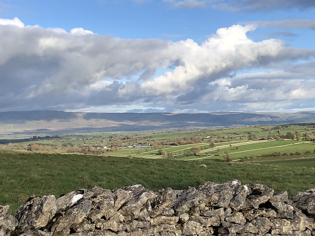
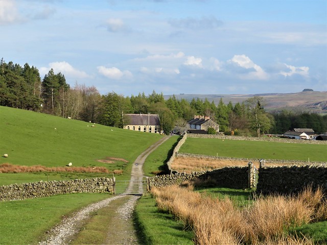
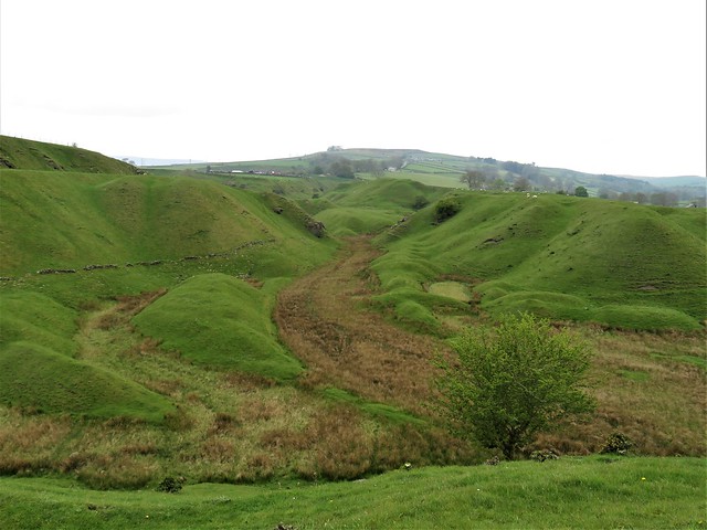
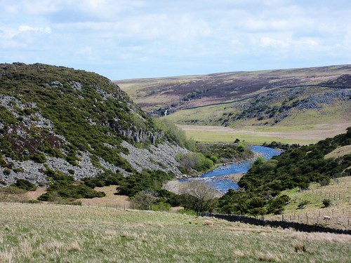
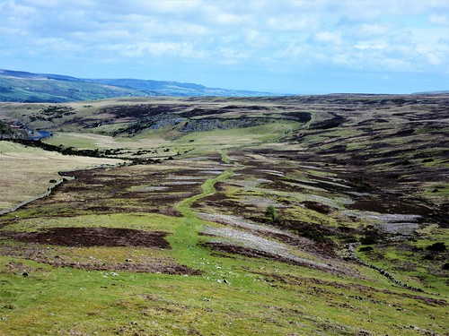
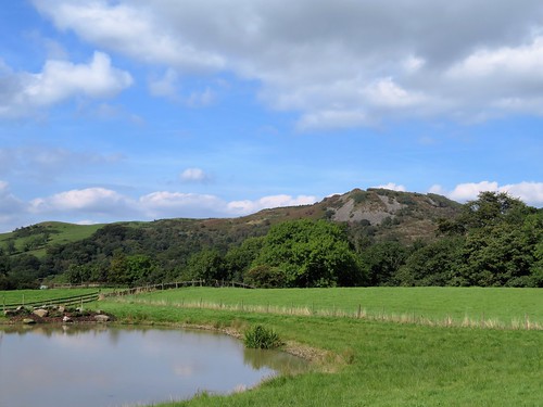
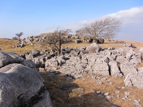
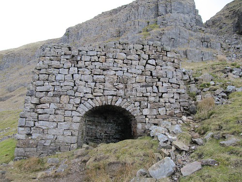
The Tolfa mountains rise some thirty miles north of Rome, in thickly wooded ridges that climb to peaks a couple of thousand feet high. The ancient Romans built summer villas there to catch the cool breezes; alum miners dug canyons into a few of the hillsides. Other than that, the outside world has tended to pass by, rushing to and from Rome and leaving the Tolfa mountains as a high green world apart.

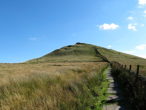
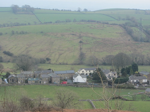
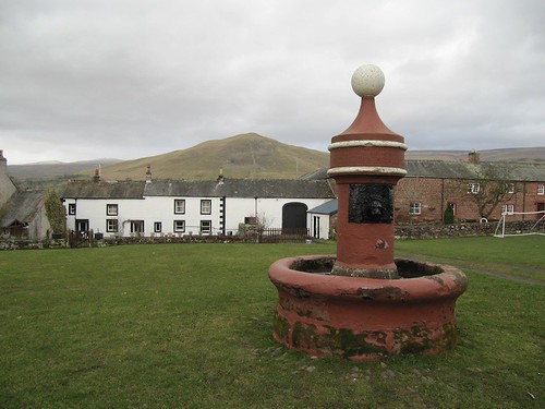
‘In 1799 Napoleon’s troops destroyed a lot of the town,’ ruminated Giovanni, cigar-holder between his teeth, as we stood breathless in the castle ruins on the peak of La Rocca, contemplating Tolfa’s great fan of pantiled roofs spread out below. ‘We don’t know exactly which part. In fact we don’t know a lot about the town’s history. But it’s full of beautiful old buildings – come, I’ll show you.’

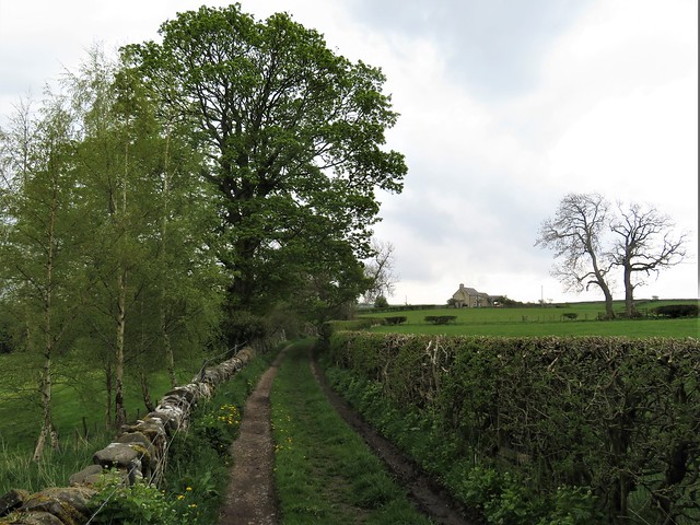
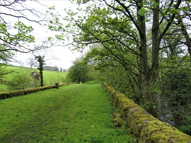
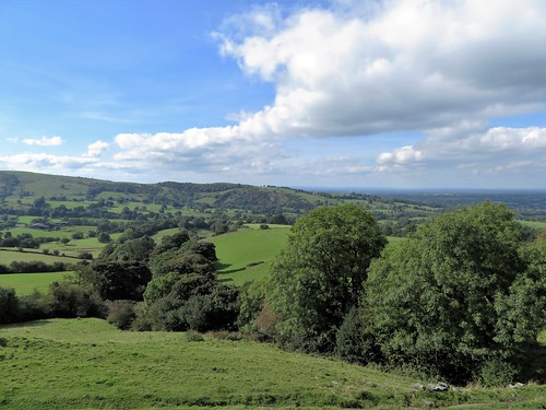
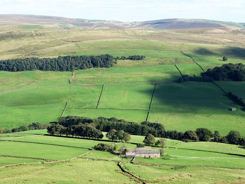
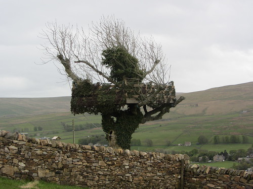
We descended ancient paved laneways, ducked under Renaissance arches, and leaned gossiping in medieval doorways carved from the white volcanic trachite that caps the dark tufa lava-stone of the district. Views from the town’s many belvederes were stunning – fifty or sixty miles from the Apennines to the coast, Tuscany to the hills beyond Rome.

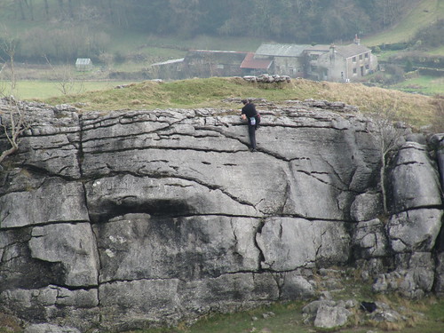
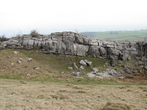
‘As kids in Tolfa just after the war,’ Giovanni reminisced, ‘we didn’t have a lot, but we had fun! Chariot racing along the Via Roma, wearing our school tunics like cloaks; sword-fighting with peeled chestnut switches, climbing La Rocca and the other cliffs.’ He puffed out fragrant blue cheroot smoke, grinning. At the Fontana di Canale laundry tanks below the town we gave good-day to a woman slapping her soapy socks and shifts (‘Ah, Giovanni! Buon giorno!’), and walked on down old cobbled droving tracks into the valleys to the east of Tolfa.

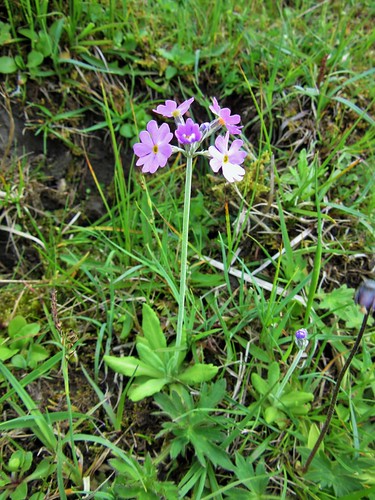
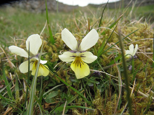
Pink blobs of cyclamen showed in the hedge roots, and the chestnut groves and medlar bushes were heavy with fruit. We sucked the sweetly rotting medlar flesh from the husks and spat out the seeds while Giovanni expatiated on the iniquities of the Allumierasci, the inhabitants of the neighbouring village of Allumiere, Tolfa’s deadly rival since time out of mind. ‘Provocative people,’ declared Giovanni. ‘They can’t get over their inferiority complex. And, let’s face it – we Tolfetani haven’t been able to stand them since the Pope gave one-third of our land to them five hundred years ago.’

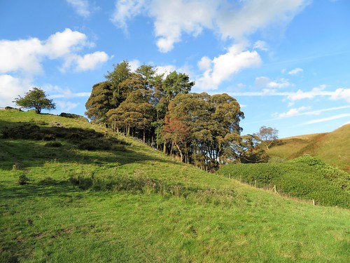
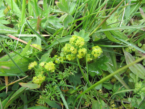
We climbed an old track deep in the oak woods and came to the grassy plateau of the Pian Conserva. ‘Wild chicory,’ said Giovanni, digging up a plant with his knife. ‘Boil it, dry it, cook it in a pan with garlic, oil, peperoncino – we call that cicoria ripassata in padella. It tastes … ahhh! …’ He raised his eyes to heaven in silent reverence.

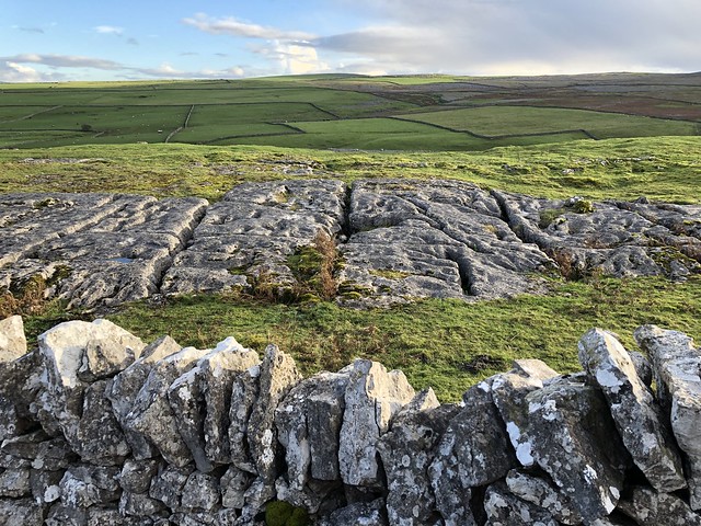
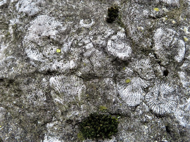
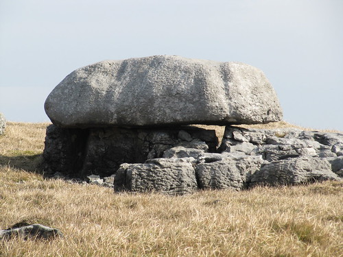
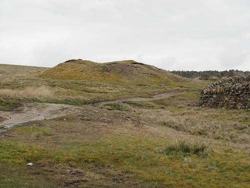
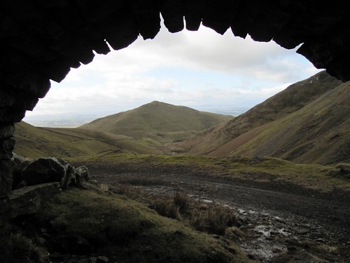
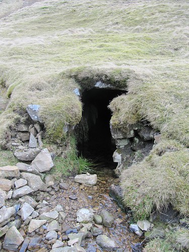
Giovanni and his friends have helped uncover many of the Tolfa mountains’ archaeological sites. Some of the most remarkable are associated with the pre-Roman civilization of the Etruscans. Here on the Pian Conserva, Giovanni showed me a unique section of Etruscan roadway, cut some ten feet down into the soft volcanic tufa. Wheel ruts made 2,500 years ago were still clearly visible in the floor of the cutting. Along the sides of this manmade canyon opened the arched black mouths of Etruscan cave tombs.

The Pian Conserva holds around 150 Etruscan tombs, ranging from simple hollows in the volcanic tufa rock to elaborate ‘houses of the dead’. In these round, domed tombs, silence falls – the silence of cold stone. Bats cling to cracks in the vaulted roofs. We inspected the stone beds on which the dead were laid, their heads resting in special compartments with a raised semi-circular rim. One bed held two of these, side by side, perhaps carved for a mother and her child.

Outside the tombs under a cloudy afternoon sky we idled on the grass, peeling apples and chatting. ‘My school friends from northern Italy couldn’t read Dante,’ mused Giovanni, ‘it was like a foreign language. But for Tuscans and for us here in the Lazio region it was like talking in our own dialect. Language – it’s really something to learn to love. I loved Shakespeare the first moment I read him. That man had a million things to say, and a million ways to say them, don’t you think so?’

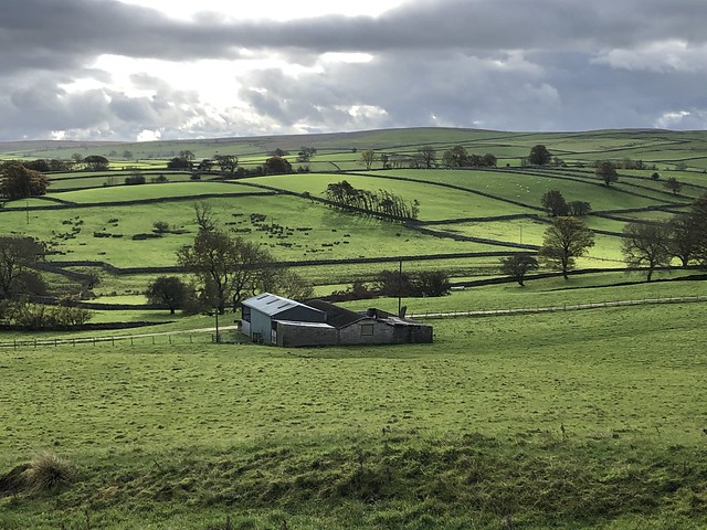
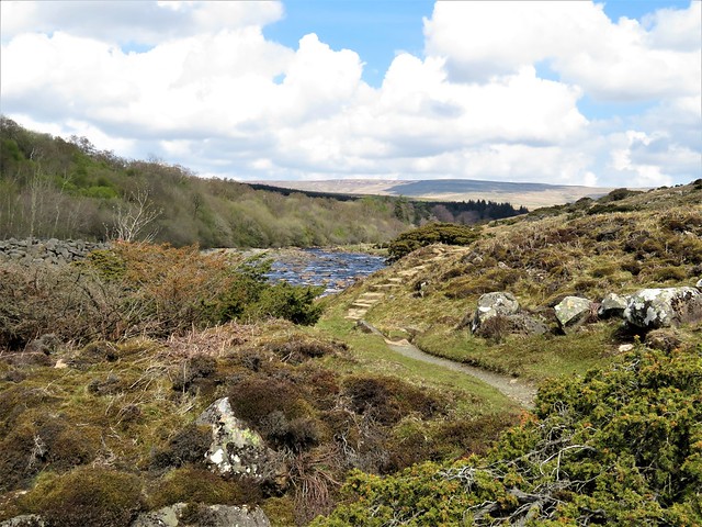
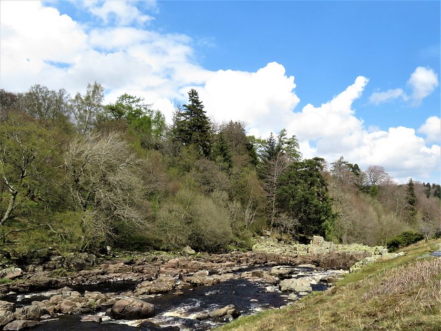
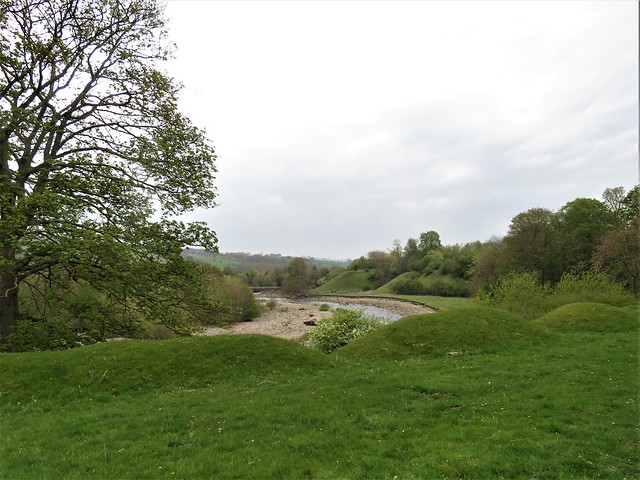
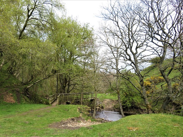
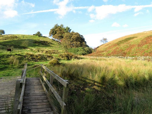
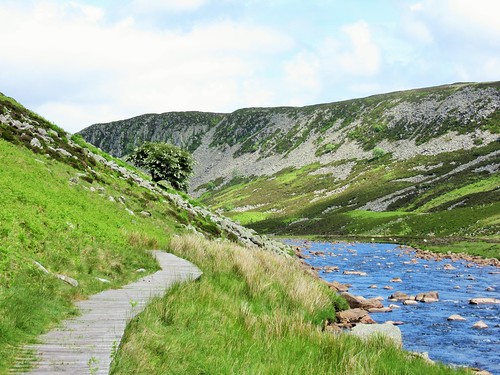
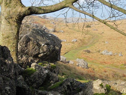
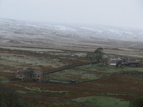
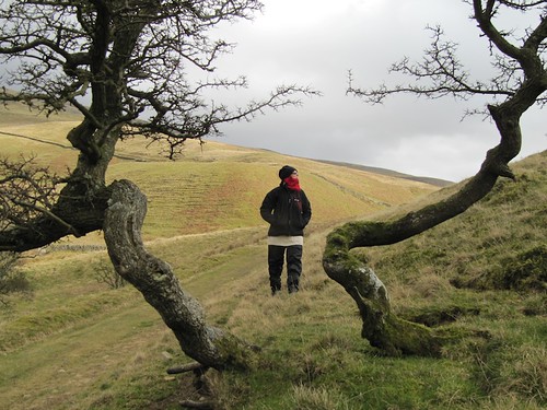
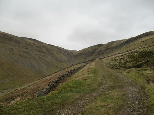
At last we heaved ourselves up and went on, descending to the floor of the valley on white dirt roads among ploughed slopes whose mineral-rich volcanic earth shaded from grey through brown to red in the span of a single field. The peak of La Rocca beckoned ahead, a dark shark-tooth of rock against a darkening sky.

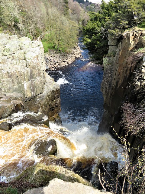
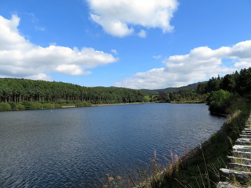
We battled down an overgrown green lane and came in the dusk to the hot springs of Il Bagnarello. Two square bathing pools lay cut into the rock, their clear blue water dimpling as the spring stream ran through them.

‘Good for rheumatism and for bad skin,’ said Giovanni as we sat dangling our tired feet in water as hot as a steaming bath. The splash of the spring and sigh of the evening wind were the only sounds. ‘A quiet place,’ Giovanni murmured to himself, dreamily, letting the volcanic water soothe the stone bruises away.


STEPPING OUT

MAP: Tolfa town hall has local maps for sale – CTR at 1:10,000 or IGM at 1:25,000. At Ignazio Padelli’s shop (Via Roma 106, tel 076-692-017), Ignazio will draw out the route for you on the map.

TRAVEL and ACCOMMODATION:

Exclusive Destinations, Wellington Gate, 7-9 Church Road, Tunbridge Wells, Kent TN1 1HT (01892-619650;

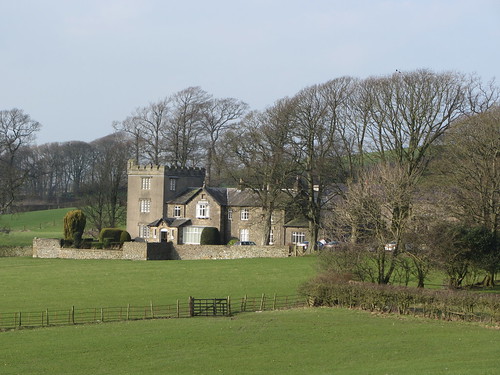
info@exclusivedestinations.co.uk; www.exclusivedestinations.co.uk) – flight from London Heathrow or Gatwick, hire car, 3 nights dble B&B at La Posta Vecchia Hotel (06-994-9501; info@lapostavecchia.com; www.lapostavecchia.com): £676 per person. Superbly comfortable former palace, ½ hr from Rome Leonardo da Vinci airport.

Alitalia (0870-544-8259; www.alitalia.co.uk) fly to Rome Leonardo da Vinci.

Avis (0208-268-5482; www.avis.co.uk ) rent cars at the airport.

Driving: from airport, A12 motorway (NB Cerveteri-Ladispoli jct. for La Posta Vecchia) to San Severa junction; Tolfa signposted from here. Park in Piazza Nova, the main square.


WALK DIRECTIONS:

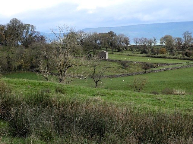
From Piazza Nova keep ahead along Via Roma to Piazza Vecchia. Left downhill past fountain; in 150 yd, right down slope of side road Via Canale, curving downhill past new houses, out of town to pass laundry troughs. In ½ mile pass barn on right; at electricity pole in fork of road just beyond, go left downhill on cobbled way to meet tarmac road. Turn right along road for ¾ mile.

At bottom of long slope, road goes under power lines and makes sharp right bend (3 warning arrows). Left on dirt road here (La Rocca and castle ruin seen over your right shoulder). Continue for ¾ mile to T-junction of track in woods, by electricity pole. Right up sunken track; at crest (150 yd), left over fence (2 blue blobs) into fields with Etruscan tombs (explanatory notice-board). Return to track. Left (downhill) to cross tarmac road by factory. On along flat dirt road on valley floor. In ¾ mile, left to cross Virginese River on concrete bridge. In 250 yd, right off dirt road at crossing of tracks (stone with blue blob on left), aiming for La Rocca dead ahead, to recross river and follow white road uphill.

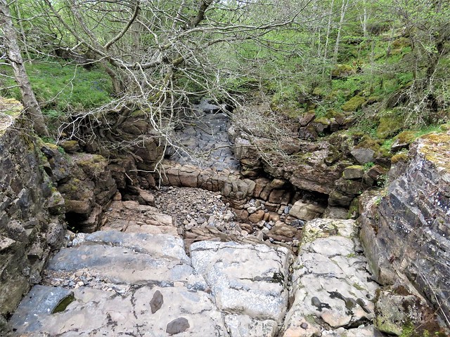
This country road will take you back to Tolfa (3 miles). To visit Il Bagnarello hot springs – after 1 mile, where road bends sharply right and thicker concrete surfacing starts (beside electricity pole, where stone-walled track joins from left), keep ahead along grassy lane with vineyard on right. Lane descends among bushes to cross river (NB boulder scramble – could be dangerous after heavy rain) and climb, following electricity cables, to T-junction with good dirt road.

Left along dirt road. Cross river (probably dry) by humpback bridge (careful of hole just beyond!); continue to farmyard on corner of another dirt road. Left along road. By grey metal electricity pole and green metal gate, fork left; in 200 yards, left down steps to hot springs.

Return up steps; right along track to green gate; left to road. Right to Tolfa (3 miles), either walking or by request stop Damibus (c. 12.30 p.m., 4.45, 7.25).

LENGTH: c.11 miles.

REFRESHMENTS: None en route – take picnic and water.

READING: The Tolfa Mountains by Kari Austbo (from Padelli’s shop).


 Posted by at 00:00