Search Results : ross-shire

Sep 202014
 

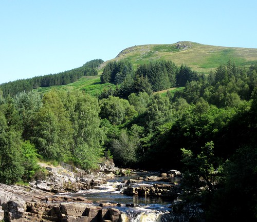
It’s one hell of a climb to the pride of Mid Ross, the 1,046m crown of the great whaleback mountain called Ben Wyvis – too much, really, for this scorcher of a summer’s day.
First published in: The Times Click here to view a map for this walk in a new window
picture picture picture picture picture picture picture picture picture picture picture picture picture
Facebook Link:
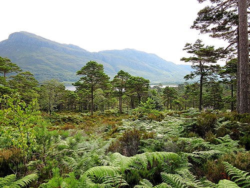
But Little Wyvis, a couple of miles to the south-west, looked just the job at 764m, a good upward pull on a fine stony track, and no-one else to share the mountain with us.

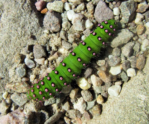
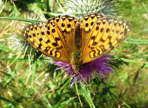
Grasshopper ticked in the grasses, bees were busy in the wild thyme and bird’s-foot trefoil flowers. The thistles were out in royal purple, with dark green fritillary butterflies opening their black-and-burned-orange wings over the brushy blooms as they delicately sipped the deep-sunk nectar. Halfway up the mountain we stopped for a water break, and sat on a rushy bank to watch a meadow pipit perched on a fence post as it preened its speckled breast and dark wing coverts.

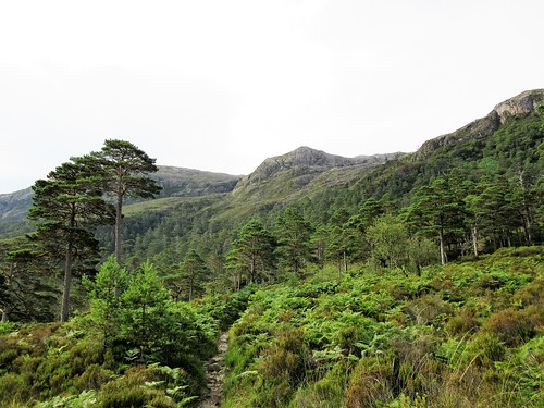
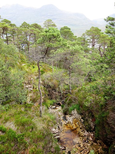
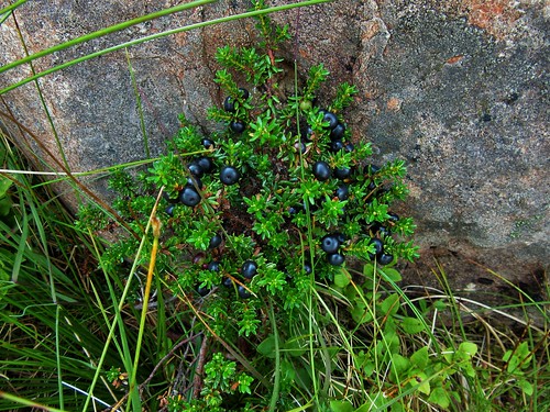
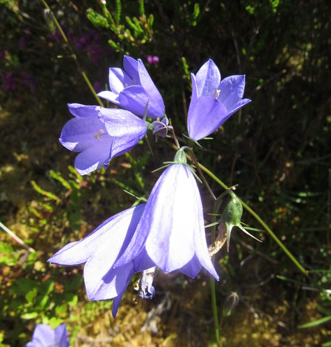
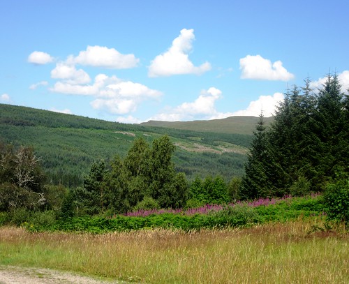
The zigzag track rose up the flank of Little Wyvis, the sun striking a million diamond winks out of its mica-sheathed rocks. We plucked juicy bilberries, sweet and sharp on the tongue, beautifully refreshing to the upward climber. The delicate white flowers of starry saxifrage dotted the acid-green sphagnum in the wet ditches along the track.

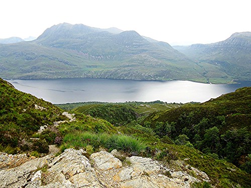
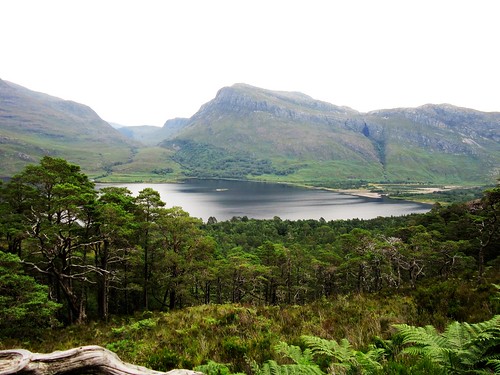
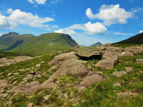
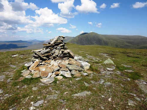
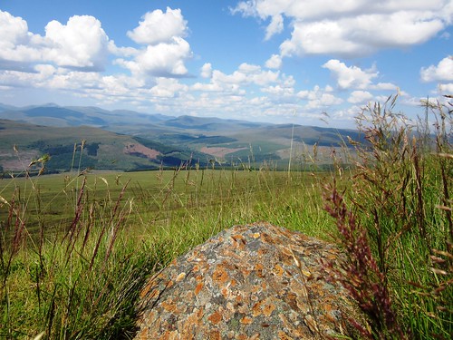
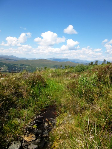
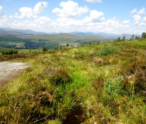
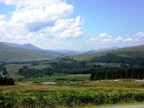
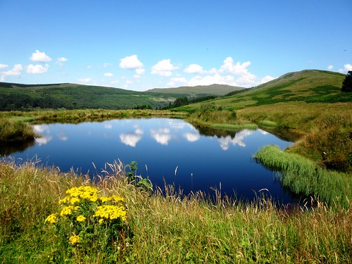
At the summit of Little Wyvis we found a little rocky cairn infested with scores of bees. Ben Wyvis rose to the north, a double hump with precipitous slopes facing in our direction. Through binoculars we saw the red and yellow dots of walkers sweltering in the sun as they struggled up the leg-twanging ascent. Rather them than us. Standing by the cairn we took in a truly stupendous view, from the lumpy mountains of Torridon way out west to the long sea lochs at Dornoch in the east, a vista of green mountains and steely waters that might fittingly have been labelled ‘Heart of Scotland’.

On the way down, two plump birds stood on a rock, staring us down. White patchy bellies, feathery feet, salt and pepper backs, and a bold red eyebrow on the male. A pair of ptarmigan, no less – my first ever sighting of these elusive birds of the high mountains. And just beyond them, a beautiful mountain hare motionless under a peat bank, his ears short and neat, his pelt ridged as though combed into dreadlocks. What a thrill.

Start: Car park on A835 Inverness-Ullapool road (OS ref NH 402639).

Getting there: A835 towards Ullapool from Inverness; 1 mile north of Garve, pass A832 turning; in another 1½ miles, car park signed on left just before bridge.

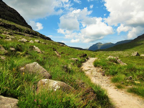
Walk (7 miles there-and-back, strenuous, OS Explorer 437. NB: online map, more walks at christophersomerville.co.uk): Cross A835 (take care!); left for 100m; right up roadway. In 50m, left past gateway post (ignore warning sign – it’s aimed at 4×4 drivers!). Follow gravel track. In ½ mile pass barn (407640); on through deer gate. In another mile, at 2nd gate, left up track (418640). In another ½ mile, track forks (422646); continue to right here, up zigzag track. In ¾ mile, just below summit at 700m, rough track goes left (427643); ignore this, and keep ahead upwards. Go through remains of fence, and on up to summit cairn (430645). Return same way.

Conditions: Clear track all the way. NB – this is a mountain walk with 650m of climb; take hillwalking boots, clothes, equipment.

Refreshments: Picnic

Accommodation: Aultguish Inn, By Garve, Ross-shire, Scotland IV23 2PQ (01997-455254; Aultguish.co.uk): cheerful, welcoming inn; also budget rooms and bunkhouse.

Info: Inverness TIC (01463-252401)

visitscotland.com; www.satmap.com; ramblers.org.uk

 Posted by at 01:51
Oct 012016


First published in: The Times Click here to view a map for this walk in a new window
picture picture picture picture picture picture picture
Facebook Link:

Beinn Eighe is a mighty mountain. It rises over 1,000 metres at its highest point, and presents an uncompromising assortment of cliffs, screes, corries and buttresses to anyone who ventures high into the range. Scottish Natural Heritage has laid out a very clear and well-marked Mountain Trail to guide walkers who don’t mind a steep and slithery ascent, on a circuit that takes in the top of one of the mountain’s eastern peaks. This isn’t a stroll in the park, though, and you need to be properly equipped for a mountain walk before you tackle it.

Our path from the shore of Loch Maree rose beside a rushing stream through banks of bracken and bilberry. The forest here is of Scots pines, some three hundred years old or more, their upper limbs bright orange in contrast with the ashen grey of their scaly trunks. We crossed the burn over a footbridge with a fine view back over the silty channels at the head of Loch Maree and the hump of Slioch mountain across the water.

Above the tree line the track climbed steep slides of marbly rock, crunchy with shattered shards of quartzite, to reach the cairn on the summit of Leathad Buidhe, ‘the broad yellow ridge’. The views made us gasp – back over the loch to the hills in the north-east, south-west to three enormous peaks of pale rock like the storm waves of a petrified sea – the northerly aspect of Beinn Eighe’s out-thrust fingers. The cairn stood sentinel over an upland of bog and lochan, shiny black crowberries and shell-burst clumps of orange-tipped deergrass – a place where the only sounds were the cheeping of meadow pipits, the raspy sigh of wind among rocks, and a faint subterranean chatter of running water.

A quick, cool dip in the peaty waters of Loch Allt an Daraich under the black-browed hummock of Meall a’ Ghiuthais, ‘pine-tree hill’. Then we followed the white twisting scar of the path across the moor to where it dropped steeply downhill beside the tumbling water of Allt na h’Airighe. The stream fell down into a dark, deep cleft, a fault torn open by giant convulsions hundreds of millions of years ago. We stopped at the rim to gaze down this crack in the face of Beinn Eighe, before descending among resin-scented pines already beginning to drip with the afternoon’s shower.

Start: Glas Leitir car park on A832 Gairloch road, 4 miles north-west of Kinlochewe (OS ref NH 001650)

Getting there: Bus twice daily, Kinlochewe-Gairloch (rome2rio.com/s/Gairloch/Kinlochewe). Road: Car park is on A832 Kinlochewe-Gairloch road, 1¾ miles beyond Beinn Eighe Visitor Centre.

Walk (4 miles, strenuous with 550m of climb, OS Explorer 433. Online maps, more walks at christophersomerville.co.uk): Cross under road and fork left (‘Mountain Trail’). Then simply follow the clearly marked trail (cairns and mountain symbol waymarks) very steeply up to cairn on Leathad Buidhe (993633). Right (north-west) past Loch Allt an Daraich, and follow trail very steeply down, along rim of Cnoc na Gaoithe above gorge, and down through woods of Coille na Glas-Leitire*. At post marked ‘6’, where Mountain Trail waymark points left along Woodland Trail, turn right down path to car park.
* (the map version has an ‘e’ on the end, though the car park is named ‘Glas Leitir car park’)

Conditions: Steep rocky paths, many steps, some rubbly stretches. Wear hillwalking clothes and boots.

Refreshments: Whistle Stop Café, Kinlochewe (01445-760423)

Accommodation: Kinlochewe Hotel, By Achnasheen, Ross-shire IV22 2PA (01445-760253, kinlochewehotel.co.uk)

Beinn Eighe Visitor Centre: 01445-760258 (open March-Oct)

Info: Mountain Trail booklet guide available from Scottish Natural Heritage’s Kinlochewe Office (01445-760254); also downloadable at snh.org.uk/publications

*’The Times Britain’s Best Walks’ by Christopher Somerville (Harper Collins) – 200 walks from the ‘A Good Walk’ column – published 6 October.

www.visitscotland.com; satmap.com; ramblers.org.uk

 Posted by at 01:58
Sep 192015


First published in: The Times Click here to view a map for this walk in a new window
picture picture picture picture picture picture picture picture
Facebook Link:

Beinn Eighe, pride of the Torridon region of western Scotland, is a noble mountain – or is it a series of mountains? The map shows it rising over the tumbled country between the sea lochs of Maree and Torridon in a ghostly swirl like a four-fingered hand, the contours so tightly bunched to indicate the steepness of its crags and promontories that it looks impenetrable to an ordinary walker. But Peter Barton in his excellent guide Walking In Torridon points out a path that reaches the core of Beinn Eighe without any trials or terrors.

It was a beautiful warm morning when we set off from the car park on the Torridon-Kinlochewe road. The stony path led up between the white screes of Còinneach Mhòr and the blocky grey cliffs of Stùc a’ Choire Dhuibh Bhig. We crossed a mountain torrent by way of stepping stones, to reach in an other-worldly upland. Great rugged tents of mountains stood pitched on a green plateau where a constellation of steely lochans lay glinting. This is the heart of Wester Ross, a roadless wilderness whose eagles and otters outnumber its human inhabitants.

A rush-chocked lochan quivering with waterboatmen and dragonflies showed where we were to turn off for the climb round the dark bulk of Sail Mhòr, the most westerly ‘finger’ or buttress of Beinn Eighe. The path rose steadily, with enormous views of sea-like waves of hills, till we came in sight of the waterfall sluicing down the rock wall that underlies the hanging corrie in the palm of Beinn Eighe.

A last upward scramble, and we were looking into a giant geological crucible. On the left, the pale shattered rock of Rhuadh Stac Mhòr; in the centre at the back of the horseshoe, three great grey buttresses in the face of Còinneach Mhòr; and on the right, Sail Mhòr’s purple-black wall of pinnacles and columns. At their feet, the long dark lake of Loch Coire Mhic Fhearchair, reflecting the peaks that hung more than a thousand feet above. It’s a view to give anyone a proper sense of their own insignificance in the scale of time and change, as these mountains experience such things.

We stripped off and crept into the shallows of the loch, cold and refreshing after the long hot climb, as smooth as olive oil on the skin. Among the rocks we found delicate white saxifrages, bulky spiders with tiny scarlet parasites attached, mountain frogs as motionless as stones, glossy black crowberries and red bearberries. A world of wonders, to be savoured in ecstatic gulps.

Start: Car park on A896, 6 miles SW of Kinlochewe (OS ref NS 959568).

Getting there: A896 Torridon road from Kinlochewe; car park is on right beside a bridge, half a mile after passing ‘Torridon Estate’.

Walk (7 map miles, about 9 miles actually walked; strenuous; OS Explorer 433. NB: online map, more walks at christophersomerville.co.uk): Start of path is marked ‘Public Footpath to Coire Mhic Nobaill’. Follow this well-maintained path. In 1¾ miles, cross stepping stones (947589). In another ¾ mile, at the far end of a rushy lochan, fork right at a cairn (935594) and follow path for 1¾ miles up to Loch Coire Mhic Fhearchair (940611). Return same way.

Conditions: Rocky, uneven path climbs 500m (1,650ft approx). Wear good walking boots, hill-walking gear.

Refreshments: Picnic

Accommodation: Kinlochewe Hotel, By Achnasheen, Ross-shire IV22 2PA (01445-760253, kinlochewehotel.co.uk) – cheerful stopover, handy for Beinn Eighe NNR.

Walking in Torridon by Peter Barton (Cicerone) – see Walk W1

satmap.com; ramblers.org.uk; visitscotland.com

 Posted by at 01:10