First published in: The Times Click here to view a map for this walk in a new window


Facebook Link:

Beinn Eighe, pride of the Torridon region of western Scotland, is a noble mountain – or is it a series of mountains? The map shows it rising over the tumbled country between the sea lochs of Maree and Torridon in a ghostly swirl like a four-fingered hand, the contours so tightly bunched to indicate the steepness of its crags and promontories that it looks impenetrable to an ordinary walker. But Peter Barton in his excellent guide Walking In Torridon points out a path that reaches the core of Beinn Eighe without any trials or terrors.
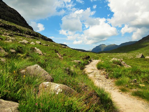
It was a beautiful warm morning when we set off from the car park on the Torridon-Kinlochewe road. The stony path led up between the white screes of Còinneach Mhòr and the blocky grey cliffs of Stùc a’ Choire Dhuibh Bhig. We crossed a mountain torrent by way of stepping stones, to reach in an other-worldly upland. Great rugged tents of mountains stood pitched on a green plateau where a constellation of steely lochans lay glinting. This is the heart of Wester Ross, a roadless wilderness whose eagles and otters outnumber its human inhabitants.
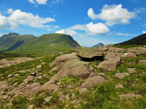
A rush-chocked lochan quivering with waterboatmen and dragonflies showed where we were to turn off for the climb round the dark bulk of Sail Mhòr, the most westerly ‘finger’ or buttress of Beinn Eighe. The path rose steadily, with enormous views of sea-like waves of hills, till we came in sight of the waterfall sluicing down the rock wall that underlies the hanging corrie in the palm of Beinn Eighe.
A last upward scramble, and we were looking into a giant geological crucible. On the left, the pale shattered rock of Rhuadh Stac Mhòr; in the centre at the back of the horseshoe, three great grey buttresses in the face of Còinneach Mhòr; and on the right, Sail Mhòr’s purple-black wall of pinnacles and columns. At their feet, the long dark lake of Loch Coire Mhic Fhearchair, reflecting the peaks that hung more than a thousand feet above. It’s a view to give anyone a proper sense of their own insignificance in the scale of time and change, as these mountains experience such things.
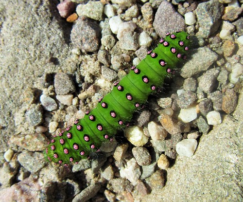
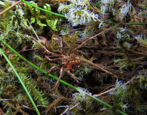
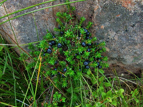
We stripped off and crept into the shallows of the loch, cold and refreshing after the long hot climb, as smooth as olive oil on the skin. Among the rocks we found delicate white saxifrages, bulky spiders with tiny scarlet parasites attached, mountain frogs as motionless as stones, glossy black crowberries and red bearberries. A world of wonders, to be savoured in ecstatic gulps.
Start: Car park on A896, 6 miles SW of Kinlochewe (OS ref NS 959568).
Getting there: A896 Torridon road from Kinlochewe; car park is on right beside a bridge, half a mile after passing ‘Torridon Estate’.
Walk (7 map miles, about 9 miles actually walked; strenuous; OS Explorer 433. NB: online map, more walks at christophersomerville.co.uk): Start of path is marked ‘Public Footpath to Coire Mhic Nobaill’. Follow this well-maintained path. In 1¾ miles, cross stepping stones (947589). In another ¾ mile, at the far end of a rushy lochan, fork right at a cairn (935594) and follow path for 1¾ miles up to Loch Coire Mhic Fhearchair (940611). Return same way.
Conditions: Rocky, uneven path climbs 500m (1,650ft approx). Wear good walking boots, hill-walking gear.
Refreshments: Picnic
Accommodation: Kinlochewe Hotel, By Achnasheen, Ross-shire IV22 2PA (01445-760253, kinlochewehotel.co.uk) – cheerful stopover, handy for Beinn Eighe NNR.
Walking in Torridon by Peter Barton (Cicerone) – see Walk W1