Search Results : yorks

Mar 232024


First published in: The Times Click here to view a map for this walk in a new window
on Cold Moor Urra Farm old mine tips above Urra Farm paved course of Cleveland Way from Carr Ridge looking across Vale of Mowbray to Roseberry Topping Wain Stones Looking towards Wain Stones from Garfit Gap looking towards Cold Moor from Urra 4 looking towards Cold Moor from Urra 3 looking towards Cold Moor from Urra 2 looking towards Cold Moor from Urra 1

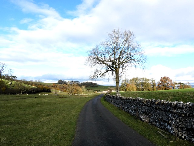
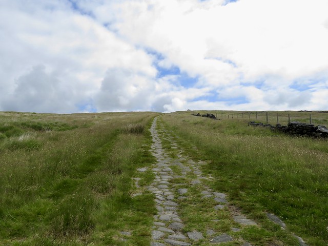
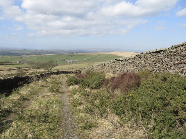
Bikers were out for a burn-up on the bendy road to Stokesley. We soon left them behind as we climbed to Carr Ridge up the Cleveland Way. This long-distance path, paved and pitched with stone, loops round the outlying hills of the North York Moors with grandstand views all the way.

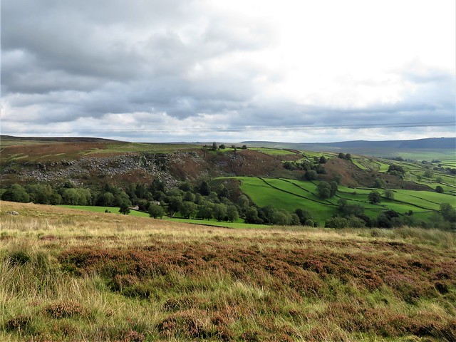
Up on top it was cold and cloudy over the moors. The sharp shark-fin of Roseberry Topping stood out to the north, its western face a concave scoop showing where half the hill had once slid away in a massive landslip.

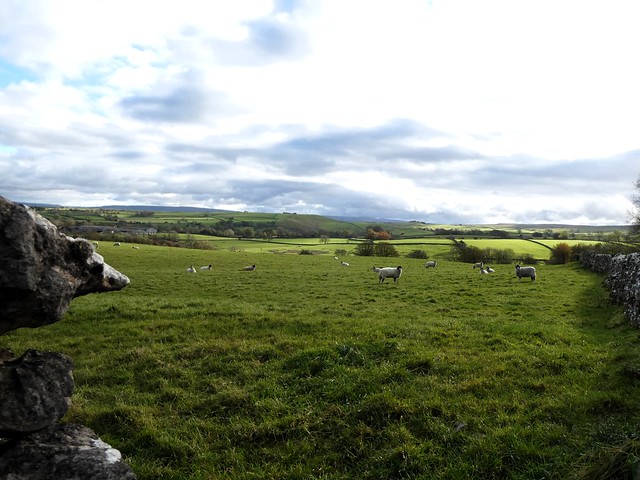
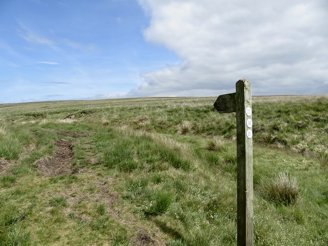
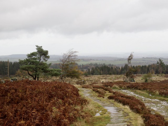
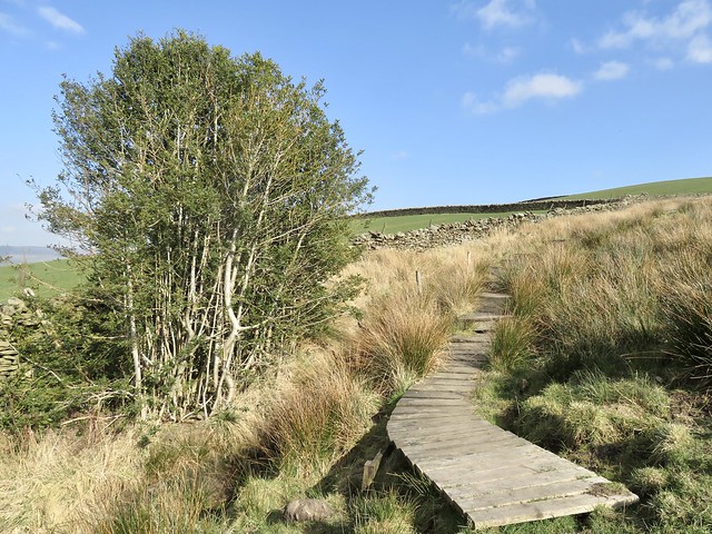
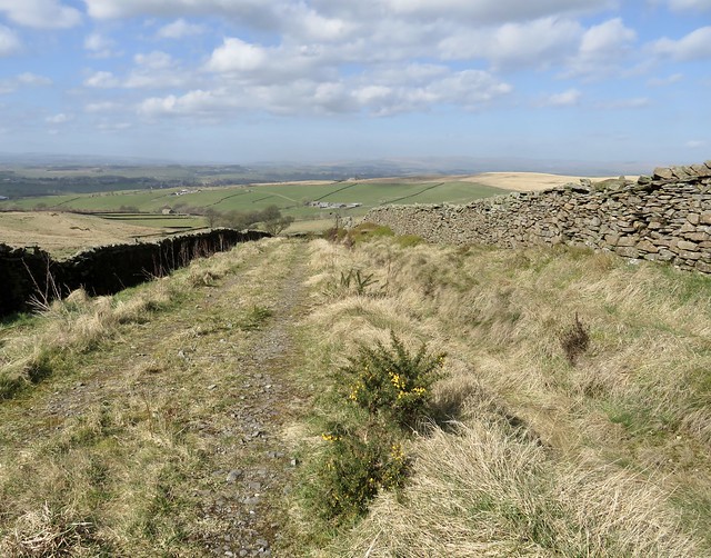
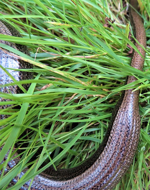
The flat flagstones of the Cleveland Way carried us dry-shod over bog and slutch. The stone slabs had once floored textile mills, and were brought here after the factories closed – a fine example of recycling. Blackfaced sheep dashed away and drew up to swivel round and stare madly at us before resuming their precise, selective nibbling among the bracken and sedge.

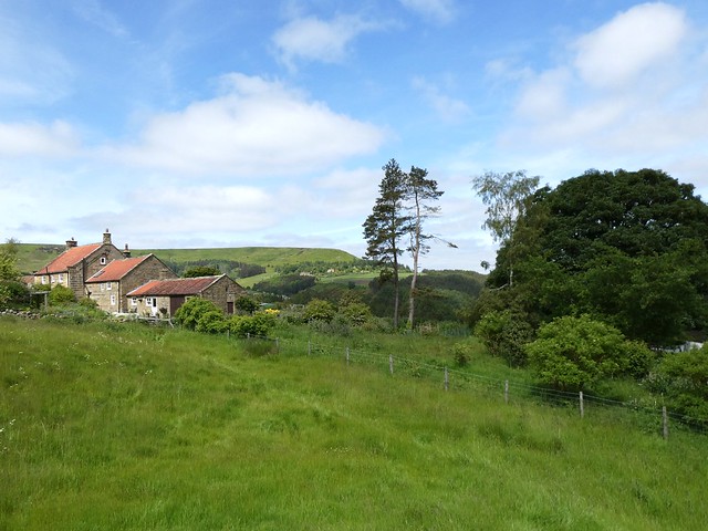
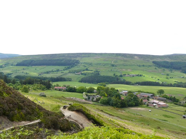
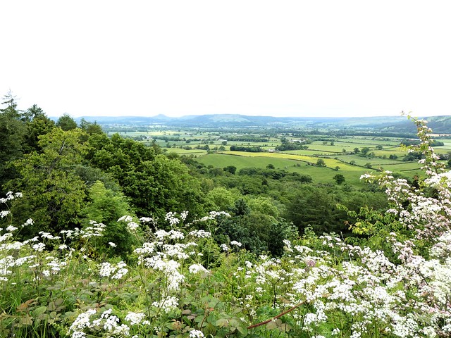
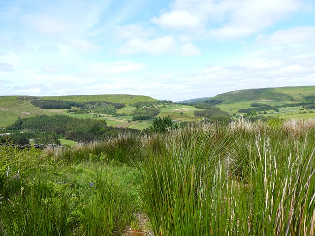
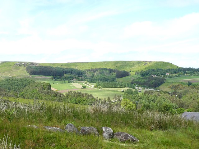
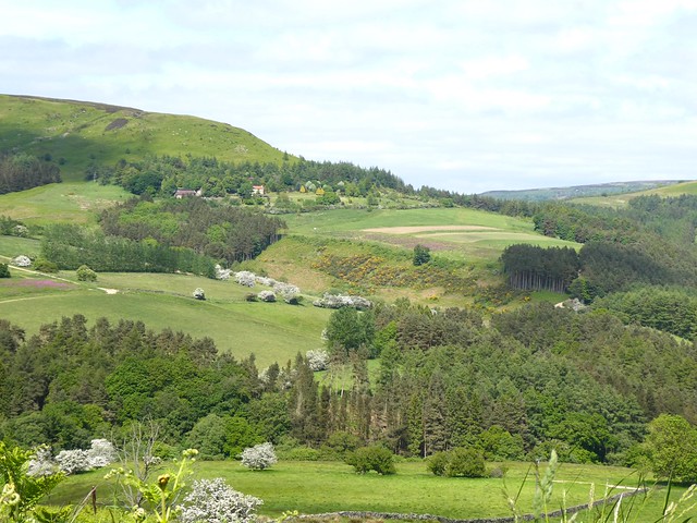
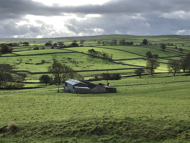
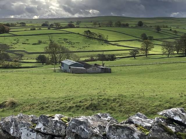
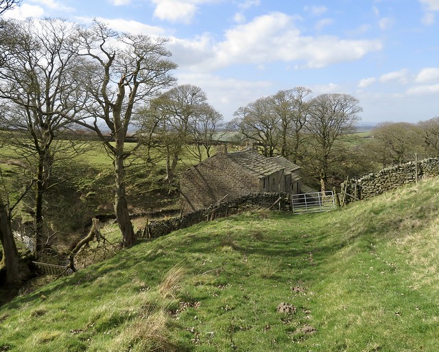
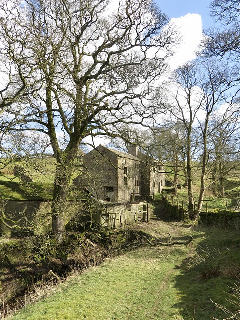
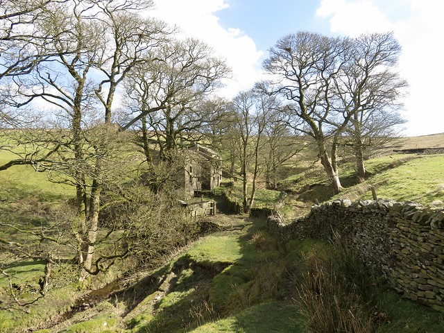
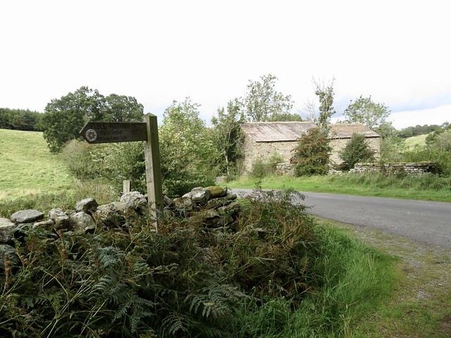
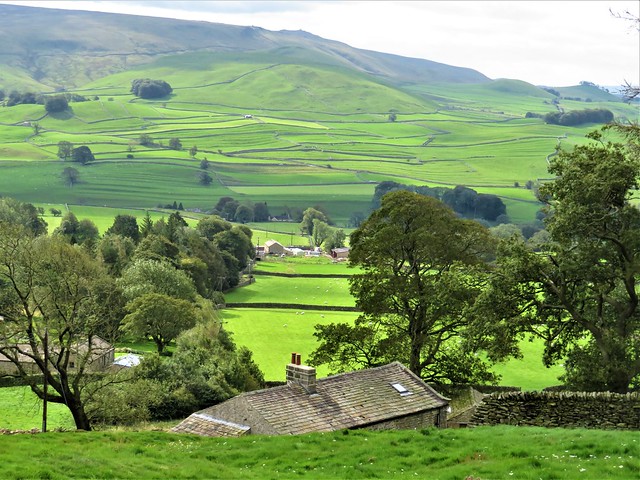
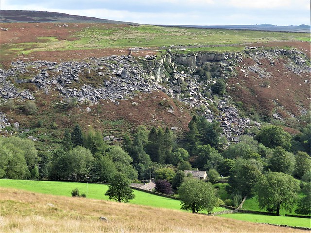
A side path left the Cleveland Way and headed across the moor to where pale heaps of spoil marked the sites of long-abandoned jet and alum mines. We picked our way between them, dropping down the hillside towards the red roofs of the farming hamlet of Urra in broad green Bilsdale below.

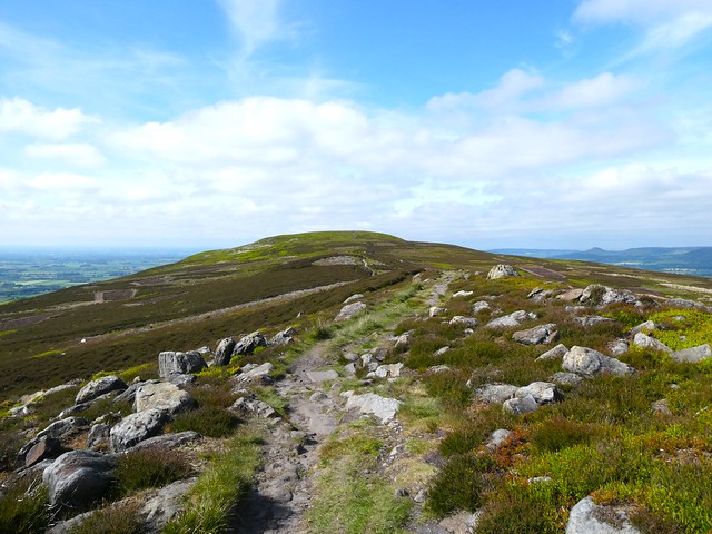
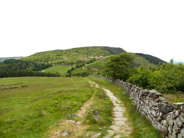
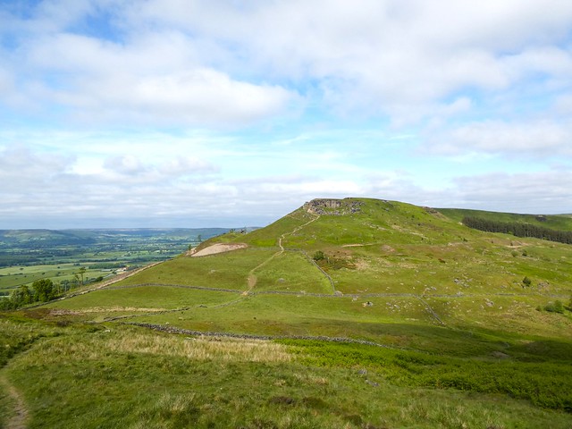
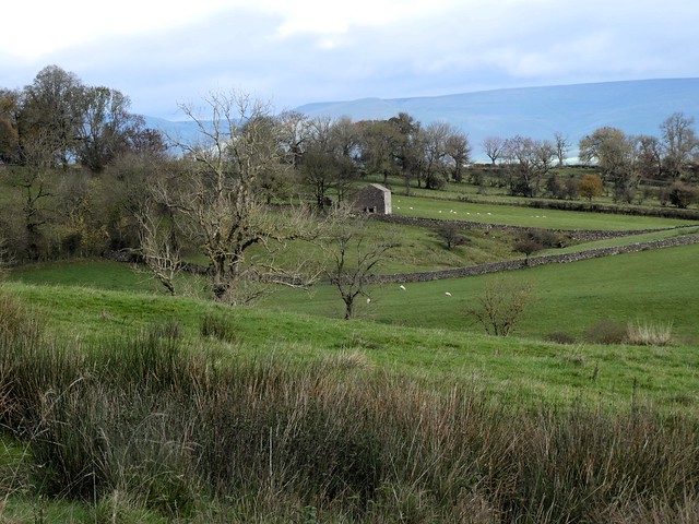
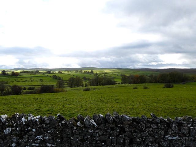
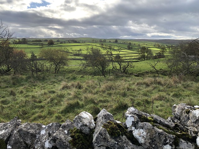
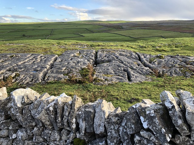
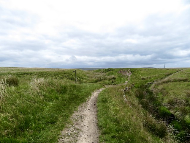
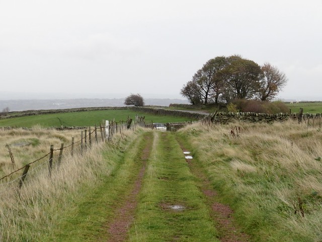
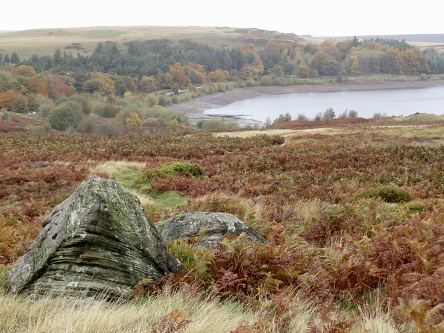
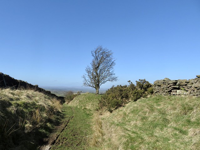
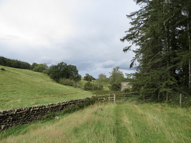
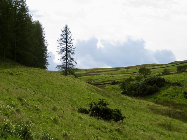
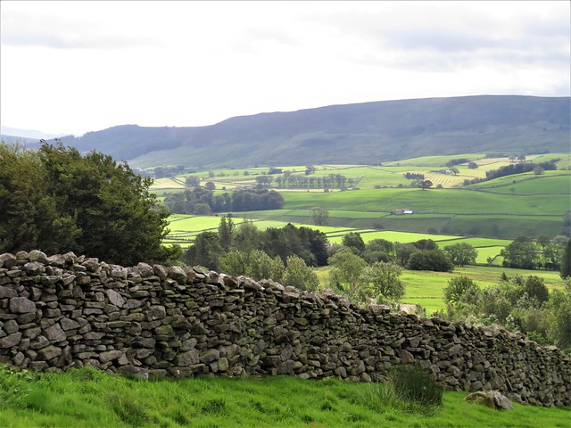
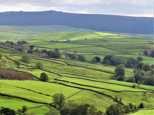
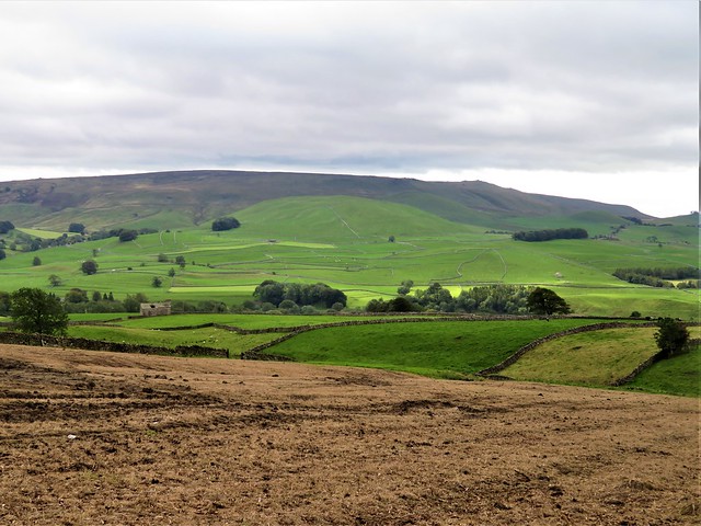
Here the landscape changed to cattle pastures and plentiful trees. We followed field paths down and up again, heading out of the sheltered valley and up a gritty track towards the aptly named Cold Moor. It was exhilarating to stride the northward ridge with a sharp wind in the face and a good firm track underfoot.

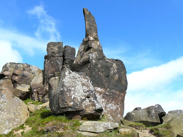
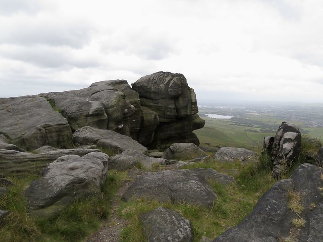
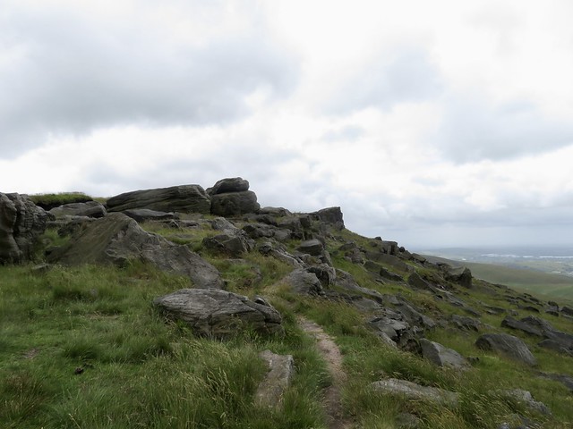
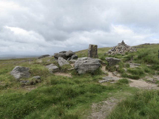
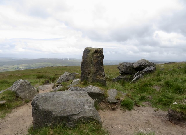
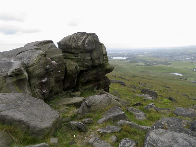
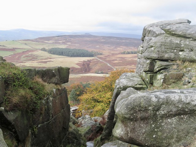
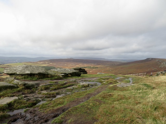
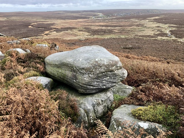
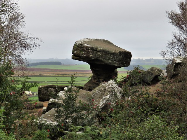
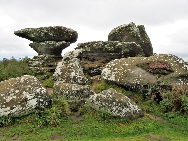
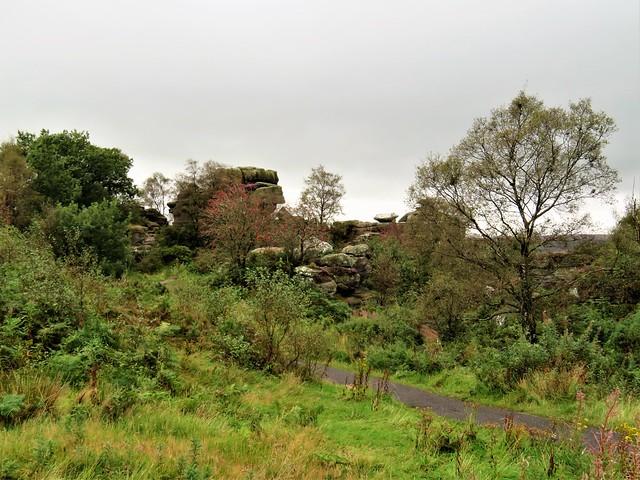
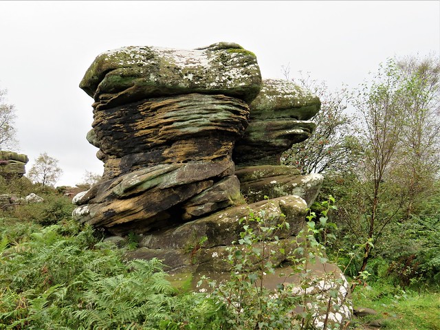
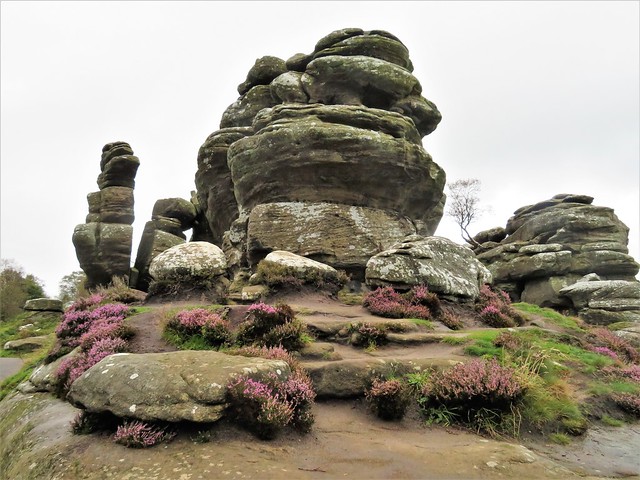
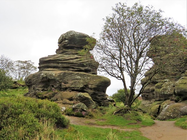
Down in the pass of Garfit Gap we met the Cleveland Way again and turned east for the stepped climb up to the sandstone outcrop of the Wain Stones. Blackened and sculpted by weathering, they stood proud of the ridge end, their Easter Island profiles and tall faces packed tight in a jumble of rocks.

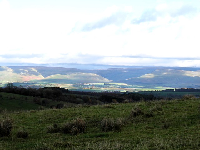
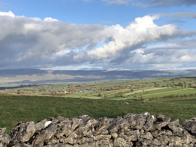
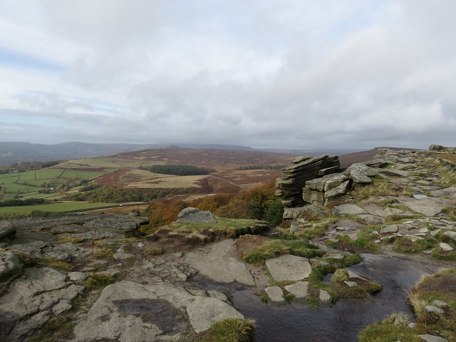
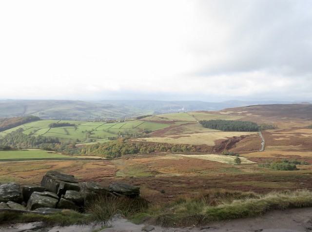
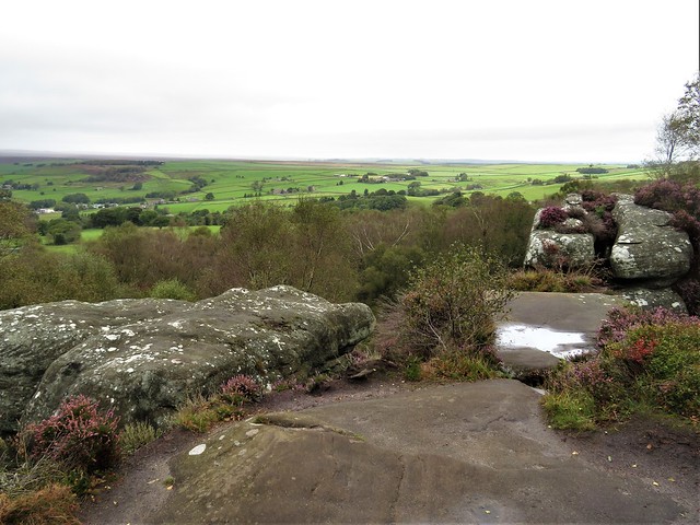
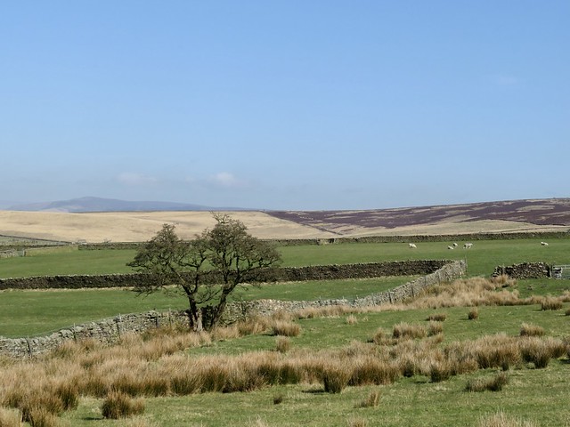
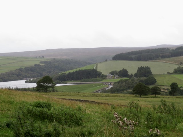
We sat on a fallen boulder and took in the view under a clearing sky. Skeletal cranes and smoking chimneys of Teesside, the great patchwork lowland of Mowbray Vale, a distant suggestion of the Pennine hills against the clouds in the southwest. And sailing high in the north the outline of Roseberry Topping once more, less of a shark fin from this perspective and more like a giant ploughshare abandoned on the ridge by some mythical tiller of the moors, perhaps one of the giants of the Wain Stones themselves.

How hard is it? 7 miles; moderate/strenuous; cobbled/paved moorland paths; a little scrambling at Wain Stones.

Start: Clay Bank car park, near Great Broughton (NZ 573035)

Getting there:
Road: Car park on B1257 between Great Broughton and Chop Gate

Walk (OS Explorer OL26): Left up road. In 200m pass ‘Bilsdale’ sign; left up stone flagged path (‘Cleveland Way’). Follow CW; at top of climb, fork right (579030, ‘Bridleway’). In ⅓ mile (occasional posts), path bears right across slab bridge (583021). In ½ mile right (576018, ‘Bridleway’) to road in Urra (572018). Right; in 100m, left (‘Urra Farm’); then stile (yellow arrow/YA), gate, stile; field path down to footbridge and road (564018). Dogleg right/left (stile); up bank to gate at Broadfield Farm (562019). Left (fingerpost, gate); right (fingerpost, wall gap); up field to gate (560019); up to track. Right; in 100m, left up steep path. Follow it for ⅔ mile to meet Cleveland Way at Garfit Gap (554034). Right up to Wain Stones (559035); round them or scramble up through them to flagged path; CW to road (513033). Left to car park.

Lunch/Accommodation: Wainstones Hotel, Great Broughton TS9 7EW (01642-712268, wainstoneshotel.co.uk)

Info: nationaltrail.co.uk; northyorkmoors.org.uk

 Posted by at 01:09
Dec 092023


First published in: The Times Click here to view a map for this walk in a new window
Stone barn near Great Asby sheep pasture near Great Asby 1 sheep pasture near Great Asby 2 rough pasture near Great Asby hawthorn berries in profusion 1 hawthorn berries in profusion 2 hawthorn berries in profusion 3 bridge on outskirts of Great Asby lane to Gaythorne Cottages looking towards North Pennines and High Cup stone wall striping the pastures near Great Asby looking south from the lane to Halligill 1 looking south from the lane to Halligill 2 looking south from the lane to Halligill 3 Great Asby church Stone wall and limestone pavement looking south towards Great Asby Scar Ash tree splitting the limestone on the lane to Halligill

Pied wagtails were pattering sidelong up the slate roofs of the cottages along the straggling lane through Great Asby. ‘Three Greyhounds?’ said the cheerful lady near the bus shelter. ‘Just over the packhorse bridge, can’t miss it.’

At the southern outskirts of the village we turned along a farm road that wound into open country. A flight of several dozen wintering fieldfares swooped into an ash tree, bounced and chattered amongst themselves, then fled downwind, their grey heads and dark tails showing out against a streaky blue sky.

A stone barn, sturdily buttressed, stood by the lane. Here the roadway roughened as it rose through rushy fields. Away south sombre moor tops lay under rolling cloud, and behind us in the east the rampart of the North Pennine hills climbed into a slate-grey murk. But here in this rolling countryside between the hills, sunlight lay thick and gold across pasture that was squared and striped with carefully maintained stone walls.

Beyond Halligill we left the track and plodged across rain-sodden fields, scrambling over a muddy beck and trudging down the grassy track to Gaythorne Hall. The farmer came puttering up on a quad as his ewes scampered away in communal panic. ‘Lambing from January on’, he told us.

Gaythorne Hall in its dell looked magnificent even in the steely embrace of scaffolding – a three-storey Tudor house, gabled and handsomely porched. We squeezed through an obstacle course of gates and a cattle crush to gain the farm lane that wound through sheep pastures up to the moor road back to Great Asby.

By the road lay the Bronze Age burial mound of Hollin Stump, where Victorian antiquarians unearthed three skeletons and a horse skull. What religious or magic connotation that had had was anyone’s guess. Walking on, we wondered what those remote ancestors would have made of the enormous rainbow that arced down from a black stormy sky towards the distant Pennine heights.

Nearing Great Asby we passed an exhausted ram lying prone in a field, smeared from head to tail with blue raddle. You might think that all rams lead the apolaustic life. But this one, surrounded by a hundred grazing ewes whose rumps he had ‘painted’ blue, bore a grim expression that said a ram’s lot at tupping time is not all beer and skittles.

How hard is it? 6 miles; easy/moderate; moorland roads and field paths, some boggy.

Start: Three Greyhounds PH, Great Asby, Appleby-in-Westmorland CA16 6EX (OS ref NY 681132)

Getting there: Great Asby is signed from B6260 (Appleby-Orton)

Walk (OS Explorer OL19): Right across bridge; left; at junction by post box, right on farm road (679129). In ½ mile pass barn; fork right (672128), In ⅓ mile track bends right towards Halligill (663128), but keep ahead over stile (yellow arrow/YA). In 50m, stile over wall on right (arrow). Half right towards left/south end of Halligill Wood. Cross beck and stile (659129, YA); up bank to step stile. Follow direction of arrow, slightly right; plantation soon in sight to right; just beyond it, double stile (656130, YA). Slight right across field to gates/stile (YA). Cross beck; follow cart track to Gaythorne Hall (650132), hidden in dip. In front of house, right (‘Drybeck’). In 50m, left (‘Gaythorne Cottages’) through walled paddock, then heavy gate, then wooden gate on right, to farm road (649131). Ahead; in ⅓ mile at Gaythorne Cottages, left (644123, ‘Great Asby’) on moor for 3 miles to Great Asby.

Lunch: Picnic; or Three Greyhounds, Great Asby (01768-351428, asbyparish.org.uk – contact for opening times).

Accommodation: George Hotel, Orton CA10 3RJ (01539-624071)

Info: asbyparish.org.uk; Appleby TIC (01768-351177)

 Posted by at 01:43
Feb 212023


First published in: The Times Click here to view a map for this walk in a new window
Blackstone Edge - one troll whispers in another's ear 1 Gritstone outcrops of Blackstone Edge 1 the Aiggin Stone and its cairn The Aiggin Stone at Blackstone Edge cobbled Roman road leading to Blackstone Edge Blackstone Edge - one troll whispers in another's ear 2 footpath fingerpost by Rishworth Drain Green Withens Reservoir - municipal architecture in the middle of nowhere fingerpost pointing the way to Baitings Reservoir - but ignore it!

Around Blackstone Edge the gritstone moors roll away, breezy uplands that are a godsend to anyone bent on getting out of the former manufacturing towns of Lancashire and Yorkshire for a good day in the open air.

From White House Inn we crossed the road and followed the broad stony track of the Pennine Way. The path surface had broken down under millions of footfalls into sand and quartz, a creamy, honeyed hue, the components of gritstone disassembled once more after three hundred million years of clinging together.

A short cobbled section of Roman road led up to the Aiggin Stone, a medieval waymark pillar set up to guide benighted or mist-beguiled travellers. From here the Pennine Way rose to Blackstone Edge, a classic gritstone ridge with cliffs jutting westward like ships’ prows. Wind-distorted boulders stood at the edge, weathered to resemble stacks of black pancakes or gossiping trolls, their rough sandy bodies studded with specks of white quartz like globules of fat in coarse salami.

The narrow, stumbly path headed south down a long slope into the rushy declivity of Redmires and Slippery Moss. ‘Standing knee deep in this filthy quagmire,’ Alfred Wainwright wrote with mordant humour in his 1967 Pennine Way Companion, ‘there is a distinct urge to give up the ghost and let life ebb away.’ But thing have changed since Wainwright’s day. Nowadays it’s a dry-shod walk on a path of flagstones salvaged from the floors of redundant textile mills.

Beyond Slippery Moss the M62 cuts the moor with a roar and rush. We turned away to follow a trickling leat of water across the peat and heather to Green Withens Reservoir, a classic of municipal sandstone architecture, built in the 1880s in the middle of nowhere to supply Wakefield with water. From here the path ascended the dimpled face of Green Withens Edge before meeting Rishworth Drain and curling back towards the Aiggin Stone.

As we came level with Rishworth Drain a big bird of prey, its pale wings tipped with black, came flapping easily along the waterway. ‘Hen harrier!’ we exclaimed on the same breath. We watched spellbound as it launched itself downwards and pounced into a grass tuffet, then resumed its flight having missed its grab. Hen harriers are wonderfully efficient hunters, but even they have their off days, it seems.

How hard is it? 7½ miles; moderate; moorland tracks. Pick a fine day.

Start: White House Inn, Blackstone Edge, Halifax Road, Littleborough OL15 0LG (OS ref SD 969178)

Getting there: Bus 587 (Rochdale-Halifax).
Road – White House Inn is on A58 (Littleborough-Sowerby Bridge)

Walk (OS Explorer OL21): Cross road; follow Pennine Way/PW, then path beside Broad Head Drain. In 800m, left through gate (970169); up cobbled road to Aiggin Stone (974170). Right on PW (gate, National Trail acorn), southward by Blackstone Edge and Redmires. In 1¾ miles PW turns right to cross M62 (984147); don’t cross, but keep ahead with motorway on your right; then follow path on right of leat (986148) to Green Withens Reservoir (991160). Right along two sides; 100m beyond far end, right beside leat (991165). In 150m, left across leat. Follow path across moor, up Green Withens Edge; near the top, left on crossing track (991169). In ½ mile at Rishworth Drain (986172), fingerpost points right (‘Baitings Reservoir’); but keep ahead here. In 700m left across footbridge by pool (982176); bear back left on rutted Old Packhorse Road to Aiggin Stone; retrace steps to White House Inn.

Lunch: White House Inn, Blackstone Edge (01706-378456, thewhitehousepub.co.uk)

Accommodation: Premier Inn, Newhey Road, Rochdale OL16 3SA (0333-321-8449, premierinn.com)

Info: moorsforthefuture.org.uk; yorkshire.com

 Posted by at 04:59
Dec 172022


First published in: The Times Click here to view a map for this walk in a new window
Looking south from Stanage Edge to the White Peak 1 green lane from Fulwood Road Redmires Reservoirs 1 Redmires Reservoirs 2 looking east down the Long Causey approaching Stanage Edge Looking south from Stanage Edge to the White Peak 2 layered gritstone outcrop overlooking Redmires Reservoirs Sheffield Water Board boundary stone at Redmires Reservoirs gritstone boulder with cross-bedding at east end of Stanage Edge cranberries beside the Long Causey Looking south from Stanage Edge to the White Peak 3

After a day of torrential rain, a cold blowy morning had broken over the Dark Peak. Grey clouds rolled east like cannon smoke, and there was a muted light over the moors of the South Yorkshire/Derbyshire border. Neatly built walls of chapel-black gritstone lined the green lane we followed uphill between sheep pastures.

A gate led onto the open moor at Rud Hill, the winding path a glinting trickle of water among bracken and rocks as the moors disgorged yesterday’s rain. There was something bracing and exhilarating about tramping this watery path with the blustery wind in our faces and the three slit-grey eyes of the Redmires Reservoirs coldly winking below.

Down beside the reservoirs it was astonishing to note how far their water levels had fallen during the past summer of drought. These water stores were built up here in the 1830s and 40s after an outbreak of cholera in nearby Sheffield had claimed more than 400 lives. Drinking-water unpolluted by sewage was desperately needed in a city that had doubled in size since 1800 but still relied on medieval drainage.

We stopped to watch a flock of fifty mistle thrushes descend to strip a rowan of its orange berries, then turned along the stony upland track of the Long Causey. Roman soldiers laid it out, packmen and their horses crossed the moors along its cobbled roadway. Today it was runners and walkers who passed the trackside verges where the bright scarlet fruit of cranberry added a dash of colour to the sombre grey of the stone and the foxy brown of the moors.

Stanage Pole stood tall among its rocks, a waymark for travellers since medieval times. Here we crossed from South Yorkshire into Derbyshire. The Long Causey dipped to Stanage Edge and a tremendous southward view across an undulating green valley to where the landscape rose towards the limestone uplands of the White Peak.

The homeward way led along Stanage Edge, a gritstone cliff filled with landscape dramas in its own right. The finely layered rocks had been weathered into faces, towers, animal shapes, stacks of pancakes. Helmeted climbers’ heads popped up over the edge, children jumped yelling off the rocks, and the wind blew everyone inside out. What a wonderful natural playground, halfway between the earth and the clouds.

How hard is it? 7½ miles; easy gradients, but watch your step; stumbly rocks, boggy patches, rough moorland paths.

Start: Fulwood Lane car park, near Norfolk Arms Hotel, SN10 4QN (OS ref SK 285840)

Getting there: Bus 258 (Sheffield)
Road – Fulwood Lane is beside Norfolk Arms, Ringinglow Road, S11 7TS

Walk (OS Explorer OL1): Right along Fulwood Lane. In ⅔ mile at right bend, ahead (277845, ladder stile) on green lane (permissive path). In 400m, through gate onto moor (273845); boggy but clearly trodden path with occasional waymark posts. In 1 mile descend from White Stones (261845 approx) to stile (258849). Left across bridge; left up stony Long Causey (257851). In ¾ mile pass Stanage Pole (247844); in 500m, left along Stanage Edge (241843 – watch your step!) for 1¼ miles to trig pillar (251830). Bear a little left; in 200m drop down through rocks on right (253830); left on path to Upper Burbage Bridge (259830). Left along road (path on left verge). In 1¼ miles opposite forestry plantation on right, left (279834, gate) on moor path. In 400m, just past white ‘gate’, fork right (278838, waymark post) to wall stile (280840). Diagonally across field; stile; across field, keeping right of wall, to Fulwood Lane (285842). Right to car park.

Lunch/Accommodation: Norfolk Arms, Ringinglow Road (0114-230-2197, norfolkarms.com)

Info: peakdistrict.gov.uk

 Posted by at 01:22
Dec 032022


First published in: The Times Click here to view a map for this walk in a new window
Weathered outcrop at Brimham Rocks 1 Weathered outcrop at Brimham Rocks 2 Circular Trail, Brimham Rocks Weathered outcrop at Brimham Rocks 3 Weathered outcrop at Brimham Rocks 4 Weathered outcrop at Brimham Rocks, showing cross-bedding The last cranberry/bearberry/cowberry flower of the year far view from the Boundary Walk

A brooding winter day of rain showers over the Yorkshire moors. Low cloud hung threateningly over Brimham Rocks. The Eagle, the Dancing Bear, Cannon Rocks, ET, the Idol: they stood against the grey sky like chubby monsters, fat stacks of gritstone sandblasted during Ice Age windstorms into fantastic shapes. Some leaned at precarious angles; others were layered like a giant pastry-cook’s mille-feuille, or ribbed as thin as a sword blade and pierced with holes punched through by wind, rain and frost.

As soon as I began to walk among the rocks, imagination took over. A lion, a dwarf, a turban, a bird. An anvil poised on a flat stand. Toadstools. Profiles of grotesque faces that had me glancing over my shoulder in spite of myself.

From the Visitor Centre I followed the Circular Trail through a great shallow bowl at the centre of the knoll, a hollow filled with piles and stacks of rocks, some dramatically undercut, dozens of tons balancing on a pivot the size of a book. The dark rain-soaked rocks were spattered with crustose lichens, pale green and white. There was an irresistible urge to touch and stroke their curves, seeded with crystals of quartz that felt rough and sandpapery under my fingers.

Off the Circular Trail branched a maze of dark sandy paths, some leading away from the main rock groupings to pass outcrops half hidden in the bracken under the silver birches, equally bizarre but out of the limelight.

The coarse sandstone known as millstone grit that formed these rocks was eroded from giant mountains and deposited in a massive river delta some 400 million years ago. That same gritstone underlies all these more easterly of Yorkshire’s moors, lending them a strong and dour character to be savoured in contrast to the softer aspect of the limestone dales to the west.

Back at the Visitor Centre I set out along the Boundary Walk around the perimeter of the knoll. Rowan trees in full berry competed with bracken and bilberry leaves for fieriest colours against the pale moor grass and dark heather of this sombre landscape. The path of black peat squelched underfoot, and a sudden flicker of white against the bracken betrayed the zigzag flight of a snipe.

At the edge of the knoll I stopped to take in the view. The mist and low cloud had lifted, and a watery sun was beginning to break through. Down in the Vale of York lay the towers of York Minster, nearly thirty miles off, and out at the edge of sight a fleet of power stations sent out white plumes of steam as they sailed the level horizon.

How hard is it? 4¾ miles (Boundary Walk 3½ miles, moderate; Circular Walk 1¼ miles, easy); defined paths; parts can be wet underfoot
Start: Brimham Rocks car park, Brimham Moor Road, Summerbridge, Harrogate HG3 4DW (OS ref SE 208645)
Getting there: Brown signs from B6165 (Pateley Bridge-Ripley)
Walk: Circular Walk: From car park follow the blue markers clockwise around the Circular Walk to see main attractions. Boundary Walk (anti-clockwise): from car park head south, parallel with road. In 500m, left across road (208640); north-east for 600m to pick up Nidderdale Way. In 400m, left on path (218642) north-west for ⅔ mile to road (214650). Right on track; in 200m, left to road (215652). Right; in 500m left; just before High North Pasture Farm (205654), left to Visitor Centre and car park.
Lunch: Picnic
Accommodation: Wellington Inn, Main Street, Darley, Harrogate HG3 2QQ (01423-780362, wellington-inn.co.uk)
Info: nationaltrust.org.uk/brimham-rocks

 Posted by at 03:24
Aug 062022


First published in: The Times Click here to view a map for this walk in a new window
Staithes village, harbour and cliffs Cliffs and scars  between Staithes and Port Mulgrave 1 Cliffs and scars  between Staithes and Port Mulgrave 2 Staithes harbour at low tide Cliffs and scars  between Staithes and Port Mulgrave 3 Staithes harbour and cliff Staithes village, harbour and cliffs What Staithes is proud of! Looking back at Staithes Staithes harbour and cliffs

A cold, cloudy day on the coast of North Yorkshire as we went down a twisty street between the closely packed houses of Staithes. The fishing village where in the 1740s young James Cook began to dream of running away to sea is a tumble of red roofed houses and steep little laneways.

A couple of cobles – local fishing boats with pointed prow and stern, Norse style – lay in the low-tide mud of Staithes harbour, a scoop of defensive walls facing the North Sea between dramatically striated cliffs with razor edge profiles.

From the cliffs above, we got a wonderful view over the many-coloured houses of the village and the rugged coast marching away north-west towards the distant giant’s geometry of industrial Teesside.

The massive buildings of Boulby mine, just inland of Staithes and still extracting rock salt and natural fertilisers, stood witness to the mineral riches that have been dug for centuries from these varicoloured cliffs – alum, potash, coal, jet and iron ore.

Below the cliffs, wide rock pavements ran out seaward, the sea roaring softly at their outer extremities. Fulmars and rock pigeons swooped with the thermals. Bands of ironstone and smeary greys of mudstone lined the cliffs, the harder ironstone outcropping in sharp-featured knobbles and crags.

At Port Mulgrave a steep path led downhill from the line of clifftop houses as far as a seat. The landslips of this unstable coast have destroyed the former hair-raising descent by ladder and rope down the lower half of the cliff. On the dark rocky shore below, a famous fossil-hunting spot, three or four cobles lay on the scars beyond a line of home-built fishermen’s huts. The crumbly cliffs stood guard all round, walling off this little world apart where a great ironstone mine once fed the blast furnaces of Teesside.

Past a terrace of former miners’ cottages with outside privy sheds, and out beyond Hinderwell across deep little stream gorges in dense woodland of sycamore and hazel. A nuthatch with a slate-blue back, buff waistcoat and dashing black eye stripe scuttled head nethermost down an oak trunk, searching the bark for insects. We topped out of the woods and crossed sheep pastures corrugated with medieval ridge-and-furrow, heading north towards Staithes where a pale blue sky hung over the invisible sea.

How hard is it? 5½ miles; strenuous in parts, steep woodland valleys

Start: Staithes car park, Staithes TS13 5AD (OS ref NZ 782185)

Getting there: Bus X4 (Middlesbrough-Whitby)
Road – Staithes is signed off A174 (Guisborough-Whitby)

Walk (OS Explorer OL27): Follow ‘Footpath to village.’ At harbour, right up Church Street; follow Cleveland Way/CW for 1¼ miles to Port Mulgrave (Optional detour – by first houses/796177, fingerpost points left down steep path to seat and viewpoint over shore. Return same way). In 200m, right/inland off CW (799175). At churchyard, left to cross A174 at Hinderwell (791169). Ahead down close; ahead up laneway; right along terrace. Follow alleyway, then footpath (fingerpost, yellow arrows/YA) across fields into woodland (785167). Down to cross Dales Beck. Keep same direction up, over and down to cross Borrowby Dale (781166). At foot of steps, right up woodland path to gate (781167). Half right across field; right (YA) past Plum Tree House (780171). On (YAs) across fields. At ‘Borrowby’ fingerpost cross 2 stiles (779175); follow right-hand hedge down to cross Dales Beck (780176). Right (‘Staithes’) up bank, past Seaton Hall to A174 (782180). Left to roundabout; right into Staithes.

Lunch: Cod & Lobster Inn, High Street, Staithes TS13 5BH (01947-840330, codandlobster.co.uk)

Accommodation: Captain Cook Inn, Staithes Lane, Staithes TS13 5AD (01947-840200, captaincookinn.co.uk)

Info: Whitby TIC (01723-383636); yorkshire.com

 Posted by at 01:52
Apr 232022


First published in: The Times Click here to view a map for this walk in a new window
On the Pennine Way near The Mount Stanridge Clough Lane 1 view from Stanridge Clough Lane towards the moors the walls, the moors, the hills around Earby Descending Dodgson's Lane, looking towards Oak Slack farm 1 Descending Dodgson's Lane, looking towards Oak Slack farm 2 In Fiddling Clough 1 In Fiddling Clough 2 In Fiddling Clough 3

The old Lancashire mill village of Earby, tucked under the western edge of the West Pennine Moors, is facing a lot of challenges, like other similar post-industrial settlements in this part of the world. But the Red Lion pub is still proud to eschew a food service in favour of specialising in well-kept beers, and the Youth Hostel (now Earby Holiday Hostel) does a lively trade.

The wind-torn sycamores were budding out as we climbed the stone walled track of Stanridge Clough Lane to the upper ground of Bleara Moor. You have to grab with both hands a day like today with unbroken blue sky, the east wind bringing cries of young lambs and the bubbling calls of curlew. The sun spread its cheerful buttery light across upland moors and valley pastures, a reminder of just how long and dreary winter had been.

When in 1965 John Hillaby came walking the just-opened Pennine Way a few miles eastward, he found the first section across the gritstone moors a muddy purgatory. But there were moments of rare delight, too, expressed by Hillaby in his classic account Journey Through Britain. The tumbling flight of courting lapwings in their aerial dances today recalled Hillaby walking into a lapwing kindergarten not far away. ‘In the air they play with the wind, toying with it, rolling over … then they settle down on their nests with a little shiver of ecstasy.’

In the black trickling sykes or peat moor streams, frogs set up their insistent mating calls: ‘Breddit, breddit, breddy-eddy-eddit.’ All over Blears Moor and Thornton Moor, nature was tuning up for the grand symphony of spring.

We descended the rough hill road of Dodgson’s Lane to pass Fiddling Clough where the farmstead lay pinched in the narrow stream cleft, abandoned, already sinking back into the ground. A former tenant, John o’Ned’s, once held a grand opening of his new henhouse for all the neighbourhood, including a contest involving eating hot dumplings from a greasy plate without benefit of cutlery. They knew how to have fun in them days.

Past Fiddling Clough and Oak Slack farm we met the Pennine Way and followed it down smooth green sheep pastures for the final couple of miles back to Earby.

How hard is it? 7 miles; easy; hill paths

Start: Car park, Victoria Road, Earby, BB18 6US (OS ref SD 907468)

Getting there: Bus 280, Preston-Skipton
Road: Earby is on A56 (Colne-Skipton)

Walk (OS Explorer OL21): left to Water Street, right; left up Red Lion Street, on up Mill Brow Road. In 600m at bench on left, fork right (918468, ‘bridleway’) for 600m to meet Stanridge Clough Lane (919461). Left. In 600m pass Higher Verjuice ruin (925458); left along wall. In 700m, left down Dodgson’s Lane (932460). In 650m at gate in dip, ahead through gate (929466); aim left of barn, right of farmhouse ruin (926469). Cross stream; continue to cross Wentcliff Brook (925472) and up to Oak Slack Farm (924474). Cross drive; up field to stone stile (923576); ahead (923478, The Mount garden, stile). Half left to footbridge (925481); left down Pennine Way to Brown House (918484). Left through farmyard between cattle sheds; through gate; follow right-hand fence, then stream on right to Booth Bridge (914478). Cross drive; path up plantation, then fields to Batty House Farm (914473). Follow drive to T-junction (913468); right past Red Lion into Earby, or left to Holiday Hostel.

Lunch: Punch Bowl, Skipton Rd, Earby BB18 6JJ (01282-843017, thepunchbowlearby.co.uk)

Accommodation: Earby Holiday Hostel, Birch Hall Lane, Earby BB18 6JX (0779-190-3454; earbyhostel.co.uk)

Info: visitpendle.com

 Posted by at 01:21
Sep 252021


First published in: The Times Click here to view a map for this walk in a new window
picture picture picture picture picture picture picture picture picture picture picture picture picture picture picture picture

When Squire William Danby of Swinton Park saw his tenants go hungry during a farming slump in the early 19th century, he did something about it – namely, he paid them a shilling a day to construct a scaled-down Stonehenge in the wilds of his North Yorkshire estate.

In the woods above the yurts, treehouses and tepees of Swinton Bivouac’s glamping grounds we found the henge, an oval of massive blocky stones enclosing a ring of trilithons or stone portals. If there’s something conscience-tweaking about the back story of the Druid’s Temple, there’s also something laughable about the structure in a Spinal Tap sort of way. Squire Danby tried to recruit a hermit to live on site, speak to no-one and let hair and beard grow free – but none of the candidates, however hungry, proved willing to tackle that job.

A cold wind blew from the sombre moors to the west as we followed the Ripon Rowel long distance path down into the valley of Pott Beck. Behind in the east the long ridge of the North York Moors, twenty miles off, lay pink and grey under a cloudy sky.

The path ran round a rim of forestry above Low Knowle Farm house, barns and byres all stone-built, old and tight-knit against the weather in their hollow.

With the spillway from the dam at Leighton Reservoir twinkling near at hand, we turned away along a path through rough pastures of rushes and clumps of harebells where blunt-faced rams stared us out as we passed. Healey village lay along its hillside beyond the River Burn, the coffee-coloured stone houses running east to the church’s tall spire.

At Broadmires Farm the house stood all of a piece with the byre, a tradition of architecture hereabouts stretching back to the longhouses that the Norse settlers built in these dales a thousand years ago.

By the chattering Sole Beck a grey wagtail bobbed on a stone, its yellow belly catching a glint of sun through the leaves. Climbing the homeward path through the birch woods above the chattering Sole Beck, we came to Lobley Hall, a grand name for a ruinous house three hundred years old. Elders choked the living room, buddleia reached out of the chimneys.

‘KW 1698’ was carved into the lintel above the doorway. Whoever KW was, the builder of Lobley Hall certainly commanded a beautiful view of beck, hillside and woodland in this lonely daleside cleft.

How hard is it? 5 miles; field and woodland paths, muddy in places

Start: Swinton Bivouac car park, High Knowle Farm, Knowle Lane, Ripon HG4 4JZ (OS ref SE 180787) – £3

Getting there: From Masham (A6108) follow ‘Fearby’. On far side of village, sharp left to cross River Burn. Right, and follow ‘Swinton Bivouac, Druid’s Temple’ to car park.

Walk (OS Explorers 298, 302): Walk to Druid’s Temple (175787, signed), and return to top of Bivouac drive. Left (‘Burgess Bank’, ‘Ripon Rowel’/RR); follow well waymarked RR clockwise for 2 miles via Knowle Plantation (175791), Burgess Bank (168793), Broadmires Farm (178798) to road (183798). Ahead; in ¼ mile RR turns left (187801, ‘Healey’), but keep ahead (‘Swinton’). In 500m ford Sole beck (192799); in 150m, right (kissing gate, yellow arrow/YA). Follow YAs for ½ mile to pass Lobley Hall ruin (191793). In another 150m ignore YA on right; continue on left bank of Sole Beck to cross road (186787). From here follow RR waymarks back to car park.

Lunch/Accommodation: Swinton Bivouac café and lodges (closed January) – 01765-680900; swintonestate.com)

Info: Harrogate TIC (01423-537300): yorkshire.com

@somerville_c

 Posted by at 01:57
May 082021


First published in: The Times Click here to view a map for this walk in a new window
picture picture picture picture picture picture picture picture picture picture
Facebook Link:

The eccentricities embodied in the quiet villages of England are a constant source of revelation. Modest Goodmanham at the southern edge of the Yorkshire Wolds sees a welter of motley nags and jovial riders each March, taking part in a mad charge round the 4-mile course of the Kiplingcotes Derby. This muddy, foggy scramble of a race has been going on for 500 years; anyone can turn up on the day and have a go.

You learn this, and many more strange tidings, if you keep your ears open at the Goodmanham Arms, one of those Poppins-style pubs that are practically perfect in every way.

There’s definitely something magical in the air at Goodmanham, a village whose All Hallows Church stands on the site of a great temple to the chief of the Saxon gods, Woden. When local high priest Coifi decided to throw in his lot with Christianity rather than the old religion in 627AD, he signified the switch by hurling a war spear into the pagan temple, which his acolytes then burned to ashes.

A wild and whirling image to take with us into the placid, sunlit landscape of the East Riding. The Yorkshire Wolds Way led north from Goodmanham, a green lane edged with garlic mustard and white dead nettle. It ducked under the handsome brick bridge of a disused railway, then rose to run among cornfields and ploughlands of pale pink chalky soil.

There was an exhilarating sense of upland striding along the old lane, with skylarks singing their hearts out over the wheat and yellowhammers flirting their golden heads as they perched on the hedge tips.

Once across the roar and rattle of the Driffield road, we walked through the lush parkland of Londesborough Park among horse chestnuts in full candle. In their shade somnolent cattle watched us go by with supreme indifference. Forget-me-nots as blue as the sky and a mass of gold kingcups framed the ornamental lake, a little slice of man-made paradise.

The Wolds Way swung south again through barley fields to reach Market Weighton, busy and nondescript, the centre of a wide swathe of low-lying agricultural country. At a cross-roads stood a full-size statue of the town’s most famous son, William Bradley, (1787-1820) at 7 ft 9 inches the tallest Englishman in history. Born in an age when a small-town giant could expect merciless teasing and exploitation, by all accounts Bradley seems to have been a very pleasant and gentle giant indeed, and someone his home town still remembers with affection.

Start: Village car park, Goodmanham, Market Weighton, E. Yorks YO43 3JA (OS ref SE 888430)

Getting there: Bus X4, Hull-Market Weighton
Road: Goodmanham is signed off A614 (Market Weighton-Driffield) just north of Market Weighton.

Walk (8 miles, easy, OS Explorer 294): From car park, left along the road. Left beyond the church (890431, Yorkshire Wolds Way/YWW, ‘Londesborough’). Follow YWW for 2 miles, crossing A614 at 897440, into Londesborough Park. Below Londesborough Park house, YWW forks (871453); bear left and follow YWW to road at a lodge (869448). Turn left; in 100m, turn right and follow YWW south for 1¾ miles, crossing A614 at Towthorpe Grange, to York Road in Market Weighton (872421). Turn left to pass the statue of the Market Weighton Giant (877418); turn left up Londesborough Road. In 200m, turn right along Hall Road (877420); continue along the Hudson Way railway path. In 1 mile, turn left at a road (900426) back to Goodmanham.

Lunch: Goodmanham Arms (01430-873849, goodmanhamarms.co.uk) – a delightful, peaceful pub

Info: visithullandeastyorkshire.com; yorkshire.com; satmap.com; ramblers.org.uk

 Posted by at 01:28
Mar 272021


First published in: The Times Click here to view a map for this walk in a new window
picture picture picture picture picture picture picture picture picture picture picture picture
Facebook Link:

Low cloud was swirling clear of the fell tops along Wharfedale as we set out from Grassington. The village was packed, as busy as ever, but ten minutes put us high above the stone-built houses on a path rising through sheep pastures to the walled track of Edge Lane, where no-one came or went.

The narrow squeeze stiles between the fields were each sealed with a tiny wicket gate on a powerful spring that shut smartly behind us with a rat trap snap. Nothing was more reminiscent of our former walks in this delectable dale than that sharp ‘crack’ of wood on stone – though the hinges have been modernised since the days when they were bodged from the soles of discarded rubber boots.

Wharfedale ran away north-west, exuding its habitual aura of peace and plenty, neat green fields walled with stone barns dotted here and there, the gently ‘inbye’ grazing rising to wild moorland tops with rugged profiles, and a far view of Pendle Hill’s broad back some 25 miles off in Lancashire.

Pine trees sighed in the wind around Wise House. Across the cleft of Hebden Beck the ground rose abruptly, too steep for farming, a jumble of red-brown bracken and pale grey rocks fallen from the scars or gritstone cliffs at the rim of the valley.

Down at Hole Bottom we teetered across Hebden Beck’s slippery stepping stones, collecting a boot full of beck water apiece. Scale Haw Force’s waterfall crashed down its rock steps just upstream, a fine noisy spectacle.

A steep climb through meadows led to a zigzag path up through the coarse gritstone rocks of Scale Haw where we came upon a large sleepy slow worm, the smooth bronze belly distended with its latest meal.

A blasting wind up at Scar Top, a puzzling scramble down hard-to-read paths on a bracken slope, and we were threading the walled lanes of Hebden towards the green and level homeward path beside the peat-brown River Wharfe.

How hard is it? 6½ miles; a moderate walk by field and fell paths; rough going just below Scar Side House

Start: Grassington National Park Centre car park, BD23 5LB (OS ref SE 003637)

Getting there: Bus 72 (Skipton-Buckden)
Road – on B6265 Wharfedale road.

Walk (OS Explorer OL2): Left into village; right (Hebden Road); in 200m right (Low Lane, High Lane). In 250m, left (006640, gate, yellow arrow/YA). Field path (stiles, YAs) to Edge Lane (013641). Right, in 550m, at gate, left (017638, ‘Hebden Gill’). Just before High Garnshaw, right (020643, gate), down fields to drive (022642), down to Hole Bottom (024641). Right along drive. In 200m, left (024639, fingerpost/FP ‘Edge Top’) to cross Hebden Beck by stepping stones (NB: if beck swollen, return to drive, left to Hebden).

From stepping stones, right along opposite bank. In 250m grassy track rises to gate (025637). Either continue parallel to Hebden Beck to cross B6265 in Hebden (see last paragraph below); or to continue this route, don’t go through gate, but turn left uphill along wall. Near top, bear left to wicket gate (026639). Grassy path up through rocks to Scar Top House (028639). Right (FP) to cross drive, stiles, FPs to pass Scar Side House (028637). Down through bracken (Access Lane = a bit of a scramble – pick your own path!) to stile/wicket gate at bottom (027635). Next gate, fields and FPs down to cross B6265 in Hebden (026632).

Ahead down road, in 150m, left (027630, kissing gate, FP); follow ‘Suspension Bridge’ beside Hebden Beck to road (027624). Right; in 150m left (‘Dales Way’ FP). Right along Dales Way for 1½ miles to Linton Falls (001634); right (FP) to car park.

Conditions: Hebden Beck is crossed by stepping stones. Slope below Scar Side is steep and scrambly in places – for adventurous walkers!

Info: National Park Centre, Grassington (01756751690), yorkshire.com
satmap.com; ramblers.org.uk
More walks info: @somerville_c

 Posted by at 01:32