First published in: The Times Click here to view a map for this walk in a new window


Facebook Link:

Mighty clouds of elephant grey came sailing over the high slopes of Black Edge and Binn Moor, and on across the Colne Valley. Among them, blue streaks gave promise of a better, if brisker, afternoon.
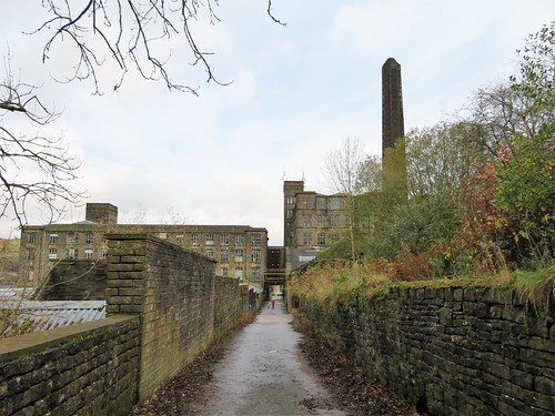
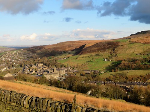
It’s a long time since the buzzer at Bank Bottom Mill summoned half the working population of Marsden to its carding machines and looms. The weather-stained old mill stands redundant at the bottom of the town, as big as a cathedral, acres of windows and grey slate roofs round a central tower and a slender octagonal chimney.
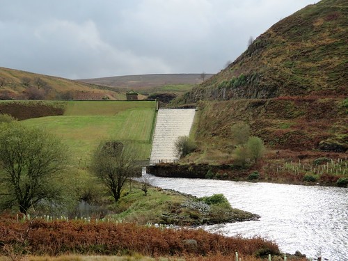
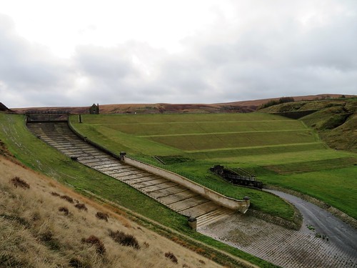
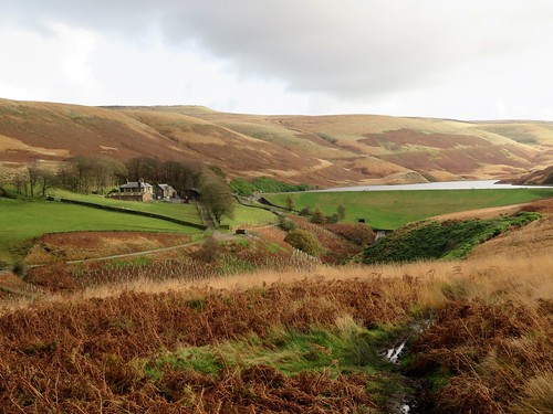
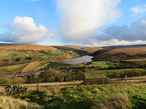
We followed a laneway among these haunting ruins, then on to where a great grass bank filled half the skyline. The dam of Butterley Reservoir is a really impressive sight, even when floodwater is not cascading in white ripples down its spillway.
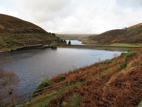
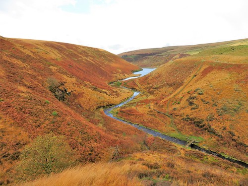
Blakeley Reservoir, high above, is smaller and wilder. Local volunteers were planting young oaks along the banks of Wessenden Brook. Here we stood and looked back along the twisting valley with its man-made lakes, insinuated among the hills at the turn of the 20th century to feed the mills and wells of industrial Huddersfield.
Walking the Pennine Way across these moors used to be a purgatorial flounder among bogs and peat hags. Nowadays, thousands of old mill flagstones give dry passage across the morass. This afternoon’s westward walk beside Blakeley Clough was a pure pleasure, striding firm-footed as the sun burst from behind the clouds and turned the moor grass to a sea of wind-ruffled gold.
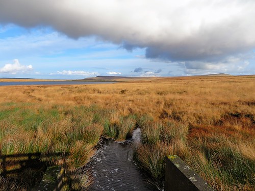
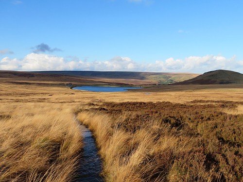
The moor top reservoirs of Black Moss and Swellands lay side by side in modest beds, their water the polished indigo of a lobster’s shell. On the shore of Redbrook Reservoir the Pennine Way met the Standedge Trail, whose stony path we followed, chased by an icy wind. It carried us down from the hills and back to Marsden by way of a narrow old walled lane, from which we looked down over the terraced houses along the valley, and the tall black chimney of the great mill complex still standing silent at the foot of the town.
Start: Marsden railway station, Marsden, W. Yorks HD7 6AX (OS ref SE 047118)
Getting there: Bus 185 from Huddersfield. Road – Marsden is on A62 (Huddersfield-Oldham)
Walk (7 miles, moderate, OS Explorers OL21, OL1): Cross canal, walk downhill. At left bend, right across river, past church. Cross Towngate; along weir side. Cross Mount Road; up Binn Road. In 100m, fork left by Marsden Industrial Society between Bank Bottom Mill buildings (048111); on along lane to Butterley Reservoir dam. Up steps on left (049106); at top, right on Kirklees Way (fingerpost) for 1 mile to top of Blakeley Reservoir. Right on Pennine Way (054091, fingerpost) over Marsden Moor for 2 miles. Just before Redbrook Reservoir, right (027094) along Standedge Trail (unmarked, broad track). In ¾ mile cross Mount Road (037101). Up Old Mount Road; in 50m fork left (‘Hades Farm’). In 900m, right (042110, ‘Marsden Heritage Trail’, Point 15) down walled lane to track (044111). Left past house; walled lane for 300m to gate on left of farmhouse (044113). Right along house wall; ahead through 2 gates (yellow arrow); down sloping field, following gully to bottom left corner (046115). Cross stile; right down lane to road; left across A62; return to station.
Conditions: Some short, steep ascents/descents; some muddy parts
Lunch: The Railway, Marsden (01484-841541, railwaymarsdenhuddersfield.co.uk)
Accommodation: The Carriage House, Manchester Rd, Standedge, Marsden HD7 6NL (01484-844419, thecarriage-house.co.uk)
Info: yorkshire.com/places/west-yorkshire; satmap.com; ramblers.org.uk