First published in: The Times Click here to view a map for this walk in a new window


Facebook Link:

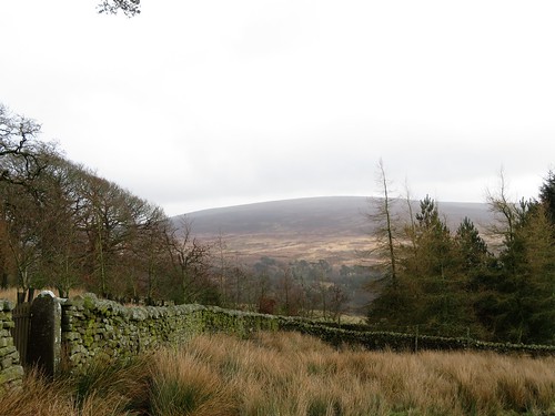
Mist on the moor tops of the Forest of Bowland, and cool grey weather down in the long green valley of the River Wyre. Abbeystead lay sheltered along its tree-lined road, an immaculate Victorian estate village built in mock-medieval style by the 4th Earl of Sefton, all stone mullions, gables and thick chimney stacks.
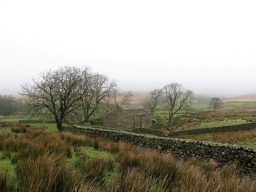
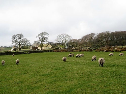
We breathed the scent of resin from the roadside pines as we set out from the village across sedgy pastures. Rain-sodden ewes with red raddled rumps went flouncing away. Top o’ Emmetts farmhouse sat on its ridge among stark stone byres and barns. A bleak late winter scene, the kind that drives you on over the wet fields and across stone walls green with algae, following the white exhalations of your own breath.
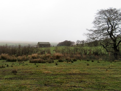
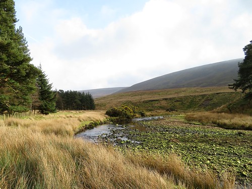
Twin rivers flow through this high valley, the Tarnbrook Wyre to the north and the Marshaw Wyre in the south, snaking west on converging courses to meet and mingle at Abbeystead Reservoir. We crossed the northern branch at Tarnbrook, where the farm dogs barked us out of the tight-huddled hamlet and on through the lonely farmsteads of Gilberton and Speight Clough.
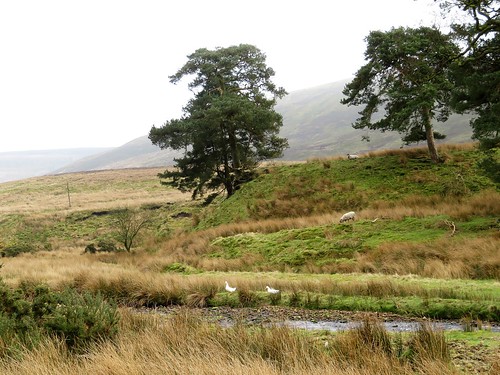
No-one came and no-one went among the sturdy old buildings. We had the whole world entirely to ourselves – the leafless straggle of Harry Wood, the moors lifting their skirts of mist coquettishly, the snipe already paired for mating and zigzagging frantically away as we swished through the rushes.
Down at Tower Lodge we walk west along the valley road past Marshaw Farm with its fat white sheep. Here the Marshaw Wyre ran deep and powerful, cutting great bends in the soft sandy banks. We floundered and squelched through the bogs, nosing out the way, to arrive opposite the serried gables and windows of Abbeystead House. From where we stood, the 4th Earl of Sefton’s ‘shooting lodge’ looked large enough to accommodate all the King’s horses and all the King’s men.
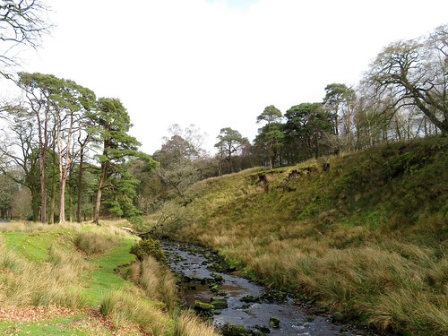
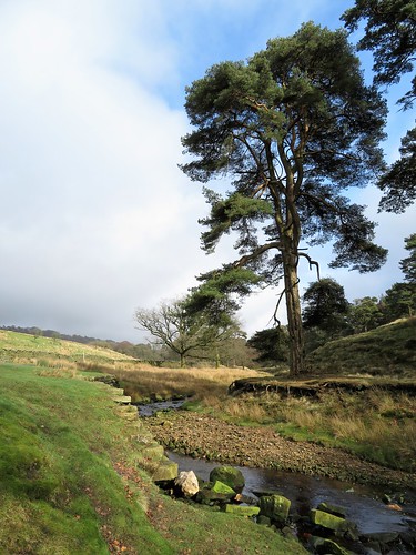
If there is a muddier path in Lancashire than the one that skirts the swamps of Abbeystead Reservoir, I never wish to walk it. But perseverance had its reward – the remarkably beautiful spectacle of the conjoined Wyre rivers sliding gracefully with a mesmeric hiss down their cunningly sloped weir, in a great lacy fan of water ripples that held one’s gaze in thrall.
Start: Car park, Stoops Bridge, Abbeystead, Nr Lancaster LA2 9BQ (OS ref. SD 564542)
Getting there: M6 Jct 33; A6 south; immediately left (Hampson Lane) across motorway, follow ‘Dolphinholme’, then ‘Abbeystead’. Drive through village; cross Tarnbrook Wyre river bridge; immediately left to car park.
Walk (8½ miles, moderate, OS Explorer OL41): From road junction by car park, right uphill; at left bend, ahead through garden gate (567546, ‘Wyre Way’/WW, yellow arrow/YA). On across field, aiming for far left corner. Stile (YA) to cross road (575547, WW, ‘Tarnbrook’). Up Top o’ Emmetts drive; right over ladder stile/LS; follow hedge on left to top left corner of field (578549). Cross footbridge and LS, then stile and footbridge (WW). Follow YAs across sedgy fields. In 500m pass right-hand end of barn (582552); follow fence/hedge on right towards farm sheds below. Follow WW past Ouzel Thorn (585555) to cross bridge at Tarnbrook (588556).
Right on tarmac road through hamlet. Farm road continues over moor. In 500m, fork right (595556, WW) over cattle grid. At Gilberton farm, cross cattle grid (595554); left to cross footbridge; left along wall to cross stone bridge; cart track to Speight Clough (597553). Through gate; YA on tree; follow wall up cleft for 500m, past Harry Wood. At top of wood, through gate (598547, WW, ‘sheep folds’ marked on OS Explorer). DON’T cross first LS on left (with blue waymarked fingerpost); take 2nd LS, 100m further along, beside gate (599546). Across field corner to cross LS; half left to next LS (601544). Keep same direction down to stony road (603543); right downhill to turn right on valley road at Tower Lodge (604539).
In ½ mile pass turning at Rakehouse Brow (585537); keep ahead (‘Abbeystead 2’) for 150m, then on right bend go through gate ahead (WW). Keep ahead with fence/hedge on left. At angle of wall, ahead to corner of wood on right (581538). DO NOT descend to cross unwaymarked footbridge below, but bear right round the corner, along wood edge, to footbridge (580539, ‘WW’). Follow right bank of river. In 200m it bends left; leave it here, cross ridge ahead, descending to cross footbridge (578540, WW).
Continue above left bank of river. In 300m, nearing a footbridge, look left for WW waymark post in a boggy patch (576542) pointing half left to steps. Climb these; over stile at top (WW); follow fence on right. In ½ mile opposite Abbeystead House, descend to cross footbridge (567543). On to road and car park at Stoops Bridge (564542).
For a circuit of Abbeystead Reservoir, turn left to cross Marshaw Wyre river (565542). Immediately right (YA) on path through woods (extremely muddy!). In 200m cross bridge and bear right along left bank of River Wyre to reach Abbeystead Reservoir weir (557538). Cross river below weir; right up path, then reservoir road. Cross cattle grid; in 100m, opposite farmyard, right (557542, WW). Through gate; across field to road by house (559542); ahead to Abbeystead.
Conditions: many wet places; reservoir circuit is extremely muddy!
Lunch/Accommodation: Fleece Inn, Dolphinholme LA2 9AQ (01524-791233, fleeceinn.co.uk): cheerful, friendly village inn
Info: Lancaster TIC (01524-582394)
visitengland.com; satmap.com; ramblers.org.uk