First published in: The Times Click here to view a map for this walk in a new window


The white tips of snowdrops were peeking in the graveyard of St Mary’s Church at the gates of Kentchurch Court. This fine old dwelling, half stronghold and half house, tucked down behind trees in a corner of the River Monnow’s broad valley, has been in the possession of the same family since before the Norman Conquest.
;)
We got a glimpse of a castellated turret as we followed the lane south beside the Monnow, the river hurrying its grey waters through the valley and away towards Monmouth. Sheep grazing the riverside pastures were decked in their winter plumage of dusky pink from foraging in the rich red mud.
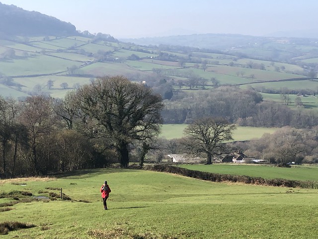
Garway Hill lay squarely ahead, a bald crown above a collar of leafless trees. We found a path that skirted the southern slopes of the hill, ascending gradually through green fields with a fine view opening across the valley, slopes and skyline all softened in the haze the sun had drawn up from fields and woods lying cold and damp with winter.
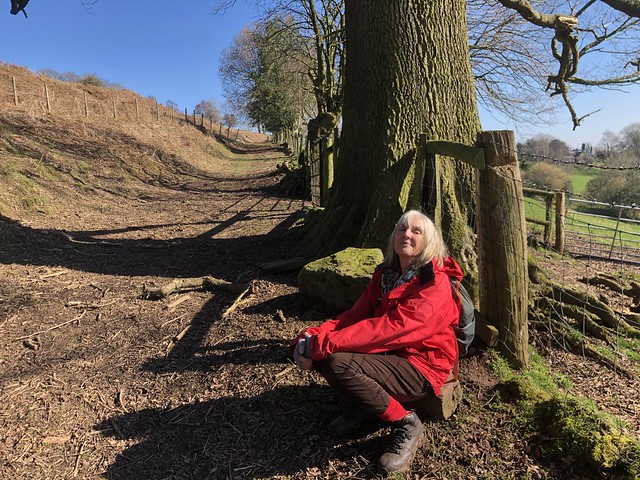
At Little Adawent the proper climb began, a steep grassy path rising through bracken past mossy seeps of water and wind-twisted thorn trees. Overhead, a solitary skylark sang its little crested head off.
Garway Hill has a witchy reputation. A local man once suffered the misfortune of having his wife stolen by the fairies, so stories say. He waited till the wee folk under Garway brought her forth to dance, then snatched her away and ran with her to the top of the hill. As soon as he reached the summit the spell was broken, she awoke from her enchantment and the fairies went away to find another playmate.
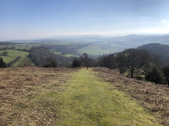
You couldn’t get a less fantastical structure than the prosaic brick shelter at the top of Garway Hill. But the views today were magical, anyway, west to the conical Sugarloaf, the whaleback Skirrid and the long spine of the Black Mountains, east to the Malverns and the Cotswold Hills, all dreamy and insubstantial in the cloudy air.
Families were picnicking around the shelter, their junior mountaineers dashing about. A white pony followed us off the hill, before thinking better of his choice and turning aside towards a couple trailing the scent of peppermint.
A green lane took us back down to lower ground, where in the pastures along the homeward path new-born lambs would soon be calling in their feeble, treble voices, to the counterpoint of phlegmy contralto from their anxious mothers – a whisper in the inner ear from faraway spring.
How hard is it? 7½ miles; moderate; short, steep climb up Garway Hill.
Start: Bridge Inn, Kentchurch, HR2 0BY (OS ref SO 410258)
Getting there: Kentchurch is signposted from A465 (Abergavenny-Hereford) at Pontrilas.
Walk (OS Explorer 189): From Bridge Inn, right; ahead (‘Garway’) at junction; in 800m, right past St Mary’s Church (420257, ‘Garway’). In ¾ mile, left off road (424248) following waymarked Herefordshire Trail (gates, stiles, yellow arrows/YA) across fields. In 1 mile, by gate on right (438243, ‘Little Adawent’), bear left away from wall, up broad grass track to summit shelter of Garway Hill (437251). Aim for gate on left of radio mast (440255); green lane downhill; in ⅓ mile at phone pole (441261, ‘Herefordshire Trail), right to road. Left; at junction, ahead (443264, ‘Bagwyllydiart’). In 100m, left (443266, YA) across fields, skirting right hand edge of Burnt House Wood and on for 1½ miles (YAs) to road at Bannut Tree Farm (423263). Left to Kentchurch.
Lunch: Bridge Inn, Kentchurch (01981-241158, thebridgeinnkentchurch.com)
Accommodation: Temple Bar Inn, Ewyas Harold HR2 0EU (01981-240423, thetemplebarinn.co.uk)
Info: visitherefordshire.co.uk