‘Is it really Essex?’
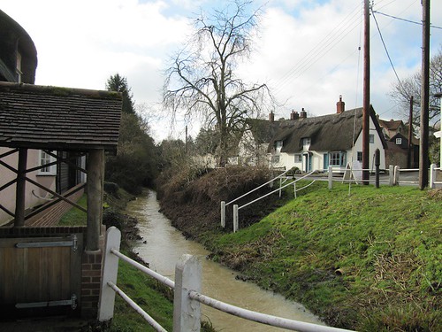
Jane’s amazement was easy to understand. Essex just isn’t associated with scenes like this. Thatched, colourwashed, timber-framed houses line Ashdon’s village street; the River Bourn courses dimpling under diminutive brick bridges; gentle farmlands rise all around.
First published in: The Times Click here to view a map for this walk in a new window

Facebook Link:
A place that wears its ‘Best Kept Village’ trophies up on its walls, with pride, for all to admire. Go to the Thames Estuary shore of Essex to have your prejudices confirmed (or challenged – but that’s for another walk); but come to the north-west corner of England’s most maligned county to have them scattered to the four winds. Here are rolling green hills, catkin-laden copses and delectably-situated medieval hall houses enough to delight any country walker with all five senses alert.
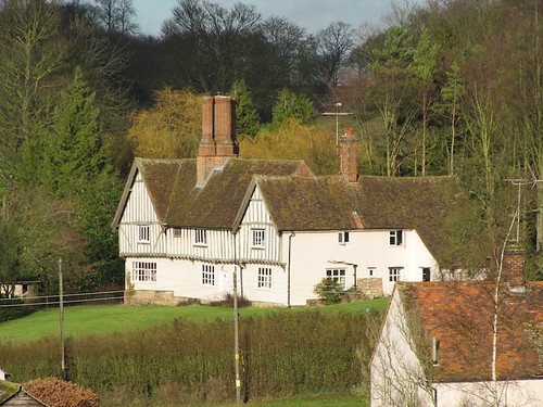
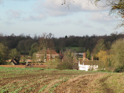
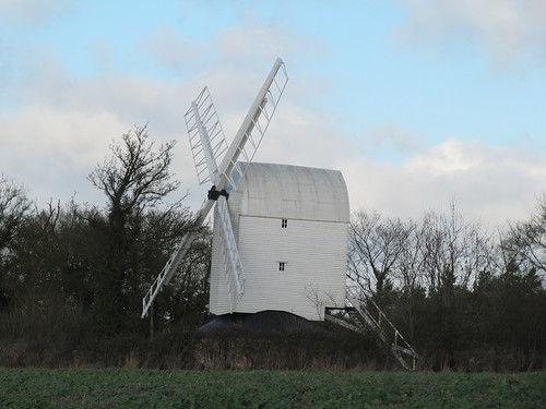
Children’s shouts drifted from the village school playground as we climbed past beetfields with flapping scarecrows to the crest where Ashdon windmill raised its white sails. Crossing the ridge to walk the descending field path into Steventon End, we gazed ahead at what must be the most perfect juxtaposition of two houses in all Essex – the beautiful half-timbered Tudor house of Ashdon Place, pink-washed, sheltered under a wooded slope; and beyond it the mellow red brick Waltons, its ranks of windows flashing back the sun, every inch an early Georgian country house, but with an Elizabethan hall buried inside it.
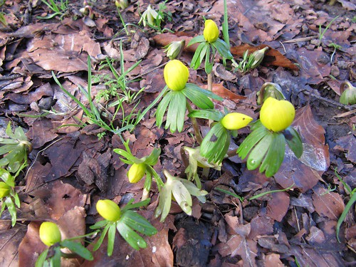
The way led through the Waltons parkland, where drifts of winter aconite with yellow hairdryer hoods and ruffs of green grew under the trees. Six chestnut foals watched us with wary curiosity from a paddock. Out among huge wheat and bean fields, their hedges white with old man’s beard, we crossed the wide roof of the hill and came down by Bowsers End with its farmhouse standing quiet among willows.
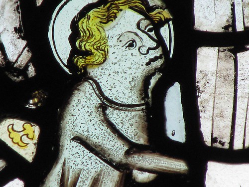
Back in Ashdon’s little sub-hamlet of Church End we found the lumps and bumps of a former village abandoned at the time of the Black Death, its remnants a couple of old cottages and a crooked, timber-framed old Guildhall. Here stands All Saints, one of those rural Essex churches cobbled together over the centuries out of bricks, flints, timber chunks, blocks of limestone. A splendid mishmash with round porthole windows on high, the whole building a bit skew-whiff and out of kilter. And in one of the south windows a few fragments of delicate, ancient glass – leaves and flowers, angels’ faces, wings, hands, and a wight with mournful countenance and golden, curly hair.
Start & finish: Rose & Crown, Ashdon, Saffron Walden CB10 2HB (OS ref TL 587421)
Getting there: Bus: Four Counties Buses (01799-516878;
www.cambridgeshire.gov.uk) Service 59 (Haverhill-Clavering)
Road: Bartlow, then Ashdon, signed from A1307 Cambridge-Haverhill at Linton
Walk
(5½ miles, easy grade, OS Explorer 209): From Rose & Crown take
road opposite (‘Radwinter’). In 200m, left up Kates Lane. In
100m, left (fingerpost); at top of bank bear right past bench
(589421; yellow arrow/YA) and follow YAs (Harcamlow Way on map). At
next bench don’t turn right; keep ahead to Ashdon Windmill
(595425). Left along road. Don’t take first 2 paths on right (black
fingerposts); keep on round bend and turn right on path (concrete
fingerpost) diagonally across field, aiming to left of buildings
below. Cross road in Steventon End (593429); up drive (fingerpost),
past Waltons house and on. Through shank of woodland; at its end,
sharp left (591434; no waymark) on bridleway along its north edge.
Cross road (584432; NB blind bend! take care!). Down lane
opposite; follow it for ½ mile. Opposite Aulnoye, left (580437,
‘bridleway’) up wood edge and on for nearly a mile to Bowsers
End. Sharp left here (568431, fingerpost) along broad footpath. In ⅔
mile pass woodland; through gate; in another 150m, left over
footbridge (577424, YA). Cross stile; aim half left for bottom left
corner of wood; cross stile with waymark here (579423). Up steps to
lane; right; at top of hill, right (581422; fingerpost) past cottage
and along farm track. In 50m, left through hedge (YA); right along
field edge past Hall Farm to road (580417). Cross; down lane to All
Saints Church (581415). On far side of church pass to left of
Guildhall; bear left past gate. In 20m, left at crossing of paths;
follow fence past east end of church and on to gap in hedge (582415).
Diagonally left across big field to far bottom corner (585418). Left
to road by village museum; right to Rose & Crown.
NB – Online map, more walks: www.christophersomerville.co.uk
Lunch:
Rose & Crown, Ashdon (01799-584337); Ashdon village museum (tea and WI cakes!)
Ashdon village museum (01799-584253): Open 2-5; Sun, Wed, BH Mon, Easter to end Sept; Sep-Christmas, Sun only.
More info: Saffron Walden TIC (01799-524002); www.visitessex.com
www.ramblers.org.uk;
www.satmap.com
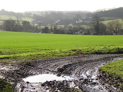
A lovely winter walk, but can be muddy in places. The house named ‘Aulnoye’ in the walk description is now called ‘Lang Meadows’. We found the Ordinance Survey map with overlay of the walk (follow link in the description above) most helpful in keeping to the walk, given the number of turns on the route.