First published in: The Times Click here to view a map for this walk in a new window
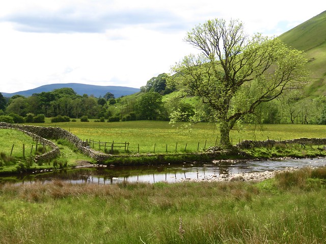


At noon under a blue sky, hens were clucking and sparrows chirping at the Cross Keys at Cautley. This old temperance inn is a pub with no beer (you’re welcome to bring your own), but it’s got just about everything else, including home cooking, enough books to stock an extremely erudite library, and that indefinable air of welcome and comfort that a weary walker dreams of finding.
;)
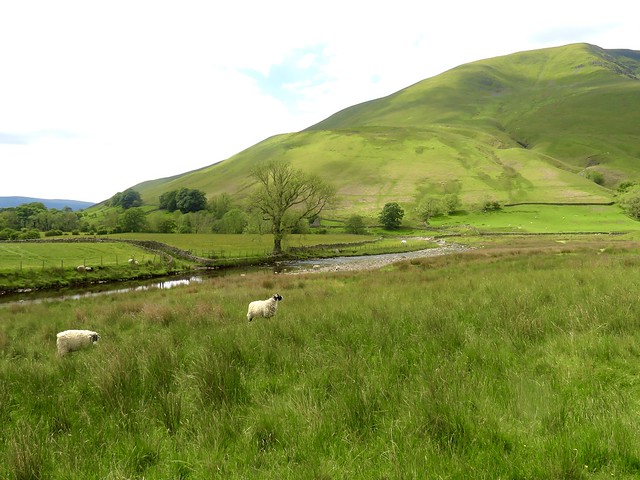
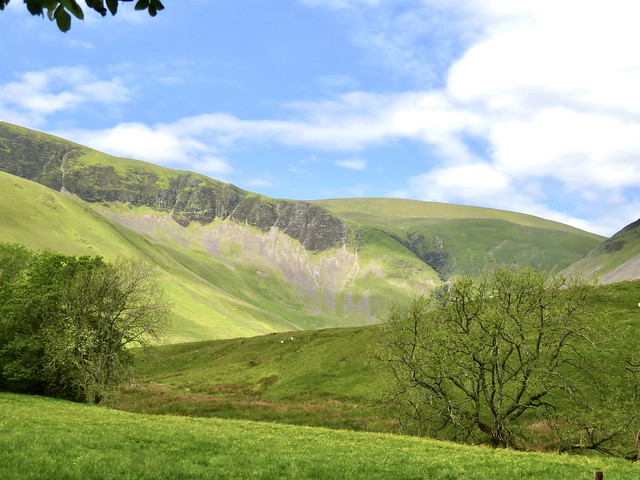
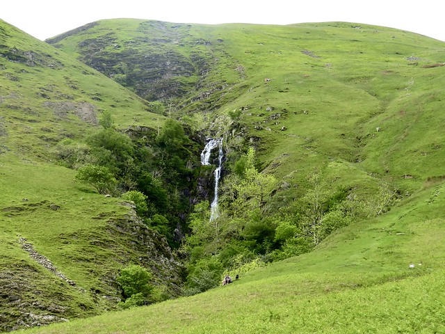
But first we had to earn our ease. The Cross Keys backs onto a wonderful view of Cautley Spout, a waterfall that tumbles some 700 feet down a dark rock cleft in the eastern flank of the Howgill Fells. A track led through sheep pastures to the foot of the fall, and from here on it was a steep puff up a path of rocky steps. It was the first time I’d ever used a stick on a walk, and I certainly was glad of it.
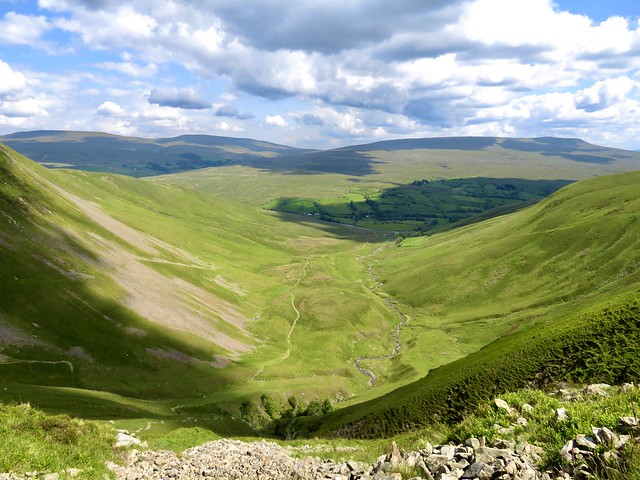
Halfway up we sat to admire the eastward view, the white fall sluicing down beside us, the glacier-sculpted valley opening symmetrical scree slopes. Sun splashes and cloud shadows slid across the fells. The twisting stream of Cautley Holme Beck wriggled away far below towards the green valley of the River Rawthey, with the humps of Bluecaster and West Baugh Fell as an eastern wall.
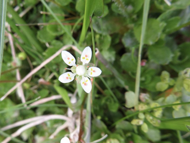
At the top we crossed the fall, suddenly diminished to a trickle hardly wide enough to wet the boots. A stony track led off west beside Force Gill Beck into a silent upland, the heart of the Howgills. Green and gold carpets of opposite-leaved saxifrage grew close to the chattering beck. A lonely sheepfold had been nicely restored, and sheep had congregated there as though the shepherd might return at any moment.
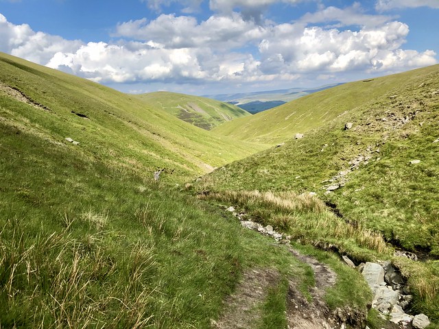
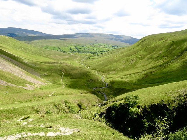
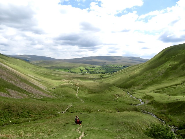
Up on the skyline a tremendous westward view suddenly burst out, fold upon fold of east Cumbrian hills towards the Lake District. We turned along the ridge on the broad track of the Dales High Way, followed by a long descent to the secret valley of Bowderdale and the homeward path.
Few walkers come through Bowderdale. Few suspect its existence – a beautiful, wild valley between high fellsides, haunted by ravens, a fitting place to set the seal on this stunning hike into the Howgill Fells.
How hard is it? Moderate with one steep climb; 6 miles, ascent 500 m/1,650 ft; upland paths. Path beside waterfall very steep with rocky steps.
Start: Car parking bay on A683 at Cross Keys Inn, Cautley, near Sedbergh LA10 5NE (OS ref SD 698969)
Getting there: Bus 54, Sedbergh – Kirkby Stephen (Tues, Thurs, Fri)
Road: M6 Jct 37, A684 to Sedbergh; A683 towards Kirby Stephen.
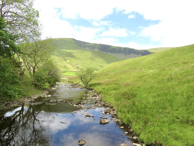
Walk (OS Explorer OL19): Down steps; cross River Rawthey; left on path to Cautley Spout. Steeply up beside waterfall. At top, left across Swere Gill (680975); follow path on right bank of Red Gill Beck. In 600m, just beyond sheep fold ruin (676971), fork right up path beside Force Gill Beck, then up to meet Dales High Way/DHW on skyline (669967). Right; follow DHW to The Calf trig pillar (667970) and on. In 600m at tarn (671964), follow path as it bends right and descends into Bowderdale. Either follow it to bottom of dale, or in ⅔ mile turn right at small cairn (677980 approx) on grassy path short-cut to dale bottom (680982 approx). Right on path to foot of Cautley Spout (683975); return to Cross Keys.
Lunch: Picnic, or Cross Keys (check opening times)
Accommodation: Cross Keys, Cautley (01539-620284, cautleyspout.co.uk) – delightful, welcoming inn. Check opening times before visiting. Accommodation any time by prior arrangement. NB Temperance inn – no alcohol served – BYO!
Info: cautleyspout.co.uk