First published in: The Times Click here to view a map for this walk in a new window

I hadn’t been to Abbeycwmhir since 1979, the year I walked the newly opened Glyndŵr’s Way long-distance path with my Dad. The stages were long, the waymarking abysmal, the flies persistent. What a treat it was on that long-ago summer evening to trudge on sore feet up the long steep valley, past the abbey ruins and in at the door of the Happy Union Inn.
;)
Nowadays Glyndŵr’s Way is a lot better waymarked. The Happy Union is open in the evenings only, and the tiny village tucked away in its forested cleft in the Radnorshire hills has a few new builds to add to its tally of old stone cottages. The Abbey Cwmhir Heritage Trust is very active, and has laid out a network of colour-coded walks based on the village. I chose the orange circuit, and set out under a windy sky that tossed grey and silver clouds about a field of china blue.
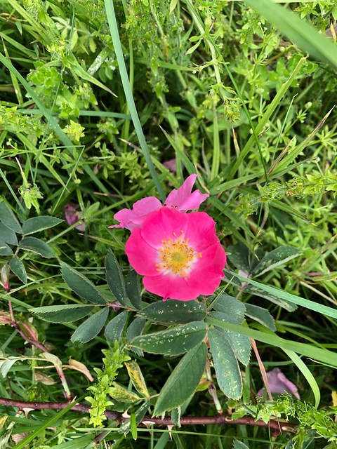
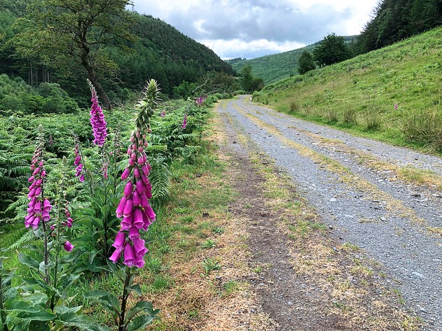
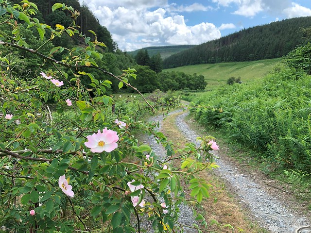
The Cistercian monks who built the abbey in the 1170s in this remote fastness picked a perfect site for the contemplative life – secluded, well wooded and watered, with beautiful hills on every hand. Today the valley road was edged with pink and white dog roses in hedges alive with noisy chaffinches.
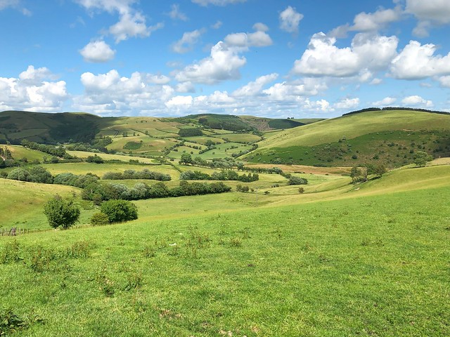
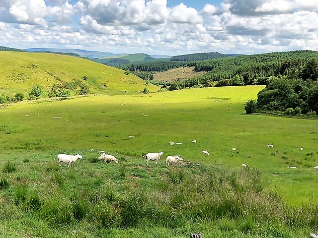
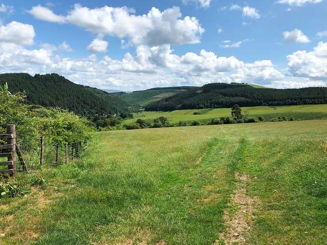
I turned off the road onto a stony track that rose gradually to the crest of the hills – the Monks Way, an old highway from Abbeycwmhir to its sister abbey of Strata Florida away to the west. At the top I crossed a broad undulating upland of pastures where the sheep sprinted towards me in vain hopes of a hand-out.
Up in the spruce forest of Cefn-crin the air was hot, dark and heavy among the trees. The wind sighed among a million pine needles, and countless insects hummed their great discordant chorus. Coming out the other side of the trees I found myself on the crest of the hills with miles of rolling and tumbling green country ahead and behind.
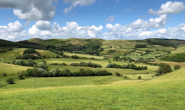
Here I hooked up again with Glyndŵr’s Way and followed it back down to Abbeycwmhir, marvelling at the improvement in its waymarking and relishing the dip of the path among knee-high grasses and in among the trees again for a last cool mile into the village.
How hard is it? 7¼ miles; moderate; well waymarked paths
Start: Phillips Hall (village hall), Abbeycwmhir, Llandrindod Wells LD1 6PH (OS ref SO 054712)
Getting there: Abbeycwmhir is signed off A483 (Llandrindod Wells – Newtown) between Crossgates and Llandewi Ystradenni
Walk (OS Explorer 214; downloadable map/instructions at abbeycwmhir.org): From Phillips Hall, right along road. Left at fork (049708, orange arrow/OA, ‘Rhayader’). In ⅔ mile opposite red brick Cwmhir Cottages, fork right (039705, kissing gate/KG, fingerpost); follow track. By blue container keep ahead through gate (OA, yellow arrow/YA). At Upper Cwmhir house, track bears left, then through right-hand gate of two (031713, OA). In ½ mile at top of Monks Way lane, through gate (025716, OA), along fence; left-hand gate of two (OA); ahead over hill; stile into woodland (022717, OA). Path to forest road; dogleg right/left across (OA); path to road junction (018719). Fork right uphill for ½ mile (tarmac becoming gravel) into Cefn-crin forest (017728). At far edge of trees, on hairpin right bend, ahead (021734, gate, OA) on hillside track. 100m beyond next gate, right (025740, yellow topped post, ‘Glyndŵr’s Way’/GW) between tree clump (left) and fence (right). Follow well-marked GW for 3 miles back to Abbeycwmhir.
Lunch: Picnic
Accommodation: Ty Morgans, East Street, Rhayader LD6 5BH (01597-811666, croesogrwp.com)
Info: abbeycwmhir.org; visitwales.com
Walking the Bones of Britain – a 3 Billion Year Journey by Christopher Somerville is published by Doubleday.