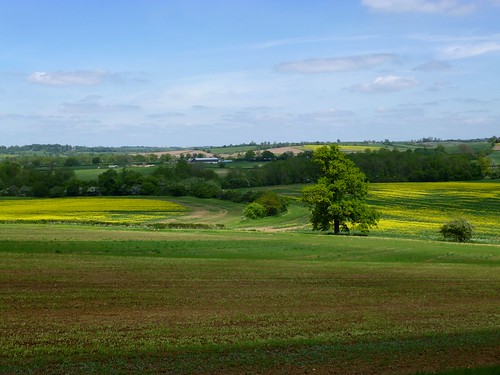
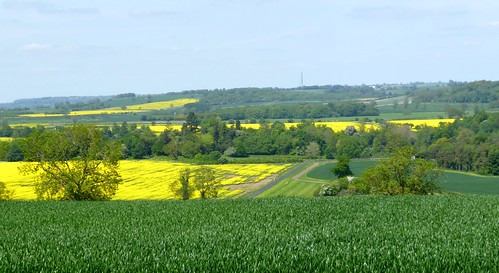
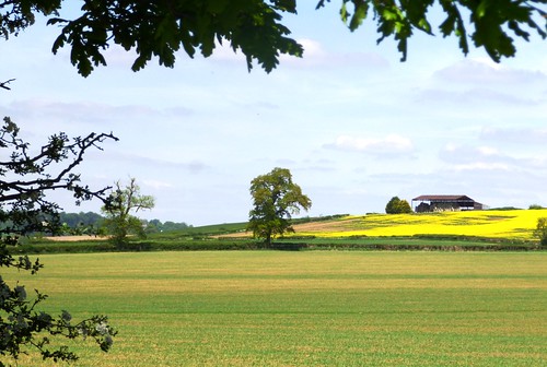
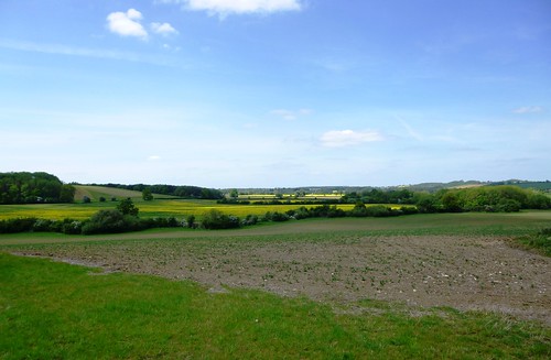
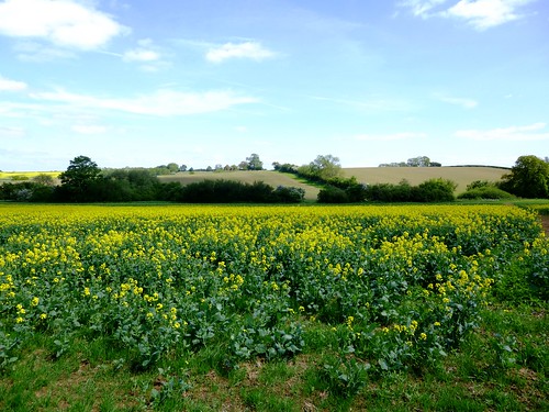
A gloriously sunny day was spread across the bean-green and rape-yellow fields of the Oxfordshire/Northamptonshire border.
First published in: The Times Click here to view a map for this walk in a new window


Facebook Link:
At Thorpe Mandeville the sun bathed the dark gold stone walls of the Three Conies inn, ancient resort of drovers and packmen, as I made my way out of the village.
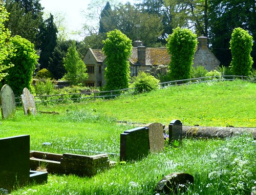
In the medieval wall paintings in St John the Baptist’s Church the infant Jesus rode the broad shoulders of St Christopher, the eyes of saviour and saint glowing like coals out of the faded pigments. I stopped in the churchyard to pay my respects at the granite memorial to Percy Honri, ‘The World’s Greatest Concertinist’, born in Thorpe Mandeville in 1874. Honri was so famous and successful a concertina player that he could afford to turn down a personal invitation from John Philip Sousa to join the great march composer’s band. He lies in a modest grave, returned in death to the place where his incredible journey began.
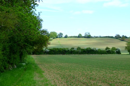
Out in the low-rolling countryside the overgrown trackbed of the Great Central Railway ran through fields of wheat and of pale, iron-rich earth. This is horse country; railed-off training gallops rollercoastered down the slopes, and a girl on a grey mare gave me ‘Good morning’ as she cantered by. In the early morning of 26 July 1469, it was the drumming of charging horse hooves that the hapless men on the crest of Edgecote Hill heard, long before they saw their enemies come bursting over the ridge towards them.
Images from BBC1’s The White Queen came vividly to mind. The Earl of Pembroke, trying to put down a rebellion by the Earl of Warwick against his master King Edward IV, had drawn his forces up on the hill, and had beaten off a strong attack already. But when Warwick’s rebels came thundering in from another quarter entirely, the King’s men threw down their weapons and took to their heels. A terrible slaughter ensued; some say 5,000 men or more died in the battle and its aftermath. Standing where Pembroke’s men had stood, I could see just how it had happened – they wouldn’t have had more than a minute’s warning of the nemesis sweeping down on them. I’d have run, that’s for sure.
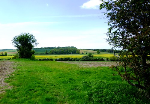
I went on along the crest of the hill and down through fields of horned ewes to Upper Wardington, all mellow stone and green sward in the sun. The homeward path threaded fields where sheep stood on their hind legs nibbling the hawthorn hedges, blue dots of speedwell studded the headlands frothing with gypsy lace, and enormous harlequin views of green and gold unfolded to the south and west under the cloudless bowl of the sky.
Start: Three Conies PH, Thorpe Mandeville, OX17 2EX (OS ref SP 531447)
Getting there: Bus – Service 499, 508 (helmdon.com), Banbury-Brackley
Road – M40 Jct 11 (Banbury); A422 towards Brackley; in 1 mile, B4525 (‘Sulgrave Manor’); Thorpe Mandeville signposted in 2½ miles.
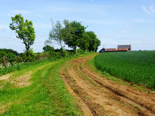
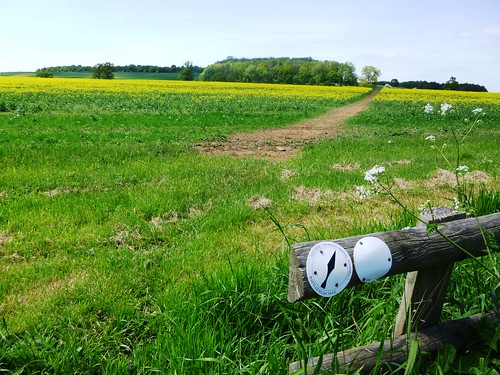
Walk (7 miles, easy, OS Explorer 206): From Three Conies PH, right along village street. By church gate, left through field gate (532449, ‘footpath’ fingerpost): up field edge. At top of churchyard, right through gate; across to top right corner of paddock; stile; across field to far right corner (528452). Through hedge onto Hill Farm drive; right through gate; follow hedge on your right past spring in hollow; on over ridge, down to cross disused railway (528456, Millennium Way; blue arrow).
Follow path north. In ⅔ mile, left up hedge (525465, Battlefield Trail/BT); over crest; down to cross stream (520465). Half right across field (BT); up right side of wood (BT); on through Edgecote Lodge farmyard (514467, BT). At end of farmyard, right across field; follow track (BT) past Douglas’s Barn (508465), across horse gallop, past Hill Barn (503466) to cross stile at meeting of 5 tracks (499464). Half left (BT) downhill; through double gateway (498462, BT); half right across meadow to kissing gate and path to Upper Wardington and Plough PH (495461).
Return to kissing gate; follow yellow arrows (YA) across fields. In 3rd field at top of rise, right down hedge (503462, YA); follow YAs. In 1 mile, cross stile (514452); bear right of stone barn to stile (black arrow/BLA); descend to disused railway (516452). Straight across; up far bank on path bearing right. At top, cross grassy ride; ahead on path into trees. In 10m, fork left through trees to cross stile (517451). Across 2 pastures (YA, stiles). At far side of 2nd pasture, follow path bearing right through trees. In 100m, fork left and over stile (522450, YA). Ahead across field, keeping right of telegraph poles. In far right corner, cross stile (523450, BLA); follow hedge on left to corner (526450); bear right to stile (528449). Cross road; cross field opposite (‘footpath’) to Thorpe Mandeville.
Lunch: Plough Inn, Upper Wardington (01295-750476; closed lunchtimes Mon-Fri, but groups welcome – please telephone); Three Conies, Thorpe Mandeville (01295-711025)
Accommodation: Brasenose Arms, Cropredy, Banbury OX17 1PW (01295-750244; brasenosearms.co.uk) – friendly pub, frequent live music
Battle of Edgecote Moor: battlefieldstrust.com
There is a need for clarification of the route around Edgcote Lodge Farm. The Times newpaper article seems to indicate going south of the Farm. The notes for the walk states ‘go through the farm yard. The map on the site shows the walk going north of the house. Signing around the first part of the walk generally is poor and some gates have additional chains.
Unfortunately we did the walk with only the Times and the OS maps. With no signs or knowing where Douglas’s Barn was we got lost.
Dear Amelia,
Thanks for getting in touch.
You’ve helpfully highlighted a problem with my website that I’ve never been aware of up to now – the fact that it offers two maps:
A. The one you get to via the red link ‘Click here to view a map for this walk in a new window’, which is a scan of the actual OS 1:25,000 Explorer map that I used on the walk with the route and places highlighted in pencil. This is the one I somehow always assume that people will use, because it’s the one I used myself.
B. The one you get to once you’ve clicked through to Map A, via the purple link, which is a GPS plot on a Landranger map. I’m afraid the route on this second map contans a mistake in routing the walk north of the farm and taking it in a loop southward to meet the actual route at Douglas’s Barn – named as such on the Explorer, but not on the Landranger. You’ll see the proper route on Map A, approaching Edgcote Lodge Farm from the east and passing to the south of it.
I should have checked this map, and I didn’t, so mea culpa. From now on I will check it, and thanks for alerting me to that.
The problem of a lack of names on the Landranger is hard to get over. It doesn’t work nearly as well to use the GPX/1:50,000 Landranger map in conjunction with my detailed instructions, because they refer to the Explorer map with its better naming and clearer route marking. So from now on we’ll include a ‘Buyer Beware’ notice on the GPS map to that effect.
Thanks very much for pointing it out! I’m sorry your walk was spoiled, but I hope you have many more wonderful ones.
With good wishes,
Christopher
Mr Somerville, you need to pass on to people that they’d better be quick with their Thorpe Mandeville walk – HS2 is going to score right across it, obliterating the hamlet, just down the hill from the church, of Lower Thorpe Mandeville. Something akin to a 12 lane motorway I believe! What a shame, because you are right, it is a beautiful area full of history.
Dear Gill,
Thanks very much for getting in touch. I had no idea about HS2 going so close to the walk. What a disaster for the village. People can learn more by visiting
http://www.thorpe-mandeville.info/www.thorpe-mandeville.info/HS2_rail_link.html
With good wishes,
Christopher