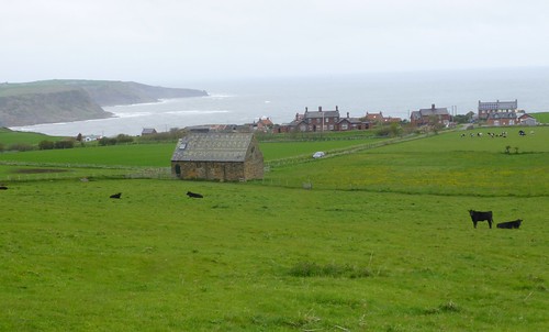
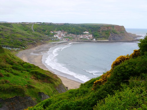
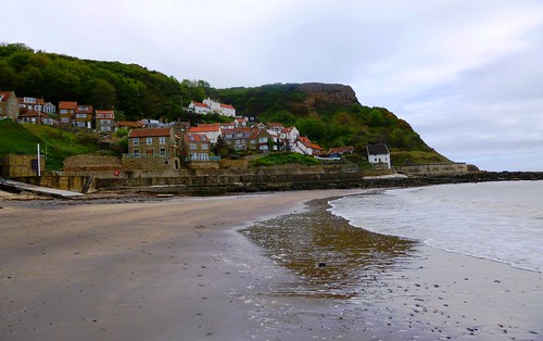
Runswick Bay, pride of the North Yorkshire coast, is an utterly charming, easel-friendly jumble of red-roofed, white-walled houses.
First published in: The Times Click here to view a map for this walk in a new window


Facebook Link:
They stand piled in one corner of a perfectly semi-circular bay whose cliffs have been assiduously quarried and mined over the centuries. The steep green slopes are patched with the black scars of landslips and footed in pebbles of black, red, ochre, cream and chocolate, colours betraying the presence of a treasury of minerals. You can still pick up pieces of raw jet on the beach after cliff falls, not to mention the ammonites and remains of prehistoric reptiles for which these bays are famous.
This is a dangerous coast for contrary currents and winds. Runswick Bay’s lifeboat is not just there for show. The crew was always traditionally drawn from the local fishermen. On one occasion in 1901, all the able-bodied men of Runswick Bay – including the lifeboatmen themselves – were out at sea fishing when a storm blew up and threatened them. It was the women on shore who launched the lifeboat, and the old and infirm men of the village who clambered in and rowed it to the rescue.
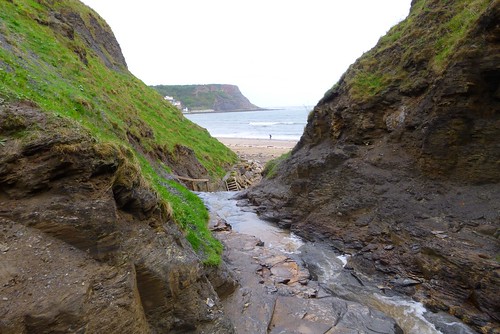
Beyond Hob Holes caves we climbed a steep flight of stairs and were away along the cliffs, looking ahead to where Whitby Abbey stood in Dracula ghostliness on its headland, eight miles off as the fulmar flies. The red pantiled roofs of Kettleness hamlet rose high above the bulbous snout of Kettle Ness, eroded by alum mining to a blunt stump of land.
We skirted above landslip bays where dense undercliffs of heather and grass never see a human footfall, and turned back inland through fields corrugated with medieval ridge-and-furrow. The grassy foundations of a Roman lookout tower lay low on a hump of ground. The tower’s minders evidently came to a bloody end at the hands of German barbarian pirates; archaeologists unearthed their skeletons, together with that of their dog, crushed in the ruins.
Lapwings wheeled and tumbled over the meadows, brown hares scampered in the long grass. We followed the track of an old railway on a great curve through the fields, and dipped down through the trees to Runswick Bay once more, a shining strand scattered with sea-smoothed stones, tide-rinsed and gleaming in our fingers.
Start: Runswick Bay car park, N. Yorks, TS13 5HT (OS ref NZ 810160)
Getting there: Road – car park is signed from Cliffemount Hotel at Runswick Bank Top (signed as ‘Runswick’ from A174 Whitby-Loftus road)
Bus – Service 5 (getdown.org.uk), Whitby-Loftus
Walk (9 miles, moderate, OS Explorer OL27. NB: online map, more walks at christophersomerville.co.uk): Right along beach. In ½ mile, just past Hob Holes caves, right (815154, Cleveland Way/CW acorn symbol) up rock, then wooden steps to cliff top. Follow CW for 2¾ miles. At Tellgreen Hill headland, right inland (850145; ‘Lythe’ fingerpost). In 150m, yellow arrow/YA points ahead, but go right here to Overdale Farm drive (847143): ahead to road (840144). Right to Goldsborough (836147). Follow ‘Kettleness’; in 50m, right (‘footpath’) through farmyard; on through gate (YA) down green lane. Through gate (836148, YA); half left via Roman lookout tower mound (835151) to shed in field corner. Over stile (YA); down to chapel (833153); over 2 stiles to road; right into Kettleness.
Left along old railway track (832155) for 2½ miles. Beside Low House, right off railway (807151) on track down to beach (812156); left to Runswick Bay.
Lunch: Royal Hotel (01947-840215) or beach café, Runswick Bay.
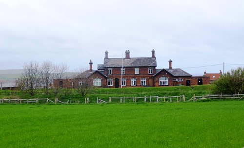
Accommodation: Cliffemount Hotel, Runswick Bay (01947-840103; cliffemounthotel.co.uk) – welcoming hotel perched above Runswick Bay.
yorkshire.com; visitengland.com; www.ramblers.org.uk www.satmap.com www.LogMyTrip.co.uk