Search Results : yorks

Feb 042017


First published in: The Times Click here to view a map for this walk in a new window
picture picture picture picture picture picture picture picture picture picture picture picture picture picture picture picture
Facebook Link:

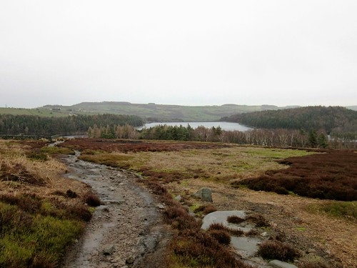
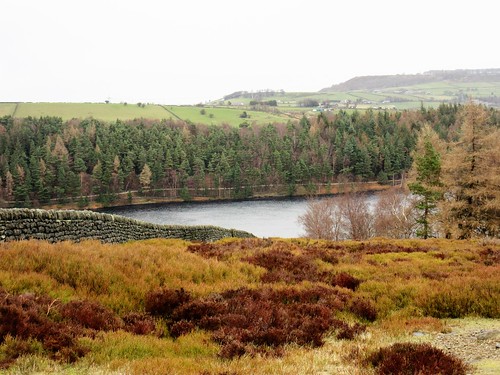
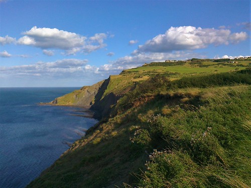
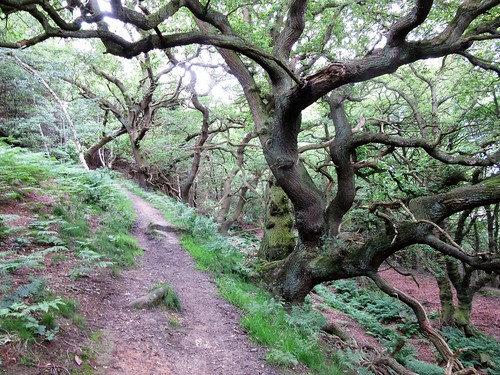
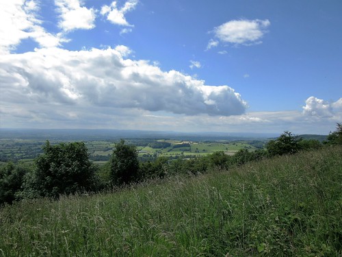
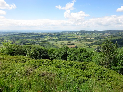
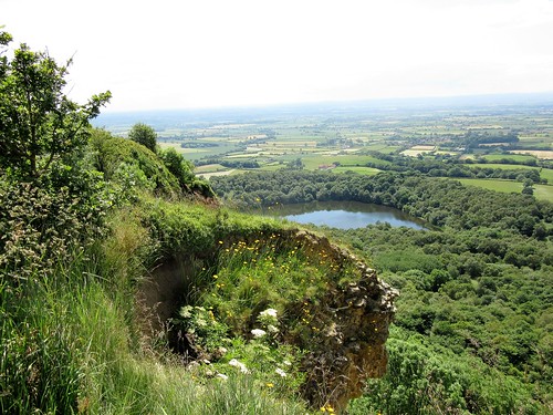
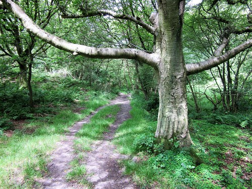
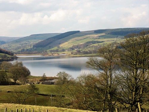
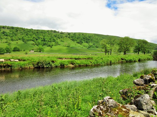
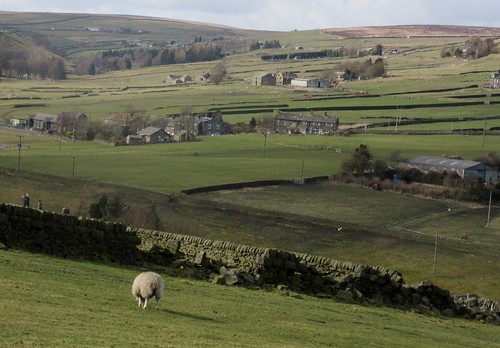
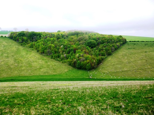
A cold wind from the South Yorkshire moors was roaring in the pine trees around Langsett Reservoir. We followed a woodland path along the north shore, watching wind-driven wavelets racing along with slate-grey peaks and silver troughs. On the far side of the water crouched Hingcliff Common and Stanny Common, low hummocks of moorland under a brisk whipping sky.

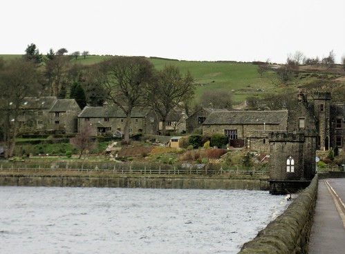
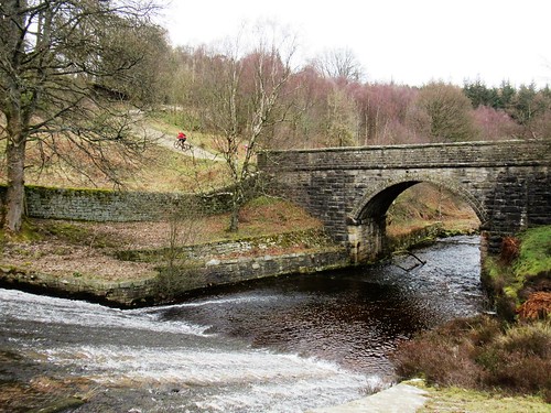
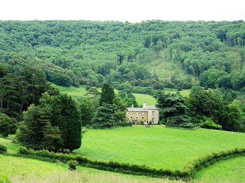
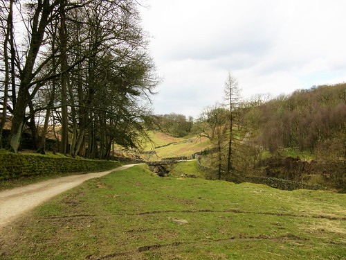
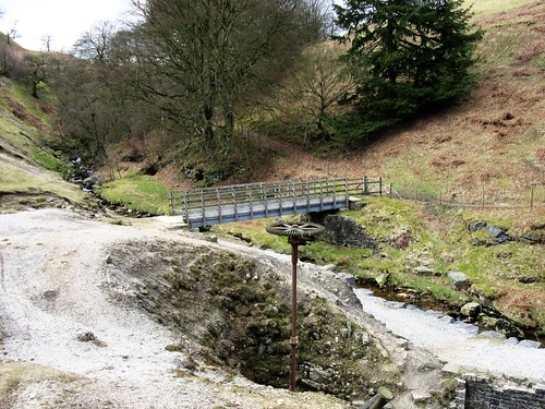
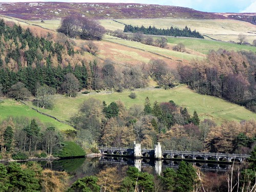
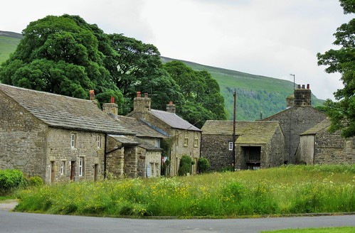
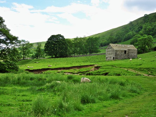
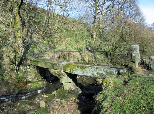
We crossed the tail of the reservoir over Brookhouse Bridge, a handsome span built at the turn of the 20th century. The stones were rustically dressed, with that meticulous attention to detail that the water boards displayed when they designed the huge reservoirs that supplied the industrial cities of Sheffield and Barnsley. Half a dozen farms were put out of business when Langsett Reservoir flooded their land around 190. Brookhouse Farm was one, an ancient foundation whose rent in the year of the Spanish Armada was rather romantically set at ‘a red rose at Christmas, and a snowball at midsummer.’

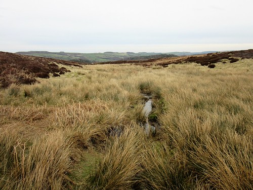
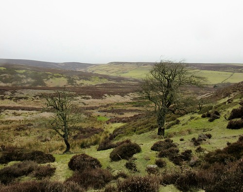
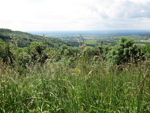
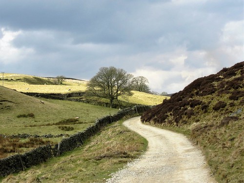
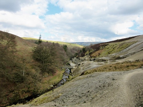
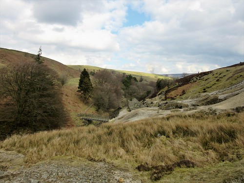
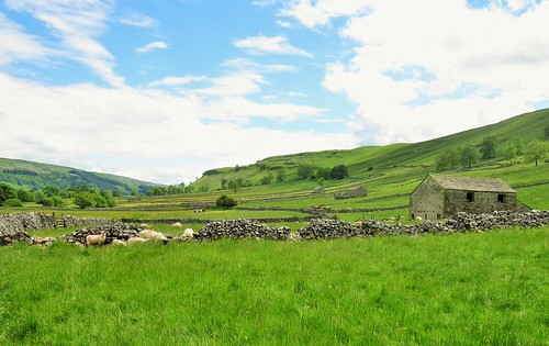
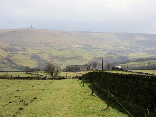
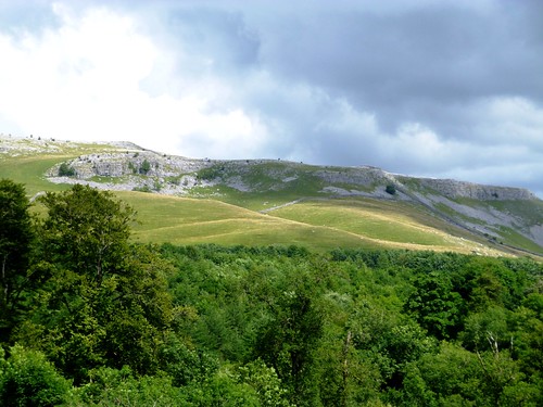
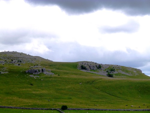
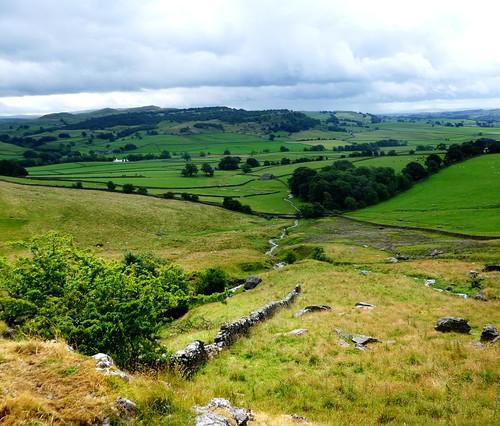
It felt as though there might be a midsummer rent to be collected up on the moors today. An icy wind sliced at us and the temperature fell as we trudged south along the old droving track of Cut Gate, its rubbly surface trodden to pale gold by the boots of walkers. It ran between banks of heather and green bilberry shoots where red grouse cackled ‘Go back, go back, g’-back-back-back!’ as they skimmed off low across the moor. Rosettes of cloudberry leaves lay in the heather, shining and leathery.

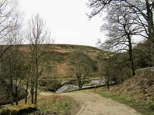
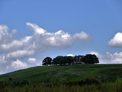
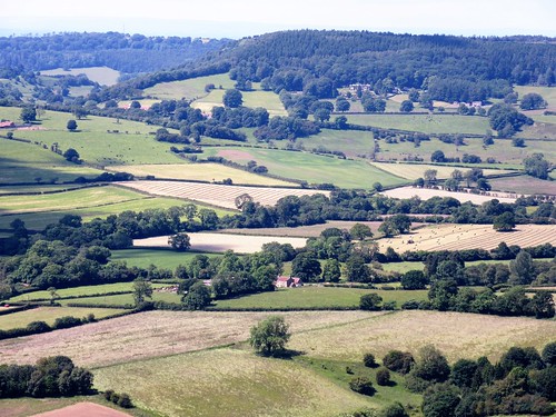
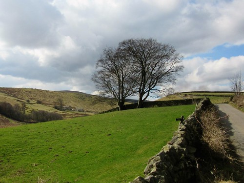
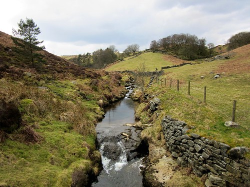
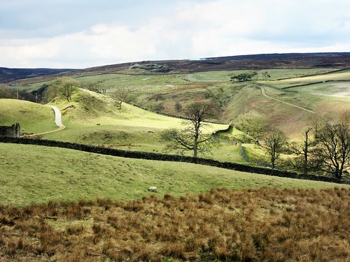
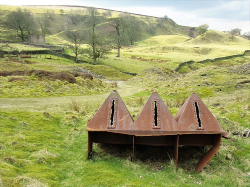
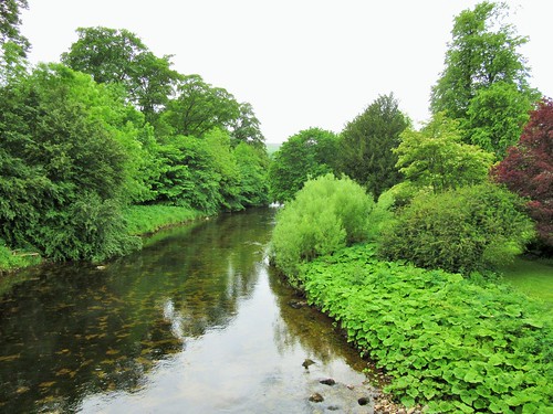
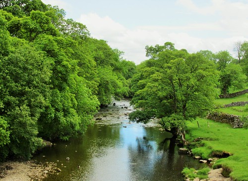
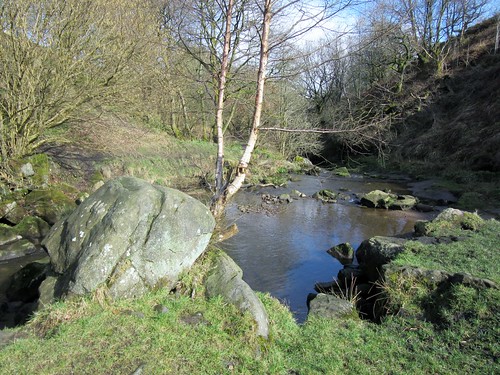
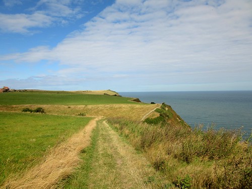
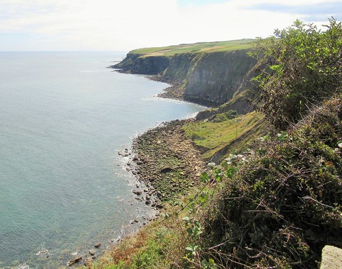
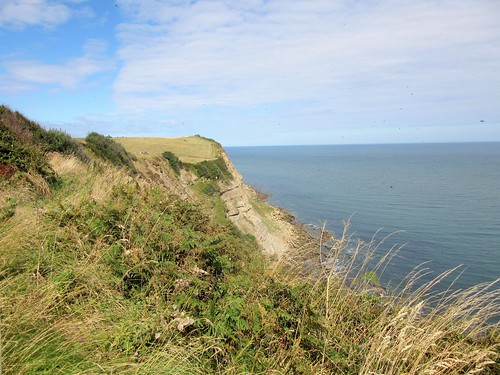
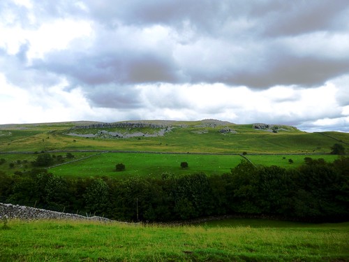
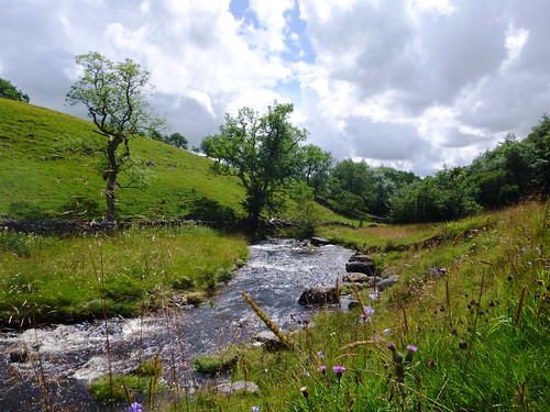
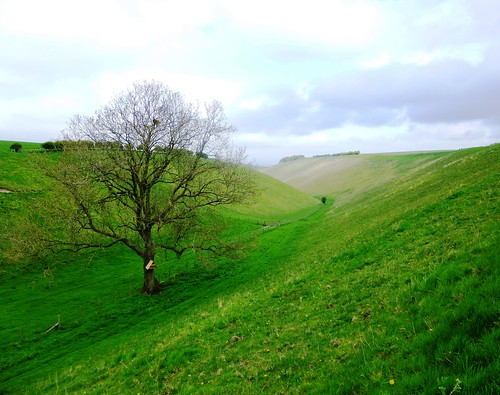
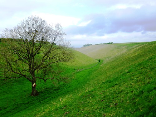
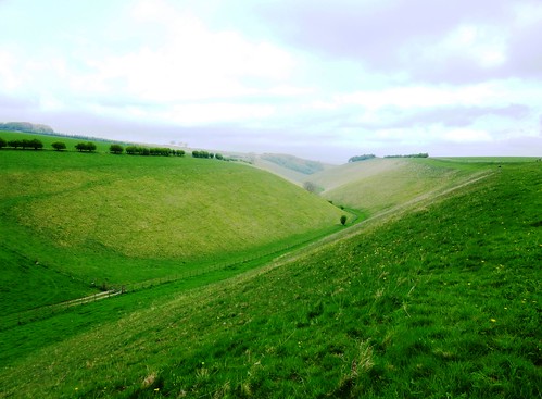
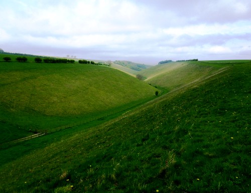
In the deep clough of Mickleden there were remnants of broken field walls and farm buildings in the velvety turf. We skirted the cleft, looking down on the sinuations of Mickleden Beck. Then we put our backs to the wind and tramped the homeward path across the edge of Stanny Common as a shower pattered on our shoulders and shot silver tracers of rain that smacked into the heather.

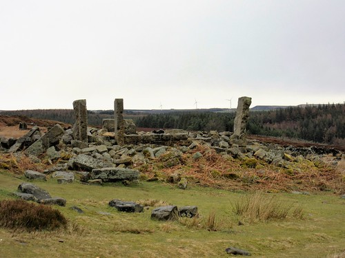
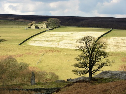
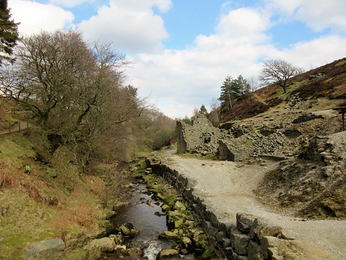
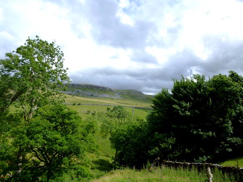
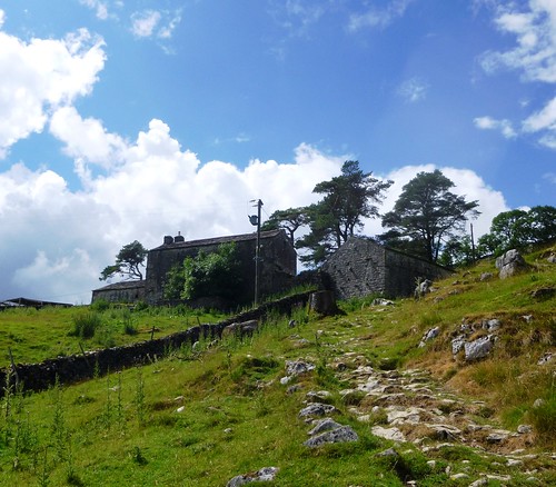
Above Langsett Reservoir lay the lonely ruins of North America Farm, the title symbolising uttermost remoteness and isolation to those who named the place. We passed its broken walls and found a path above the water, where beyond the lapping of the waves we could hear the bubble of curlews coming faintly from the moors.

Start: Langsett Barn car park, S36 4GY (OS ref SE 211004)
Getting there: Bus 20A (Barnsley)
Road – car park is signed off A616 in Langsett, between Stocksbridge and New Mill (M1, Jct 35a)
Walk (5 miles, moderate – slippery and rocky in places – OS Explorer OL1. Online maps, more walks at christophersomerville.co.uk): Through lower wall of car park, down to reservoir wall; right and follow path. At west end of reservoir, left across Brookhouse Bridge (198006). Left through gate and follow clear Cut Gate track south. In ½ a mile keep ahead at arrow post (198000, ‘Kinder Loop’ bridleway). In another mile, left past green sign ‘Langsett and Penistone’ (192987); follow path north-east. In 1 mile, with North America Farm ruins through gate on left, bear right (203997) along track above south side of reservoir. In 650m, through gate (208994); ahead past ‘Langsett At War’ info board along reservoir wall (‘Permissive Path’ arrow) through trees. In ¾ of a mile, left along road (216001), across dam wall. At far end, left (‘Bridleway’) to car park.

Lunch: Waggon & Horses, Langsett (01226-763147, langsettinn.com)
Bank View Café, Langsett (01226-762337, bankviewcafe.co.uk)

Accommodation: Cubley Hall Hotel, Mortimer Rd, Penistone S36 9DF (01226-766086, cubleyhallhotel.co.uk)

Info: Info panel in car park
bradfield-walkers.org.uk; yorkshire.com; satmap.com; ramblers.org.uk

The January Man – A Year of Walking Britain by Christopher Somerville (Doubleday, £14.99)

 Posted by at 01:54
Sep 102016


First published in: The Times Click here to view a map for this walk in a new window
picture picture picture picture picture picture picture picture picture picture picture
Facebook Link:

I hadn’t visited Scarborough for 20 years, and my daughter Ruth had never been there in her life. But she’d often pictured the town, a classic among North Yorkshire’s seaside resorts, and on this lovely morning it was more than fulfilling her fantasies. Regency crescents, sweeping sands, the cliffside tumble of the old town, donkey rides, tacky fun palaces and elegant cast-iron arcades, all lay bathed in clear sunshine.

We climbed the many steps to St Mary’s Church on its ridge. Poor Anne Brontë, dead at 29 of the consumption that had already claimed her sister Emily, lies buried here in a flower-strewn plot. The prospect from the cliff railings just above the church must be one of the best on this coast of wonderful views – the big crescent of North Bay rimmed with elegant Victorian hotels and houses, headlands of many-coloured cliffs reaching into the ice-blue sea beyond.

From the northern end of the strand we looked back to the gaunt ruin of Scarborough Castle silhouetted high on the dark ship-like promontory that divides the town’s two sandy bays. From here northwards the bays have a harder edge; they are floored with ‘scars’ or parallel ribs of rock, remnants of strata turned on edge through subterranean upheavals, then ground down by the sea.

The well signposted Cleveland Way took us unerringly north at the very edge of the crumbly cliffs. This is a mineral coast, a working place where alum, jet, iron and coal were dug with pick and shovel out of the cliff faces. We passed headlands delved and eroded by diggings, bays with tiny rough jetties and tramways. Inland it was all gently undulating cornfields and old farms with pale stone walls and red roofs.

The miles flew by. I was amazed to see the great bulk of Ravenscar promontory loom ahead, a signifier that we’d walked a dozen miles at least. A quick cuppa in the tearoom on the headland and we were striding along the curved coastline towards the red roofs of Robin Hood’s Bay, a shovelful of houses thrown down a cleft by some careless giant.

We trod the steep streets of the village on feet that were beginning to feel the miles. Every crooked corner and flight of narrow steps called for the camera; but we had only baths, beers and beds on our minds just now.

Start: South Bay Underground car park, Foreshore Road, Scarborough, YO11 2HD (OS ref TA 045877)

Getting there: Rail to Scarborough. Bus 93 from Whitby. Road – A171 (Whitby), A170 (Pickering), A64 (York), A165 (Bridlington).

Walk (15 miles, easy, OS Explorer OL27. Online maps, more walks at christophersomerville.co.uk): North up South Bay promenade. At NW corner of Old Harbour (047888), left up West Sandgate Terrace; on up steps to church and Anne Brontë’s grave (047891). Up snicket opposite church to railings; left round North Bay to Old Scalby Mills PH (036909). From here, follow well-waymarked Cleveland Way National Trail to Robin Hood’s Bay.
Return: Bus 93 from Thorpe Lane, Robin Hood’s Bay.

Conditions: Some steep flights of steps; unguarded cliff edges.

Refreshments: Hayburn Wyke Inn YO13 0AU, 1½ miles north of Cloughton, ½ a mile off Cleveland Way (01723-870202, hayburnwykeinn.co.uk); Raven Hall Hotel, Ravenscar (01723-870353, ravenhall.co.uk)

Accommodation: 17 West Street, Scarborough, YO11 2QN (01723-361914, 17weststreet.co.uk) – stylish and welcoming stopover.
Victoria Hotel, Station Rd, Robin Hood’s Bay YO22 4RL (01947-880205, victoriarhb.com) – very friendly and full of character.

Information: Scarborough TIC (01723-383636)

www.visitengland.com; satmap.com; ramblers.org.uk

 Posted by at 01:05
Jun 182016


First published in: The Times Click here to view a map for this walk in a new window
picture picture picture picture picture picture picture picture picture picture picture picture picture picture picture
Facebook Link:

A glider was circling perilously near the cliffs on Sutton Bank, but no-one on the Cleveland Way had eyes for it – not with the signposts proclaiming ‘The Finest View in England – 50 metres’. That might be a bit of an eyebrow raiser as a claim, but the prospect over the Vale of York from the sharply-cut crags of Sutton Brow is certainly a stunning one. I looked out south and west over a giant plain, patched with cloud and sun, green and pale gold, rolling away to splendid blue hills on the edge of sight.

‘The Yorkshire Dales, them are,’ said a man at my side. ‘See Great Whernside there?’ He pointed out a diminutive hump on the skyline. ‘Thirty mile off, that is. Entrance to Wensleydale’s that great dark cliff you see there. Damned if it isn’t a hundred mile or more, this view.’ He inhaled as though he were drawing the scene inside to hold it deep down.

The Cleveland Way National Trail shadows Sutton Brow and the long south-north escarpment of the Hambleton Hills, so walkers get the full effect of the sensational view for mile after mile. I chose a side turning, and plunged down a path edged with pale pink dog roses through the ancient woodland of Garbutt Wood. Bluebell pods as fat as peas stood among the star-like flowers of yellow pimpernel. Gaps in the silver birch and oaks gave snatches of the view over the plain.

Young coots and moorhens were squeaking in the reeds of Gormire Lake when I got down to it at the foot of the bluff. At the pretty cottage of Southwoods Lodge I found a north-running bridleway between hedges thick with lacy umbellifers. A bee landed on one of the flat plant heads and slid its hair-thin proboscis into each tiny white flower in turn, drawing out sweetness and carrying pollen away to fertilize the next host in its round of feeding.

At Midge Holm I walked fields of coarse grass round a lake, remnants of a landscaped park now subsiding back into the landscape. On through uncut hayfields, the ripe grass heads hazing the meadows with a wash of pale purple as they released steamy warmth I could feel on my cheeks and arms.

‘I’m 82 tomorrow,’ said a slim and upright gentleman in walking boots whom I met on the homeward track to Sutton Bank, ‘and I’m lucky. Nothing ever ails me.’ He indicated the wonderful view to the distant hills. ‘Take a hold of this and put it away in the memory banks for a dark winter day. You can’t beat it, eh? Summer with its best coat on.’

Start: Sutton Bank car park, YO7 2EH (OS ref SE 517831)

Getting there: Car park is at top of Sutton Bank on A170 (Thirsk-Helmsley)

Walk (6 miles, moderate, OS Explorer OL26): Follow tarmac path up left side of Sutton Bank Bikes shop. At ‘White Horse 1¼” fingerpost, ahead through car park; follow gravel path on right of A170 to cross side road (515830); ahead along Cleveland Way/CW (‘Sneck Yate’). In 400m, left off CW (511833; ‘Footpath, Nature Trail’) steeply down through Garbutt Wood, passing numbered posts. At Post 9 (505833) ignore ‘Southwoods’ sign to right; bear left downhill to Gormire Lake. Right (504833, ‘Bridleway, Southwoods’). At Southwoods Lodge cottage (502838), right along bridleway (blue arrow/BA).

At Midge Holm Gate (502843), cross road; through gate to left of Southwoods Hall gates (‘Tang Hall, Southwoods’ fingerpost); curve anti-clockwise round field edge and on (bridleway fingerposts, BAs) to road at Tang Hall (496851). Right over cattle grid; track to Greendale farm. Through gate to left of farmyard (499854, BA); up field, through gate; left (‘bridleway’) through skirts of wood. In 350m, at 3-finger post, right (499857; ‘Bridleway, Little Moor’) up woodland track, across Little Moor, up forestry track (BAs) for ⅔ mile. At top (507853), right along CW (‘Sutton Bank’) for 2 miles to car park.

Refreshments: Sutton Bank visitor centre café (01845-597962)

Info: North York Moors Visitor Centre, Sutton Bank (01845-597426; northyorkmoors.org.uk)

Yorkshire Wolds Walking & Outdoor Festival 2016 (10-18 September) – theyorkshirewolds.com

visitengland.com; satmap.com; ramblers.org.uk

 Posted by at 02:24
Mar 122016


First published in: The Times Click here to view a map for this walk in a new window
picture picture picture picture picture picture picture picture picture picture picture picture picture picture picture picture
Facebook Link:

Business-like bunches of walkers were assembling in Pateley Bridge car park in a clatter of boots and sticks. Nidderdale is a favourite spot for walkers in North Yorkshire, and everyone wants to grab hold of a day like this, with enormous white clouds slowly drifting in a blue sky across the dale. We lost sight of everyone as soon as we’d left the little market town. This sort of steep, rolling country has a mysterious way of swallowing its walkers, and true to form we scarcely saw another soul all day.

The spring wind came down from the moors, full of the baby cries of new-born lambs and cold enough to prickle the nose. We followed the waymarked Nidderdale Way west along a narrow farm road between carefully maintained stone walls that sparkled with minute, intense winks of sunlight. Farms lay along the higher contours of the green inbye land. The steep fields were striped with walls that wriggled like snakes up the undulations of the daleside and vanished over the top into sombre-coloured moorland, where heather-burning operations were sending up slowly curling towers of oily-coloured smoke.

We sat to eat our snack on a fallen stone lintel opposite the bankside cottage of Throstle Nest. A gang of ewes still heavy with unborn lambs came up bleating for crisps. They soon settled to cropping the grass with short, decisive jerks of their greenish teeth – gentle company, and a peaceful sound to picnic by.

We followed the lane down to Ashfold Side Beck through a tremendous slump of old lead mine workings. Below the ashen tips a cluster of tumbledown buildings and a great rusty cogwheel and shaft showed where 19th-century miners had processed the precious and poisonous ore. Cornishmen, Irishmen, Scots and Welsh all laboured here for the Prosperous and Providence Lead Mining Company, working the Wonderful and Perseverance Levels – names that say everything about the triumph of hope over experience.

Back along the beck and up over the fields to Stripe Head Farm, where the farmer in cap and gumboots was helping a ewe newly delivered of twins. ‘I’m out at eleven at night to check on them this time of year,’ he said, ‘and out at 5.30 am, too.’ The newborn lambs staggered about and cried until they found what they were looking for under their mother’s shaggy pelmet of wool stained dark by the winter. Then you couldn’t hear a sound out of them.
Start: Showground car park, Pateley Bridge HG3 5HW (OS ref SE 157654)

Getting there: Bus – 24 from Harrogate
Road – Pateley Bridge is on B6265 between Grassington and Ripon.

Walk (7 miles, easy/moderate, OS Explorer 298): From car park, left along B6265. Pass turning to Ramsgill; in 50m, right (fingerpost, yellow arrow) up laneway to road (155654). Dogleg right/left (‘Ladies Rigg’), and follow path through fields past Eagle Hall, following left-hand hedge/fence to meet Nidderdale Way/NiW at corner of wood (147655). Turn right along road, following NiW.

In 1 mile, fork right at Hillend along lower lane (131653, ‘Ashfold Side, Cockhill’; NiW). In 700m cross Brandstone Dub Bridge (124655); follow stony lane to left. In ½ mile follow path down through ruin of Providence Lead Mine workings to cross Ashfold Side Beck (119611). Follow NiW downstream for 1¼ miles. Beyond Low Wood, left off lane (138664, NiW, ‘Heathfield’). Up field edge, through Spring House farmyard (138665); half right across next field to gate; on along track by wall. In 500m pass Highfield Farm; on down to Heathfield and Grange Lane (138673).

Left along road. In 250m, 100m before Pie Gill drive, right through gate (137676, fingerpost). Follow left-hand wall; cross stile; half right between garage and wall. Keep wall on left till it bends left; aim half right for gate below (139679). Down track to Stripe Head Farm; through gate to right of buildings; down to road (141680). Right; in 500m, left (‘Wath’) across bridge (145677); right on NiW along River Nidd for 1¾ miles to Pateley Bridge.

Lunch: Sportsman’s Arms, Wath (01423-711306; sportsmans-arms.co.uk)

Accommodation: High Green Farm, Wath, Pateley bridge HG3 5PJ (01423-715958; highgreen-nidderdale.co.uk) – first class B&B or self-catering.

Info: Pateley Bridge Museum, King Street, Pateley Bridge (01423-711255; nidderdalemuseum.com); Pateley Bridge TIC (01423-711147); visitharrogate.co.uk; nidderdaleaonb.org.uk

visitengland.com; satmap.com; ramblers.org.uk

 Posted by at 01:36
Jun 272015


First published in: The Times Click here to view a map for this walk in a new window
picture picture picture picture picture picture picture picture
Facebook Link:
Littondale lies tucked away, a secluded cleft running away to the north-west from its parent valley of Wharfedale. If people venture to Littondale, it’s usually to get a sight of Arncliffe, the gorgeous little stone-built village where the first few series of ‘Emmerdale’ were filmed. Arncliffe’s houses line its expansive green, presided over by the creeper-hung Falcon Inn where beer is still served from barrel to jug to glass, the proper way.

The steep hillside I climbed out of Arncliffe was a mass of wild flowers – milkwort, bird’s-foot trefoil, lady’s bedstraw, hawkbit, rockrose, a litany of lovely jewel-like plants growing on the slopes. Every step left a pungency of crushed wild thyme as I went on up into a far bleaker moor landscape of black peat and sombre dark green heather. I passed pale stony heaps of lead mine spoil, and deep shake holes where subterranean caverns had subsided directly underneath.

A gate in the summit wall led to the downward track into Wensleydale, the valley spread out at my feet in patchy sunshine with the clustered stone houses of Starbotton and Kettlewell under the long back of Cam Pastures, and miniature dots of sheep feeding in a maze of meadows boxed in by drystone walls, each field with its own handsome stone-built barn.

Down at Starbotton I followed the Dales Way beside the River Wharfe through flat pastures glinting gold with buttercups in the pale sun. The Wharfe ran slow and darkly viscous round its many meanders. This seemingly tame river can grow fierce in spate. Starbotton was wrecked in one terrible flood in 1686. ‘The rain descended with great violence for one hour and a half; at the same time the hill opening, and casting up water to a prodigious height, demolished several houses, and filled others with gravel to the chamber windows. The affrighted inhabitants fled for their lives.’

At Kettlewell I turned steeply back up the daleside, scrambling up through limestone crags to the top of the moor. Then it was down over sedgy grass, precipitously down the rocky sides of Park Scar Wood, and over the little humpy bridge into Arncliffe in the last of the sunshine.

Start: Village green, Arncliffe, N. Yorks, BD23 5QE (OS ref SD 931718)

Getting there: A59 (Skipton – Harrogate) to Bolton Bridge; B6160 through Grassington; past Kilnsey, left on minor road to Arncliffe.

Walk (7½ miles, strenuous, OS Explorer OL30. Online maps, more walks at christophersomerville.co.uk): Take laneway opposite water trough; cross river; at bend (932721) up steps, through gate, up fellside to cart track bridleway (932723). Turn right along it for 1 mile to go through gate at crest (941730). Down for ½ mile to circular sheep pen ruin near gate in wall (951736, 3-finger post). Left down to bridge over Wharfe (951745), Don’t cross; turn right along Dales Way for 1¾ miles to Kettlewell. At bridge (967722), hairpin back right up stony track, through gate. In 50m, left (‘Arncliffe’), steeply up fields. Rocky ‘staircase’ through outcrops (964723); on up grassy path. In 600m, right over ladder stile (958723); on up to 2 ladder stiles in quick succession at crest (952722). Down for 1 mile to gate into Park Scar Wood (938721). Steeply down to road (934721). Right, then left into Arncliffe.

Conditions: Very steep, slippery descent in Park Scar Wood.

Lunch: Plenty of places in Kettlewell.

Accommodation: Queen’s Arms, Litton, BD23 5QJ (01756-770096) – smart rooms, cheerful air. Also Falcon Hotel, Arncliffe, BD23 5QE (01756-770205, thefalconinn.com).

Info: Yorkshire Dales National Park Centre, Grassington (01756-751690); yorkshire.com

satmap.com; ramblers.org.uk; visitengland.com

 Posted by at 01:40
Apr 182015


First published in: The Times Click here to view a map for this walk in a new window
picture picture picture picture picture picture picture picture picture picture picture picture picture picture picture picture
Facebook Link:
Fifty years ago next week Britain’s first National Trail, the Pennine Way, was officially opened. It wound through some steep and beautiful landscape in industrial West Yorkshire, but it gave a wide berth to Hebden Bridge – back then a stinking, roaring, smoking mill town, famous for its fustians and corduroys, but nobody’s idea of a pleasant stopover for holiday makers.

Times have changed, and so has the town after a big smartening-up. A new detour route, the Hebden Bridge Loop, is being opened to coincide with the Pennine Way’s anniversary, beckoning walkers aside to savour the organic cafes, artisan bakers and boutique shops of the newly sparkling gritstone town down there in the depths of Calderdale.

On a brisk day with newborn lambs jumping in the fields I climbed the cobbled lane to Horsehold Farm, where the new Loop path led me along the edge of a steep beechwood. A strong, cold wind blew in from the west with a spatter of snowflakes in its skirts. I dropped down through the tender new green leaves of Callis Wood to where road, railway canal and river ran squashed close together by the tight geography of the Calder Valley.

The Hebden Bridge Loop rose very steeply up the northern flank of Calderdale by way of narrow cobbled laneways between green gritstone walls footed in daffodils. Up in the fields 600 feet above the valley bottom, nesting curlews and golden plover flew away with wild bubbling cries, the haunting sound of spring in the northern dales. Back across Calderdale the slim finger of the monument on Stoodley Pike stood high, pointing into a sky swirling with snow and sun.

From the ridge I descended with a superb view north over Golden Clough to far moors painted chocolate and cream. Down through fields of heavily pregnant ewes to Hebble Hole and the little ancient stone footbridge over the Golden Water, a perfect picnic spot on some warm summer’s day. But today it was up and on with the wind at my back to high-perched Heptonstall on the edge of its cleft, and a vertiginous path all the way back down through Mytholm Woods to Hebden Bridge.

Start: Hebden Bridge Station, W. Yorks HX7 6JE (OS ref SD 996268)

Getting there: Rail to Hebden Bridge. Bus – 500 (Keighley), 590, 592 (Halifax-Todmorden), 900 (Huddersfield). Road – M62, Jct 20; A58, A6033 to Todmorden; A46 to Hebden Bridge

Walk: (7 miles, strenuous, OS Explorer OL21): From station entrance, right under railway; right up Palace Hill Road. Down across railway; first left (989271, ‘Horsehold’) up road. Just before Horsehold Farm (982267), follow red circles and white arrows of Hebden Bridge Loop /HBL. In third of a mile, at fingerpost ‘Mankinholes 3¼ miles’, turn right across stream (980261; ‘Collis Bridge’, HBL) In100m, right down gravelled track (‘Pennine Bridleway’). In 450m, with house in sight through trees to left, cross over broad track and take path (978265, ‘Pennine Way’/PW) down to track; on down to cross canal, river and A646 (971264)

Right (PW); in 50m, left (PW, ‘Hebble Hole’) under railway. Very steeply up cobbled laneway. At second pair of yellow arrows/YA, fork left uphill; on up past Higher Underbank Farm. In 100m, hairpin back right by board marked ‘Wainwright Route/ Official Route’ (968266). Follow Official Route over stile, along path. In 300m, fork left uphill at 2-arrow post (970268); steeply up to The Cludgie (ancient WC) and house on road (971269). Left (PW); in 200m, right (PW) north up field edges. In ⅓ mile, cross Badger Lane (967274); on past Badger Fields Farm, over crest, down to cross Golden Water in Hebble Hole on footbridge (968282). In 30m, fork left (YA); in another 100m fork right and keep parallel with river. In 150m, left up steps (970282), through gate (HBL) onto paved field path. Follow this (HBL, YAs) for ¾ mile to Windy Harbour Farm (982283). Right off lane here; immediately left through squeeze stile; follow HBL to road (983283). Right into Heptonstall.

Pass Cross Inn; first right into Hepton Drive (HBL on road name plate); first right into Church Lane; follow HBL past church, then steeply down vertiginous path through woods to road in Hebden Bridge (989273). Right (HBL); in 100m, left (HBL) down steps. Left along A646 at bottom; at traffic lights (991272) right to cross canal; left along towpath. Pass under bridge No. 16 (995270); hairpin back right to road; left to station.

NB – Some short, steep climbs; many steps; vertiginous path from Heptonstall to Hebden Bridge.

Lunch: Cross Inn, Heptonstall (01422-843284).

Accommodation: Hare and Hounds, Old Town, Hebden Bridge HX7 8TN (01422-842671, hareandhounds.me.uk) – very friendly, cosy country pub.

Pennine Way 50th Anniversary celebrations: nationaltrail.co.uk/pennine-way
Hebden Bridge Loop Launch Day, 25th April. Info, map etc – hbwalksersaction.org.uk/pennine-way.html

Info: Hebden Bridge TIC (01422-843831); yorkshire.com
satmap.com; ramblers.org.uk; LogMyTrip.co.uk

 Posted by at 01:54
Dec 132014


First published in: The Times Click here to view a map for this walk in a new window
picture picture picture picture picture picture picture picture
Facebook Link:
Robin Hood’s Bay is one of those coastal villages so intrinsically beautiful and full of character that it draws you back again and again. Mazy laneways tangle on either side of the precipitous main street. Cobbled or flagged, twisting and turning, plunging from one level to another by worn stone stairs, wriggling between tiny gardens, climbing and falling, framing views of sea and cliff under cooked archways – Fisherhead, Sunny Place and Bakehouse Steps, they seduced me into lingering long after I should have been away.

The tide had slipped in to cover the great scars or eroded rock layers that floor the bay in extravagant arcs. I turned my back on the red pantiled roofs of Robin Hood’s Bay at last and set out along the cliffs with a good stiff north-westerly breeze in my face. I hadn’t walked this stretch of the North Yorkshire coast in years, but I well remembered the jagged out-thrust of the headlands with their horizontal bands of mineral-bearing rock, and the black boulders that carpeted the tiny bays.

The map names held magic – Craze Naze and Clock Case Nab, Pursglove Stye Batts and Maw Wyke Hole. Angular names for angular places, where men wriggled into the most awkward of holes to win the fossilised wood which, properly shaped and polished, transformed itself into Whitby jet. A hard job for hard times – but as they told over-romantic visitors lamenting the mining scars, ‘You can’t eat scenery!’

The sun came through the mackerel sky and shone a silver shaft as thick as a searchlight beam on the sea where lobster pot buoys and flags were bobbing. A jaunty gang of jackdaws went chakkering off inland. Fulmars rode the thermals along the cliffs with upturned tails and slender wings stiffened at right angles to their bodies. I marvelled yet again at these seabirds’ precision of flight, every movement economical and as graceful as a dancer’s.

I passed the stubby white lighthouse on Whitestone Point and skirted Saltwick Bay with its fast-eroding sea stacks and gull-dotted rock pavements. The black skeleton of Whitby Abbey stood ahead on its cliff, forever haunted by the ghastly shade of Count Dracula – one of many scenes in his horror novel Dracula that Bram Stoker set in Whitby, to the delight of today’s nation of Goths who hang whey-faced around the town.

A wildly steep cobbled alley precipitated me from the abbey down to Whitby harbour. The town where Captain Cook learned his sea trade was under attack by jovial pretend pirates today, one of Whitby’s frequent festivals of fun. I dodged Bluebeard and Blackbeard and Short John Silver, and went off to find a fish pie with a nice sea view.

Start: Upper car park, Station Road, Robin Hood’s Bay, North Yorkshire YO22 4RE (OS ref NZ 949055)

Getting there: Bus 93, Whitby-Scarborough
Road: Robin Hood’s Bay (B1447) is signed from A171 Whitby-Scarborough road at Hawsker.

Walk (7 miles, easy/moderate, OS Explorer OL27. NB: online map, more walks at christophersomerville.co.uk): Right along B1447 towards village; on right bend, left along Mount Pleasant North (951055, ‘Cleveland Way’). From here, follow well-waymarked Cleveland Way to Whitby. Return by Bus 93, or taxi from Whitby railway station (£10-£15).

Conditions: Unguarded cliff edges; some steep flights of steps

Lunch: Duke of York, Whitby (01947-600324, dukeofyork.co.uk) – at bottom of 199 steps from St Mary’s Church

Accommodation: Victoria Hotel, Station Street, Robin Hood’s Bay YO22 4RL (01947-880205, victoriarhb.com) – a long-established hotel, characterful, helpful and friendly.

Info: Whitby TIC (01723-383636)
visitengland.com; www.satmap.com; ramblers.org.uk; LogMyTrip.co.uk

 Posted by at 01:44
Mar 222014
 

Reginald Farrer of Ingleborough Hall, intrepid and dedicated Victorian plantsman, travelled all over the wild lands of China, Tibet and Upper Burma to collect seeds for the out-of-doors plant collection he established around his family home in the North Yorkshire village of Clapham. First published in: The Times Click here to view a map for this walk in a new window
picture picture picture picture picture picture picture picture picture picture picture picture picture
Facebook Link:
Some thought him mad, especially when he took to firing seed out of a shotgun to scatter it evenly along the crevices of Clapdale. It was a pleasing picture to have in the mind on our way up the cobbled lane that travels in tunnels and artificial stone-walled canyons through the grounds of Ingleborough Hall and on up to the limestone fells beyond.

The walled lane ran between the sullen grey cliffs of Robin Proctor’s Scar and the broad sunlit valleys to the south. We turned up the sloping fields and found the path up to Norber, a slanting upland where the retreating glaciers dumped hundreds of sandstone erratics – square boulders as big as tanks – on the limestone pavements 10,000 years ago. One boulder had been left delicately perched on limestone blocks like a barn on staddle-stones.

Pen-y-ghent’s lion face poked out of a welter of dark grey cloud ahead as we made for the lane up Crummack Dale in a spatter of rain. A great heavily-muscled bull lay beside the lane, but although he cocked his ears towards us he didn’t deign to turn his head. A grass track brought us up to the ridge at Long Scar, where the tremendous view encompassed Pen-y-ghent, the elongated purple back of Ingleborough ahead in the north, and away to the south the bulk of what we guessed to be Pendle Hill far off in Lancashire.

On the way down to Clapham we stopped off for a tour of Ingleborough Cave. It was an impressive moment when our young guide Sam blew out his candle and plunged us into the profoundest possible blackness. Candles were all those first explorers had to light their way in 1837 when they first ventured into this now famous tangle of caves and cramped passages. Brave as lions, or mad as hatters? Like Reginald Farrer, probably – a good stiff dose of both.

Start: National Park car park, Church Avenue, Clapham, N. Yorks LA2 8EF (OS ref SD 745692).

Getting there: Bus – Little Red Bus service 581 (01423-526655, littleredbus.co.uk); Malham Tarn shuttle service 881 (Sun, BH Mon, April – Oct)
Road – Clapham is signed off A65 Ingleton-Settle road

Walk (7½ miles, moderate, OS Explorer OL2): From car park, right up Church Avenue. Right by church (‘Austwick’ fingerpost) and on through tunnels. In ⅓ mile fork right (751694, ‘Austwick’). In another ⅔ mile, where wall angles in on left, turn left off walled lane over ladder stile (760692, ‘Norber’). Aim half right for far corner of wall; cross ladder stile (763695) and on to 4-finger post (766697). Left (‘Norber’) up to plateau and erratic boulders (766700).

Return to 4-finger post; left, down to wall; left along it. Right over wall by stone steps at marker pole on crest (768698); down to cross tumbled wall, on below Nappa Scars to gate/stile into Crummack Lane (772697). Left for 1¼ miles to Crummack. Through gate by farm drive entrance (771714); on past first fingerpost (‘Bridleway’). At second fingerpost, left (772715, ‘Sulber’) uphill on grassy track. In 300m it bends right (770716) and runs to right below scar. At crest (768719), meet track; left past cairn, down to go through gate in wall. On down to far left corner of wall (758716); left through gate and down walled lane.

In 200m, right over ladder stile; steeply downhill to ladder stile into stony lane in valley (757715); left to Ingleborough Cave Centre (754711). On beside beck; in 250m, just before gate across lane, right through another gate (753708, blue arrow/BA). Climb bridleway to Clapdale farm. Left (751709, BA) through farmyard; follow track back to Clapham.

Lunch: Reading Room Café, Clapham (01524-251144; claphambunk.com)

Accommodation: New Inn, Clapham, N. Yorks LA2 8HH (01524-251203, newinn-clapham.co.uk) – stylishly refurbished; friendly and comfortable.

Ingleborough Cave: 01524-2581242, ingleboroughcave.co.uk; tours £7 adults, £3.50 child).

Information: Ingleton TIC (01524-241049); yorkshire.com
www.ramblers.org.uk www.satmap.com www.LogMyTrip.co.uk

 Posted by at 01:57
Oct 052013
 

A soft half-light day, muted and cool, lay over the Yorkshire Wolds.
First published in: The Times Click here to view a map for this walk in a new window
picture picture picture picture picture picture picture picture picture picture picture picture picture picture picture picture
Facebook Link:
We left the Wolds Inn at Huggate with chaffinch noise in our ears and David Hockney’s tree tunnels and swooping fields in our mind’s eye. Jane had returned from Hockney’s 2012 Royal Academy exhibition of landscape paintings fired with enthusiasm for exploring the folded East Yorkshire countryside, where in the early 1950s the Bradford boy had spent his summer helping out a local farmer with the harvest and learning to drink beer in Huggate’s village pub.

The long shallow hills of the Yorkshire Wolds dip and rise around Huggate in successive waves; a clichéd image, perhaps, but nothing better expresses the sense of frozen movement, the smooth roll and majestic length of these ridges of chalky ground. Our heads might have been filled with Hockney’s golden seas of corn, scarlet shadows and bright white farmhouses, but today all colours lay leached and subdued, soft greys and blues washing the sky, wheatfields and woods. A red tractor with white wheels moved shockingly bright against the shrouded landscape.

Up on the backs of the Wolds the impression is of walking in land that’s almost flat. I wouldn’t have been surprised to see the sea appear ahead. Then suddenly we were on the brink of Pasturedale, a hidden valley opening at our feet, a snaking crack in the earth. A steep chalky track brought us down the dale side into the valley, and we headed up the flat bottomed Frendal Dale and Tun Dale in a golden spatter of dandelions with the dark sides rising sharply to rims clear cut against the sky three hundred feet overhead.

At the top of Tun Dale we emerged onto the roof of the Wolds again. Great yellow rape and green wheat fields ran away to isolated farms and thick dark shelter belts of trees on the horizon. Down once more into the depths, into Horse Dale whose Access Land status gave us leave to wander the cleft among cowslips, speedwell patches and just-flowering bedstraws. Sparrowhawks were hunting the slopes, drifting and swinging across the wind blowing south down the dale, then finding a rigid stance a hundred feet in the air to hang and scan the ground.

At the head of the dale we joined the Yorkshire Wolds Way and followed it back towards Huggate’s church spire down an avenue of cherries frothing with pink and white blossom, brilliantly lit in a burst of sunshine come through at last.

Start: Wolds Inn, Huggate, East Yorks, YO42 1YH (OS ref SE 882550)

Getting there: Huggate is signed from A166 York-Driffield road

Walk (10 miles, easy, OS Explorer 294. NB: online map, more walks at christophersomerville.co.uk). From Wolds Inn, right; first right (‘Village only’). Descend beyond houses; left on Yorkshire Wolds Way/YWW (881557). Follow YWW for 3 miles via York Lane (867558), Pocklington Lane (866548) and Jessop’s Plantation (854543) to cross road at foot of Pasture Dale (850546). Follow Chalkland Way for 3 miles via Frendale Dale and Tun Dale, Waterman Hole (856569) and West Lands (866566) to go through gate at foot of Horse Dale (867561). Slant left up far side; follow east rim of Horse Dale (Access Land) for 1 mile, passing opposite diamond-shaped wood on far slope. Look for prominent tree on east rim; just beyond it; right through gate (883570); follow YWW back to Huggate.

Lunch: Picnic

Accommodation: Wolds Inn, Huggate (01377-288217; woldsinn.co.uk) – cheerful and welcoming; many David Hockney associations (just ask!).

Information: Beverley TIC (01482-391672, visithullandeastyorkshire.com);
yorkshire.com visitengland.com www.ramblers.org.uk www.satmap.com www.LogMyTrip.co.uk

 Posted by at 01:26
Aug 032013
 

Runswick Bay, pride of the North Yorkshire coast, is an utterly charming, easel-friendly jumble of red-roofed, white-walled houses.
First published in: The Times Click here to view a map for this walk in a new window
picture picture picture picture picture picture picture picture
Facebook Link:
They stand piled in one corner of a perfectly semi-circular bay whose cliffs have been assiduously quarried and mined over the centuries. The steep green slopes are patched with the black scars of landslips and footed in pebbles of black, red, ochre, cream and chocolate, colours betraying the presence of a treasury of minerals. You can still pick up pieces of raw jet on the beach after cliff falls, not to mention the ammonites and remains of prehistoric reptiles for which these bays are famous.

This is a dangerous coast for contrary currents and winds. Runswick Bay’s lifeboat is not just there for show. The crew was always traditionally drawn from the local fishermen. On one occasion in 1901, all the able-bodied men of Runswick Bay – including the lifeboatmen themselves – were out at sea fishing when a storm blew up and threatened them. It was the women on shore who launched the lifeboat, and the old and infirm men of the village who clambered in and rowed it to the rescue.

Beyond Hob Holes caves we climbed a steep flight of stairs and were away along the cliffs, looking ahead to where Whitby Abbey stood in Dracula ghostliness on its headland, eight miles off as the fulmar flies. The red pantiled roofs of Kettleness hamlet rose high above the bulbous snout of Kettle Ness, eroded by alum mining to a blunt stump of land.

We skirted above landslip bays where dense undercliffs of heather and grass never see a human footfall, and turned back inland through fields corrugated with medieval ridge-and-furrow. The grassy foundations of a Roman lookout tower lay low on a hump of ground. The tower’s minders evidently came to a bloody end at the hands of German barbarian pirates; archaeologists unearthed their skeletons, together with that of their dog, crushed in the ruins.

Lapwings wheeled and tumbled over the meadows, brown hares scampered in the long grass. We followed the track of an old railway on a great curve through the fields, and dipped down through the trees to Runswick Bay once more, a shining strand scattered with sea-smoothed stones, tide-rinsed and gleaming in our fingers.

Start: Runswick Bay car park, N. Yorks, TS13 5HT (OS ref NZ 810160)

Getting there: Road – car park is signed from Cliffemount Hotel at Runswick Bank Top (signed as ‘Runswick’ from A174 Whitby-Loftus road)
Bus – Service 5 (getdown.org.uk), Whitby-Loftus

Walk (9 miles, moderate, OS Explorer OL27. NB: online map, more walks at christophersomerville.co.uk): Right along beach. In ½ mile, just past Hob Holes caves, right (815154, Cleveland Way/CW acorn symbol) up rock, then wooden steps to cliff top. Follow CW for 2¾ miles. At Tellgreen Hill headland, right inland (850145; ‘Lythe’ fingerpost). In 150m, yellow arrow/YA points ahead, but go right here to Overdale Farm drive (847143): ahead to road (840144). Right to Goldsborough (836147). Follow ‘Kettleness’; in 50m, right (‘footpath’) through farmyard; on through gate (YA) down green lane. Through gate (836148, YA); half left via Roman lookout tower mound (835151) to shed in field corner. Over stile (YA); down to chapel (833153); over 2 stiles to road; right into Kettleness.

Left along old railway track (832155) for 2½ miles. Beside Low House, right off railway (807151) on track down to beach (812156); left to Runswick Bay.

Lunch: Royal Hotel (01947-840215) or beach café, Runswick Bay.

Accommodation: Cliffemount Hotel, Runswick Bay (01947-840103; cliffemounthotel.co.uk) – welcoming hotel perched above Runswick Bay.

yorkshire.com; visitengland.com; www.ramblers.org.uk www.satmap.com www.LogMyTrip.co.uk

 Posted by at 01:43