Search Results : dartmoor

Jan 132024


First published in: The Times Click here to view a map for this walk in a new window
Deckless clapper bridge at Bellever 1 Bellever Tor Laughter Man standing stone Granite rocks of Bellever Tor 1 Granite rocks of Bellever Tor 2 Granite rocks of Bellever Tor 3 Deckless clapper bridge at Bellever 2 Stone circle on Lakehead Hill Kraps Ring ancient settlement Granite rocks of Bellever Tor 4 Deckless clapper bridge at Bellever 3 Deckless clapper bridge at Bellever 5 Deckless clapper bridge at Bellever 4

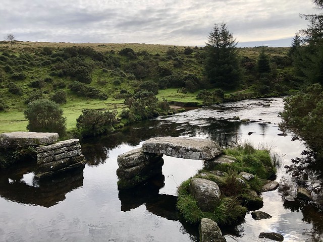
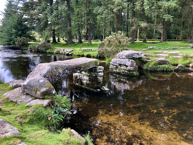
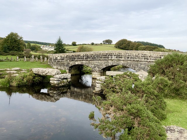
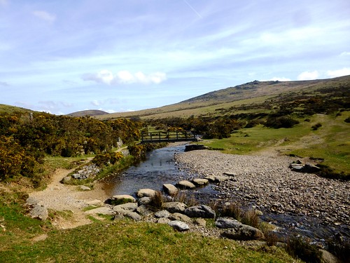
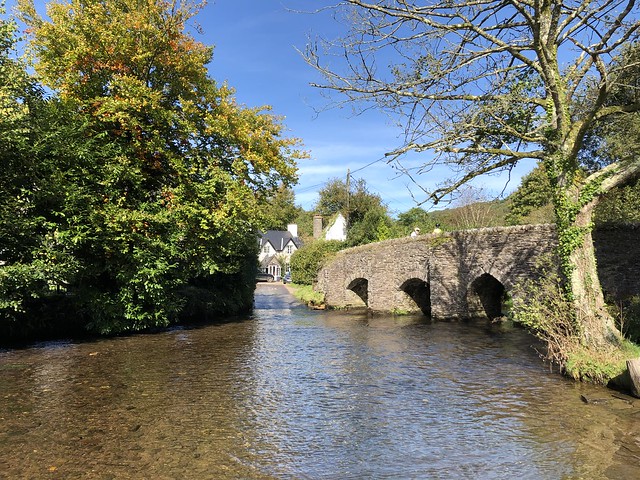
Postbridge lies more or less in the middle of Dartmoor, its main attraction the medieval clapper bridge that crosses the East Dart River. Early on this brisk morning I had the bridge with its great granite slabs and piled supports to myself.

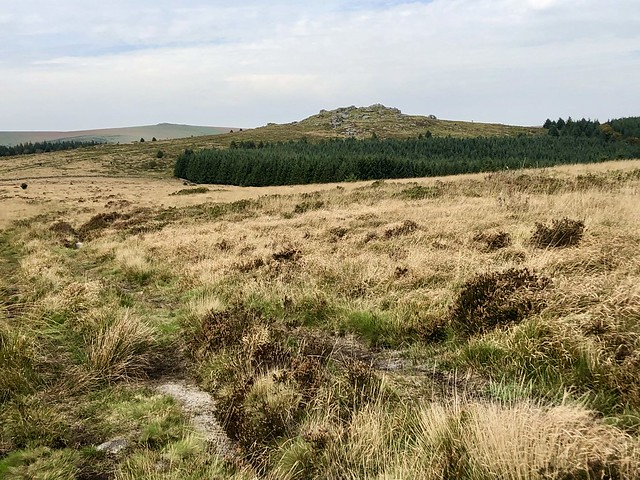
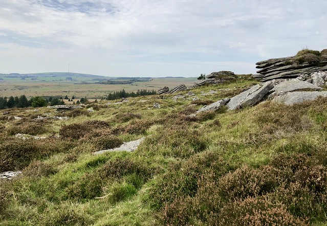
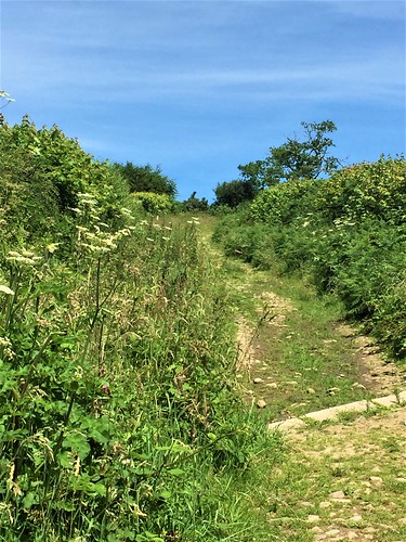
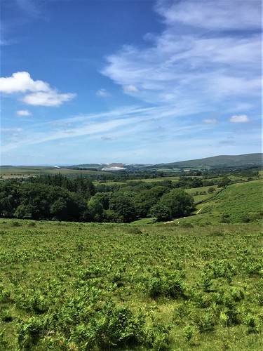
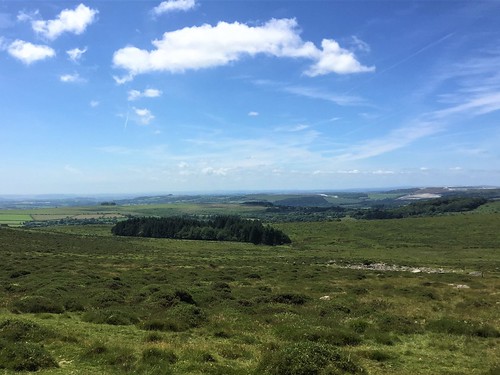
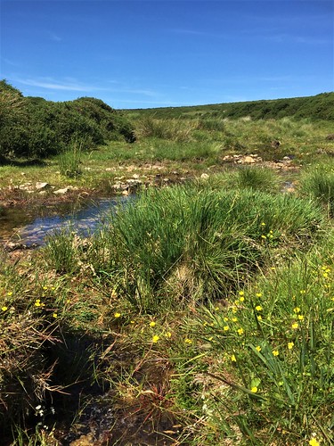
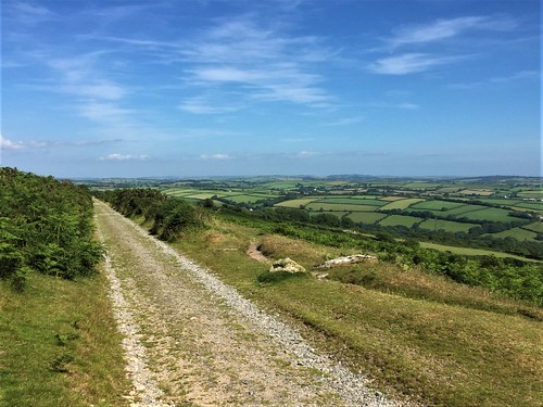
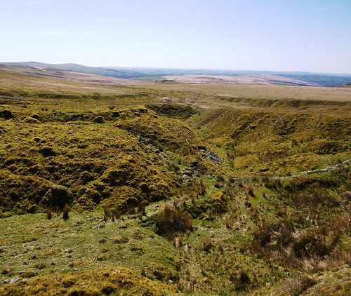
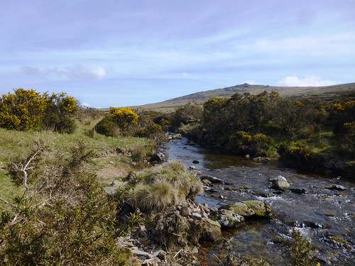
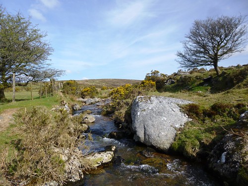
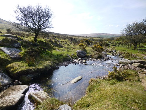
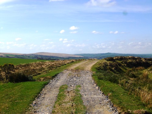
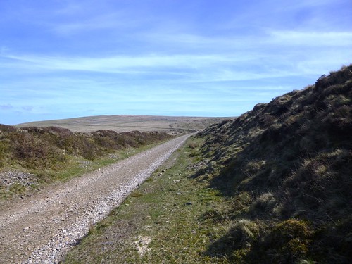
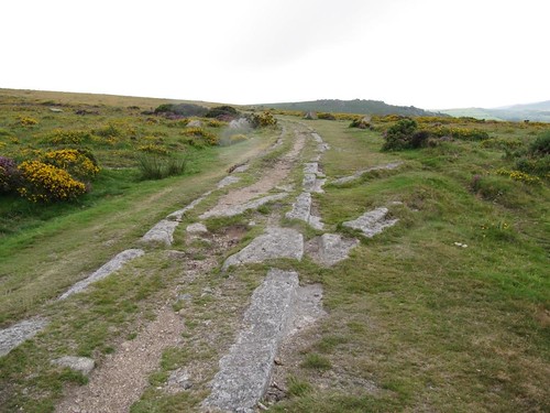
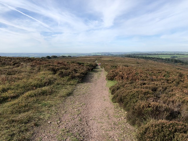
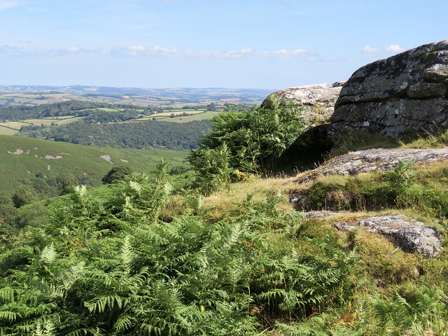
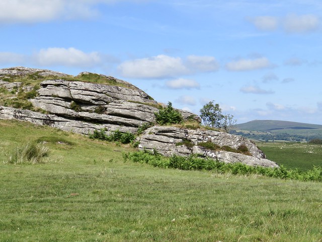
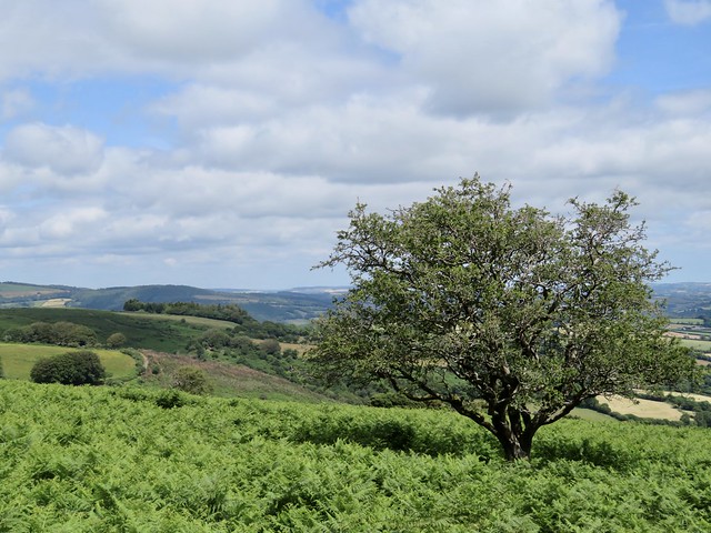
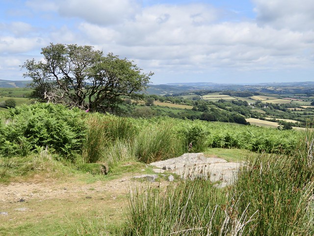
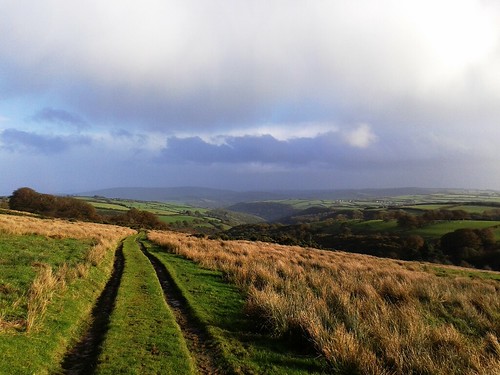
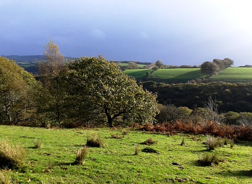
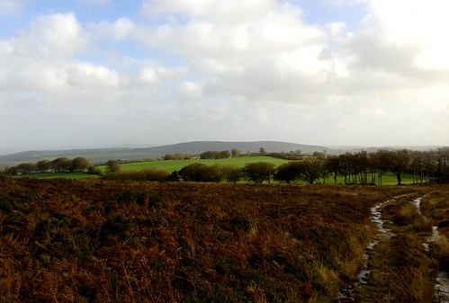
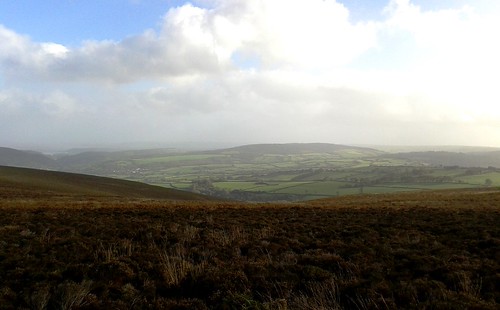
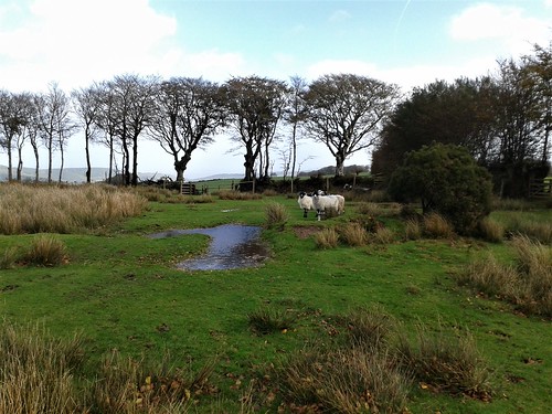
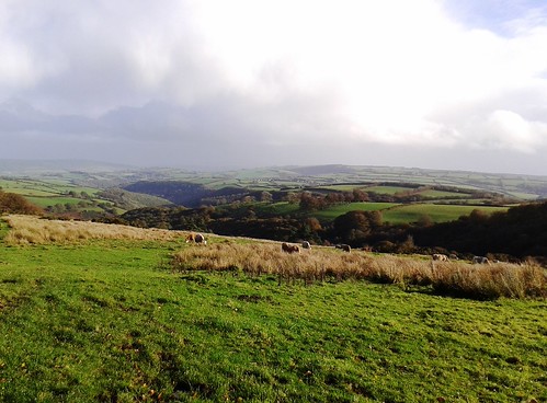
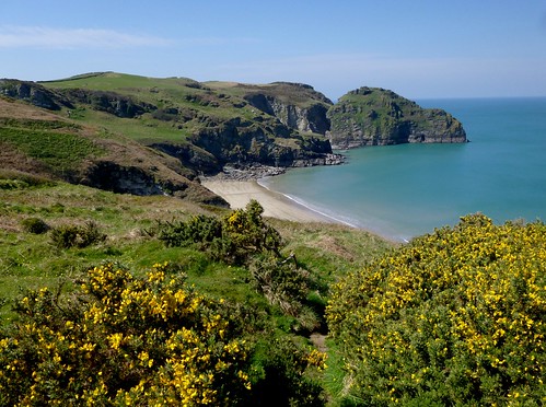
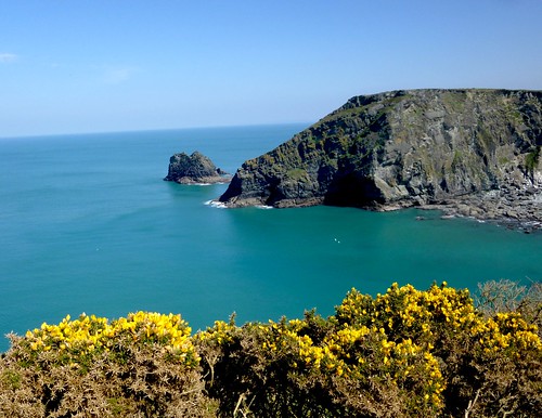
Out on the open moor a broad grassy bridlepath ran south through pale wiry grass. All round the long skyline of the moor swelled, its smooth undulations broken by the hard outlines of granite tors.

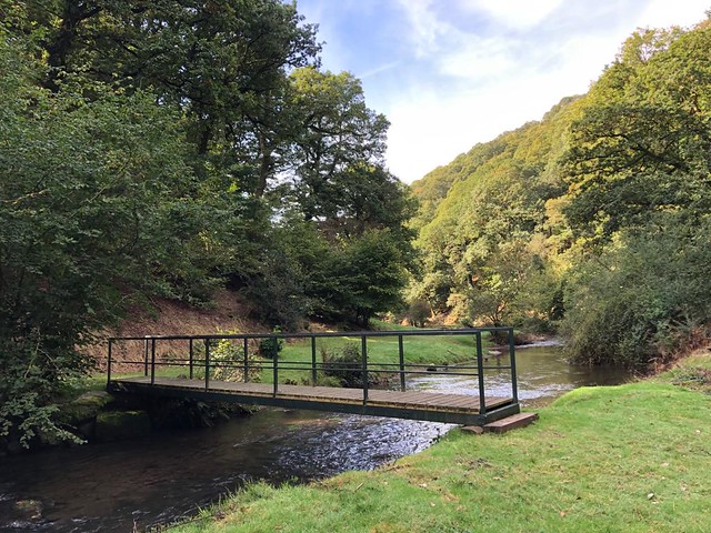
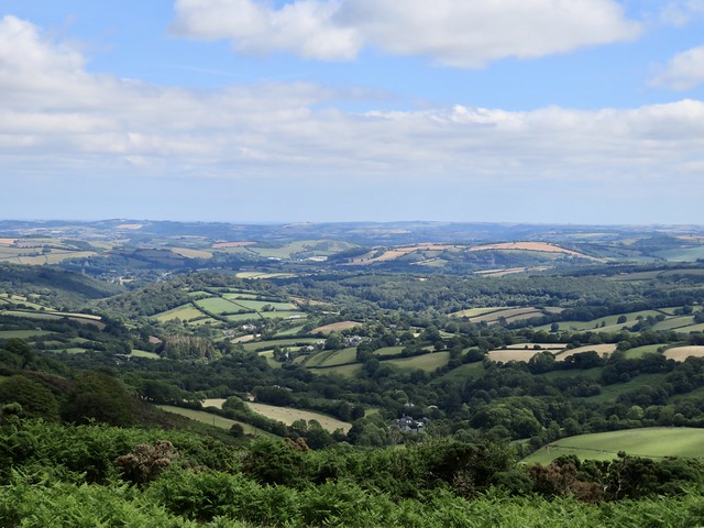
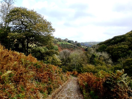
Down in a sheltered hollow the white cottages of Bellever lay cradled in dark forestry. The village has its own clapper bridge; the central slab is missing, and it would be a brave leaper who dared the jump.

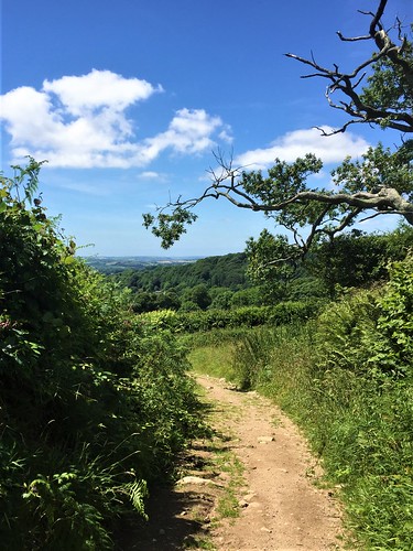
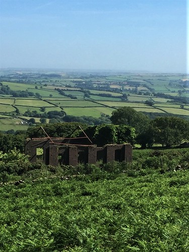
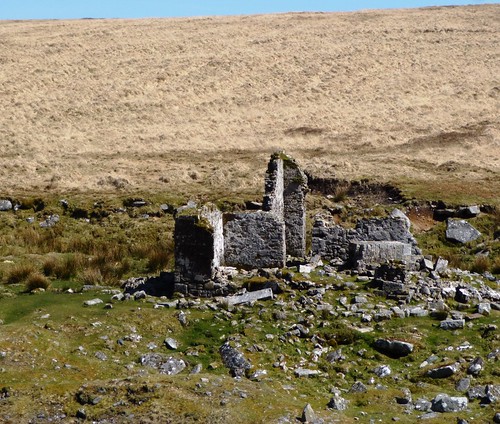
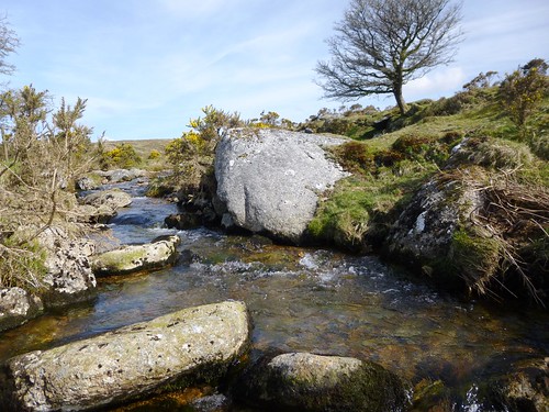
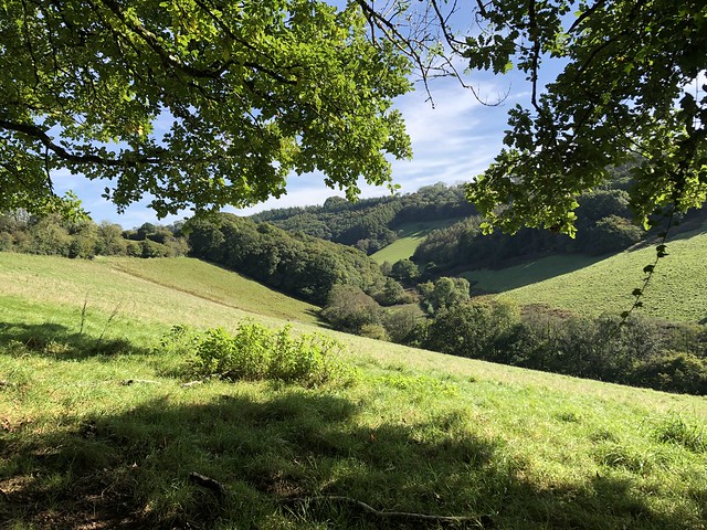
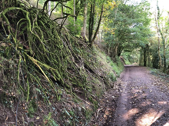
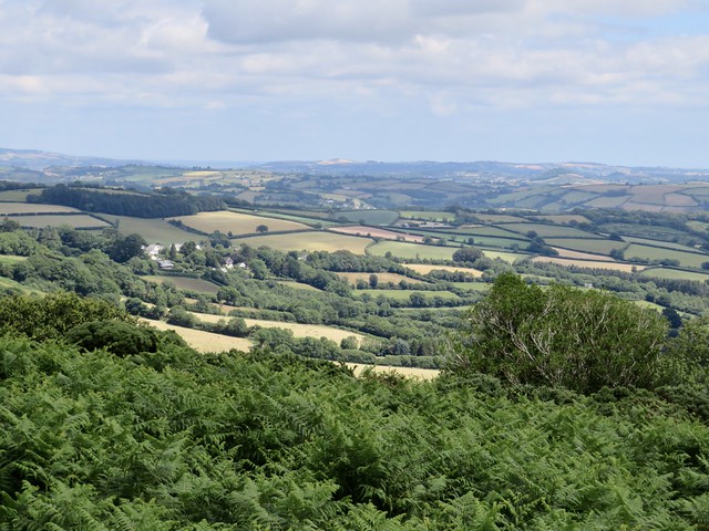
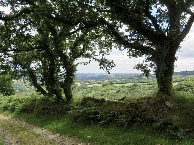
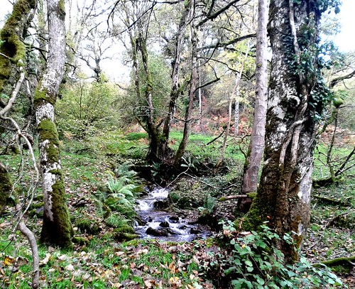
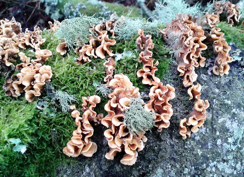
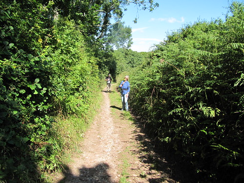
A gravel roadway led through the conifers of Bellever forest to where Laughter Hole Farm lay silent and derelict among ancient trees trailing long green beards of usnea lichen. Beyond the farm the track headed on across the moor, wide open country all round, low ridges and hidden valleys, stunted thorns and willows dotting the coarse grass.

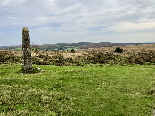
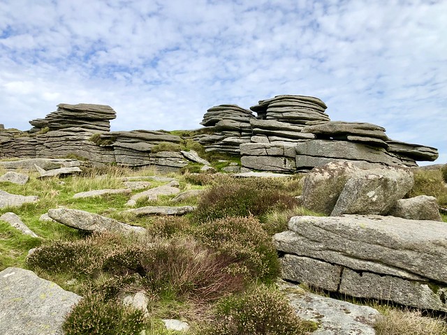
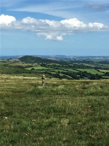
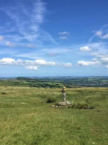
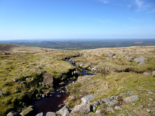
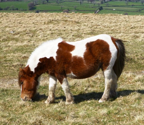
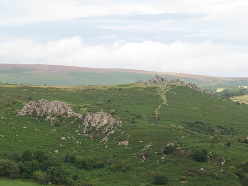
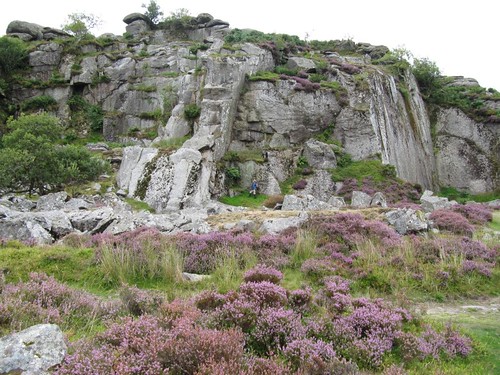
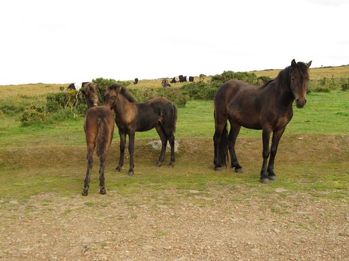
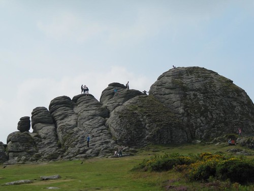
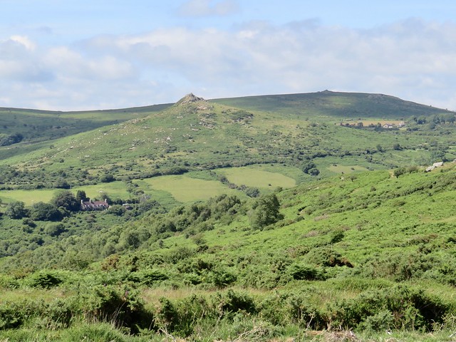
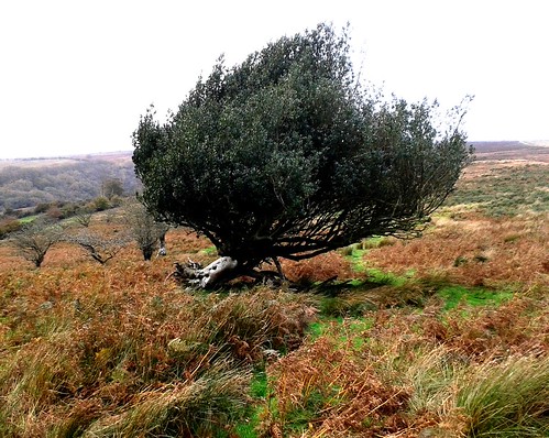
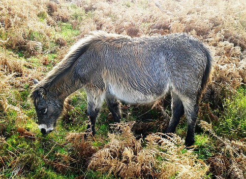
I turned off along a green track to pass the Laughter Man, a 10-ft tall standing stone on the slope of Laughter Tor. From here Bellever Tor stood tall on the western skyline, a jumble of granite that resolved itself as I got nearer into piles of flat wind-sculpted rocks stacked like grey pancakes. Near the top Dartmoor ponies grazed, glancing at me from under their rock star fringes.

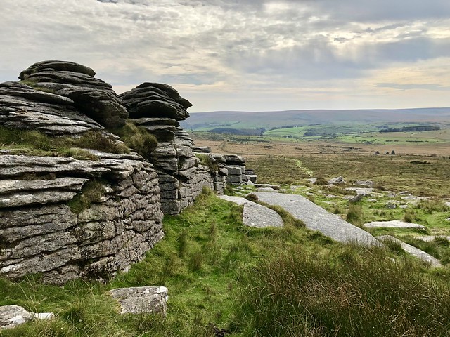
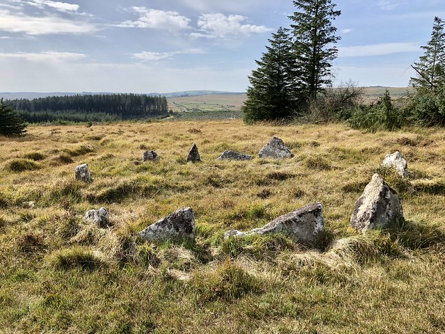
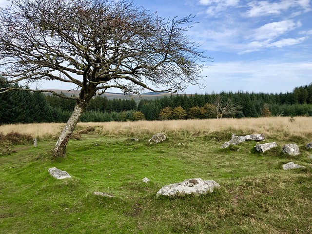
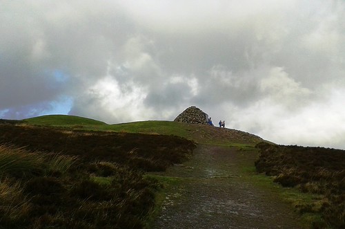
It might have been the arresting profile of Bellever Tor that caused our ancient ancestors to construct their sacred sites across the slopes of Lakehead Hill. I followed a rough path through the tussocks, stumbling upon stone circles, a cist burial under a flat capstone, and a row of twelve tooth-like stones carefully aligned with the rising and setting of the sun.

There was something about these obscure monuments half buried in the moor grass that made me linger in their presence far longer than I’d intended to. Walking on at last, I thought of Tom White of Postbridge, a lovelorn suitor who dallied too long with his girlfriend. The pixies of Bellever Tor caught him on the way home and taught him a lesson by making him dance from midnight till dawn.

How hard is it? 5¾ miles; moderate; rough moorland paths. No recommended in mist.

Start: Bellever Forest car park, Postbridge PL20 6TH (OS ref SX 647786)

Getting there: Bus 98 (Tavistock-Yelverton)
Road – Postbridge is on B3212 between Moretonhampstead and Two Bridges

Walk (OS Explorer OL28): From car park, follow signs to clapper bridge (649788). Just before bridge, turn south off road (‘Bridleway’); up steps onto moor. In ⅔ mile at gate (652778) cross track; bridleway descends into Bellever. At road, left (656773) to clapper bridge (659773). Return along road; left through forest car park; follow track past Laughter Hole Farm (659759). On up hill (‘Country Road B3157’ fingerpost). At gate leave trees (658755); ahead (‘Dunnabridge Pound’). In 500m at cross-tracks (654752), right past Laughter Man standing stone (653753); on towards Bellever Tor. In ½ mile through/over gate (646758); right on grassy track to Bellever Tor summit (645764). Down broad path towards forest; in 400m, fork left (646767) on path up right flank of tussocky Lakehead Hill between forestry blocks. Follow it for 1 mile past cairn circle and cist (644774), stone row (644776) and stone circle (644777) to Kraps Ring settlement (645781). Path through trees beyond (post ‘5A’); in 200m, right on track, then left to Postbridge.

Lunch/Accommodation: East Dart Inn, Postbridge PL20 6TJ (01822-880213)

Info: Visitor Centre, Postbridge (01822-880272, dartmoor.gov.uk)

 Posted by at 03:34
Jul 142018


First published in: The Times Click here to view a map for this walk in a new window
picture picture picture picture picture picture picture picture picture picture picture picture
Facebook Link:

As we crossed Stowford Bridge on the northern outskirts of Ivybridge in proper summer sunshine, the slopes of Dartmoor rose to the north under a blue sky. A stony lane brought us up there, climbing between hedges thick with bedstraw and foxgloves, among which the velvety wings of small heath butterflies flicked open and shut.

Out on the moor cattle and sheep grazed, muzzles all down. Two contrasting landscapes lay in view – harsh green and brown slopes of bare moorland ahead, with a white scab of china clay workings to the west, and the broad stretch of the South Hams of Devon behind us, a patchwork of hedges, woodland, green pastures and the yellow squares of meadows just cut for silage.

Extracting china clay was one of the most important Dartmoor industries in bygone times. In 1911 a narrow-gauge tramway was built from Ivybridge to the Redlake works in the middle of the moor. We followed its snaking course along the flanks of Weatherdon Hill, across stream trickles where dragonflies with biplane wings and electric blue bodies hunted the sodden green jungles of moss.

Beyond the piled granite boulders of Hangershell Rock a stone row crossed the old tramway. No-one knows when this monument of stubby, shin-high standing stones was erected – perhaps 4,000 years ago – but here it still stands, defying time and weather.

A harras* of moor ponies was gathered round a pond, their manes and tails streaming like the steeds of pre-Raphaelite knights. Nearby stood Spurrell’s Cross, weather-beaten and stumpy, a marker of pink granite sparkling with mica, raised by medieval monks to mark the meeting place of two of their routes across the moor. Here we sat, munching chocolate eggs (nutritious, no – delicious, yes) and gazing north-east over thirty miles of tumbled lowlands.

From Spurrell’s Cross we headed south towards Wrangaton along the old monks’ road, a groove in the heather and grass worn by countless boots and hooves. We dropped down to cross Lud Brook at a ford of pink granite rubble. At the foot of Western Beacon we found the old tramway once more, and turned along it for home with half of south Devon spread out gloriously before us in the late afternoon sun.

*Please retain this word – it’s the correct term for a group of these wild ponies!
Start: Stowford Bridge, Cole Road, Ivybridge, PL21 0EY approx. (OS ref SX 641567)

Getting there: Rail to Ivybridge (half mile footpath to Stowford Bridge)
Bus 20A (Plymouth – Macandrew Walk, Ivybridge)
Road – Ivybridge is signed off A38 Exeter-Plymouth. Parking spaces on Cole Road near Stowford Bridge.

Walk (7 miles, easy underfoot, OS Explorer OL28): Cross Stowford Bridge (‘Harford’). In 300m, right opposite Stowford Farm (642570, ‘2 Moors Way’/2MW) up lane. In ½ mile, through gate onto moor (645576); half right on 2MW. In ½ mile, left along tramway track (651583). In 1½ miles, right at pond (658599) for 150m to Spurrell’s Cross. From here, south on broad grass track, keeping Ugborough Beacon on left. In ⅔ mile (663589 approx), keep stream valley close on right, descending to ford Lud Brook (662587). Left along right bank; in 400m through gate (661583); down grass path to gate (661579, ‘Private Property’). Right along edge of Access Land; in 100m, through gate; bear left on grass path round lower slopes of Western Beacon. In ½ mile (658572), right along tramway track. In ¾ mile, left (649575) to moor gate; return to start.

Conditions: Best avoided in mist.

Lunch: Picnic

Accommodation: Anchor Inn, Ugborough, PL21 0NG (01752-690388, anchorinnugborough.co.uk) – excellent, comfortable village inn.

visitdartmoor.co.uk; satmap.com; ramblers.org.uk

 Posted by at 09:30
Jan 172015


First published in: The Times Click here to view a map for this walk in a new window
picture picture picture picture picture picture picture picture picture picture picture picture picture picture picture
Facebook Link:
‘The peat fires!’ rhapsodised Sabine Barry Gould in his 1910 Book of Dartmoor. ‘What fires can surpass them? They do not flame, but they glow, and diffuse an aroma that fills the lungs with balm.’

It wasn’t the dream of a lungful of balm that lured so many 19th-century prospectors out into the wilds of Dartmoor, but the chance of turning a fat profit by distilling naphtha oil from the ‘black gold’ of the peat that blanketed the moors. Naphtha oil could be converted into candles and mothballs, as well as the spectrally flickering naphtha flares that lit the evening markets of country towns.

Following the trackbed of the horse-drawn tramway built in 1879 for the Rattlebrook Peat Works, we marvelled at the ingenuity and sheer muscle power that the moorland railway had demanded – the cuttings in the granite rock, the curves and embankments, the granite sleepers hand-bevelled for the rails. A couple of miles out from the Dartmoor Inn, we stopped and took in a mighty view, forty miles across the dun-coloured moor and green farmlands to a broad strip of cobalt Atlantic where the land met the eggshell-blue sky.

Moor ponies grazed the sunny slopes, their long manes and tails streaming wildly in the cold wind. At the end of the old railway line a hundred men once laboured to dig, dry and load the peat. Here we found a couple of tumbledown peat-drying kilns and two venerable rusty boilers.

Nearby on the banks of the Rattle Brook stood the ruin of the aptly named Bleak House, home of the peat company’s caretaker. All around, the moor slopes had been combed into drainage channels for peat cutting. The ditches, like the ancient packhorse tracks we followed back to the Dartmoor Inn, were already half obliterated by the inexorably growing peat.

Tinning, quarrying, farming, peat cutting – man has tried them all in the wilds of Dartmoor and the land has swallowed all his endeavours. The meadow pipits, the moor ponies and the harshly calling ravens are the true masters of these moors.

Start: Car park off A386 near Dartmoor Inn, Lydford, Okehampton, Devon EX20 4AY (OS ref SX 525854)

Getting there: Bus service 11, 118 (Tavistock-Okehampton)
Road: A30 past Okehampton, A386 towards Tavistock. In 4½ miles, 20m before Dartmoor Inn, left up narrow tarmac lane. Car park is beyond gate.

Walk (8 miles, moderate, OS Explorer OL28. NB: online maps, more walks at christophersomerville.co.uk): Follow stony track by left-hand wall to River Lyd stepping stones/footbridge (532857). Don’t cross; turn left beside river for a ⅓ of a mile. Where wall turns left (532863) keep ahead; in 50m, cross old tramway; on up path opposite. In 100m, right (533865) along higher tramway track, passing Great Nodden. In 1¾ miles, reach reversing point/turning circle on Coombe Down (546887). Hairpin back up to right; follow tramway track for 1½ miles to ruined kiln houses (560871). Just before ruin, right on boggy track for 500m. 100m before Bleak House ruin, cross Rattle Brook (560866); follow clear track, bearing away from brook. Pass Lower Dunna Goat tor; in another 250m, turn right/west (557861) on wide, well-walked bridleway path for 1¾ miles to River Lyd footbridge (532857), aiming to descend between Arms Tor and Widgery Cross. Ahead to Dartmoor Inn.

NB: Good boots, hill walking gear. Map, compass, GPS. Not advisable in heavy mist.

Lunch/Accommodation: Dartmoor Inn, Moorside, Lydford (01822-820221, dartmoorinn.com)

Info: Museum of Dartmoor Life, Okehampton (01837-52295, museumofdartmoorlife.co.uk) or Princetown Visitor Centre (01822-890414)
www.satmap.com; ramblers.org.uk; LogMyTrip.co.uk

 Posted by at 01:15
Nov 062010
 

First published in: The Times Click here to view a map for this walk in a new window
picture picture picture picture picture picture picture picture
Facebook Link:
" 'Mr Holmes, they were the footprints of a gigantic hound!' "

The most thrilling and chilling lines in The Hound of the Baskervilles were first read by ten-year-old me under the bedclothes with a frisson of pure, delicious fear. I’ve loved Holmes and Watson’s great supernatural Dartmoor caper ever since. And although the real Hound Tor isn’t quite within howling distance of Conan Doyle’s fictional Great Grimpen Mire, I just couldn’t resist that atavistic name when it came to choosing a walk on the moor.

It turned out misty – well, of course. As soon as Jane and I had climbed from Haytor Vale up onto the open moor, ghostly hands began to draw a white woollen blanket across the granite tors and the undulating sea of gorse and heather in which they rode like weathered grey ships. The twin hulks of Haytor Rocks slipped out of sight, and nearer at hand a harras of moor mares and their foals faded to insubstantial silhouettes. But moor mists are funny things, and this one ran up against an invisible barrier. Smallacombe Rocks, our aiming point, remained in broad sunlight, and from the tor we saw the dog’s tooth of Hound Tor sharply outlined against blue sky across the steep little valley of the Becka Brook.

We descended among crab apples, sloes and whortleberries, and crossed the Becka Brook by a stout old clapper bridge. Up in the shadow of Hound Tor the path ran past a tight-packed maze of stone-built dwellings, smothered in bracken and bramble. The high ground of Dartmoor may be deserted today, but in medieval time it was spattered with shepherding and tin-mining settlements such as this.

On the peak of Hound Tor we paused to breathe and take in the view. Then it was on, down to ford the Becka Brook, up again to follow the rails and sidings of the Haytor Granite Tramway. Laid down in the 1820s, its railway lines carved out of solid stone, the tramway trundled granite from the Dartmoor quarries to build some of London’s greatest Victorian edifices.

Haytor Rocks stood clear of the receding mist. We climbed to the top and surveyed the moor. Snaking away through the purple-gold landscape, the chunky granite tramway looked endearingly clumsy – as though a troll had taken a peep over George Stephenson’s shoulder, and decided to do a bit of DIY on his own account.


Start & finish: Rock Inn, Haytor Vale TQ13 9XP (OS ref SX 771772)

Getting there: Haytor Hoppa bus service 271 (Sat April-Oct, plus Thurs May-Sep) from Bovey Tracey (www.dartmoor-npa.gov.uk/vi-haytorhoppa)

Road – M5, A38, B3344 to Bovey Tracey; B3387 towards Widecombe-in-the-Moor; in 3 miles, Haytor Vale signed to left.

Walk (6½ miles, moderate, OS Explorer OL28): Leaving Rock Inn, right for 50 yards; on bend, ahead (bridleway fingerpost); in 75 yards, right (‘Moor, Smallacombe’). In 350 yards, in a dip, fork left through turnstile; follow roadway to cross B3387 (778773). Up path opposite through bracken to ridge; left towards Haytor Rocks for ⅔ mile to cross Manaton road through car park (770778). Follow clear track across Haytor Down, with Haytor Rocks ¾ mile away on your left. Just before reaching Smallacombe Rocks, bear right/north (756782) down rocky path. In 300 yards, at fork, left downhill past fingerpost (754786; ‘Houndtor Down’). Follow bridleway to cross Becka Brook (752787); uphill past medieval settlement (746787) to Hound Tor (742789).

Retrace steps for 300 yards; right (south) along green path just above settlement, with Greator Rocks on left. In 100 yards pass waymark post, and on. In 300 yards, through gate (745783); left (‘Haytor Down’); descend to ford Becka Brook (747778). Up path opposite, aiming for Holwell Tor, to reach Haytor Granite Tramway track just below it (750778). Left along it. In ⅓ mile, pass branch to right (757777); in another ¼ mile, right (761777) along branch through quarry to climb Haytor Rocks (757771). Aim for Dartmoor National Park centre on B3387 below (767772); left along road; in 100 yards right, then immediately left to Haytor Vale.

NB – In mist, only for map/compass/GPS users.

Online maps, more walks: www.christophersomerville.co.uk

Lunch/accommodation: Rock Inn, Haytor Vale (01364-661305; www.rock-inn.co.uk)

Cottage rent: Beam Ends, Haytor Vale (Jill Morrish, 01364-661376, morrish.beamends@talktalk.net)

More info: Ashburton TIC (01364-653426); www.dartmoor.co.uk; www.visitdevon.co.uk

Dartmoor National Park Visitor Centre, Haytor (01364-661520) – books, guides, maps, advice

www.ramblers.org.uk; www.satmap.com


 Posted by at 00:00
May 092009
 

First published in: The Times Click here to view a map for this walk in a new window
Facebook Link:

Whatever the Tradesman’s Arms put in their beef jalfrezi on Curry Night, it revved me right up for a brilliant walk the following day. The hamlet of Scorriton, sitting tight under the eastern rim of Dartmoor, almost lost its pub a few years back, and the shock of that threat galvanised the Tradesman’s Arms into a whole sparky new life. The food’s good, the beer’s excellent, and the social life that revolves around the little inn, from poetry nights to quizzes and singsongs to story-telling, is just amazing. If only all rural communities could respond like tiny Scorriton to the gradual sapping of their resources!

I strode up the stony lane to Chalk Ford like a man on a mission. Misty weather was forecast for later in the day, and though I had my trusty Satmap GPS device in my pack, I didn’t particularly want to find myself in a Dartmoor pea-souper. Once across the rushing River Mardle and up on the moor proper, I found the old track to Huntingdon Warren and hurried along it. When the broad slope of the Warren hove in view beyond the curve of the moor, the ancient settlements, the rabbit warrener’s mounds and the bumpy burial monuments of many millennia stood out unmistakeably.

I got over the lower wall and climbed the hill past the pillow mounds where the farmer/warrener fed and nurtured the rabbits he culled for market. From the crest of the hill I looked down on the ruins of Red Lake china clay works and the huge green and black cone of waste left by the workers. They plagued the merry hell out of the warrener with their poaching raids, undeterred by the security men he posted around his domain.

Back down by the Western Wella Brook I found the little stone-lined hollow of Mattins Corner, with the cross-inscribed stone that Keble Martin set up as a devout young lad in 1909. The future naturalist, painter and author of The Concise British Flora often camped here with his brothers, gaining inspiration from this exceptionally lonely, bleak and beautiful hollow in the moor.

Beyond Mattins Corner stood Huntingdon Cross, carved in granite who knows how many hundreds of years before the Martin brothers created their rough chapel. A gauze of rainy mist came trailing down along the wind. I patted the harsh, weather-smoothed cross for good luck, and then made over Hickaton Hill for Scorriton by luck, GPS, compass and the pricking of my thumbs.

Start & finish: Tradesman’s Arms, Scorriton, Devon, TQ11 0JB (OS ref SX 704685)

Getting there: A38 to Buckfastleigh; signs to Buckfast, then Scorriton.

Walk (OS Explorer OL28):

Easy (4 miles): From village square, pass The Barn B&B and on up lane for 1¼ miles to Chalk Ford (685681). Cross River Mardle; left along lower field edge for ½ mile to Lud Gate (683673). Left down Strole Lane for ¼ mile, left (689673) through Scae Wood to Higher Coombe (700681), Combe and Scorriton.

Moderate (5½ miles, excluding exploration of Huntingdon Warren): From Chalk Ford, diagonally left (SW) up slope for nearly ¾ mile to meet track from Lud Gate at 679678. Bear right and follow track for ¾ mile to Huntingdon Warren wall (667670). Return to Lud Gate; as above to Scorriton.

Hard (6½ miles, as above): At Huntingdon Warren wall, left past Mattins Corner (666665) to Huntingdon Cross (665662). Bear left diagonally up slope of Hickaton Hill, keeping left of large circular enclosure, and follow faint track ENE, then NE for nearly 1 mile to meet Lud Gate track (676671). Right to Lud Gate, as above to Scorriton.

NB: Moderate and hard walks – faintly marked paths, rough open moorland, hard to follow in mist. For walkers competent with map, compass and/or GPS.

Lunch:

Short walk – Tradesman’s Arms, Scorriton (01364-631206; www.thetradesmansarms.co.uk); longer walks, take picnic.

Accommodation: The Barn, Scorriton (01364-631567; www.thebarndartmoor.com) – excellent, welcoming place; £60 dble B&B.

More info: Buckfastleigh TIC (01364-644522; www.visitdevon.co.uk)

 Posted by at 00:00
Nov 182023


First published in: The Times Click here to view a map for this walk in a new window
Brutalist concrete dam at Wimbleball Lake footbridge over River Haddeo in Hartford Bottom Wimbleball Lake from Haddon Hill 1 Exmoor pony on Haddon Hill with Wimbleball Lake beyond pink sandstone track on Haddon Hill steep green pastures beside Haddon Lane 1 steep green pastures beside Haddon Lane 2 packhorse bridge and ford at Bury in Hartford Bottom between Hartford and Bury

Unseasonably warm, unseasonably sunny – so said everyone in the car park as they prepared for their Sunday constitutionals across Haddon Hill, a fine double hump of sandstone standing proud on the south-eastern edge of Exmoor.

Once out on the open moor there were dark shaggy Exmoor ponies cropping the grass among the bracken, stonechats with black caps and white clerical collars calling wheesht-chip-chip! from the tips of gorse bushes, and a wonderful view north down to Wimbleball Lake lying as smooth as iced glass.

On top of the trig pillar at the summit of Haddon Hill sat a tiny boy clutching a woollen rabbit. His father teetered a-tiptoe behind him on the pillar, expounding on the remarkable view from the Exmoor outliers in the north to the craggy profile of distant Dartmoor away to the south.

I followed a rubbly track steeply down through a bronze sea of bracken towards the lake. Autumn seemed on the cusp of handing over to winter with the silver birch already bare, leaves of toffee and lemon hue lining the verges of the paths, and a robin giving out that sharp silvery burst of song so characteristic of woodland at the dead end of the year.

The dam wall and control house of Wimbleball Lake are an essay in stark brutalist concrete, in striking contrast to the naturalistic curves of water and woodland. A boy came riding his bike across the dam, wheelie-ing all the way and grinning like a prancing cowboy at a rodeo.

Down in the depths of Hartford Bottom, the densely wooded combe beyond, I trudged the muddy track from the few cottages of Hartford past the bubbling tanks of a fishery and on beside the meanders of the fast-rushing River Haddeo. A beautiful green cleft in the hills, mossy and full of the noise of lively water.

At Bury a car moved slowly between the trim stone cottages before inching across the village ford. I crossed the river alongside by way of a handsome old packhorse bridge with humpy back and pointed arches. Then it was a long winding climb from the sunny valley up to the open moor again under the overarching beeches of shaly, slippery Haddon Lane, half steep holloway, half trickling stream.

How hard is it? 6½ miles; moderate; bridleway road from reservoir dam down to Hartford is slippery; muddy between Hartford and Bury, and in Haddon Lane.

Start: Haddon Hill car park, near Dulverton TA4 2DS (OS ref SS 970284)

Getting there: Car park is off B3190 (Watchet-Bampton) between Ralegh’s Cross and Morebath.

Walk (OS Explorer OL9): Through gate at NW (top left) corner of car park. Bear right away from trees; follow main stony track gradually uphill to pass trig pillar (962286). Continue along track; in 300m fork right on grass path; in 150m sharp right (959286) on track heading for lake. In ½ mile fork left (967288) downhill past reservoir to road (969288). Left downhill to pass dam (965292). Continue downhill (‘Hartford ½’); at road, left (960294) through Hartford and on (‘Bury 2’). At Bury, left across bridge (945274). In 150m, just past Chilcotts house, left up Haddon Lane (‘Haddon Hill 1¼’). At Haddon Farm (955281) dogleg left/right onto track (‘Haddon Hill’). In 400m fork right through trees (958281, ‘Bridleway Upton’). In 100m into field; ahead through gate; half left up field slope to gate at far top left (962282). Forestry track to car park.

Lunch: Picnic

Accommodation: Ralegh’s Cross Inn, Brendon Hill TA23 0LN (01984-640343, raleghs-cross.co.uk)

Info: visit-exmoor.co.uk

 Posted by at 01:51
Aug 012020


First published in: The Times Click here to view a map for this walk in a new window
picture picture picture picture picture picture picture picture picture picture picture
Facebook Link:

The painted saints contemplated one another from their rood screen panels in the Church of St Mary the Virgin at Holne. Looking at their long, expressive faces and richly coloured robes, we wondered what could have persuaded an artist of such talent to come in Tudor times to this obscure village church under the eastern rim of Dartmoor. Whoever he was, he left a remarkable legacy here.

Holne lies sunk in a hollow above the young River Dart. A green churchyard path led out of the village, and soon we were descending the narrow road to Michelcombe under a hot afternoon sun. Cooper the golden retriever bounced out of a house to bark us on our way up a clinking stony lane that climbed towards the moor.

Sheep lay panting on a heap of soil in a gateway, their chins pressed deep into the cool earth. The views broadened all the way, south and east over steep pastureland to where the sea lay beneath a grey haze in Tor Bay.

A gate led out onto the open moor. We crossed the granite bars of an ancient cattle grid over Wheal Emma Leat, once the power source for the tin mines of this area, now a low ditch half hidden among sedges.

A path wound through the bracken, heading northeast, its dry peat surface stamped with the prints of sheep’s hooves and pony shoes. Soon it made rendezvous with a moor road that ran between banks of devil’s-bit scabious and wild thyme.

A dozen moor ponies were hanging out in the car park at Venford Reservoir, moodily swishing their long tails as they waited for tourist sandwiches. We made for the flat granite boulders of Bench Tor, a grandstand from which to admire the giant view and to spy out the homeward path.

A precipitous scramble down beside a stone wall into the depths of the River Dart’s gorge, a delicious cool plunge in the peat-dark waters of Sharrah Pool, and we were heading back to Holne on the riverside track through oak woods where the declining sun dappled tree trunks, pathway and the shallows of the river in the quiet valley.

Start: Village car park, Holne, Newton Abbott TQ13 7SL (OS ref SX 706695)

Getting there: Holne is signposted off B3357 Two Bridges road, west of Ashburton (A38)

Walk (7½ miles, moderate/strenuous, OS Explorer OL28): From west end of church, left through hedge gap; right (fingerpost/FP) across field. Cross road (705694); on to Michelcombe. Right at junction (697690), follow ‘Bridleway’ up stony track. In ½ mile, ahead through gate (687690) onto Access Land; same direction to cross stone bars over Wheal Emma Leat (685691). In 150m, right on grass track (685692); in 500m, meet and follow wall (687697); in 400m, join stony road (690698). Cross stream (692699); in 150m, sharp right at junction (691700) to road (694701). Left to Venford Reservoir car park (688709). Aim across moor to Bench Tor (692716); then southeast to corner of stone wall (692715). Keep wall on right; in 300m, follow it left (695713), very steeply down beside wall through woods to River Dart (697715). Left along track to Sharrah Pool (696717). Return along track and on. In 1¾ miles hairpin sharp right (711703, FP on right) up Two Moors Way back to Holne.

Conditions: Very steep descent to River Dart – for surefooted people! Unwaymarked paths across the moor.

Picnic: On Bench Tor, or down by the River Dart

Info: Totnes TIC (01803-411183); visitsouthdevon.co.uk; satmap.com; ramblers.org.uk

 Posted by at 01:17
Oct 272018


First published in: The Times Click here to view a map for this walk in a new window
picture picture picture picture picture picture picture picture picture picture picture picture picture
Facebook Link:

A wild, blustery autumn day had marched in on Exmoor from the west. We waited in the car park at Dunkery Gate until the rain army had charged through and away, and set out in its heels to climb the path to the crest of Dunkery Beacon. A piglet-like squealing came down the wind from above, and when we came over the brow we found three children leaping and yelling for sheer glee round the summit cairn, their coats flying in the gale.

Up here on Exmoor’s highest point, standing by the cairn on the rocky tomb of some long-forgotten king, we drank in the view, as brisk and refreshing as a great gulp of cold water. Ninety wide and beautiful miles stretched out from the tiny tip of the Sugar Loaf, north across the Bristol Channel in Wales some 50 miles away, to Yes Tor’s hummock on Dartmoor nearly 40 miles to the south. Not that we could see those two distant landmarks in such conditions of wind and sun dazzle and rain curtains – it was enough to know they were out there, visible from Dunkery Beacon on the clearest of clear days. What we saw today were rolling ridges of moorland, humped green fields squared with tall hedge-banks, and a sunlit valley leading north to the bulky seaward slope of Hurlstone Point.

We turned east on the rocky ridge track, bowling along with the wind astern pushing us like a second-row rugby forward. The sun burst out across the hills, bringing the whitewashed farm houses far below into brilliant relief against their green meadows and woods. Suddenly a flight of twenty small birds went skimming across the path just ahead, cutting and turning like one creature, the sun flashing on their white breasts and sabre-blade wings – dunlin or plovers, they passed and vanished too quickly to be sure.

From the ridge, a squelchy river of a bridleway made a sloshy descent southward into the sheltered cleft of Mansley Combe. Down here, deep sunk in the valley bottom, the day fell suddenly calm. Gale-driven clouds tore over from rim to rim of the combe a hundred feet overhead, and the wind rushed and sighed in the beech canopy where leaves scattered horizontally in showers of gold.

We forded the River Avill, hurrying in bubbles and miniature rapids under a canopy of silver birches and luxuriant, rain-pearled ferns. As we followed the red mud track steeply up towards Dunkery Gate again, from the trees in the depths of the combe came a grinding, grating roar – a red stag bolving*, calling out a defiant rutting challenge to all comers, a wild voice to suit the wild day.
* Yes, that’s the word!

Start: Dunkery Gate car park, near Wheddon Cross, TA24 7AT approx (OS ref SS 896406)

Getting there: Dunkery Beacon is signed off B3224, 1 mile west of Wheddon Cross (A396 Dunster-Dulverton)

Walk (4½ miles, moderate, OS Explorer OL9): Cross Dunkery Bridge; in 100m, left (‘Public Bridleway Dunkery Beacon’) to summit cairn (892416). Right along main ridge track for nearly 1 mile. Cross road (904420) and continue; in 300m, right (907422, cairn) on bridleway through heather for nearly 1 mile. At hedge-bank (914410), don’t go through gate; turn right, keeping hedge-bank on left. In 450m, bear sharp left (910410); follow hedge-bank downhill, through gate (910407, ‘bridleway’), down to track in combe bottom. Right (‘Draper’s Way, Dunkery Gate’); uphill for 1 mile to Dunkery Gate.

Lunch/accommodation: White Horse, Exford, TA24 7PY (01643-831229; exmoor-whitehorse.co.uk)

Information: National Park Centre, Dulverton (01398-323841); visit-exmoor.co.uk
satmap.com; ramblers.org.uk

 Posted by at 02:22
May 022015


First published in: The Times Click here to view a map for this walk in a new window
picture picture picture picture picture picture picture picture picture picture picture picture picture picture picture picture
Facebook Link:
There’s no shortage of plumed helmets, dragon-roaring shields, coats of mail, crossbows and swords – some of these real enough to cleave a foe in twain – in English Heritage’s child-friendly shop at the gates of Tintagel Castle.

I crossed the footbridge slung over the chasm that separates the mainland from the castle on its massive, rock-like promontory, known as The Island. Here, protected by sheer cliffs on all sides, a prosperous community traded tin for Mediterranean pottery and glassware in post-Roman times. And here, if the ancient chroniclers and poets can be believed, Arthur the Once and Future King was conceived of an adulterous union (magically facilitated by the wizard Merlin) between the British King Uther Pendragon and the Duke of Cornwall’s wife, beautiful Igraine.

Was Arthur born at Tintagel? Or was he washed up there on a tempest-driven wave, to be raised by Merlin in the cave that still underpins The Island? And what of the ancient stone inscribed with Arthur’s name, unearthed at Tintagel in 1998? I pondered these signs and wonders as I explored the tiny Dark Ages dwellings and the stark castle ruins on the promontory. Then I set out north along the coast path with the sun on my back and the wind in my face.

It was a springtime day in a thousand, under a sky of unbroken blue. The path wound into and out of hidden valleys, swung up flights of steps and slithered down over slaty rocks. Primroses, white sea campion and pink tuffets of thrift trembled in the strong sea breeze. Herring gulls wheeled and wailed above a sea of milky turquoise two hundred feet below. Ahead, the cliffs crinkled around tiny rock coves, leading the eye forward to a great curve of coast where Cornwall ran north into Devon.

In the gorse banks above Smith’s Cliff, tiny Dartmoor ponies galloped skittishly to and fro. I walked out to the spectacular sheer-sided promontory of Willapark, one among dozens of sections of this precious piece of coastline bought by the National Trust with funds raised through their Neptune Coastline Campaign – 50 years old this very month. Beyond Benoath Cove’s perfect fingernail of dull gold sand lay Rocky Valley, where the Trevillet River jumps down towards the sea over a series of rock steps. I crossed a little grassy saddle near Firebeacon Hill, brilliant with violets and shiny yellow stars of celandine.

Under the white tower of a coastguard lookout, the coal-black cliffs of Western Blackapit stood twisted, contorted and streaked with splashes of quartzite as though a painter had flicked his brush across them. Beyond the promontory, the white houses of Boscastle lay hidden in their deep narrow cleft, appearing in sight only at the last moment as I turned the corner by the harbour wall – a magical revelation of which Merlin himself might have been proud

Start: Tintagel Castle, near Camelford, Cornwall, PL34 0HE (OS ref SX 052889)

Getting there: A30, A395, B3266; or A39, B3263 to Boscastle. Park in village car park (PL35 0HE) – about £5 in coins. Then take bus 595, or taxi (£10, Boscars, tel 07790-983911, boscars.co.uk) to Tintagel. Walk down to castle entrance.

Walk (6 miles, strenuous, OS Explorer 111. NB: online maps, more walks at HYPERLINK “http://www.christophersomerville.co.uk” christophersomerville.co.uk): Follow South West Coast Path to Boscastle.

Conditions: Many steps and short steep sections

Lunch/Tea: Harbour Lights Tea Garden, Boscastle (01840-250953)

Accommodation: Mill House, Trebarwith, near Tintagel, PL34 0HD (01840-770200, themillhouseinn.co.uk)

Tintagel Castle (English Heritage): 01840-770328; english-heritage.org.uk

NT South West Coastal Festival 2015: nationaltrust.org.uk/visit/south-west

Info: Boscastle TIC (01840-250010)
satmap.com; ramblers.org.uk; LogMyTrip.co.uk

 Posted by at 02:13
Apr 162011
 

Goliath lay at ease in Churston station, lazily jetting steam and curls of smoke into the cloudless blue South Devon sky.
First published in: The Times Click here to view a map for this walk in a new window
picture picture picture picture picture picture picture picture
Facebook Link:
We stood watching – Jane, her sister Susan and I – mesmerised by the sounds and smells of childhood. ‘She’ll stay there till she’s ready to go,’ was the Zen-like observation of the man on the bridge. When the little black tank engine finally moved off, chuffing and clanking, her place at the platform was taken by Lydham Manor, resplendent in Great Western Railway green, simmering like a kettle and emitting mournful hoots like an owl on the boil.

Out beyond the village we found stony Combe Lane rising gently, a hollow way through unseen fields. Buildings, cars and the trains of the Dart Valley Railway had all been whisked out of sight and earshot in a fold of the landscape, and we walked in a tunnel of blackthorn bushes and coarse-leaved elm suckers bursting with finch song. It wasn’t until we were standing tiptoe on the fence at the crest of the hill like inquisitive kids (it must have been the Goliath effect) that we caught our first glimpse of the Dart estuary, a blue gleam between wooded hills, a scatter of yachts, a sprinkle of civilisation around Torbay, and the jagged granite vertebrae of Haytor sticking out of the back of Dartmoor on the northern horizon a dozen miles off.

Beyond Higher Greenway and tree-cloaked Oakham Hill we followed a permissive path near the narrow estuary, south along a hillside where Long Wood clung steeply above the river. A hoot and a rapid panting from down by the Dart betrayed Goliath’s progress along the waterside line. A gap in the trees allowed a peep over the river, a jade-green snake between dark woods and fields of deep red Devon soil. ‘I-think-I-can, I-think-I-can!’ fussed invisible Goliath.

Down and out of the woods, descending paths to emerge on the River Dart opposite the Royal Naval College, huge in red brick, all towers and ranks of windows on its hill. Trundling ferries churned the estuary between Kingswear and Dartmouth, opposing nests of tight-packed houses, blue, pink, white, yellow on the steep, as pretty as a picture. As we walked between river and railway towards Kingswear, Lydham Manor came hissing past in a cloud of pungent coal smoke, every carriage window filled with faces, an escapist grin across every one.

Start: Churston station, Dart Valley Railway TQ5 0LL (OS ref. SX 894563)
Finish: Kingswear station TQ6 0AA (OS ref SX 881510)
Getting there: Train (www.thetrainline.com; www.railcard.co.uk) to Paignton; Dart Valley Railway (01803-555872; www.dartmouthrailriver.co.uk) to Churston.
Road: A379 Paignton-Dartmouth; Churston station signed in Galmpton.
Walk (5 miles, moderate, OS Explorer OL20): Leaving Churston station, left across railway; left down Greenway Road. In ⅓ mile, left past Manor Inn. Up hill; left along Kennel Lane; cross railway; right along Combe Lane (‘Greenway Walk’/GW). In ⅔ mile at top of rise among trees, right (blue arrow, GW) along hedged lane. Cross stile; follow hedge/fence for ⅓ mile. Just before gate of Higher Greenway, left (‘permissive path’; Dart Valley Trail/DVT) into Long Wood. Steeply downhill; follow track (white, blue arrows). Where DVT turns steeply downhill to right by wooden frame, keep ahead. In 1 mile path hairpins right; descend to bear left across stream (DVT). Follow DVT for ½ mile to cross A379; on along roadway; in 400m, right (DVT) down path; cross road and railway; left along estuary to Kingswear station.
NB – Online maps, more walks: www.christophersomerville.co.uk
Lunch: Royal Dart Inn (01803-752213), Ship Inn (01803-752348; www.shipinnforecast.com), Kingswear
More info: Dartmouth TIC (01803-834224; www.discoverdartmouth.com)
www.ramblers.org.uk www.satmap.com www.LogMyTrip.co.uk
Llanelli Festival of Walks, Carmarthenshire: 27–30 May 2011

 Posted by at 05:00