Search Results : essex

Dec 042021


First published in: The Times Click here to view a map for this walk in a new window
leaving Sydling St Nicholas along the rutted path of the Wessex Ridgeway Norden Hill from the River Frome valley 2 winter shadows in the lane near Cattistock Norden Hill from the River Frome valley 1 wintry fields near Maiden Newton view west from Wessex Ridgeway toward Frome Valley looking back east over Sydling St Nicholas 2 looking back east over Sydling St Nicholas 1 Sydling St Nicholas church rustic fence by Sydling St Nicholas churchyard teasels by the path to Sydling St Nicholas muddy lane to Sydling St Nicholas path up Middle Hill Lankham Bottom and the flank of Middle Hill 1

Sunk deep in the green downland valley of the River Frome lies Maiden Newton, a sprawling village, with its church tower upstanding yet far below the skyline. Dorset dialect poet William Barnes caught the scene in his poem ‘The Fancy Feäir’:

‘The Frome, wi’ ever-water’d brink
Do run where sholvèn hills do zink,
Wi’ housen all a’cluster’d roun’
The parish tow’rs below the down.’

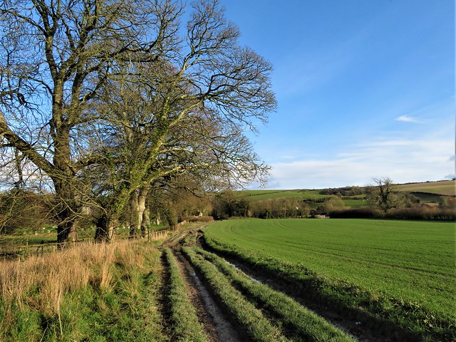
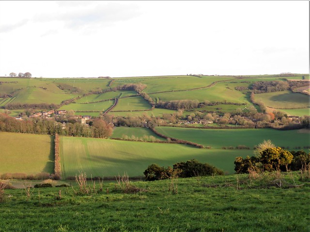
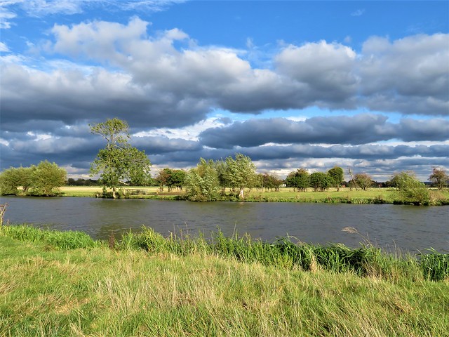
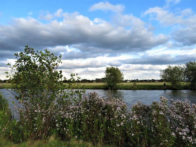
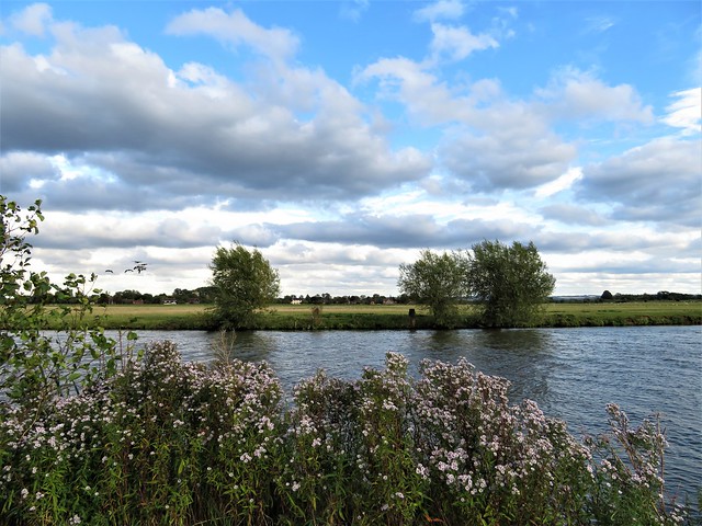
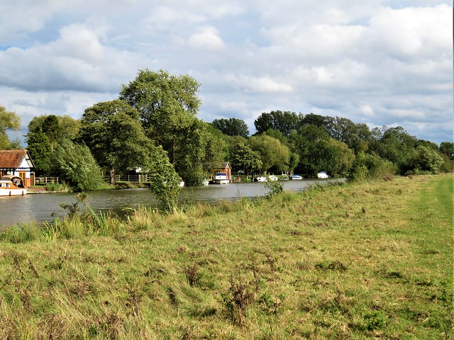
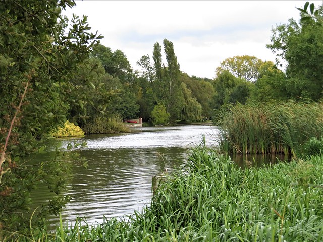
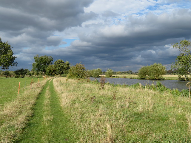
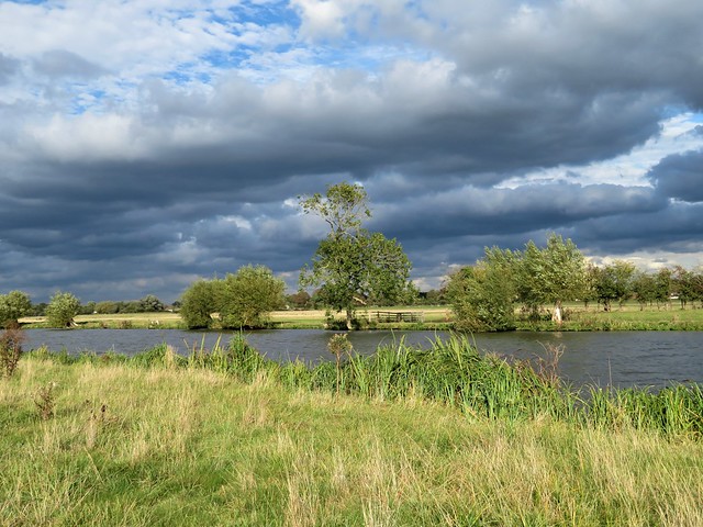
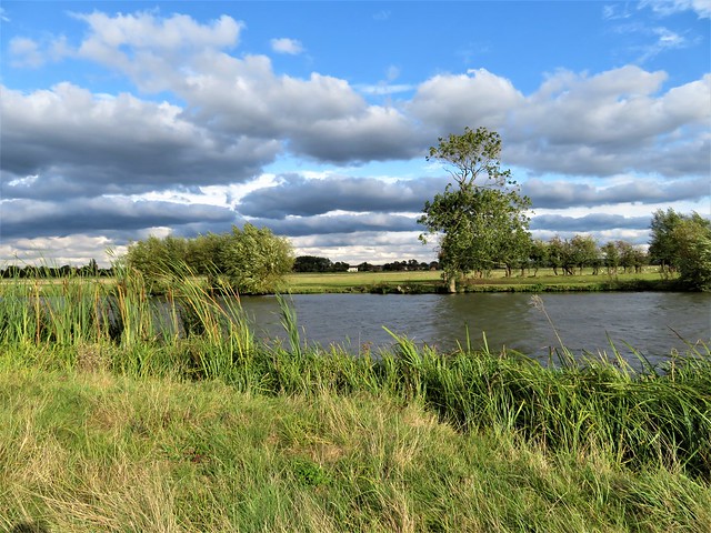
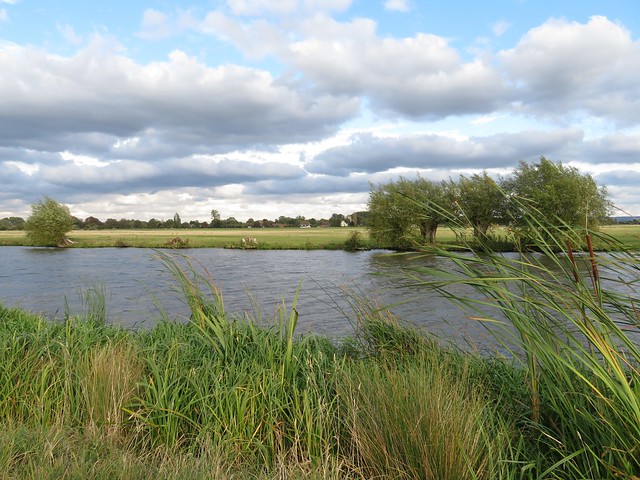
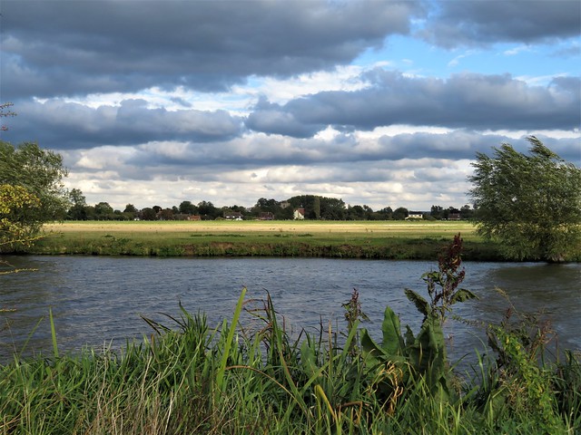
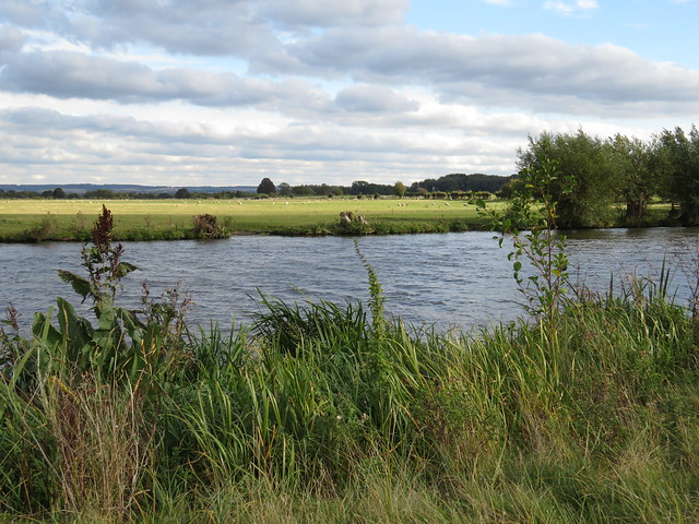
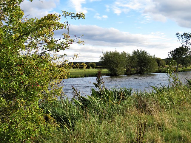
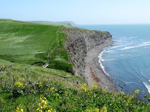
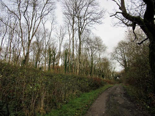
We found the brink of the shallow, gravel-bottomed River Frome well watered, and well muddied too. It was a squelch and a splosh up the riverside path to Cattistock. Sir George Gilbert Scott designed Cattistock’s church with a remarkable tall tower. It beckons you into the crooked street of the village that William Barnes called ‘elbow-streeted Catt’stock.’

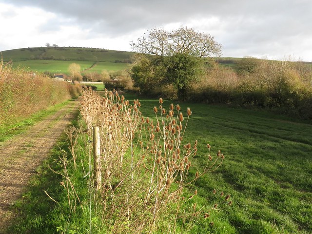
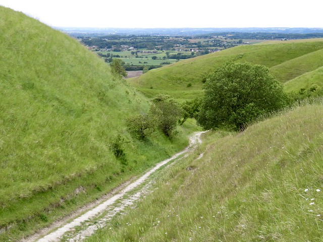
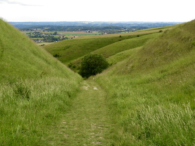
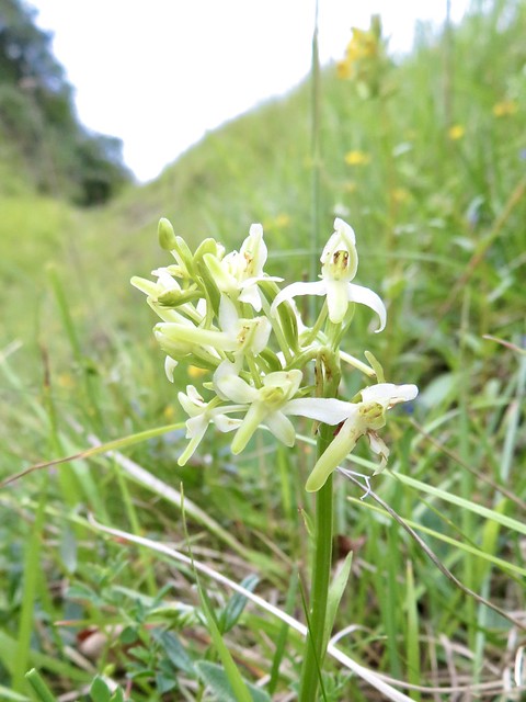
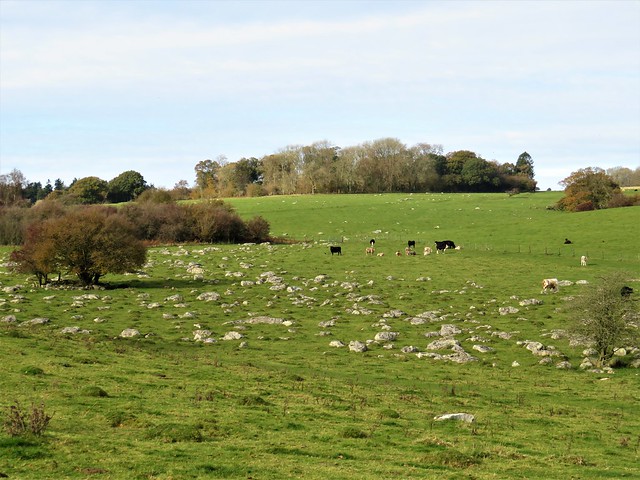
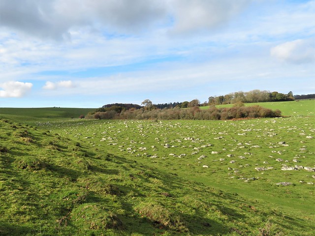
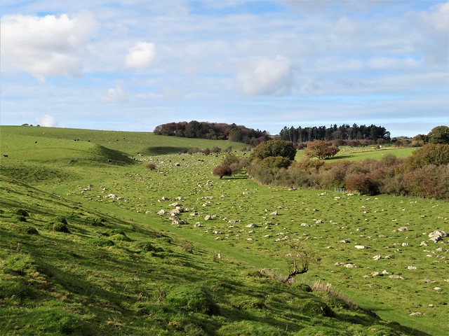
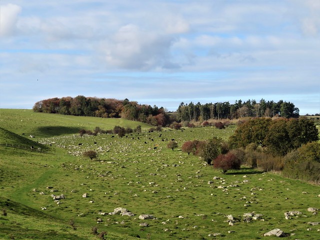
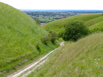
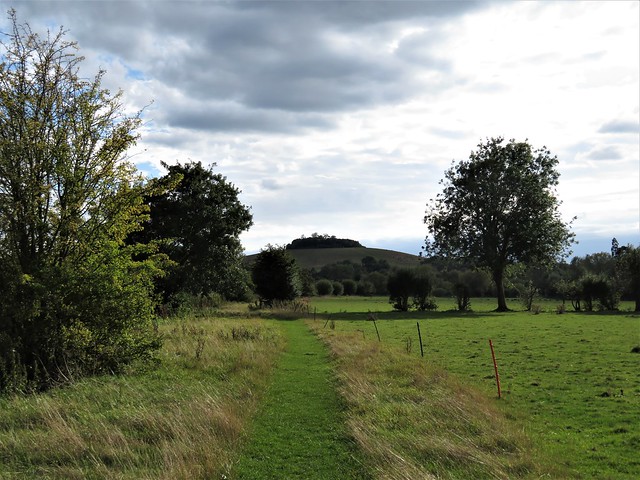
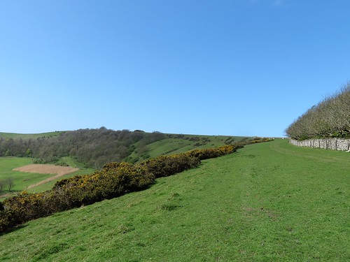
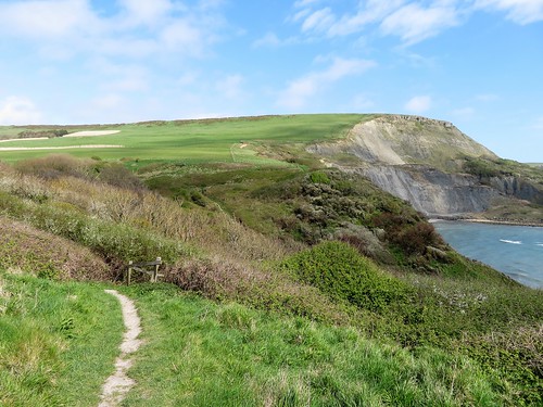
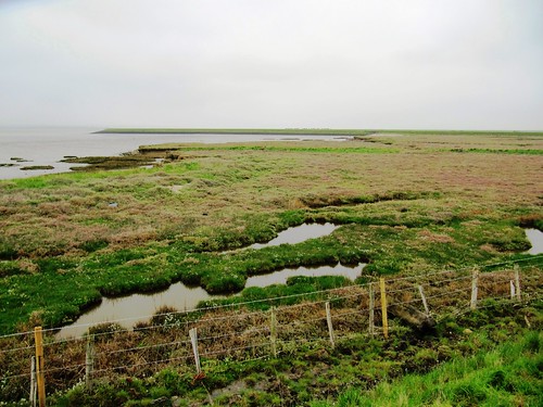
Cattistock has kept its village amenities intact – church, post office, cricket field, Fox & Hounds inn, and an active pack of fox hounds. We heard them give tongue from their kennels as we headed east up the chalk grassland slopes of Lankham Bottom.

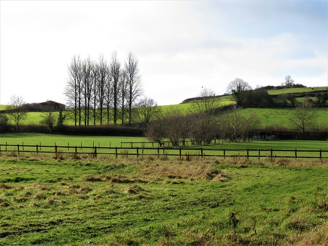
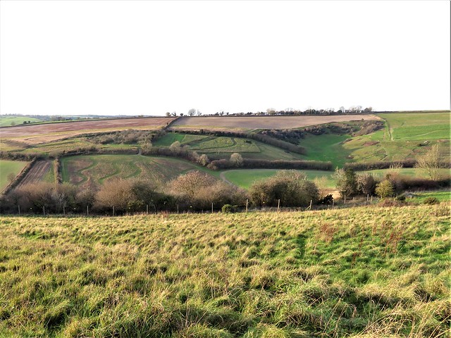
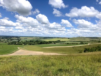
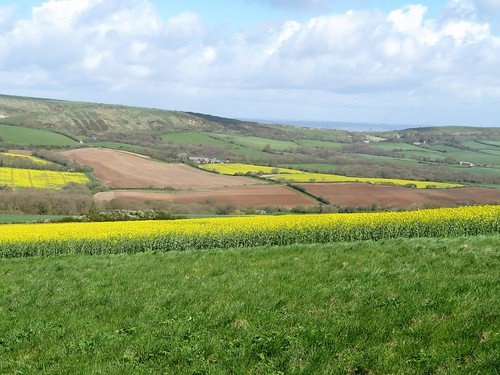
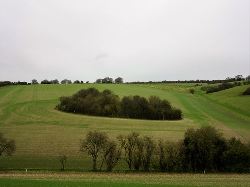
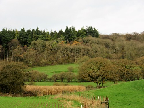
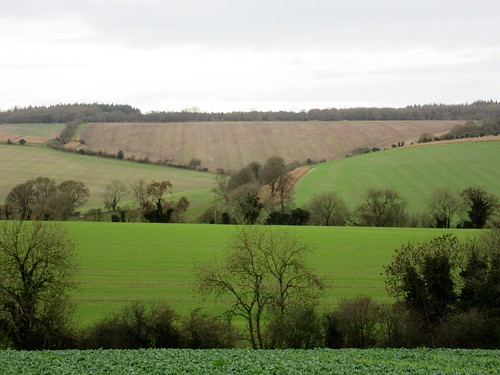
The low angle of the winter sun made relief models of the field boundaries on the downs, their shadows stark against the green slopes. The tattered old hawthorns that marked out the path were in full crimson berry, and mistle thrushes dashed among them like busy Christmas shoppers, never pausing for more than a moment.

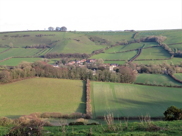
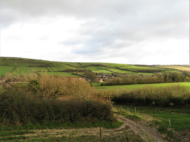
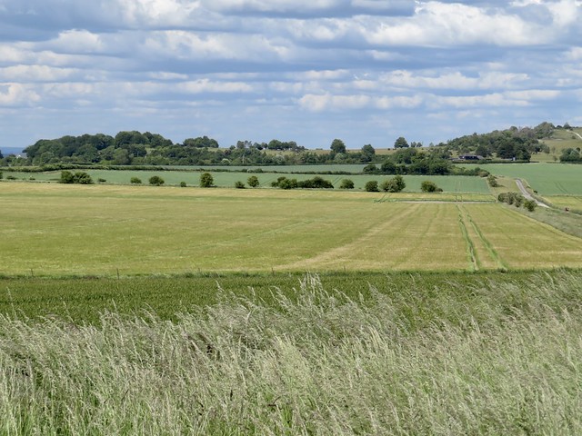
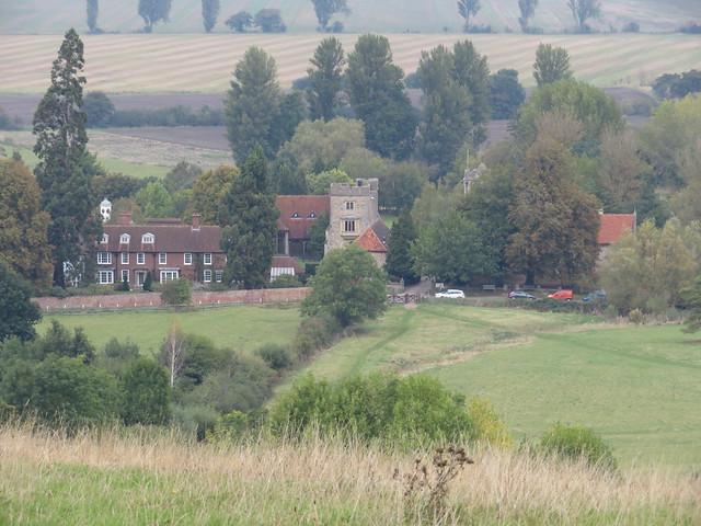
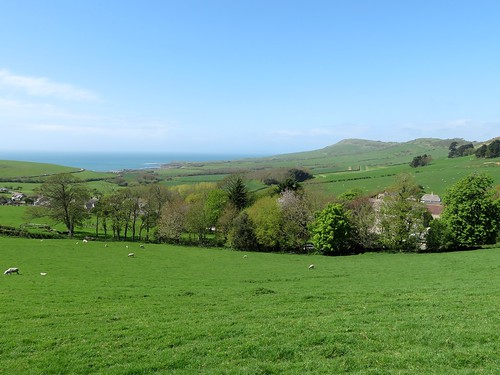
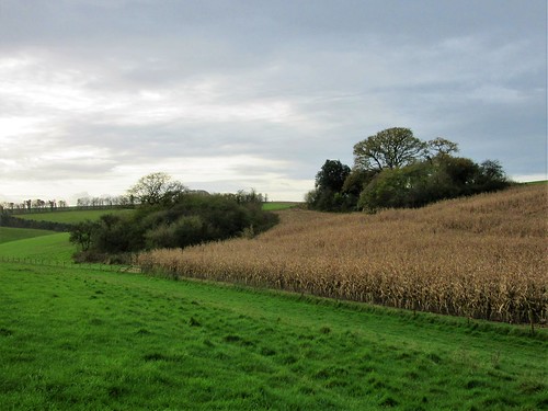
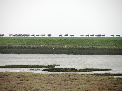
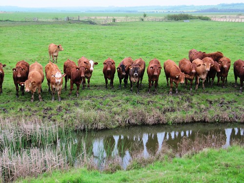
Up at Stagg’s Cross we braved the rushing traffic tide of the A37, then sauntered along a forgotten old strip of road where moss grew through the tarmac and down across the pastures to where Sydling St Nichols unravelled along its watercress stream.

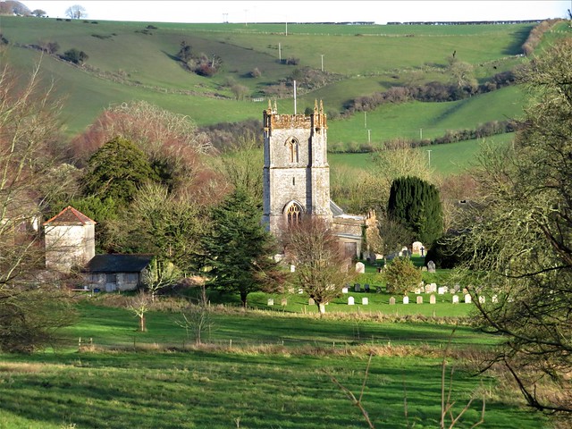
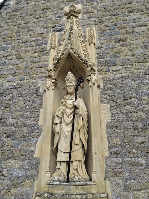
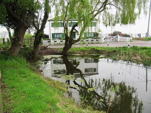
Ancient Court House Farm and tithe barn lay together alongside a church guarded by fat-cheeked gargoyles choking on their waterspouts. As we sat in the church porch a terrier came wriggling up, very keen to find out what was in our sandwiches (it was ham and mustard).

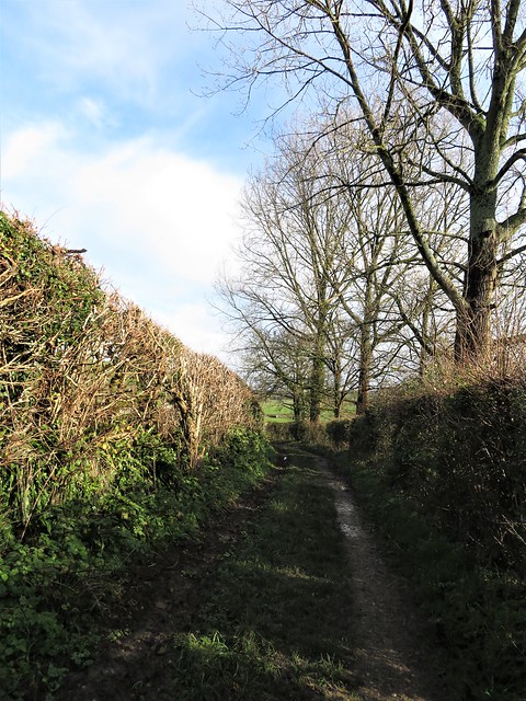
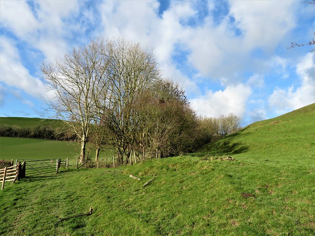
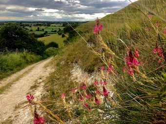
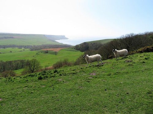
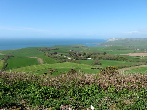
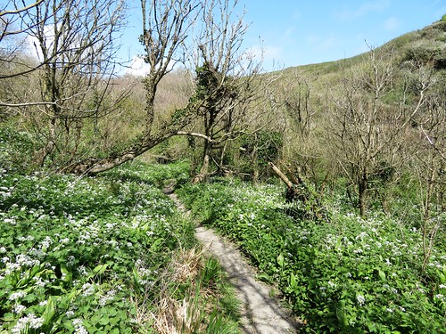
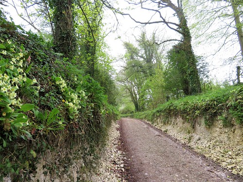
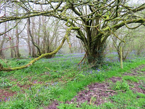
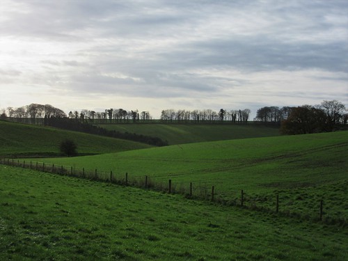
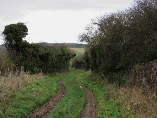
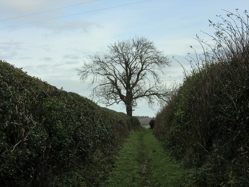
The Wessex Ridgeway hurdled us back across the downs, a broad and muddy old track in a sunny green tunnel of trees that rose to the ridge and fell away west towards Maiden Newton. The western sun turned all the clipped hedges to gold, and over the invisible sea beyond the hills to the south a strong clear coastal light silvered the base of clouds slowly building out there.

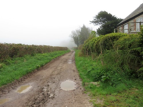
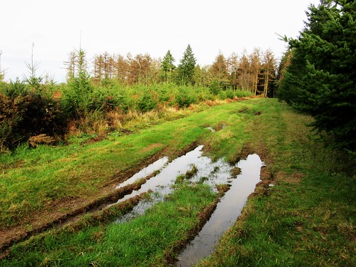
How hard is it? 8½ miles; easy downland tracks; some muddy and puddled stretches.

Start: Maiden Newton railway station, Dorchester DT2 0AE (SY 598979)

Getting there: Rail to Maiden Newton; Bus 212 (Dorchester-Yeovil)
Road: Maiden Newton is on A386 (Crewkerne-Dorchester)

Walk (OS Explorer 117): Down Station Road; left at junction. In 100m, right past church; left (597979, ‘Wessex Ridgeway’/WR, ‘Frome Valley Trail’ fish arrow waymark). In ¾ mile, right at road (590988); in 650m under railway; left at junction (592993). In 100m, left (‘Macmillan Way’); fork left in Cattistock churchyard; ahead up street. Just beyond Post Office, right by Rose Cottage (591998, ‘Staggs Cross’); follow bridleway to pass Manor Farm. On up Lankham Bottom; in 700m by metal gate on right, half left (604000) past post, up slope to gate (606002). On to gate onto road (612005); right to cross A37 (613004). Follow old road; left at junction (620002); in 600m, right (626001, gate with shackle) across 2 fields; left along farm track (628998). In 200m, right (630998, stile) to junction (630994); keep ahead; in 100m, right (kissing gate, ‘Breakheart Hill’). Left down east end of church; cross stile; right on track for 550m to meet Wessex Ridgeway (627993). Left; follow WR for 2 miles back to Maiden Newton.

Lunch/Accommodation: Fox & Hounds, Cattistock DT2 0JH (01300-320444, foxandhoundsinn.com)

Info: Dorchester TIC (01305-267992)

 Posted by at 01:52
May 222021


First published in: The Times Click here to view a map for this walk in a new window
picture picture picture picture picture picture picture picture picture picture
Facebook Link:

Heddington lay in thatch and mellow brick, cradled by the Wiltshire downs, as pretty and sleepy as a summer photograph from long ago.

We passed the tiny half-timbered Ivy Inn and were soon walking through green pastures towards the hills.

At Harley Farm we crossed the neat garden and the cornfields beyond, to join the straight old track that leads as a deep chalky holloway due east up on to the crest of Morgan’s Hill. A crowd gathered here to see local man John Morgan hanged in 1720 for the murder of his uncle. Today the hill has a gentler reputation as a nature reserve with wonderful views to all quarters.

We sat in the sun and wind among wild thyme and common spotted orchids to eat macaroons like the Famous Five, gazing north over a landscape striped and chequerboarded in white chalk and green barley and beans. The wind moved the unripe barley in silky waves and brought us the sweetly pungent smell of the bean flowers.

The patchwork variety of the plants and creatures of the reserve came as a striking contrast to the shaven uniformity of golf course grass on the south slope of Morgan’s Hill. Soon we were down in a long valley that looked south towards Salisbury Plain, following the ancient Wessex Ridgeway between fields of oats and beans and barley, just as the old song names them.

Corn buntings are in severe decline across the UK, their habitat degraded and food sources diminished by pesticides. But now one of these chunky little birds with a striped chest and thick bill kept us company, flitting a little ahead and perching along the fence wire.

The way home ran past the Iron Age hill fort called Oliver’s Castle. Here on 13 July 1643 a Parliamentarian army suffered heavy defeat by Royalist forces. Many of the Roundhead casualties were troopers in flight; they rode in panic over the steep edge of the down and crashed to their deaths in a heap of men and horses.

On this sunny afternoon the banks of the ‘Bloody Ditch’ were thick with bee and lesser butterfly orchids. Wandering here, it was hard to give credence to the awful scenes of the long-ago disaster that gave this flowery cleft its ominous name.

How hard is it? 8¼ miles; easy; field paths and trackways

Start: St Andrew’s Church, Heddington, Calne, Wilts SN11 0PL (OS ref ST 999663)

Getting there: Bus 43 from Calne
Road: Heddington is signed off A3102 between Calne and Devizes

Walk (OS Explorers 156, 157): Stockley Road north out of Heddington. In ⅓ mile, opposite row of cottages, right (SU 001666, stile); follow field path (unwaymarked) for ⅓ mile east, then north-east to Harley Farm (006671). Through gate into garden (unwaymarked, but it’s a Right of Way); half right to stile. On across 2 fields to stony lane (006675). Right; in 300m, ahead at bend (009675). In ½ mile dogleg right/left across road (018673, ‘Byway’) and on.

In 500m, reach Morgan’s Hill Nature Reserve gate on right, with another gate/track on left (023672). Take middle track between them along north edge of reserve. In 500m, right (027672, gate, white arrow), diagonally across nature reserve. At top, through gate onto golf course (025671). Dogleg left/right down path through golf course; in 300m bear right (025668, arrows) to cross road near Club House (023667). On along Wessex Ridgeway. In 1¾ miles pass Plantation car park (015642); in 300m, right (013639, ‘Leipzig Plantation’) up road. In just under 1 mile, near Oliver’s Castle, dogleg left/right and on (005648). In ¼ mile, left through gate (003651); down steep cleft. In ¾ mile at bottom of hill, on left bend just after gates on right (992655), go right through hedge gap by wooden post. North along path; in 300m cross marked Byway and on (992658, ‘Restricted Byway’) to Heddington.

Lunch: Ivy Inn, Heddington SN11 0PL (01380-859652, ivyinnheddington.co.uk)

Accommodation: George & Dragon, High Street, Rowde, Devizes SN10 2PN (01380-723053, thegeorgeanddragonrowde.co.uk)

Info: Calne TIC (01249-814000); visitwiltshire.co.uk
satmap.com; ramblers.org.uk

 Posted by at 03:34
Feb 062021


First published in: The Times Click here to view a map for this walk in a new window
picture picture picture picture picture picture picture picture picture picture
Facebook Link:

The sun had broken through at last, rolling away a cold blanket of mist to reveal the Wiltshire Downs and their subtle undulations. We stepped out under a blue sky, hearing horse hooves pounding along an unseen gallop in the hollow where Manton Stables lay hidden.

This wide open downland is horse and cattle country, the gallops tending to stretch along the tops, the cattle grazing the dry valleys below. A very fine Charolais bull, contentedly recumbent, kept a lazy eye on us as we passed on our way to the Devil’s Den.

Neolithic men raised the huge stones that form the structure of this passage grave. After the end of the last glaciation, these sarsens – ‘saracens’ or foreign stones – lay scattered all across the downs, easy pickings for the builders of Stonehenge and other ancient monuments.

We followed a wide path west through a shallow valley where a great congregation of lichen-stained sarsens delineated the curve of the hollow. Local people, seeing their resemblance to an enormous flock of sheep in bedraggled fleeces, named these clustered stones the Grey Wethers. Cows moved slowly among them, and a handsome ginger-and-white Simmental bull licked one ruminatively for the minerals it contained.

Sarsen stone is composed of sandstone bound together with a glassy silica. In his book ‘The Stonemason,’ Andrew Ziminsky calls it ‘diamond-hard, tougher even than granite.’ Nonetheless, three centuries ago in his ‘Palaeographia Britannica,’ antiquarian William Stukeley warned masons not to build with sarsen; ‘It is always moist and dewy, and rots the furniture.’

We shadowed the river of stones up the valley, then took to the ancient downland tracks that are the pride and joy of Wiltshire’s walkers. The Herepath (a Saxon word for ‘warpath’) led to the Ridgeway, a high road of braided ruts with a stunning view westward over many miles of downs and wooded valleys gilded by the afternoon sun.

Sarsens lay alongside the Ridgeway, and sarsens bounded the White Horse Trail, another venerable downland track that led us homeward between leafless hedges. A yellowhammer perched high on a bush, its breast sulphurous in the sunlight, and fieldfares flew over with vigorous wing thrusts, flocking together for protection and company in obedience to an age-old winter instinct.
How hard is it? 7½ miles; easy; downland paths and tracks

Please only walk within your Tier area, or enjoy this as an armchair walk till restrictions lift. And please consider others when you park.
gov.uk/government/publications/the-countryside-code 

Start: Gravel Hill car park, Downs Lane, near Fyfield, Wilts SN8 1PL (OS ref SU 159700)

Getting there: Follow ‘Manton House & Hollow’ on A4 (Calne-Marlborough) between Fyfield and Manton. Car park 1 mile on left.

Walk (OS Explorer 157): Follow gravelled trackway west. In 700m left through gate (153703); on through field, with fence on left. In 500m, left (149701) down slope beside fence; left through gate (150698) to Devil’s Den stones (152697). Return to gate; on along grass track through Grey Wethers valley. In 1 mile path curves right to metal gate (137706). On with fence on right to corner of Wroughton Copse (138711); left down slope; left along Wessex Ridgeway/Herepath (133710). In 300m cross gallop (130709); bear right for 550m to stile onto Ridgeway National Trail (127714). Right for 1 mile; right onto White Horse Trail/WHT (125729). In ⅔ mile fork right at copse (132723), cross track and on (WHT). Through wood (135720), then grassy track (WHT). In 600m, left on Wessex Ridgeway/Herepath (143714); in 100m right (‘Byway’) to car park.

Info: uksouthwest.net/wiltshire/fyfield-down; satmap.com; ramblers.org.uk

The Stonemason by Andrew Ziminski (John Murray)

 Posted by at 01:29
Jun 232020
 

We went to walk east of our village where the landscape turns from craggy limestone hills to long downs of chalk and greensand, moulded by rain and wind into a gently rolling, green and white countryside.

Near the start we came across an all-too-familiar scene – a mile or so of pasture through which the footpath ran unmarked over neglected stiles, to pitch up at a done-up farmhouse where the right of way passed across the farmhouse garden. An unguarded electric fence blocked access to the gate leading into the garden, where all signs and waymarks had been removed, to give the impression that there was no right of way. We hollered for the owner, who first sent the dog out, then somewhat shamefacedly emerged from the house and admitted that, yes, the path did cross her garden. No apologies for the electric shock we got crossing the fence, however!

It’s been very noticeable in recent times how many rights of way have been obliterated or obscured, waymarks and signposts removed, and obstacles erected around nice country houses whose new owners have done the properties up to the nines and decided unilaterally that the rights of way they accepted when they bought the house can be quietly abolished. Poverty of resources at County Hall has led to the laying off of many of the county Footpaths Officers whose job it is to keep our wonderful and unique network of paths open by making sure that householders and landowners do toe the line about maintaining access. The Ramblers organisation do the best they can – and we walkers are the best weapon they have in the fight to preserve what amounts to an irreplaceable national treasure. Keep walking those paths, folks! Rant over!

Up on the downs the views were breathtaking, far north to the Cotswolds, far south to Salisbury Plain. John Morgan was an unfortunate felon hanged for murder on these downs in 1720, and his name lives on at Morgan’s Hill, now a nature reserve where we picnicked among pyramidal orchids, yellow rattle, scabious and blue butterflies.

From here the Wessex Ridgeway took us south through a long valley where I was thrilled to see a corn bunting on the barbed wire fence between fields where oats and beans and barley grow. A stout little bird with a streaky breast, increasingly rare as its habitat and food sources have come under pressure from modern pesticides.


The homeward path led over Oliver’s Castle hillfort, where in 13 July 1643 an army of Parliamentary soldiers was routed by Royalist cavalry, many of them pursued at a panicky gallop till they tumbled in a terrible heap of men and horses down the steep face of the downs into the cleft known now as the Bloody Ditch.


No such awful scenes on these slopes today – just marbled white butterflies, bee orchids and lesser butterfly orchids, and of course the sky-filling songs of larks.


 Posted by at 16:02
Feb 012020


First published in: The Times Click here to view a map for this walk in a new window
picture picture picture picture picture picture picture picture picture picture picture picture picture picture picture picture picture picture picture picture
Facebook Link:

A cold Oxfordshire day under a billowing sky. St Birinus looked pinched and chilly in his niche in the chapel wall at Dorchester-on-Thames. The folds of his carved stone face seemed full of disapproval as we passed him on our way down to the river.

It was Birinus, a missionary from Rome, who ducked King Cynegils of Wessex in the River Thames nearby in token of baptism in 634 AD. This act paid dividends; the newly christened king gave his baptist land on which to found a bishopric, a vast one that eventually stretched from Thames to Humber.

Beyond the neat houses and gardens of Dorchester we crossed the Dyke Hills, a curious Iron Age earthwork that raises a double seam across the fields. It was built to defend a settlement established by the river here long before the Romans came to Britain.

From Little Wittenham we climbed the short, steep path up the face of the Sinodun Hills, a double bulge of tree-topped chalk known locally as Wittenham Clumps. They draw the eye for many miles in the flat Thames-side country. On Round Hill a handy topograph picked out landmarks far and near, from the long ridge of the Chiltern Hills to Dorchester’s abbey church, the chimneys of Didcot power station, a glimpse of dreaming spires in far-off Oxford, and nearer at hand the tower and red brick frontage of Little Wittingham’s manor house below.

Among its many excellent ecological ventures, the locally based Earth Trust has established a wild flower sward on the Wittenham Clumps, and a network of permitted footpaths all round the area. We followed the paths across the hill fort ramparts on Castle Hill, then down towards Long Wittenham and the Thames through Earth Trust meadows and woodland.

The walk wheeled slowly around the fixed hub of Wittenham Clumps, away to our right across the fields. Paul Nash painted these hills again and again between the wars, trying to catch the movement of the crowning trees in the wind, the moods and changing colours of the chalk and turf.

‘A beautiful legendary country haunted by old gods long forgotten,’ was the artist’s perception of this understated but captivating corner of the Thames, and that’s as good an encapsulation as any.

Start: Bridge End car park, Dorchester-on-Thames OX10 7JT (OS ref 579940)

Getting there: Car park is signed off Henley Road by bridge at south end of town (off A4074, Wallingford-Oxford)

Walk (9 miles, easy, OS Explorer 170): Ahead past chapel; south down Wittenham Lane to Thames (578932). Right; in ¾ mile, left across 3 bridges (568935); opposite Little Wittenham church, left (566934, gate). Up hill path ahead to summit of Round Hill (566928). Around clump; on to summit of Castle Hill (569926). From poem stone on far side, descend grass path through ditch. In 150m, left (572926, gate) across valley. In 250m fork right (570928) through trees. In 250m at T-junction, left (570930); downhill to Little Wittenham. Left along road; in ¼ mile, right (564931, ‘Long Wittenham’). In 250m, left through gate; follow permitted path parallel to road for 1 mile to road in Long Wittenham (551940). Right by thatched house (‘No Through Road’). In ⅔ mile at Northfield Farm entrance (555949), left along green lane to Thames (553958). Right. In 2 miles, left across weir/Day’s Lock (568936). Half left on fenced path; cross Dyke Hills (572937); on to Dorchester.

Lunch/Accommodation: White Hart, High St, Dorchester OX10 7HN (01865-340074, white-hart-hotel-dorchester.co.uk)

Info: Wallingford TIC (01491-826972)

Earth Trust: earthtrust.org.uk; satmap.com; ramblers.org.uk

 Posted by at 02:13
Apr 132019


First published in: The Times Click here to view a map for this walk in a new window
picture picture picture picture picture picture picture picture picture picture picture picture picture picture picture picture
Facebook Link:

A brisk windy day across the Isle of Purbeck. From high-perched Kingston we looked north across the valley to a gap in the long ridge of the Purbeck Hills, neatly plugged by the ruins of Corfe Castle. It seemed against the laws of gravity that such tall slender fragments of wall would not have tumbled long ago.

We followed the road west out of Kingston between neat grey stone cottages. Guns thudded from the military ranges beyond the downs, as though a sulky giant were banging a lambeg drum. Larks sang over stony plough and spring wheat. Bluebells and wild garlic contended for mastery of the woods, a springtime splash of blue and white.

We followed a track up through pastures of fat lambs. Walls of thinly sliced stone curled away to reach the tumulus on Swyre Head, highest eminence of Purbeck. Here was a viewing point over downs, farmlands and a dramatic coast of crumbling chalk and freestone cliffs running westward to where the Isle of Portland, Thomas Hardy’s ‘Gibraltar of Wessex’, stretched its low wedge shape into the sea.

The path bent inland along a ridge of grass polished to a shimmer by the sun. The strong sea wind hissed in the gorse bushes, bringing scents of coconut. A trail of smoke arose from the trees around Kimmeridge, and when we got down there it was to find the cottages of the old quarrying village now primped to a sheen of perfection.

We passed the immaculate new Museum of Jurassic Marine Life and followed the road round the knoll of Metherhills to the shores of Kimmeridge Bay. These tilted strata of dark shale yield a harvest of oil, sucked up from nearly a mile underground by a nodding donkey pump on the cliffs.

We sniffed the metallic tang of the oil on the wind, then climbed to the curious Tuscan folly of Clavell Tower. The tower, built by a 19th-century rectorial squire, was moved back bodily from the cliff edge in 2008, a costly and complicated operation.

From here the coast path led east, crumbly and cracked, at the very rim of ash-grey cliffs footed on flat rock pavements among a litter of fallen stones. The wind battered and shoved us, the sea creamed in lines of breakers, and we swooped homeward up and down the cliffs in breathless exhilaration.

Start: Houns-Tout car park, West Street, Kingston, Corfe, Dorset BH20 5LH (OS ref SY 953794)

Getting there: Bus 40 (Corfe-Swanage). Road – Kingston is signposted off A351 (Corfe-Swanage); right at Scott Arms along West Street to car park.

Walk (9½ miles, steep climbs on coast path, OS Explorer OL15): Left (west) along road. At next car park (943793), left through gates on track (‘Swyre Head’). At Swyre Head (934784), hairpin right through gate; ridge path for 1½ miles, descending to road (919801). Left; at junction, cross road; signed path opposite down to Kimmeridge (917799). Ahead past Fossil Museum on road to coast. At end of road (911787), right past WC. In 200m, left up steps (‘Chapman’s Pool’); follow coast path east for 3 miles. At top of Houns-Tout cliff by stone seat (950773), left (stile, yellow arrow, ‘Hardy Way’) inland on path for 1½ miles to Kingston.

Conditions: Steep climb to Houns-Tout cliff; unguarded, crumbly cliff edge path.

Lunch/Accommodation: Scott Arms, Kingston (01929-480270, thescottarms.com) – cheerful, lively pub with rooms – sensational views.

Info: Swanage TIC (01929-766018); visit-dorset.com.
4-19 May: isleofwightwalkingfestival.co.uk

satmap.com; ramblers.org.uk

* Christopher’s latest book, Ships of Heaven, The Private Life of Britain’s Cathedrals, published 11 April

 Posted by at 01:00

Ships of Heaven – talks and events coming up round the country


2020 Dates:

23 January, 6.45 pm – Henleaze Library, 30 Northumbria Drive, Bristol BS9 4HP

30 January, 1pm – Stanfords Travel Writers Festival, Olympia, Hammersmith Rd, Hammersmith, London W14 8UX – www.stanfords.co.uk/Destinations-Show-Travel-Writers-Festival

17 March, 7.00pm – Southwark Cathedral, London – cathedral.southwark.anglican.org

28 March, 2pm – Balliol Hall, Church Rd, West Huntspill, Highbridge, Somerset TA9 3RN

10 May, 11am – Chiddingstone Castle Literary Festival, Kent – chiddingstonecastle.org.uk

12 May, 4pm – Stratford-on-Avon Literary Festival, Warwickshire – stratfordliteraryfestival.co.uk

29 May-6 June (date TBC) – Derby Book Festival – derbybookfestival.co.uk

25 June – Reform Club, Pall Mall, London

5 September, 3pm – Friends Day, Salisbury Cathedral – salisburycathedralfriends.co.uk

 Posted by at 08:15
May 262018


First published in: The Times Click here to view a map for this walk in a new window
picture picture picture picture picture
Facebook Link:

Mist was rolling high on the Dorset downs as we came down a steep green valley into Plush. The little collection of houses lay under mossy thatch along their lane. A few cheerful drinkers looked out of the windows at the Brace of Pheasants and shook their heads over the weather. ‘Going out walking? You won’t see a thing!’

In the chalky holloway that lifted us to the heights of Church Hill grew primroses and violets, bluebells and pink campion. All had burst out together last week at the first hint of spring warmth. Today the birds seemed subdued by the cold hand of the mist, but a blackcap suddenly produced a mellifluous solo among the oaks, short but sweet.

As we reached the gaunt old barn at the top of the climb a roe deer went bounding away, leaping high over crops and fences. We followed the rutted course of the Wessex Ridgeway, an ancient drove road running east-west along the nape of the hills. The old cottage at Folly was once a drover’s inn, where the hardy drovers in their felt hats, stocking feet soaped against blisters, would stop in for refreshment while their flocks cropped the wide verges of the ridgeway.

We passed through woods of oak and ash where bluebells made a hazy sky of the undergrowth, and dropped down a long flinty lane into Higher Melcombe. Lumps and bumps in the fields were all that remained of the medieval village deserted by its people after the Black Death deprived them of their feudal livings. But the handsome old manor house was still there, its chapel walls striped in stone and flint.

Blackbirds sang, and a tractor whined as it trimmed the first grass of the year. We climbed away up a hedge towards a wood, invisible in the hill mist, that roared softly and mightily, a sea-like cadence. Primroses and cowslips spattered the banks of the hollow lane, and among them a hybrid of the two plants raised its dark yellow multiform head on a slender talk.

We skirted the plunging slopes of Lyscombe Bottom, farmed with no pesticides or artificial fertilisers, and descended another deep-sunk old green road into Plush. ‘See anything?’ asked the regulars in the Brace of Pheasants. ‘No, not a thing,’ we replied.

Start: Brace of Pheasants Inn, Plush, Piddletrenthide, Dorset DT2 7RQ (OS ref ST714022)

Getting there: Plush is signposted from Piddletrenthide on B3143 (off A35 at Puddletown).

Walk (8 miles, trackways and farm paths, OS Explorer 117): From Brace of Pheasants, right along road; in 100m, right (‘Church Hill’ fingerpost/FP) up bridleway for 1 mile to Wessex Ridgeway/WR (707035). Right (east) along WR to cross road at Folly (728032). In 300m fork left uphill (733030, bridleway fingerpost/BFP); in 100m fork left (BFP). In 400m through gate, turn left (737028, BFP) across field.

Pass telephone pole, then breeze-block shed; ahead in same direction (WR) across field and through double gateway (740030, WR). Keep ahead; in 50m, fork right down grassy holloway, through gate into wood (741031). WR forks left, but keep ahead downhill (‘Higher Melcombe’) for ⅔ mile to road (751025). Right through Higher Melcombe.

In ¼ mile, just before Higher Melcombe Farm, left (747025, blue arrow/BA, FP in hedge) on track. In 70m, right (gate, BA) up field edge. In 250m through gate (745025, BA); left up hedge, then sunken lane. In 600m at top of rise, through gate; right on gravel track (742021, ‘Nettlecombe Tout’) with hedge on right. In 500m fork left (740025) across field to go through gate by Lyscombe Farm notice (739026).

Fork left away from fence, but keep it close on your right, following same contour across lumpy ground. In 900m at 4-finger post on right (730024), right through gate; left (‘Doles Ash Farm’) along hedge. In 300m at end of trees, left across fence (728021); right past trig pillar. On beside fence, then across field, for ½ mile to corner of triangular copse (721018). Bear right (WNW) across open field (perhaps through crops) for 300m to hedge gap with arrow (718019). Ahead to stile (717020); downhill to road (717022); left into Plush.

Lunch/Accommodation: Brace of Pheasants, Plush (01300-348357, braceofpheasants.co.uk) – cosy, friendly village inn.

Info: Dorchester TIC (01305-267992); visit-dorset.com; satmap.com; ramblers.org.uk

 Posted by at 01:09
Dec 192015


First published in: The Times Click here to view a map for this walk in a new window
picture picture picture picture picture picture picture picture picture picture picture picture picture picture picture
Facebook Link:

The great rural writer W H Hudson stayed at the Lamb Inn at Hindon in 1909 while he was writing his classic book, A Shepherd’s Life. He watched fledgling throstles, flycatchers and pied wagtails make their maiden flights from their nests in the ivy above his bedroom window, and rejoiced that the village had become ‘sober and purified’ since the bad old days.

The gamekeepers, beaters and shooters who packed the bar of the Lamb the night before our walk were celebrating a good day in the open air with plenty of beer and plenty of talk, their wind-reddened faces growing ever more rosy in front of the log fire. This part of South Wiltshire is pheasant-shooting country, and almost the first thing we heard as we stepped out next morning was the flat ‘pop-pop!’ of shotguns from distant ridges.

The broad track of the Wessex Ridgeway led us through fields where yellow-faced siskins flitted in the hawthorn bushes. Once across the roar and swish of the A303, we followed a quiet green valley up into the skirts of Great Ridge Wood. Hudson came here day after day, revelling in the silence and solitude of the ancient wood. He met no-one – locals had been banned from their traditional right of gathering firesticks in the wood since the introduction of pheasants reared for the shoots.

All was quiet in Great Ridge Wood for us, too, a century later, tracing the route of the Roman road that once brought lead from Somerset’s Mendip Hills to Old Sarum. A cold wind rose, tossing the fir tops and the flame-like leaves of the young larches. At the edge of the wood we saw a line of shooters and dogs in the valley beyond, patiently waiting for the beaters to initiate their morning’s sport.

Another ancient trackway brought us south again off the ridge, walking beside milky green fields of winter wheat. Dusky pink spindle berries hung in thick clusters in the hedges, and the track rose and fell in a beautiful tumble of downland valleys, silent and still under a pearly winter sky.
Start: Lamb Inn, Hindon, Wilts SP3 6DP (OS ref ST 910329).

Getting there: Bus 25, 26 (Salisbury-Gillingham)
Road: Hindon is signed off A303 between Wylye and Mere.

Walk (7¾ miles, easy, OS Explorer 143): From Lamb Inn, right past church. In 150m, just past Fairmead bungalow, right (909330; ‘Bridleway’ fingerpost/BFP in left hedge) along fenced path of Wessex Ridgeway. At road, left (912333); at left bend, ahead (913337, BFP) between hedges, then across fields to A303 (920346). Right alongside road for 300m; left across it (922346); through gate (BFP) and up valley. Keeping fence, then track at bottom on your left, follow grass path for ¾ mile to join track (926358); follow it up to T-junction in woods (928361). Left; in 50m pass grass track on left; in another 150m, left (928362) on grassy ride between tall and short conifers. In 650m, at T-junction, right (921362); in 200m, left along wide forest road.

In 1 mile, at edge of wood, left on track (906362); in 200m, right (BFP) inside trees. In ½ mile, at end of trees at T-junction, left (898364) along track. In ¾ mile, at bottom of valley (898354), keep ahead on right-hand of 2 parallel tracks, rising to pass inside Bockerly Coppice. At top of rise, at gate into open field, 2 tracks fork left into wood (899351). Take right-hand one (BFP) inside top edge of wood. On down to cross A303 (901343, take care!). Uphill in tunnel of trees. At reservoir at top (903339), ahead on track to road (904336); left to Hindon.

Conditions: Take great care at 2 crossings of A303!

Lunch/Accommodation: Lamb Inn, Hindon (01747-820573, lambhindon.com) – lively local inn, scented by log fire.

Ramblers Festival of Winter Walks, 19 Dec – 3 Jan: ramblers.org.uk/winterwalks

Info: Salisbury TIC (01722-342860)
visitengland.com satmap.com; ramblers.org.uk

 Posted by at 01:30
Apr 062013
 

The nightingale sang as though its heart would break. The infinitely slow and sweet contralto warbling filled the scrubby wood at the RSPB’s High Halstow reserve, an operatic aria against the plainer chorus of blue tits, chiffchaffs and wrens, and the stage-hand knocking and hammering of great and lesser spotted woodpeckers.
First published in: The Times Click here to view a map for this walk in a new window
picture picture picture picture picture picture picture picture
Facebook Link:
There can’t be a more poignant or a richer bird song anywhere in England on a misty spring morning, and it held us enchanted on our way down the Isle of Grain’s escarpment to the moody Kentish shore of the River Thames.

We followed a path out of the woods through green wheatfields and a blue haze of linseed towards the first glimpse of the Thames – a broad leaden tideway rolling seaward, the tall spindly stacks of an oil refinery on the Essex shore misted out into grey and white spires like a city in a dream.

A rough old lane led north between vigorous young elm hedges, a puddled track under a thick grey sky that brought us through the dead flat grazing meadows of Halstow Marshes to Egypt Bay in a crook of the sea wall that rims the Isle of Grain.

Yellow cockle shell sands lay at the feet of low black cliffs, leading out to a wide sheet of bird-haunted tidal mud, slippery and glutinous. In Egypt Bay the overarching imagination of Charles Dickens tethered the dreaded prison hulk from which the convict Magwitch escaped to terrorise young Pip in Great Expectations. There really were hulks in Egypt Bay in Dickens’s day – stinking, superannuated men-of-war in which convicts were incarcerated to rot away in hellish isolation.

Nowadays Egypt Bay and neighbouring St Mary’s Bay hold nothing more threatening than oystercatchers, avocets, curlew and brent geese. They are beautiful, sombre, wild places, destined to be overwhelmed if ‘Boris Island’, the monstrous Thames Estuary airport now under consideration, ever comes to pass – because it would be built right here.

A herd of bullocks paced the sea wall, evenly spaced one behind the next like the wagons of a slow-moving goods train. We left them to it, took a last lungful of salty estuary air, and made inland for the pretty duckpond hamlet of St Mary Hoo and the homeward path.

START& FINISH: RSPB car park, Woodside, High Halstow, Kent ME3 8TQ (OS ref TQ 781757).

GETTING THERE: From M2 Jct 1, A289, A228 towards Grain. At roundabout on outskirts of Hoo St Werburgh, left down Dux Court Road (‘Deangate Ridge’). At High Halstow church, right along The Street past school. Left into Harrison Drive; 2nd left into Northwood Avenue; immediately left down Woodlands to RSPB car park.

WALK: (8 miles, easy, OS Explorer 163):
From car park, don’t take the path with several arrows, but the other path through a swing gate with ‘No Fouling’ notice. In 150 m, left (‘Toddler Trail’); in 100 m, right, in 150 m, right again (‘Heron Trail’) up slope. At top, at T-junction, left; in 250 m, ‘Woodland Trail’ points ahead but turn right here up steps. In 100 m, with stile on right, turn left; in 50 m, right on Saxon Shore Way/SSW (782761). Leave wood; bear left along edge of picnic field, through hedge (785761) and on over field. In 200 m, left along field edge (787762; yellow arrow/YA). At top of field dogleg right and left (787764, YA) and on through scrub wood to road (787766). Left past Decoy Farm to Swigshole (788776). Over stile (YA; ‘Curlews, Convicts & Contraband’/CCC). In 100 m at fork, keep ahead (CCC) on Manor Way track for ¾ mile to end of track (783786). Left over stile (CCC) and next one; bear left along flood bank. Soon you cross stile with 2 YAs; bear right up onto flood bank at Egypt Bay (778790).

Right over stile (YA; CCC) and follow sea wall for 1½ miles. At south-east corner of St Mary’s Bay, right over stile (796788); head inland along green lane. In ½ mile, cross stile (796779; YA); ahead past sheepfold (797776; CCC); up slope to cross stile (798772; YA) and follow track to gate and stile into lane (801769; CCC). Follow lane round Ross Farm buildings to road in St Mary Hoo (803766). Ahead to visit church and pond. Retrace steps; at right bend (803766) keep ahead down stony lane (fingerpost, YA), through fields to pass Newlands Farm. Up steps by corrugated barn (797763; YA); on across field. At path crossing rejoin SSW (792763); ahead to road. Ahead round next bend; left (789762, SSW) to where SSW enters Northward Hill Wood (783761). Bear left on wide grass path across picnic field to gate and road (782759). Right (YA); in 250 m, right (RSPB sign) down Woodside to car park.

LUNCH: Red Dog, High Halstow (01634-253001; reddogpub.co.uk)

RSPB: Northward Hill and High Halstow Reserves: 01634-222480; rspb.org.uk

INFORMATION: Medway Visitor Centre, Rochester (01634-843666); visitkent.co.uk
www.ramblers.org.uk www.satmap.com www.LogMyTrip.co.uk
Click on Facebook “Like” link to share this walk with Facebook friends.

 Posted by at 01:42