Jan 012021


New Year’s Day. We looked out to see a good thick frost on the garden. The hill slope beyond lay whitened, the woods dark along the ridge, the sky leached colourless.

In the lane the severely trimmed hedges were covered in a thin film of frost. Trees stood black and skeletal. Breath steamed as we went up the steep incline of Stony Sleight, a rubble of pebbles brought downhill by rain floods littering the skiddy red limestone. Jane picked up a water-smoothed stone along whose rim the dripping water had frozen overnight into a line of tiny glassy stalactites, like the teeth in a T Rex jaw.


Beech leaves lay blackened in clots, each leaf edged with a lace of crusted ice. Interwoven strands of ivy wrapped a cut tree branch, the frost covering giving the whole composition the look of an artwork. The earth of tractor ruts was frozen hard, and the brown water in the ruts themselves was skinned over with panes of white ice, the two colours swirled together like a coffee and vanilla ice cream. I broke through a pane with my boot, the crunch and crack reminding me of the magic that frost and ice brought to walks in childhood.


On the way down from the hill towards the village we crossed fields still whitened, where the frost was rising from every blade of grass and fallen leaf to form a misty miasma in the valley. Ice in the hoof pocks left by cattle was melting, so that what had been a crunching walk ended as a squelching one.


 Posted by at 20:32
Dec 262020


We left the house on Christmas morning as the first crack of light was spreading in the east. Down empty roads and muddy lanes running with water, to a little parking space where the puddles were iced over. The first time this year I’d pulled on hat, scarf, thick gloves, thermals and padded winter coat.

Across a racing stream on a footbridge slippery with frost, and up a frozen grass slope to the long barrow darkly silhouetted on the skyline against a sky already broadened into a peach coloured dawn, the blue above streaked with dozens of drifting horsetails of cloud.

I wormed my way into the cold, damp stone passage that led back for 30 feet or so into the artificial hillock of the barrow. The floor where I knelt was wet and muddy, the stones hard against my back. At the entrance a big ammonite embedded in one of the kerbstones. Looking out, the view was south-east up a gentle slope to a wood on the skyline.

It was a half-hour wait, with the invisible sun lighting up the higher features of the village in the valley, church tower and fine tall buildings, the golden light gradually creeping down the slope behind the houses, and crowds of rooks becoming agitated and vocal at the sunrise they could already see from their vantage points fifty feet in the air.


At last the moment came as the first shallow arc of the sun rimmed the hill, spinning like a ball, its intense light diffused behind the ivy-thickened skeletons of the trees. The clouds gleamed, the peachiness of the sky leached into pale blue, and a finger of dazzling sunlight approached down the sloping field, entered the passage, and lit up the back wall of the burial chamber in an unbroken wash of light as bright as polished silver, as it has done at every winter solstice since the architects of the barrow aligned it so precisely 5,000 years ago.


 Posted by at 21:25
Oct 242020


Abbotsbury lies on the Dorset coast a little inland of Chesil Beach, the notorious shingle bar on which hundreds of ships and thousands of seafarers came to grief in days of sail. On stormy days the waves pound the bar with a menacing roar, but today all was still and calm under a cloudy sky as we set out among the rich gold stone cottages of Abbotsbury with their grey thatched roofs.

How did Blind Lane earn its name? An old holloway floored with flint and dark iron-rich stone, it led away up the hill behind the village. Black cattle grazed the strip lynchets or terraced scars left by medieval ploughing.

It was an exhilarating walk westward at the rim of the down, shoved along by a strong easterly wind. Neolithic long barrows and Bronze Age round ones pimpled the turf. The gorse-smothered Iron Age ramparts of Abbotsbury hill fort stood remarkably well preserved. Ahead opened the dramatic seascape and landscape of the Jurassic Coast, its cliffs faced with gold and white as landslips reveal the underlying strata. Further round Lyme Bay the colours darkened to the greys and blacks of the tottering cliffs beyond Lyme Regis, some of the most unstable land in these islands.

Down the single sloping street of West Bexington, and back east into the wind along a beach of pebbles mumbled so small by the sea that they resembled coarse sand. Ahead the long curve of Chesil Beach terminated in the sloping wedge of the Isle of Portland with its squared-off cliffs, quarried for freestone since Roman times.

A short sharp climb inland across a corrugation of lynchets to reach St Catherine’s Chapel on its round hill, with a superb view down over Abbotsbury and its mighty medieval tithe barn. Spinsters in fading hopes of securing a man would climb to the chapel and pray:

‘A man, St Catherine!
Please, St Catherine!
Soon, St Catherine!’

The coda was then whispered:

‘Arn-a-one’s better than narn-a-one!’


 Posted by at 17:07
Oct 022020


The River Severn’s estuary was at a fantastically low tide as we crossed the ‘new’ bridge on a day of no cloud whatsoever. Looking seaward through the stroboscopic flicker of the bracing wires, we could see the tidal outcrop of the English stones fully exposed and slathered in red mud. Downriver, the little hump of Denny Island off Portishead stood marooned in a huge desert of sand. Other sand and mud banks lay around the widening tideway like beached whales. Unwary strangers might even suppose you could cross the five miles from the English to the Welsh bank on foot and do no more than bespatter your spats. And maybe you could, if you were able to walk on water while negotiating quicksand, slow mud, sudden drops, fathomless pools, and the second highest tidal range in the world sneaking round the corners to cut you off.

Over in Wales we hightailed it to Llanfihangel Crucorney, a placename whose sound put the immortal walking writer John Hillaby in mind of ‘a toy train scampering over points’. LC lies in the River Monnow’s valley that forms the eastern boundary of the Black Mountains and Brecon Beacons. It’s a great jumping off point for walks westward into those mountains, but today we were aiming east to climb The Skirrid (Ysgyryd Fawr, the ‘big split one’), a tall hill that lies north-south with its head cocked and spine raised like an alert old dog.

The Skirrid is made of tough old red sandstone lying in a heavy lump on top of thin layers of weaker mudstone – hence its history of slippage and landslides. We came up to it in cold wind and brilliant sunshine across fields of sheep, skirting its western flank through scrub woods, gorse bushes blooming yellow and holly trees in a blaze of scarlet berries, with the dark purple crags of the northern end hanging over little rugged passes of landslide rocks fallen in a jumble.


The ascent is short, steep and stepped, but it’s the sort of ‘starter mountain’ that families with six-year-olds can manage. Many were out – mums, dads, children, students, ‘maturer’ folk such as us, all hurrying to revel in this one-in-a-thousand day before the threatened reintroduction of lockdown in Wales should come into force.


Once at the peak in this unbelievably clear weather we gasped to see the landscape laid out in pin-sharp detail a thousand feet below and fifty miles off – Malverns, Black Mountains; farmlands rising and falling towards Gloucestershire and the Midlands; the slanting tabletops of Penyfan and Cribyn over in the Brecon Beacons; Cotswolds, Mendip, Exmoor; and the south Wales coast trending round into far-off Pembrokeshire.

Nearer at hand a grey streak of softly glimmering sea showed the tide rising in the Severn Estuary past Brean Down’s promontory, the slight disc of Flat Holm and the hump of her sister island Steep Holm, their lower edges lost in mist so that they looked like floating islands in some fabulous sea.


 Posted by at 19:43
Aug 252020


I’d just about heard the name of Sezincote, but no more than that. I thought it must be another of those gorgeous Elizabethan manors of golden stone that the Cotswolds are so rich in. Queen Bess probably stayed there; Charles II might have dodged pursuit up an oak tree in the park – that sort of thing. But what we found tucked in below the woods near Moreton-in-Marsh was quite a shock to behold.

A day of grumpy weather – nearly as grumpy as Jimmy Anderson. I kept my phone on constant refresh, trying to keep up with the missed catches, rain delays, Pakistani obduracy and other obstacles falling in the path of England’s Greatest Bowler as he strained to capture his 600th Test wicket at Southampton.


Moreton-in-Marsh is a lovely town with a very wide sheep-straggle of a high street tortured by traffic; Bourton-on-the-Hill a beautiful little sloping village of honey-coloured houses made miserable by 4X4s, fat cars and inexcusably fast and noisy motorbikes pelting down its narrow roadway. Between these two, long fields of harvested barley and wheat with cotton-reel bales of straw regularly spaced, as though giants had temporarily suspended some esoteric game and left all the pieces on the board. Rusty barns, far views across a rolling landscape of green and brown, and church towers and gables of that remarkable golden stone peeping out from trees far and near.

South of Bourton, we came on a slice of the Mughal empire set down in the Cotswolds – the extraordinary house of Sezincote, built in 1805 for Sir Charles Cockerell to the designs of his brother Samuel Pepys Cockerell, who incorporated Georgian, Muslim and Hindu architectural styles in a glorious, jolting mishmash of a building. We walked slowly along the fence at the foot of the slope leading up to the house, marvelling at the minarets, enormous curving orangery, cupolas and great green onion dome capping the whole thing off. George, Prince Regent, visited in 1807, and it’s pretty clear where the inspiration for tarting up his Marine Pavilion in Brighton came from.


Other delights of the walk – huge old oaks with acorns sprouting galls like the tentacles of sea anemones, and a hedge full of large plump bullace, fat as damsons and bitter as sloes, which we picked into a bag. They’ll form a bubble with gin and sugar, and be ready to come out of isolation in a Kilner jar just in time for Christmas.


 Posted by at 14:49
Jul 122020


A short but magical walk in the green lanes and meadows around Glastonbury Tor. It’s only a hop and a skip from the village, a landscape of short steep rises and falls, above which the Tor stands out like a beacon. I’ve known this piece of country all my life, and have added and subtracted the tower on the Tor in my mind’s eye countless times, trying to decide if the hill itself would be so remarkable and eye-catching if it wasn’t completed by that finger of stone pointing up to the sky.

A network of lanes surrounds the Tor. Some are proper green lanes with grassy floors and thick hedges through which you get an occasional striking glimpse of the hill, its smoothly rising back silhouetted against the sky, bristling with the tiny figures of pilgrims ascending to the crowning landmark. Other lanes are stony or laid with cracked old tarmac. All are narrow, single-track roadways, overhung with ash and beech, a few of the ash looking sick and limp from ash dieback disease. A perfect comma butterfly sunned itself with scalloped wings outspread, not a tatter in its fabric.


We walked a rising lane through a holloway cutting. Beech trees clung to the exposed strata of rock with roots as grey and knobbled as old men’s fingers. Out along a ridge with grassy verges, where giant hogweed raised multiple heads packed with chunky purple and silver seeds. Northwards we had a wonderful sunlit view of the whole Mendip range from the little quiff of Crook Peak in the west to the hills beyond Shepton in the east, with the towers of Wells Cathedral shining at the foot of the ridge. Nearer at hand lay shapely Launcherley Hill, always a magnet to my eyes, the archetype of a West Country hill, a rounded patchwork of pastures, hedges and trees.


Back round the northern meadows, paying our respects as we passed the twin giants Meg and Mog, huge old trees now split, dried and skeletal, but still exuding a kind of ruined majesty.


 Posted by at 20:48
Jun 302020


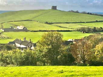
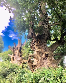
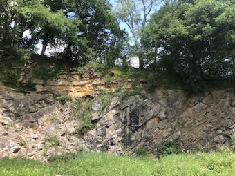
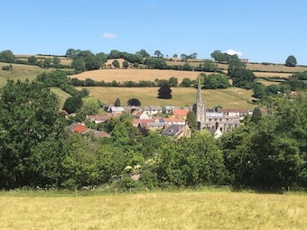
… is not only a lovely William Blake poem, and a tremendous novel by Glyn Hughes, but a phrase that takes me straight back to my childhood playground, the flat green floodplain of the River Severn. Jane and I went walking there yesterday, a day of high blustery wind and tremendous rolling cloud in a blue sky. We set off from the Red Lion at Wainlode Hill between Gloucester and Tewkesbury, a big old red-brick riverside pub on a bend of the Severn where the river surges had sculpted out a tall cliff.

Some brilliant faces here:
https://www.redlionwainlode.co.uk/pub-history/

The landlord once told me that he remembered as a young boy going into the cellar there and being absolutely dumbstruck at seeing the floor covered in shining silver. It was a mass of salmon, caught in the Severn and stored in the old pub before being sold.


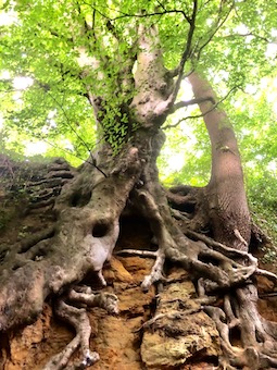
My chum Roo and I used to fish and fool around on the beach under the tall cliff hollowed out by the surging of the river round the bend. How we didn’t drown ourselves I can’t imagine – it’s a very dangerous spot, full of backwaters and eddies and submerged trees washed down by the very strong current. We didn’t see the hazards back then, of course.

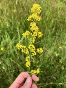
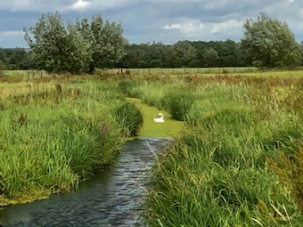
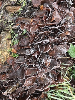
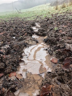
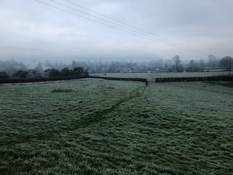
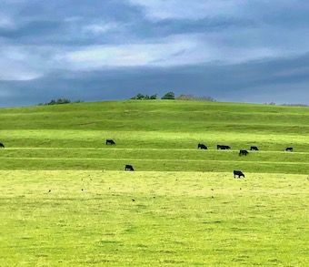
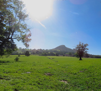
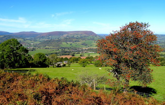
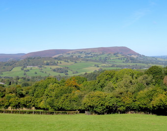
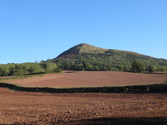
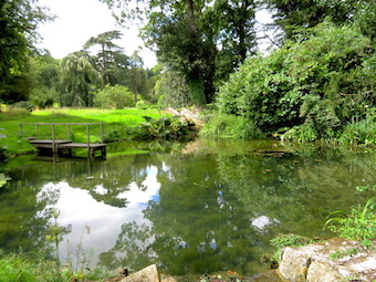
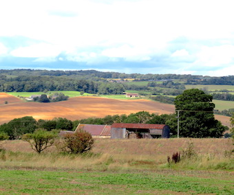
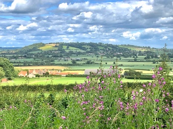
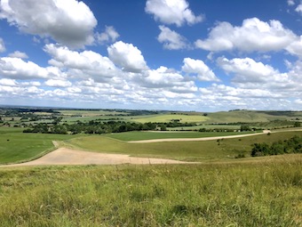
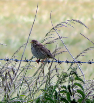
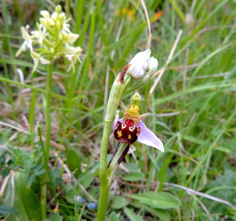
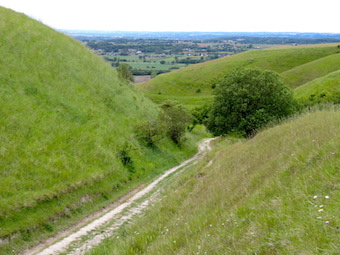
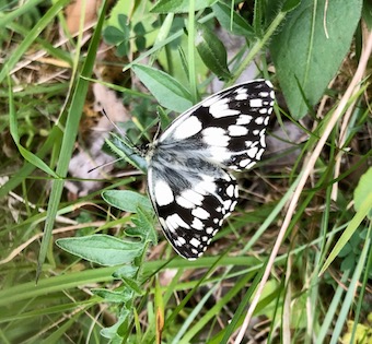
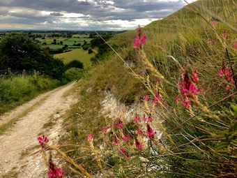
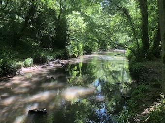
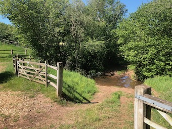
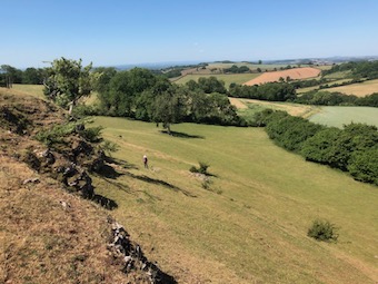
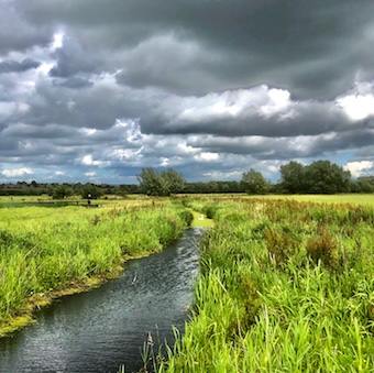
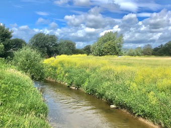
A couple of miles north through the meadows by the Severn, some freshly cut, others thick with tall grasses. A hop over a hummock of hill at Apperley, and we were wandering the paths of Coombe Hill Meadows Nature Reserve, with the long smooth line of the Cotswolds along the eastern skyline and the Malvern Hills standing out like a miniature mountain range in the west. All here is flat, lush, squelchy and packed with life. Swallows, swifts and martins zoomed about like fighter pilots over the meadows and pools, chasing down insects. The old canal that once linked the Severn with the Midlands, long abandoned, was lined with meadowsweet and tufty rockets of intensely purple loosestrife. Dragonflies hovered. The day was too wild and windy to see the hobbies and peregrines that hunt the reserve, but there was a sort of brisk pleasure in facing the wind as it teased the reed heads and thrashed the willow leaves till they whitened and turned inside out.

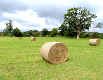
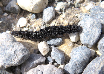
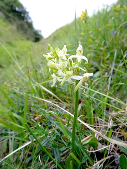
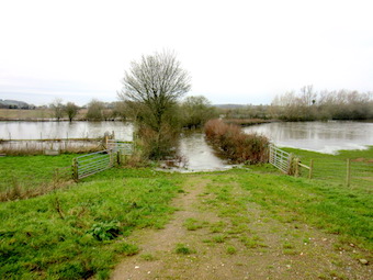
I’m so thankful to have been a child in the 1950s, when one was expected to be out of doors and away over the fields all day, ranging widely and getting into a lot of mischief. Roo and I knew our particular portion of these soggy lands as the Big Meadow. They were flooded most winters, mile after mile of King Severn’s invasions, and in fact they still are. We were chased up a tree, stark naked, by cattle after swimming in the canal. We chucked stones at ‘water rats’ (i.e. water voles), we broke down fences, we shared stolen ciggies and rude words, and once we beat up an old bus that we found parked in the bushes. Mea culpa, mea maxima culpa! All we wanted was to have rowdy outdoor fun. If we’d known that these were Lammas meadows, traditional farmed for hay and famous for their wild flowers and clouds of lapwing, snipe and geese, we wouldn’t have cared less. But I’m glad I know now, and I’m double glad to see them restored to health and richness by the Gloucestershire Wildlife Trust after decades of chemical pesticides and fertiliser had reduced them to sterile silage factories.

https://ww2.rspb.org.uk/groups/gloucestershire/places/320842/


 Posted by at 16:37
Jun 232020
 

We went to walk east of our village where the landscape turns from craggy limestone hills to long downs of chalk and greensand, moulded by rain and wind into a gently rolling, green and white countryside.

Near the start we came across an all-too-familiar scene – a mile or so of pasture through which the footpath ran unmarked over neglected stiles, to pitch up at a done-up farmhouse where the right of way passed across the farmhouse garden. An unguarded electric fence blocked access to the gate leading into the garden, where all signs and waymarks had been removed, to give the impression that there was no right of way. We hollered for the owner, who first sent the dog out, then somewhat shamefacedly emerged from the house and admitted that, yes, the path did cross her garden. No apologies for the electric shock we got crossing the fence, however!

It’s been very noticeable in recent times how many rights of way have been obliterated or obscured, waymarks and signposts removed, and obstacles erected around nice country houses whose new owners have done the properties up to the nines and decided unilaterally that the rights of way they accepted when they bought the house can be quietly abolished. Poverty of resources at County Hall has led to the laying off of many of the county Footpaths Officers whose job it is to keep our wonderful and unique network of paths open by making sure that householders and landowners do toe the line about maintaining access. The Ramblers organisation do the best they can – and we walkers are the best weapon they have in the fight to preserve what amounts to an irreplaceable national treasure. Keep walking those paths, folks! Rant over!

Up on the downs the views were breathtaking, far north to the Cotswolds, far south to Salisbury Plain. John Morgan was an unfortunate felon hanged for murder on these downs in 1720, and his name lives on at Morgan’s Hill, now a nature reserve where we picnicked among pyramidal orchids, yellow rattle, scabious and blue butterflies.

From here the Wessex Ridgeway took us south through a long valley where I was thrilled to see a corn bunting on the barbed wire fence between fields where oats and beans and barley grow. A stout little bird with a streaky breast, increasingly rare as its habitat and food sources have come under pressure from modern pesticides.


The homeward path led over Oliver’s Castle hillfort, where in 13 July 1643 an army of Parliamentary soldiers was routed by Royalist cavalry, many of them pursued at a panicky gallop till they tumbled in a terrible heap of men and horses down the steep face of the downs into the cleft known now as the Bloody Ditch.


No such awful scenes on these slopes today – just marbled white butterflies, bee orchids and lesser butterfly orchids, and of course the sky-filling songs of larks.


 Posted by at 16:02
Jun 112020


The woods are full of secrets, and it’s taken Lockdown to give me eyes to see them. If it hadn’t been for these remarkable times and their constraints, I don’t suppose I would ever have taken such a close look at the map, day after day, to spy out these tangled webs of purely local walks. What a delight it has been to focus in on a knoll or cleft or patchwork of fields, and realise that my own countryside is still a mystery and an enticement.

Ironmaster’s Vale runs east/west, a very twisty and narrow stream hollow that’s not quite a gorge, and not a valley either. Sunk in here among the trees are the ruins of an iron-grinding industry – arches, walls, spillways, sluices and old rotten beams thick with ferns. Limekilns and millstones, caves and quarries.

A footpath meanders through the vale, with side turnings leading off through the nettles and butterbur. The narrowest and least noticeable of these unofficial trails leads to a most remarkable quarry wall, a concave sweep of grey carboniferous limestone about 350 million years old canted at a steep angle, with a cap of buttery yellow oolitic limestone lying horizontally on top where it was deposited about 180 million years ago. A geologist’s thrill, and a questioning mind’s delight.

Two boys were dipping for crayfish in the stream. They had caught one apiece, lobster-like creatures about five inches long that scuttled round the bottom of their bucket. These white-clawed crayfish, natives of Britain, are threatened by an invasion of American signal crayfish, which are bigger and tougher. The newcomers also carry a plague to which our chaps have no resistance.

So crayfish have their worries, too.


 Posted by at 11:08
Jun 042020
 

Leaving the village early on a hot windy morning, we skirted the west end of Quarry Hill. Ash dieback disease has got a firm grip of the young trees here, and is reducing them to pale skeletons in the wood. On the far side we crossed the dry yellow pastures of Dragondown where the cattle plodded one after another towards the shade of oak trees now turned as dark as iron by this two-month drought.

In the quiet green valley of the Russet Mere stream beyond Dragondown, a private revolution is taking place. The old knockabout farmhouses, beautifully sited but long neglected, have been bought up and spruced to the nines. The former dairying pastures of poached slopes and tough grass have been transformed into wildflower meadows thick with buttercups, knapweed, clovers and silky grasses with lovely names – Yorkshire fog, cock’s foot, crested dog’s tail. Aspens in stout tree guards, rustic park fencing and carefully signed paths all point to new influences, welcome ecologically, but oddly troubling too. At what point do the economics of everyday farming fall below feasibility, obliging the old farming families to give way to well-heeled conservers of the countryside?

Food for thought as we wandered the path through these delectable meadows and up to the strange gritty outcrop called Monk’s Kitchen. From here a really wonderful view down over the track of an old railway sneaking round the foot of Quarry Hill, and out across fields and woods to a prospect opening over the distant coast and the Quantock and Exmoor hills beyond.

The path to Holdfast Farm below had been impenetrably blocked with a crop of wheat. Damn you, farmer! We pushed our way along the field margin ploughed and sown right up to the spiky hedge. Hmm, yes, old style farming ahoy!

Up on the rise beyond we stood looking down on our neighbour village with its tall grey church spire, roofs and trees – a classic English view in early summer.

In a quiet green valley beyond.


 Posted by at 17:40