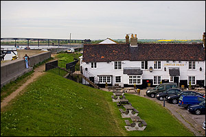
Search Results : essex

Dec 082012
 

Setting out from Beaminster to climb Lewesdon Hill, the highest point in Dorset at 279 metres, is a baffling task. Which hill is which?First published in: The Times Click here to view a map for this walk in a new window
picture picture picture picture picture picture picture picture
Facebook Link:
There are so many knolls, hillocks and knobbles in the billowing green countryside that enfolds snug little Beaminster. The Wessex Ridgeway Trail connects most of the best, though, and so we entrusted ourselves to its steep and muddy course.

With the deliciously rich smell of decomposing beech leaves coming from underfoot, and a blowy sky of silver and blue-grey overhead, we climbed away west along the Wessex Ridgeway up the green tump of Gerrard’s Hill to the windwhistle spinney of storm-battered beeches at the summit. Chart Knolle farmhouse lay below, perfectly positioned and beautifully maintained on its saddle of ground between two deep valleys. Stoke Knapp’s farmhouse a little further on was a sad contrast, silent and empty at the roadside with windows blank and slates beginning to slip.

A green lane skirts the flank of Lewesdon Hill, rising gently and running between huge old beeches in mossy hedgebanks. From the lane we followed a leaf-smothered cartway up through the woods to Lewesdon’s top. Here we sat and gazed south to folded hills cradling a long slip of tarnished-silver sea. Iron Age folk ramparted Lewesdon’s summit, Romans fortified neighbouring Waddon Hill, and looking from the roof-tree of Dorset, the sense is of an ancient landscape with a history that any imaginative watcher could unfold.

A steep path brought us down from the peak of Lewesdon through the beechwoods, with glimpses between the silvery trunks out west to the top of Pilsdon Hill, flattened and spectacularly embanked by the Durotriges tribe more than 2,000 years ago.

Stoke Abbot was a maze of dark gold hamstone houses under thatch. Beyond the village we took to the ancient green road of Long Barrow Lane, slanting down across the fields to a puzzle of paths in the boggy stream bottom of Little Giant Wood. Nearing Beaminster, we walked under an evening sky dramatically smeared with a fiery glow of scarlet and gold. As we came through a meadow I glanced up and saw a dozen horses blackly outlined on a ridge, grazing companionably in the last light of day – a sight essentially unchanged since the Durotriges rode this land.

Start: Beaminster Square, Dorset DT8 3AW (OS ref ST 481014)

Travel: Bus Service 47 (firstgroup.com), Bridport-Yeovil
Road: Beaminster is on A3066 between Crewkerne and Bridport

Walk: Down Church Street past Beaminster church (479013), on along Shorts Lane. In 400m cross lane end (475014); across next field to Stoke Road (473014); left, then right in 30m (fingerpost) along Halfacre Lane. In 100m, left (472014 ‘Wessex Ridgeway Trail’/WRT) through stile; half-right across field to barn (470014). Through gate; left (WRT) around field edge. Through gate (‘Beaminster Ramblers Millennium Walk’/BRMW); down through woodland (‘Chart Knolle’). Cross footbridge (467012; BRMW); steeply up to stile on skyline. On over stiles (WRT) to top of Gerrard’s Hill (460012).

Down to Chart Knolle farmhouse (456014); on west (‘Stoke Knapp’, WRT) through fields to Stoke Knapp farm (445015). Cross B3162 (fingerpost); on along Lewesdon Hill Lane (green lane). In 600m pass National Trust sign on left (439014); in another 250m, just before blue arrow, turn left (437014) past National Trust sign and information board up broad woodland track to Lewesdon Hill summit (438012). Follow track steeply downhill southwards off summit. In 600m it descends as a bridleway to T-junction of tracks; right to gate into roadway (437005). Left for 50m; right through gate (yellow arrow); half-left across 2 fields, then left to cross B3162 (440003).

Follow lane (‘New Inn’). At Brimley Cottage lane bends left (445003); keep right of cottage (fingerpost) down path and through gate (‘Jubilee Trail’/JT). Follow hedge on right for 200m; where it bends right towards a field gate (447003) keep ahead down slope, through kissing gate (448003, JT). Along boardwalk, through kissing gate (JT). Half left up field slope, passing to left side of house (449003). Cross 2 fields to sunken lane (451003), left to road, right into Stoke Abbott.

Follow road through village, past New Inn; in 100m, right (454008, fingerpost) along fenced path. Through gate (JT); on down slope. Left through gate (JT); cross stream; left along stream to recross it (JT). Bear left with stream on left, passing Horsehill Farm to descend and bear right through gateway (459005, JT). In 50m, left to cross stream (JT); follow path with stream on right to gate (JT); across field to shed where you cross farm track (463005). Ahead through wicket gate (JT); right along grassy Long Barrow Lane.

In 550m, dogleg left (466002, JT), then right in field (fingerpost). Descend to cross stream (469000). In 100m, DON’T turn right to cross another footbridge, but keep stream on right, bearing away from it half-left to gate from wood into field (470000, JT on reverse side). Half left across field to far top corner; cross stony lane (472001, JT) and next field. Through gate; left (473002, JT, blue arrow) along lane. In 350m, on through gate’ in another 100m, lane ends at gate (475006). Continue ahead (ignore lower path that forks right towards cottage). Cross field on upper path; through 2 gates in succession (477009). Follow fence to gate (479010, BRMW) and lane into Beaminster. At T-junction, right to town centre.

Walk: (7 miles, moderate, OS Explorer 116 – NB: Detailed directions (essential!), online map, more walks: christophersomerville.co.uk).

Church Street past Beaminster church (479013); Shorts Lane, then well-waymarked Wessex Ridgeway Trail and Beaminster Ramblers Millennium Walk west for 3 miles via Stoke Road (473014), Higher Barrowfield Farm (470014), Gerrard’s Hill (460012), Chart Knolle farmhouse (456014), Stoke Knapp farmhouse/B3162 (445015), and Lewesdon Hill Lane. At 2nd National Trust sign, left up track to Lewesdon Hill summit (438012). South for 600m to farm roadway (437005); field path to cross B3162 (440003). Follow waymarked Jubilee Trail for 3½ miles back to Beaminster via Brimley Cottage (445003), stream crossing (448003), road (451003) through Stoke Abbott. 100m past New Inn, right (454008, fingerpost); follow Jubilee Trail past Horsehill Farm (459005); on via Long Barrow Lane (463005-466002) and stream crossing (469000). Gate into field (470000); across field, lane (472001), field to lane (473002), left and follow JT to Beaminster.

NB: Mudproof and waterproof footwear!

Lunch: New Inn, Stoke Abbott (winter hours: closed Sunday evening, all Monday). Tel: 01308-868333

Accommodation: Bridge House Hotel, Beaminster DT8 3AY (01308-862200; bridge-house.co.uk)

Information: Bridport TIC (01308-424901)
www.ramblers.org.uk www.satmap.com www.LogMyTrip.co.uk

 Posted by at 01:53

Walks near Bristol


Chapter 17. Wallasea Island, Essex (extract)


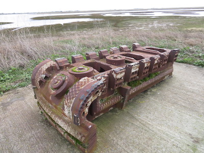
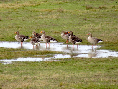
(a) Cutting head of Crossrail tunnel boring machine         (b) Greylag geese on Wallasea’s new grazing marshes

When I first ventured to Wallasea Island in the 1980s, it was a dead flat, dead green crop factory in a remote corner of the Essex coast. The one public footpath petered out halfway round the crumbling sea wall of the island, and there was no particular welcome for wildlife or the walker. Then lonely Wallasea was chosen by DEFRA, the Department for Environment, Food & Rural Affairs, for the innovative experiment of ‘managed realignment’ – in other words, breaking the walls to let in the sea, an attempt to work with natural forces rather than continue with the futile policy of trying to outface them. Between 2007 and 2015 Wallasea saw the arrival of three million tons of ‘arisings’ or spoil, excavated during the building of tunnels and ventilation shafts for the Crossrail rapid transit railway across London. The spoil was loaded into dumper trucks and carted off to form the islets, banks and foundations of Jubilee Marsh, and to reinvent the cornfields as saline lagoons with their own creeks and grazing marshes.

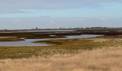
Looking from the new sea wall today, I really could not believe it was the same place. Where were the wall-to-wall fields of corn and beans? Staring south across the island, I saw the whole regimented prairie had gone. In its place lay pools and lagoons, coarse grasslands and marshes, as far as I could see. And on this bitter winter day the island was alive with the movements and noises of birds. Curlews bubbled, oystercatchers piped, pik-pik! Redshank and shelduck patrolled the shore. Brent geese with white rumps and black heads came in to land on the grass with hoarse hound-like yelping, their wings held stiffly up and behind them at the moment of landing.

… Over on Foulness Island someone had lit a monstrous fire. Black smoke rose from a red glowing point and billowed into the sky. The volcanic look of the fire sent me back through the bones of Britain, back up the long road past the glittering city and the gently settling chalk, the Great Dying and the miracle of life on land and in the sea, past gritstone and limestone, coal and shale and the metamorphic mountains, all the way back to the fire and fury at the beginning of the world. There was a tingle in my feet and my head seemed full to bursting. What a hell of a journey I’d been on.
                                                                                            (c) Jubilee Marsh, Wallasea – created in 2015

 Posted by at 22:25

Books


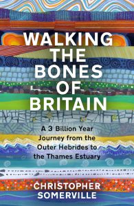
Walking the Bones of Britain is the story of a thousand-mile journey through the rocks and landscapes of the British Isles, unrolling over three billion years. It starts in the Outer Hebrides at the northwest tip of Scotland among the most ancient rocks in the land, formed in fire and fury when the world was still molten. And it finishes a thousand miles away in the southeast corner of England, where nature and man are collaborating to build new land.

In between, an incredible journey along footpaths and byways, moving from melted rock to volcanic upheaval, the clash of continents, mountain ranges rising and falling, seas invading and retreating, lands ripped apart and oceans snapping shut. In the evidence of the rocks under our feet and the landscapes around us we find life forming and flourishing, snuffed out by crashing asteroids, sent packing by ice sheets a mile thick, flooding back by land and sea.


In my workroom is a case of shelves that holds 450 notebooks. Their pages are creased and stained with mud, blood, flattened insect corpses, beer glass rings, smears of plant juice and gallons of sweat. Everything I’ve written about walking the British countryside has had its origin among these little black-and-red books.

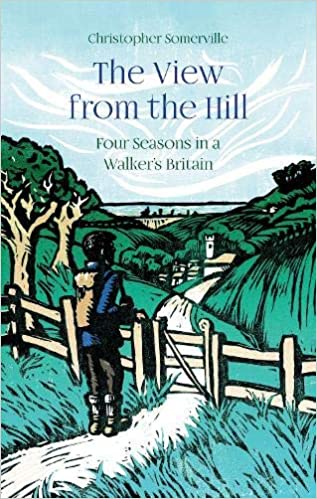
During the lockdowns and enforced idleness of the Covid-19 pandemic, I began to revisit this rough treasury of notes, spanning forty years of exploring these islands on foot. The View from the Hill pulls together the cream of this well-seasoned crop, following the cycle of the seasons from a freezing January on the Severn Estuary to the sight of sunrise on Christmas morning from inside a prehistoric burial mound. In between are hundreds of walks to discover randy natterjack toads in a Cumbrian spring, trout in a Hampshire chalk stream in lazy midsummer, a lordly red stag at the autumn rut on the Isle of Mull, and three thousand geese at full gabble in the wintry Norfolk sky.
https://www.hauspublishing.com/product/the-view-from-the-hill/


Our War Paperback – Unabridged
‘Our War – How the British Commonwealth Fought the Second World War’ tells the extraordinary story of the men and women of the British Commonwealth, from many nations all over the world, who volunteered to fight alongside Britain during World War Two.

How did people of all kinds, races, religions and ways of thinking come together like this? Why did young men and women from Trinidad and Australia, India and Canada, Seychelles, Kenya and New Zealand put themselves at risk thousands of miles from home? Why did they feel so strongly attached to Britain, the ‘mother country’? And how were their lives and attitudes changed by their experiences?

From the jungles of Burma and the night skies over Berlin to the icy waves of the Arctic convoys, the blitzed streets of London and the hellish PoW camps of Borneo and Poland we follow them. Survivor’s guilt, immense pride, PTSD, stoicism and bitter anger: all these are here, in the words of people who never dreamed they would find themselves at the cutting edge of war.

I travelled round the world in the nick of time to catch the experiences of these elderly survivors of many nations. This is the one and only only record of their service and its aftermath.

‘Our War – How the British Commonwealth Fought the Second World War’, published by Weidenfeld & Nicolson 16 April 2020 in paperback and audio.

Our War


Ships of Heaven – The Private Life of Britain’s Cathedrals is the story of Britain’s flotilla of cathedrals, tossed on waves of power and glory, scandal and mayhem for a thousand years. Nowadays these great stone ships seem as solid and unshakeable as any Rock of Ages. But they are leaky old vessels in uncharted waters. They creak and groan, they fail and founder, then resurface against all odds. Theirs is a thrilling saga of crisis and boldness, of ruin and revival.

Ships


The January Man (paperback edition)
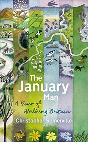
The January Man (shortlisted for Wainwright and Richard Jefferies prizes) – Christopher’s much-praised account of a year’s walking and nature watching in Britain, out in paperback.

JanMan
The January Man
The January Man is the story of a year of walks that was inspired by a song, Dave Goulder’s ‘The January Man’. Christopher describes the circle of the seasons around the British Isles, each month in its own unique setting – January in the winter floodlands of the River Severn where he grew up, March in the lambing pastures of Nidderdale, May amid the rare spring flowers of Teesdale, June along towering seabird cliffs on the remote Shetland island of Foula, September among the ancient oaks of Sherwood Forest. Flowers and birds, sensational landscapes and remote corners of country, winter and rough weather, shepherds, musicians and farmers, Robin Hood and the Green Man – they’re all here in this powerful evocation of the countryside, its treasures and secrets, and its cycle of life, death and rebirth.

The walks and landscapes of The January Man are interwoven with meditations on the relationships between people of Christopher Somerville’s post-war generation and their reticent fathers. Christopher’s father John, a senior civil servant at the secret GCHQ establishment in Cheltenham, never spoke about his work or his wartime experiences. But he was a great walker during his lifetime, and it was through walking and talking that he began to open up to his son as they drew closer to one another. As he walks the land through the cycle of the seasons, ten years after John’s death, Christopher comes to appreciate and understand the man that his father really was, as he reflects on the circle of his life.

JanMan


Times Britain’s Best Walks (paperback edition)
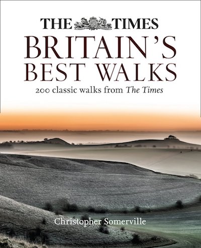
Times Britain’s Best Walks – 200 walks all over these islands, this paperback edition offers the cream of Christopher’s long-running ‘A Good Walk’ column in The Times.

BBW
The Times Britain’s Best Walks
At long, long last! – 200 of the best of Christopher’s ‘A Good Walk’ walks from The Times, gathered between covers. Lovely photos (many by Christopher’s wife Jane), maps, detailed directions, where to eat/drink etc., how to get there – and of course, Christopher’s lyrical descriptions of landscape, nature, history and people.
TTBBW

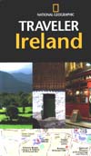
Traveler Ireland
A 4th edition of this top-selling guidebook to Ireland is just out.
‘This book and Map was amazing!! It had EVERTHING on it. I took 4 guide books with us; Rick Steve’s, Ireland for Dummies, Back Roads of Ireland, and this one. I never used any of the other books but this one. It have everything we needed and more. The other books seemed to be promoting areas that were not that great, This book highlighted some of the most amazing places that were off the beaten path of the main tourist areas.’ – Amazon review of 3rd edition by ‘Samantha’, 1 July 2014.

travi

Somerville’s 100 Best Walks
Hooray! Haus Publishing have produced a new paperback of ‘Somerville’s 100 Best Walks’, a collection (first published in 2009) of some of the best walks I did during my 17-year stint as Walking Correspondent of The Daily Telegraph. Entitled ‘Somerville’s 100 Best British Walks’, the new version (in weatherproof laminated covers) is smaller, lighter and more handy, but still contains all the walks complete with their wonderful hand-drawn illustrated maps by Claire Littlejohn.

100

Where To See Wildlife In Britain And Ireland
‘Where To See Wildlife …’ brings together the very best places you can see wildlife in Britain and Ireland – 826 of them, from famous national nature reserves to local sites, hillsides, woodlands, marshes and mountains.

The wildlife of the British Isles is just about the most diverse and fascinating in the world for such a small archipelago. Chalkhill blue butterflies, early purple orchids, golden eagles, spawning salmon, otters, thousands of insects and fungi … We value and admire these beautiful creatures and plants – but where can we actually find them? Where, near your house or your holiday cottage or campsite, can you go to smell a fragrant orchid, see a rare large blue butterfly mating, or hear the roar of a rutting stag or the babble of ten thousand dunlin on a tideline? ‘Where To See Wildlife …’ tells you exactly where.

Each of these sites is individually and evocatively described, and enhanced with how-to-get-there directions, conservation designations, and information on facilities, refreshments and much else. Superb colour photos and maps, too.


This book is a practical tool as much as a treasure-chest of descriptions. Keep it in the car or by the bed; take it with you on holiday or work trips; put it in with the bird-watching binoculars and walking boots.

Wildlife

Traveler Great Britain
A new edition (the 3rd), part of the very highly respected National Geographic Traveler series, which I’ve updated and enhanced with lots of ‘Experience’ and ‘Tips’ panels – how and where to experience everything from watching a cricket match to joining in a Scottish ceilidh, hunting for Ice Age flora to taking a guided walk in Snowdonia.

Great Britain

Traveler Ireland
A new edition (the 3rd), part of the very highly respected National Geographic Traveler series, which I’ve updated and enhanced with lots of ‘Experience’ and ‘Tips’ panels – how and where to experience everything from
discovering Dublin’s great pubs to viewing the gable-end murals of Belfast, and from cookery classes at famed Ballymaloe in Counbty Cork to taking a seaweed bath in County Mayo!

Ireland

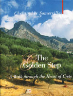
The Golden Step
Christopher’s much-acclaimed account of his 300-mile walk across Crete has gone into another, larger-format edition.

Golden Step

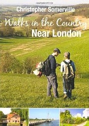
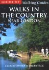
Walks in the Country near London
New and improved – 25 walks from railway stations (4 of them new, all of them re-walked – thank you for your help, Ruth!) in the beautiful countryside just outside London. Kentish apple blossom, Surrey lanes, Buckinghamshire beech woods, Essex wildfowl creeks – they’re all here.

walksnearlondon.jpg

Somerville’s Travels’ (AA Publishing – see below), Christopher’s account of 20 journeys at slow pace through Britain from Land’s End to Shetland, has been reissued as an ebook with a new and maybe better title – ‘Slow Travels Around Britain’. Here’s your chance to kick back with Christopher on your Kindle!

slowtravels.jpg

Britain and Ireland’s Best Wild Places
‘A gloriously idiosyncratic guide … Reading him, you want to get out, get walking, get looking’ (Robert Macfarlane, Sunday Times)
‘Brilliant and heartfelt … magnificent … an extraordinary work’ (Sunday Telegraph)
‘An excellent survey .. informative and poetic’ (Financial Times)
‘Utterly charming … a wonderful book and elegant reference guide’ (Irish Times)


That’s what the critics said about Christopher’s best-selling guide to 500 wild excursions, ‘Britain and Ireland’s Best Wild Places’. Now it’s out in paperback!

500.jpg

Never Eat Shredded Wheat, Christopher’s acclaimed gallop through the Geography of the British Isles (complete with Pub Quiz, naturally), is out in paperback! Here’s what the critics said:

‘This is geography not as a dry academic subject full of jargon and terminology, but as the natural history of a living, evolving landscape.’ (Economist )

‘This neat and engaging book will remind you of the geography of our green and pleasant isle, and, aside from anything else, will ensure you are never without the correct fact again’ (The Oldie )

‘Let’s lift our heads from the flat, mechanical, simplistic world inside the video screens and feast our five senses on the earthly delights of real geography where it rules supreme: out there.’ (Sunday Express )

‘An amusing and informative read.’ (Sunday Telegraph )

‘Packed with a wealth of information – making it a must for fans of pub quizzes. And it’s good to know someone else was taught that Great Britain looks like an old lady riding a pig’ (Press Association )

‘This book is brilliant…you will find explanations and descriptions of every nook and cranny of our nation.’ (The Sentinel )


‘A sort of Lynne Truss for our geography, by the author of COAST.’ (The Bookseller )

Never Eat Shredded Wheat

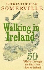
Walking has never been a more popular pastime and nowhere is more beautiful for walkers to explore than Ireland. In this beautifully written and superbly researched guide, Christopher Somerville draws on his very popular column for the “Irish Independent”, to present 50 of the very best walks in Ireland – from the Nephin Beg Mountains in Sligo in the North to Dingle Way in Kerry in the South. Practical instructions for the walks are married with evocative and informative passages on the history, flora and fauna, culture and topography of the land. Whether it’s exploring the Burren in its floral glory or seeing the Walls of Derry, or even sitting at home in your armchair planning your next walk, this book will prove popular with walkers, holiday makers and anyone who loves the Irish landscape.

Walking in Ireland.jpg

I’ve written Never Eat Shredded Wheat for everyone who – like me – found schoolroom Geography a boring parade of facts and figures, or who has forgotten most of what they did learn, or who has come to rely so heavily on Sat Nav that they’ve stopped noticing the landmarks that make our wonderful country such a pleasure to explore. We are so insulated from the real world when we’re in the car, plane or train, so plugged into iPods, stereos, CDs, phones and laptops, that we are in danger of becoming the best-travelled and worst-orientated Britons ever known. Let’s reconnect with the Geography of our islands – their look and feel, what made them and shaped them, where everything is, and why it’s there. Let’s celebrate the journey, and let’s arrive enriched and bewitched, with all our five senses tingling!
Never Eat Shredded Wheat takes you exploring the coasts and islands, the rivers and rocks, the cities and counties of Britain, from the Thames Estuary to the Irish Sea and from Rockall to Land’s End. It’s packed with facts and stories, anecdotes and jokes and ‘did-you-know’s. There’s a huge, 200-question Pub Quiz to test your knowledge and get one up on your friends. And the whole book is delightfully illustrated with maps and cartoons by my long-term collaborator Claire Littlejohn.

nesw.jpg


This book tells the story of 20 journeys- mostly on foot, but also by bicycle, branch line train, bus, narrowboat and ferry – across very special areas of Britain. Here are remarkable landscapes, travelled by the unfrequented ways that reveal their unique characters – the ancient Cornish coast wrapped in mist, the South Country downs threaded by the oldest road in Britain, post-industrial Birmingham and Stoke explored by canal, the Cheviot Hills on the tracks of cattle-thieves, musicians and murderers, the Shetland Isles and the northernmost point of our idiosyncratic archipelago. Illustrated throughout with colour photos, most taken by Christopher on his journeys.

travels.jpg


Christopher Somerville has been walking, exploring and writing all over the world for 30 years, and as the Walking Correspondent of the “Daily Telegraph” has written the “Walk of the Month” for over 15 years. This is his selection of his 100 favourite walks. They are to be read individually, as they are a true traveller’s observations of people, places, moods and reflections as they strike him. As a collection, they take the reader on a vivid, moving and unforgettable adventure through Britain, from the A of Angus Glens to not quite the Z but at least Y of York City Walls.

DT100.jpg

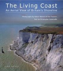
I have had the pleasure of writing the text, the captions and a long poem for this pictorial journey round the coast of Britain by way of sublime aerial photos by Adrian Warren and his wife Dae Sasitorn. These have to be seen to be believed – some of the rock, estuary and shoreline shots are more like collages or sculptures than photos. A real work of art, and it was a tremendous challenge for me to find the words that would enhance rather than weigh down such /images. ‘The Living Coast’ is published by Adrian and Dae’s publishing house, Last Refuge.

the-living-coast.jpg

Christopher’s acclaimed account of his end-to-end walk through Crete is now out in paperback!

gs.jpg


My second collection of poems – 100 of them, all inspired by my travels over the past 10 years. Thank you, Haus Publishing, for taking this on! It isn’t just a solid block of indigestible poems – here are notes and comments to give the context in which each poem was written, so that readers who’d normally run a mile at the thought of reading poetry can enjoy these, while the mystery and magic inherent in poems stays intact.

greenwooddark.jpg


This is a keenly-anticipated treasury of a book, illustrated with over 150 colour photographs and hand-drawn maps, the fruit of Christopher’s 30 years of exploring out-of-the-way places all over Britain and Ireland. Here are 500 Wild Places – overgrown city cemeteries, stormy cliffs and mountains, old quarries filled with orchids, ancient woods loud with nightingales, remote isles off the coasts of Wales, Scotland and Ireland. Lyrical descriptions combine with practical where-to and how-to instructions to make this a unique, indispensable guide to the Wild in these islands in all its forms, out in the wild blue yonder or right there on your doorstep.

NB – one of the 500 doesn’t really exist! Can you spot which it is? Visit www.penguin.co.uk/static/cs/uk/0/callofthewild/ to see how you can win a prize … !

wild.jpg


The Golden Step: A Walk Through the Heart of Crete (Haus Publishing 2007) The story of Christopher’s 300-mile walk from end to end of the magical Mediterranean island of Crete – across some of the toughest mountain terrain in Europe, among some of the world’s most fiercely hospitable people.

GoldenStep.jpg


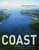
Coast – The Journey Continues Following the smash hit success of COAST, this new book accompanies the second and third BBC TV series, exploring new regions and uncovering yet more fascinating stories around our British and Irish coasts (BBC Books 2006)

coast2.jpg

Coast – A Celebration of Britain’s Coastal Heritage Accompanies the major television series (BBC Books 2005)

coast1.jpg


The Story of Where You Live – Uncover the history of your home, neighbourhood and countryside (The Reader’s Digest Association Ltd)

tsowyl.jpg

OUR WAR – How the British Commonwealth Fought the Second World War
(Cassell Military Paperbacks 2005)

pbwar.jpg

AA Key Guide Ireland (AA Key Guide 2005)

keyIreland.jpg

Ireland (National Geographic Traveler 2005)

tIreland.jpg

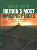
Britain’s Most Amazing Places (The Reader’s Digest Association Ltd)

amazing.jpg

Walks in the Country Near London (Globetrotter Walking Guides)

globwalksnl.jpg

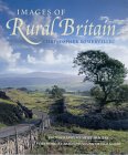
/images OF RURAL BRITAIN (New Holland 2001)

rural.jpg

THE SPIRIT OF RURAL IRELAND
(New Holland 2001)

rurali.jpg

AAA BRITAIN TRAVEL BOOK (2001 – Edition)

aaabrit.jpg

AA SPIRAL IRELAND (AA Books 2000)

ireland.jpg

EXTRAORDINARY FLIGHT – collection of poems (Rockingham Press 2000)

flight.jpg

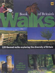
AA BOOK OF BRITAIN’S WALKS (1999 – contributions)

brit.jpg

NATIONAL GEOGRAPHIC TRAVELER BRITAIN (National Geographic/AA Books 1999)

britain.jpg

OUR WAR – How the British Commonwealth Fought the Second World War (Weidenfeld & Nicolson 1998)

war.jpg

AA EXPLORER CRETE (AA Books 1995)

crete.jpg

COUNTRY WALKS NEAR LONDON (Simon & Schuster 1994)

london.jpg

DAILY TELEGRAPH WEEKEND WALKS (Pan Books 1993)

teleww.jpg

THE ROAD TO ROARINGWATER – A Walk down the West of Ireland
(Harper Collins 1993; p/b 1994)

rr.jpg

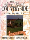
THE GREAT BRITISH COUNTRYSIDE (David & Charles 1992)

gbside.jpg

WELSH BORDERS (George Philip 1991)

welsh.jpg

THE BEDSIDE RAMBLER (Harper Collins 1991)

bed.jpg

THE OTHER BRITISH ISLES (Grafton 1990)

other.jpg

ENGLISH HARBOURS & COASTAL VILLAGES (Weidenfeld & Nicolson 1989/93)

harbour.jpg

BRITAIN BESIDE THE SEA (Grafton 1989)

beside.jpg

FIFTY BEST RIVER WALKS (Webb & Bower 1988)

50.jpg

COASTAL WALKS IN ENGLAND AND WALES (Grafton 1988)

coast.jpg

SOUTH SEA STORIES (WH Allen 1985)

southsea.jpg

TWELVE LITERARY WALKS (WH Allen 1985)

12.jpg

WALKING WEST COUNTRY RAILWAYS (David & Charles 1982)

wrail.jpg

WALKING OLD RAILWAYS (David & Charles 1979)

rail.jpg
 Posted by at 14:48

About the Author


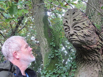
Christopher and the Mud Lane Green Man

About Christopher

Christopher Somerville is Walking Correspondent of The Times. His long-running ‘A Good Walk’ series appears every Saturday in the Times Weekend section. He has written some 40 books, many about his travels on foot in various parts of the world, and thousands of articles in all the national newspapers. He has had two collections of poetry published. He loves music, and sometimes tries to play it.


Walking the Bones of Britain
(published by Doubleday, 24 August 2023)


Walking the Bones of Britain is the story of a thousand-mile journey through the rocks and landscapes of the British Isles, unrolling over three billion years. It starts in the Outer Hebrides at the northwest tip of Scotland among the most ancient rocks in the land, formed in fire and fury when the world was still molten. And it finishes a thousand miles away in the southeast corner of England, where nature and man are collaborating to build new land.

In between, an incredible journey along footpaths and byways, moving from melted rock to volcanic upheaval, the clash of continents, mountain ranges rising and falling, seas invading and retreating, lands ripped apart and oceans snapping shut. In the evidence of the rocks under our feet and the landscapes around us we find life forming and flourishing, snuffed out by crashing asteroids, sent packing by ice sheets a mile thick, flooding back by land and sea.

And man as survivor and inventor, destroyer and conserver, rushing to the cliff edge and drawing back, time after time.

This book has taken me forty years to realise. It brings together two national treasures particular to the UK – this country’s unrivalled network of public footpaths, and the unique diversity of the geology that shapes its landscapes and history.

Geology can be very hard work. I have written Walking the Bones of Britain to demystify the subject, and to unearth from its dry, stony vocabulary and dense layers of facts the really vivid and extraordinary events that give these islands the world’s richest and most remarkable geological story.


Chapter 17. Wallasea Island, Essex (extract)


(a) Cutting head of Crossrail tunnel boring machine         (b) Greylag geese on Wallasea’s new grazing marshes

When I first ventured to Wallasea Island in the 1980s, it was a dead flat, dead green crop factory in a remote corner of the Essex coast. The one public footpath petered out halfway round the crumbling sea wall of the island, and there was no particular welcome for wildlife or the walker. Then lonely Wallasea was chosen by DEFRA, the Department for Environment, Food & Rural Affairs, for the innovative experiment of ‘managed realignment’ – in other words, breaking the walls to let in the sea, an attempt to work with natural forces rather than continue with the futile policy of trying to outface them. Between 2007 and 2015 Wallasea saw the arrival of three million tons of ‘arisings’ or spoil, excavated during the building of tunnels and ventilation shafts for the Crossrail rapid transit railway across London. The spoil was loaded into dumper trucks and carted off to form the islets, banks and foundations of Jubilee Marsh, and to reinvent the cornfields as saline lagoons with their own creeks and grazing marshes.

Looking from the new sea wall today, I really could not believe it was the same place. Where were the wall-to-wall fields of corn and beans? Staring south across the island, I saw the whole regimented prairie had gone. In its place lay pools and lagoons, coarse grasslands and marshes, as far as I could see. And on this bitter winter day the island was alive with the movements and noises of birds. Curlews bubbled, oystercatchers piped, pik-pik! Redshank and shelduck patrolled the shore. Brent geese with white rumps and black heads came in to land on the grass with hoarse hound-like yelping, their wings held stiffly up and behind them at the moment of landing.

… Over on Foulness Island someone had lit a monstrous fire. Black smoke rose from a red glowing point and billowed into the sky. The volcanic look of the fire sent me back through the bones of Britain, back up the long road past the glittering city and the gently settling chalk, the Great Dying and the miracle of life on land and in the sea, past gritstone and limestone, coal and shale and the metamorphic mountains, all the way back to the fire and fury at the beginning of the world. There was a tingle in my feet and my head seemed full to bursting. What a hell of a journey I’d been on.
                                                                                            (c) Jubilee Marsh, Wallasea – created in 2015


 Posted by at 16:42
Dec 182010
 

Facebook Link:

1. Lanlivery and Helman’s Tor, Cornwall

Lanlivery lies lost among its high-banked lanes to the west of Lostwithiel, a tiny hamlet sprinkled around the nucleus of St Brevita’s Church and the ancient Crown Inn. The pub – cosy and welcoming – dates back to Norman times. In fact it predates the church; the masons who built St Brevita’s with its tower of striped granite were put up there. As for Brevita: rather charmingly, absolutely nothing whatever is known about her – or him. There’s certainly a Saints Road or Saints Way that runs past the village, a former droving track (now a waymarked long-distance path) whose slanting course across the Cornish peninsula is dotted with ancient crosses, wells, standing stones and burial sites. It’s this path you follow between high hedges, a secret lane that smuggles you through the fields until you come out at the foot of Helman’s Tor. Up at the summit among the granite boulders you’ll find a logan or rocking stone – see if you can discover the subtle pressure needed to make it rock, while admiring the sensational views across the rolling Cornish farmlands.

Start: Crown Inn, Lanlivery, near Lostwithiel PL30 5BT (OS ref SX 079591)

Walk symbol: 4 miles, 2 hours, OS Explorer 107

Route: From Crown Inn, take Luxulyan road. At chapel, straight on (‘Lanivet’). In a quarter of a mile, right up green lane (‘Saints Way’) for 1 and a quarter miles to car park under Helman’s Tor. Climb Tor; return same way.

Lunch symbol: Crown Inn, Lanlivery (01208-8727071; www.wagtailinns.com).

Grade: 2/5 boots. Gentle ascent of tor. Green lane can be muddy!

Info: Lostwithiel TIC (01208-872207); www.visitcornwall.com


2. Stourhead and Alfred’s Tower, Wiltshire

Superb 18th-century Palladian grounds and park created by the Hoares – father Henry ‘The Good’, son Henry ‘The Magnificent’. Stroll a circuit of the lake and its temples, follies and grottoes, or step out up the valley to the wonderful Rapunzel-like Alfred’s Tower on the ridge above. Then cosy up to a cockle-warming casserole in the Spread Eagle Inn at the park gates, or plump for cake and cuppa in the tearooms.

Start: Stourhead car park, BA12 6QD (OS ref SX 778340) – signed from B3092 Zeals-Maiden Bradley road, off A303 at Mere

Walk symbol: 1 and a half miles round lake (1 hour) or 5 and a half miles Alfred’s Tower circuit (2-3 hours), OS Explorer 142 (grounds map available at Visitor Centre)

Route: From Visitor Centre. down path. Don’t cross bridge to gardens and house; turn left to Spread Eagle Inn and Lower Garden entrance (pay/show NT card). Anti-clockwise round lake. For Alfred’s Tower circuit: At Pantheon, don’t turn left across Iron Bridge; continue through trees to gate and gravel roadway. Right (‘Alfred’s Tower’); follow blue arrows up valley for 1 and a half miles. At top, left to Alfred’s Tower. From tower, retrace steps 100 yards; right into woods (yellow arrow/YA). In 300 yards YA points right, but keep ahead on main track. In 500 yards at crossroads, main track swings left (YA); but take downhill path. In 200 yards near foot of slope, left (YA) past shed; follow YA back to Pantheon; cross Iron Bridge; complete lake circuit.

Lunch symbol: Spread Eagle Inn (01747-840587; www.spreadeagleinn.com)

Tea symbol:

Grade: Lake 2/5 boots; Alfred’s Tower 3/5.

Stourhead (National Trust): 01747-841152; http://www.nationaltrust.org.uk/main/w-stourhead


3. Chidham Peninsula, West Sussex

The Chidham peninsula hangs like a skate’s wing in the middle of Chichester Harbour’s vast flats of marsh and mud. At any time of year you’ll get a tang of green countryside and a salty smack of the sea here. In winter there’s the added thrill of big crowds of over-wintering seabirds.

From the friendly Old House At Home pub in Chidham village, grass paths lead to the eastern shore of the peninsula. There’s a fine view across water, mud flats and saltmarsh to the squat grey spire of Bosham church above a cluster of waterfront houses – every chocolate-box artist’s dream of delight. The sea wall path runs south around Cobnor Point with its wonderfully gnarly and contorted old oaks, and on up the edge of Nutbourne Marshes where wildfowl spend the winter in their tens of thousands. A new sea bank has been built inland here, against the day when the old one is washed away by the never-satisfied, ever-hungry sea.

Start: Old House At Home PH, Chidham PO18 8SU (OS ref SV 786040)

Walk symbol: 5 miles, 2 hours, OS Explorer 120

Route: From pub, right along road. Just before church, right along grassy path (fingerpost), past Chidmere Pond to road. Right for 100 yards; right (fingerpost) through car park; left along hedge to shore (797034). Right (clockwise) round peninsula for 3 miles to pass Chidham Point (779042). In a quarter of a mile, right (781045) on footpath along field edges to road; right to Old House At Home.

Lunch symbol: Old House At Home PH, Chidham (01243-572477; www.theoldhouseathome.co.uk)

Grade: 1/5 boots. Flat seawall path.

Info: Chichester TIC (01243-775888; www.visitchichester.org); Chichester Harbour Conservancy (www.conservancy.co.uk)

4. Shoreham and Eynsford, Kent

A really delightful walk in north Kent’s wide Darent Valley. The rood screen and organ casing in Shoreham’s church boast fabulous carving. Just down the road, Water House (private) was a 19th-century haven for artists including William Blake and Samuel Palmer. The Darent Valley Path takes you north in lovely river scenery to pass Lullingstone Castle, a gorgeous Tudor country house, and Lullingstone Roman Villa – 30 rooms, several frescoes, and a magnificent mosaic floor. At the turn of the walk, Eynsford is a photogenic old village with a fine tumbledown Norman castle. From here you follow a quiet road up a secret valley, then climb over the ridge through the woods to return to Shoreham.

Start: Shoreham station, Shoreham, Kent TN14 7RT (OS ref TQ 526615)

Walk symbol: 8 miles, 3-4 hours, OS Explorers 147, 162

Route: Shoreham station – Shoreham church (523616) – Water House (521616) – Darent Valley Path (signed) north for 3 and a half miles via Lullingstone Castle (530644) and Lullingstone Roman Villa (530651) to Eynsford. Left along A225 to Eynsford Castle (542658); return through village. Just before railway bridge, left past Eynsford station; follow Upper Austin Lodge Road for 1½ miles. Before Upper Austin Lodge, fork right past golf clubhouse; footpath south-west through woods for 1 mile to cross A225 and railway (526618); dogleg left to Station Road – Shoreham station.

Lunch symbol: Olde George Inn, Shoreham (01959-522017); teashops and pubs in Eynsford

Grade: 2/5 boots. Field and woodland paths (muddy!).

Info: Lullingstone Castle and gardens (www.lullingstonecastle.co.uk) closed till April; Lullingstone Roman Villa and Eynsford Castle (EH; www.english-heritage.org.uk) open Wed-Sun till 31 Jan (closed 24-26 Dec, 1 Jan); open daily thereafter.


5. Regent’s Canal, Victoria Park and Thames Path

To get you going on this exploration of east London’s waterways and markets, a gentle blur of reggae among the earring and shawl stalls in the covered shed of Old Spitalfields Market. Next, Brick Lane’s street market – curry, chilli, salsa, roasting beef and goat; titfers and tomatoes, fish and fascinators, bread and chairs, sandwiches, socks and sun-specs in more colours than the good Lord ever made. A pause to commune with the animals in the city farm; then you follow Regent’s Canal’s towpath towards the Thames in company with tinies in pushchairs, runners, strollers and the dog walkers of wide green Victoria Park. Approaching the river, the colossi of Canary Wharf and the space-rocket nose of the Gherkin rise pale and ghostly. There’s the smack of tidal waves and a tang of the sea as you swap the stillness of the canal for the salty vigour of the Thames, to stroll upriver into the cosmopolitan heart of the city once again.

Start: Liverpool Street station (Central/Circle/Metropolitan/Hammersmith & City)

Walk symbol: 8 miles, 3-4 hours, OS Explorer 173, London A-Z pp 40-2, 54-6

Route: Liverpool Street Station –- Old Spitalfields Market – Brick Lane – Bethnal Green Road – City Farm – Haggerston Park. Regent’s Canal to Limehouse Basin. Thames Path to St Katharine Docks. North via Mansell Street and Commercial Road to Liverpool Street.

Lunch symbol: Beigel Bake, Brick Lane (0207-729-0616) – salt beef, cream cheese, fish: you name it, it’s here in a fresh-baked bagel

Grade: 1/5 boots.

More info: Old Spitalfields Market www.visitspitalfields.com; Brick Lane Market www.visitbricklane.org; Regent’s Canal http://www.bertuchi.co.uk/regentscanal.php; Thames Path www.walklondon.org.uk

Reading: London Adventure Walks for Families by Becky Jones and Clare Lewis ( Frances Lincoln)


6. Ingatestone and Mountnessing Hall, Essex

Here’s a beautiful ramble in easy country (but muddy!) out in mid-Essex, a much-overlooked walking county. Ingatestone Hall is a superb Elizabethan mansion with ranks of mullioned and latticed windows, acres of tiled roofs, crowstepped gables and castellated turrets. Cross the fields to Buttsbury church on its ridge; then head south through old field lanes and horse paddocks to the outskirts of Billericay. A stumpy spire beckons you west across the River Wid to where St Giles’s Church and handsome Mountnessing Hall with its tall chimneys stand companionably side by side. From here field paths lead north past Tilehurst, a Victorian mansion out of a Gothic fable, and on back to Ingatestone.

Start: Ingatestone station, Essex CM4 0BS (OS ref TQ 650992)

Walk symbol: 7 miles, 3 hours, OS Explorer 175

Route: From station, left on path; left to cross railway; Hall Lane to Ingatestone Hall. Field path (yellow arrows/YAs) to St Mary’s Church, Buttsbury (664986). Buttsbury road – footpath south for 1 and three quarter miles (YAs) via Little Farm and Buckwyns Farm to road on west edge of Billericay (661977). Left for 150 yards to right bend; ahead here on footpath for 1 mile to Mountnessing Hall and church. Field path north (YAs) for three quarters of a mile to road (648975) and Westlands Farm. Path via Kitchen Wood to Tilehurst; road to Ingatestone Hall and station.

Lunch symbol: Star Inn, Ingatestone (01277-353618)

Grade: 2/5 boots. Gentle farmland paths. Can be very muddy!

Info: Ingatestone Hall (01277-353010; www.ingatestonehall.com) open Easter-Sept; guided tours at other times by arrangement

Chelmsford TIC (01245 283400; www.visitessex.com)


7. Little Chalfont and the Chess Valley, Buckinghamshire

As soon as you get into the woods that lie north of Chalfont & Latimer tube station, you’re immersed in proper countryside. The Buckinghamshire landscape slopes to cross the winding River Chess and reach the charming small village of Latimer, where the heart and harness of Lord Chesham’s bold charger Villebois are buried in the village green. From here the Chess Valley Walk leads by the river. Out in the fields you pass the brick-built tomb of ‘Mr William Liberty of Chorleywood, Brickmaker, 1777’, and follow the beautiful River Chess up to Church End (Christmas-themed 14th-century church frescoes, and delightful Cock Inn). The main feature of the homeward walk is Chenies village with its vast church monuments and grand Tudor manor – the house is haunted by the ghost of King Henry VIII.

Start: Chalfont & Latimer tube station, Metropolitan line, HP7 9PR (OS ref SU 997975)

Walk symbol: 7 miles, 3 hours, OS Explorer 172

Route: From station follow Chess Valley Walk across River Chess to Latimer; then east for 2 miles along River Chess valley, passing William Liberty’s tomb (009987), Valley Farm (026090) and Sarratt Bottom. At 034984, opposite footbridge over Chess, left on footpath to Church End (Holy Cross Church; Cock Inn), Return to cross 2 footbridges; in 100 yards fork right (032984) – path via Mountwood Farm (024984) to Chenies. Bridleway west via Walk Wood, Stony Lane (005982) and West Wood to Chess Valley Walk (997981) and station.

Lunch symbol: Cock Inn, Church End (01923-282908; www.cockinn.net)

Grade: 2/5 boots. Field and woodland paths.

Info: Chenies Manor (01494-762888; www.cheniesmanorhouse.co.uk) open April-Oct.

High Wycombe TIC (01494-421892); www.visitbuckinghamshire.org


8. Goring to Pangbourne, Oxfordshire/Berkshire

This is one of the most appealing sections of the Thames Path, linking two classically attractive Thames-side pairs of towns by way of a lovely wooded path. Descending the hill from Goring’s railway station, you turn left along the river bank and are swallowed in a tunnel of trees. Here the Thames snakes through the Goring Gap, a cleavage between the thickly wooded Berkshire Downs and the more open and bare Chiltern Hills.

Soon you are out in wide grazing meadows, passing under the stained and weatherbeaten brick railway bridge that carries Isambard Kingdom Brunel’s Great Western Railway line across the river. Now the Thames Path enters woodland of beech, yew, alder and willow; soon it climbs to the rolling downs, before striking into a farm track and then the road down into Whitchurch-on-Thames. Cross the Thames into Pangbourne. Kenneth Grahame, author of The Wind In The Willows, lived in Pangbourne for the last eight years of his life, and is buried in the churchyard just up the street. It was at Pangbourne that the soaked and miserable heroes of Three Men In A Boat abandoned their craft and caught the train back to London.

Start: Goring & Streatley station, RG8 0EP (OS ref SU 603806)

Walk symbol: 5 miles, 2 hours, OS Explorer 171

Route: From Goring station, left and left again to River Thames; left on Thames Path to Whitchurch; cross river to Pangbourne station; return to Goring.

Lunch symbol: Ferryboat Inn, Whitchurch (0118-984-2161; www.theferryboat.eu)

Grade: 3/5 boots. Flat path by river; some ascents in woodland.

Info: Wallingford TIC (01491-826972); www.nationaltrail.co.uk/thamespath


9. Apperley, Deerhurst and the River Severn, Gloucestershire

A gorgeous half-day’s walk in classic River Severn country – rolling, green, gentle, bucolic. From the Severnside village of Apperley you follow field paths north to climb a ridge with wonderful views, before dipping down to the river at Lower Lode. Tewkesbury’s Abbey and half-timbered houses are just up the river-bank; but the walk heads south, with the wide Severn at your elbow. Make time to explore Odda’s Chapel and St Mary’s Church at Deerhurst with their rare and beautiful Saxon stonework and angel carvings, before heading back downriver to the Coal House Inn for ‘steak on a stone’ – a hungry walker’s delight.

Start: Coal House Inn, Gabb Lane, Apperley GL19 4DN (OS ref SO 855284)

Walk symbol: 6 and a half miles, 3 hours, OS Explorers 190, 179

Route: From Coal House Inn, up lane; in 50 yards, footpath (fingerpost) to road (862282). Left through Apperley; follow ‘Tewkesbury, Cheltenham’; left past village hall (867285; fingerpost). Footpath for 1 mile by Wrightfield Manor, passing Deerhurst Vicarage (872293), to cross road (873298; 3-way fingerpost). Cross stile (not gateway!); north for a third of a mile to pond (874303); north along ridge for 1 mile to River Severn at Lower Lode Lane (881317). Left along Severn Way for 1⅓ miles to Deerhurst; detour left to Odda’s Chapel (869299) and Church of St Mary (870300). Return to Severn Way; continue for 1⅓ miles to Coal House Inn

Lunch symbol: Coal House Inn, Apperley ((01452-780211)

Grade: 3/5 boots. Field and riverside paths. Can be muddy!

Info: Tewkesbury TIC (01684-855040);

http://www.enjoyengland.com/destinations/find/south-west/gloucestershire/dg.aspx


10. Ysgyryd Fawr (‘The Skirrid’), Abergavenny, Gwent

Ysgyryd Fawr, the Holy Mountain, rises in a beautiful and striking whaleback above the neat farming landscape on the eastern edge of the Brecon Beacons National Park. To see it is to want to climb it, whether you’re a hill-walker, country rambler or active youngster. The climb from car park to summit is just under a thousand feet, and once up there (a really superb spot for mince-pies and hot coffee) you are monarch of a huge view around the Welsh Border country. Traces of earthen ramparts show where Iron Age tribesmen fortified the hilltop, and a scatter of stones marks the site of St Michael’s Church, where the Catholic faithful attended the outlawed Mass during the 17th century.

Start: Car park on B4521, 2 and a half miles east of Abergavenny (OS ref SO 328164). NB – Please don’t leave valuables on show!

Walk symbol: 3 and a half miles round base, 2 and a half miles to summit and back (both 1 and a half – 2 hours), OS Explorer OL13

Route: From car park, follow pass across fields, up through Caer Wood, through gate (327172). Left to make clockwise circuit of base of hill; otherwise right. In 300 yards, either keep ahead for anti-clockwise circuit, or fork left. Steep climb, then levelling out for half a mile to reach summit (330182). Retrace steps; or continue, forking left or right to descend steep north slope to bottom; left or right to return to car park via round-base path.

Lunch symbol: Walnut Tree Restaurant, Llanddewi Skirrid (01873-852797; www.thewalnuttreeinn.com)

Grade: 3/5 boots round base; 5/5 to summit (steep). Wrap up warm!

Info: Abergavenny TIC (01873-857588); www.brecon-beacons.com


11. The Stiperstones, Long Mynd, Shropshire

It’s tough, but you’ve got to do it … tear yourself away from the warm welcome and fabulous home baking at the Bog Centre, and venture out up the stony path among the extraordinary quartzite outcrops of the Stiperstones. Cranberry Rock, Manstone Rock, the Devil’s Chair, Shepherd’s Rock – they poke up out of the beautifully restored heathland along their ridge like craggy spines on a stegosaurus back. Legends of warlocks and witches hang thickly round the Stiperstones. Lady Godiva rides naked there still. When the mist is down, the Devil himself sits brooding in his great rock Chair.

From the ridge you descend steeply to the Stiperstones Inn. It’s a stiff climb afterwards, and a stony lane home.


Start: The Bog Centre, Stiperstones, SY5 0NG (OS ref SO 355979)

Walk symbol: 5 miles, 2-3 hours, OS Explorer 216

Route: From Bog Centre, footpath/road to south end of Stiperstones ridge (362976). Follow Shropshire Way past Cranberry Rock (365981), Manstone Rock (367986) and Devil’s Chair (368991). From cairn just before Shepherd’s Rock (374000), bear left on steep descent between Perkins Beach and Green Hill to road in Stiperstones village (363004). Left past Stiperstones Inn for 400 yards; left across stile (361002; fingerpost, arrows); steep climb for half a mile (arrows), up past National Nature Reserve board to reach stony lane (36294). Follow it south, parallel to Stiperstones for ¾ mile. At Black Ditch opposite Cranberry Rock, through gate (361983); footpath down to road and Bog Centre.

Lunch symbol: The Bog Centre; or Stiperstones Inn, Stiperstones village (01743-791327; www.stiperstonesinn.co.uk)

Grade: 4/5 boots. Rough and stony around Stiperstones; steep descent to road; steep ascent to lane.

Info: Bog Centre (01743-792484; www.bogcentre.co.uk)


12. Thetford Forest, Suffolk/Norfolk border

Thetford Forest covers some 80 square miles of the sandy Breckland country along the Norfolk/Suffolk border; and as it’s largely composed of conifers, you might think it’s a gloomy old place for a winter walk. In fact low winter light lends mystery to the dark forest. Walking is sheltered and easy. Well-waymarked Yellow and Red Trails circle out from High Lodge and Thetford Warren Lodge respectively; combining the two gives you an excellent morning’s stroll. Children love clambering on the huge squirrel, spider, woodpecker and chum along the Giant Play Sculpture Trail (wheelchair and buggy friendly). Towards the end of winter there will be a night-time spectacular as the trees are transformed into the Electric Forest, with stunning light and sound effects.

Start: High Lodge Forest Centre, IP27 0AF – signed off B1107 Thetford-Brandon road (OS ref TL 809850)

Walk symbol: Red Route, 3 and a half miles; Yellow Route, 3 miles; Red/Yellow combined 7 miles; Giant Play Sculpture Trail (Easy Access), 1 mile. Map online (see below); OS Explorer 229

Lunch symbol: High Lodge café.

Grade: 1/5 boots. NB Parts of trails may be closed for forestry operations; diversions signposted.

Info: High Lodge Forest Centre (01842-815434; http://www.forestry.gov.uk/highlodge)

Electric Forest (www.theelectricforest.co.uk) – over February half-term 2011 (19 to 27 February), plus 3 to 6 March. Book your slot (5-9 pm) online or tel 01842-814012; £15.50 adult, £10 concessions, £41 family. 1 and a half mile self-guided walk by night; spectacular lights, effects; food and drink

13. Robin Hood and the Royal Forest, Edwinstowe, Nottinghamshire

This Sherwood Forest walk follows the newly-opened ‘Robin Hood and the Royal Forest’ trail from the Visitor Centre near Edwinstowe. It passes two massive and venerable trees, the Major Oak and the Centre Tree – the philanthropic outlaw’s hideout and rendezvous, according to legend. From here the trail curves through the forest to reach King Edwin’s Cross, marking the spot where Edwin, King of Northumbria, was buried after his death in battle in 633AD. A track on the edge of the forest brings you to Edwinstowe and the Norman church of St Mary. Were Robin Hood and Maid Marian married here? Anyone with an ounce of romance thinks so.

Christmas-flavoured celebrities at Sherwood Forest Visitor Centre include St Nicholas, who will be manning his grotto till 19 December (11-4), and the Dukeries Singers who belt out their Christmas songs on 19th (2-3 pm).

Start: Sherwood Forest Country Park Visitor Centre car park, Edwinstowe, Notts NG21 9QA (OS ref SK 627676)

Walk symbol: 6 miles, 3 hours, OS Explorer 270

Route: From Visitor Centre follow Blue Trail to Major Oak 621679); on along Robin Hood Way to the Centre Tree (606676); ahead, keeping same direction, for three quarters of a mile; left (595672) along ride for a third of a mile; left (591667) past King Edwin’s Cross (594666) to meet A6075. Left along verge for 300 yards; left (north) for half a mile; right (607671) for nearly a mile towards Visitor Centre. Right (621676) on bridleway to Edwinstowe and St Mary’s Church. Return to Visitor Centre.

Lunch symbol: Visitor Centre

Grade: 2/5 boots. Forest tracks.

Info: Sherwood Forest Country Park Visitor Centre (01623-823202); www.sherwoodforest.org.uk


14. Beverley and Westwood, East Yorkshire

A cosy, friendly town, some truly astonishing medieval artwork, a wide green common and a (very) characterful pub with coal fires and great food – what more could you ask of a winter walk? Beverley Minster and St Mary’s Church between them boast some of the finest stone carvings in Britain – merry musicians, gurning demons, Green Men spewing foliage, forest monsters and improbable animals. Gaze and marvel your fill; then stroll through the town, every vista packed with nice old buildings. Walk across the racecourse and out over the wide open spaces of Westwood Common, carefully preserved from development by Beverley’s vigilant Pasture Masters. From the Black Mill high on its ridge there’s time for a lingering prospect over the town, before making for the warmth, good cheer and bright fires of the White Horse in Hengate – know to all as Nellie’s.

Start: Beverley station, HU17 0AS (OS ref TA 038396))

Walk symbol: 5 miles, 2-3 hours, OS Explorer 293

Route: Beverley Minster – Wednesday Market – Saturday Market – St Mary’s Church. Through North Bar – along North Bar Without – left down Norfolk Street onto Westwood Common (025401). Ahead across racecourse, then A1174 (019397). Ahead through Burton Bushes, to exit stile at far side (010392). Aim for Black Mill on hill (021390). From mill, aim for St Mary’s tower; through Newbegin Pits dell to footpath on far side (027395). Right past Westwood Hospital; left along Lovers Lane (027394 – kissing gate, lamp post) to St Mary’s Church and town centre.

Lunch symbol: White Horse, Hengate, Beverley (01482-861973; www.nellies.co.uk)

Grade: 2/5 boots. Town pavements, grass paths

Info: Beverley TIC (01482-391672; www.realyorkshire.co.uk)

15. Whitby and Hawsker, North Yorkshire

Whitby is a great winter town, full of museums, teashops and odd nooks and crannies. It’s also where Bram Stoker based Dracula, and the walk starts up the steps, through the clifftop churchyard and by the towering abbey ruins haunted by the toothy Transylvanian. Then a wonderful, wind-blown three miles along the cliffs where Victorian miners dug shards of fossilised monkey-puzzle trees. Polished and shaped by craftsmen, the fragments became shiny black jet, to be turned into ornaments that made many Whitby fortunes. Inland over the fields, and then a smooth stretch of the old Whitby & Scarborough Railway, a hop over the River Esk across mighty Larpool Viaduct, and a bun and cup of tea in Elizabeth Botham’s iconic and excellent teashop.

Start: Whitby harbour bridge (OS ref NZ 900111).

Walk symbol: 8 miles, 4 hours, OS Explorer OL27

Route: Church Street – 199 Steps – St Mary’s Church (902113) – Whitby Abbey – Cleveland Way coast path east for 3 miles. Near Gnipe Howe farm, cross stream (934091); in another third of a mile, right (936086; arrow, ‘Hawsker’ fingerpost) to Gnipe Howe (934085). Farm drive for two thirds of a mile – right on Scarborough-Whitby Railway Path for 2 and a half miles. Cross Larpool Viaduct (896097); in 250 yards, right (arrow; Esk Valley Walk ‘leaping fish’ fingerpost) – cross A171 (898102). Right for 100 yards; left (fingerpost), descending to west quayside – ahead along River Esk to bridge.

Lunch symbol: Windmill Inn, Stainsacre (01947-602671, closed Tues and Thurs lunchtime; Elizabeth Botham’s Teashop, 35-9 Skinner Street, Whitby (01947-602823; www.botham.co.uk)

Grade: 3/5 boots. Coast and field paths (muddy round Gnipe Howe Farm); cycleway

Info: Whitby TIC, Langborne Road (01723-383637); www.yorkshire.com


16. Keld and Tan Hill, North Yorkshire

A long morning’s or afternoon’s walk in a very beautiful location, this moorland hike is an absolute peach, especially if the sun’s out and it’s a crisp winter day. You start from Keld Lodge Hotel, a great conversion job on the old youth hostel, and walk through the pretty stone-built village of Keld before crossing the River Swale by some fine waterfalls. The well-marked Pennine Way National leads you north across open, rolling moorland, with the Tan Hill Inn beckoning– a classic walker’s inn, very lively and warm. The return walk is down a ribbon-like moorland road; then you retrace your steps along a mile of the Pennine Way before taking the footpath down lovely Stonesdale to the rushing waterfall of Currack Force on the outskirts of Keld.

Start: Keld Lodge Hotel, Keld, N. Yorks DL11 6LL (OS ref NY 110839)

Walk symbol: 9 miles, 4 hours, OS Explorer OL30

Route: Right along road; left into Keld. Right (893012; ‘footpath to Muker’). In 300 yards, left downhill (‘Pennine Way/PW’). Cross River Swale footbridge; follow PW for 4 miles to Tan Hill Inn (897067). Left along road for 100 yards; left on moor road for 1 and three quarter miles. Just before Stonesdale Bridge, left on bridleway for 200 yards (884043); right on PW for 1 mile. Just beyond Frith Lodge drive, right on footpath (890030), south for three quarters of a mile to meet bridleway near Currack Force on Stonesdale Beck (888016). Left to PW and Keld.

Lunch symbol: Keld Lodge Hotel (01748-886259; www.keldlodge.com); Tan Hill Inn (01833-628246; www.tanhillinn.co.uk)

Grade: 3/5 boots. No steep ascents, but rough moorland paths. Hillwalking gear, boots.

Info: Richmond TIC (01748-828742); www.yorkshire.com


17. Askham and Heughscar Hill, Cumbria

Alfred Wainwright wrote his walking guidebook Outlying Fells Of Lakeland (Frances Lincoln) for ‘old age pensioners and others who can no longer climb high fells’. That makes his Heughscar Hill walk perfect for those with a bellyful of Christmas grub. A farm lane winds west from Askham village on the eastern edge of the Lake District, bringing you gently up to the ‘heights’ of Heughscar. This modest green ridge of limestone pavement gives stunning views west over Ullswater to the Helvellyn range, and east to the upthrust of Cross Fell on the Pennine spine. The old Roman Road of High Street carries you to The Cockpit, an ancient circle of knee-high stones on a wide moor. From here green paths and farm tracks return you to Askham.

Start: Queen’s Head Inn, Askham CA10 2PF (OS ref NY 514237)

Walk symbol: 5 and a half miles, 2-3 hours, OS Explorer OL5

Route: Follow wide tree-lined street uphill. West out of village past Town Head Farm (508236). Over cattle grid; ignore tarred road branching left; keep ahead with wall on right for three quarters of a mile, passing barn (502232). At Rigginleys Top (498230), through gate; aim for corner of wood half a mile ahead. Along wood edge. At far corner (489229), aim a little right on path past boundary stone (488230) to Heughscar Hill summit (tiny cairn, 488232). On for a third of a mile to Heugh Scar crags (486237). Descend left; left along broad track of High Street. In two thirds of a mile descend to pass cairn (483227); on to stone circle (482222 – ‘The Cockpit’ on map). Aim for wood edge uphill on left (491229); return to Askham.

Lunch symbol: Queen’s Head, Askham (01931-712225; www.queensheadaskham.com)

Grade: 3/5 boots. Farm tracks, moorland paths.

Info: Penrith TIC (01768-867466); www.golakes.co.uk


18. Gilsland and Birdoswald Fort, Hadrian’s Wall, Northumberland

This fascinating ramble is one of the Hadrian’s Wall Linked Walks – short, circular, family-friendly walks that take in a glimpse of the Wall and some of its countryside. Start from Gilsland, following Hadrian’s Wall Path beside the monument. At Willowford Farm there’s a fine section of Wall. In the 1,600 years since the Romans left Britain, these handy stones have built houses, barn and walls all along the line of the Wall. Willowford Farm is full of them. One barn wall incorporates a stone with an inscription, the lettering all but faded: ‘The Fifth Cohort of the Century of Gellius Philippus (built this)’.

Beyond the farm, the river and its steep bank offered the Romans a natural defence. Here are the massive abutments of Hadrian’s great bridge across the river. Before a footbridge was built here in the 1960s, children walking to school in Gilsland would cross the river by aerial ropeway – what a thrill that must have been.

Beyond lies Birdoswald fort with its fine gateways, its drill hall and its pair of stone-paved granaries big enough to feed a garrison of up to a thousand men. Here you leave Hadrian’s wall and descend through hazel and oak wood to cross Harrow’s Beck, before a stretch of country road back into Gilsland.


Start: Samson Inn, Gilsland, Northumberland CA8 7DR (OS ref NY 636663)

Walk symbol: 3 and a half miles, 2 hours, OS Explorer OL43

Route: Gilsland – Hadrian’s Wall Path to Birdoswald Fort – lane towards Breckney Bed Bridge. Path (616665) – cross Harrow’s Beck to road (622669) at The Hill – right to Gilsland.

Lunch symbol: Samson Inn, Gilsland (01697-747220)

Grade: 2/5 boots. Good paths.

Info: Walk – http://www.eccp.org.uk/images/great-days-out/BirdO-Gilsland2.pdf

Birdoswald Roman Fort (01697-747602; www.english-heritage.org.uk/birdoswald); www.hadrians-wall.org


19. Old Military Road, Creetown to Gatehouse-of-Fleet, Dumfries & Galloway

Following the chaotic troop movements of the ’45 Jacobite Rebellion, the Old Military Road from Creetown to Gatehouse-of-Fleet was built in 1763 to allow soldiers an easy march through to Stranraer, port of embarkation for Ireland. You get a flavour of its military straightness and purpose as you follow it out of Creetown, a narrow tarmac ribbon running through woods and past a fine old stone circle, climbing over wild moors, to shed its surface and run as a stony green lane down to the poignant ruin of Anwoth Old Kirk with its tombs and inscriptions. Climb to the heights of the lumpy Boreland Hills (wonderful views), before descending into neat and charming Gatehouse of Fleet.

Start: Creetown clock tower, High Street/St John Street DG8 7JF (OS ref NX 476589)

Walk symbol: 9 miles, 4 hours, OS Explorers 311, 312

Route: Uphill up High Street (‘Gem Rock Museum’). In 150 yards, right (‘Glenquicken Farm’). Follow road for 5 miles, crossing Billy Diamond’s Bridge (508585) and stone circle beyond (far side of field on right; 509582) then past Cambret and Stronach Hills. Where road bend sharp right (548582) keep ahead (‘Lorry restriction’ sign) across Glen Bridge. 300 yards past Lauchentyre cottage, ahead over crossroads (561574); on for 3 miles to Anwoth. Up right side of Old Kirk (582562; ‘public path Gatehouse’); yellow arrows/YAs to gate into wood (584562). Steeply up; leave wood; left (YA). At next YA post bear left; follow YAs through hollows of Boreland Hills; down to Gatehouse-of-Fleet.

Return to Creetown: bus service 431 or 500/X75

Lunch symbol: Ship Inn, Gatehouse of Fleet (01557-814217; www.theshipinngatehouse.co.uk)

Grade: 2/5 boots. Easy all the way.

Info: Gatehouse TIC, Mill on the Fleet (01557-814212); www.visitdumfriesandgalloway.co.uk


20. Castle Archdale, Co Fermanagh

During the Second World War, Lower Lough Erne’s huge sheet of water was perfectly placed (once a secret deal over airspace had been struck with the Republic) for Sunderland and Catalina flying boats, based on the wooded peninsula of Castle Archdale, to hunt U-boats out in the Atlantic. Follow the waymarked World War II heritage trail as it loops round the headland, past fuel and ammunition stores as overgrown and ancient-looking as Stone Age huts, down to the marina with its big white beacon and memorial stone to wartime crash victims, and out along the ‘Burma Road’, a jungly path cut through the forest to reach the isolated explosives dumps. The lake views are superb, too.

Start: Castle Archdale Visitor Centre, near Lisnarick, BT94 1PP

Walk symbol: 2 and a half miles, 1-2 hours, OS of NI Discoverer 17; downloadable maps/instructions at www.walkni.com

Route: (World War 2 Heritage Trail marked with numbered posts): From Courtyard Centre car park, sharp left past ‘No Entry’ sign on path through trees. Follow ‘Woodland Walk’ signs to roadway. Left for 30 yards; right to marina. Left to beacon; left along shore path; bear right at yellow marker, continue on cycle track. At another yellow marker, right to shore path. Follow it through Skunk Hole car park. Follow ‘Butterfly Garden’ past pond, butterfly garden and deer enclosure. Dogleg right and left to gate at drive (don’t go through!). Left along path; right to castle gardens.

Lunch symbol: Tullana on the Green, Lisnarick (028-6862-8713; www.tullanaonthegreen.co.uk); Molly’s Bar, Irvinestown (028-6862-8777; www.mollysbarirvinestown.com)

Grade: 1/5 boots. Surfaced paths

Info: Castle Archdale Visitor Centre (028-6862-1588;

www.ni-environment.gov.uk/places_to_visit…/parks/archdale.htm) – winter opening Sundays, 12-4

www.discovernorthernireland.com

 Posted by at 00:00
Jan 162010
 

Low over the undulating countryside where southernmost Suffolk tips over into northern Essex, rainclouds rolled heavy and grey. At the crossroads in ridge-top Stoke-by-Nayland, the village’s brace of inns, Crown and Angel, faced each other like mutually suspicious cats.
First published in: The Times Click here to view a map for this walk in a new window
picture picture picture picture picture picture picture
Facebook Link:
I had a pint of Adnams in one and a ploughman’s in the other, in the interests of good neighbourliness. Then I set out under dripping ash and hazel along roads glistening from a midday downpour, into a landscape smoky and insubstantial behind the golden sheen of a vaporous, sun-splashed winter afternoon.

The deeply furrowed landscape hereabouts would astonish believers in the old canard about East Anglia being pancake flat. I crossed grazing fields sloping sharply into oakwoods that lifted and swung back up to the ridges. Farms founded before the Reformation stood under acres of red pantiles. This timeless landscape of rural England on the borders of Suffolk and Essex gave expression to the genius of local lad John Constable, and there wasn’t a prospect in sight this afternoon that might not have come from one of his canvases.

Down in the valley of the River Box the stiff clay plough lay dark and flat. How strange it felt to be walking empty-handed through fields where, twenty-five years ago, I never strolled without a child’s mouse-like paw in my fist. The sinuous Box was one of our favourite family walks when we lived in Nayland just up the valley. On one of those expeditions a chance kick at a clod of earth had uncovered a Stone Age scraping tool, its delicately scalloped cutting edge still sharp as a razor.

Time moves on. Wrens, roses and thistles still adorned the pargetted walls of Farthings house at Thorington Street, but I found the Rose Inn closed and turned into a private dwelling. Back in the day, a big treat for the children was lunch in the Rose’s garden, where a straw-stuffed cage marked ‘Silver Water ‘Otter’ fascinated them. A tug on the chain brought forth nothing more exotic than an aluminium kettle – the landlord’s little jest.
In the grounds of Tendring Hall shotguns were popping. A cock pheasant scuttled across the path with head and tail strained high, like a brightly coloured barge scudding before a breeze. Neighbouring churches framed the walk – St James’s at Nayland low in the south near the River Stour, its stumpy spire rising among leafless trees, and on the ridge to the north the great brick tower of St Mary’s. I steered for the latter by way of Poplar Farm, a gorgeous old tall-chimneyed house tucked away in the trees. Looking up from here, the Stoke-by-Nayland ridge stood innocent of buildings, as though village and church had been magically drawn down into the earth. But as I climbed the field path the tower of St Mary’s appeared again, rising in apricot light as the sun went down over the valley.


Start & finish: Crown Inn, Stoke-by-Nayland CO6 4SE (OS ref TL 989363)

Getting there: Bus – Chambers Coaches service 84 from Colchester or Sudbury (http://www.carlberry.co.uk/rfnshowr.asp?RN=EX084A). Road: M25, A12 to Colchester; A134 to Nayland; B1087.

Walk (5½ miles, easy, OS Explorer 196): Lane opposite Angel Inn (‘Hadleigh, Shelley’); in 400 yards, right (992365; fingerpost) up path. Through kissing gate, left and follow field edge, then yellow arrows/YA for ½ mile to Valley Farm (001361). Ahead along River Box (YA) for ⅓ mile; then (005358) follow YAs away from river to lane (010356); right to B1068 in Thorington Street. Right for 50 yards, then left (010353; fingerpost) past reservoir to Wick Farm (011349). Right along road; left between barn and Grove Cottage (007351; fingerpost) along farm drive. Skirt right of Tendring Hall Farm (994353); follow drive to B1087. Right (take care!) for ¼ mile; left opposite ‘fishing temple’ (986355) along farm track to Poplar Farm (978359). At 3-finger post, right up track into Stoke-by-Nayland. Through churchyard to crossroads and Crown Inn.

Lunch/accommodation: Crown Inn (01206-262001; www.crowninn.net) or Angel Inn (01206-263245; www.theangelinn.net), Stoke-by-Nayland

More info: Sudbury TIC (01787-881320);

www.visitsuffolk.org.uk; www.visiteastofengland.com; www.ramblers.org.uk


 Posted by at 00:00
Jan 022010
 

The houses of Southstoke, built of the same pale silver and cream oolitic limestone as their Big Brother city of Bath just over the hill, were lightly dusted with powder snow on this cold winter’s morning.
First published in: The Times Click here to view a map for this walk in a new window
picture picture picture picture picture picture picture
Facebook Link:
Over the porch of the Church of St James the Great, a Millennium carving of the much-travelled Apostle showed him staring with seer’s eyes from the shelter of a pilgrim’s scallop shell. With one shoulder bare and a crust of last night’s snow for a collar, the hero of Santiago looked a little under-dressed for the weather. Not so the two young girls busy making snow pancakes outside the Packhorse Inn – they were kitted out like crimson-cheeked polar explorers.

From the ridge beyond Southstoke a wonderful vista opened out southwards over deeply cut valleys frosted to lemon yellow and ice green. A smoky grey sky hung low, telling of more snow on the way. I pushed my hands deeper into my pockets and went crunching down the slopes of Horsecombe Vale. The cattle in the fields moved gingerly, sensing the ankle-breaking hollows concealed below the ice lids over their own hoofpocks. Warmed by their sweet, cloudy breath, I skittered down through the woods to Tucking Mill.

The tree-knotted trackbed of the former Somerset & Dorset Railway led south to Midford. The clanking steam engines of the S&D had carried me to school in the long ago, and I used to look out as we passed over Midford Viaduct to see the abandoned tracks of the Somerset Coal Canal and the Cam Valley Railway snaking away below. Although the canal was killed off when the railway opened before the First World War, it is the graceful structures of the old waterway that claim attention as one walks the Cam Valley today – a packhorse bridge isolated in a field, and three long, narrow lock basins of beautiful silvery Bath stone, empty and ivy-strangled along a hedge. The bigger, blunter instrument of the abandoned railway eventually came striding in on a tall embankment, shouldering the canal aside into the woods and hurrying me on to Combe Hay.

A proper old lane, stony and tree-lined, led up behind the Wheatsheaf Inn to the crest of the ridge and the field path back to Southstoke. I looked out over whitened fields and blackened woods, a Breughelian scene already half obscured by newly falling snow.


Start & finish: Pack Horse Inn, Southstoke, Bath BA2 7DU (OS ref ST 747612). NB Very limited parking at Pack Horse Inn; please park considerately, elsewhere.

Getting there: Southstoke is signed from B3110 between Combe Down and Midford

Walk (5 ½ miles, moderate grade, OS Explorer 155): From Pack Horse, uphill for 50 yards; right along road. Just past Southstoke House, left through kissing gate (fingerpost) across field. Cross B3110. Descend fields of Horsecombe Vale (yellow arrows/YA); cross brook; follow path to Wessex Water plant. Right; just beyond Tucking Mill viaduct, right up steps (fingerpost); follow old railway to Midford station. Right to road; left through viaduct; cross B3110 (take care!); descend steps opposite Hope & Anchor PH (fingerpost); right along Cam Valley old railway and canal path for 2 miles to Wheatsheaf Inn, Combe Hay. Right beside inn, up lane for 3/4 of a mile to road; right on path (fingerpost) to Southstoke.

Online map, more walks: www.christophersomerville.co.uk

Lunch: Pack Horse Inn, Southstoke (832060; www.packhorseinn.com) – sheer rural delight.

More info: Bath TIC (0906-711-2000 – 50p./min);

www.visitbath.co.uk; www.ramblers.org.uk

Christopher Somerville will be talking about his latest book, Somerville’s Travels, at Topping’s Bookshop, The Paragon, Bath (01225-428111), on Thursday 7 January at 7.45 p.m.

 Posted by at 00:00
Sep 262009
 

First published in: The Times Click here to view a map for this walk in a new window
picture picture picture picture picture picture picture
Facebook Link:

A blackbird was singing on the garden wall of Portesham House, where stone lions couchant guarded the porch. Thomas Masterman Hardy, who lived here in the Dorset downs as a young boy in 1778, was destined for fame as a much-loved sailor and man of action. Horatio Nelson’s close friend and trusted Flag Captain died loaded with honours in September 1839. In that month his namesake, the future novelist and poet Thomas Hardy, became the tiniest of twinkles in his mother’s eye at Higher Bockhampton, a few miles over the hills to the east. It’s not the great writer who is commemorated by the tall stone Hardy’s Monument on the downs, but the fighting admiral from little Portesham village.

Near the path to Hardy’s Monument crouches the Hell Stone, a neolithic tomb resembling a heavily armoured giant crab, whose nine massive stone legs support a huge capstone of flint-studded conglomerate. The Devil, playing a game of quoits, hurled the Hell Stone here from the Isle of Portland ten miles away, so local stories say.

Up in a cold wind by the monument, Jane and I savoured that fabulous tale along with an equally fabulous burger of local beef, cooked and served with a relish of friendly banter by the pony-tailed man in the Hobo Catering van. Hobo the Canadian Inuit dog (who has kindly lent her name to the admirable fast-food business run by her master) followed every mouthful with the soulful gaze of true cupboard love.

Truth to tell, Hardy’s Monument looks more like a factory chimney than a memorial to a national hero. But the views over Dorset are sensational. Even more stunning is the prospect from the steep ridge above Waddon House, where we paused on the way back to Portesham. Downs and farmlands, the shingle bar of Chesil Beach, St Catherine’s Chapel on its knoll of strip lynchets, the Devil’s quoits pitch of Portland lying like the Gibraltar of Wessex on a bay of molten silver – if any view could entice an adventurous lad to sea, it would be this.

Start & finish: King’s Arms, Portesham, Dorset DT3 4ET (OS ref SY 603857)

Getting there: Train (www.thetrainline.com; www.railcard.co.uk) to Upwey (6 miles); Bus service 61 from Dorchester (www.surelinebuses.co.uk); Road – Portesham signed off A35 Dorchester-Bridport at Winterbourne Abbas

Walk (7 ½ miles, moderate grade, OS Explorer OL15): From King’s Arms, cross street; up Church Lane; right up Back Street; left opposite Manor Close (602860). Follow ‘Portesham Withy Beds, White Hill, Abbotsbury Round Walk/ARW’ signs/waymark arrows. Pass withy beds; through gate at end of trees (592860). Sharp right up steep bank; follow fence (fingerpost, ARW) for 1/3 mile. Right over stile (592865) by ‘South Dorset Ridgeway, Hardy’s Monument/HM’ marker stone. Follow ‘Inland Coast Path/ICP’ for 2/3 mile to road (601869). Left (great care!) for 30 yd; right (HM fingerpost) down fence for 2 fields. Detour right (605869; ‘Hell Stone only’) over stone stile to Hell Stone (605867); return to path; follow ICP through wood to Hardy’s Monument (613876). Cross road; follow ICP to recross road (616877; ‘ICP, Jubilee Trail/JT’). In 1/3 mile (620874), right off ICP, following JT for 1 ¼ miles past Bench farm ruins (624864) to road (630857). Right; in 100 yd, right (’Portesham’); in 200 yd, right over stile (yellow arrow/YA). Diagonally right to ridge top; follow fence (stiles, YAs) for 1 mile. Through gate by Portesham Farm (612861); left down drive; right along lane into Portesham.

NB – Online map, more walks: www.christophersomerville.co.uk

Lunch: Hobo catering van at Hardy’s Monument (presence likely, not guaranteed); King’s Arms, Portesham (01305-871342; www.kingsarmsportesham.com; B&B available)

More info: Dorchester TIC (01305-267992)

www.westdorset.com; www.ramblers.org.uk


 Posted by at 00:00
May 052007
 

‘Cloud Nine, that used to be,’ says Chris Fenwick, as we gather round him on the Canvey Island sea wall. He points across Parkin’s funfair to a little upstairs clubroom beyond. ‘That’s where Dr Feelgood played their first gigs, a few dozen jammed in, a few quid if we were lucky, plus a pint each. I was really green as their manager then, but I knew enough to count the punters on the door!’

Pekka from Finland, a doctor by day and a Feelgood tribute band member by night, has a question – so when did things actually take off for Dr Feelgood? The Big Figure, the Canvey-born-and-bred R&B heroes’ original drummer, has been strolling the sea wall with us, a dozen outdoor-minded souls out of the hundreds of fans and followers who have come down to the ‘Canvey Delta’ – as we affectionately term this muddy, marshy corner of the Thames Estuary – to worship at the shrine of ‘the greatest local band in the world’. Now he nods. ‘Things kicked off big style when we started hitting the London pubs, forty miles up the A13 that way.’ The Big Figure points a leather-jacketed arm west up the murky Thames. ‘That was the pub rock scene back in the ‘70s. Bang! We were off and running. But Canvey was the backdrop, our home town, a very unpretentious and down-to-earth place. We were Canvey boys, pure and simple. Canvey made us all what we were. And we didn’t ever let each other forget that.

Lee Brilleaux, the gravel-voiced frontman of that famous first incarnation of Dr Feelgood, died of lymphoma in 1994. In his honour Feelgood fans gather in Essex from the four corners of the globe every year on the weekend nearest his birthday, 10 May, for the Lee Brilleaux Memorial. Chris Fenwick, the band’s manager since Day One, steers us on a nostalgic walking circuit of Feelgood sites around the sea walls of Canvey Island – sometimes, if our luck is in, with former Feelgoods for company. Then we drink a bathload of beer in the tiny, atmospheric Canvey Club, before sending the Oysterfleet Hotel reeling with a night of gale-force R&B. Revered rockers from the area – Eddie and the Hot Rods, the Kursaal Flyers, Larry Wallis of the Pink Fairies and Motörhead – jump up on stage with the current Feelgoods to trade Telecaster licks and thunderous drum fills. It’s a sweaty, chaotic, brilliant night, with any oversize egos left at the door and all proceeds to a local community nursing team.

Canvey Island, the flat piece of reclaimed marshland shaped like a horse’s skull that lies off the Essex coast of the Thames Estuary between Tilbury and Southend-on-Sea, is a Feelgood fan’s R&B Shangri-la. Where others see only a bleak shore seeded with chemical silos and cheek-by-jowl housing, we scent romance and adventure. No matter that many of us have come to know the real Canvey well, and have made good friends among the Canvey islanders. The moment we cross East Haven Creek we enter a parallel universe – the chancy but captivating world of Oil City where men are men and women are vixens, where devastating dames tap their scarlet nails on your wallet, and dodgy motors are forever screeching up with just the kind of bourbon-guzzling characters you’d step off the sidewalk to avoid.

It was Wilko Johnson, the Bard of Canvey, who created this fantasy island in our minds back in the early 1970s when he was Dr Feelgood’s guitar-slinger supreme. The Feelgoods were Canvey to their boot-heels, a quartet of sharply-dressed R&B belters who burst through the soft underbelly of the jaded post-Beatles music business like an uppercut from a private dick. Gruff-voiced Lee barked out the 100 mph, three-minute-maximum songs; John B. Sparks thwacked a bass impassively; the Big Figure played whipcrack drums. Wilko Johnson, meanwhile, thrummed his Fender Telecaster like a stuttering machine-gun and jerked around the stage like a bug-eyed madman. But the guitarist was far more than simply a showman. Wilko was a rock’n’roll poet, a master craftsman of tales and tunes. The songs he wrote presented sharp cameos of cheerful chancers down on their luck, of cheating girls and hard men, citizens of a harsh yet lively town he called ‘Oil City’. Each miniature chronicle came across as pungently and economically as a Raymond Carver short story.

‘Back when we were starting out,’ Lee Brilleaux once told me, ‘Canvey had an element of toughness, like most working-class places. Men were expected to be men. If you wanted to find a fight, you only had to spill another man’s beer or look at his wife. But there was a warmth about it as well. The funny thing was, Canvey was really a rural community in lots of ways. Everyone on the island knew us kids, and they’d look out for us. I grew up playing on the creeks, building pirate dens out on the marshes – a country boy’s background. We knew about tides, about birds and shellfish, alongside the bookies and the boozers.

Wilko’s Johnson’s songs did not exactly detail the real Canvey Island, but they played around with it as a setting and an atmosphere. In Wilko’s Oil City, his hard-boiled protagonists watched the refinery towers burning at the break of day as they waited for some red-eyed rendezvous; they went places and stayed too long; they jumped up right out of a dream to find the front door wide open and the rain blowing in from the street. If a Wilko Johnson character was faced with an unfaithful girlfriend, he wouldn’t lose his cool or burst into tears: no, he’d just rasp, ‘I’m gonna get some concrete mix and fill your back door up with bricks – and you’d better be there waiting when I get my business fixed!’

One way of discovering Canvey Island – the Feelgood version – is to turn up at the Lobster Smack Inn on the sea wall on Memorial Friday morning, and join we Feelgood walkers on our R&B pilgrimage. Or you can nose it out on your own. The sea wall path runs right round the island, a superb 14-mile expedition. You can walk the eastern half with its tight-packed streets and shell-sand beaches, its marshes and huge estuary views. Or start at Benfleet station, cross the creek onto Canvey and strike out round the green western end, strolling for hours with only oystercatchers and marsh horses for company before ducking into the Lobster Smack for plaice and chips and a pint. Charles Dickens, that supreme appreciator of lonely marsh country, had Pip and Magwitch hiding out at the Lobster Smack in Great Expectations, and the old pub under the sea wall still somehow retains a tang of remoteness and of idiosyncrasy.

Wilko and his three Canvey Island compadres parted musical company long ago. The guitarist tours with his own band these days. Dr Feelgood are still on the road, too, other musicians having slipped into the shoes of the original Feelgoods over the years. Now the dust has settled, it’s no strange thing to see them all up on the stage on Memorial night, giving it plenty. And that’s what happens when Pekka and I swagger into the Oysterfleet this evening with our crowd, some sorefoot from the walk, all thirsty, all up for it – whatever ‘it’ might turn out to be.  

Dennis the Dog is on the door and we give him a respectful hello. Then it’s into the ballroom, pints in hand. On the stage Wilko Johnson, the Big Figure and sundry band members past and present are giving the Feelgood songbook a good sound thrashing. ‘I looked for my baby all over in town,’ sings Wilko, up to the mic and back again with his tense clockwork strut, ‘I never seen so many women since the time they closed the factory down.’ He grimaces, bulges his eyes menacingly. ‘Midnight on the river, by the light of the flames; I’m staring at the water and I’m trying to fit a number to her name.’

We’ve stared at that water, too, today, and have seen the light of the flames flaring from the pipes on Shell Haven oil refinery. I stand wedged in between Pekka and Chris, glorying in the sheer escapist pleasure of hearing those tight, razor-edged Oil City tales of drinking, cheating and losing the plot as they should be heard – live, loud, and right here in their Canvey Island birthplace.


FACT FILE

Travel: Rail to Benfleet (08459-484950; www.thetrainline.co.uk), then taxi (01268-693355 or 680865). Car from M25 – Jct 29, A127, A130; Jct 30, A13, A130

Staying:Oysterfleet Hotel, Knightswick Road, Canvey Island (01268-510111; www.oysterfleethotel.de) – £56dble B&B.Lee Brilleaux Memorial Walk: Friday 11 May 2007; meet at Lobster Smack Inn, Canvey Island sea wall, 10.00-ish.

For details of gigs, recordings, Lee Brilleaux Memorial and all other information about Wilko Johnson and Dr Feelgood, visit www.drfeelgood.org

 Posted by at 00:00