Search Results : dorset

May 262018


First published in: The Times Click here to view a map for this walk in a new window
picture picture picture picture picture
Facebook Link:

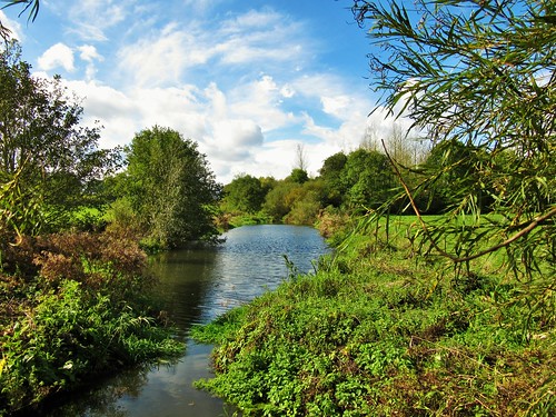
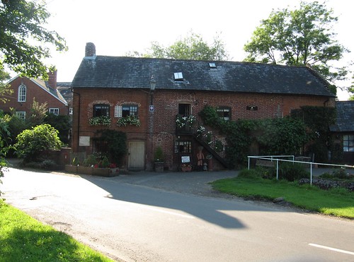
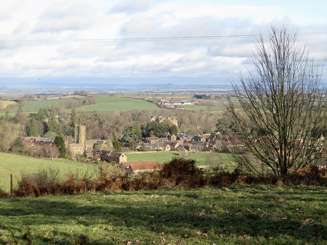
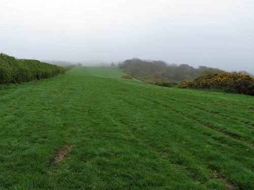
Mist was rolling high on the Dorset downs as we came down a steep green valley into Plush. The little collection of houses lay under mossy thatch along their lane. A few cheerful drinkers looked out of the windows at the Brace of Pheasants and shook their heads over the weather. ‘Going out walking? You won’t see a thing!’

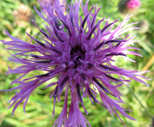
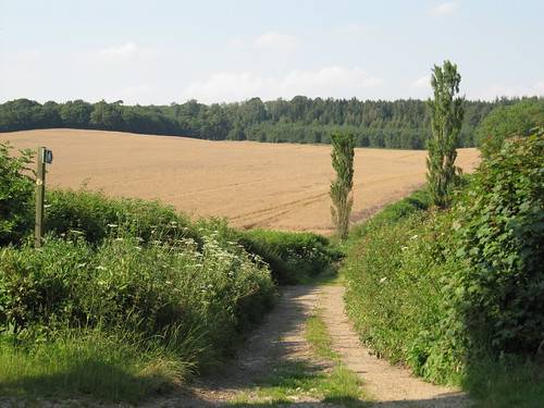
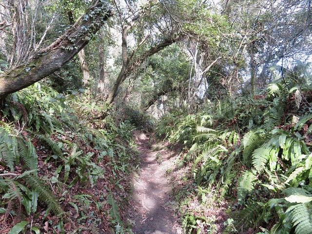
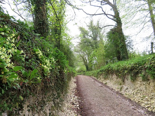
In the chalky holloway that lifted us to the heights of Church Hill grew primroses and violets, bluebells and pink campion. All had burst out together last week at the first hint of spring warmth. Today the birds seemed subdued by the cold hand of the mist, but a blackcap suddenly produced a mellifluous solo among the oaks, short but sweet.

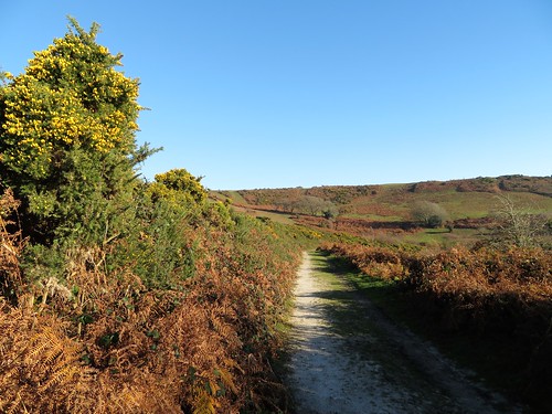
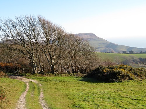
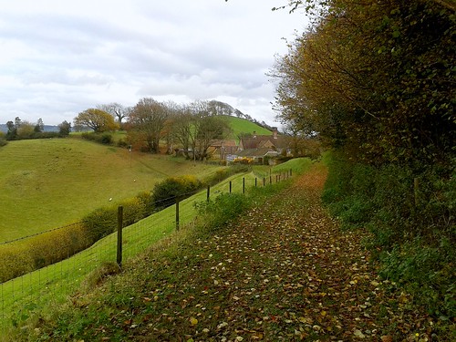
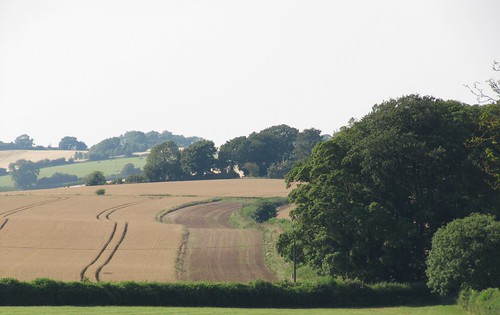
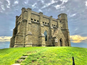
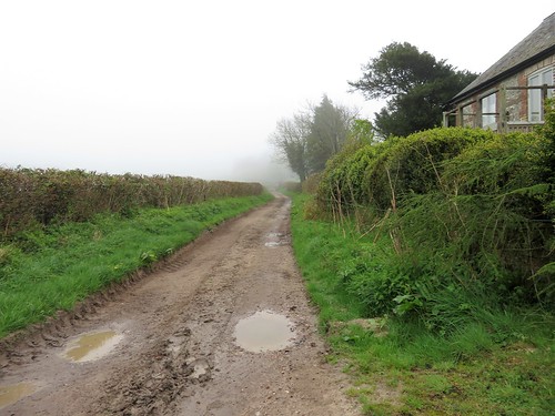
As we reached the gaunt old barn at the top of the climb a roe deer went bounding away, leaping high over crops and fences. We followed the rutted course of the Wessex Ridgeway, an ancient drove road running east-west along the nape of the hills. The old cottage at Folly was once a drover’s inn, where the hardy drovers in their felt hats, stocking feet soaped against blisters, would stop in for refreshment while their flocks cropped the wide verges of the ridgeway.

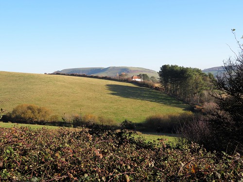
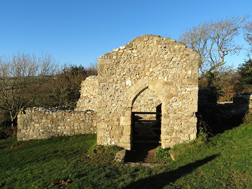
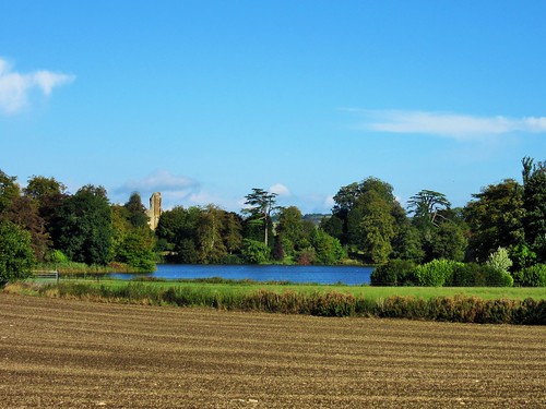
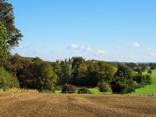
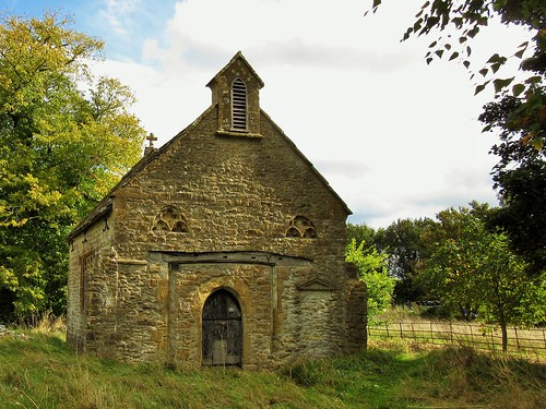
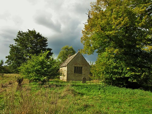
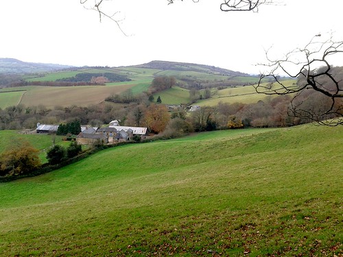
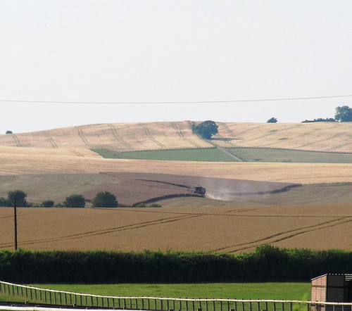
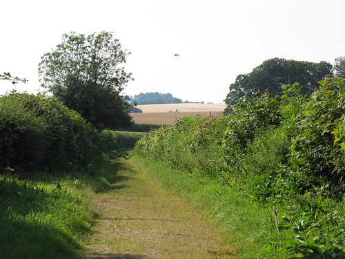
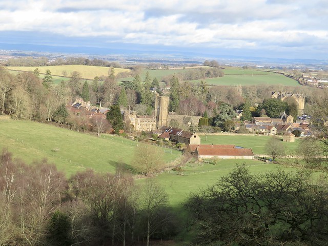
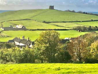
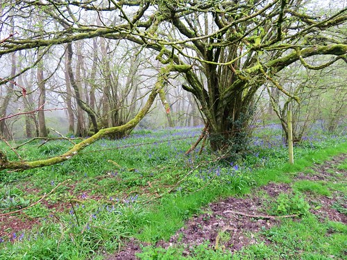
We passed through woods of oak and ash where bluebells made a hazy sky of the undergrowth, and dropped down a long flinty lane into Higher Melcombe. Lumps and bumps in the fields were all that remained of the medieval village deserted by its people after the Black Death deprived them of their feudal livings. But the handsome old manor house was still there, its chapel walls striped in stone and flint.

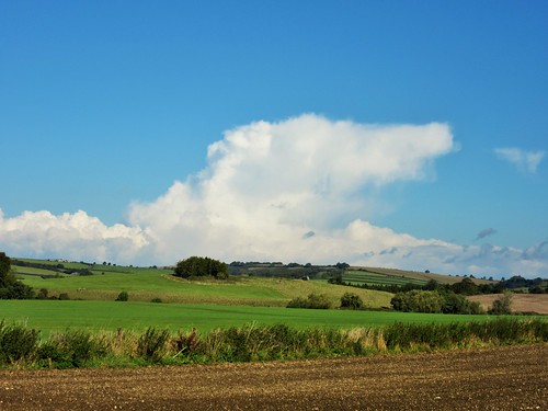
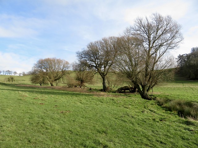
Blackbirds sang, and a tractor whined as it trimmed the first grass of the year. We climbed away up a hedge towards a wood, invisible in the hill mist, that roared softly and mightily, a sea-like cadence. Primroses and cowslips spattered the banks of the hollow lane, and among them a hybrid of the two plants raised its dark yellow multiform head on a slender talk.

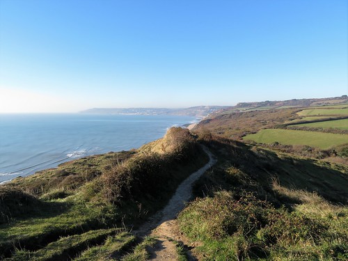
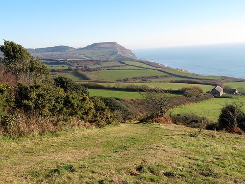
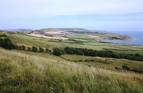
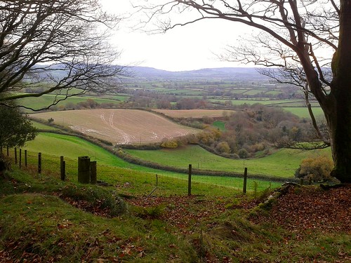
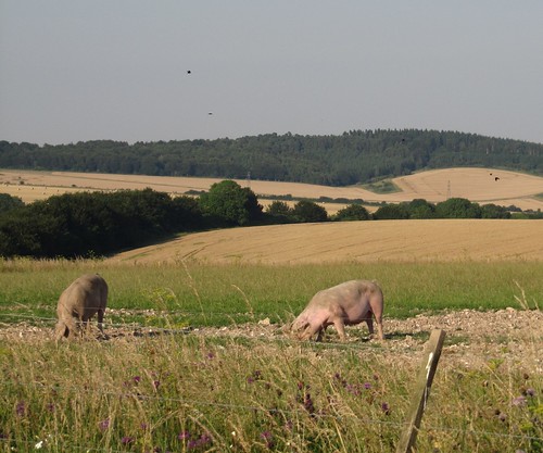
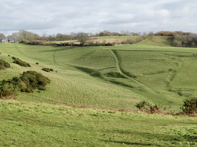
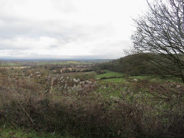
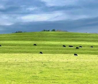
We skirted the plunging slopes of Lyscombe Bottom, farmed with no pesticides or artificial fertilisers, and descended another deep-sunk old green road into Plush. ‘See anything?’ asked the regulars in the Brace of Pheasants. ‘No, not a thing,’ we replied.

Start: Brace of Pheasants Inn, Plush, Piddletrenthide, Dorset DT2 7RQ (OS ref ST714022)

Getting there: Plush is signposted from Piddletrenthide on B3143 (off A35 at Puddletown).

Walk (8 miles, trackways and farm paths, OS Explorer 117): From Brace of Pheasants, right along road; in 100m, right (‘Church Hill’ fingerpost/FP) up bridleway for 1 mile to Wessex Ridgeway/WR (707035). Right (east) along WR to cross road at Folly (728032). In 300m fork left uphill (733030, bridleway fingerpost/BFP); in 100m fork left (BFP). In 400m through gate, turn left (737028, BFP) across field.

Pass telephone pole, then breeze-block shed; ahead in same direction (WR) across field and through double gateway (740030, WR). Keep ahead; in 50m, fork right down grassy holloway, through gate into wood (741031). WR forks left, but keep ahead downhill (‘Higher Melcombe’) for ⅔ mile to road (751025). Right through Higher Melcombe.

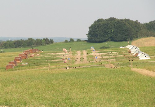
In ¼ mile, just before Higher Melcombe Farm, left (747025, blue arrow/BA, FP in hedge) on track. In 70m, right (gate, BA) up field edge. In 250m through gate (745025, BA); left up hedge, then sunken lane. In 600m at top of rise, through gate; right on gravel track (742021, ‘Nettlecombe Tout’) with hedge on right. In 500m fork left (740025) across field to go through gate by Lyscombe Farm notice (739026).

Fork left away from fence, but keep it close on your right, following same contour across lumpy ground. In 900m at 4-finger post on right (730024), right through gate; left (‘Doles Ash Farm’) along hedge. In 300m at end of trees, left across fence (728021); right past trig pillar. On beside fence, then across field, for ½ mile to corner of triangular copse (721018). Bear right (WNW) across open field (perhaps through crops) for 300m to hedge gap with arrow (718019). Ahead to stile (717020); downhill to road (717022); left into Plush.

Lunch/Accommodation: Brace of Pheasants, Plush (01300-348357, braceofpheasants.co.uk) – cosy, friendly village inn.

Info: Dorchester TIC (01305-267992); visit-dorset.com; satmap.com; ramblers.org.uk

 Posted by at 01:09
Dec 242016


First published in: The Times Click here to view a map for this walk in a new window
picture picture picture picture picture picture picture picture picture picture picture picture picture picture picture picture
Facebook Link:

Seatown lies tucked into a crack in the Dorset coast, right at the heart of a spectacular run of crumbling cliffs that stretches west from Chesil Beach to well beyond Lyme Regis. This is walking country so superb that it came as a surprise, even on a weekday morning in mid winter, to find ourselves climbing away westward from Seatown’s cosy old smugglers’ pub, the Anchor Inn, with only a handful of walkers to share the South West Coast Path with us.

The weather matched the landscape for magnificence, a cloudless blue bowl of sky, upturned over a coast of close-cropped pasture fields and tall bitten-off cliff faces. The whaleback of Golden Cap is the highest piece of land along the Dorset Coast. Up there, more than 600 feet above the sea, the view was sublime – east along the yellow wall of cliffs to the long curve of Chesil Beach and the distant wedge of the Isle of Portland, west over a great sloping rampart of rock steps smothered in scrub, to Charmouth and Lyme Regis sprinkled in white cubes down their valleys, and the tottering coast beyond.

This is one of the most dynamic coasts in Britain, the greensand and chalk toppings of the cliffs constantly slipping and sliding seaward on the treacherous layer of skiddy gault that underlies them. Rainfall and hidden springs lubricate the clay layer, making things even more wobbly. Falls are frequent, landslips commonplace. The angled flanks of the cliffs and the skirt of fallen material and rocks at their feet bear witness to their remarkable instability.

A young robin, emboldened by hunger, followed us down the steps from Golden Cap, pecking at fragments of chocolate that we let fall. We followed the Coast Path west along the shaky rim of the cliffs, looking down into the chaotic jumble of the undercliff where sedges, willows and brambles flourished in the untrodden ground.

At last we turned inland past lonely Westhay Farm, up to the ridge of Stonebarrow Hill and the homeward path. At Upcot Farm chickens roamed, the farmer dug his muckheap, and a handsome bull stood unmoving beside the stile, contemplating space and his own internal rumblings.

Down in a cleft below Golden Cap we found the broken walls of St Gabriel’s Chapel, built 800 years ago to serve a remote agricultural community in this isolated hollow. Most likely those medieval peasants never had the time or leisure, as we did, to drop down onto the beach at Seatown and watch the red ball of the winter sun sink below the horizon and leave a track of wrinkled gold across the sea.

Start: Anchor Inn, Seatown, Bridport, Dorset DT6 6JU (OS ref SY 420917)

Getting there: Seatown is signed off A35 Lyme Regis to Bridport road at Chideock.

Walk (6¾ miles, moderate, OS Explorer 116): From Anchor Inn, inland up road. In 250m, left (fingerpost/FP, ‘Coast Path’/CP’, ‘Golden Cap’) on path also marked ‘Monarch’s Way’. Follow CP for 2½ miles, over Golden Cap (407922) and three streams (398923, 389926, 386926). In field that follows 3rd stream, Westhay Water, bear right just below Westhay Farm at 3-finger post (385927, FP ‘Stonebarrow Hill’). 200m above farm, drive bends right; ahead here (382930, ‘NT car park’), up bridleway to car park (381932). Right on track along Stonebarrow Hill.

In ½ mile at next car park, fork right (390935, FP ‘Chardown Hill’). In 20m, through gate (‘St Gabriel’s’); fork right, diagonally downhill, path soon becoming a track, for ⅔ mile, to Upcot farm. Left (397930, FP ‘St Gabriel’s’); in 150m, right (FP, stile); follow hedge on right to bottom corner of field; right over stile (399927) into lane. Right, down to St Gabriel’s.

Opposite St Gabriel’s House, left (401924, FP ‘Seatown’) past chapel ruin (blue arrow) and on (‘Langdon Wood, Seatown’). In 250m, right (404925, FP ‘Langdon Wood’) up to 3-finger post (405924). ‘Langdon Wood’ points left, but bear half right uphill, following top hedge to gate (408924). Forward (FP ‘Langdon Hill’) to gate (410923). Forward (‘Seatown, Chideock’) along edge of Langdon Wood. In 300m, right (413923, FP, ‘Seatown’) down to CP (415921); left to Seatown.

Conditions: Some short steep climbs; unguarded cliff edges

Lunch/Accommodation: Anchor Inn, Seatown (01297-489215, theanchorinnseatown.co.uk) – friendly, comfortable, superbly situated.

Info: Lyme Regis TIC (01297-442138); visitengland.com; satmap.com; ramblers.org.uk

Britain’s Best Walks: 200 Classic Walks from The Times by Christopher Somerville (HarperCollins, £30). To receive 30 per cent off plus free p&p visit harpercollins.co.uk and enter code TIMES30, or call 0844 5768122

 Posted by at 01:37
Sep 262015


First published in: The Times Click here to view a map for this walk in a new window
picture picture picture picture picture picture picture picture picture picture picture picture picture
Facebook Link:

Sherborne, one of Dorset’s most beautiful towns, is full of buildings made of that very distinctive, iron-rich golden limestone called ‘hamstone’. Medieval masons worked it to sublime effect in the delicately constructed chapels and lacy fan vaulting of the abbey church that stands at the heart of the town.

From the slopes of Sherborne Park I looked across the meadows to Sherborne’s twin castles – an old Norman stronghold in picturesque ruin beyond the trees, its Tudor counterpart beside the long lake. The original lodge, built in brick by Sir Walter Raleigh in 1594 after Queen Elizabeth I had gifted him the land, was enfolded by grand wings added later. Lit by today’s strong sunshine and framed in fat white cumulus clouds, it looked altogether splendid in its setting of broad parkland studded with magnificent specimen oaks. I imagined Raleigh’s ghost sitting smoking, as it is apparently in the habit of doing, in the stone seat that Sir Walter installed by the lake, puffing out an extra cloud of Virginia-scented satisfaction on this lovely morning.

Two young women walked ahead on the broad path through the park, their babies on their backs. I followed them over the heathy common where homeless Poles were housed after the Second World War as Displaced Persons in the cramped, cold and very basic Nissen huts of a former field hospital. ‘People were all in the same circumstances,’ writes Teresa Stolarczyk-Marshall, who lived there as a child (website – see below), ‘in a strange country where they could not speak the language. So they rallied round helping one another. People were very patriotic, observing their traditions and bringing their children up in a Polish spirit. Haydon Park become Little Poland.’
I turned north through the parkland trees, looking over the cottage at Pinfold Farm towards the green cap of Crackmore Wood. A quiet moment in a golden stone chancel by the roaring A30, all that’s left of the 16th-century Church of St Cuthbert (one of the very last churches built before the Reformation); and then a saunter through Oborne village between hedges netted with pungent-smelling hop bines. The old green road of Underdown Lane dropped me back into the outskirts of Sherborne, and a path through the sunlit meadows by the River Yeo led easily back to the station once more.

Start & finish: Sherborne railway station DT9 3NB (OS ref ST 641162)
Getting there: Train to Sherborne; Bus 57, 58 from Yeovil. Road: A30 from Yeovil or Shaftesbury; park at railway station.

Walk (6 miles, easy grade, OS Explorer 129): Cross railway; at T-junction, cross B3145; through kissing gate opposite; left on path/track through Sherborne Park. From thatched lodge in 1¼ miles (660161), follow yellow arrows/YAs to pass The Camp depot (665161). In another 400m, at YA (669160), left across field to stile (668162, YA). Through Deer Park wood and on (YAs) to track at Pinford Farm (664172). Left (YA); in 150m, right (YA) to go between ornate gateposts (662173). In 15m, left (YA) into wood. In 30m, right (YA), north inside wood edge. In 300m, left to leave wood through kissing gate (661176); across 3 fields (YAs), under railway (654178) to St Cuthbert’s Church chancel (653178). Cross A30 (take care!); up road to Oborne. In 600m, left (655185) past Oborne church; on along green lane, then Underdown Lane for nearly a mile to cross A30 (647174). Keep ahead (‘Bridleway’) to farmyard and road (646170). Ahead to crossroads; right along B3145; in 300m, left (644168, ‘Dorchester, Blandford’) along New Road. Cross railway and river; right (645166, fingerpost) on field path to station.

Lunch: Oliver’s Coffee House, Cheap Street, Sherborne (01935-815005); or the excellent Station Café (01935-814111) – fry-up heaven!

Haydon Park Polish camp: www.polishresettlementcampsintheuk.co.uk/haydonpark1.htm

More info: Sherborne TIC (01935-815341)

satmap.com; ramblers.org.uk;

 Posted by at 01:30
Sep 062014
 

‘Please treat the church and houses with care,’ said the handwritten plea left pinned by the villagers of Tyneham to their church door in the dark days of the Second World War.
First published in: The Times Click here to view a map for this walk in a new window
picture picture picture picture picture picture picture picture picture picture picture picture picture picture picture
Facebook Link:
‘We have given up our homes where many of us lived for generations to help win the war to keep men free. We shall return one day,’ the note ended, poignantly, ‘and thank you for treating the village kindly.’
That return was to remain forever a dream. Evicted by the Army in 1943 so that their homes and lands could be used for training soldiers, the 40-or-so villagers of Tyneham and their 200 fellow parishioners never returned to the lonely valley in the Dorset downs. Lulworth Ranges absorbed the place and threw a cloak of inadmissibility over it. Nowadays only the school, church and great barn of Tyneham remain in good repair, open to the public on certain days (see below). Tyneham’s cottages and Post Office are empty shells whose former inhabitants stare from old photographs in the wall displays; the great manor house crumbles unseen and out of bounds among the trees.
We wandered around the skeleton village with dairyman Walter Candy, shepherd James Lucas and a ghostly host of pinafored children and hobnailed farmworkers at our elbow, then made for the grassy track that undulates along the crest of Whiteway Hill, with stunning views west along the chalky, fossil-filled cliffs of Dorset’s Jurassic Coast.
A breeze rippled the grassheads like an invisible hand stroking a head of newly-washed hair. We teetered down the steep slope below the ramparts of Flower’s Barrow hill fort, and had a quick, ecstatic plunge in the semi-circle of sea under the sloping cliffs of Worbarrow Bay. A stiff climb out of the cove and we were looking down on the Tyneham valley, its green slopes untouched by the intensive agriculture of the past seventy years, its trees concealing their secrets.
On past clumps of wild marjoram, so pungent when pinched that they made me gasp. The submerged rock ledges far below off Brandy Bay shimmered orange, black and jade green. In the sea haze the long wedge of Portland seemed not so much a peninsula as an island detached from the shore. A last look east to the much-quarried freestone cliffs under St Alban’s Head, and we were bowling back to Tyneham along the ridge of Tyneham Cap where sparrowhawks hovered on quivering wings, and a croaky old raven was teaching formation flying to this year’s youngsters.

Start: Tyneham car park, near East Lulworth, Dorset BH20 5DE (OS ref SY 882802)

Getting there: Tyneham is signposted from East Lulworth (B3070 from A352 near Wareham; or B3071 from Wool, 4½ miles west of Wareham on A352).

Walk: (8 miles, moderate/strenuous, OS Explorer OL15): From Tyneham church follow track north to top of down (882810; yellow marker posts/YM). Left along crest of down for 1 mile to Flower’s Barrow hill fort. Pass through first rampart; at Coast Path marker stone (866805), hairpin left (YM), steeply down to Worbarrow Bay. Steeply up and along Coast Path. Pass opposite Tyneham car park; in 500m, at gate/cattle grid (889798), fork right between YMs and on round edge of Brandy Bay. Halfway round Kimmeridge Bay, at ‘Kimmeridge View Point’ board and flagpole on right (904792), turn left up hedge. YMs to top of down (905802); left along crest of down. In 1 mile cross cattle grid/gate (889798); in another 400m, just beyond ‘Keep Back, Unstable Cliff’ notice (883797), fork right to Tyneham.

Conditions: Many ups and downs, some steep.

Opening: Lulworth Range walks and Tyneham are open weekends (9am Sat. to 8am Mon.) except 27/28 Sep, 15/16 Nov 2014. Also open for some school holidays and Bank Holidays. Info – Lulworth Range Control Office, 01929-404819;
gov.uk/government/publications/lulworth-access-times

Refreshments: Picnic

Information: Dorchester TIC (01305-267992; visit-dorset.com)
tynehamvillage.org; visitengland.com; www.satmap.com; ramblers.org.uk

 Posted by at 02:21
Dec 082012
 

Setting out from Beaminster to climb Lewesdon Hill, the highest point in Dorset at 279 metres, is a baffling task. Which hill is which?First published in: The Times Click here to view a map for this walk in a new window
picture picture picture picture picture picture picture picture
Facebook Link:
There are so many knolls, hillocks and knobbles in the billowing green countryside that enfolds snug little Beaminster. The Wessex Ridgeway Trail connects most of the best, though, and so we entrusted ourselves to its steep and muddy course.

With the deliciously rich smell of decomposing beech leaves coming from underfoot, and a blowy sky of silver and blue-grey overhead, we climbed away west along the Wessex Ridgeway up the green tump of Gerrard’s Hill to the windwhistle spinney of storm-battered beeches at the summit. Chart Knolle farmhouse lay below, perfectly positioned and beautifully maintained on its saddle of ground between two deep valleys. Stoke Knapp’s farmhouse a little further on was a sad contrast, silent and empty at the roadside with windows blank and slates beginning to slip.

A green lane skirts the flank of Lewesdon Hill, rising gently and running between huge old beeches in mossy hedgebanks. From the lane we followed a leaf-smothered cartway up through the woods to Lewesdon’s top. Here we sat and gazed south to folded hills cradling a long slip of tarnished-silver sea. Iron Age folk ramparted Lewesdon’s summit, Romans fortified neighbouring Waddon Hill, and looking from the roof-tree of Dorset, the sense is of an ancient landscape with a history that any imaginative watcher could unfold.

A steep path brought us down from the peak of Lewesdon through the beechwoods, with glimpses between the silvery trunks out west to the top of Pilsdon Hill, flattened and spectacularly embanked by the Durotriges tribe more than 2,000 years ago.

Stoke Abbot was a maze of dark gold hamstone houses under thatch. Beyond the village we took to the ancient green road of Long Barrow Lane, slanting down across the fields to a puzzle of paths in the boggy stream bottom of Little Giant Wood. Nearing Beaminster, we walked under an evening sky dramatically smeared with a fiery glow of scarlet and gold. As we came through a meadow I glanced up and saw a dozen horses blackly outlined on a ridge, grazing companionably in the last light of day – a sight essentially unchanged since the Durotriges rode this land.

Start: Beaminster Square, Dorset DT8 3AW (OS ref ST 481014)

Travel: Bus Service 47 (firstgroup.com), Bridport-Yeovil
Road: Beaminster is on A3066 between Crewkerne and Bridport

Walk: Down Church Street past Beaminster church (479013), on along Shorts Lane. In 400m cross lane end (475014); across next field to Stoke Road (473014); left, then right in 30m (fingerpost) along Halfacre Lane. In 100m, left (472014 ‘Wessex Ridgeway Trail’/WRT) through stile; half-right across field to barn (470014). Through gate; left (WRT) around field edge. Through gate (‘Beaminster Ramblers Millennium Walk’/BRMW); down through woodland (‘Chart Knolle’). Cross footbridge (467012; BRMW); steeply up to stile on skyline. On over stiles (WRT) to top of Gerrard’s Hill (460012).

Down to Chart Knolle farmhouse (456014); on west (‘Stoke Knapp’, WRT) through fields to Stoke Knapp farm (445015). Cross B3162 (fingerpost); on along Lewesdon Hill Lane (green lane). In 600m pass National Trust sign on left (439014); in another 250m, just before blue arrow, turn left (437014) past National Trust sign and information board up broad woodland track to Lewesdon Hill summit (438012). Follow track steeply downhill southwards off summit. In 600m it descends as a bridleway to T-junction of tracks; right to gate into roadway (437005). Left for 50m; right through gate (yellow arrow); half-left across 2 fields, then left to cross B3162 (440003).

Follow lane (‘New Inn’). At Brimley Cottage lane bends left (445003); keep right of cottage (fingerpost) down path and through gate (‘Jubilee Trail’/JT). Follow hedge on right for 200m; where it bends right towards a field gate (447003) keep ahead down slope, through kissing gate (448003, JT). Along boardwalk, through kissing gate (JT). Half left up field slope, passing to left side of house (449003). Cross 2 fields to sunken lane (451003), left to road, right into Stoke Abbott.

Follow road through village, past New Inn; in 100m, right (454008, fingerpost) along fenced path. Through gate (JT); on down slope. Left through gate (JT); cross stream; left along stream to recross it (JT). Bear left with stream on left, passing Horsehill Farm to descend and bear right through gateway (459005, JT). In 50m, left to cross stream (JT); follow path with stream on right to gate (JT); across field to shed where you cross farm track (463005). Ahead through wicket gate (JT); right along grassy Long Barrow Lane.

In 550m, dogleg left (466002, JT), then right in field (fingerpost). Descend to cross stream (469000). In 100m, DON’T turn right to cross another footbridge, but keep stream on right, bearing away from it half-left to gate from wood into field (470000, JT on reverse side). Half left across field to far top corner; cross stony lane (472001, JT) and next field. Through gate; left (473002, JT, blue arrow) along lane. In 350m, on through gate’ in another 100m, lane ends at gate (475006). Continue ahead (ignore lower path that forks right towards cottage). Cross field on upper path; through 2 gates in succession (477009). Follow fence to gate (479010, BRMW) and lane into Beaminster. At T-junction, right to town centre.

Walk: (7 miles, moderate, OS Explorer 116 – NB: Detailed directions (essential!), online map, more walks: christophersomerville.co.uk).

Church Street past Beaminster church (479013); Shorts Lane, then well-waymarked Wessex Ridgeway Trail and Beaminster Ramblers Millennium Walk west for 3 miles via Stoke Road (473014), Higher Barrowfield Farm (470014), Gerrard’s Hill (460012), Chart Knolle farmhouse (456014), Stoke Knapp farmhouse/B3162 (445015), and Lewesdon Hill Lane. At 2nd National Trust sign, left up track to Lewesdon Hill summit (438012). South for 600m to farm roadway (437005); field path to cross B3162 (440003). Follow waymarked Jubilee Trail for 3½ miles back to Beaminster via Brimley Cottage (445003), stream crossing (448003), road (451003) through Stoke Abbott. 100m past New Inn, right (454008, fingerpost); follow Jubilee Trail past Horsehill Farm (459005); on via Long Barrow Lane (463005-466002) and stream crossing (469000). Gate into field (470000); across field, lane (472001), field to lane (473002), left and follow JT to Beaminster.

NB: Mudproof and waterproof footwear!

Lunch: New Inn, Stoke Abbott (winter hours: closed Sunday evening, all Monday). Tel: 01308-868333

Accommodation: Bridge House Hotel, Beaminster DT8 3AY (01308-862200; bridge-house.co.uk)

Information: Bridport TIC (01308-424901)
www.ramblers.org.uk www.satmap.com www.LogMyTrip.co.uk

 Posted by at 01:53
Aug 112012
 

The view from Boveridge Farm was all you’d want on a beautiful summer’s day – the gentle swell of the Dorset Downs, the snaky blue line of a fence or chalky track cutting across the hill, trees throwing ink-black shadows along the hedges. First published in: The Times Click here to view a map for this walk in a new window
picture picture picture picture picture picture picture picture
Facebook Link:
I stood admiring the prospect, then shifted my stance – a couple of steps to the side for a new perspective. Now I could see a blood-red slash of earth across the tree-crowned hill, and the shadows had assumed the look of sharp-tipped tentacles, reaching out into the fields with a whisper of menace. Two paintings in an exhibition, both of the same subject, separated by fifty years and a generation – The View from Boveridge Farm, 1992, by Tim Nicholson, and Boveridge, painted by the artist’s mother E,Q. Nicholson in 1943, at the height of the Second World War.

Artists have been visiting and settling around Cranborne Chase for a century or more. Elisabeth Frink, Stanley Spencer, Lucian Freud, Henry Lamb and various members of the arty Nicholson family are among those who found room to breathe and mighty inspiration in this great expanse of forest and downland at the meeting place of Hampshire, Wiltshire and Dorset. Salisbury and South Wiltshire’s summer exhibition of the work of Cranborne Chase artists past and present, ‘Circles and Tangents’, set me off exploring the landscape around Cranborne, across the border in Dorset, that inspired the Nicholsons.

Cranborne was an English idyll on a hot afternoon, with sun on the brick walls and children running home soaking wet from paddling in the River Crane. The cornfields began on the edge of the village, from where I looked back through a hedge gap over Cranborne’s roofs, some red-tiled, some thatched, in their wooded bowl of ground. Up at Boveridge Farm tractors roared in dusty fields. I caught immediately what Nicholson mother and son had represented so magically – the essence of downland, a working landscape of dull gold barley, crop and stubble, beautiful but far from twee or cosy.

A green lane packed with butterbur and the drooping purple bells of comfrey led me through Stone Hill Wood and on by Boulsbury Farm, a self-contained huddle of farmhouse and barns where mallow flowers grew through an old hay turner. In Stony Lane I got a wave from a girl in a red singlet at the helm of a giant new tractor. All the farming world was out and double-busy in this harvest weather; but at Alderholt Bridge all was cool and still, with the millstream gurgling under the nearby mill.

Here EQ Nicholson lived during the war, entertaining the likes of Lucian Freud and John Craxton, and painting all she could see. Her picture The Stream at the Mill House showed willow branches reaching like fingers across the blue mill stream; Craxton’s Alderholt Mill stood old and strong against a stormy sky, the wall of the mill race sinuating below. If I’d been a painter I’d have wanted to capture the scene here, too – red brick against blue sky, bottle-green water bubbling, and a proper sense of place.

Start: Inn at Cranborne, near Wimborne, Dorset BH21 5PP (OS ref SU056133)
Getting there: Bus 97 (Dorset Community Transport), Fordingbridge – Alderholt – Cranborne (0871-200-2233).
Road – A338 to Fordingbridge, B3078 to Cranborne.
Walk: (8 miles, easy, OS Explorer OL22 and 118; detailed instructions – essential! – more walks, online map: christophersomerville.co.uk):
From Inn at Cranborne, right along Wimborne Street. Follow ‘Damerham’. After 2 bends turn right down Penny’s Lane (057134) past recreation ground. In ¼ mile pass concrete trough and turn left (060133) up field edge and on for 350m to road (061136). Right for 40m; left through gates and keep straight ahead along track through Burwood for ⅔ mile to road (062145). Left; in 100m, right up path (fingerpost/FP, yellow arrows/YA). In 100m, cross stile (062147); left over gate; right up fenced path. At top, bear right to road (062150); right. Between barns, just before tree surrounded by staddle stones, left (064150) past Boveridge Farm. On (YA) along green lane.

At gate into Stone Hill Wood, bear right (066156, YA) along wood edge. At top of rise, bear left (069155) and follow deeply rutted track. In 200m it becomes hard-surfaced track. In another 200m (072156) keep ahead (not right) at fork, soon descending. At T-junction at wood edge (074156), ahead through hedge. Left for 100m; right across field, up to stile in far hedge (077159, FP). Forward along track to pass Boulsbury Farm. Just past farmhouse, right at fork (079163). At Boulsbury Cottages (082162) fork left along tarmac lane. In ¼ mile, round right bend; in another ¼ mile road bends sharp left; keep ahead here (089161; bridleway FP; cycle trail blue arrow/BA) in tunnel of trees. Cross road at Four Corners (093159, BA); on along Stony Lane under power lines for ½ mile.

Arriving at Ashley Park Farm complex and stables (097153), left past Manor Farm House; on along lane for 600m. At T-junction (103154), right for 20m; left along hedge (FP) on path in tunnel of trees. At road (106155), right, and follow tarmac lane to Hill Farm. Pass farm nameboard; in 100m, right over stile (108155; FP, YA) and follow stiles and YAs. After 3rd field cross footbridge (109152); on along lower edge of next field with hedge on right. At post with YAs (110151), forward with hedge on right and stream beyond. At the end of this long field, ahead through hedge. Cross jungly bit to reach T-junction of paths (114148). Right (YA) and keep ahead between hedge and fence for 300m. At kissing gate (116146) fork right across field. Through chain-link stile, then the following kissing gate (118145)). Keep ahead (YA) through trees to road at Alderholt Bridge (120143). Right past Alderholt Mill. Continue along road (take great care!) for 300m. Pass Little Thatch on right, and take next right along farm drive (118140; ‘No Through Road’). Pass cottages at Alderholt Park (113133); on through High Wood for ½ mile to reach B3078 (112125). Left to Churchill Arms PH and bus stop (across road).

Walk: Inn at Cranborne – Burwood (062125) – Boveridge Farm (064150) – Stone Hill Wood (066156) – Boulsbury Farm (079163) – Boulsbury Cottages (082162) – Four Corners (093159). Stony Lane – Ashley Park Farm (097153) – road at South End (103154) – Hill Farm (108155) – field path just to north of stream and lakes to Alderholt Bridge and Mill (120143). Alderholt Park (113133) – High Wood – B3078 opposite Churchill Arms PH, Charing Cross, Alderholt (112125).
Refreshments: Churchill Arms, Alderholt (01425-652147)
Lunch/accommodation: Inn at Cranborne (01725-551249; theinnatcranborne.co.uk) – very friendly place
Circles and Tangents Exhibition: Salisbury and South Wiltshire Museum (until 29th September) – The King’s House, 65 The Close, Salisbury, Wiltshire, SP1 2EN (01722-332151; museum@salisburymuseum.org.uk) – Cranborne Chase painters, sculptors, potters etc., past and present
Information: Fordingbridge TIC (01425-654560); Salisbury TIC (01722-342860)
www.ramblers.org.uk www.satmap.com www.LogMyTrip.co.uk

 Posted by at 06:13
Sep 262009
 

First published in: The Times Click here to view a map for this walk in a new window
picture picture picture picture picture picture picture
Facebook Link:

A blackbird was singing on the garden wall of Portesham House, where stone lions couchant guarded the porch. Thomas Masterman Hardy, who lived here in the Dorset downs as a young boy in 1778, was destined for fame as a much-loved sailor and man of action. Horatio Nelson’s close friend and trusted Flag Captain died loaded with honours in September 1839. In that month his namesake, the future novelist and poet Thomas Hardy, became the tiniest of twinkles in his mother’s eye at Higher Bockhampton, a few miles over the hills to the east. It’s not the great writer who is commemorated by the tall stone Hardy’s Monument on the downs, but the fighting admiral from little Portesham village.

Near the path to Hardy’s Monument crouches the Hell Stone, a neolithic tomb resembling a heavily armoured giant crab, whose nine massive stone legs support a huge capstone of flint-studded conglomerate. The Devil, playing a game of quoits, hurled the Hell Stone here from the Isle of Portland ten miles away, so local stories say.

Up in a cold wind by the monument, Jane and I savoured that fabulous tale along with an equally fabulous burger of local beef, cooked and served with a relish of friendly banter by the pony-tailed man in the Hobo Catering van. Hobo the Canadian Inuit dog (who has kindly lent her name to the admirable fast-food business run by her master) followed every mouthful with the soulful gaze of true cupboard love.

Truth to tell, Hardy’s Monument looks more like a factory chimney than a memorial to a national hero. But the views over Dorset are sensational. Even more stunning is the prospect from the steep ridge above Waddon House, where we paused on the way back to Portesham. Downs and farmlands, the shingle bar of Chesil Beach, St Catherine’s Chapel on its knoll of strip lynchets, the Devil’s quoits pitch of Portland lying like the Gibraltar of Wessex on a bay of molten silver – if any view could entice an adventurous lad to sea, it would be this.

Start & finish: King’s Arms, Portesham, Dorset DT3 4ET (OS ref SY 603857)

Getting there: Train (www.thetrainline.com; www.railcard.co.uk) to Upwey (6 miles); Bus service 61 from Dorchester (www.surelinebuses.co.uk); Road – Portesham signed off A35 Dorchester-Bridport at Winterbourne Abbas

Walk (7 ½ miles, moderate grade, OS Explorer OL15): From King’s Arms, cross street; up Church Lane; right up Back Street; left opposite Manor Close (602860). Follow ‘Portesham Withy Beds, White Hill, Abbotsbury Round Walk/ARW’ signs/waymark arrows. Pass withy beds; through gate at end of trees (592860). Sharp right up steep bank; follow fence (fingerpost, ARW) for 1/3 mile. Right over stile (592865) by ‘South Dorset Ridgeway, Hardy’s Monument/HM’ marker stone. Follow ‘Inland Coast Path/ICP’ for 2/3 mile to road (601869). Left (great care!) for 30 yd; right (HM fingerpost) down fence for 2 fields. Detour right (605869; ‘Hell Stone only’) over stone stile to Hell Stone (605867); return to path; follow ICP through wood to Hardy’s Monument (613876). Cross road; follow ICP to recross road (616877; ‘ICP, Jubilee Trail/JT’). In 1/3 mile (620874), right off ICP, following JT for 1 ¼ miles past Bench farm ruins (624864) to road (630857). Right; in 100 yd, right (’Portesham’); in 200 yd, right over stile (yellow arrow/YA). Diagonally right to ridge top; follow fence (stiles, YAs) for 1 mile. Through gate by Portesham Farm (612861); left down drive; right along lane into Portesham.

NB – Online map, more walks: www.christophersomerville.co.uk

Lunch: Hobo catering van at Hardy’s Monument (presence likely, not guaranteed); King’s Arms, Portesham (01305-871342; www.kingsarmsportesham.com; B&B available)

More info: Dorchester TIC (01305-267992)

www.westdorset.com; www.ramblers.org.uk


 Posted by at 00:00
Feb 112023


First published in: The Times Click here to view a map for this walk in a new window
Looking north over Montacute from Hollow Lane footpath 1 Liberty Trail descends a ferny holloway Willows along the Witcombe Valley brook 1 Looking north over Montacute from Hollow Lane footpath 2 lumps and bumps of abandoned medieval village of Witcombe Looking north over Montacute from Hollow Lane footpath 3 GV of wintry country from Ham Hill folly tower on St Michael's Hill Willows along the Witcombe Valley brook 2 Witcombe Valley

The Celtic tribe known as the Durotriges were expert builders of hilltop forts. The stronghold they dug and mounded on Ham Hill is a remarkable structure. It encompasses more than two hundred acres of south Somerset hilltop within a huge L-shaped enclosure of steep-sided double ramparts. On this windy winter morning the views were sensational, taking in dozens of miles of low-lying farmland bounded by blue and grey hill ranges – Mendip, Blackdown, Quantock and the Dorset downs. The local sandy limestone, known as hamstone, is a glorious deep gold, much prized by builders down the centuries.

A hungry buzzard wheeled and mewed overhead as I followed the brambly ramparts south off the hill through lumps and delvings of many centuries of quarrying. At the foot of the ridge lay the quiet green valley of Witcombe, where mown paths led north again past the grassy outlines of a medieval village, abandoned when sheep farming became more profitable to landlords than the arable husbandry of the peasants.

On the far side of the ridge I found a path edged with emerging daffodils. Last autumn’s beechmast crackled underfoot as I dropped downhill towards Montacute. The village lay below in clear wintry sunshine, a perfect composition, church tower, cottages and great Elizabethan mansion all glowing in golden hamstone.

A quick pint of Palmers and a bowl of leek-and-potato soup in the conversational, dog-friendly Phelips Arms, and I made for the tree-smothered tump of St Michael’s Hill beyond the handsome old Cluniac priory gatehouse on the western edge of Montacute.

‘Mons Acutus, Mont Aigu’ – the abrupt profile of the hill gave its name to the village. Legend says that the Devil appeared in a dream to Tostig, standard bearer to King Cnut, ordering him to dig on the hill. A blacksmith was told to get on with it, and promptly unearthed a life-size crucifix of pure black flint.

The Norman castle built on the summit was replaced by a chapel, itself supplanted in 1760 by a phallic folly tower of hamstone. I climbed the steep holloway to the summit and got a memorable prospect over sunlit lands where Blakean shafts of rain radiated out of the clouds as though to spotlight hidden treasure below in the gleaming floods of winter.

How hard is it? 5 miles; easy, but steep climb up St Michael’s Hill

Start: Ham Hill Country Park, near Stoke-sub-Hamdon TA14 6RL (OS ref. ST479168)

Getting there: Country Park signed from Stoke-sub-Hamdon (signed off A303 between Ilchester and Ilminster)

Walk (OS Explorer 129): Return to road. Left; pass right fork (478166); in 100m right to fingerpost (‘Monarch’s Way’/MW); left, following uppermost path (MW) for ¾ mile to T-junction (485159). Right downhill (‘Liberty Trail’). Near bottom, left (486154, ‘Witcombe Lane’); up valley; across road (492163). Follow footpath (fingerpost) above Hollow Lane; in 500m left along Hollow Lane (497166) into Montacute. Left down South Street (499168); at church and King’s Head PH, left (497169). Through gate; right (‘Hedgecock Hill’); follow MW up St Michael’s Hill. In 200m fork right (494168); in 50m right through gate; left up steep holloway, then path to summit tower (494169). Return down path; at purple arrow fork right; path descends to field. Ahead; in 100m sharp left (494170, purple arrows) downhill. Through gate; keep ahead; left beside stream. In 200m right (491169, stile, MW); in 30m left; follow track. In 250m, gate onto open ground (489169). Follow wood edge; in 700m right (481166, gate); right past circular stone; fork left on MW to car park.

Lunch/accommodation: Phelips Arms, Montacute TA15 6XB (01935-822557, phelipsarms.co.uk)

Info: friendsofhamhill.org; visitsouthsomerset.com; nationaltrust.org.uk/montacute

 Posted by at 03:50
Oct 242020


Abbotsbury lies on the Dorset coast a little inland of Chesil Beach, the notorious shingle bar on which hundreds of ships and thousands of seafarers came to grief in days of sail. On stormy days the waves pound the bar with a menacing roar, but today all was still and calm under a cloudy sky as we set out among the rich gold stone cottages of Abbotsbury with their grey thatched roofs.

How did Blind Lane earn its name? An old holloway floored with flint and dark iron-rich stone, it led away up the hill behind the village. Black cattle grazed the strip lynchets or terraced scars left by medieval ploughing.

It was an exhilarating walk westward at the rim of the down, shoved along by a strong easterly wind. Neolithic long barrows and Bronze Age round ones pimpled the turf. The gorse-smothered Iron Age ramparts of Abbotsbury hill fort stood remarkably well preserved. Ahead opened the dramatic seascape and landscape of the Jurassic Coast, its cliffs faced with gold and white as landslips reveal the underlying strata. Further round Lyme Bay the colours darkened to the greys and blacks of the tottering cliffs beyond Lyme Regis, some of the most unstable land in these islands.

Down the single sloping street of West Bexington, and back east into the wind along a beach of pebbles mumbled so small by the sea that they resembled coarse sand. Ahead the long curve of Chesil Beach terminated in the sloping wedge of the Isle of Portland with its squared-off cliffs, quarried for freestone since Roman times.

A short sharp climb inland across a corrugation of lynchets to reach St Catherine’s Chapel on its round hill, with a superb view down over Abbotsbury and its mighty medieval tithe barn. Spinsters in fading hopes of securing a man would climb to the chapel and pray:

‘A man, St Catherine!
Please, St Catherine!
Soon, St Catherine!’

The coda was then whispered:

‘Arn-a-one’s better than narn-a-one!’


 Posted by at 17:07

Ships of Heaven – talks and events coming up round the country


2020 Dates:

23 January, 6.45 pm – Henleaze Library, 30 Northumbria Drive, Bristol BS9 4HP

30 January, 1pm – Stanfords Travel Writers Festival, Olympia, Hammersmith Rd, Hammersmith, London W14 8UX – www.stanfords.co.uk/Destinations-Show-Travel-Writers-Festival

17 March, 7.00pm – Southwark Cathedral, London – cathedral.southwark.anglican.org

28 March, 2pm – Balliol Hall, Church Rd, West Huntspill, Highbridge, Somerset TA9 3RN

10 May, 11am – Chiddingstone Castle Literary Festival, Kent – chiddingstonecastle.org.uk

12 May, 4pm – Stratford-on-Avon Literary Festival, Warwickshire – stratfordliteraryfestival.co.uk

29 May-6 June (date TBC) – Derby Book Festival – derbybookfestival.co.uk

25 June – Reform Club, Pall Mall, London

5 September, 3pm – Friends Day, Salisbury Cathedral – salisburycathedralfriends.co.uk

 Posted by at 08:15